
×

Papua New Guinea🇵🇬 | hikesKundiawa to Salt NomaneSalt springs, Sinasina gardens, Chimbu gorge, Mount Wilhelm views | things to do and best time to go

Explore Kokoda TrackExplore Saruwaged Range Trek

Backpacking in Kundiawa to Salt Nomane
By Johan Kruseman 🇳🇱 | Updated October 15, 2026

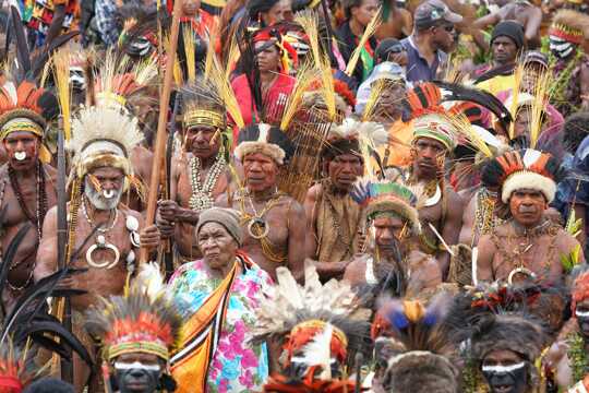
Salt Nomane is a mountain village with a salt spring rather than a coastal flat, and the walk to it is a highland trek, not a beach stroll. It starts in Kundiawa, the capital of Chimbu Province in the Highlands of Papua New Guinea, and heads up toward Mount Wilhelm country on the Sinasina side. You climb out of town on steep gardens trails, cross creeks on log bridges and pass sweet potato plots stitched across slopes. Views open to ridgelines and cloud pooling in valleys, and villagers will stop you for a chat. The catch: trails are rough, signage is nil, public transport is PMV minibuses only as far as the road allows, and a local guide is essential. Unlike the popular Mount Wilhelm climb, this one is about people and salt-making, not a summit.

Discover everything you want to know in the 📖 Papua New Guinea Travel Guide.
Best time to go: April - November
Duration: 2 days
Distance: 18 kilometers
Total ascent: 1200 meters


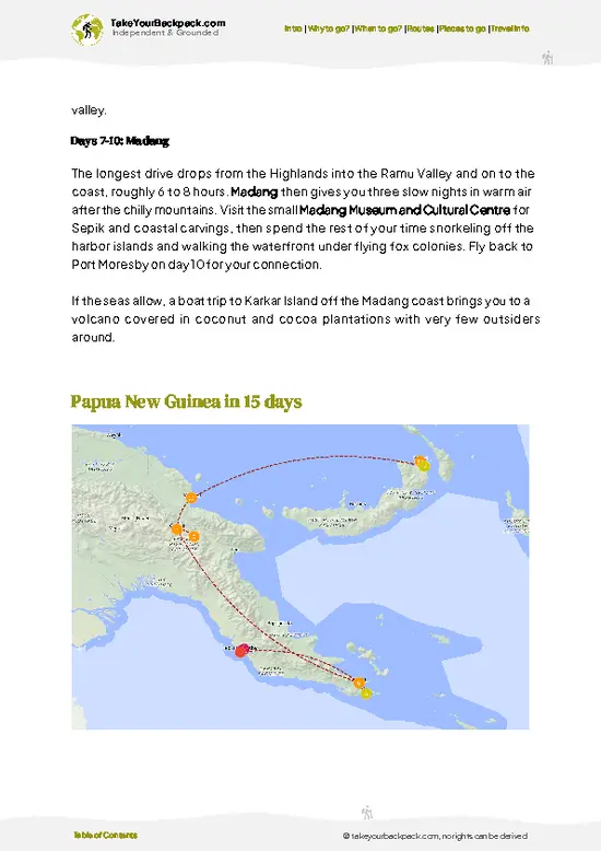
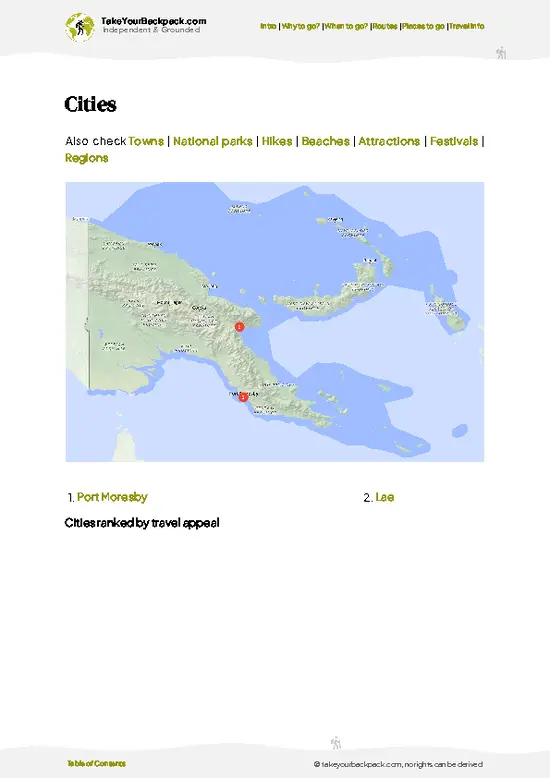
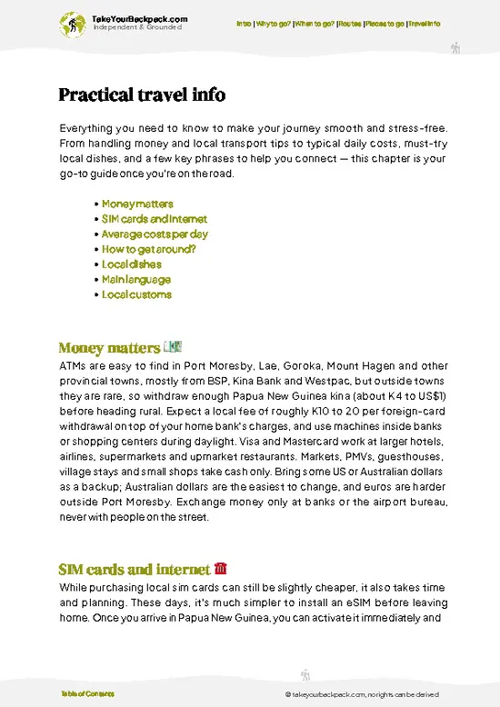
example page 0 from our offline Travel Guide for Papua New Guinea
example page 1 from our offline Travel Guide for Papua New Guinea
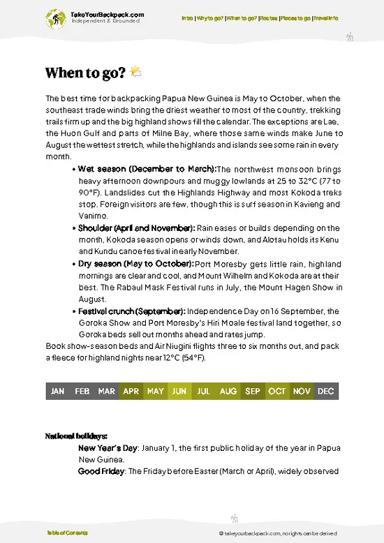
example page 2 from our offline Travel Guide for Papua New Guinea
example page 3 from our offline Travel Guide for Papua New Guinea
example page 4 from our offline Travel Guide for Papua New Guinea
example page 5 from our offline Travel Guide for Papua New Guinea
example page 6 from our offline Travel Guide for Papua New Guinea
example page 7 from our offline Travel Guide for Papua New Guinea
Loading the map 🌍
CLICK TO FILTER
cities
towns
national parks
hikes
beaches
attractions
festivals
regions
SHOW COUNTRY’S BESTSHOW ALL

✨ Why go?
Ranked #99 hike in Papua New Guinea
Why visitors keep coming back

Most people come for the Kundiawa to Salt Nomane walk because it drops you into Chimbu Province life at walking pace, on tracks that villagers still use to carry coffee, sweet potato and trade goods. Kundiawa sits in a valley beneath the Highlands ridges, and the route climbs and descends through steep gardens, kunai grass slopes and patches of mountain forest, with the Wahgi and Chimbu river country spread below you.

The real draw is Salt Nomane itself. Salt Nomane is a salt-making area in the Highlands where salt has long been traded, and reaching it on foot gives you a reason for the walk that goes beyond the views: you are following an old exchange route to a place with a purpose.

It also suits a flexible plan. Kundiawa is a regular stop on the Highlands Highway, so you can arrive by … read more 👉
Most people come for the Kundiawa to Salt Nomane walk because it drops you into Chimbu Province life at walking pace, on tracks that villagers still use to carry coffee, sweet potato and trade goods. Kundiawa sits in a valley beneath the Highlands ridges, and the route climbs and descends through steep gardens, kunai grass slopes and patches of mountain forest, with the Wahgi and Chimbu river country spread below you.

The real draw is Salt Nomane itself. Salt Nomane is a salt-making area in the Highlands where salt has long been traded, and reaching it on foot gives you a reason for the walk that goes beyond the views: you are following an old exchange route to a place with a purpose.

It also suits a flexible plan. Kundiawa is a regular stop on the Highlands Highway, so you can arrive by PMV minibus, hire a local guide from the community and break the walk at villages as the day dictates. Expect to arrange permission and a guide through local leaders first, which is part of the experience and a good way to meet people.

💡 HighlightsPlaces and moments you shouldn't skip

  1. Salt Nomane springs: The reason to walk here. Brine is drawn from natural springs and boiled down by local families into salt that was once traded across the Highlands. Watching the process is the highlight.
  2. Kundiawa town and Chimbu River gorge: The start point sits above the Chimbu River, and the early climb gives you a wide look back over the town and the river valley.
  3. Sinasina village gardens: Terraced sweet potato plots and fenced pig pens climb steep slopes. Walking through them shows how highlanders farm ground most people would call impossible.
  4. Log and vine creek crossings: Narrow plank and log bridges over fast, cold streams add a small thrill and fresh water for a rest.
  5. Ridge viewpoints toward Mount Wilhelm: On clear mornings the high ridges show Papua New Guinea’s tallest peak range,
… read more 👉
  1. Salt Nomane springs: The reason to walk here. Brine is drawn from natural springs and boiled down by local families into salt that was once traded across the Highlands. Watching the process is the highlight.
  2. Kundiawa town and Chimbu River gorge: The start point sits above the Chimbu River, and the early climb gives you a wide look back over the town and the river valley.
  3. Sinasina village gardens: Terraced sweet potato plots and fenced pig pens climb steep slopes. Walking through them shows how highlanders farm ground most people would call impossible.
  4. Log and vine creek crossings: Narrow plank and log bridges over fast, cold streams add a small thrill and fresh water for a rest.
  5. Ridge viewpoints toward Mount Wilhelm: On clear mornings the high ridges show Papua New Guinea’s tallest peak range, with cloud boiling off the valleys below.
If time is short, skip the creek-side detours and push straight to the springs.
Spotted a mistake or missing something? Contact us.

🌤️ When to go?Seasonal considerations and timing

  • Dry Season (May to October): Firmest trail and the clearest views of Mount Wilhelm’s flanks above Kundiawa. Days reach 22 to 26°C (72 to 79°F) in the valleys, nights drop to 8 to 12°C (46 to 54°F) in the highlands. Daylight runs roughly 6am to 6pm all year.
  • Wet Season (November to April): Afternoon downpours turn clay sections of the Chimbu track into slides and swell the creeks. Temperatures barely change, but mist settles by early afternoon and rivers can block progress for a day.
  • Festival and Market Timing: Chimbu Province gatherings and weekend markets in Kundiawa bring crowds and energy. Village accommodation and PMV seats get scarce around these dates.
  • Prices: Porter and guide rates stay fairly steady, but transport costs rise when roads wash out in the wet months.
Start walking by 6am in … read more 👉
  • Dry Season (May to October): Firmest trail and the clearest views of Mount Wilhelm’s flanks above Kundiawa. Days reach 22 to 26°C (72 to 79°F) in the valleys, nights drop to 8 to 12°C (46 to 54°F) in the highlands. Daylight runs roughly 6am to 6pm all year.
  • Wet Season (November to April): Afternoon downpours turn clay sections of the Chimbu track into slides and swell the creeks. Temperatures barely change, but mist settles by early afternoon and rivers can block progress for a day.
  • Festival and Market Timing: Chimbu Province gatherings and weekend markets in Kundiawa bring crowds and energy. Village accommodation and PMV seats get scarce around these dates.
  • Prices: Porter and guide rates stay fairly steady, but transport costs rise when roads wash out in the wet months.
Start walking by 6am in any season, because cloud usually closes in by early afternoon.


source: climatestotravel.comJANJanuary: fair for travelingFEBFebruary: fair for travelingMARMarch: fair for travelingAPRApril: good for travelingMAYMay: excellent for travelingJUNJune: excellent for travelingJULJuly: excellent for travelingAUGAugust: excellent for travelingSEPSeptember: excellent for travelingOCTOctober: excellent for travelingNOVNovember: good for travelingDECDecember: fair for traveling
when-to-go

✈️ The backpacker research shortcutPapua New Guinea Travel Guide

An offline-friendly backpacking guide with optimized travel routes, ranked highlights, transport advice, and the best areas to stay.
example page 0 from our offline Travel Guide for Papua New Guinea
example page 1 from our offline Travel Guide for Papua New Guinea
example page 2 from our offline Travel Guide for Papua New Guinea
example page 3 from our offline Travel Guide for Papua New Guinea
example page 4 from our offline Travel Guide for Papua New Guinea
example page 5 from our offline Travel Guide for Papua New Guinea
example page 6 from our offline Travel Guide for Papua New Guinea
example page 7 from our offline Travel Guide for Papua New Guinea
The digital guide (251 pages) contains:
✅ 81 highlights, ranked by travel appeal
✅ Optimized 5, 10 & 15-day travel routes
✅ Cities, national parks, landmarks, beaches
✅ How to get around
✅ Offline-friendly for travel without Wi-Fi
👉 Click to see all 30+ guide features

📅 Plan smarter in minutes, not weeks
✅ Month by month travel advice
✅ Festivals & national holidays
✅ Budget expectations

🗺️ Go to the right places, skip the overrated ones
✅ Honest pros & cons of destinations
✅ Top hikes, parks & viewpoints
✅ Lesser-known places most travelers miss
✅ Clear “worth it vs skip it” guidance

🛏️ Travel smoothly without rookie mistakes
✅ Best areas to stay
✅ Transport systems explained simply
✅ Common scams & safety advice
✅ SIM cards, money & practical tips

🌍 Understand the country, not just visit it
✅ Culture & traditions
✅ 52 Essential phrases & customs
✅ Festivals worth planning around
✅ Traveler-friendly historical context
✅ Insights that make places more meaningful

📱 Built for real travel conditions
✅ Fully downloadable PDF
✅ Works completely offline
✅ Optimized for phone use
✅ Useful in remote areas & buses
✅ Everything in one place
Stop searching, start planning
Get instant access to your full guide. 30‑day money-back guarantee.
+ Add another guide for just

By proceeding you agree to our terms.
Sent to your inbox immediately after payment • 100% Secure Checkout
Best Backpacking Travel Advisor 2025 tourism awardBest Backpacking
Travel Advisor
2025
What others say about Take Your Backpack Guides:
⭐⭐⭐⭐⭐
Fantastic, amazing amount of information!
⭐⭐⭐⭐⭐
My goodness this is amazing, it's what I've been looking for hats off too you!
⭐⭐⭐⭐⭐
I think this is absolutely BRILLIANT
⭐⭐⭐⭐
Very complete and informative. It's still missing places, but I gotta to commend you
⭐⭐⭐⭐⭐
This is truly amazing, thank you, can't wait to explore it with my kids!
⭐⭐⭐⭐⭐
Awesome resource, thank you!
⭐⭐⭐⭐⭐
This is amazing! Can't wait to explore the ones I haven't seen
⭐⭐⭐⭐
I love this! Well done, great idea.
⭐⭐⭐⭐⭐
Thanks for taking the time to make this gem!
⭐⭐⭐⭐⭐
This might be the best website I've ever seen.
⭐⭐⭐⭐⭐
Congratulations, and thank you so much for your work; it's incredibly valuable.
⭐⭐⭐⭐
In all seriousness I think you did a great job pointing out the important spots
⭐⭐⭐⭐⭐
10/10 very good
⭐⭐⭐⭐⭐
As someone who's only just starting to visit regularly this is awesome, thank you.
⭐⭐⭐⭐
Thank you very much! I'm going to visit my dad, it's going to be very useful!
⭐⭐⭐⭐⭐
This is really cool! We'll be travelling for the first time and this definitely come in handy.
⭐⭐⭐⭐⭐
You are now our minister of culture, congratulations 👨‍💼
⭐⭐⭐⭐⭐
Just wanted to tell you that this is a pearl! Going to follow your recommendations.
⭐⭐⭐⭐⭐
This is so cool. I'll definitely be using the resource for my travels soon.
⭐⭐⭐⭐⭐
This is very impressive! Good work.
⭐⭐⭐⭐⭐
This is an amazing and informative site. Very well done!

🛏️ Where to stay?Best areas and accommodation options

If you enjoy meeting fellow travelers, consider choosing hostels with high ratings for atmosphere. On the other hand, if you prefer having your own space, a hotel might be a better option.

🥾 Hike detailsKey facts about the Kundiawa to Salt Nomane hike

Total Distance: Roughly 15 to 20 kilometers one way, depending on the route your guide picks.
Estimated Duration: One long day or an easy two days with a village overnight.
Difficulty: Moderate to hard. Slopes are steep, tracks slick after rain, and there are no signs.
Starting Point: Kundiawa, reached by PMV minibus on the Highlands Highway from Goroka or Mount Hagen. Local PMVs run out toward Sinasina along the road before the footpath takes over.
Major Landmarks:
  • Kundiawa: Market, banks and supplies before you leave.
  • Sinasina villages: Garden country and likely overnight stops.
  • Salt Nomane: Salt springs
… read more 👉
Total Distance: Roughly 15 to 20 kilometers one way, depending on the route your guide picks.
Estimated Duration: One long day or an easy two days with a village overnight.
Difficulty: Moderate to hard. Slopes are steep, tracks slick after rain, and there are no signs.
Starting Point: Kundiawa, reached by PMV minibus on the Highlands Highway from Goroka or Mount Hagen. Local PMVs run out toward Sinasina along the road before the footpath takes over.
Major Landmarks:
  • Kundiawa: Market, banks and supplies before you leave.
  • Sinasina villages: Garden country and likely overnight stops.
  • Salt Nomane: Salt springs and boiling huts.
Terrain and Scenery: Steep ridges, river gorges, muddy tracks and log bridges, with long views over valleys.
Vegetation: Garden plots of sweet potato and banana, casuarina and pandanus groves, and patches of mid-mountain forest.
Wildlife: Mostly birds, with pigs in the villages. Forest patches hold honeyeaters and the occasional parrot.
Practical Notes: Hire a local guide, carry water treatment and rain gear, and ask permission before entering village land.
⚠️ Hiking info can sometimes be outdated or inaccurate. Before you hit the trail, check the latest conditions with locals. If you do spot anything that's off, I'd love to hear from you, so I can update it for fellow travelers.

🛡️ SafetyScams, Hazards, and Annoyances

The biggest everyday risks on this route are slippery footing and unpredictable local conditions, not wildlife. Clay and root-tangled sections turn greasy after rain, so wear boots with real tread, carry trekking poles, and keep a steady, unhurried pace on the descents. Rivers can rise fast after highland storms; cross early in the day and wait rather than force a swollen ford. Nights are cold at altitude, so pack a proper warm layer and rain shell. Security is the practical concern in Papua New Guinea: travel with a local guide arranged through your host or a Kundiawa contact, ask village leaders for permission before walking through their land, and avoid hiking after dark. Carry water treatment, a basic first aid kit, and cash in small notes, since there are no shops or ATMs along the way.

FAQFrequently asked questions about Kundiawa to Salt Nomane

Plan on 2 to 3 days of walking for the Kundiawa to Salt Nomane route, with long days of 6 to 8 hours on foot. Most people allow an extra day for road transport to the trailhead and for weather delays. Overnights are normally in village guesthouses or with host families along the way.
Expect a demanding hike, rated moderate to hard, with steep ridge climbs, muddy clay and several creek crossings. Elevation changes of several hundred meters a day are normal in the Chimbu highlands, and the cool nights add to the effort. Reasonable fitness and sturdy boots are enough, since no technical climbing is involved.
A local guide is strongly advised, and there is no formal national park permit system, but you need permission from landowners and village leaders along the way. Guides and porters usually charge roughly K100 to 250 (about US$25 to 65) per day, arranged through Kundiawa contacts or a lodge. Expect small customary payments to communities you cross.
⚠️ Things can change over time, so always validate details locally before you go.

Other Papua New Guinean hikes near Kundiawa to Salt Nomane

Explore more nearby:

  • Crater Mountain Trek—volcanic plateaus, mossy rainforest, birdlife hotspots| 64 km away
  • Finisterre Range Trek—Ramu Valley ridges, garden-terrace villages, cane bridges, Madang Province| 123 km away
  • Saruwaged Range Trek—Huon Peninsula crest, bird-of-paradise trees, moss forest, guide-led footpaths| 237 km away

💡 Not sure where to go next?
Create a personalized itinerary for Papua New Guinea including Kundiawa to Salt Nomane and the places that fit your trip.

Generate my itinerary

👉 Discover all hikes

Or checkout all Papua New Guinea has to offer (think cities, towns, villages, national parks, hikes, beaches, festivals)
Country photo of Papua New Guinea

We 💚 feedbackFinal thoughts on hiking the Kundiawa to Salt Nomane

This walk suits curious, fit travelers who prefer conversation and culture to summit photos. I would bring small gifts or cash for guides and hosts, and start early so rain does not catch you on the clay slopes.

✍️ Help improve this page!
The information on this page is based on in-depth research, insights shared by experienced travelers, and feedback from the local travel community in Papua New Guinea. While every effort is made to keep the information accurate and current, conditions can change — so if you spot anything incorrect or outdated, please get in touch.


🙋‍♂️ Give feedback

👋 Meet the founderWho’s Behind Take Your Backpack?

Johan, backpacker and founder of TakeYourBackpackHi, I’m Johan (Netherlands 🇳🇱), the creator of TakeYourBackpack. Over the past 3 decades, I’ve backpacked through 90+ countries across six continents, gaining extensive experience with independent travel, long-term trips, and overland routes.

This site is built on a combination of firsthand travel experience and carefully curated insights from other backpackers. Many guides are based on places I’ve personally visited, while others bring together tips, observations, and practical advice shared by trusted travelers I’ve met along the way.

The goal is to provide realistic, experience-driven guidance — not generic itineraries — so you can explore destinations with better context, clearer expectations, and more confidence.