×

Peru🇵🇪 | hikesSanta Cruz TrekAlpamayo, Punta Union, arrieros and burros, lake-to-lake loop | things to do and best time to go

Explore Ausangate TrekExplore Laguna 69

Backpacking in Santa Cruz Trek
🌟 Highlighthike ranked #4
By Johan Kruseman 🇳🇱 | Updated October 19, 2026

Arrieros here still lead burros and mules along the trail, so you step aside on the narrow stretches and let the loaded animals pass. The Santa Cruz Trek runs through the Cordillera Blanca in the Ancash region of northern Peru, a four-day route from Vaquería to Cashapampa past turquoise lakes and glaciated giants. The scenery is superb, but the Punta Union Pass tops out near 4,750 meters, so arrive acclimatized in Huaraz for at least three days. Colectivos reach the trailheads, yet they leave when full, so start early and carry small bills for the park fee, which is paid in cash. Bring your own fuel and food to avoid pricey surprises. At Llamacorral camp I paid US$2 for a mug of hot coca tea and a fried-egg sandwich from a local family, and it beat my freeze-dried dinner. Unlike the crowded Laguna 69 day hike, this one gives you quiet nights under the peaks.

Discover everything you want to know in the 📖 Peru Travel Guide.
Best time to go: May - September
Duration: 4 days
Distance: 50 kilometers
Total ascent: 1500 meters


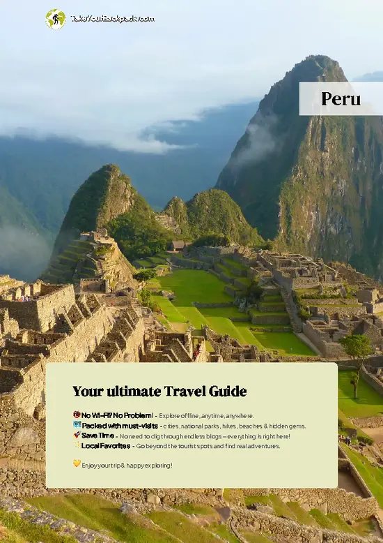
example page 0 from our offline Travel Guide for Peru
example page 1 from our offline Travel Guide for Peru
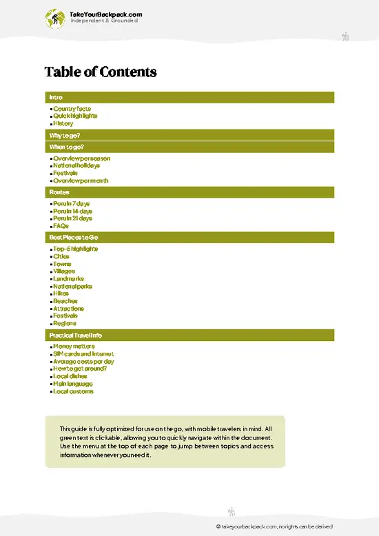
example page 2 from our offline Travel Guide for Peru
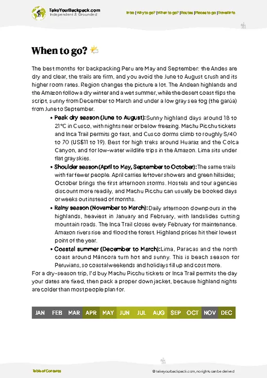
example page 3 from our offline Travel Guide for Peru
example page 4 from our offline Travel Guide for Peru
example page 5 from our offline Travel Guide for Peru
example page 6 from our offline Travel Guide for Peru
example page 7 from our offline Travel Guide for Peru
Loading the map 🌍
CLICK TO FILTER
cities
towns
villages
landmarks
national parks
hikes
beaches
attractions
festivals
regions
SHOW COUNTRY’S BESTSHOW ALL

✨ Why go?
Ranked #4 hike in Peru
What makes it a must-see hike

Santa Cruz Trek gives you a full Andean expedition without a guide, because the route is well marked and the camps are established. The payoff is the density of big views: Alpamayo, Taulliraju, and Artesonraju rise around you, and you cross the pass at Punta Union, where the valley opens to a sweeping panorama. Getting started is easy. Huaraz sits within a few hours of both trailheads by local colectivo, so you can fold it into a Lima to Cusco route without paying for private transport. You can also keep costs low by hiring a burro driver for the heavy gear, or skip it and carry everything yourself. The trail is also flexible. Many hikers add a side detour to Alpamayo Base Camp for one extra day, while others shorten the loop by starting at Cashapampa, which means a gentler first climb. Either … read more 👉
Santa Cruz Trek gives you a full Andean expedition without a guide, because the route is well marked and the camps are established. The payoff is the density of big views: Alpamayo, Taulliraju, and Artesonraju rise around you, and you cross the pass at Punta Union, where the valley opens to a sweeping panorama. Getting started is easy. Huaraz sits within a few hours of both trailheads by local colectivo, so you can fold it into a Lima to Cusco route without paying for private transport. You can also keep costs low by hiring a burro driver for the heavy gear, or skip it and carry everything yourself. The trail is also flexible. Many hikers add a side detour to Alpamayo Base Camp for one extra day, while others shorten the loop by starting at Cashapampa, which means a gentler first climb. Either way, you finish in a village with simple lodging and a cold beer.

💡 HighlightsThe experiences that define the visit

  1. Punta Union Pass: The high point of the trek at about 4,750 meters, with a steep final push and a wide view down to the turquoise lakes of the Huaripampa valley on the far side.
  2. Taulliraju: A sharp, pyramid-shaped peak above the Taullipampa camp, best seen at dusk when the faces catch the last light.
  3. Alpamayo: Often called one of the most beautiful mountains in the world, its near-perfect snow pyramid shows from the side trail to the base camp viewpoint.
  4. Laguna Jatuncocha: A broad glacial lake in the Santa Cruz valley, colored milky turquoise and ringed by cliffs, with easy flat camping beside it.
  5. Llamacorral and Paria Valley: A green valley floor with grazing cattle, braided streams, and views of Pisco and Chacraraju, great for an easy rest day.
If time is short, skip the Alpamayo side detour and keep to the main loop over the pass.
Spotted a mistake or missing something? Contact us.

Things to do near Santa Cruz Trek

Ratings based on Tripadvisor reviews. When you book through this link, you support our work at no extra cost to you.

🌤️ When to go?Choosing the right time of year

  • Dry Season (May to September): Late May through August gives the most stable trekking in the Cordillera Blanca. Days reach 15 to 20°C (59 to 68°F) in the valleys, and nights on the Punta Union side drop to -5 to 0°C (23 to 32°F). Sun runs roughly 11.5 to 12 hours a day.
  • Peak Crowds (June to August): Camps fill, mule teams queue at the pass, and agency prices in Huaraz rise by about 10 to 20 percent. Book a few weeks ahead.
  • Shoulder Months (April, May, September, October): Fewer hikers, with occasional afternoon storms. Lakes still look good, and bargaining is easier.
  • Wet Season (November to March): Heavy rain and snow at Punta Union (4,750 m / 15,584 ft) make the trail muddy and the views unreliable. Most operators run few departures.
Start in early June or September to get dry weather without the July and August crush.

source: climatestotravel.comJANJanuary: fair for travelingFEBFebruary: fair for travelingMARMarch: fair for travelingAPRApril: fair for travelingMAYMay: highly recommended for travelingJUNJune: excellent for travelingJULJuly: excellent for travelingAUGAugust: excellent for travelingSEPSeptember: highly recommended for travelingOCTOctober: fair for travelingNOVNovember: fair for travelingDECDecember: fair for traveling
peru-hike-santa-cruz-trek
© Google |

✈️ The backpacker research shortcutPeru Travel Guide

An offline-friendly backpacking guide with optimized travel routes, ranked highlights, transport advice, and the best areas to stay.
example page 0 from our offline Travel Guide for Peru
example page 1 from our offline Travel Guide for Peru
example page 2 from our offline Travel Guide for Peru
example page 3 from our offline Travel Guide for Peru
example page 4 from our offline Travel Guide for Peru
example page 5 from our offline Travel Guide for Peru
example page 6 from our offline Travel Guide for Peru
example page 7 from our offline Travel Guide for Peru
The digital guide (310 pages) contains:
✅ 102 highlights, ranked by travel appeal
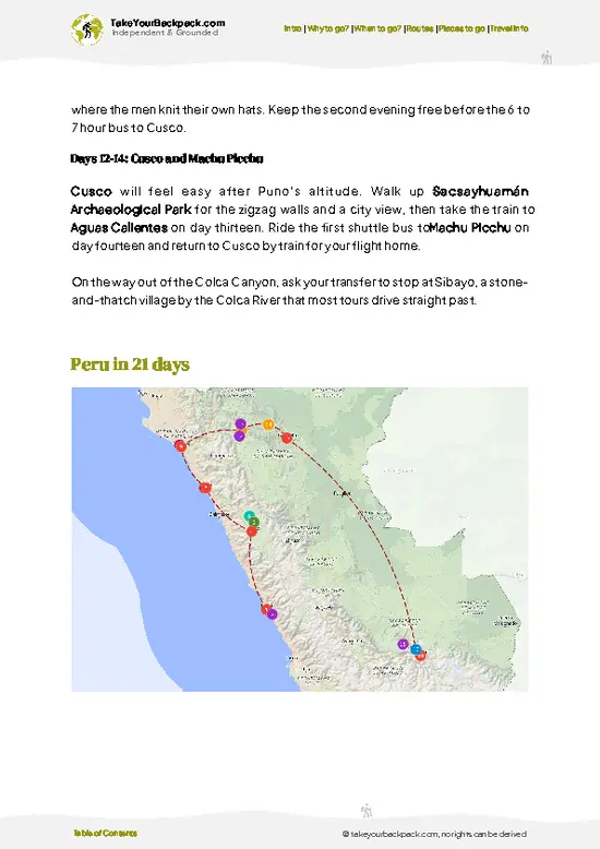
✅ Optimized 7, 14 & 21-day travel routes
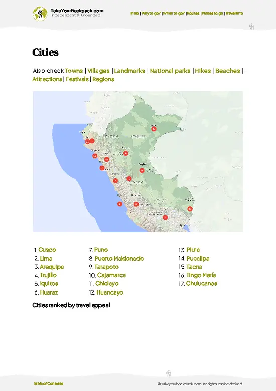
✅ Cities, national parks, landmarks, beaches
✅ How to get around
✅ Offline-friendly for travel without Wi-Fi
👉 Click to see all 30+ guide features

📅 Plan smarter in minutes, not weeks
✅ Month by month travel advice
✅ Festivals & national holidays
✅ Budget expectations

🗺️ Go to the right places, skip the overrated ones
✅ Honest pros & cons of destinations
✅ Top hikes, parks & viewpoints
✅ Lesser-known places most travelers miss
✅ Clear “worth it vs skip it” guidance

🛏️ Travel smoothly without rookie mistakes
✅ Best areas to stay
✅ Transport systems explained simply
✅ Common scams & safety advice
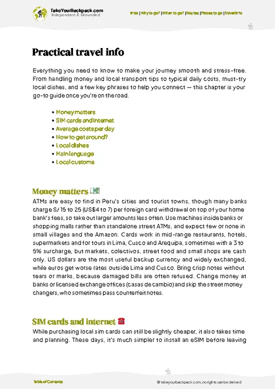
✅ SIM cards, money & practical tips

🌍 Understand the country, not just visit it
✅ Culture & traditions
✅ 52 Essential phrases & customs
✅ Festivals worth planning around
✅ Traveler-friendly historical context
✅ Insights that make places more meaningful

📱 Built for real travel conditions
✅ Fully downloadable PDF
✅ Works completely offline
✅ Optimized for phone use
✅ Useful in remote areas & buses
✅ Everything in one place
Stop searching, start planning
Get instant access to your full guide. 30‑day money-back guarantee.
+ Add another guide for just

By proceeding you agree to our terms.
Sent to your inbox immediately after payment • 100% Secure Checkout
Best Backpacking Travel Advisor 2025 tourism awardBest Backpacking
Travel Advisor
2025
What others say about Take Your Backpack Guides:
⭐⭐⭐⭐⭐
Fantastic, amazing amount of information!
⭐⭐⭐⭐⭐
My goodness this is amazing, it's what I've been looking for hats off too you!
⭐⭐⭐⭐⭐
I think this is absolutely BRILLIANT
⭐⭐⭐⭐
Very complete and informative. It's still missing places, but I gotta to commend you
⭐⭐⭐⭐⭐
This is truly amazing, thank you, can't wait to explore it with my kids!
⭐⭐⭐⭐⭐
Awesome resource, thank you!
⭐⭐⭐⭐⭐
This is amazing! Can't wait to explore the ones I haven't seen
⭐⭐⭐⭐
I love this! Well done, great idea.
⭐⭐⭐⭐⭐
Thanks for taking the time to make this gem!
⭐⭐⭐⭐⭐
This might be the best website I've ever seen.
⭐⭐⭐⭐⭐
Congratulations, and thank you so much for your work; it's incredibly valuable.
⭐⭐⭐⭐
In all seriousness I think you did a great job pointing out the important spots
⭐⭐⭐⭐⭐
10/10 very good
⭐⭐⭐⭐⭐
As someone who's only just starting to visit regularly this is awesome, thank you.
⭐⭐⭐⭐
Thank you very much! I'm going to visit my dad, it's going to be very useful!
⭐⭐⭐⭐⭐
This is really cool! We'll be travelling for the first time and this definitely come in handy.
⭐⭐⭐⭐⭐
You are now our minister of culture, congratulations 👨‍💼
⭐⭐⭐⭐⭐
Just wanted to tell you that this is a pearl! Going to follow your recommendations.
⭐⭐⭐⭐⭐
This is so cool. I'll definitely be using the resource for my travels soon.
⭐⭐⭐⭐⭐
This is very impressive! Good work.
⭐⭐⭐⭐⭐
This is an amazing and informative site. Very well done!

🛏️ Where to stay?Best areas and accommodation options

If you enjoy meeting fellow travelers, consider choosing hostels with high ratings for atmosphere. On the other hand, if you prefer having your own space, a hotel might be a better option.

🥾 Hike detailsHike details: route, duration, and difficulty of Santa Cruz Trek

Total Distance: Santa Cruz Trek covers about 45 to 50 kilometers from end to end.
Duration: Four days is standard, or three if you are fast and acclimatized.
Difficulty: Moderate to demanding, mainly due to altitude and the long climb to the pass.
Starting Point: Most hikers start in Vaquería and finish in Cashapampa, or reverse it.
  • Access: Colectivos from Huaraz run via Yungay and Caraz, then on to the trailheads.
  • Direction: Starting at Vaquería means you cross Punta Union with a gentler overall gradient.
Major Landmarks:
  • Punta Union: The pass at roughly 4,750 meters.
  • Taullipampa: A camp below Taulliraju
… read more 👉
Total Distance: Santa Cruz Trek covers about 45 to 50 kilometers from end to end.
Duration: Four days is standard, or three if you are fast and acclimatized.
Difficulty: Moderate to demanding, mainly due to altitude and the long climb to the pass.
Starting Point: Most hikers start in Vaquería and finish in Cashapampa, or reverse it.
  • Access: Colectivos from Huaraz run via Yungay and Caraz, then on to the trailheads.
  • Direction: Starting at Vaquería means you cross Punta Union with a gentler overall gradient.
Major Landmarks:
  • Punta Union: The pass at roughly 4,750 meters.
  • Taullipampa: A camp below Taulliraju with glacier views.
  • Jatuncocha: A large turquoise lake.
  • Llamacorral: A popular camp in the green valley.
Terrain and Scenery: Rocky trail, grassy valley floors, stream crossings, and a steep zigzag climb to the pass, framed by glaciers throughout.
Vegetation: Puna grassland, polylepis patches, and bright wildflowers at lower elevations, with bare rock higher up.
Wildlife: Cattle and donkeys are common. Look for Andean condors, vizcachas, and sometimes the Andean fox.
⚠️ Hiking info can sometimes be outdated or inaccurate. Before you hit the trail, check the latest conditions with locals. If you do spot anything that's off, I'd love to hear from you, so I can update it for fellow travelers.

🛡️ SafetySafety Tips and Common Scams in Santa Cruz Trek

Santa Cruz Trek is a well-trodden, well-supported route, and most problems come from altitude rather than danger on the trail. The route crosses Punta Union at 4,750 meters, so spend at least two or three days in Huaraz (3,050 m) first, walk slowly, and drink plenty. Headaches are common, and descending is the cure if they worsen. Weather swings fast: strong sun and cold nights in the same day, with afternoon cloud or hail even in dry months. Bring a warm sleeping bag rated to -10°C, a rain shell, sunscreen, and trekking poles for the steep, loose descent from the pass. The path is clear and busy, so navigation is easy. Cattle and donkeys roam the valley, and mule trains have right of way, so step to the uphill side. Dogs near villages are usually harmless. Pack out all trash and treat your water from streams.

FAQCommon questions from travelers

Santa Cruz Trek takes 4 days and 3 nights for the standard route, covering about 45 to 50 kilometers from Vaqueria to Cashapampa (or the reverse). Daily walking runs roughly 5 to 7 hours. Getting to the trailhead from Huaraz means shared transport via Yungay and the Llanganuco Valley. A shorter 3-day version exists with a vehicle assist.
Santa Cruz Trek is moderate, with the main challenge being altitude rather than technical terrain. The highest point is Punta Union at 4,750 meters, reached on day 2 with a climb of roughly 700 to 800 meters. Paths are clear and maintained, and most reasonably fit hikers with 2 to 3 days of acclimatization in Huaraz finish comfortably. Camping nights hover near freezing, which adds to the effort.
Santa Cruz Trek requires a park entry ticket for Huascaran National Park, about US$40, for four to 30 days, paid at the Cashapampa or Vaqueria checkpoints or in Huaraz. A guide is not mandatory, and independent hikers do it regularly with their own gear and food. Guided group trips from Huaraz cost around US$180 to 300 for 4 days including meals, tents, and mules, and a muleteer can be hired for about US$25 to 35 a day.
⚠️ Things can change over time, so always validate details locally before you go.

Other Peruvian hikes near Santa Cruz Trek

Explore more nearby:

  • Laguna 69—Chacraraju ice walls, turquoise lake, day hike, 4,600 m finish| 21 km away
  • Cordillera Huayhuash Circuit—Yerupajá, Siula Grande, multi-week circuit, 5,000 m passes| 174 km away
  • Marcahuasi—Granite rock forest, plateau camping, giant stone face, mule-assisted climb| 341 km away

💡 Not sure where to go next?
Create a personalized itinerary for Peru including Santa Cruz Trek and the places that fit your trip.

Generate my itinerary

👉 Discover all hikes

Or checkout all Peru has to offer (think cities, towns, villages, national parks, hikes, beaches, festivals)
Country photo of Peru

We 💚 feedbackSumming up the experience

Santa Cruz Trek rewards those who look down as well as up, because the stone-lined path and the herders’ corrals carry a long history of shepherding that most hikers rush past. I would slow down in the Paria valley and give your legs a gentler day before the pass.

✈️ When did I visit Peru?
Peru I visited during my half year trip through South and Central America back in 2003

✍️ Help improve this page!
The information on this page is based on my own backpacking experience in Peru, supplemented with up-to-date research and feedback from other travelers. Travel details can change, so if you notice anything outdated or incomplete, feel free to let me know.


🙋‍♂️ Give feedback

👋 Meet the founderWho’s Behind Take Your Backpack?

Johan, backpacker and founder of TakeYourBackpackHi, I’m Johan (Netherlands 🇳🇱), the creator of TakeYourBackpack. Over the past 3 decades, I’ve backpacked through 90+ countries across six continents, gaining extensive experience with independent travel, long-term trips, and overland routes.

This site is built on a combination of firsthand travel experience and carefully curated insights from other backpackers. Many guides are based on places I’ve personally visited, while others bring together tips, observations, and practical advice shared by trusted travelers I’ve met along the way.

The goal is to provide realistic, experience-driven guidance — not generic itineraries — so you can explore destinations with better context, clearer expectations, and more confidence.