
×

Peru🇵🇪 | hikesCordillera Huayhuash CircuitYerupajá, Siula Grande, multi-week circuit, 5,000 m passes | things to do and best time to go

Explore Laguna 69Explore Vilcabamba Trek

Backpacking in Cordillera Huayhuash Circuit
🏆 Top pickhike ranked #3
By Johan Kruseman 🇳🇱 | Updated October 19, 2026

Most travelers face one decision here: go with an arriero-supported group or carry everything yourself, and the answer comes down to altitude and logistics. Camps sit at 4,000 to 4,700 meters and passes top 5,000, so a burro team saves your knees and your mood. Cordillera Huayhuash Circuit loops around a compact range in the Andes of north-central Peru, with roughly 8 to 12 days of ridgelines, turquoise lakes and glaciers, all hard, all brilliant. Buses from Huaraz or Lima reach Chiquián, the usual start, though you then need a colectivo to Llamac or Pocpa. At Llamac, a woman selling bread told me, “Eat now, mountain will make you slow,” and pressed a second roll on me for free. She was right. Unlike the Santa Cruz trek next door, which is short and busy, Huayhuash is longer, wilder and far more remote.

Discover everything you want to know in the 📖 Peru Travel Guide.
Best time to go: May - September
Duration: 10 days
Distance: 125 kilometers
Total ascent: 6500 meters


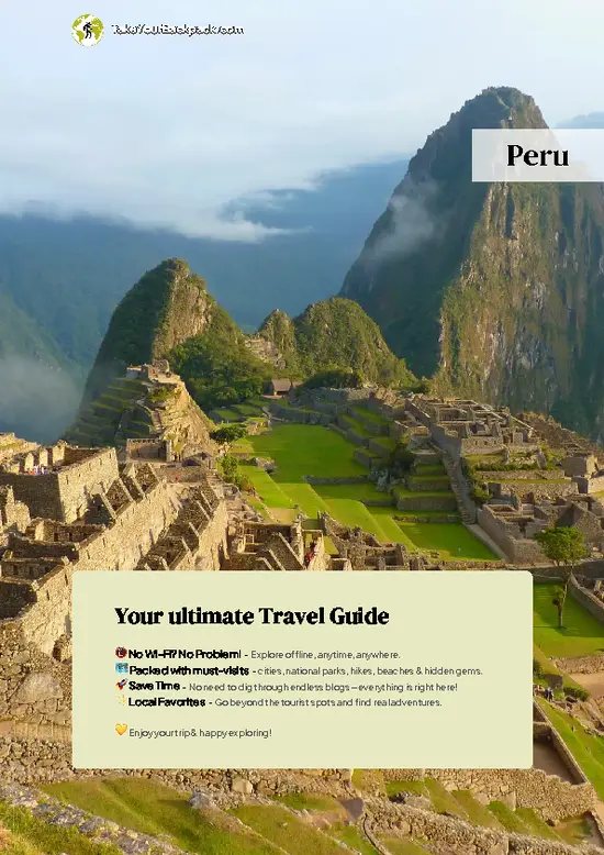
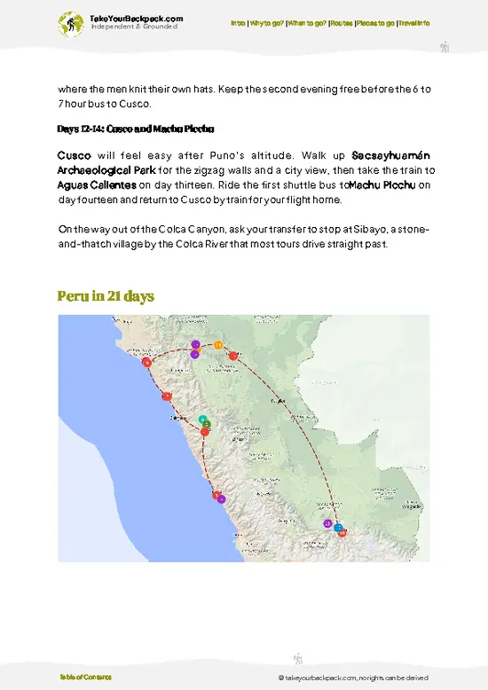
example page 0 from our offline Travel Guide for Peru
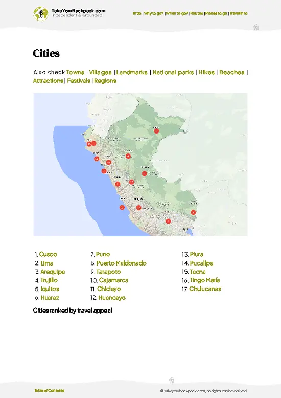
example page 1 from our offline Travel Guide for Peru
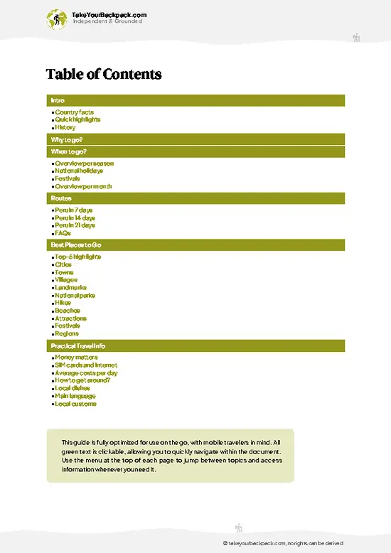
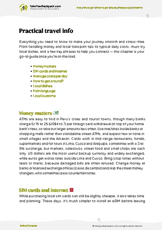
example page 2 from our offline Travel Guide for Peru
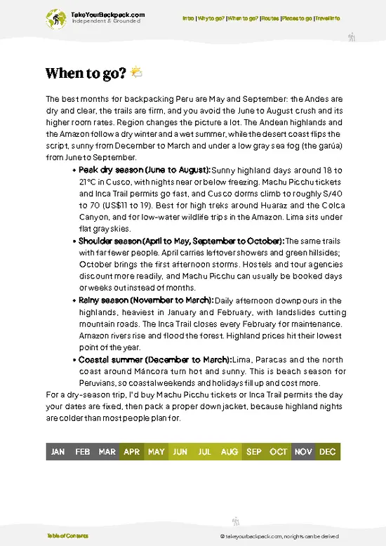
example page 3 from our offline Travel Guide for Peru
example page 4 from our offline Travel Guide for Peru
example page 5 from our offline Travel Guide for Peru
example page 6 from our offline Travel Guide for Peru
example page 7 from our offline Travel Guide for Peru
Loading the map 🌍
CLICK TO FILTER
cities
towns
villages
landmarks
national parks
hikes
beaches
attractions
festivals
regions
SHOW COUNTRY’S BESTSHOW ALL

✨ Why go?
Ranked #3 hike in Peru
Why Cordillera Huayhuash Circuit should be on your travel list

Cordillera Huayhuash Circuit packs a staggering amount of high-alpine drama into one loop. Within a single day you can cross a pass above 5,000 meters, drop to a glacial lake, and camp beneath the wall of Siula Grande or Yerupajá, Peru’s second-highest peak. Few treks anywhere give you that density of peaks, and you rarely share the trail with more than a handful of groups.

The second draw is flexibility. Purists do the full circuit of about 10 days, but shortened versions of 5 to 7 days exist, and you can skip the hardest stretches by joining at different villages. Access is simple enough for independent budget travelers, since Huaraz is a well-stocked trekking hub with gear rental and agencies that will arrange only the donkeys and cook if that is all you want. Add a few days in the Cordillera … read more 👉
Cordillera Huayhuash Circuit packs a staggering amount of high-alpine drama into one loop. Within a single day you can cross a pass above 5,000 meters, drop to a glacial lake, and camp beneath the wall of Siula Grande or Yerupajá, Peru’s second-highest peak. Few treks anywhere give you that density of peaks, and you rarely share the trail with more than a handful of groups.

The second draw is flexibility. Purists do the full circuit of about 10 days, but shortened versions of 5 to 7 days exist, and you can skip the hardest stretches by joining at different villages. Access is simple enough for independent budget travelers, since Huaraz is a well-stocked trekking hub with gear rental and agencies that will arrange only the donkeys and cook if that is all you want. Add a few days in the Cordillera Blanca for acclimatization and the circuit slots into a longer Peru route without special planning. Community entry fees fund local villages, and that money is visible on the trail.

💡 HighlightsThe experiences that define the visit

  1. Laguna Carhuacocha and Yerupajá: The classic first camp. Yerupajá, Peru’s second-highest peak at 6,617 meters, rises straight above a turquoise lake, with Siula Grande and Rasac visible too. It is the view most people picture.
  2. Siula Grande Base Camp (Laguna Sarapococha): Reached by a side trip, this is where the story behind Touching the Void unfolded. Climbers and film fans come for the vertical ice and the quiet.
  3. Punta Cuyoc Pass (5,000 meters): A steep zigzag leads to a pass with a sweeping view over glacial basins and the high ridge across the valley. Hard going, yet the panorama earns it.
  4. Laguna Mitucocha and Laguna Jahuacocha: Jahuacocha lies below Rondoy and Ninashanca, and the bright green-blue water reflects the peaks on calm mornings. A gentler stop, ideal for acclimatization.
  5. Viconga
… read more 👉
  1. Laguna Carhuacocha and Yerupajá: The classic first camp. Yerupajá, Peru’s second-highest peak at 6,617 meters, rises straight above a turquoise lake, with Siula Grande and Rasac visible too. It is the view most people picture.
  2. Siula Grande Base Camp (Laguna Sarapococha): Reached by a side trip, this is where the story behind Touching the Void unfolded. Climbers and film fans come for the vertical ice and the quiet.
  3. Punta Cuyoc Pass (5,000 meters): A steep zigzag leads to a pass with a sweeping view over glacial basins and the high ridge across the valley. Hard going, yet the panorama earns it.
  4. Laguna Mitucocha and Laguna Jahuacocha: Jahuacocha lies below Rondoy and Ninashanca, and the bright green-blue water reflects the peaks on calm mornings. A gentler stop, ideal for acclimatization.
  5. Viconga Hot Springs: Natural thermal pools by the Viconga camp, sitting beneath a glacier. Soaking after the highest section of the route is a welcome ritual, and the stone pools are simple but warm.
All five sights together take roughly 8 to 10 days at a steady circuit pace, or 6 days if you trim the loop.
Spotted a mistake or missing something? Contact us.

🌤️ When to go?Best time to hike the Cordillera Huayhuash Circuit

  • Dry Season (May to September): June to August is the window for the circuit, with mostly clear mornings and little rain. Daytime highs reach 12 to 18°C (54 to 64°F) at camp, while nights at 4,200 to 4,700 m drop to -10 to -2°C (14 to 28°F). Daylight is steady at about 11 to 12 hours.
  • Peak Crowds (July and August): Campsites such as Carhuacocha and Viconga fill up, and local guides, arrieros and mule prices run highest.
  • Shoulder Months (April, May, September): Fewer hikers, still decent weather, and slightly easier bargaining. Afternoon cloud and the odd snow flurry show up at the edges.
  • Wet Season (November to March): Expect daily rain and snow on the passes, temperatures of -5 to 10°C (23 to 50°F), muddy trails and blocked views. Most operators stop running.
Book a mid-June start to get dry weather with a little breathing room at campsites.

source: climatestotravel.comJANJanuary: below average for travelingFEBFebruary: below average for travelingMARMarch: below average for travelingAPRApril: fair for travelingMAYMay: highly recommended for travelingJUNJune: excellent for travelingJULJuly: excellent for travelingAUGAugust: excellent for travelingSEPSeptember: highly recommended for travelingOCTOctober: fair for travelingNOVNovember: below average for travelingDECDecember: below average for traveling
when-to-go

✈️ The backpacker research shortcutPeru Travel Guide

An offline-friendly backpacking guide with optimized travel routes, ranked highlights, transport advice, and the best areas to stay.
example page 0 from our offline Travel Guide for Peru
example page 1 from our offline Travel Guide for Peru
example page 2 from our offline Travel Guide for Peru
example page 3 from our offline Travel Guide for Peru
example page 4 from our offline Travel Guide for Peru
example page 5 from our offline Travel Guide for Peru
example page 6 from our offline Travel Guide for Peru
example page 7 from our offline Travel Guide for Peru
The digital guide (310 pages) contains:
✅ 102 highlights, ranked by travel appeal
✅ Optimized 7, 14 & 21-day travel routes
✅ Cities, national parks, landmarks, beaches
✅ How to get around
✅ Offline-friendly for travel without Wi-Fi
👉 Click to see all 30+ guide features

📅 Plan smarter in minutes, not weeks
✅ Month by month travel advice
✅ Festivals & national holidays
✅ Budget expectations

🗺️ Go to the right places, skip the overrated ones
✅ Honest pros & cons of destinations
✅ Top hikes, parks & viewpoints
✅ Lesser-known places most travelers miss
✅ Clear “worth it vs skip it” guidance

🛏️ Travel smoothly without rookie mistakes
✅ Best areas to stay
✅ Transport systems explained simply
✅ Common scams & safety advice
✅ SIM cards, money & practical tips

🌍 Understand the country, not just visit it
✅ Culture & traditions
✅ 52 Essential phrases & customs
✅ Festivals worth planning around
✅ Traveler-friendly historical context
✅ Insights that make places more meaningful

📱 Built for real travel conditions
✅ Fully downloadable PDF
✅ Works completely offline
✅ Optimized for phone use
✅ Useful in remote areas & buses
✅ Everything in one place
Stop searching, start planning
Get instant access to your full guide. 30‑day money-back guarantee.
+ Add another guide for just

By proceeding you agree to our terms.
Sent to your inbox immediately after payment • 100% Secure Checkout
Best Backpacking Travel Advisor 2025 tourism awardBest Backpacking
Travel Advisor
2025
What others say about Take Your Backpack Guides:
⭐⭐⭐⭐⭐
Fantastic, amazing amount of information!
⭐⭐⭐⭐⭐
My goodness this is amazing, it's what I've been looking for hats off too you!
⭐⭐⭐⭐⭐
I think this is absolutely BRILLIANT
⭐⭐⭐⭐
Very complete and informative. It's still missing places, but I gotta to commend you
⭐⭐⭐⭐⭐
This is truly amazing, thank you, can't wait to explore it with my kids!
⭐⭐⭐⭐⭐
Awesome resource, thank you!
⭐⭐⭐⭐⭐
This is amazing! Can't wait to explore the ones I haven't seen
⭐⭐⭐⭐
I love this! Well done, great idea.
⭐⭐⭐⭐⭐
Thanks for taking the time to make this gem!
⭐⭐⭐⭐⭐
This might be the best website I've ever seen.
⭐⭐⭐⭐⭐
Congratulations, and thank you so much for your work; it's incredibly valuable.
⭐⭐⭐⭐
In all seriousness I think you did a great job pointing out the important spots
⭐⭐⭐⭐⭐
10/10 very good
⭐⭐⭐⭐⭐
As someone who's only just starting to visit regularly this is awesome, thank you.
⭐⭐⭐⭐
Thank you very much! I'm going to visit my dad, it's going to be very useful!
⭐⭐⭐⭐⭐
This is really cool! We'll be travelling for the first time and this definitely come in handy.
⭐⭐⭐⭐⭐
You are now our minister of culture, congratulations 👨‍💼
⭐⭐⭐⭐⭐
Just wanted to tell you that this is a pearl! Going to follow your recommendations.
⭐⭐⭐⭐⭐
This is so cool. I'll definitely be using the resource for my travels soon.
⭐⭐⭐⭐⭐
This is very impressive! Good work.
⭐⭐⭐⭐⭐
This is an amazing and informative site. Very well done!

🛏️ Where to stay?Where staying makes the most sense

If you enjoy meeting fellow travelers, consider choosing hostels with high ratings for atmosphere. On the other hand, if you prefer having your own space, a hotel might be a better option.

🥾 Hike detailsTrail overview: what to expect on the hike

Cordillera Huayhuash Circuit is a multi-day high-altitude loop that demands acclimatization first.
Total Distance: About 120 to 130 kilometers for the full loop.
Estimated Duration: 8 to 12 days, with shortcuts to 5 or 6 days.
Difficulty: Strenuous. Passes regularly exceed 4,600 meters, and several top 5,000.
Starting Point: Most hikers start at Llamac or Pocpa, reached from Chiquián.
  • Public Transport: Buses run from Huaraz to Chiquián, then local colectivos or hired cars continue to the trailhead.
Major Landmarks:
  • Laguna Carhuacocha: Camp beneath Yerupajá and Siula Grande.
  • Punta Cacanan Pass: Roughly
… read more 👉
Cordillera Huayhuash Circuit is a multi-day high-altitude loop that demands acclimatization first.
Total Distance: About 120 to 130 kilometers for the full loop.
Estimated Duration: 8 to 12 days, with shortcuts to 5 or 6 days.
Difficulty: Strenuous. Passes regularly exceed 4,600 meters, and several top 5,000.
Starting Point: Most hikers start at Llamac or Pocpa, reached from Chiquián.
  • Public Transport: Buses run from Huaraz to Chiquián, then local colectivos or hired cars continue to the trailhead.
Major Landmarks:
  • Laguna Carhuacocha: Camp beneath Yerupajá and Siula Grande.
  • Punta Cacanan Pass: Roughly 4,690 meters, with big views of Jirishanca.
  • Viconga Hot Springs: A thermal soak near the high point of the route.
  • Punta Cuyoc: A 5,000 meter pass with long views.
Terrain and Scenery: Rocky switchbacks, high puna grassland, glacial moraines, and turquoise lakes under steep granite and ice walls.
Vegetation: Ichu grass, cushion plants and scattered queñual (polylepis) pockets lower down. Above 4,500 meters it is mostly rock and ice.
Wildlife: Vicuñas, vizcachas, Andean condors, and sometimes foxes. Donkeys and mules are the most common animals on the trail.
Practical Notes: Community camping fees are paid in local currency at villages, so carry small bills. Pack a four-season sleeping bag and waterproof layers.
⚠️ Hiking info can sometimes be outdated or inaccurate. Before you hit the trail, check the latest conditions with locals. If you do spot anything that's off, I'd love to hear from you, so I can update it for fellow travelers.

🛡️ SafetyStaying Safe: What Travelers Should Know

The Cordillera Huayhuash Circuit is a remote high-altitude trek where altitude and weather cause most problems, not crime or wildlife. Every pass sits above 4,600 m, and the highest, Punta Cuyoc, reaches about 5,000 m, so spend at least three days acclimatizing in Huaraz or Chiquián first, walk slowly, and drink plenty of water. Nights are freezing, so bring a sleeping bag rated to -10°C (14°F) and waterproof layers, since afternoon storms and hail can arrive even in dry season. Trails are well worn, but fog makes navigation tricky, so carry an offline map. Rivers are usually shallow, though some crossings get cold and fast after rain. Communities collect camping fees at each site, and keep your gear in sight at camp, as petty theft has been reported. Guard dogs and grazing cattle are common, … read more 👉
The Cordillera Huayhuash Circuit is a remote high-altitude trek where altitude and weather cause most problems, not crime or wildlife. Every pass sits above 4,600 m, and the highest, Punta Cuyoc, reaches about 5,000 m, so spend at least three days acclimatizing in Huaraz or Chiquián first, walk slowly, and drink plenty of water. Nights are freezing, so bring a sleeping bag rated to -10°C (14°F) and waterproof layers, since afternoon storms and hail can arrive even in dry season. Trails are well worn, but fog makes navigation tricky, so carry an offline map. Rivers are usually shallow, though some crossings get cold and fast after rain. Communities collect camping fees at each site, and keep your gear in sight at camp, as petty theft has been reported. Guard dogs and grazing cattle are common, so give them space. Insurance covering evacuation is worth having, as help is days away.

FAQFrequently asked questions about Cordillera Huayhuash Circuit

The full Cordillera Huayhuash Circuit takes 8 to 10 days, covering roughly 115 to 130 km. Shorter 6 to 7 day versions skip sections or use transport shortcuts, while the Huayhuash Trek with extra side trips can stretch to 12 days. Most hikers begin and end at Llamac or Pocpa and reach them by road from Chiquián, about 3 to 4 hours from Huaraz.
Difficult. Expect a high-altitude trek with around 8 passes between 4,600 and 5,000 m, long days of 6 to 9 hours, and cold camps at 4,000 to 4,700 m. Previous multiday hiking experience and 3 or more days of acclimatization in Huaraz (3,050 m) make a big difference, and the Punta Cuyoc and Yaucha sections are the toughest.
A guide is not required, and many experienced hikers go independently or with a local arriero for mules. Permits are not issued centrally. Instead, you pay community fees at each camp and entrance point, totaling about US$70 to 100 in cash (soles) for the whole circuit. Fully guided packages from Huaraz run about US$600 to 1,000 and include food, mules and camping gear.
⚠️ Things can change over time, so always validate details locally before you go.

Other Peruvian hikes near Cordillera Huayhuash Circuit

Explore more nearby:

  • Laguna 69—Chacraraju ice walls, turquoise lake, day hike, 4,600 m finish| 157 km away
  • Marcahuasi—Granite rock forest, plateau camping, giant stone face, mule-assisted climb| 173 km away
  • Santa Cruz Trek—Alpamayo, Punta Union, arrieros and burros, lake-to-lake loop| 174 km away

💡 Not sure where to go next?
Create a personalized itinerary for Peru including Cordillera Huayhuash Circuit and the places that fit your trip.

Generate my itinerary

👉 Discover all hikes

Or checkout all Peru has to offer (think cities, towns, villages, national parks, hikes, beaches, festivals)
Country photo of Peru

We 💚 feedbackKey takeaways before you go

Give Cordillera Huayhuash Circuit at least 8 days if you want the full loop without rushing, and add 3 days in Huaraz beforehand to adapt to altitude. If time is short, I would take the 5 to 6 day version rather than hurry the passes. Bring a warm sleeping bag and cash for community fees.

✈️ When did I visit Peru?
Peru I visited during my half year trip through South and Central America back in 2003

✍️ Help improve this page!
The information on this page is based on my own backpacking experience in Peru, supplemented with up-to-date research and feedback from other travelers. Travel details can change, so if you notice anything outdated or incomplete, feel free to let me know.


🙋‍♂️ Give feedback

👋 Meet the founderWho’s Behind Take Your Backpack?

Johan, backpacker and founder of TakeYourBackpackHi, I’m Johan (Netherlands 🇳🇱), the creator of TakeYourBackpack. Over the past 3 decades, I’ve backpacked through 90+ countries across six continents, gaining extensive experience with independent travel, long-term trips, and overland routes.

This site is built on a combination of firsthand travel experience and carefully curated insights from other backpackers. Many guides are based on places I’ve personally visited, while others bring together tips, observations, and practical advice shared by trusted travelers I’ve met along the way.

The goal is to provide realistic, experience-driven guidance — not generic itineraries — so you can explore destinations with better context, clearer expectations, and more confidence.