×

Sierra Leone🇸🇱 | hikesMount BintumaniSierra Leone’s highest summit, dripping montane forest, tussock ridges, foot-village guides | things to do and best time to go

Explore Loma MountainsExplore Gola Rainforest Trek

Backpacking in Mount Bintumani
🏆 Top pickhike ranked #1
By Johan Kruseman 🇳🇱 | Updated October 22, 2026

The big decision at Mount Bintumani is how many days to give it, and a clear weather window plus a local guide from the foot villages tips it toward two unhurried days rather than a one-day sprint. The mountain sits in the northeast of Sierra Leone, inside the Loma Mountains, and the standard approach starts on red laterite tracks that end at small farming villages where roosters and woodsmoke wake you. From there the path climbs through dark, dripping forest, then breaks into open grassland where the wind carries a cool, grassy smell and your boots slap wet ground. It is steep in places and muddy for most of the year. Public transport stops well short of the trailhead, so expect shared vehicles, motorbikes and some walking to reach the base. The reward is the highest point in the country, a bald summit with a cairn and a view over ridgelines in every direction. At the top, mist often pours through the gaps in seconds.

Discover everything you want to know in the 📖 Sierra Leone Travel Guide.
Best time to go: November - April
Duration: 2 days
Distance: 30 kilometers
Total ascent: 1200 meters


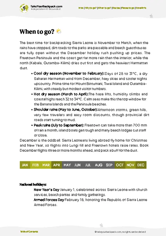
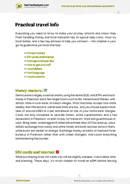
example page 0 from our offline Travel Guide for Sierra Leone
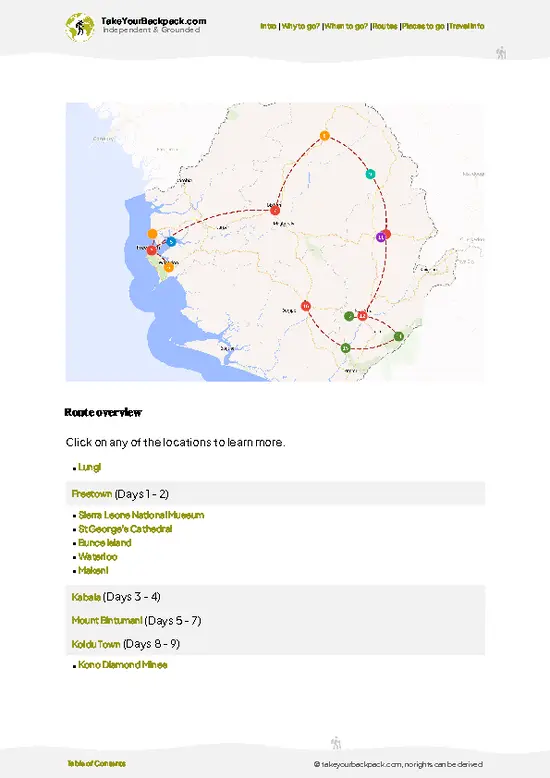
example page 1 from our offline Travel Guide for Sierra Leone
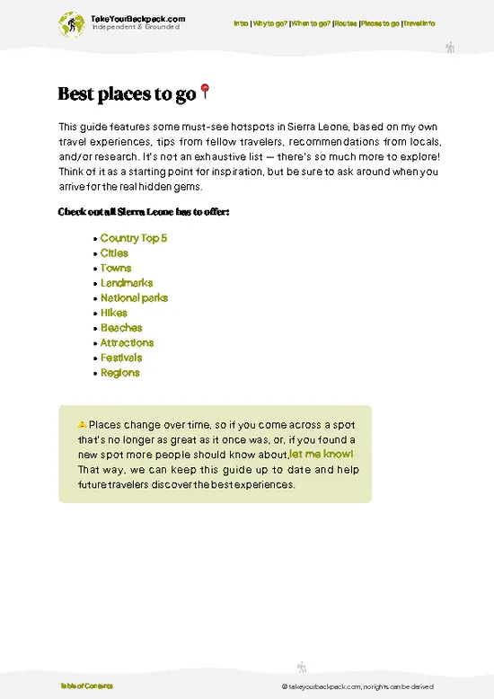
example page 2 from our offline Travel Guide for Sierra Leone
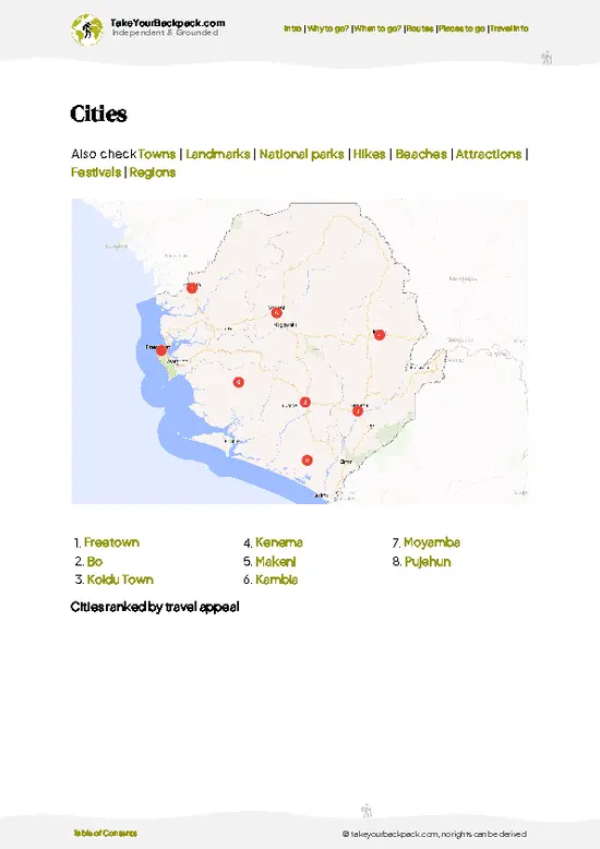
example page 3 from our offline Travel Guide for Sierra Leone
example page 4 from our offline Travel Guide for Sierra Leone
example page 5 from our offline Travel Guide for Sierra Leone
example page 6 from our offline Travel Guide for Sierra Leone
example page 7 from our offline Travel Guide for Sierra Leone
Loading the map 🌍
CLICK TO FILTER
cities
towns
landmarks
national parks
hikes
beaches
attractions
festivals
regions
SHOW COUNTRY’S BESTSHOW ALL

✨ Why go?
Ranked #1 hike in Sierra Leone
What makes it a must-see hike

Mount Bintumani is the one summit in Sierra Leone that gets a real mountaineering label, and that alone draws the backpackers who like ticking off national high points. Its peak, known locally as Loma Mansa, tops out near 1,945 meters, which puts you above the haze that sits over the lowlands and gives you a very different country from the coast. The hike is also a rare chance to walk through a protected forest in West Africa without other tourists, so you share the path with farmers, porters and your guide, and not another group. Add in the cost, which stays low because you pay for a guide, a bed in a village and food from local cooks, and it suits a longer overland route through the north. Walkers who finish on the summit often say the simple village hospitality at the start was as memorable as the view.

💡 HighlightsWhat this place is best known for

  1. Loma Mansa Summit: This is the reason anyone comes. The highest point in Sierra Leone is an exposed, grassy dome with a marker at the top and views that stretch over the Loma range and the forested lowlands. Cloud often rolls in fast, so reaching the top early gives you the clearest look.
  2. Loma Mountains Forest Belt: The lower slopes climb through dense montane forest, with buttress roots, hanging vines and a constant drip from the canopy. It is dim and humid, loud with insects and birds, and the mud holds your boots at every step.
  3. Upland Grassland Ridges: Above the tree line the path opens onto rolling tussock grass and rocky outcrops. The air turns noticeably cooler here, and the wind makes this the best stretch for sweeping views and for camp-style rest breaks.
  4. Sinekoro and the Foot Villages:
… read more 👉
  1. Loma Mansa Summit: This is the reason anyone comes. The highest point in Sierra Leone is an exposed, grassy dome with a marker at the top and views that stretch over the Loma range and the forested lowlands. Cloud often rolls in fast, so reaching the top early gives you the clearest look.
  2. Loma Mountains Forest Belt: The lower slopes climb through dense montane forest, with buttress roots, hanging vines and a constant drip from the canopy. It is dim and humid, loud with insects and birds, and the mud holds your boots at every step.
  3. Upland Grassland Ridges: Above the tree line the path opens onto rolling tussock grass and rocky outcrops. The air turns noticeably cooler here, and the wind makes this the best stretch for sweeping views and for camp-style rest breaks.
  4. Sinekoro and the Foot Villages: The trail begins in small farming communities where you arrange guides and porters, and where meals of rice and sauce are cooked over open fires. Spending an evening here gives you a feel for rural life in the northeast that you will not get from a bus window.
  5. Wildlife of the Loma Mountains Reserve: The reserve shelters western chimpanzees, forest elephants, Diana monkeys and several duikers. You are unlikely to see the larger animals, but fresh tracks, hooting calls from the canopy and colorful forest birds are common companions on the way up.
Mount Bintumani takes two full days to walk with the approach and descent, and a third day is useful as a buffer for bad weather.
Spotted a mistake or missing something? Contact us.

🌤️ When to go?When to go for the best experience

  • Late November to February: Harmattan haze and the driest, most reliable trekking weather. Days reach 28 to 33°C (82 to 91°F) in the foothills, and summit nights drop to roughly 14 to 18°C (57 to 64°F). Mornings can be hazy, so distant views blur. Expect around 11 to 12 hours of daylight.
  • March to April: Hot and clear, with heat of 32 to 36°C (90 to 97°F) on the lower slopes. Early starts matter. Late-season storms begin to build by April.
  • May to October: Heavy rain, slick laterite, swollen streams and cloud that often swallows the summit. Leeches and mud are common. Few hikers go, and porters and drivers have more flexibility on price, but access roads from Sefadu and Koinadugu districts can turn to soup.
  • Early November: Rains fade, the forest is green and the air is clearer than in midwinter.
… read more 👉
  • Late November to February: Harmattan haze and the driest, most reliable trekking weather. Days reach 28 to 33°C (82 to 91°F) in the foothills, and summit nights drop to roughly 14 to 18°C (57 to 64°F). Mornings can be hazy, so distant views blur. Expect around 11 to 12 hours of daylight.
  • March to April: Hot and clear, with heat of 32 to 36°C (90 to 97°F) on the lower slopes. Early starts matter. Late-season storms begin to build by April.
  • May to October: Heavy rain, slick laterite, swollen streams and cloud that often swallows the summit. Leeches and mud are common. Few hikers go, and porters and drivers have more flexibility on price, but access roads from Sefadu and Koinadugu districts can turn to soup.
  • Early November: Rains fade, the forest is green and the air is clearer than in midwinter. Crowds are minimal all year, so timing is about conditions, not queues.
Book your guide and transport a week ahead for December and January, when the few expedition groups cluster.


source: climatestotravel.comJANJanuary: excellent for travelingFEBFebruary: excellent for travelingMARMarch: excellent for travelingAPRApril: excellent for travelingMAYMay: fair for travelingJUNJune: below average for travelingJULJuly: below average for travelingAUGAugust: below average for travelingSEPSeptember: fair for travelingOCTOctober: fair for travelingNOVNovember: highly recommended for travelingDECDecember: highly recommended for traveling
when-to-go

✈️ The backpacker research shortcutSierra Leone Travel Guide

An offline-friendly backpacking guide with optimized travel routes, ranked highlights, transport advice, and the best areas to stay.
example page 0 from our offline Travel Guide for Sierra Leone
example page 1 from our offline Travel Guide for Sierra Leone
example page 2 from our offline Travel Guide for Sierra Leone
example page 3 from our offline Travel Guide for Sierra Leone
example page 4 from our offline Travel Guide for Sierra Leone
example page 5 from our offline Travel Guide for Sierra Leone
example page 6 from our offline Travel Guide for Sierra Leone
example page 7 from our offline Travel Guide for Sierra Leone
The digital guide (242 pages) contains:
✅ 50 highlights, ranked by travel appeal
✅ Optimized 5, 10 & 15-day travel routes
✅ Cities, national parks, landmarks, beaches
✅ How to get around
✅ Offline-friendly for travel without Wi-Fi
👉 Click to see all 30+ guide features

📅 Plan smarter in minutes, not weeks
✅ Month by month travel advice
✅ Festivals & national holidays
✅ Budget expectations

🗺️ Go to the right places, skip the overrated ones
✅ Honest pros & cons of destinations
✅ Top hikes, parks & viewpoints
✅ Lesser-known places most travelers miss
✅ Clear “worth it vs skip it” guidance

🛏️ Travel smoothly without rookie mistakes
✅ Best areas to stay
✅ Transport systems explained simply
✅ Common scams & safety advice
✅ SIM cards, money & practical tips

🌍 Understand the country, not just visit it
✅ Culture & traditions
✅ 52 Essential phrases & customs
✅ Festivals worth planning around
✅ Traveler-friendly historical context
✅ Insights that make places more meaningful

📱 Built for real travel conditions
✅ Fully downloadable PDF
✅ Works completely offline
✅ Optimized for phone use
✅ Useful in remote areas & buses
✅ Everything in one place
Stop searching, start planning
Get instant access to your full guide. 30‑day money-back guarantee.
+ Add another guide for just

By proceeding you agree to our terms.
Sent to your inbox immediately after payment • 100% Secure Checkout
Best Backpacking Travel Advisor 2025 tourism awardBest Backpacking
Travel Advisor
2025
What others say about Take Your Backpack Guides:
⭐⭐⭐⭐⭐
Fantastic, amazing amount of information!
⭐⭐⭐⭐⭐
My goodness this is amazing, it's what I've been looking for hats off too you!
⭐⭐⭐⭐⭐
I think this is absolutely BRILLIANT
⭐⭐⭐⭐
Very complete and informative. It's still missing places, but I gotta to commend you
⭐⭐⭐⭐⭐
This is truly amazing, thank you, can't wait to explore it with my kids!
⭐⭐⭐⭐⭐
Awesome resource, thank you!
⭐⭐⭐⭐⭐
This is amazing! Can't wait to explore the ones I haven't seen
⭐⭐⭐⭐
I love this! Well done, great idea.
⭐⭐⭐⭐⭐
Thanks for taking the time to make this gem!
⭐⭐⭐⭐⭐
This might be the best website I've ever seen.
⭐⭐⭐⭐⭐
Congratulations, and thank you so much for your work; it's incredibly valuable.
⭐⭐⭐⭐
In all seriousness I think you did a great job pointing out the important spots
⭐⭐⭐⭐⭐
10/10 very good
⭐⭐⭐⭐⭐
As someone who's only just starting to visit regularly this is awesome, thank you.
⭐⭐⭐⭐
Thank you very much! I'm going to visit my dad, it's going to be very useful!
⭐⭐⭐⭐⭐
This is really cool! We'll be travelling for the first time and this definitely come in handy.
⭐⭐⭐⭐⭐
You are now our minister of culture, congratulations 👨‍💼
⭐⭐⭐⭐⭐
Just wanted to tell you that this is a pearl! Going to follow your recommendations.
⭐⭐⭐⭐⭐
This is so cool. I'll definitely be using the resource for my travels soon.
⭐⭐⭐⭐⭐
This is very impressive! Good work.
⭐⭐⭐⭐⭐
This is an amazing and informative site. Very well done!

🛏️ Where to stay?How to pick the right area

If you enjoy meeting fellow travelers, consider choosing hostels with high ratings for atmosphere. On the other hand, if you prefer having your own space, a hotel might be a better option.

🥾 Hike detailsRoute, distance, and difficulty explained

Total Distance: Mount Bintumani is roughly 30 kilometers as a round trip from the foot villages, depending on where your transport drops you.
Estimated Duration: Plan two days, with a night camped or sheltered high on the mountain or in the lower villages, and one spare day for weather.
Difficulty: Moderate to hard. The climb is steady, the ground is slick with mud and roots, and there is little shade on the upper grassland. Fitness and sturdy boots matter more than technical skill.
Starting Point: The usual start is Sinekoro and neighboring villages at the foot of the Loma Mountains in the northeast.
… read more 👉
Total Distance: Mount Bintumani is roughly 30 kilometers as a round trip from the foot villages, depending on where your transport drops you.
Estimated Duration: Plan two days, with a night camped or sheltered high on the mountain or in the lower villages, and one spare day for weather.
Difficulty: Moderate to hard. The climb is steady, the ground is slick with mud and roots, and there is little shade on the upper grassland. Fitness and sturdy boots matter more than technical skill.
Starting Point: The usual start is Sinekoro and neighboring villages at the foot of the Loma Mountains in the northeast. Public transport reaches the larger market towns, and from there you continue by shared vehicle or motorbike on rough tracks, then on foot. A local guide is the standard way to find the correct path.
Major Landmarks:
  • Foot Villages: Farming settlements where you register, hire a guide and buy food.
  • Forest Belt: The long, shaded middle section with streams to cross.
  • Open Ridges: Grass and rock slopes leading to the final push.
  • Loma Mansa: The summit dome with 360 degree views.
Terrain and Scenery: Red laterite tracks give way to narrow forest paths, steep root steps and boggy patches. Higher up, the ground is firm grass and rock with long views across ridgelines and deep valleys.
Vegetation: Lowland farmland and secondary growth, then montane forest with tall trees, ferns and vines, then upland grass and shrubs near the top.
Wildlife: Chimpanzees, forest elephants, Diana monkeys, duikers, hornbills and other forest birds live in the reserve. Most sightings are of birds and monkeys, with larger mammals showing up mainly as tracks and dung.
Practical Notes: Bring water purification, rain protection, warm layers for the summit and snacks for the climb. Paths can disappear after heavy rain, so do not go without a guide.
⚠️ Hiking info can sometimes be outdated or inaccurate. Before you hit the trail, check the latest conditions with locals. If you do spot anything that's off, I'd love to hear from you, so I can update it for fellow travelers.

🛡️ SafetyStaying Safe: What Travelers Should Know

Mount Bintumani is a remote, lightly serviced climb, so the main hazards are heat, slippery footing and distance from help. Start at first light and carry at least 3 liters of water per person, plus purification tablets or a filter, since the lower sections are hot and humid. Trails are rough and sometimes faint through forest and grassland, so go with a local guide from the Sinekoro or Kabala side who knows the route. Boots with real grip matter on wet laterite and loose rock. In the rainy season, river crossings can rise fast and storms bring lightning on the exposed upper ridge, so turn back if clouds build. Cover up against ticks and mosquitoes, and take malaria prophylaxis. Wildlife is rarely a problem. You may hear monkeys and see snakes only if you step carelessly, so watch your feet … read more 👉
Mount Bintumani is a remote, lightly serviced climb, so the main hazards are heat, slippery footing and distance from help. Start at first light and carry at least 3 liters of water per person, plus purification tablets or a filter, since the lower sections are hot and humid. Trails are rough and sometimes faint through forest and grassland, so go with a local guide from the Sinekoro or Kabala side who knows the route. Boots with real grip matter on wet laterite and loose rock. In the rainy season, river crossings can rise fast and storms bring lightning on the exposed upper ridge, so turn back if clouds build. Cover up against ticks and mosquitoes, and take malaria prophylaxis. Wildlife is rarely a problem. You may hear monkeys and see snakes only if you step carelessly, so watch your feet and keep to the path. Carry a first aid kit, cash in small bills and a charged phone, as signal is patchy.

FAQTraveler FAQ

Mount Bintumani takes about 2 to 3 days for most trekkers, including the approach through villages near Sinekoro. The summit push from the base camp area usually takes 4 to 6 hours up and 3 to 4 down. Add a day of travel from Freetown, which is a long road journey of roughly 8 to 10 hours depending on conditions.
Mount Bintumani is moderate to challenging, mainly because of heat, humidity and rough, sometimes unmarked trails rather than technical climbing. At 1,945 meters (6,381 feet) it is West Africa’s high point in the Loma Mountains, and the ascent gains well over 1,000 meters. Reasonable fitness, sturdy boots and 3 liters of water per person are needed, and the rainy season makes it noticeably harder.
Mount Bintumani requires a local guide in practice, since trails are poorly marked and villages control access. Guides and porters typically cost roughly US$15 to 30 a day each, and community or park fees of a few dollars may apply. The Loma Mountains National Park area is managed with local authorities, so arrange the trek through a Freetown operator or the park office in advance.
⚠️ Things can change over time, so always validate details locally before you go.

Other Sierra Leonean hikes near Mount Bintumani

Explore more nearby:


💡 Not sure where to go next?
Create a personalized itinerary for Sierra Leone including Mount Bintumani and the places that fit your trip.

Generate my itinerary

👉 Discover all hikes

Or checkout all Sierra Leone has to offer (think cities, towns, villages, national parks, hikes, beaches, festivals)
Country photo of Sierra Leone

We 💚 feedbackWhat to keep in mind

Mount Bintumani trips go wrong when people treat the summit as a fast day hike and set off late from the village. Start at first light, carry a warm layer and a rain shell even if the morning is hot, and give yourself a spare day. The top is often clear early and swallowed by cloud by midday.

✍️ Help improve this page!
The information on this page is based on in-depth research, insights shared by experienced travelers, and feedback from the local travel community in Sierra Leone. While every effort is made to keep the information accurate and current, conditions can change — so if you spot anything incorrect or outdated, please get in touch.


🙋‍♂️ Give feedback

👋 Meet the founderWho’s Behind Take Your Backpack?

Johan, backpacker and founder of TakeYourBackpackHi, I’m Johan (Netherlands 🇳🇱), the creator of TakeYourBackpack. Over the past 3 decades, I’ve backpacked through 90+ countries across six continents, gaining extensive experience with independent travel, long-term trips, and overland routes.

This site is built on a combination of firsthand travel experience and carefully curated insights from other backpackers. Many guides are based on places I’ve personally visited, while others bring together tips, observations, and practical advice shared by trusted travelers I’ve met along the way.

The goal is to provide realistic, experience-driven guidance — not generic itineraries — so you can explore destinations with better context, clearer expectations, and more confidence.