
×

Somalia🇸🇴 | hikesGolis MountainsSheikh hill town, juniper ridges, goat tracks, camel herds | things to do and best time to go

Explore Daallo ForestExplore Shimbiris

Backpacking in Golis Mountains
🌟 Highlighthike ranked #2
By Johan Kruseman 🇳🇱 | Updated November 2, 2026

Along the escarpment above Sheikh, the air drops several degrees within a short drive of the sweltering coast, and you can smell juniper smoke from the stone houses before you see them. The Golis Mountains run east to west across the north of Somalia, in the Somaliland region, between the hot Guban coastal plain and the dry plateau inland. Skip the idea of a marked, waymarked long-distance trail: there is none, and you should not come for ticked boxes. Come for ridge walks through juniper and acacia, with the Gulf of Aden haze far below. Difficulty is moderate, mostly steep goat tracks and loose rock. Access is by shared minibus along the Berbera to Burao road, which climbs through Sheikh, but you need a local guide for any walking. The reward is cool nights and a view that justifies every switchback.

Part of Backpacking in Somalia: all 68 places on one map, with routes and the best time to go.
Discover everything you want to know in the 📖 Somalia Travel Guide.
Best time to go: June - February
Duration: 2 days
Distance: 25 kilometers
Total ascent: 900 meters
Safety warning

The current risk level for Somalia is high. Check the advice before going.


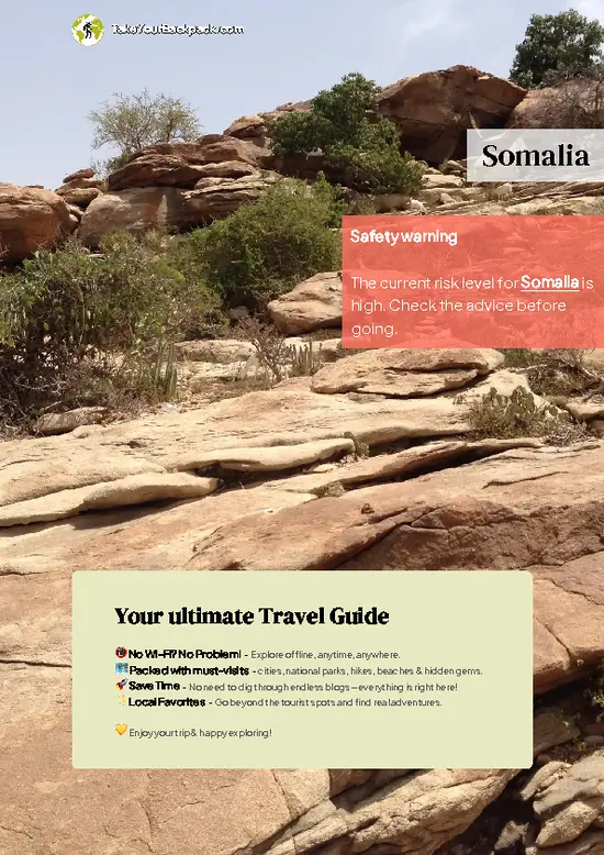
example page 0 from our offline Travel Guide for Somalia
example page 1 from our offline Travel Guide for Somalia
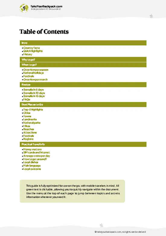
example page 2 from our offline Travel Guide for Somalia
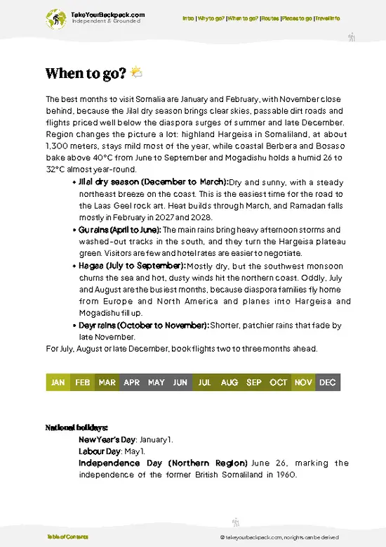
example page 3 from our offline Travel Guide for Somalia
example page 4 from our offline Travel Guide for Somalia
example page 5 from our offline Travel Guide for Somalia
example page 6 from our offline Travel Guide for Somalia
example page 7 from our offline Travel Guide for Somalia
Loading the map 🌍
CLICK TO FILTER
cities
towns
landmarks
national parks
hikes
beaches
attractions
festivals
regions
SHOW COUNTRY’S BESTSHOW ALL

✨ Why go?
Ranked #2 hike in Somalia
Reasons people choose to hike the here

Golis Mountains give you something rare in the Horn of Africa: a real highland walk where you can sleep under a blanket. The range rises sharply from the coastal desert, so a single day of climbing takes you from baking plain to cool juniper ridges around Sheikh, a highland town with a very different feel from the lowlands. That contrast is the main draw.

The second reason is access. The paved road between Berbera and Burao crosses the range, so you can reach the foot of the climb by shared minibus and set your own distance. A half-day wander from Sheikh suits one traveler, while a two-day ridge traverse suits another, with nomad families and their camels and goats as your only company.

It also fits a longer route through Somaliland well. Many travelers pair it with the coast at Berbera … read more 👉
Golis Mountains give you something rare in the Horn of Africa: a real highland walk where you can sleep under a blanket. The range rises sharply from the coastal desert, so a single day of climbing takes you from baking plain to cool juniper ridges around Sheikh, a highland town with a very different feel from the lowlands. That contrast is the main draw.

The second reason is access. The paved road between Berbera and Burao crosses the range, so you can reach the foot of the climb by shared minibus and set your own distance. A half-day wander from Sheikh suits one traveler, while a two-day ridge traverse suits another, with nomad families and their camels and goats as your only company.

It also fits a longer route through Somaliland well. Many travelers pair it with the coast at Berbera and the Laas Geel rock art to the west, and the hills give you a cool breather between the two. Go with a local guide, arranged through your guesthouse.

💡 HighlightsTop highlights of Golis Mountains

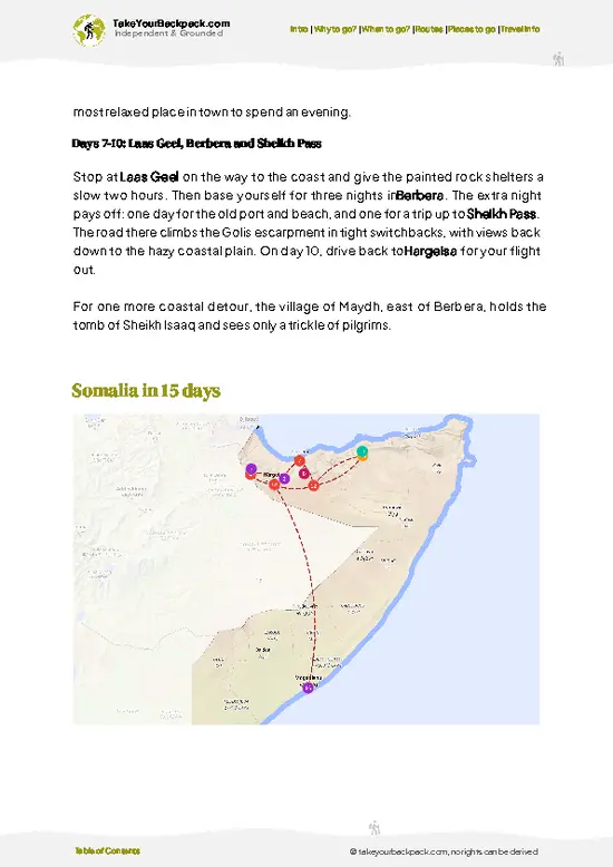
  1. Sheikh Pass escarpment: The road from Berbera climbs this wall of rock in tight bends, and the pull-offs give the widest views over the Guban plain toward the Gulf of Aden. It is the best-known sight of the range.
  2. Sheikh hill town: A cool-air settlement of stone buildings set at around 1,400 meters, including the old boarding school. Wandering the lanes takes an hour and gives you a feel for the highlands.
  3. Juniper and olive woodland ridges: Higher up, the bare slopes give way to dense stands of wild olive and juniper with a resinous smell. Walking here is the most pleasant part of the hike, with shade and birdsong.
  4. Hamadryas baboon troops: Groups gather on cliffs and by the road in the early day. Watching them from a distance is entertaining, but keep food out of sight, because they steal.
  5. Nomad
… read more 👉
  1. Sheikh Pass escarpment: The road from Berbera climbs this wall of rock in tight bends, and the pull-offs give the widest views over the Guban plain toward the Gulf of Aden. It is the best-known sight of the range.
  2. Sheikh hill town: A cool-air settlement of stone buildings set at around 1,400 meters, including the old boarding school. Wandering the lanes takes an hour and gives you a feel for the highlands.
  3. Juniper and olive woodland ridges: Higher up, the bare slopes give way to dense stands of wild olive and juniper with a resinous smell. Walking here is the most pleasant part of the hike, with shade and birdsong.
  4. Hamadryas baboon troops: Groups gather on cliffs and by the road in the early day. Watching them from a distance is entertaining, but keep food out of sight, because they steal.
  5. Nomad camps and camel herds: Pastoral families graze animals on the plateau side of the range. A guide can arrange a short tea stop, and the hospitality is generous.
No item in Golis Mountains needs a ticket, but you should arrange a local guide in advance through your guesthouse in Berbera or Burao, because walking without one is not advisable.
Spotted a mistake or missing something? Contact us.

🌤️ When to go?Weather, crowds, and seasonal trade-offs

  • Gu (April to June): Spring rains green the escarpment and bring the best grazing, with highs of 24 to 30°C (75 to 86°F) on the plateau and cooler nights near 14 to 18°C (57 to 64°F). Afternoon showers can turn dirt tracks slick.
  • Hagaa (July to September): Dry, hazy and windy, with highs of 26 to 32°C (79 to 90°F). Most hikers find it the easiest walking, though the coastal plain below is much hotter.
  • Deyr (October to November): Short rains return, lighter than Gu, with 22 to 28°C (72 to 82°F). Views stay clear between showers.
  • Jilaal (December to March): Driest and coolest, with chilly mornings of 8 to 14°C (46 to 57°F) and highs of 20 to 27°C (68 to 81°F). Dust haze can dull long views.
Daylight stays close to 12 hours all year, so start walking early whatever the month. Crowds are never an issue … read more 👉
  • Gu (April to June): Spring rains green the escarpment and bring the best grazing, with highs of 24 to 30°C (75 to 86°F) on the plateau and cooler nights near 14 to 18°C (57 to 64°F). Afternoon showers can turn dirt tracks slick.
  • Hagaa (July to September): Dry, hazy and windy, with highs of 26 to 32°C (79 to 90°F). Most hikers find it the easiest walking, though the coastal plain below is much hotter.
  • Deyr (October to November): Short rains return, lighter than Gu, with 22 to 28°C (72 to 82°F). Views stay clear between showers.
  • Jilaal (December to March): Driest and coolest, with chilly mornings of 8 to 14°C (46 to 57°F) and highs of 20 to 27°C (68 to 81°F). Dust haze can dull long views.
Daylight stays close to 12 hours all year, so start walking early whatever the month. Crowds are never an issue here, but local guide and vehicle rates, roughly US$30 to 80 a day, rise around Eid holidays, so book outside those dates.


source: climatestotravel.comJANJanuary: excellent for travelingFEBFebruary: excellent for travelingMARMarch: fair for travelingAPRApril: fair for travelingMAYMay: fair for travelingJUNJune: good for travelingJULJuly: good for travelingAUGAugust: good for travelingSEPSeptember: good for travelingOCTOctober: good for travelingNOVNovember: excellent for travelingDECDecember: excellent for traveling
when-to-go

✈️ The backpacker research shortcutSomalia Travel Guide

What the free pages can't give you: ready-made routes, every place ranked, and it works offline. All in 1 guide.
example page 0 from our offline Travel Guide for Somalia
example page 1 from our offline Travel Guide for Somalia
example page 2 from our offline Travel Guide for Somalia
example page 3 from our offline Travel Guide for Somalia
example page 4 from our offline Travel Guide for Somalia
example page 5 from our offline Travel Guide for Somalia
example page 6 from our offline Travel Guide for Somalia
example page 7 from our offline Travel Guide for Somalia
The digital guide (237 pages) contains:-page digital guide:
✅ Ready-made 5, 10 & 15-day routes
✅ All 68 places ranked, so you skip the overrated ones
✅ Works offline, all in 1 guide
✅ Cities, national parks, landmarks, beaches
✅ How to get around
👉 Click to see all 30+ guide features

📅 Plan smarter in minutes, not weeks
✅ Month by month travel advice
✅ Festivals & national holidays
✅ Budget expectations

🗺️ Go to the right places, skip the overrated ones
✅ Honest pros & cons of destinations
✅ Top hikes, parks & viewpoints
✅ Lesser-known places most travelers miss
✅ Clear “worth it vs skip it” guidance

🛏️ Travel smoothly without rookie mistakes
✅ Best areas to stay
✅ Transport systems explained simply
✅ Common scams & safety advice
✅ SIM cards, money & practical tips

🌍 Understand the country, not just visit it
✅ Culture & traditions
✅ 52 Essential phrases & customs
✅ Festivals worth planning around
✅ Traveler-friendly historical context
✅ Insights that make places more meaningful

📱 Built for real travel conditions
✅ Fully downloadable PDF
✅ Works completely offline
✅ Optimized for phone use
✅ Useful in remote areas & buses
✅ All in 1 guide
Stop searching, start planning
Get instant access to your full guide. 30‑day money-back guarantee.


By proceeding you agree to our terms.
Sent to your inbox immediately after payment • 100% Secure Checkout
Best Backpacking Travel Advisor 2025 tourism awardBest Backpacking
Travel Advisor
2025
What others say about Take Your Backpack Guides:
⭐⭐⭐⭐⭐
Fantastic, amazing amount of information!
⭐⭐⭐⭐⭐
My goodness this is amazing, it's what I've been looking for hats off too you!
⭐⭐⭐⭐⭐
I think this is absolutely BRILLIANT
⭐⭐⭐⭐
Very complete and informative. It's still missing places, but I gotta to commend you
⭐⭐⭐⭐⭐
This is truly amazing, thank you, can't wait to explore it with my kids!
⭐⭐⭐⭐⭐
Awesome resource, thank you!
⭐⭐⭐⭐⭐
This is amazing! Can't wait to explore the ones I haven't seen
⭐⭐⭐⭐
I love this! Well done, great idea.
⭐⭐⭐⭐⭐
Thanks for taking the time to make this gem!
⭐⭐⭐⭐⭐
This might be the best website I've ever seen.
⭐⭐⭐⭐⭐
Congratulations, and thank you so much for your work; it's incredibly valuable.
⭐⭐⭐⭐
In all seriousness I think you did a great job pointing out the important spots
⭐⭐⭐⭐⭐
10/10 very good
⭐⭐⭐⭐⭐
As someone who's only just starting to visit regularly this is awesome, thank you.
⭐⭐⭐⭐
Thank you very much! I'm going to visit my dad, it's going to be very useful!
⭐⭐⭐⭐⭐
This is really cool! We'll be travelling for the first time and this definitely come in handy.
⭐⭐⭐⭐⭐
You are now our minister of culture, congratulations 👨‍💼
⭐⭐⭐⭐⭐
Just wanted to tell you that this is a pearl! Going to follow your recommendations.
⭐⭐⭐⭐⭐
This is so cool. I'll definitely be using the resource for my travels soon.
⭐⭐⭐⭐⭐
This is very impressive! Good work.
⭐⭐⭐⭐⭐
This is an amazing and informative site. Very well done!

🛏️ Where to stay?Choosing the right base

If you enjoy meeting fellow travelers, consider choosing hostels with high ratings for atmosphere. On the other hand, if you prefer having your own space, a hotel might be a better option.

🥾 Hike detailsTrail overview: what to expect on the hike

Total Distance: Golis Mountains has no single official trail. A typical ridge route from Sheikh runs about 20 to 30 kilometers, and shorter loops of 8 to 12 kilometers are easy to arrange locally.
Estimated Duration: One long day or a relaxed two days with a night in a nomad camp or at a guesthouse in Sheikh.
Difficulty: Moderate. The tracks are steep and rocky, shade is patchy, and navigation is difficult without a guide.
Starting Point: Sheikh, on the paved road linking Berbera and Burao. Shared minibuses and cars on that road drop you in town, and your guesthouse can arrange the guide.
Major Landmarks:
  • Sheikh
… read more 👉
Total Distance: Golis Mountains has no single official trail. A typical ridge route from Sheikh runs about 20 to 30 kilometers, and shorter loops of 8 to 12 kilometers are easy to arrange locally.
Estimated Duration: One long day or a relaxed two days with a night in a nomad camp or at a guesthouse in Sheikh.
Difficulty: Moderate. The tracks are steep and rocky, shade is patchy, and navigation is difficult without a guide.
Starting Point: Sheikh, on the paved road linking Berbera and Burao. Shared minibuses and cars on that road drop you in town, and your guesthouse can arrange the guide.
Major Landmarks:
  • Sheikh Pass: The switchbacks and lookout points above the Guban plain.
  • Sheikh town: Stone buildings, the former school and a cool-air market area.
  • Upper ridges: Woodland and open grazing land with views both ways.
Terrain and Scenery: Rocky limestone and sandstone slopes, dry stream beds and sudden drops. On clear mornings the sea haze lies far to the north, and the plateau stretches south.
Vegetation: Wild olive, juniper and acacia on the higher slopes, thorny scrub and aloes lower down. The air smells of resin on warm days.
Wildlife: Hamadryas baboons, rock hyraxes, dik-diks and many birds. Camels, goats and sheep are the animals you will meet most often.
Practical Notes: Carry at least three liters of water, a hat and sturdy shoes. Nights at altitude are cool, so pack a warm layer. Follow your guide on all security matters and check the current situation locally before setting out.
⚠️ Hiking info can sometimes be outdated or inaccurate. Before you hit the trail, check the latest conditions with locals. If you do spot anything that's off, I'd love to hear from you, so I can update it for fellow travelers.

🛡️ SafetyScams, Hazards, and Annoyances

Golis Mountains is a remote, lightly visited range where the main hazards are logistical rather than natural. Security is the first thing to settle: conditions vary by district and change with little notice, so arrange local guidance, travel only in daylight and check current advisories before you go. Hiking itself is moderate, on rocky goat paths over dry, loose scree where good boots matter more than technical skill. Trails are rarely marked, so walk with a local who knows the routes and carry offline maps. Afternoon heat and strong sun catch newcomers out, and water sources are scarce, so carry at least 3 to 4 liters per person, plus a hat and sun protection. Short, intense downpours in the rainy seasons can flood dry riverbeds, so stay out of them when clouds build. Baboons and hyenas … read more 👉
Golis Mountains is a remote, lightly visited range where the main hazards are logistical rather than natural. Security is the first thing to settle: conditions vary by district and change with little notice, so arrange local guidance, travel only in daylight and check current advisories before you go. Hiking itself is moderate, on rocky goat paths over dry, loose scree where good boots matter more than technical skill. Trails are rarely marked, so walk with a local who knows the routes and carry offline maps. Afternoon heat and strong sun catch newcomers out, and water sources are scarce, so carry at least 3 to 4 liters per person, plus a hat and sun protection. Short, intense downpours in the rainy seasons can flood dry riverbeds, so stay out of them when clouds build. Baboons and hyenas exist but rarely cause trouble. Keep food sealed, do not feed animals and camp away from livestock routes. Dress modestly and ask before photographing people.

FAQFrequently asked questions about Golis Mountains

Most hikes in Golis Mountains take one to three days, depending on the section and your starting point. A day walk on the escarpment trails typically covers 8 to 15 kilometers in 4 to 7 hours, while a multi-day traverse with village stops runs 2 to 3 days. Allow extra travel time by road from Hargeisa or Erigavo, often half a day on rough tracks.
Golis Mountains is moderate in difficulty for anyone with basic fitness. Paths are steep and rocky in places, with loose scree and little shade. Heat and scarce water make the walking harder than the distances suggest, so carry 3 to 4 liters per person.
Golis Mountains has no formal park permit system, but a local guide is strongly advised and often necessary for security and navigation. Expect to pay roughly US$30 to 80 a day for a guide with a vehicle, and arrange it through a reputable agency or hotel in Hargeisa. Visitors usually need a Somaliland or Somalia visa depending on route, and local authorities may ask you to register or take an escort.
⚠️ Things can change over time, so always validate details locally before you go.

Other Somali hikes near Golis Mountains

Explore more nearby:

  • Hargeisa Rock Art Sites—prehistoric cave paintings, sandstone shelters, semi-desert terrain| 84 km away
  • Shimbiris—Somalia's highest summit, Cal Madow escarpment, juniper forest, Erigavo start, Warsangli linnet| 242 km away
  • Daallo Forest—Lichen-hung junipers, escarpment rim, cool mist, baboon troops| 254 km away

💡 Not sure where to go next?
Create a personalized itinerary for Somalia including Golis Mountains and the places that fit your trip.

Generate my itinerary

👉 Discover all hikes

Or checkout all Somalia has to offer (think cities, towns, villages, national parks, hikes, beaches, festivals)
Country photo of Somalia

We 💚 feedbackWhat to keep in mind

Golis Mountains suit travelers who already like Somaliland's slow pace and want cool air, a rocky ridge and tea with herders more than a checklist of summits. I would go with a local guide, bring a warm layer for the night and leave plenty of time at Sheikh. Skip it if you need waymarks and mapped huts.

✍️ Help improve this page!
The information on this page is based on in-depth research, insights shared by experienced travelers, and feedback from the local travel community in Somalia. While every effort is made to keep the information accurate and current, conditions can change — so if you spot anything incorrect or outdated, please get in touch.


🙋‍♂️ Give feedback

👋 Meet the founderWho’s Behind Take Your Backpack?

Johan, backpacker and founder of TakeYourBackpackHi, I’m Johan (Netherlands 🇳🇱), the creator of TakeYourBackpack. Over the past 30 years, I’ve backpacked through 88 countries across six continents, gaining extensive experience with independent travel, long-term trips, and overland routes.

This site is built on a combination of firsthand travel experience and carefully curated insights from other backpackers. Many guides are based on places I’ve personally visited, while others bring together tips, observations, and practical advice shared by trusted travelers I’ve met along the way.

The goal is to provide realistic, experience-driven guidance — not generic itineraries — so you can explore destinations with better context, clearer expectations, and more confidence.