×

Somalia🇸🇴 | hikesShimbirisSomalia's highest summit, Cal Madow escarpment, juniper forest, Erigavo start, Warsangli linnet | things to do and best time to go

Explore Golis MountainsExplore Hargeisa Rock Art Sites

Backpacking in Shimbiris
👌 Worth visitinghike ranked #3
By Johan Kruseman 🇳🇱 | Updated November 2, 2026

Shimbiris is the highest point in Somalia, a summit of about 2,416 meters in the Sanaag region's Cal Madow range, in the north of Somalia. The hike starts from Erigavo, and that is the only sensible gateway. The scenery is the draw: a cool plateau, juniper forest and sharp escarpments that drop toward the Gulf of Aden, unlike the dry lowlands you cross to get there. What works is the altitude, the air and the sense of being somewhere almost nobody goes. What doesn’t: there are no marked trails, no facilities and no public information on timing, so don’t budget on guesswork. Arrange a local guide and an armed escort through Erigavo contacts first, because turning up unannounced wastes days and money. Carry all your water and food from town, since you can’t count on buying anything on the mountain. Skip any plan that depends on tight onward flights. Public transport reaches Erigavo, not the trailhead, so expect to hire a vehicle for the last stretch. Near the top, the wind often carries the smell of juniper smoke from herders’ camps.

Part of Backpacking in Somalia: all 68 places on one map, with routes and the best time to go.
Discover everything you want to know in the 📖 Somalia Travel Guide.
Safety warning

The current risk level for Somalia is high. Check the advice before going.


example page 0 from our offline Travel Guide for Somalia
example page 1 from our offline Travel Guide for Somalia
example page 2 from our offline Travel Guide for Somalia
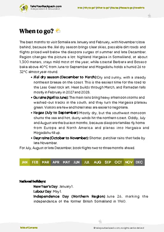
example page 3 from our offline Travel Guide for Somalia
example page 4 from our offline Travel Guide for Somalia
example page 5 from our offline Travel Guide for Somalia
example page 6 from our offline Travel Guide for Somalia
example page 7 from our offline Travel Guide for Somalia
Loading the map 🌍
CLICK TO FILTER
cities
towns
landmarks
national parks
hikes
beaches
attractions
festivals
regions
SHOW COUNTRY’S BESTSHOW ALL

✨ Why go?
Ranked #3 hike in Somalia
What sets this place apart

Backpackers seek out Shimbiris because it is the roof of Somalia, and standing on it is a claim almost no other traveler can make. The Cal Madow range gives you cool, forested highlands where the air feels nothing like the hot coast far below, and the juniper woodland around Erigavo is among the rarest landscapes in the Horn of Africa. That contrast between baking plains and misty ridges is the real scenic payoff, and you get it without technical climbing. The hike also costs little in gear and permits compared with famous peaks elsewhere, though local arrangements take planning. For travelers collecting high points or off-map places, Shimbiris fits neatly into a longer trip through Somaliland and Puntland’s eastern edge, since Erigavo sits on the road linking the region’s towns. Go for the … read more 👉
Backpackers seek out Shimbiris because it is the roof of Somalia, and standing on it is a claim almost no other traveler can make. The Cal Madow range gives you cool, forested highlands where the air feels nothing like the hot coast far below, and the juniper woodland around Erigavo is among the rarest landscapes in the Horn of Africa. That contrast between baking plains and misty ridges is the real scenic payoff, and you get it without technical climbing. The hike also costs little in gear and permits compared with famous peaks elsewhere, though local arrangements take planning. For travelers collecting high points or off-map places, Shimbiris fits neatly into a longer trip through Somaliland and Puntland’s eastern edge, since Erigavo sits on the road linking the region’s towns. Go for the quiet, the cool nights and the chance to meet semi-nomadic herders on the plateau. Go with realistic expectations: this is a rugged, undeveloped mountain, and what it offers is solitude and altitude, not infrastructure.

💡 HighlightsWhat this place is best known for

  1. Shimbiris summit: The country’s highest point, at about 2,416 meters. The top is broad and cool, and the view runs north across the escarpment toward the Gulf of Aden on clear mornings.
  2. Cal Madow escarpment: The ridge line that carries Shimbiris drops in steep folds and cliffs toward the coastal plain. It is the most dramatic landscape in this part of Somalia, and the edges make the best photo spots.
  3. Daallo Forest: A remnant of high juniper forest on the same range, with old twisted trees draped in lichen. The shade and damp air are a sharp change from the dry lowlands.
  4. Warsangli linnet and highland birds: The forest is the home of the endemic Warsangli linnet, a small finch found almost nowhere else. Bring binoculars and walk slowly at the forest edge.
  5. Erigavo and its surroundings: The town below
… read more 👉
  1. Shimbiris summit: The country’s highest point, at about 2,416 meters. The top is broad and cool, and the view runs north across the escarpment toward the Gulf of Aden on clear mornings.
  2. Cal Madow escarpment: The ridge line that carries Shimbiris drops in steep folds and cliffs toward the coastal plain. It is the most dramatic landscape in this part of Somalia, and the edges make the best photo spots.
  3. Daallo Forest: A remnant of high juniper forest on the same range, with old twisted trees draped in lichen. The shade and damp air are a sharp change from the dry lowlands.
  4. Warsangli linnet and highland birds: The forest is the home of the endemic Warsangli linnet, a small finch found almost nowhere else. Bring binoculars and walk slowly at the forest edge.
  5. Erigavo and its surroundings: The town below the mountain is your base, and its market and teahouses are where guides and drivers are found. The hills around it hold frankincense and myrrh trees, which locals tap for resin.
Nothing at Shimbiris sells tickets, but the summit itself needs a local guide and a vehicle with security arranged in Erigavo before you set out.
Spotted a mistake or missing something? Contact us.

🌤️ When to go?Weather, crowds, and seasonal trade-offs

  • Gu Rains (April to June): Shimbiris sits at about 2,416 m (7,927 ft), Somalia’s highest point, so nights at the top drop to roughly 5 to 10°C (41 to 50°F) and days reach 18 to 24°C (64 to 75°F). Showers turn the rocky tracks slick and cloud often hides the summit.
  • Hagaa Dry Season (July to September): Hazy and dry in the Sanaag highlands, with cooler air than the coast. Visibility is decent, though dust softens the views.
  • Deyr Rains (October to November): Short showers bring green hillsides and juniper forest scent. Expect 12 to 22°C (54 to 72°F) by day.
  • Jilaal Dry Season (December to March): Clearest skies, the coolest nights (near freezing is possible) and the most reliable footing. Days run about 11 to 12 hours, with light at both ends of the hiking day.
Crowds are never an issue, but escort … read more 👉
  • Gu Rains (April to June): Shimbiris sits at about 2,416 m (7,927 ft), Somalia’s highest point, so nights at the top drop to roughly 5 to 10°C (41 to 50°F) and days reach 18 to 24°C (64 to 75°F). Showers turn the rocky tracks slick and cloud often hides the summit.
  • Hagaa Dry Season (July to September): Hazy and dry in the Sanaag highlands, with cooler air than the coast. Visibility is decent, though dust softens the views.
  • Deyr Rains (October to November): Short showers bring green hillsides and juniper forest scent. Expect 12 to 22°C (54 to 72°F) by day.
  • Jilaal Dry Season (December to March): Clearest skies, the coolest nights (near freezing is possible) and the most reliable footing. Days run about 11 to 12 hours, with light at both ends of the hiking day.
Crowds are never an issue, but escort and vehicle costs in Erigavo rise a little in the dry months, so book a few days ahead.


source: climatestotravel.comJANJanuary: highly recommended for travelingFEBFebruary: highly recommended for travelingMARMarch: good for travelingAPRApril: below average for travelingMAYMay: below average for travelingJUNJune: below average for travelingJULJuly: fair for travelingAUGAugust: fair for travelingSEPSeptember: good for travelingOCTOctober: good for travelingNOVNovember: excellent for travelingDECDecember: highly recommended for traveling
when-to-go

✈️ The backpacker research shortcutSomalia Travel Guide

What the free pages can't give you: ready-made routes, every place ranked, and it works offline. All in 1 guide.
example page 0 from our offline Travel Guide for Somalia
example page 1 from our offline Travel Guide for Somalia
example page 2 from our offline Travel Guide for Somalia
example page 3 from our offline Travel Guide for Somalia
example page 4 from our offline Travel Guide for Somalia
example page 5 from our offline Travel Guide for Somalia
example page 6 from our offline Travel Guide for Somalia
example page 7 from our offline Travel Guide for Somalia
The digital guide (237 pages) contains:-page digital guide:
✅ Ready-made 5, 10 & 15-day routes
✅ All 68 places ranked, so you skip the overrated ones
✅ Works offline, all in 1 guide
✅ Cities, national parks, landmarks, beaches
✅ How to get around
👉 Click to see all 30+ guide features

📅 Plan smarter in minutes, not weeks
✅ Month by month travel advice
✅ Festivals & national holidays
✅ Budget expectations

🗺️ Go to the right places, skip the overrated ones
✅ Honest pros & cons of destinations
✅ Top hikes, parks & viewpoints
✅ Lesser-known places most travelers miss
✅ Clear “worth it vs skip it” guidance

🛏️ Travel smoothly without rookie mistakes
✅ Best areas to stay
✅ Transport systems explained simply
✅ Common scams & safety advice
✅ SIM cards, money & practical tips

🌍 Understand the country, not just visit it
✅ Culture & traditions
✅ 52 Essential phrases & customs
✅ Festivals worth planning around
✅ Traveler-friendly historical context
✅ Insights that make places more meaningful

📱 Built for real travel conditions
✅ Fully downloadable PDF
✅ Works completely offline
✅ Optimized for phone use
✅ Useful in remote areas & buses
✅ All in 1 guide
Stop searching, start planning
Get instant access to your full guide. 30‑day money-back guarantee.


By proceeding you agree to our terms.
Sent to your inbox immediately after payment • 100% Secure Checkout
Best Backpacking Travel Advisor 2025 tourism awardBest Backpacking
Travel Advisor
2025
What others say about Take Your Backpack Guides:
⭐⭐⭐⭐⭐
Fantastic, amazing amount of information!
⭐⭐⭐⭐⭐
My goodness this is amazing, it's what I've been looking for hats off too you!
⭐⭐⭐⭐⭐
I think this is absolutely BRILLIANT
⭐⭐⭐⭐
Very complete and informative. It's still missing places, but I gotta to commend you
⭐⭐⭐⭐⭐
This is truly amazing, thank you, can't wait to explore it with my kids!
⭐⭐⭐⭐⭐
Awesome resource, thank you!
⭐⭐⭐⭐⭐
This is amazing! Can't wait to explore the ones I haven't seen
⭐⭐⭐⭐
I love this! Well done, great idea.
⭐⭐⭐⭐⭐
Thanks for taking the time to make this gem!
⭐⭐⭐⭐⭐
This might be the best website I've ever seen.
⭐⭐⭐⭐⭐
Congratulations, and thank you so much for your work; it's incredibly valuable.
⭐⭐⭐⭐
In all seriousness I think you did a great job pointing out the important spots
⭐⭐⭐⭐⭐
10/10 very good
⭐⭐⭐⭐⭐
As someone who's only just starting to visit regularly this is awesome, thank you.
⭐⭐⭐⭐
Thank you very much! I'm going to visit my dad, it's going to be very useful!
⭐⭐⭐⭐⭐
This is really cool! We'll be travelling for the first time and this definitely come in handy.
⭐⭐⭐⭐⭐
You are now our minister of culture, congratulations 👨‍💼
⭐⭐⭐⭐⭐
Just wanted to tell you that this is a pearl! Going to follow your recommendations.
⭐⭐⭐⭐⭐
This is so cool. I'll definitely be using the resource for my travels soon.
⭐⭐⭐⭐⭐
This is very impressive! Good work.
⭐⭐⭐⭐⭐
This is an amazing and informative site. Very well done!

🛏️ Where to stay?How to pick the right area

If you enjoy meeting fellow travelers, consider choosing hostels with high ratings for atmosphere. On the other hand, if you prefer having your own space, a hotel might be a better option.

🥾 Hike detailsEverything you need to know before hiking Shimbiris

Total Distance: No dependable measured figure exists for Shimbiris, so plan the route with your local guide in Erigavo.
Estimated Duration: Allow a full day-plus window and flexibility for weather, vehicle transfers and escort arrangements.
Difficulty: Moderate to demanding. The challenge is altitude, rough off-trail ground and logistics rather than technical climbing.
Starting Point: The hike starts from Erigavo. Buses and shared vehicles run into town, and you then hire a 4x4 with a driver to reach the foot of the range. There is no base camp.
Major Landmarks:
  • Erigavo: The final supply stop. Buy
… read more 👉
Total Distance: No dependable measured figure exists for Shimbiris, so plan the route with your local guide in Erigavo.
Estimated Duration: Allow a full day-plus window and flexibility for weather, vehicle transfers and escort arrangements.
Difficulty: Moderate to demanding. The challenge is altitude, rough off-trail ground and logistics rather than technical climbing.
Starting Point: The hike starts from Erigavo. Buses and shared vehicles run into town, and you then hire a 4x4 with a driver to reach the foot of the range. There is no base camp.
Major Landmarks:
  • Erigavo: The final supply stop. Buy water, bread, dates and any fuel here.
  • Cal Madow escarpments: Steep walls and ridgelines with long views north toward the Gulf of Aden.
  • Shimbiris summit: The highest point in Somalia, reached across open plateau and rocky slopes.
Terrain and Scenery: Rocky tracks, loose scree, grassy plateau and sudden cliffs. Cloud and mist can settle on the ridge and cut visibility fast, so keep your guide close.
Vegetation:
  • Juniper forest: Dense, fragrant stands on the higher slopes, a relic of cooler climates.
  • Acacia and scrub: Lower slopes thin out into thorny shrubs and dry grass.
Wildlife: Birdlife is the most likely sighting, and herders’ goats, sheep and camels share the plateau. Larger mammals are shy and rarely seen.
Practical Notes: Pack warm layers for cold nights, plenty of water, sun protection and a charged phone with offline maps. Agree the route, escort and fees before leaving Erigavo.
⚠️ Hiking info can sometimes be outdated or inaccurate. Before you hit the trail, check the latest conditions with locals. If you do spot anything that's off, I'd love to hear from you, so I can update it for fellow travelers.

🛡️ SafetyScams, Hazards, and Annoyances

Shimbiris is a remote, high-altitude hike in Sanaag, and the main issue is security rather than the terrain. Travel here only with a local escort arranged in Erigavo, the nearest town, and check current conditions on the ground before setting out, since the region’s situation can shift. The route itself is a steady climb on rocky, sometimes loose footing, with no marked trail, so a local guide is also your navigation. At around 2,400 m (7,900 ft) altitude sickness is unlikely, but the sun is strong and nights are cold, so bring layers, a windproof shell, sturdy boots and a headlamp. Carry all your water, at least 3 liters per person, as sources are unreliable. Mobile coverage is patchy. Baboons and hyenas live in the area, so keep food sealed and never feed animals. Start at first light to finish before afternoon cloud and wind.

FAQCommon questions from travelers

Shimbiris has no published trail length or standard duration, so plan on a full day on the mountain with a night in Erigavo before and after. The hike starts from Erigavo in the Sanaag region, with no base camp, and Shimbiris (about 2,400 meters, the highest point in Somalia) is reached by driving out of town and then walking the final stretch. Most travelers arrange the outing as one long day, and it is worth keeping a spare day in Erigavo in case weather or logistics shift the plan.
Shimbiris is a moderate effort for anyone with basic fitness, since the summit sits around 2,400 meters and the air is thinner than at sea level but not extreme. The footing is rocky and uneven, so you need sturdy boots rather than sandals, and the sun is strong with little shade on the upper slopes. The harder part is logistics rather than technique, because there are no marked trails, no huts and no services above Erigavo.
Yes to both in practice. Shimbiris sits in a remote part of Sanaag where independent wandering is not realistic, so arrange a local guide and an armed escort through your Erigavo hotel or a local contact, and expect to pay roughly US$50 to 150 a day for the guide, vehicle and escort combined. No formal hiking permit exists for Shimbiris, but you should register with local authorities in Erigavo before heading out, and the escort arrangement usually takes care of that.
⚠️ Things can change over time, so always validate details locally before you go.

Other Somali hikes near Shimbiris

Explore more nearby:

  • Daallo Forest—Lichen-hung junipers, escarpment rim, cool mist, baboon troops| 12 km away
  • Golis Mountains—Sheikh hill town, juniper ridges, goat tracks, camel herds| 242 km away
  • Hargeisa Rock Art Sites—prehistoric cave paintings, sandstone shelters, semi-desert terrain| 324 km away

💡 Not sure where to go next?
Create a personalized itinerary for Somalia including Shimbiris and the places that fit your trip.

Generate my itinerary

👉 Discover all hikes

Or checkout all Somalia has to offer (think cities, towns, villages, national parks, hikes, beaches, festivals)
Country photo of Somalia

We 💚 feedbackWhat to keep in mind

Shimbiris pairs best with a slow overland loop through northern Somalia and Somaliland, with the Daallo Forest tacked on for birds and shade. I would give it a full extra day in Erigavo so a washed-out track does not wreck the plan, and bring a warm jacket, since the summit stays cold well into the morning.

✍️ Help improve this page!
The information on this page is based on in-depth research, insights shared by experienced travelers, and feedback from the local travel community in Somalia. While every effort is made to keep the information accurate and current, conditions can change — so if you spot anything incorrect or outdated, please get in touch.


🙋‍♂️ Give feedback

👋 Meet the founderWho’s Behind Take Your Backpack?

Johan, backpacker and founder of TakeYourBackpackHi, I’m Johan (Netherlands 🇳🇱), the creator of TakeYourBackpack. Over the past 30 years, I’ve backpacked through 88 countries across six continents, gaining extensive experience with independent travel, long-term trips, and overland routes.

This site is built on a combination of firsthand travel experience and carefully curated insights from other backpackers. Many guides are based on places I’ve personally visited, while others bring together tips, observations, and practical advice shared by trusted travelers I’ve met along the way.

The goal is to provide realistic, experience-driven guidance — not generic itineraries — so you can explore destinations with better context, clearer expectations, and more confidence.