
×

South Africa🇿🇦 | hikesRim of Africa650 km fold mountains, Wolfberg Arch, Sneeuberg, faint paths | things to do and best time to go

Explore Fanie Botha TrailExplore Wild Coast Hiking Trail

Backpacking in Rim of Africa
👌 Worth visitinghike ranked #10
By Johan Kruseman 🇳🇱 | Updated October 22, 2026

The Rim of Africa is a 650-kilometer route through the Cape Fold Mountains that you can walk in sections, and most hikers never tackle more than a slice. It runs through the Western Cape in South Africa, from Cederberg toward Hottentots Holland, with the Wolwekloof and Tulbagh area near Ceres in the middle. The paths are rocky, steep and often faint, and the fynbos catches your shins. The reward is silence, sandstone and wide valley views. I once skipped refilling water at a stream, assumed another would appear, and had a dry afternoon. Now I always fill up. Overnight huts and campsites need booking, and public transport to trailheads is thin, so book your lift first.

Discover everything you want to know in the 📖 South Africa Travel Guide.
Best time to go: March - October
Duration: 6 weeks
Distance: 650 kilometers
Total ascent: 20000 meters


example page 0 from our offline Travel Guide for South Africa
example page 1 from our offline Travel Guide for South Africa
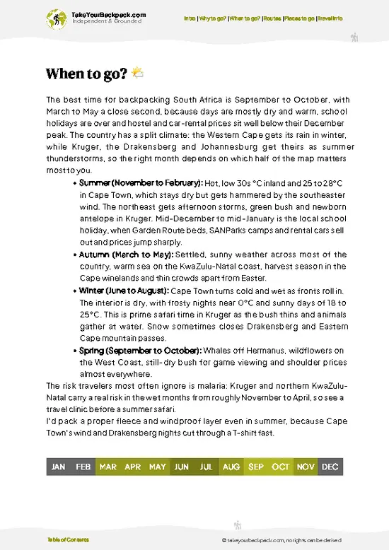
example page 2 from our offline Travel Guide for South Africa
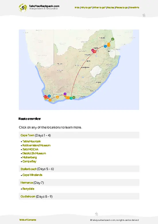
example page 3 from our offline Travel Guide for South Africa
example page 4 from our offline Travel Guide for South Africa
example page 5 from our offline Travel Guide for South Africa
example page 6 from our offline Travel Guide for South Africa
example page 7 from our offline Travel Guide for South Africa
Loading the map 🌍
CLICK TO FILTER
cities
towns
villages
landmarks
national parks
hikes
beaches
attractions
festivals
regions
SHOW COUNTRY’S BESTSHOW ALL

✨ Why go?
Ranked #10 hike in South Africa
The unique appeal for travelers

Rim of Africa gives you wilderness without the crowds you find on Table Mountain. The route links Cederberg’s sandstone arches with the Hex River and Hottentots Holland ranges, so you can stitch together a few nights or a few weeks. Distances are flexible because you can pick one stage and exit at a pass road. Huts and campsites are cheap compared with commercial trails, and the fynbos flowers, including proteas and ericas, change character with each range. Backpackers also like that it slots onto a Cape Town based itinerary, with Ceres and Tulbagh offering supplies and a bed before you head out. Expect to carry your own food and water, and to read maps well. If you want real navigation and solitude, this is where to get them.

💡 HighlightsEssential experiences to have while hiking the Rim of Africa

  1. Wolfberg Cracks and Arch: Best known on the Cederberg section, these sandstone fissures and the huge arch are what hikers photograph and search for. You squeeze through gaps between rust-colored walls.
  2. Sneeuberg Peak: The highest point in the Cederberg, with sweeping views over layered ridges. The climb is long and exposed, so start early.
  3. Stadsaal Caves: Rock shelters with San paintings of animals and figures, thousands of years old. They sit beneath overhanging sandstone, an easy side visit from the route.
  4. Matroosberg: A snow-prone peak near Ceres where winter dustings draw day trippers. The surrounding ridges give great fynbos walking in summer.
  5. Tulbagh Valley Viewpoints: Ridge sections above the valley show orchards and vineyards in a neat patchwork. The rocky descent gives you a good dinner
… read more 👉
  1. Wolfberg Cracks and Arch: Best known on the Cederberg section, these sandstone fissures and the huge arch are what hikers photograph and search for. You squeeze through gaps between rust-colored walls.
  2. Sneeuberg Peak: The highest point in the Cederberg, with sweeping views over layered ridges. The climb is long and exposed, so start early.
  3. Stadsaal Caves: Rock shelters with San paintings of animals and figures, thousands of years old. They sit beneath overhanging sandstone, an easy side visit from the route.
  4. Matroosberg: A snow-prone peak near Ceres where winter dustings draw day trippers. The surrounding ridges give great fynbos walking in summer.
  5. Tulbagh Valley Viewpoints: Ridge sections above the valley show orchards and vineyards in a neat patchwork. The rocky descent gives you a good dinner reward.
Rim of Africa trips pair Stadsaal Caves and the Wolfberg Cracks well in one day, since both sit in the same Cederberg area and the walking between them is moderate.
Spotted a mistake or missing something? Contact us.

Things to do near Rim of Africa

Ratings based on Tripadvisor reviews. When you book through this link, you support our work at no extra cost to you.

🌤️ When to go?When to go for the best experience

  • Spring (September to November): Fynbos flowers, full streams and daytime highs of 18 to 25°C (64 to 77°F) make this the easiest stretch for walking the Cederberg and Hex River sections of the Rim of Africa trail. Nights can still drop to 5°C (41°F).
  • Summer (December to February): Highs of 30 to 38°C (86 to 100°F) with almost no shade. Daylight runs about 14 hours, but you need to start at dawn. Rock pools are welcome, and accommodation near Ceres and Citrusdal costs more.
  • Autumn (March to May): Stable, clear days of 20 to 28°C (68 to 82°F) and quiet trails. Water sources are low early on.
  • Winter (June to August): Cold fronts bring rain and snow on high peaks, with highs of 8 to 16°C (46 to 61°F) and about 10 hours of light. Prices dip, but passes can close.
Book huts and campsites early for September and October weekends.

source: climatestotravel.comJANJanuary: fair for travelingFEBFebruary: fair for travelingMARMarch: good for travelingAPRApril: highly recommended for travelingMAYMay: highly recommended for travelingJUNJune: excellent for travelingJULJuly: excellent for travelingAUGAugust: excellent for travelingSEPSeptember: highly recommended for travelingOCTOctober: good for travelingNOVNovember: fair for travelingDECDecember: fair for traveling
when-to-go

✈️ The backpacker research shortcutSouth Africa Travel Guide

An offline-friendly backpacking guide with optimized travel routes, ranked highlights, transport advice, and the best areas to stay.
example page 0 from our offline Travel Guide for South Africa
example page 1 from our offline Travel Guide for South Africa
example page 2 from our offline Travel Guide for South Africa
example page 3 from our offline Travel Guide for South Africa
example page 4 from our offline Travel Guide for South Africa
example page 5 from our offline Travel Guide for South Africa
example page 6 from our offline Travel Guide for South Africa
example page 7 from our offline Travel Guide for South Africa
The digital guide (457 pages) contains:
✅ 125 highlights, ranked by travel appeal
✅ Optimized 7, 14 & 21-day travel routes
✅ Cities, national parks, landmarks, beaches
✅ How to get around
✅ Offline-friendly for travel without Wi-Fi
👉 Click to see all 30+ guide features

📅 Plan smarter in minutes, not weeks
✅ Month by month travel advice
✅ Festivals & national holidays
✅ Budget expectations

🗺️ Go to the right places, skip the overrated ones
✅ Honest pros & cons of destinations
✅ Top hikes, parks & viewpoints
✅ Lesser-known places most travelers miss
✅ Clear “worth it vs skip it” guidance

🛏️ Travel smoothly without rookie mistakes
✅ Best areas to stay
✅ Transport systems explained simply
✅ Common scams & safety advice
✅ SIM cards, money & practical tips

🌍 Understand the country, not just visit it
✅ Culture & traditions
✅ 52 Essential phrases & customs
✅ Festivals worth planning around
✅ Traveler-friendly historical context
✅ Insights that make places more meaningful

📱 Built for real travel conditions
✅ Fully downloadable PDF
✅ Works completely offline
✅ Optimized for phone use
✅ Useful in remote areas & buses
✅ Everything in one place
Stop searching, start planning
Get instant access to your full guide. 30‑day money-back guarantee.
+ Add another guide for just

By proceeding you agree to our terms.
Sent to your inbox immediately after payment • 100% Secure Checkout
Best Backpacking Travel Advisor 2025 tourism awardBest Backpacking
Travel Advisor
2025
What others say about Take Your Backpack Guides:
⭐⭐⭐⭐⭐
Fantastic, amazing amount of information!
⭐⭐⭐⭐⭐
My goodness this is amazing, it's what I've been looking for hats off too you!
⭐⭐⭐⭐⭐
I think this is absolutely BRILLIANT
⭐⭐⭐⭐
Very complete and informative. It's still missing places, but I gotta to commend you
⭐⭐⭐⭐⭐
This is truly amazing, thank you, can't wait to explore it with my kids!
⭐⭐⭐⭐⭐
Awesome resource, thank you!
⭐⭐⭐⭐⭐
This is amazing! Can't wait to explore the ones I haven't seen
⭐⭐⭐⭐
I love this! Well done, great idea.
⭐⭐⭐⭐⭐
Thanks for taking the time to make this gem!
⭐⭐⭐⭐⭐
This might be the best website I've ever seen.
⭐⭐⭐⭐⭐
Congratulations, and thank you so much for your work; it's incredibly valuable.
⭐⭐⭐⭐
In all seriousness I think you did a great job pointing out the important spots
⭐⭐⭐⭐⭐
10/10 very good
⭐⭐⭐⭐⭐
As someone who's only just starting to visit regularly this is awesome, thank you.
⭐⭐⭐⭐
Thank you very much! I'm going to visit my dad, it's going to be very useful!
⭐⭐⭐⭐⭐
This is really cool! We'll be travelling for the first time and this definitely come in handy.
⭐⭐⭐⭐⭐
You are now our minister of culture, congratulations 👨‍💼
⭐⭐⭐⭐⭐
Just wanted to tell you that this is a pearl! Going to follow your recommendations.
⭐⭐⭐⭐⭐
This is so cool. I'll definitely be using the resource for my travels soon.
⭐⭐⭐⭐⭐
This is very impressive! Good work.
⭐⭐⭐⭐⭐
This is an amazing and informative site. Very well done!

🛏️ Where to stay?How to pick the right area

If you enjoy meeting fellow travelers, consider choosing hostels with high ratings for atmosphere. On the other hand, if you prefer having your own space, a hotel might be a better option.

🥾 Hike detailsHike details: route, duration, and difficulty of Rim of Africa

Total Distance: Rim of Africa runs about 650 kilometers in full, usually walked in sections of 15 to 25 kilometers a day.
Estimated Duration: The complete route takes roughly 5 to 7 weeks. Most hikers choose 2 to 5 day sections.
Difficulty: Strenuous. Paths are rocky, steep and sometimes faint, and navigation skills are required.
Starting Point: The route is usually started in the Cederberg and finished near Hottentots Holland. Public transport is limited, so many hikers arrange shuttles from Cape Town or Ceres.
Major Landmarks:
  • Wolfberg Cracks: Sandstone passages and a natural arch.
  • Sneeuberg: The
… read more 👉
Total Distance: Rim of Africa runs about 650 kilometers in full, usually walked in sections of 15 to 25 kilometers a day.
Estimated Duration: The complete route takes roughly 5 to 7 weeks. Most hikers choose 2 to 5 day sections.
Difficulty: Strenuous. Paths are rocky, steep and sometimes faint, and navigation skills are required.
Starting Point: The route is usually started in the Cederberg and finished near Hottentots Holland. Public transport is limited, so many hikers arrange shuttles from Cape Town or Ceres.
Major Landmarks:
  • Wolfberg Cracks: Sandstone passages and a natural arch.
  • Sneeuberg: The Cederberg’s highest summit.
  • Matroosberg: A high peak near Ceres.
  • Tulbagh Valley: Ridge views over farmland.
Terrain and Scenery: Sandstone boulders, scree slopes, mountain passes and open plateaus, with long views across valleys.
Vegetation: Fynbos, including proteas, ericas and restios, with rooibos country in the north.
Wildlife: Klipspringer, baboons and rock hyrax are seen, plus many birds. Leopards live here but are rarely encountered.
⚠️ Hiking info can sometimes be outdated or inaccurate. Before you hit the trail, check the latest conditions with locals. If you do spot anything that's off, I'd love to hear from you, so I can update it for fellow travelers.

🛡️ SafetyTraveler Safety Guide

Rim of Africa is a remote, mostly unsigned mountain route, so the main risks are heat, sudden weather shifts and getting lost. Summer sun on exposed sandstone is punishing, so carry more water than seems sensible (4 to 5 liters a day between sources) and walk at dawn. In winter, cold fronts can arrive within hours, bringing rain, wind and snow, so pack proper waterproofs and insulation. Navigation relies on GPS tracks and paper maps, since cairns are sparse and fynbos regrows over paths. Footing is loose and rocky. Baboons and snakes (puff adders, cape cobras) are present but rarely trouble hikers who give them space. Leave your route with someone, because phone signal is patchy.

FAQTraveler FAQ

The full Rim of Africa route takes about 6 to 8 weeks, covering roughly 650 km from Cederberg to Grootvadersbos near Swellendam. Most backpackers walk it in sections of 3 to 7 days instead, such as the Cederberg or Hex River Mountains. Each section is typically 15 to 25 km a day.
Rim of Africa is a demanding, strenuous trek, graded for experienced hikers. Days of 15 to 25 km with 800 to 1,500 meters of climbing over rocky, often pathless terrain are common, and water can be scarce in summer. Strong navigation skills and self-sufficiency matter more than technical climbing ability.
Rim of Africa does not require a single guide, but most sections cross private farms or CapeNature reserves that need permits or overnight bookings. Reserve permits usually cost about US$5 to 15 per person a night, and mountain huts or farm campsites cost roughly US$10 to 25. Guides are optional but recommended for first-timers, at roughly US$80 to 150 a day, and the Rim of Africa organization offers route maps and advice.
⚠️ Things can change over time, so always validate details locally before you go.

Other South African hikes near Rim of Africa

Explore more nearby:

  • Whale Trail—Right whale bays, Potberg vultures, white dunes, Noetsie hut| 113 km away
  • Table Mountain—Platteklip Gorge, cable car, Maclear’s Beacon, tablecloth cloud| 127 km away
  • Harkerville Coastal Trail—Sandstone cliffs, ladders and gullies, forest hut, tidal pools| 327 km away

💡 Not sure where to go next?
Create a personalized itinerary for South Africa including Rim of Africa and the places that fit your trip.

Generate my itinerary

👉 Discover all hikes

Or checkout all South Africa has to offer (think cities, towns, villages, national parks, hikes, beaches, festivals)
Country photo of South Africa

We 💚 feedbackWhat to keep in mind

Rim of Africa is a long-haul trail, and I would plan at least a week on it, ten days if you want rest stops in the Cederberg villages. Short sections suit a weekend, but the best stretches of sandstone and fynbos sit far apart. Book huts early, carry water for dry crossings, and skip the rush.

✈️ When did I visit South Africa?
I have visited South Africa, before and after my Zimbabwe trip in 2001.

✍️ Help improve this page!
The information on this page is based on my own backpacking experience in South Africa, supplemented with up-to-date research and feedback from other travelers. Travel details can change, so if you notice anything outdated or incomplete, feel free to let me know.


🙋‍♂️ Give feedback

👋 Meet the founderWho’s Behind Take Your Backpack?

Johan, backpacker and founder of TakeYourBackpackHi, I’m Johan (Netherlands 🇳🇱), the creator of TakeYourBackpack. Over the past 3 decades, I’ve backpacked through 90+ countries across six continents, gaining extensive experience with independent travel, long-term trips, and overland routes.

This site is built on a combination of firsthand travel experience and carefully curated insights from other backpackers. Many guides are based on places I’ve personally visited, while others bring together tips, observations, and practical advice shared by trusted travelers I’ve met along the way.

The goal is to provide realistic, experience-driven guidance — not generic itineraries — so you can explore destinations with better context, clearer expectations, and more confidence.