×

Switzerland🇨🇭 | hikesSäntisAppenzell peaks, weather station, exposed ridges | things to do and best time to go

Explore Matterhorn Glacier TrailExplore Oeschinensee

Backpacking in Säntis
👌 Worth visitinghike ranked #11
By Johan Kruseman 🇳🇱 | Updated October 15, 2026

Most people sell Mount Säntis as a cable-car viewpoint, but the surprise is how wild and committing the actual hike feels once you leave the tourist bubble. Sitting in northeastern Switzerland on the Appenzell-St. Gallen border, Säntis gives you jagged limestone, cow-bell meadows, and big-drop exposure in one hit. The routes are steep, often long, and can feel more alpine scramble than casual walk, yet trains and postbuses drop you almost absurdly close to trailheads like Wasserauen and Schwägalp. Compared with nearby Alpstein classics like Seealpsee or Ebenalp, Säntis is tougher, rockier, and less “cute,” but the summit panorama over six countries makes every burning quad worth it.

Discover everything you want to know in the 📖 Switzerland Travel Guide.
Best time to go: May - September
Duration: 6 to 8 hours
Distance: 12 kilometers
Total ascent: 1,200 meters


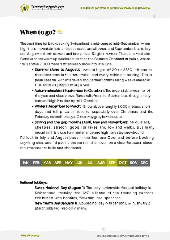
example page 0 from our offline Travel Guide for Switzerland
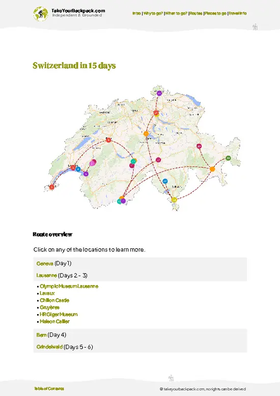
example page 1 from our offline Travel Guide for Switzerland
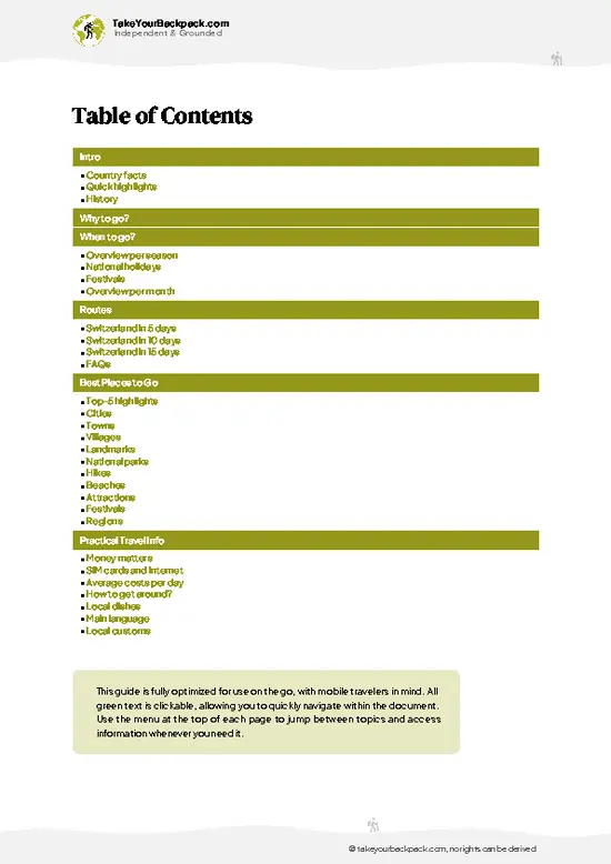
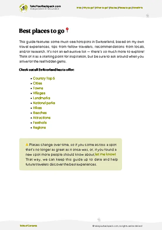
example page 2 from our offline Travel Guide for Switzerland
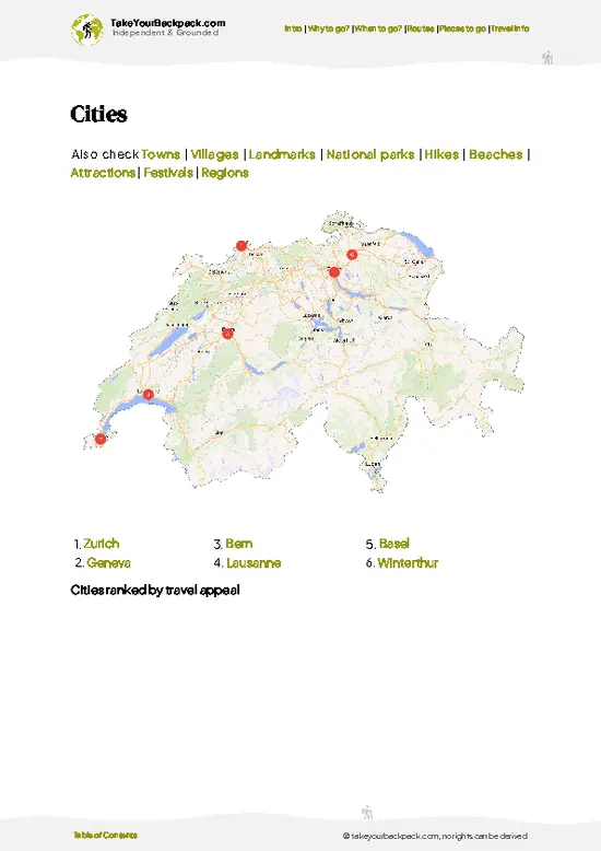
example page 3 from our offline Travel Guide for Switzerland
example page 4 from our offline Travel Guide for Switzerland
example page 5 from our offline Travel Guide for Switzerland
example page 6 from our offline Travel Guide for Switzerland
example page 7 from our offline Travel Guide for Switzerland
Loading the map 🌍
CLICK TO FILTER
cities
towns
villages
landmarks
national parks
hikes
beaches
attractions
festivals
regions
SHOW COUNTRY’S BESTSHOW ALL

✨ Why go?
Ranked #11 hike in Switzerland
Why visitors keep coming back

The Säntis is a magnet for backpackers, and for good reason. The scenery-to-effort ratio is off the charts; you’ll sweat a bit, but the panoramic views of the Swiss Alps and Lake Constance are worth every drop. Getting there is a breeze with public transport access—trains and buses whisk you right to the trailhead, making it easy to fit into your itinerary.

You can tailor your trek to your energy levels, choosing from flexible distances that range from a casual stroll to a more challenging ascent. Plus, it’s a low-cost adventure; no pricey permits or entry fees here. This hike seamlessly integrates into a longer backpacking route, allowing you to soak in the Swiss landscape without breaking the bank. The moment you reach the summit, with that first cold beer in hand, you’ll know the effort was more than worth it.

💡 HighlightsMust-see experiences and standout moments

  1. 360° summit panorama (see six countries) — On a clear day the view from Säntis is ridiculous: Lake Constance below, the jagged Alpstein around you and, if the air’s kind, you can pick out Switzerland, Germany, Austria, Liechtenstein, France and Italy. It’s the kind of vista that rewards the climb and makes every photo worth the huffing and puffing.
  2. Rocky summit plateau and transmission tower — The weird/awesome mix of raw limestone ledges and the tall Säntis broadcasting tower gives the top a dramatic, alpine-industrial feel. The exposed rock, fissures and steep drop-offs make the ridge memorable compared with softer, grassy summits.
  3. Sea of clouds and rapid weather shows — Säntis lives up to its weather-station rep: conditions flip fast and you often get a cinematic sea of fog filling
… read more 👉
  1. 360° summit panorama (see six countries) — On a clear day the view from Säntis is ridiculous: Lake Constance below, the jagged Alpstein around you and, if the air’s kind, you can pick out Switzerland, Germany, Austria, Liechtenstein, France and Italy. It’s the kind of vista that rewards the climb and makes every photo worth the huffing and puffing.
  2. Rocky summit plateau and transmission tower — The weird/awesome mix of raw limestone ledges and the tall Säntis broadcasting tower gives the top a dramatic, alpine-industrial feel. The exposed rock, fissures and steep drop-offs make the ridge memorable compared with softer, grassy summits.
  3. Sea of clouds and rapid weather shows — Säntis lives up to its weather-station rep: conditions flip fast and you often get a cinematic sea of fog filling the valleys or sudden sunlight slashing through clouds. It’s a favourite for moody landscape photos and those brief, jaw-drop moments.
  4. Alpine flora and wildlife encounters — Summer brings carpets of alpine flowers; keep your eyes open for marmots, chamois and the occasional ibex on the cliffs. Wildlife is approachable but wild — stay respectful, quiet and you’ll often be rewarded with easy sightings.
  5. Accessible summit culture — cable car, huts and the terrace — Whether you hike up or take the Schwägalp cable car, the summit station with its terrace/restaurant and small exhibits makes Säntis social and satisfying. It’s a neat blend of traditional mountain hospitality and high-alpine infrastructure, perfect for a reward coffee with a view.
Spotted a mistake or missing something? Contact us.

Things to do near Säntis

Ratings based on Tripadvisor reviews. When you book through this link, you support our work at no extra cost to you.

🌤️ When to go?Weather, crowds, and seasonal trade-offs

  • Weather: The trail opens up from late May to early October. Snow melts by June, but early summer can still throw chilly rain and fog your way. July and August bring clearer skies but also unpredictable thunderstorms—stay sharp.
  • Temperature: Daytime highs hover between 15-22°C (59-72°F) in summer, perfect for sweating it out without overheating. Nights dip to 5-10°C (41-50°F), so pack layers for the chill.
  • Daylight Hours: Peak summer grants you up to 16 hours of light, stretching your hiking window. By September, daylight shrinks to about 12 hours—enough, but plan your pace accordingly.
  • Crowds: July and August pack the trails with weekend warriors and tourists. Early June and late September offer quieter paths, letting you own the mountain’s raw edge.
  • Seasonal Activities: Summer opens
… read more 👉
  • Weather: The trail opens up from late May to early October. Snow melts by June, but early summer can still throw chilly rain and fog your way. July and August bring clearer skies but also unpredictable thunderstorms—stay sharp.
  • Temperature: Daytime highs hover between 15-22°C (59-72°F) in summer, perfect for sweating it out without overheating. Nights dip to 5-10°C (41-50°F), so pack layers for the chill.
  • Daylight Hours: Peak summer grants you up to 16 hours of light, stretching your hiking window. By September, daylight shrinks to about 12 hours—enough, but plan your pace accordingly.
  • Crowds: July and August pack the trails with weekend warriors and tourists. Early June and late September offer quieter paths, letting you own the mountain’s raw edge.
  • Seasonal Activities: Summer opens alpine huts and cable cars, easing access and rewarding you with hearty meals and panoramic views. Outside this window, many services shut down, turning the hike into a more rugged, self-reliant affair.
  • Price Fluctuations: Accommodation and transport costs peak mid-summer. Booking early or aiming for shoulder months like June or September can save you a solid chunk of cash.
Pro-tip: Hit the trail in early June or late September—fewer crowds, cooler temps, and the mountain’s mood feels more authentic, like it’s daring you to prove yourself.


source: climatestotravel.comJANJanuary: below average for travelingFEBFebruary: below average for travelingMARMarch: below average for travelingAPRApril: fair for travelingMAYMay: good for travelingJUNJune: highly recommended for travelingJULJuly: highly recommended for travelingAUGAugust: highly recommended for travelingSEPSeptember: highly recommended for travelingOCTOctober: fair for travelingNOVNovember: below average for travelingDECDecember: below average for traveling
when-to-go

✈️ The backpacker research shortcutSwitzerland Travel Guide

An offline-friendly backpacking guide with optimized travel routes, ranked highlights, transport advice, and the best areas to stay.
example page 0 from our offline Travel Guide for Switzerland
example page 1 from our offline Travel Guide for Switzerland
example page 2 from our offline Travel Guide for Switzerland
example page 3 from our offline Travel Guide for Switzerland
example page 4 from our offline Travel Guide for Switzerland
example page 5 from our offline Travel Guide for Switzerland
example page 6 from our offline Travel Guide for Switzerland
example page 7 from our offline Travel Guide for Switzerland
The digital guide (432 pages) contains:
✅ 117 highlights, ranked by travel appeal
✅ Optimized 5, 10 & 15-day travel routes
✅ Cities, national parks, landmarks, beaches
✅ How to get around
✅ Offline-friendly for travel without Wi-Fi
👉 Click to see all 30+ guide features

📅 Plan smarter in minutes, not weeks
✅ Month by month travel advice
✅ Festivals & national holidays
✅ Budget expectations

🗺️ Go to the right places, skip the overrated ones
✅ Honest pros & cons of destinations
✅ Top hikes, parks & viewpoints
✅ Lesser-known places most travelers miss
✅ Clear “worth it vs skip it” guidance

🛏️ Travel smoothly without rookie mistakes
✅ Best areas to stay
✅ Transport systems explained simply
✅ Common scams & safety advice
✅ SIM cards, money & practical tips

🌍 Understand the country, not just visit it
✅ Culture & traditions
✅ 52 Essential phrases & customs
✅ Festivals worth planning around
✅ Traveler-friendly historical context
✅ Insights that make places more meaningful

📱 Built for real travel conditions
✅ Fully downloadable PDF
✅ Works completely offline
✅ Optimized for phone use
✅ Useful in remote areas & buses
✅ Everything in one place
Stop searching, start planning
Get instant access to your full guide. 30‑day money-back guarantee.
+ Add another guide for just

By proceeding you agree to our terms.
Sent to your inbox immediately after payment • 100% Secure Checkout
Best Backpacking Travel Advisor 2025 tourism awardBest Backpacking
Travel Advisor
2025
What others say about Take Your Backpack Guides:
⭐⭐⭐⭐⭐
Fantastic, amazing amount of information!
⭐⭐⭐⭐⭐
My goodness this is amazing, it's what I've been looking for hats off too you!
⭐⭐⭐⭐⭐
I think this is absolutely BRILLIANT
⭐⭐⭐⭐
Very complete and informative. It's still missing places, but I gotta to commend you
⭐⭐⭐⭐⭐
This is truly amazing, thank you, can't wait to explore it with my kids!
⭐⭐⭐⭐⭐
Awesome resource, thank you!
⭐⭐⭐⭐⭐
This is amazing! Can't wait to explore the ones I haven't seen
⭐⭐⭐⭐
I love this! Well done, great idea.
⭐⭐⭐⭐⭐
Thanks for taking the time to make this gem!
⭐⭐⭐⭐⭐
This might be the best website I've ever seen.
⭐⭐⭐⭐⭐
Congratulations, and thank you so much for your work; it's incredibly valuable.
⭐⭐⭐⭐
In all seriousness I think you did a great job pointing out the important spots
⭐⭐⭐⭐⭐
10/10 very good
⭐⭐⭐⭐⭐
As someone who's only just starting to visit regularly this is awesome, thank you.
⭐⭐⭐⭐
Thank you very much! I'm going to visit my dad, it's going to be very useful!
⭐⭐⭐⭐⭐
This is really cool! We'll be travelling for the first time and this definitely come in handy.
⭐⭐⭐⭐⭐
You are now our minister of culture, congratulations 👨‍💼
⭐⭐⭐⭐⭐
Just wanted to tell you that this is a pearl! Going to follow your recommendations.
⭐⭐⭐⭐⭐
This is so cool. I'll definitely be using the resource for my travels soon.
⭐⭐⭐⭐⭐
This is very impressive! Good work.
⭐⭐⭐⭐⭐
This is an amazing and informative site. Very well done!

🛏️ Where to stay?Best areas and accommodation options

If you enjoy meeting fellow travelers, consider choosing hostels with high ratings for atmosphere. On the other hand, if you prefer having your own space, a hotel might be a better option.

🥾 Hike detailsHike details: route, duration, and difficulty of Säntis

Total Distance: The Mount Säntis hike covers approximately 12 kilometers (about 7.5 miles) round trip, depending on your route and any detours you might take.

Estimated Duration: Plan for around 5 to 7 hours to complete the hike. This includes time for breaks, photo ops, and soaking in the views.

Difficulty Level: This trail is considered moderate to difficult. While it’s well-marked, the elevation gain and some rocky sections can be challenging, especially for those not used to mountain hiking.

Starting Point: The hike typically begins at the Schwägalp mountain pass.
  • Public Transport: You
… read more 👉
Total Distance: The Mount Säntis hike covers approximately 12 kilometers (about 7.5 miles) round trip, depending on your route and any detours you might take.

Estimated Duration: Plan for around 5 to 7 hours to complete the hike. This includes time for breaks, photo ops, and soaking in the views.

Difficulty Level: This trail is considered moderate to difficult. While it’s well-marked, the elevation gain and some rocky sections can be challenging, especially for those not used to mountain hiking.

Starting Point: The hike typically begins at the Schwägalp mountain pass.
  • Public Transport: You can reach Schwägalp by taking a train to Urnäsch or Appenzell, then catching a bus to Schwägalp. Check local schedules, as bus frequency can vary.

Major Landmarks:
  • Säntis Summit: The main attraction, offering breathtaking panoramic views of the Alps and surrounding valleys.
  • Alpstein Mountain Range: Stunning scenery throughout the hike, especially as you approach the summit.
  • Restaurant at the Summit: A great spot to grab a bite or a drink after your climb.

Type of Terrain and Scenery: Expect a mix of well-trodden paths and rocky sections. The trail starts through lush meadows and gradually ascends into rocky alpine terrain. You’ll be surrounded by dramatic cliffs and stunning vistas as you climb higher.

Typical Vegetation and Wildlife:
  • Vegetation: You’ll see a variety of wildflowers in the meadows, with alpine flora as you gain elevation.
  • Wildlife: Keep an eye out for chamois, marmots, and various bird species, especially in the early morning or late afternoon.

This hike is a gem for independent travelers looking for a bit of adventure while enjoying some of Switzerland’s most breathtaking landscapes. Just make sure to pack plenty of water and snacks, and check the weather before you go—conditions can change quickly up there!
⚠️ Hiking info can sometimes be outdated or inaccurate. Before you hit the trail, check the latest conditions with locals. If you do spot anything that's off, I'd love to hear from you, so I can update it for fellow travelers.

🛡️ SafetyStaying Safe: What Travelers Should Know

Mount Säntis offers a thrilling challenge, but it’s not without its quirks. Weather can shift in an instant; sunny skies can morph into thick clouds, so pack layers and a reliable rain jacket. The trail is steep and rocky in sections, demanding solid footing and a steady pace. Watch your step, especially on the descent—slips can happen.

Wildlife is part of the charm, but keep your distance. If you spot a chamois or marmot, enjoy the moment without getting too close. Timing is key; start early to avoid afternoon storms and crowds. With the right gear and a mindful approach, the summit view and that first cold beer at the top will make every step worthwhile.

FAQTraveler FAQ

The Säntis typically takes around 4 to 6 hours to complete, depending on your pace and starting point. The main trail covers approximately 12 kilometers with an elevation gain of about 1,300 meters. Plan for a full day to enjoy the hike comfortably.
The hike is rated as moderate to challenging due to steep sections and altitude gain. It requires good physical fitness and some hiking experience, especially on rocky or exposed parts. Proper footwear and weather-appropriate gear are essential.
No guide or permit is required to hike Mount Säntis. The trails are well-marked and accessible year-round, but using a guide can enhance safety and experience in winter or poor weather conditions.
⚠️ Things can change over time, so always validate details locally before you go.

Other Swiss hikes near Säntis

Explore more nearby:

  • Klöntalersee—emerald lake, steep cliffs, forested shoreline| 37 km away
  • Dreibündenstein—alpine plateau, panoramic ridges, Roman history| 51 km away
  • Viamala Gorge—deep canyon, ancient bridges, turquoise river| 66 km away

💡 Not sure where to go next?
Create a personalized itinerary for Switzerland including Säntis and the places that fit your trip.

Generate my itinerary

👉 Discover all hikes

Or checkout all Switzerland has to offer (think cities, towns, villages, national parks, hikes, beaches, festivals)
Country photo of Switzerland

We 💚 feedbackParting advice and final tips

The Mount Säntis hike is a workout that rewards you with jaw-dropping views of the Swiss Alps. The way the landscape unfolds beneath you is pure magic. But be ready for a steep climb; it’s not for the faint of heart. The burn in your legs is real, but that first cold beer at the summit makes every step worth it.

✈️ When did I visit Switzerland?
Being so close to my home country, and me loving mountains, I have visited Switzerland many times in my childhood during summer holidays for hiking in the Alps. One of the most beautiful countries in the world, though expensive.

✍️ Help improve this page!
The information on this page is based on my own backpacking experience in Switzerland, supplemented with up-to-date research and feedback from other travelers. Travel details can change, so if you notice anything outdated or incomplete, feel free to let me know.


🙋‍♂️ Give feedback

👋 Meet the founderWho’s Behind Take Your Backpack?

Johan, backpacker and founder of TakeYourBackpackHi, I’m Johan (Netherlands 🇳🇱), the creator of TakeYourBackpack. Over the past 3 decades, I’ve backpacked through 90+ countries across six continents, gaining extensive experience with independent travel, long-term trips, and overland routes.

This site is built on a combination of firsthand travel experience and carefully curated insights from other backpackers. Many guides are based on places I’ve personally visited, while others bring together tips, observations, and practical advice shared by trusted travelers I’ve met along the way.

The goal is to provide realistic, experience-driven guidance — not generic itineraries — so you can explore destinations with better context, clearer expectations, and more confidence.