×

Tunisia🇹🇳 | hikesJugurtha TablelandLimestone mesa, rim views, ruined cisterns, Kalaat Senan | things to do and best time to go

Explore Festival of the Medina in KairouanExplore Le Cap Bon

Backpacking in Jugurtha Tableland
🏆 Top pickhike ranked #1
By Johan Kruseman 🇳🇱 | Updated October 22, 2026

A flat-topped limestone mesa about 1,270 meters high, with cliffs on most sides, is what put Jugurtha Tableland on the map, and it still looks like a fortress somebody forgot to staff. It sits in the west of Tunisia, southwest of El Kef, above the small town of Kalaat Senan and close to the Algerian border. The hike is short, roughly 6 kilometers round trip with a steady climb of about 300 meters, and the top is a broad plateau with long views over farmland and pine slopes. Difficulty is moderate. Footing is loose in places, and there is almost no shade. Getting there is the real sport: louages run from El Kef toward Kalaat Senan, schedules are whatever the driver decides, and you finish with a short walk or a hitch to the base. Signage is minimal, so a downloaded map helps. Best for curious walkers who like history without a ticket booth. Not for anyone wanting facilities, guides or a café at the summit.

Discover everything you want to know in the 📖 Tunisia Travel Guide.
Best time to go: September - May
Duration: 4 hours
Distance: 6 kilometers
Total ascent: 300 meters


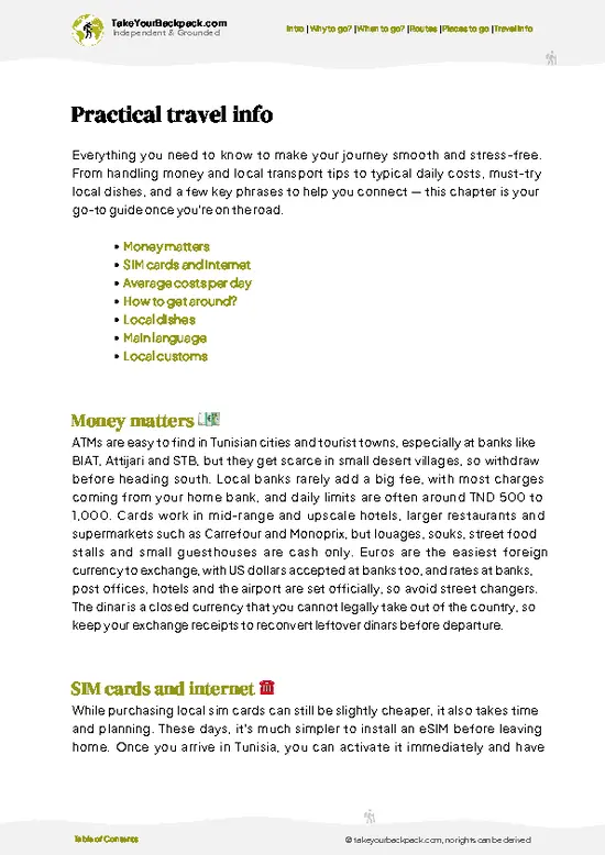
example page 0 from our offline Travel Guide for Tunisia
example page 1 from our offline Travel Guide for Tunisia
example page 2 from our offline Travel Guide for Tunisia
example page 3 from our offline Travel Guide for Tunisia
example page 4 from our offline Travel Guide for Tunisia
example page 5 from our offline Travel Guide for Tunisia
example page 6 from our offline Travel Guide for Tunisia
example page 7 from our offline Travel Guide for Tunisia
Loading the map 🌍
CLICK TO FILTER
cities
towns
villages
landmarks
national parks
hikes
beaches
attractions
festivals
regions
SHOW COUNTRY’S BESTSHOW ALL

✨ Why go?
Ranked #1 hike in Tunisia
The unique appeal for travelers

Backpackers seek out Jugurtha Tableland for the sheer drama of the shape. The mesa rises abruptly from rolling grain fields, and the flat summit plateau gives a 360-degree view toward the Algerian ranges, which is a lot of horizon for a half-day walk. It also carries a name every history reader knows. The Numidian king Jugurtha, who fought Rome in the late second century BC, is tied to this rock in local tradition and in the Roman writer Sallust’s accounts of hilltop strongholds. That story gives the cliffs a bit of narrative weight even when the ruins on top are modest.

The second draw is where it sits in a route. The mesa works as an unhurried detour for anyone linking El Kef and the Roman sites of the northwest, and you can fold it into a day without carrying camping gear. Distances flex … read more 👉
Backpackers seek out Jugurtha Tableland for the sheer drama of the shape. The mesa rises abruptly from rolling grain fields, and the flat summit plateau gives a 360-degree view toward the Algerian ranges, which is a lot of horizon for a half-day walk. It also carries a name every history reader knows. The Numidian king Jugurtha, who fought Rome in the late second century BC, is tied to this rock in local tradition and in the Roman writer Sallust’s accounts of hilltop strongholds. That story gives the cliffs a bit of narrative weight even when the ruins on top are modest.

The second draw is where it sits in a route. The mesa works as an unhurried detour for anyone linking El Kef and the Roman sites of the northwest, and you can fold it into a day without carrying camping gear. Distances flex too: stroll to the base, scramble partway, or spend the afternoon wandering the top. Costs are close to nothing, since there is no gate and no fee, and you meet the farming community of Kalaat Senan on the way in.

💡 HighlightsThe experiences that define the visit

  1. The summit plateau: The reason to come. The top is a wide, nearly flat expanse of rock and scrub, big enough to wander for an hour, with the edges dropping away to cliffs on several sides. It is free to enter and open any time.
  2. Cliff-edge viewpoints: Walk the rim and the land opens in every direction, with wheat and barley fields, scattered farms and pine-covered ridges running toward the Algerian border. The drops are real and unfenced, so keep your distance from the edge in wind.
  3. The ruined fortifications and cisterns: Traces of old walls and water storage on the plateau explain how a garrison could hold out on a dry summit. They are weathered and low, so look for the lines of cut stone rather than standing buildings.
  4. Kalaat Senan town: The working town at the foot of the mesa is where the
… read more 👉
  1. The summit plateau: The reason to come. The top is a wide, nearly flat expanse of rock and scrub, big enough to wander for an hour, with the edges dropping away to cliffs on several sides. It is free to enter and open any time.
  2. Cliff-edge viewpoints: Walk the rim and the land opens in every direction, with wheat and barley fields, scattered farms and pine-covered ridges running toward the Algerian border. The drops are real and unfenced, so keep your distance from the edge in wind.
  3. The ruined fortifications and cisterns: Traces of old walls and water storage on the plateau explain how a garrison could hold out on a dry summit. They are weathered and low, so look for the lines of cut stone rather than standing buildings.
  4. Kalaat Senan town: The working town at the foot of the mesa is where the walk starts. Locals know the rock well and will point you toward the usual approach, and a mint tea in a plain café is easy to find before the climb.
  5. The approach path through fields and pines: The ascent crosses farmland and Aleppo pine, with rocky switchbacks near the top. Spring brings green fields and wildflowers, and you may hear sheep bells and see kestrels or other raptors riding the updrafts along the cliff.
Every item on Jugurtha Tableland costs nothing, since there is no entrance fee, and the town café is the only place you will spend anything.
Spotted a mistake or missing something? Contact us.

🌤️ When to go?When to go for the best experience

  • Spring (March to May): Days run 15 to 25°C (59 to 77°F) and the plateau grass is green, with wildflowers in April. Daylight stretches to about 13 hours by May, which suits a full circuit of the ruins and the cliff edge. Expect school groups on weekends.
  • Summer (June to August): Highs of 33 to 38°C (91 to 100°F) with almost no shade on the flat top. Start walking at dawn or skip it. Daylight lasts up to 14 hours, but midday is punishing.
  • Autumn (September to November): Temperatures ease to 20 to 30°C (68 to 86°F) early on, then drop. Light is clear, crowds are thin, and a few storms can arrive from late October.
  • Winter (December to February): Days of 8 to 15°C (46 to 59°F), cold nights near freezing, and wind across the exposed top. Rain turns tracks to mud. Daylight is only about 10 hours.
Lodging … read more 👉
  • Spring (March to May): Days run 15 to 25°C (59 to 77°F) and the plateau grass is green, with wildflowers in April. Daylight stretches to about 13 hours by May, which suits a full circuit of the ruins and the cliff edge. Expect school groups on weekends.
  • Summer (June to August): Highs of 33 to 38°C (91 to 100°F) with almost no shade on the flat top. Start walking at dawn or skip it. Daylight lasts up to 14 hours, but midday is punishing.
  • Autumn (September to November): Temperatures ease to 20 to 30°C (68 to 86°F) early on, then drop. Light is clear, crowds are thin, and a few storms can arrive from late October.
  • Winter (December to February): Days of 8 to 15°C (46 to 59°F), cold nights near freezing, and wind across the exposed top. Rain turns tracks to mud. Daylight is only about 10 hours.
Lodging in nearby Le Kef and Tébessourt barely changes by season, so choose by temperature and aim for April or October.


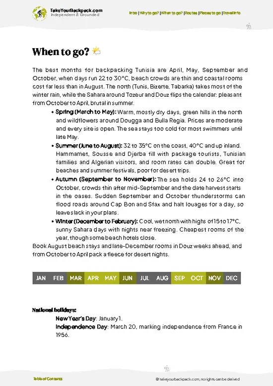
source: climatestotravel.comJANJanuary: good for travelingFEBFebruary: good for travelingMARMarch: highly recommended for travelingAPRApril: excellent for travelingMAYMay: excellent for travelingJUNJune: fair for travelingJULJuly: below average for travelingAUGAugust: below average for travelingSEPSeptember: excellent for travelingOCTOctober: excellent for travelingNOVNovember: highly recommended for travelingDECDecember: good for traveling
when-to-go

✈️ The backpacker research shortcutTunisia Travel Guide

An offline-friendly backpacking guide with optimized travel routes, ranked highlights, transport advice, and the best areas to stay.
example page 0 from our offline Travel Guide for Tunisia
example page 1 from our offline Travel Guide for Tunisia
example page 2 from our offline Travel Guide for Tunisia
example page 3 from our offline Travel Guide for Tunisia
example page 4 from our offline Travel Guide for Tunisia
example page 5 from our offline Travel Guide for Tunisia
example page 6 from our offline Travel Guide for Tunisia
example page 7 from our offline Travel Guide for Tunisia
The digital guide (355 pages) contains:
✅ 90 highlights, ranked by travel appeal
✅ Optimized 5, 10 & 15-day travel routes
✅ Cities, national parks, landmarks, beaches
✅ How to get around
✅ Offline-friendly for travel without Wi-Fi
👉 Click to see all 30+ guide features

📅 Plan smarter in minutes, not weeks
✅ Month by month travel advice
✅ Festivals & national holidays
✅ Budget expectations

🗺️ Go to the right places, skip the overrated ones
✅ Honest pros & cons of destinations
✅ Top hikes, parks & viewpoints
✅ Lesser-known places most travelers miss
✅ Clear “worth it vs skip it” guidance

🛏️ Travel smoothly without rookie mistakes
✅ Best areas to stay
✅ Transport systems explained simply
✅ Common scams & safety advice
✅ SIM cards, money & practical tips

🌍 Understand the country, not just visit it
✅ Culture & traditions
✅ 52 Essential phrases & customs
✅ Festivals worth planning around
✅ Traveler-friendly historical context
✅ Insights that make places more meaningful

📱 Built for real travel conditions
✅ Fully downloadable PDF
✅ Works completely offline
✅ Optimized for phone use
✅ Useful in remote areas & buses
✅ Everything in one place
Stop searching, start planning
Get instant access to your full guide. 30‑day money-back guarantee.
+ Add another guide for just

By proceeding you agree to our terms.
Sent to your inbox immediately after payment • 100% Secure Checkout
Best Backpacking Travel Advisor 2025 tourism awardBest Backpacking
Travel Advisor
2025
What others say about Take Your Backpack Guides:
⭐⭐⭐⭐⭐
Fantastic, amazing amount of information!
⭐⭐⭐⭐⭐
My goodness this is amazing, it's what I've been looking for hats off too you!
⭐⭐⭐⭐⭐
I think this is absolutely BRILLIANT
⭐⭐⭐⭐
Very complete and informative. It's still missing places, but I gotta to commend you
⭐⭐⭐⭐⭐
This is truly amazing, thank you, can't wait to explore it with my kids!
⭐⭐⭐⭐⭐
Awesome resource, thank you!
⭐⭐⭐⭐⭐
This is amazing! Can't wait to explore the ones I haven't seen
⭐⭐⭐⭐
I love this! Well done, great idea.
⭐⭐⭐⭐⭐
Thanks for taking the time to make this gem!
⭐⭐⭐⭐⭐
This might be the best website I've ever seen.
⭐⭐⭐⭐⭐
Congratulations, and thank you so much for your work; it's incredibly valuable.
⭐⭐⭐⭐
In all seriousness I think you did a great job pointing out the important spots
⭐⭐⭐⭐⭐
10/10 very good
⭐⭐⭐⭐⭐
As someone who's only just starting to visit regularly this is awesome, thank you.
⭐⭐⭐⭐
Thank you very much! I'm going to visit my dad, it's going to be very useful!
⭐⭐⭐⭐⭐
This is really cool! We'll be travelling for the first time and this definitely come in handy.
⭐⭐⭐⭐⭐
You are now our minister of culture, congratulations 👨‍💼
⭐⭐⭐⭐⭐
Just wanted to tell you that this is a pearl! Going to follow your recommendations.
⭐⭐⭐⭐⭐
This is so cool. I'll definitely be using the resource for my travels soon.
⭐⭐⭐⭐⭐
This is very impressive! Good work.
⭐⭐⭐⭐⭐
This is an amazing and informative site. Very well done!

🛏️ Where to stay?Best areas and accommodation options

If you enjoy meeting fellow travelers, consider choosing hostels with high ratings for atmosphere. On the other hand, if you prefer having your own space, a hotel might be a better option.

🥾 Hike detailsTrail overview: what to expect on the hike

Jugurtha Tableland overview: A short out-and-back climb onto a high mesa, suited to independent hikers with no gear beyond sturdy shoes and water.
Total Distance: About 6 kilometers round trip, more if you walk in from the town or explore the plateau.
Estimated Duration: Around 3 to 4 hours including time on top.
Difficulty: Moderate. The climb is steady with loose stone, and some sections need hands-on scrambling. Wind on the rim can be strong.
Starting Point: Kalaat Senan, at the foot of the mesa. Louages and local transport link the town with El Kef. Departures fill up and leave when full, so ask
… read more 👉
Jugurtha Tableland overview: A short out-and-back climb onto a high mesa, suited to independent hikers with no gear beyond sturdy shoes and water.
Total Distance: About 6 kilometers round trip, more if you walk in from the town or explore the plateau.
Estimated Duration: Around 3 to 4 hours including time on top.
Difficulty: Moderate. The climb is steady with loose stone, and some sections need hands-on scrambling. Wind on the rim can be strong.
Starting Point: Kalaat Senan, at the foot of the mesa. Louages and local transport link the town with El Kef. Departures fill up and leave when full, so ask early about the return, because afternoon vehicles are sparse.
Major Landmarks:
  • Base of the mesa: Fields and farm tracks give way to the first rocky slope.
  • Upper ramp: A steeper stretch where the path narrows below the cliff line.
  • Summit plateau: Broad flat top with remnants of walls and cisterns.
  • Rim viewpoints: Open outlooks across the border country.
Terrain and Scenery: Limestone rock, scree and dirt paths, rising from rolling cereal country. The cliffs are sheer in places, and the summit gives wide views in every direction.
Vegetation: Cultivated grain fields at the base, then Aleppo pine, rosemary, thyme and low scrub higher up. Spring brings wildflowers, while summer dries everything to straw.
Wildlife: Birds of prey circle the cliffs. Foxes, hares and reptiles live among the rocks, and sheep and goats graze the lower slopes.
Practical Notes:
  • Water: Carry at least 2 liters, since there is none on the route.
  • Shade: Almost none, so a hat matters from late spring to early autumn.
  • Season: Winter can be cold and windy, and rain makes the rock slippery.
⚠️ Hiking info can sometimes be outdated or inaccurate. Before you hit the trail, check the latest conditions with locals. If you do spot anything that's off, I'd love to hear from you, so I can update it for fellow travelers.

🛡️ SafetyTraveler Safety Guide

Jugurtha Tableland is a short, well-defined hike, and the main hazards are sun, wind and the cliff edge. The summit is a flat, open plateau with almost no shade, so carry at least 2 liters of water per person, a hat and sunscreen from May through September. In winter the wind is sharp and rain makes the clay path slippery, so wear shoes with real grip. The climb up is steep and rocky in places, and loose stone near the rim can shift underfoot. Keep a safe distance from the drop, especially in gusts and with children. Paths are not signed in detail, so download an offline map before you set out and keep the rock face in view to stay oriented. Mobile signal can be patchy. Stray dogs may bark around the base, and shepherds with flocks are common, so greet them and keep your distance from the … read more 👉
Jugurtha Tableland is a short, well-defined hike, and the main hazards are sun, wind and the cliff edge. The summit is a flat, open plateau with almost no shade, so carry at least 2 liters of water per person, a hat and sunscreen from May through September. In winter the wind is sharp and rain makes the clay path slippery, so wear shoes with real grip. The climb up is steep and rocky in places, and loose stone near the rim can shift underfoot. Keep a safe distance from the drop, especially in gusts and with children. Paths are not signed in detail, so download an offline map before you set out and keep the rock face in view to stay oriented. Mobile signal can be patchy. Stray dogs may bark around the base, and shepherds with flocks are common, so greet them and keep your distance from the animals. Go with someone or tell your lodging where you are heading.

FAQCommon questions from travelers

Jugurtha Tableland takes about 2 to 3 hours for the climb, a loop across the top and the descent. The ascent alone is roughly 45 to 60 minutes from the base near Ksour, and the plateau walk adds 1 to 1.5 hours. Allow a little extra if you want to linger at the viewpoints over the Tunisian steppe.
Jugurtha Tableland is a moderate hike, mainly because of the steep, rocky ascent of about 150 to 250 meters rather than any technical ground. The top is flat and easy, with a loop of roughly 4 to 6 kilometers if you circle the edge. Most reasonably fit first-timers manage it, but summer heat makes it noticeably harder, so bring 2 liters of water.
No, Jugurtha Tableland does not require a guide or a permit, and there is no entry gate on the plateau. Entry to the site is free, though a local guide from nearby Ksour can be arranged for roughly US$10 to 20 if you want the history of the fortress and the legends explained. Paths are faint, so offline maps are useful if you go alone.
⚠️ Things can change over time, so always validate details locally before you go.

Other Tunisian hikes near Jugurtha Tableland

Explore more nearby:


💡 Not sure where to go next?
Create a personalized itinerary for Tunisia including Jugurtha Tableland and the places that fit your trip.

Generate my itinerary

👉 Discover all hikes

Or checkout all Tunisia has to offer (think cities, towns, villages, national parks, hikes, beaches, festivals)
Country photo of Tunisia

We 💚 feedbackIs it worth it?

Jugurtha Tableland trips go wrong when people treat it as a quick stop and arrive late with one bottle of water and no plan for getting back. Start in the morning, bring plenty to drink, and agree on a return ride before you leave town. Then take your time on the top, because the view is the whole point.

✍️ Help improve this page!
The information on this page is based on in-depth research, insights shared by experienced travelers, and feedback from the local travel community in Tunisia. While every effort is made to keep the information accurate and current, conditions can change — so if you spot anything incorrect or outdated, please get in touch.


🙋‍♂️ Give feedback

👋 Meet the founderWho’s Behind Take Your Backpack?

Johan, backpacker and founder of TakeYourBackpackHi, I’m Johan (Netherlands 🇳🇱), the creator of TakeYourBackpack. Over the past 3 decades, I’ve backpacked through 90+ countries across six continents, gaining extensive experience with independent travel, long-term trips, and overland routes.

This site is built on a combination of firsthand travel experience and carefully curated insights from other backpackers. Many guides are based on places I’ve personally visited, while others bring together tips, observations, and practical advice shared by trusted travelers I’ve met along the way.

The goal is to provide realistic, experience-driven guidance — not generic itineraries — so you can explore destinations with better context, clearer expectations, and more confidence.