×

Tunisia🇹🇳 | hikesChott el Jerid Salt Flats WalkSalt crust, mirages, pink patches, causeway stalls | things to do and best time to go

Explore Ksar Ghilane to Douz TrekExplore Matmata to Tamezret Trail

Backpacking in Chott el Jerid Salt Flats Walk
👌 Worth visitinghike ranked #4
By Johan Kruseman 🇳🇱 | Updated October 22, 2026

The crust crunches like stale meringue under your boots, and then the horizon starts to wobble, a mirage lake hovering where no lake exists. Chott el Jerid Salt Flats Walk sits in the south of Tunisia, between Tozeur and Kebili, on the largest salt pan in the Sahara. The scenery is flat, white, pink and sometimes blue, with almost nothing to hide behind, which is either meditative or monotonous depending on your mood. A day on the crust covers roughly 10 to 15 kilometers, easy underfoot but exposed, and there is no trail marking to speak of. Buses and shared louages reach both Tozeur and Kebili, so getting to the edge is simple. The mistakes are predictable. Wandering off the causeway after rain can swallow a shoe or a whole car, so stay on firm crust and ask locals about recent wet spells. Bring more water than seems sensible, plus sunglasses and a hat. Most of all, go with a local guide or driver who knows where the crust is solid.

Discover everything you want to know in the 📖 Tunisia Travel Guide.
Best time to go: March - May, September - November
Duration: 3 hours
Distance: 6 kilometers
Total ascent: 0 meters


example page 0 from our offline Travel Guide for Tunisia
example page 1 from our offline Travel Guide for Tunisia
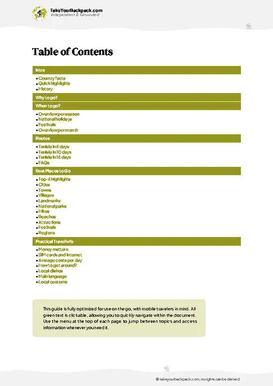
example page 2 from our offline Travel Guide for Tunisia
example page 3 from our offline Travel Guide for Tunisia
example page 4 from our offline Travel Guide for Tunisia
example page 5 from our offline Travel Guide for Tunisia
example page 6 from our offline Travel Guide for Tunisia
example page 7 from our offline Travel Guide for Tunisia
Loading the map 🌍
CLICK TO FILTER
cities
towns
villages
landmarks
national parks
hikes
beaches
attractions
festivals
regions
SHOW COUNTRY’S BESTSHOW ALL

✨ Why go?
Ranked #4 hike in Tunisia
What makes this hike worth hiking

Chott el Jerid Salt Flats Walk gives you one of the strangest landscapes in North Africa without any planning headaches. The lake covers roughly 7,000 square kilometers, and from the edge of the causeway road between Tozeur and Kebili you can step onto the crust in minutes. You choose the distance: a 30-minute wander for photos, or a few kilometers out until the road shrinks into a thin line and the silence gets heavy. That flexibility suits a trip through the Sahara gateway towns, where Tozeur's palm oasis and the Star Wars film sets near Nefta are a short hop away.

The second pull is the light. Mirages shimmer over the surface in the heat, and the salt shifts between white, pink and pale green depending on moisture and sun angle. It is cheap, needs no permit or guide, and fits easily between other desert stops.

💡 HighlightsDon't-miss highlights and experiences

  1. The Salt Crust Itself: The main draw is walking on the dry lakebed, a hard, crackling white surface with polygon patterns and crystals that glitter underfoot. It feels oddly like frozen snow without the cold.
  2. Mirages on the Horizon: On hot days the heat haze lifts distant hills and palms into floating shapes. They appear most clearly in the middle of the lake, far from the road.
  3. The Pink and Green Salt Patches: Where moisture and algae collect, the salt takes on rose and greenish tints. They make the best close-up photos, but keep to firm ground nearby.
  4. The Causeway Road Viewpoints: The road crossing the lake has pull-offs where the salt stretches to both sides. Roadside stalls sell salt roses and desert crystals, and a small tea stop is sometimes open for a quick break.
  5. Sunset over the Chott:
… read more 👉
  1. The Salt Crust Itself: The main draw is walking on the dry lakebed, a hard, crackling white surface with polygon patterns and crystals that glitter underfoot. It feels oddly like frozen snow without the cold.
  2. Mirages on the Horizon: On hot days the heat haze lifts distant hills and palms into floating shapes. They appear most clearly in the middle of the lake, far from the road.
  3. The Pink and Green Salt Patches: Where moisture and algae collect, the salt takes on rose and greenish tints. They make the best close-up photos, but keep to firm ground nearby.
  4. The Causeway Road Viewpoints: The road crossing the lake has pull-offs where the salt stretches to both sides. Roadside stalls sell salt roses and desert crystals, and a small tea stop is sometimes open for a quick break.
  5. Sunset over the Chott: As the sun drops, the flat surface mirrors the sky in warm color and long shadows fall across the crust. It is the most atmospheric time to be out there, but plan your return before dark.
Start with the salt crust walk itself while the surface is firm and the air is cooler, since every other highlight depends on how far and how comfortably you can get out onto it.
Spotted a mistake or missing something? Contact us.

Things to do near Chott el Jerid Salt Flats Walk

Ratings based on Tripadvisor reviews. When you book through this link, you support our work at no extra cost to you.

🌤️ When to go?When to go for the best experience

  • Winter (December to February): Daytime highs run 15 to 19°C (59 to 66°F), nights drop to 3 to 6°C (37 to 43°F), and the crust is firmest after rain-free spells. Daylight lasts roughly 10 hours. Hotels in Tozeur and Douz peak around Christmas and the Sahara Festival period, so beds cost more.
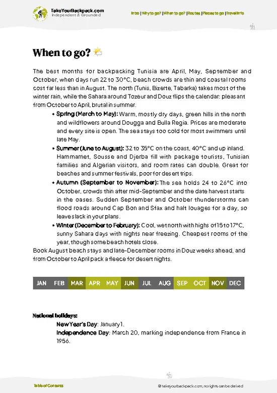
  • Spring (March to May): Highs climb from 23°C (73°F) to 35°C (95°F) and days stretch past 12 hours. Mirages shimmer by midday. Crowds thin after Easter.
  • Summer (June to August): Highs of 40 to 46°C (104 to 115°F) make walking on white salt punishing. Prices fall, and few travelers come.
  • Autumn (September to November): Highs ease from 34°C (93°F) to 22°C (72°F). Flooded patches can appear after the first storms, usually November. Date harvest season brings busy oases and mid-range prices.
Start walking at first … read more 👉
  • Winter (December to February): Daytime highs run 15 to 19°C (59 to 66°F), nights drop to 3 to 6°C (37 to 43°F), and the crust is firmest after rain-free spells. Daylight lasts roughly 10 hours. Hotels in Tozeur and Douz peak around Christmas and the Sahara Festival period, so beds cost more.
  • Spring (March to May): Highs climb from 23°C (73°F) to 35°C (95°F) and days stretch past 12 hours. Mirages shimmer by midday. Crowds thin after Easter.
  • Summer (June to August): Highs of 40 to 46°C (104 to 115°F) make walking on white salt punishing. Prices fall, and few travelers come.
  • Autumn (September to November): Highs ease from 34°C (93°F) to 22°C (72°F). Flooded patches can appear after the first storms, usually November. Date harvest season brings busy oases and mid-range prices.
Start walking at first light and aim to be off the salt before the heat builds, especially from March onward.


source: climatestotravel.comJANJanuary: fair for travelingFEBFebruary: fair for travelingMARMarch: highly recommended for travelingAPRApril: excellent for travelingMAYMay: highly recommended for travelingJUNJune: fair for travelingJULJuly: below average for travelingAUGAugust: below average for travelingSEPSeptember: highly recommended for travelingOCTOctober: excellent for travelingNOVNovember: highly recommended for travelingDECDecember: fair for traveling
when-to-go

✈️ The backpacker research shortcutTunisia Travel Guide

An offline-friendly backpacking guide with optimized travel routes, ranked highlights, transport advice, and the best areas to stay.
example page 0 from our offline Travel Guide for Tunisia
example page 1 from our offline Travel Guide for Tunisia
example page 2 from our offline Travel Guide for Tunisia
example page 3 from our offline Travel Guide for Tunisia
example page 4 from our offline Travel Guide for Tunisia
example page 5 from our offline Travel Guide for Tunisia
example page 6 from our offline Travel Guide for Tunisia
example page 7 from our offline Travel Guide for Tunisia
The digital guide (355 pages) contains:
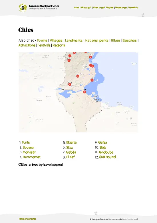
✅ 90 highlights, ranked by travel appeal
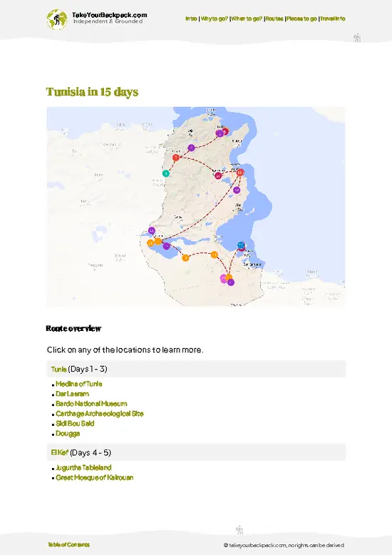
✅ Optimized 5, 10 & 15-day travel routes
✅ Cities, national parks, landmarks, beaches
✅ How to get around
✅ Offline-friendly for travel without Wi-Fi
👉 Click to see all 30+ guide features

📅 Plan smarter in minutes, not weeks
✅ Month by month travel advice
✅ Festivals & national holidays
✅ Budget expectations

🗺️ Go to the right places, skip the overrated ones
✅ Honest pros & cons of destinations
✅ Top hikes, parks & viewpoints
✅ Lesser-known places most travelers miss
✅ Clear “worth it vs skip it” guidance

🛏️ Travel smoothly without rookie mistakes
✅ Best areas to stay
✅ Transport systems explained simply
✅ Common scams & safety advice
✅ SIM cards, money & practical tips

🌍 Understand the country, not just visit it
✅ Culture & traditions
✅ 52 Essential phrases & customs
✅ Festivals worth planning around
✅ Traveler-friendly historical context
✅ Insights that make places more meaningful

📱 Built for real travel conditions
✅ Fully downloadable PDF
✅ Works completely offline
✅ Optimized for phone use
✅ Useful in remote areas & buses
✅ Everything in one place
Stop searching, start planning
Get instant access to your full guide. 30‑day money-back guarantee.
+ Add another guide for just

By proceeding you agree to our terms.
Sent to your inbox immediately after payment • 100% Secure Checkout
Best Backpacking Travel Advisor 2025 tourism awardBest Backpacking
Travel Advisor
2025
What others say about Take Your Backpack Guides:
⭐⭐⭐⭐⭐
Fantastic, amazing amount of information!
⭐⭐⭐⭐⭐
My goodness this is amazing, it's what I've been looking for hats off too you!
⭐⭐⭐⭐⭐
I think this is absolutely BRILLIANT
⭐⭐⭐⭐
Very complete and informative. It's still missing places, but I gotta to commend you
⭐⭐⭐⭐⭐
This is truly amazing, thank you, can't wait to explore it with my kids!
⭐⭐⭐⭐⭐
Awesome resource, thank you!
⭐⭐⭐⭐⭐
This is amazing! Can't wait to explore the ones I haven't seen
⭐⭐⭐⭐
I love this! Well done, great idea.
⭐⭐⭐⭐⭐
Thanks for taking the time to make this gem!
⭐⭐⭐⭐⭐
This might be the best website I've ever seen.
⭐⭐⭐⭐⭐
Congratulations, and thank you so much for your work; it's incredibly valuable.
⭐⭐⭐⭐
In all seriousness I think you did a great job pointing out the important spots
⭐⭐⭐⭐⭐
10/10 very good
⭐⭐⭐⭐⭐
As someone who's only just starting to visit regularly this is awesome, thank you.
⭐⭐⭐⭐
Thank you very much! I'm going to visit my dad, it's going to be very useful!
⭐⭐⭐⭐⭐
This is really cool! We'll be travelling for the first time and this definitely come in handy.
⭐⭐⭐⭐⭐
You are now our minister of culture, congratulations 👨‍💼
⭐⭐⭐⭐⭐
Just wanted to tell you that this is a pearl! Going to follow your recommendations.
⭐⭐⭐⭐⭐
This is so cool. I'll definitely be using the resource for my travels soon.
⭐⭐⭐⭐⭐
This is very impressive! Good work.
⭐⭐⭐⭐⭐
This is an amazing and informative site. Very well done!

🛏️ Where to stay?Best areas and accommodation options

If you enjoy meeting fellow travelers, consider choosing hostels with high ratings for atmosphere. On the other hand, if you prefer having your own space, a hotel might be a better option.

🥾 Hike detailsRoute, distance, and difficulty explained

Chott el Jerid Salt Flats Walk: an out-and-back stroll on the dry salt lake in southern Tunisia, with no marked trail.
Total Distance: Typically 3 to 8 kilometers return, depending on how far from the road you go.
Estimated Duration: 1.5 to 4 hours including photo stops.
Difficulty: Easy underfoot but demanding in heat. The flat ground has almost no ascent, yet exposure and glare are tough.
Starting Point: The causeway road between Tozeur and Kebili. Buses and shared louages pass along it, so ask the driver to drop you at a safe roadside spot and agree a pickup plan.
Major Landmarks:
  • Causeway Road:
… read more 👉
Chott el Jerid Salt Flats Walk: an out-and-back stroll on the dry salt lake in southern Tunisia, with no marked trail.
Total Distance: Typically 3 to 8 kilometers return, depending on how far from the road you go.
Estimated Duration: 1.5 to 4 hours including photo stops.
Difficulty: Easy underfoot but demanding in heat. The flat ground has almost no ascent, yet exposure and glare are tough.
Starting Point: The causeway road between Tozeur and Kebili. Buses and shared louages pass along it, so ask the driver to drop you at a safe roadside spot and agree a pickup plan.
Major Landmarks:
  • Causeway Road: Your anchor point; keep it in sight.
  • Salt Stalls: Roadside sellers of crystals and salt roses.
  • Colored Patches: Pink and green zones where moisture sits.
Terrain and Scenery: A hard salt crust, flat to every horizon, with cracked polygons and glittering crystals. Dark, damp areas can be soft or boggy, so stay on pale firm crust. After rain the whole lake can turn slick.
Vegetation: Almost none on the lake. Salt-tolerant shrubs and date palms appear at the oasis edges near Tozeur and Kebili.
Wildlife: Very little on the crust. You may see birds near the edges, lizards and insects, and occasionally desert foxes elsewhere in the region.
⚠️ Hiking info can sometimes be outdated or inaccurate. Before you hit the trail, check the latest conditions with locals. If you do spot anything that's off, I'd love to hear from you, so I can update it for fellow travelers.

🛡️ SafetySafety Tips and Common Scams in Chott el Jerid Salt Flats Walk

Chott el Jerid is flat, open and easy underfoot in dry weather, but the main dangers are heat, glare and a surface that changes. Carry at least 3 to 4 liters of water per person, a wide-brimmed hat, sunglasses and high-SPF sunscreen, because white salt reflects sunlight upward and shade does not exist. Stay on established tracks and the causeway-adjacent routes. Off them, a thin crust can hide wet, sticky mud, and after rain it turns slippery and can swallow a shoe or a vehicle. Navigation is hard in haze and mirage conditions, so download an offline map and track your position by phone or GPS. Summer walks should be skipped or kept very short. Wind can whip up salt dust, so bring a buff and eye protection. Wildlife is minimal, with only the occasional lizard or desert fox. Tell your hotel … read more 👉
Chott el Jerid is flat, open and easy underfoot in dry weather, but the main dangers are heat, glare and a surface that changes. Carry at least 3 to 4 liters of water per person, a wide-brimmed hat, sunglasses and high-SPF sunscreen, because white salt reflects sunlight upward and shade does not exist. Stay on established tracks and the causeway-adjacent routes. Off them, a thin crust can hide wet, sticky mud, and after rain it turns slippery and can swallow a shoe or a vehicle. Navigation is hard in haze and mirage conditions, so download an offline map and track your position by phone or GPS. Summer walks should be skipped or kept very short. Wind can whip up salt dust, so bring a buff and eye protection. Wildlife is minimal, with only the occasional lizard or desert fox. Tell your hotel in Tozeur or Douz your plan and keep a charged phone.

FAQFrequently asked questions about Chott el Jerid Salt Flats Walk

Crossing Chott el Jerid Salt Flats Walk on foot takes roughly 3 to 5 hours for a typical out-and-back stroll onto the crust from the Tozeur or Kebili side, while a full crossing on foot is not practical. The paved road between Tozeur and Kebili runs about 90 to 100 km across the lake, which is 1.5 hours by car or shared taxi. Most backpackers walk 1 to 2 km out from a roadside pull-off near Tozeur and spend an hour or two wandering, with a longer wander if they stay for the light changing over the crust.
Chott el Jerid Salt Flats Walk is easy in terms of effort, since the ground is flat and you gain almost no elevation. The challenge is exposure: summer temperatures often pass 40°C (104°F), there is no shade for kilometers, and the surface can turn soft and treacherous after rain. Plan on at least 2 liters of water per person, sunglasses, a hat and closed shoes, and stay on firm, whitish crust rather than dark, damp patches.
Chott el Jerid Salt Flats Walk needs no permit and no entry fee, and you can walk onto the salt from pull-offs along the Tozeur to Kebili road. A guide is not required, but one is wise if you want to go beyond the first kilometer or two, since the crust can be unstable and tracks fade into the glare. A local driver or guide from Tozeur typically charges around US$30 to 70 for a half-day trip, often combined with a visit to the mirage-prone central stretch and the salt-lake roadside stalls.
⚠️ Things can change over time, so always validate details locally before you go.

Other Tunisian hikes near Chott el Jerid Salt Flats Walk

Explore more nearby:


💡 Not sure where to go next?
Create a personalized itinerary for Tunisia including Chott el Jerid Salt Flats Walk and the places that fit your trip.

Generate my itinerary

👉 Discover all hikes

Or checkout all Tunisia has to offer (think cities, towns, villages, national parks, hikes, beaches, festivals)
Country photo of Tunisia

We 💚 feedbackParting advice and final tips

Chott el Jerid Salt Flats Walk is best for photographers, road-trippers and anyone who loves empty, odd landscapes. If you need peaks and shade, skip it. I would go with at least 3 liters of water, a hat, sunglasses and a firm pickup plan, and I would turn back well before the road disappears.

✍️ Help improve this page!
The information on this page is based on in-depth research, insights shared by experienced travelers, and feedback from the local travel community in Tunisia. While every effort is made to keep the information accurate and current, conditions can change — so if you spot anything incorrect or outdated, please get in touch.


🙋‍♂️ Give feedback

👋 Meet the founderWho’s Behind Take Your Backpack?

Johan, backpacker and founder of TakeYourBackpackHi, I’m Johan (Netherlands 🇳🇱), the creator of TakeYourBackpack. Over the past 3 decades, I’ve backpacked through 90+ countries across six continents, gaining extensive experience with independent travel, long-term trips, and overland routes.

This site is built on a combination of firsthand travel experience and carefully curated insights from other backpackers. Many guides are based on places I’ve personally visited, while others bring together tips, observations, and practical advice shared by trusted travelers I’ve met along the way.

The goal is to provide realistic, experience-driven guidance — not generic itineraries — so you can explore destinations with better context, clearer expectations, and more confidence.