×

Turkmenistan🇹🇲 | national parksGaplaňgyr Nature ReserveKaplankyr plateau, limestone escarpments, kulan and mouflon, Sarykamysh views | things to do and best time to go

Explore Badhyz State Nature ReserveExplore Bereketli Garagum Nature Reserve

Backpacking in Gaplaňgyr Nature Reserve
👍 Recommendednational park ranked #6
By Johan Kruseman 🇳🇱 | Updated November 15, 2026

Gaplaňgyr Nature Reserve sits on a plateau where wild onagers, the Turkmen kulan, roam, and the reserve is closed to casual walk-in visitors, so a pre-arranged permit and an escort decide whether you get in at all. It lies in the northwest of Turkmenistan, on the border with Uzbekistan, a long drive from Daşoguz. The scenery is chalk canyons, dry steppe and limestone ridges, with gazelles and the occasional raptor for wildlife. Hiking here means short, guided walks, not multi-day trekking, and there is no infrastructure for independent routes. Crowds are essentially nonexistent, which gives the place a quiet, remote feel, but that same remoteness means poor access and little flexibility. Delays are the usual trouble: permits can take weeks, and turning up without one wastes the trip. Apply early through a licensed Turkmen tour agency, and arrange transport before you leave Daşoguz.

Part of Backpacking in Turkmenistan: all 41 places on one map, with routes and the best time to go.
Discover everything you want to know in the 📖 Turkmenistan Travel Guide.


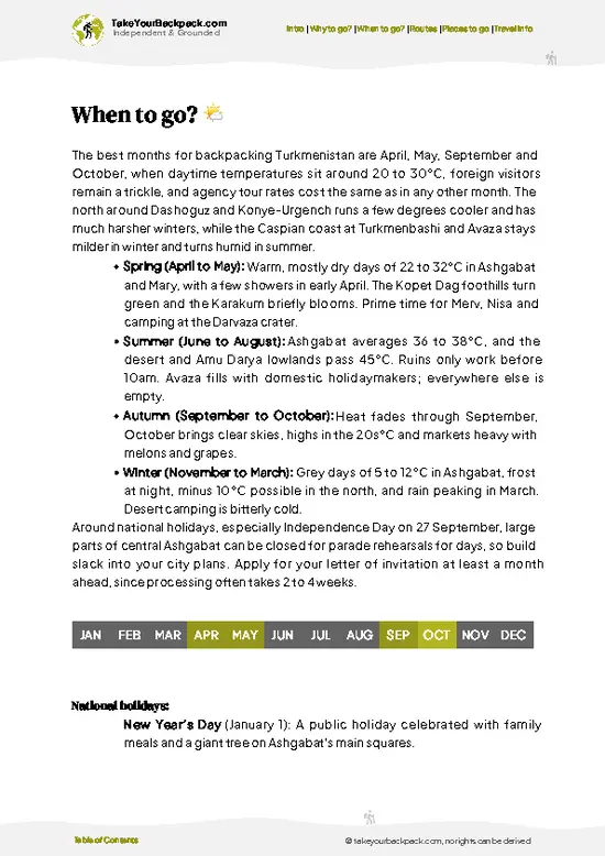
example page 0 from our offline Travel Guide for Turkmenistan
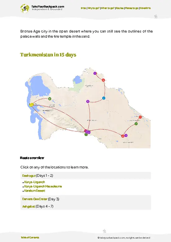
example page 1 from our offline Travel Guide for Turkmenistan
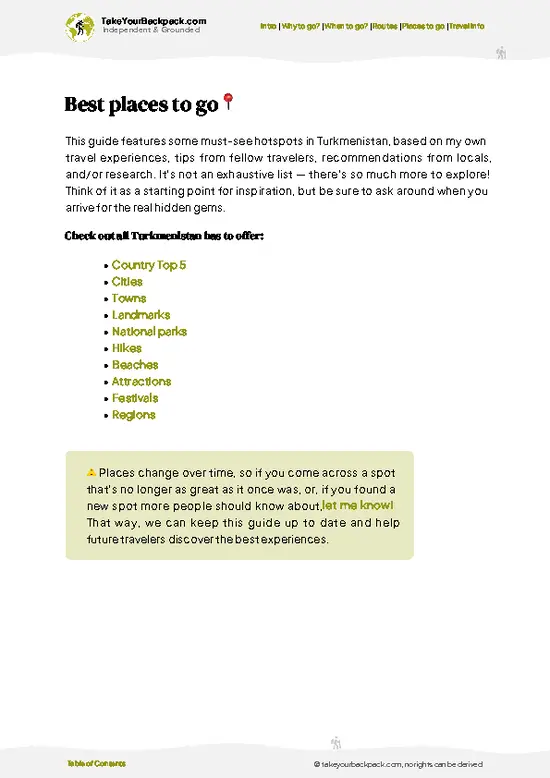
example page 2 from our offline Travel Guide for Turkmenistan
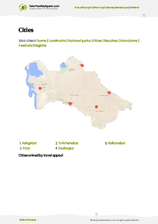
example page 3 from our offline Travel Guide for Turkmenistan
example page 4 from our offline Travel Guide for Turkmenistan
example page 5 from our offline Travel Guide for Turkmenistan
example page 6 from our offline Travel Guide for Turkmenistan
example page 7 from our offline Travel Guide for Turkmenistan
Loading the map 🌍
CLICK TO FILTER
cities
towns
landmarks
national parks
hikes
beaches
attractions
festivals
regions
SHOW COUNTRY’S BESTSHOW ALL

✨ Why go?
Ranked #6 national park in Turkmenistan
What makes it a must-see national park

Gaplaňgyr Nature Reserve suits backpackers who prefer raw landscape to ticking off sights. The Kaplankyr plateau is a place where you can spend a day with only wind, rock and tracks of animals for company, a rare thing in a country where most visitors stick to a few famous sites. Independent exploration is limited by the permit system and the lack of facilities, but that restriction is also why the ground feels untouched. Travelers who already know the Karakum and want something different will appreciate the contrast: flat-topped chinks, the steep eroded edges of the plateau, give the terrain a shape that sand desert lacks. Wildlife is the other draw. Kulan, the Asiatic wild ass, and gazelles roam the open steppe, and patient scanning from a vehicle or a ridge usually beats any scheduled tour. … read more 👉
Gaplaňgyr Nature Reserve suits backpackers who prefer raw landscape to ticking off sights. The Kaplankyr plateau is a place where you can spend a day with only wind, rock and tracks of animals for company, a rare thing in a country where most visitors stick to a few famous sites. Independent exploration is limited by the permit system and the lack of facilities, but that restriction is also why the ground feels untouched. Travelers who already know the Karakum and want something different will appreciate the contrast: flat-topped chinks, the steep eroded edges of the plateau, give the terrain a shape that sand desert lacks. Wildlife is the other draw. Kulan, the Asiatic wild ass, and gazelles roam the open steppe, and patient scanning from a vehicle or a ridge usually beats any scheduled tour. Go for space, silence and the odd animal sighting.

💡 HighlightsWhat this place is best known for

  1. Kaplankyr Plateau: The reserve’s defining landform, a broad limestone tableland of steppe and thin scrub that feels very remote and very quiet.
  2. The Chinks (Escarpments): Steep, eroded cliff edges where the plateau drops away, with layered rock, small canyons and wide views over the plains below.
  3. Kulan Herds: Asiatic wild asses live on the open steppe, and spotting a herd moving across the horizon is the highlight for many visitors.
  4. Goitered Gazelle: Slender, pale gazelles that bolt at the first sound of an engine, best watched from a distance with binoculars.
  5. Ustyurt Mouflon Habitat: Rocky outcrops and ledges where wild sheep are found, a place to scan carefully and wait rather than hurry.
  6. Steppe and Semi-Desert Flora: In spring the ground greens briefly and flowers appear between the stones, a
… read more 👉
  1. Kaplankyr Plateau: The reserve’s defining landform, a broad limestone tableland of steppe and thin scrub that feels very remote and very quiet.
  2. The Chinks (Escarpments): Steep, eroded cliff edges where the plateau drops away, with layered rock, small canyons and wide views over the plains below.
  3. Kulan Herds: Asiatic wild asses live on the open steppe, and spotting a herd moving across the horizon is the highlight for many visitors.
  4. Goitered Gazelle: Slender, pale gazelles that bolt at the first sound of an engine, best watched from a distance with binoculars.
  5. Ustyurt Mouflon Habitat: Rocky outcrops and ledges where wild sheep are found, a place to scan carefully and wait rather than hurry.
  6. Steppe and Semi-Desert Flora: In spring the ground greens briefly and flowers appear between the stones, a short season that transforms the otherwise tawny landscape.
  7. Sarykamysh Lake Surroundings: The vast salty lake to the east, fed by drainage water, adds a very different horizon of water, reeds and birds to the dry plateau.
Standing at a plateau edge to take in the chinks costs nothing at Gaplaňgyr Nature Reserve beyond the permit you need to be there at all.
Spotted a mistake or missing something? Contact us.

🌤️ When to go?Weather, crowds, and seasonal trade-offs

  • Spring (March to May): Days run 15 to 28°C (59 to 82°F) and the clay plateau and canyon floors carry grass and tulips in April. Rain turns tracks to slick mud, so allow slack days. Nights can dip near 5°C (41°F).
  • Summer (June to August): Highs of 38 to 45°C (100 to 113°F) make daytime walking miserable, with almost no shade on the plateau. Daylight is longest, but I would skip these months.
  • Autumn (September to November): Daytime 18 to 30°C (64 to 86°F) in September and October, cooling to 5 to 15°C (41 to 59°F) by November. Dry, clear and quiet.
  • Winter (December to February): Highs of 0 to 8°C (32 to 46°F), frost at night, short days. Few visitors, and tour operators may add little in the way of discounts.
Aim for April or late September to October, when the heat is gone and the ground is firm or in bloom.

source: climatestotravel.comJANJanuary: below average for travelingFEBFebruary: below average for travelingMARMarch: fair for travelingAPRApril: excellent for travelingMAYMay: highly recommended for travelingJUNJune: fair for travelingJULJuly: below average for travelingAUGAugust: below average for travelingSEPSeptember: excellent for travelingOCTOctober: excellent for travelingNOVNovember: fair for travelingDECDecember: below average for traveling
when-to-go

✈️ The backpacker research shortcutTurkmenistan Travel Guide

What the free pages can't give you: ready-made routes, every place ranked, and it works offline. All in 1 guide.
example page 0 from our offline Travel Guide for Turkmenistan
example page 1 from our offline Travel Guide for Turkmenistan
example page 2 from our offline Travel Guide for Turkmenistan
example page 3 from our offline Travel Guide for Turkmenistan
example page 4 from our offline Travel Guide for Turkmenistan
example page 5 from our offline Travel Guide for Turkmenistan
example page 6 from our offline Travel Guide for Turkmenistan
example page 7 from our offline Travel Guide for Turkmenistan
The digital guide (153 pages) contains:-page digital guide:
✅ Ready-made 5, 10 & 15-day routes
✅ All 41 places ranked, so you skip the overrated ones
✅ Works offline, all in 1 guide
✅ Cities, national parks, landmarks, beaches
✅ How to get around
👉 Click to see all 30+ guide features

📅 Plan smarter in minutes, not weeks
✅ Month by month travel advice
✅ Festivals & national holidays
✅ Budget expectations

🗺️ Go to the right places, skip the overrated ones
✅ Honest pros & cons of destinations
✅ Top hikes, parks & viewpoints
✅ Lesser-known places most travelers miss
✅ Clear “worth it vs skip it” guidance

🛏️ Travel smoothly without rookie mistakes
✅ Best areas to stay
✅ Transport systems explained simply
✅ Common scams & safety advice
✅ SIM cards, money & practical tips

🌍 Understand the country, not just visit it
✅ Culture & traditions
✅ 52 Essential phrases & customs
✅ Festivals worth planning around
✅ Traveler-friendly historical context
✅ Insights that make places more meaningful

📱 Built for real travel conditions
✅ Fully downloadable PDF
✅ Works completely offline
✅ Optimized for phone use
✅ Useful in remote areas & buses
✅ All in 1 guide
Stop searching, start planning
Get instant access to your full guide. 30‑day money-back guarantee.


By proceeding you agree to our terms.
Sent to your inbox immediately after payment • 100% Secure Checkout
Best Backpacking Travel Advisor 2025 tourism awardBest Backpacking
Travel Advisor
2025
What others say about Take Your Backpack Guides:
⭐⭐⭐⭐⭐
Fantastic, amazing amount of information!
⭐⭐⭐⭐⭐
My goodness this is amazing, it's what I've been looking for hats off too you!
⭐⭐⭐⭐⭐
I think this is absolutely BRILLIANT
⭐⭐⭐⭐
Very complete and informative. It's still missing places, but I gotta to commend you
⭐⭐⭐⭐⭐
This is truly amazing, thank you, can't wait to explore it with my kids!
⭐⭐⭐⭐⭐
Awesome resource, thank you!
⭐⭐⭐⭐⭐
This is amazing! Can't wait to explore the ones I haven't seen
⭐⭐⭐⭐
I love this! Well done, great idea.
⭐⭐⭐⭐⭐
Thanks for taking the time to make this gem!
⭐⭐⭐⭐⭐
This might be the best website I've ever seen.
⭐⭐⭐⭐⭐
Congratulations, and thank you so much for your work; it's incredibly valuable.
⭐⭐⭐⭐
In all seriousness I think you did a great job pointing out the important spots
⭐⭐⭐⭐⭐
10/10 very good
⭐⭐⭐⭐⭐
As someone who's only just starting to visit regularly this is awesome, thank you.
⭐⭐⭐⭐
Thank you very much! I'm going to visit my dad, it's going to be very useful!
⭐⭐⭐⭐⭐
This is really cool! We'll be travelling for the first time and this definitely come in handy.
⭐⭐⭐⭐⭐
You are now our minister of culture, congratulations 👨‍💼
⭐⭐⭐⭐⭐
Just wanted to tell you that this is a pearl! Going to follow your recommendations.
⭐⭐⭐⭐⭐
This is so cool. I'll definitely be using the resource for my travels soon.
⭐⭐⭐⭐⭐
This is very impressive! Good work.
⭐⭐⭐⭐⭐
This is an amazing and informative site. Very well done!

🛏️ Where to stay?Where staying makes the most sense

There is no formal accommodation inside Gaplaňgyr Nature Reserve, so most backpackers base themselves in Daşoguz and make the trip in a hired 4x4 with a driver. Daşoguz, the closest city, has a handful of state-run and private hotels, typically US$25 to 60 a night for a double, plus a few guesthouses at the lower end. The city has bazaars for stocking up on bread, fruit and water before you head out. Another option is Köneürgenç, a smaller town with its UNESCO-listed ruins, where homestays and small hotels run roughly US$20 to 45. Neither town is on the doorstep, as the reserve is a long, rough … read more 👉
There is no formal accommodation inside Gaplaňgyr Nature Reserve, so most backpackers base themselves in Daşoguz and make the trip in a hired 4x4 with a driver. Daşoguz, the closest city, has a handful of state-run and private hotels, typically US$25 to 60 a night for a double, plus a few guesthouses at the lower end. The city has bazaars for stocking up on bread, fruit and water before you head out. Another option is Köneürgenç, a smaller town with its UNESCO-listed ruins, where homestays and small hotels run roughly US$20 to 45. Neither town is on the doorstep, as the reserve is a long, rough drive away across desert and steppe. The reserve itself is remote and permit-controlled, so independent camping is only realistic as part of an arranged trip with a licensed agency, which normally brings its own tents, food and water. Book accommodation ahead through an agency, because foreign visitors need registered lodging and the invitation or tour paperwork that goes with it.

👛 Costs (as of 15 November 2026)What things cost and how to budget

Gaplaňgyr Nature Reserve costs about US$150 to 310 a day for a visitor, since access almost always goes through an agency with a driver and vehicle. Costs are mostly set by the transfer and permits, and do not drop much for solo travelers.
CategoryBudget RangeLocal Reality
Entrance and permitsUS$10 to 30Reserve access needs permits, usually arranged by the agency and added to the invoice.
Accommodation (high season)US$25 to 60Hotels or guesthouses in Daşoguz; camping with an agency is often included in the package.
Local transportUS$80 to 150A 4x4 and driver from Daşoguz, ideally split among a group.
Food and suppliesUS$10 to 20Simple meals in town, picnic food from the bazaar, and bottled water.
GuideUS$25 to 50Often bundled with the vehicle by agencies.
Total Daily BudgetUS$150 to 310Roughly US$200 for a typical day when shared.


source: turkmenistan.gov.tm
⚠️ Prices can change and everyone travels differently, so take this as a rough guide. Hope it helps you plan your adventure!

🥾 TrailsScenic routes and wildlife spotting in Gaplaňgyr Nature Reserve

Gaplaňgyr Nature Reserve has no signposted trail network, so the walking here is done as informal outings from a vehicle track rather than on named routes. The reserve’s protected status means you usually move with a guide or ranger, and the route is set by what they allow on the day.
  • Plateau-edge walks: Drive to a point along the chinks, then walk the rim for one to three hours. Terrain is flat to gently rolling limestone with loose stones; difficulty is easy, though there is no shade.
  • Gully scrambles: Short descents into dry canyons below the escarpment, usually an hour or two. Footing is rocky
… read more 👉
Gaplaňgyr Nature Reserve has no signposted trail network, so the walking here is done as informal outings from a vehicle track rather than on named routes. The reserve’s protected status means you usually move with a guide or ranger, and the route is set by what they allow on the day.
  • Plateau-edge walks: Drive to a point along the chinks, then walk the rim for one to three hours. Terrain is flat to gently rolling limestone with loose stones; difficulty is easy, though there is no shade.
  • Gully scrambles: Short descents into dry canyons below the escarpment, usually an hour or two. Footing is rocky and slippery with scree, so moderate difficulty and sturdy boots matter.
  • Wildlife watching on foot: Slow, quiet stalks across open steppe for kulan and gazelle, often half a day. The effort is low, but patience is required, and animals keep their distance.
  • Vehicle-based loops: Longer days by 4x4 across the plateau with stops for short walks, covering far more ground than you could on foot.
Wildlife is sparse and shy, so expect distant sightings rather than close encounters. Scenery shifts with the season: green and floral in spring, pale and cracked by midsummer, cold and windswept in winter. Carry all your own water, sun protection and food, because nothing is sold in the reserve.
Reaching the area depends on a private or arranged vehicle, since public transport options toward the plateau are minimal. Visits require a reserve permit, usually organized by an agency together with any border-zone paperwork, and an entrance charge may be included in what the agency quotes. Crowds are not a concern; you may well be the only visitors that day.
⚠️ Hiking info can sometimes be outdated or inaccurate. Before you hit the trail, check the latest conditions with locals. If you do spot anything that's off, I'd love to hear from you, so I can update it for fellow travelers.

🛡️ SafetyStaying Safe: What Travelers Should Know

Gaplaňgyr is remote, and the main risks are heat, thin services and rough tracks rather than anything dramatic. Summer temperatures above 40°C (104°F) on shadeless plateau are the real hazard, so walk in spring or autumn and carry far more water than seems sensible, at least 4 to 5 liters per person per day. Phone signal is patchy or absent, so travel with a driver or guide who knows the tracks, and agree a check-in plan. Canyon edges and clay slopes crumble, and rain makes them slippery, so keep back from rims and avoid gullies after storms. Snakes, scorpions and spiders live in the desert, so shake out boots and watch where your hands go on rocks. Wolves and caracals are present but shy. Border zones and the reserve itself need permits, so keep your passport and paperwork accessible for checkpoints.

FAQTraveler FAQ

Gaplaňgyr Nature Reserve needs two days at minimum: one for the drive out and a first look at the canyons and plateau, and one for exploring and returning. From Daşoguz the drive is long and rough, so a third day lets you slow down. Most agencies run it as a 2 to 3 day trip from Daşoguz.
Gaplaňgyr Nature Reserve is not practical without a vehicle, as there is no public transport to the reserve and tracks are unpaved. Visitors normally hire a 4x4 with a driver in Daşoguz, costing roughly US$80 to 150 a day. Sharing it among four people brings the cost down a lot.
Gaplaňgyr Nature Reserve requires a permit, and entry is generally arranged by a licensed agency alongside your visa and travel paperwork. Expect roughly US$10 to 30 for access, usually folded into a tour price. Arrange it several weeks ahead, because the reserve is remote and sits near a border zone.
⚠️ Things can change over time, so always validate details locally before you go.

Other Turkmen national parks near Gaplaňgyr Nature Reserve

Explore more nearby:


💡 Not sure where to go next?
Create a personalized itinerary for Turkmenistan including Gaplaňgyr Nature Reserve and the places that fit your trip.

Generate my itinerary

👉 Discover all national parks

Or checkout all Turkmenistan has to offer (think cities, towns, villages, national parks, hikes, beaches, festivals)
Country photo of Turkmenistan

We 💚 feedbackIs it worth it?

Gaplaňgyr Nature Reserve hides its best light in the shadows of the chinks, where the pale cliff faces change color as the sun moves, so I would plan to stay beside the escarpment for a couple of hours instead of rushing on. Bring binoculars and a warm layer, because the wind on the plateau can be sharp even on sunny days.

✍️ Help improve this page!
The information on this page is based on in-depth research, insights shared by experienced travelers, and feedback from the local travel community in Turkmenistan. While every effort is made to keep the information accurate and current, conditions can change — so if you spot anything incorrect or outdated, please get in touch.


🙋‍♂️ Give feedback

👋 Meet the founderWho’s Behind Take Your Backpack?

Johan, backpacker and founder of TakeYourBackpackHi, I’m Johan (Netherlands 🇳🇱), the creator of TakeYourBackpack. Over the past 30 years, I’ve backpacked through 88 countries across six continents, gaining extensive experience with independent travel, long-term trips, and overland routes.

This site is built on a combination of firsthand travel experience and carefully curated insights from other backpackers. Many guides are based on places I’ve personally visited, while others bring together tips, observations, and practical advice shared by trusted travelers I’ve met along the way.

The goal is to provide realistic, experience-driven guidance — not generic itineraries — so you can explore destinations with better context, clearer expectations, and more confidence.