×

Uganda🇺🇬 | national parksRwenzori Mountains National ParkMargherita Peak, Central Circuit, glacial lakes, giant groundsel | things to do and best time to go

Explore Queen Elizabeth National ParkExplore Semuliki National Park

Backpacking in Rwenzori Mountains
UNESCO World Heritage site
🌟 Highlightnational park ranked #6
By Johan Kruseman 🇳🇱 | Updated October 22, 2026

Rwenzori Mountains National Park holds Africa’s third-highest peak, Margherita on Mount Stanley at 5,109 meters, and you cannot walk in without a licensed guide and porters. It sits in western Uganda along the Congo border, west of Kasese. Book through the park-linked operators before you arrive, because turning up cold means a day lost haggling. Pack for mud: the Central Circuit is wet in nearly every season, so rent gumboots at the trailhead instead of ruining your own. Costs climb with extra days, so pick your route first. At Nyakalengija, my host pointed at my trainers, laughed, and said, “Those are for Kampala. Take the boots.” I took the boots. Spend your first day settling in at the trailhead village, sorting permits, and hiking the lower forest toward the first hut.

Discover everything you want to know in the 📖 Uganda Travel Guide.
Safety warning

The current risk level for Uganda is high. Check the advice before going.


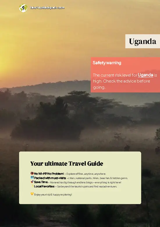
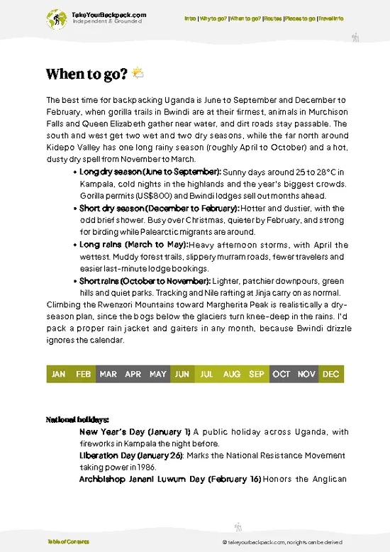
example page 0 from our offline Travel Guide for Uganda
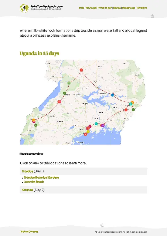
example page 1 from our offline Travel Guide for Uganda
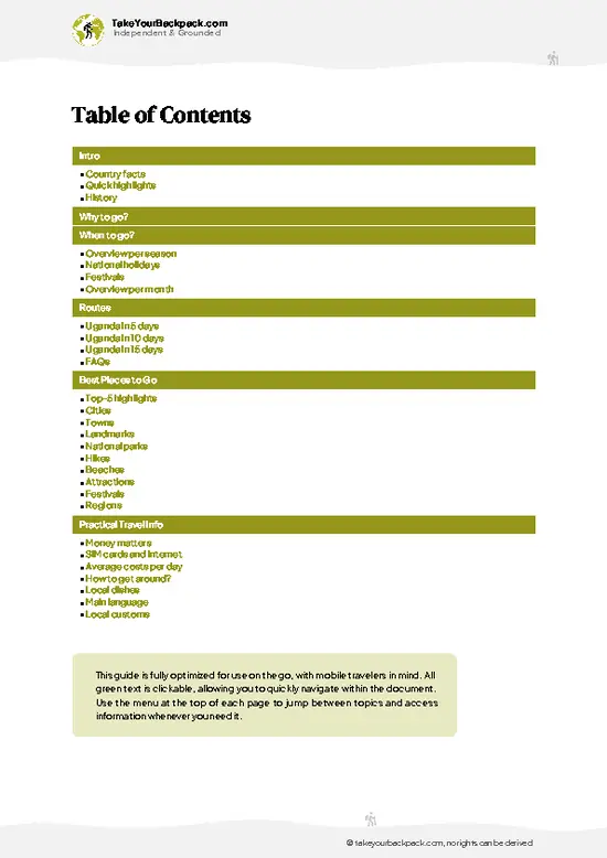
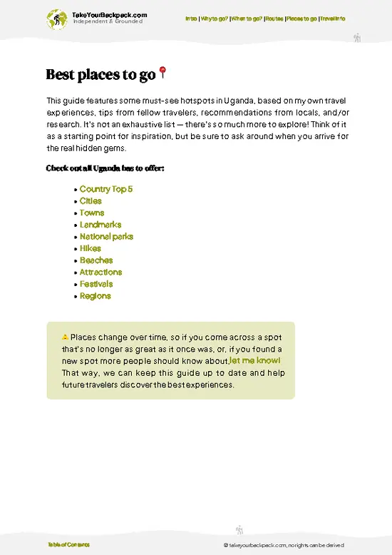
example page 2 from our offline Travel Guide for Uganda
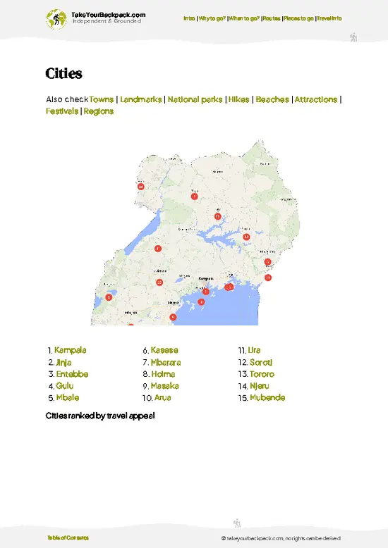
example page 3 from our offline Travel Guide for Uganda
example page 4 from our offline Travel Guide for Uganda
example page 5 from our offline Travel Guide for Uganda
example page 6 from our offline Travel Guide for Uganda
example page 7 from our offline Travel Guide for Uganda
Loading the map 🌍
CLICK TO FILTER
cities
towns
landmarks
national parks
hikes
beaches
attractions
festivals
regions
SHOW COUNTRY’S BESTSHOW ALL

✨ Why go?
Ranked #6 national park in Uganda
Reasons people choose to explore here

Rwenzori Mountains National Park suits backpackers who want real altitude without a technical climbing résumé. The big draw is the Central Circuit, a loop of roughly 6 to 7 days that carries you past glacial lakes, giant lobelias and tree heather, with no ropes needed on the standard route. Guides and porters are mandatory, so you are not exploring on your own, yet the system is organized, and huts along the route mean you carry no tent. Shorter options matter too. The Nyakalengija trailhead offers one- and two-day walks into the lower forest, perfect if you lack time or want to test your legs and your boots before committing. Because the summits sit near the equator, you see snow and rock while the valley below stays green and warm. Self-guided travelers should know the independence here … read more 👉
Rwenzori Mountains National Park suits backpackers who want real altitude without a technical climbing résumé. The big draw is the Central Circuit, a loop of roughly 6 to 7 days that carries you past glacial lakes, giant lobelias and tree heather, with no ropes needed on the standard route. Guides and porters are mandatory, so you are not exploring on your own, yet the system is organized, and huts along the route mean you carry no tent. Shorter options matter too. The Nyakalengija trailhead offers one- and two-day walks into the lower forest, perfect if you lack time or want to test your legs and your boots before committing. Because the summits sit near the equator, you see snow and rock while the valley below stays green and warm. Self-guided travelers should know the independence here is in choosing your route and pace, not in going alone.

💡 HighlightsEssential experiences to have while exploring Rwenzori Mountains

  1. Margherita Peak: The highest point on Mount Stanley at 5,109 meters, reached on the Margherita Peak route with a guide. It requires glacier and rope work and is the park’s headline summit.
  2. Central Circuit: The classic loop through multiple valleys and passes, with huts, bogs and sweeping views. Many consider it the best way to see the range.
  3. Lake Bujuku: A glacial lake in the Bujuku Valley, ringed by peaks and often reflecting cloud and rock faces.
  4. Lake Mahoma: Reached on the Kilembe trail, this forest-ringed lake offers a gentler outing and a good introduction to the range.
  5. Giant lobelia and groundsel: In the afro-alpine zone, these oversized plants stand like sculptures above the bog, unlike anything else you will see in East Africa.
  6. Kitandara Lakes: Two high lakes beneath Mount Baker and Mount
… read more 👉
  1. Margherita Peak: The highest point on Mount Stanley at 5,109 meters, reached on the Margherita Peak route with a guide. It requires glacier and rope work and is the park’s headline summit.
  2. Central Circuit: The classic loop through multiple valleys and passes, with huts, bogs and sweeping views. Many consider it the best way to see the range.
  3. Lake Bujuku: A glacial lake in the Bujuku Valley, ringed by peaks and often reflecting cloud and rock faces.
  4. Lake Mahoma: Reached on the Kilembe trail, this forest-ringed lake offers a gentler outing and a good introduction to the range.
  5. Giant lobelia and groundsel: In the afro-alpine zone, these oversized plants stand like sculptures above the bog, unlike anything else you will see in East Africa.
  6. Kitandara Lakes: Two high lakes beneath Mount Baker and Mount Stanley, among the most photographed spots on the circuit.
  7. Bamboo and montane forest: The lower slopes hold dense forest where you may hear turacos and see Rwenzori colobus monkeys.
Allow two days for the short walks or about a week for the full circuit.
Spotted a mistake or missing something? Contact us.

Things to do near Rwenzori Mountains National Park

Ratings based on Tripadvisor reviews. When you book through this link, you support our work at no extra cost to you.

🌤️ When to go?Weather, crowds, and seasonal trade-offs

  • Main Dry Season (December to February): Clearest skies and firmest trails. Valley days reach 20 to 26°C (68 to 79°F), while Bujuku and Kitandara huts at 3,900 to 4,000 m (12,800 to 13,100 ft) drop to around 0°C (32°F) at night. Peak Margherita summit attempts and the highest crowds, still small.
  • Short Dry Season (June to August): Another good window with fewer clouds, slightly cooler valleys at 18 to 24°C (64 to 75°F). Guide and porter availability is easy.
  • Wet Seasons (March to May, September to November): Daily rain turns the bogs of the Bigo and Mubuku sections into knee-deep mud, and peaks hide in cloud for days. Trails are empty, and some operators trim rates by 10 to 20 percent.
  • Daylight: Close to the equator, days are steady at about 12 hours, so start hiking by 8 am to finish before afternoon
… read more 👉
  • Main Dry Season (December to February): Clearest skies and firmest trails. Valley days reach 20 to 26°C (68 to 79°F), while Bujuku and Kitandara huts at 3,900 to 4,000 m (12,800 to 13,100 ft) drop to around 0°C (32°F) at night. Peak Margherita summit attempts and the highest crowds, still small.
  • Short Dry Season (June to August): Another good window with fewer clouds, slightly cooler valleys at 18 to 24°C (64 to 75°F). Guide and porter availability is easy.
  • Wet Seasons (March to May, September to November): Daily rain turns the bogs of the Bigo and Mubuku sections into knee-deep mud, and peaks hide in cloud for days. Trails are empty, and some operators trim rates by 10 to 20 percent.
  • Daylight: Close to the equator, days are steady at about 12 hours, so start hiking by 8 am to finish before afternoon cloud and rain.
Book your guides and porters a few weeks ahead for December to February, and pack a full rain shell whatever the month.


source: climatestotravel.comJANJanuary: excellent for travelingFEBFebruary: excellent for travelingMARMarch: fair for travelingAPRApril: fair for travelingMAYMay: good for travelingJUNJune: excellent for travelingJULJuly: excellent for travelingAUGAugust: excellent for travelingSEPSeptember: excellent for travelingOCTOctober: good for travelingNOVNovember: fair for travelingDECDecember: excellent for traveling
when-to-go

✈️ The backpacker research shortcutUganda Travel Guide

An offline-friendly backpacking guide with optimized travel routes, ranked highlights, transport advice, and the best areas to stay.
example page 0 from our offline Travel Guide for Uganda
example page 1 from our offline Travel Guide for Uganda
example page 2 from our offline Travel Guide for Uganda
example page 3 from our offline Travel Guide for Uganda
example page 4 from our offline Travel Guide for Uganda
example page 5 from our offline Travel Guide for Uganda
example page 6 from our offline Travel Guide for Uganda
example page 7 from our offline Travel Guide for Uganda
The digital guide (372 pages) contains:
✅ 96 highlights, ranked by travel appeal
✅ Optimized 5, 10 & 15-day travel routes
✅ Cities, national parks, landmarks, beaches
✅ How to get around
✅ Offline-friendly for travel without Wi-Fi
👉 Click to see all 30+ guide features

📅 Plan smarter in minutes, not weeks
✅ Month by month travel advice
✅ Festivals & national holidays
✅ Budget expectations

🗺️ Go to the right places, skip the overrated ones
✅ Honest pros & cons of destinations
✅ Top hikes, parks & viewpoints
✅ Lesser-known places most travelers miss
✅ Clear “worth it vs skip it” guidance

🛏️ Travel smoothly without rookie mistakes
✅ Best areas to stay
✅ Transport systems explained simply
✅ Common scams & safety advice
✅ SIM cards, money & practical tips

🌍 Understand the country, not just visit it
✅ Culture & traditions
✅ 52 Essential phrases & customs
✅ Festivals worth planning around
✅ Traveler-friendly historical context
✅ Insights that make places more meaningful

📱 Built for real travel conditions
✅ Fully downloadable PDF
✅ Works completely offline
✅ Optimized for phone use
✅ Useful in remote areas & buses
✅ Everything in one place
Stop searching, start planning
Get instant access to your full guide. 30‑day money-back guarantee.
+ Add another guide for just

By proceeding you agree to our terms.
Sent to your inbox immediately after payment • 100% Secure Checkout
Best Backpacking Travel Advisor 2025 tourism awardBest Backpacking
Travel Advisor
2025
What others say about Take Your Backpack Guides:
⭐⭐⭐⭐⭐
Fantastic, amazing amount of information!
⭐⭐⭐⭐⭐
My goodness this is amazing, it's what I've been looking for hats off too you!
⭐⭐⭐⭐⭐
I think this is absolutely BRILLIANT
⭐⭐⭐⭐
Very complete and informative. It's still missing places, but I gotta to commend you
⭐⭐⭐⭐⭐
This is truly amazing, thank you, can't wait to explore it with my kids!
⭐⭐⭐⭐⭐
Awesome resource, thank you!
⭐⭐⭐⭐⭐
This is amazing! Can't wait to explore the ones I haven't seen
⭐⭐⭐⭐
I love this! Well done, great idea.
⭐⭐⭐⭐⭐
Thanks for taking the time to make this gem!
⭐⭐⭐⭐⭐
This might be the best website I've ever seen.
⭐⭐⭐⭐⭐
Congratulations, and thank you so much for your work; it's incredibly valuable.
⭐⭐⭐⭐
In all seriousness I think you did a great job pointing out the important spots
⭐⭐⭐⭐⭐
10/10 very good
⭐⭐⭐⭐⭐
As someone who's only just starting to visit regularly this is awesome, thank you.
⭐⭐⭐⭐
Thank you very much! I'm going to visit my dad, it's going to be very useful!
⭐⭐⭐⭐⭐
This is really cool! We'll be travelling for the first time and this definitely come in handy.
⭐⭐⭐⭐⭐
You are now our minister of culture, congratulations 👨‍💼
⭐⭐⭐⭐⭐
Just wanted to tell you that this is a pearl! Going to follow your recommendations.
⭐⭐⭐⭐⭐
This is so cool. I'll definitely be using the resource for my travels soon.
⭐⭐⭐⭐⭐
This is very impressive! Good work.
⭐⭐⭐⭐⭐
This is an amazing and informative site. Very well done!

🛏️ Where to stay?Choosing the right base

Most backpackers sleep in Kasese or Nyakalengija, with mountain huts taking over once the trek begins. Kasese, about 25 km from the trailhead, is the practical hub, with guesthouses and hostel-style rooms at US$10 to 30 a night, plus restaurants, ATMs and the shared taxis and boda-bodas that go to the foothills. Nyakalengija, the Central Circuit trailhead, is the closest option, with the Rwenzori Trekking Services (RTS) hostel and a basic dorm-style bed at US$15 to 25, plus simple meals. Further along the foothills, Ibanda and Kilembe have community-run lodges and homestays at US$20 to 50, handy … read more 👉
Most backpackers sleep in Kasese or Nyakalengija, with mountain huts taking over once the trek begins. Kasese, about 25 km from the trailhead, is the practical hub, with guesthouses and hostel-style rooms at US$10 to 30 a night, plus restaurants, ATMs and the shared taxis and boda-bodas that go to the foothills. Nyakalengija, the Central Circuit trailhead, is the closest option, with the Rwenzori Trekking Services (RTS) hostel and a basic dorm-style bed at US$15 to 25, plus simple meals. Further along the foothills, Ibanda and Kilembe have community-run lodges and homestays at US$20 to 50, handy for the Kilembe Trail. Inside the park, there are no hotels, only trekking huts along the trails, such as Nyabitaba, John Matte, Bujuku, Kitandara and Guy Yeoman. They run about US$30 to 40 a night for a bunk and are usually included in trekking packages. Carry a warm sleeping bag since huts have no heating. For a hotel with hot water and Wi-Fi, Kasese has the best choice. Arrive the day before your trek to meet guides and check gear.

👛 Costs (as of 22 October 2026)Travel costs and budget guide for Rwenzori Mountains

A typical day at Rwenzori Mountains National Park costs about US$125 to 180 for a guided trek, with park fees making up the largest share, while hostel days in Kasese cost far less. Prices vary by operator and group size, and you pay in Ugandan shillings or US dollars.
CategoryBudget RangeLocal Reality
Park entrance feeUS$35 to 50Per day on the trail, charged for each day inside the park for foreign visitors.
Guide and porterUS$25 to 40Guides are mandatory. Porters are usually hired for each trekker and tipped separately.
Hut or camp accommodationUS$30 to 40Bunk beds in basic huts, with bedding to be brought. Kasese town beds run US$10 to 30.
Food and suppliesUS$25 to 40Trek packages include cooked meals. Snacks, water treatment and drinks are extra.
Local transportUS$5 to 15Shared taxi or boda-boda
… read more 👉
A typical day at Rwenzori Mountains National Park costs about US$125 to 180 for a guided trek, with park fees making up the largest share, while hostel days in Kasese cost far less. Prices vary by operator and group size, and you pay in Ugandan shillings or US dollars.
CategoryBudget RangeLocal Reality
Park entrance feeUS$35 to 50Per day on the trail, charged for each day inside the park for foreign visitors.
Guide and porterUS$25 to 40Guides are mandatory. Porters are usually hired for each trekker and tipped separately.
Hut or camp accommodationUS$30 to 40Bunk beds in basic huts, with bedding to be brought. Kasese town beds run US$10 to 30.
Food and suppliesUS$25 to 40Trek packages include cooked meals. Snacks, water treatment and drinks are extra.
Local transportUS$5 to 15Shared taxi or boda-boda from Kasese to Nyakalengija, with private cars costing more.
Equipment rentalUS$5 to 15Boots, rain gear and sleeping bags can be rented near the trailhead.
Total Daily BudgetUS$125 to 180Per person, per day, in high season.
⚠️ Prices can change and everyone travels differently, so take this as a rough guide. Hope it helps you plan your adventure!

🥾 TrailsBest hikes in Rwenzori Mountains national park

Rwenzori Mountains National Park offers multi-day treks over muddy, steep, often misty terrain, and every route needs a guide. Here are the main options.
  • Central Circuit: About 6 to 7 days, hard. Loops from Nyakalengija through Bujuku and Kitandara valleys, with boggy ground, rock scrambles and high passes near 4,000 meters.
  • Kilembe Trail: Roughly 7 days, hard. Climbs from the Kilembe side past Lake Mahoma and Lake Kitandara, with long forest sections and steep ridges.
  • Margherita Peak route: Usually 8 or more days, very hard. Needs rope, crampons and experience on the glacier above the huts.
  • Short
… read more 👉
Rwenzori Mountains National Park offers multi-day treks over muddy, steep, often misty terrain, and every route needs a guide. Here are the main options.
  • Central Circuit: About 6 to 7 days, hard. Loops from Nyakalengija through Bujuku and Kitandara valleys, with boggy ground, rock scrambles and high passes near 4,000 meters.
  • Kilembe Trail: Roughly 7 days, hard. Climbs from the Kilembe side past Lake Mahoma and Lake Kitandara, with long forest sections and steep ridges.
  • Margherita Peak route: Usually 8 or more days, very hard. Needs rope, crampons and experience on the glacier above the huts.
  • Short forest walks: One or two days, easy to moderate. Start at Nyakalengija and follow the river into the forest, passing moss-draped trees and, with luck, Rwenzori colobus and many birds.
Wildlife includes forest elephants and chimpanzees in lower areas, though you are far more likely to see monkeys, sunbirds and the lobelias that define the high zone. Expect rain and mud year-round, and bring waterproofs, gaiters and warm layers for nights at the huts.
Getting here usually means a ride to Kasese and then onward transport to the trailheads. Crowds are small compared with Uganda’s gorilla parks. An entrance fee and compulsory guide and porter fees apply, so book through a licensed operator.
⚠️ Hiking info can sometimes be outdated or inaccurate. Before you hit the trail, check the latest conditions with locals. If you do spot anything that's off, I'd love to hear from you, so I can update it for fellow travelers.

🛡️ SafetySafety Tips and Common Scams in Rwenzori Mountains

Rwenzori Mountains National Park is safe when treated as a serious mountain trek, with the main hazards being cold, wet and altitude. Rain falls most afternoons, and trails turn into deep mud and bog, so waterproof boots, gaiters and a real rain jacket matter more than anything else. Altitude sickness is the most common problem on the Central Circuit, which climbs above 4,000 m. Take it slowly, drink plenty and descend if headaches or nausea worsen. Guides are mandatory and know the route, which is often hidden in mist. Elephants and buffalo are rare on the upper trails, but forest elephants live at lower altitudes, so keep your distance and follow your guide. Chimpanzees and monkeys are common near the huts, so keep food packed away. Carry spare dry socks, since wet feet cause most of the … read more 👉
Rwenzori Mountains National Park is safe when treated as a serious mountain trek, with the main hazards being cold, wet and altitude. Rain falls most afternoons, and trails turn into deep mud and bog, so waterproof boots, gaiters and a real rain jacket matter more than anything else. Altitude sickness is the most common problem on the Central Circuit, which climbs above 4,000 m. Take it slowly, drink plenty and descend if headaches or nausea worsen. Guides are mandatory and know the route, which is often hidden in mist. Elephants and buffalo are rare on the upper trails, but forest elephants live at lower altitudes, so keep your distance and follow your guide. Chimpanzees and monkeys are common near the huts, so keep food packed away. Carry spare dry socks, since wet feet cause most of the misery, and book well-established operators who supply insulated clothing.

FAQCommon questions from travelers

Plan on 4 to 9 days for Rwenzori Mountains National Park, depending on the route. The Kilembe Trail short hikes take 1 to 3 days, while the Central Circuit takes 6 to 7 days and a Margherita Peak climb adds one or two more. Allow an extra day in Kasese for gear checks and recovery.
Reaching Rwenzori Mountains National Park without a car is possible and common. Shared taxis run from Kampala to Kasese in about 7 to 9 hours for US$8 to 15, and from Kasese a boda-boda or shared taxi covers the roughly 25 km to Nyakalengija in 45 minutes to an hour for US$3 to 10. Most trekking operators also arrange pickups from Kasese.
Yes, Rwenzori Mountains National Park charges an entrance fee, and foreign visitors pay roughly US$35 to 50 per day on the trail, plus guide and porter charges. Guides are required for all treks, and there are no standalone permits beyond the park fee, which operators in Kasese or Nyakalengija arrange when booking. Payment is usually made in US dollars or shillings.
⚠️ Things can change over time, so always validate details locally before you go.

Other Ugandan national parks near Rwenzori Mountains

Explore more nearby:


💡 Not sure where to go next?
Create a personalized itinerary for Uganda including Rwenzori Mountains and the places that fit your trip.

Generate my itinerary

👉 Discover all national parks

Or checkout all Uganda has to offer (think cities, towns, villages, national parks, hikes, beaches, festivals)
Country photo of Uganda

We 💚 feedbackParting advice and final tips

Rwenzori Mountains National Park rewards people who respect its mud. Most first-timers focus on the peaks and forget that the bogs, not the altitude, wear you down. I would bring a second pair of dry socks for every day, plus gaiters, and rent the gumboots. Your feet will decide how much you enjoy the views.

✈️ When did I visit Uganda?
In September 2019 I have done a backpacking trip through Uganda. Seeing gorillas in the wild from up close was a pure unexpected highlight!

✍️ Help improve this page!
The information on this page is based on my own backpacking experience in Uganda, supplemented with up-to-date research and feedback from other travelers. Travel details can change, so if you notice anything outdated or incomplete, feel free to let me know.


🙋‍♂️ Give feedback

👋 Meet the founderWho’s Behind Take Your Backpack?

Johan, backpacker and founder of TakeYourBackpackHi, I’m Johan (Netherlands 🇳🇱), the creator of TakeYourBackpack. Over the past 3 decades, I’ve backpacked through 90+ countries across six continents, gaining extensive experience with independent travel, long-term trips, and overland routes.

This site is built on a combination of firsthand travel experience and carefully curated insights from other backpackers. Many guides are based on places I’ve personally visited, while others bring together tips, observations, and practical advice shared by trusted travelers I’ve met along the way.

The goal is to provide realistic, experience-driven guidance — not generic itineraries — so you can explore destinations with better context, clearer expectations, and more confidence.