
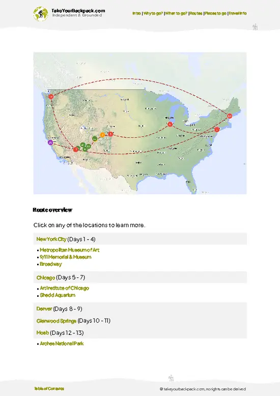
- Kuwohi (formerly Clingmans Dome): The park’s highest point at 6,643 feet, reached by a steep half-mile paved path to a concrete observation tower with ridge views across both states.
- Alum Cave Trail to Mount LeConte: Passes Arch Rock and a bluff overhang, then climbs to LeConte Lodge, reachable only on foot.
- Cades Cove: An 11-mile one-way loop past log cabins, churches and meadows where deer and black bears feed at dawn.
- Laurel Falls: A paved 2.6-mile round trip to an 80-foot waterfall, easy but popular.
- Newfound Gap: Pass on the state line where the Appalachian Trail crosses the road, with wide overlooks.
- Roaring Fork Motor Nature Trail: A narrow one-way loop with old homesteads and a stream-fed forest.
- Cataloochee Valley: A remote valley where reintroduced elk graze near historic buildings.
Spotted a mistake or missing something? Contact us.

3-Hour Nantahala River Fully Guided Rafting Experience

Chasing Waterfalls: A Smoky Mountain Guided Hike

Great Smoky Mountains National Park Self-Guided Driving Tour

Self-Guided Audio Driving Tour in Great Smoky Mountains

Great Smoky Mountains & Cades Cove Self-Guided Driving Tours

Museum of the Cherokee People Admission Ticket

River Magic: An Easy Smoky Mountain Guided Walk

Sharing Nature with Children: Hands-On Smoky Mountain Discovery
Cades Cove Sightseeing Self-Guided Driving Audio Tour


 Best Backpacking
 Hi, I’m Johan (Netherlands 🇳🇱), the creator of TakeYourBackpack. Over the past 3 decades, I’ve backpacked through 90+ countries across six continents, gaining extensive experience with independent travel, long-term trips, and overland routes.