×

Uruguay🇺🇾 | villagesCerro ChapeuCuchilla ridges, open border street, Lunarejo canyons, cattle country | things to do and best time to go

Explore ValizasExplore Salto del Penitente

Backpacking in Cerro Chapeu
🏆 Top pickvillage ranked #1
By Johan Kruseman 🇳🇱 | Updated October 19, 2026

The border with Brazil near Cerro Chapeu is a street, with no checkpoint, so you can walk from one country to the other without showing a document. Cerro Chapeu sits in the north of Uruguay, in Rivera Department, close to Rivera city and its twin town on the Brazilian side. The land is rolling cuchilla country: low ridges, cattle pasture, gallery forest along creeks and a wide sky. The good side is quiet, a rural pace and easy access to the border towns. The weaker side is thin tourist infrastructure and few buses, so you will want a car or taxi. Sleeping in Rivera costs a little more than a village bed, but it saves time and gives you shops, food and transport links, which makes it the better base for most backpackers. Unlike Minas de Corrales, a larger former mining town with an established story to tell, Cerro Chapeu is smaller, plainer and far less visited.

Discover everything you want to know in the 📖 Uruguay Travel Guide.


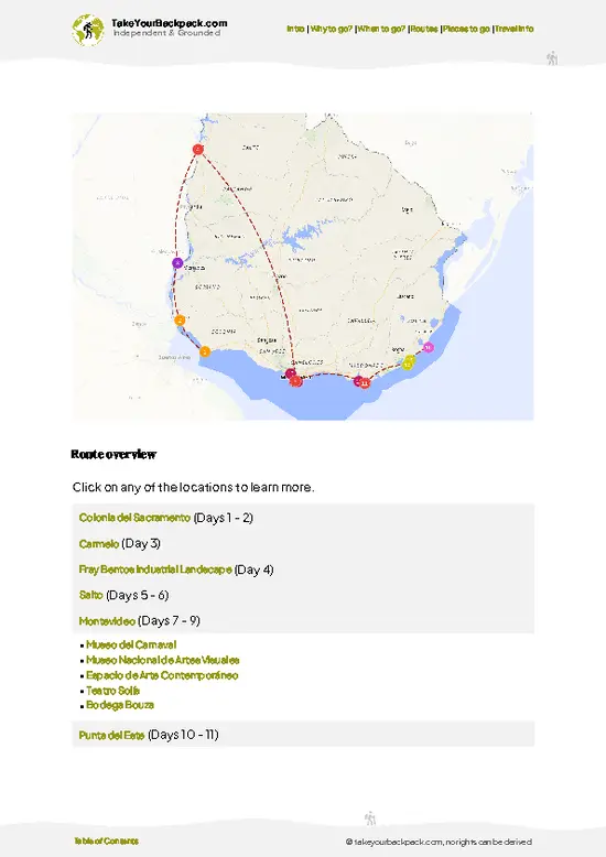
example page 0 from our offline Travel Guide for Uruguay
example page 1 from our offline Travel Guide for Uruguay
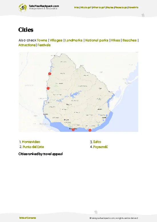
example page 2 from our offline Travel Guide for Uruguay
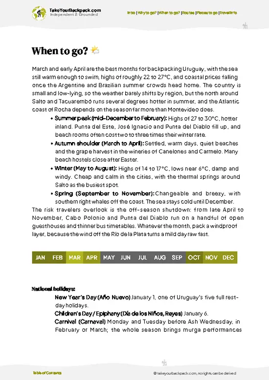
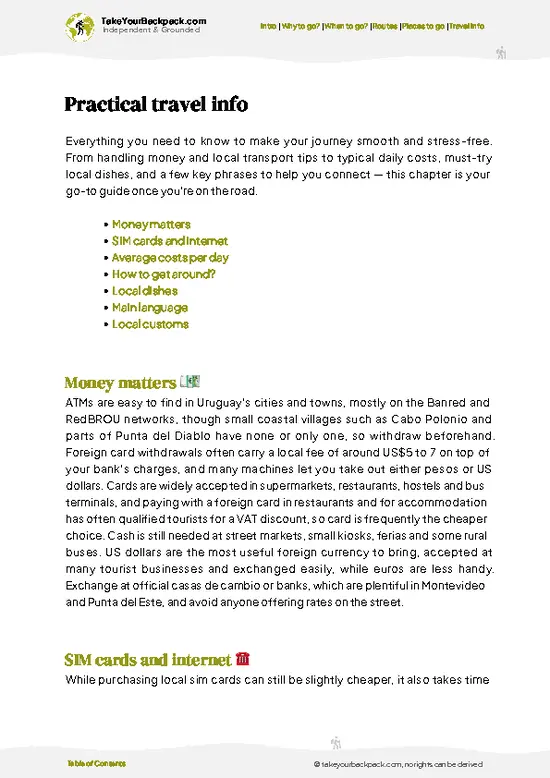
example page 3 from our offline Travel Guide for Uruguay
example page 4 from our offline Travel Guide for Uruguay
example page 5 from our offline Travel Guide for Uruguay
example page 6 from our offline Travel Guide for Uruguay
example page 7 from our offline Travel Guide for Uruguay
Loading the map 🌍
CLICK TO FILTER
cities
towns
villages
landmarks
national parks
hikes
beaches
attractions
festivals
SHOW COUNTRY’S BESTSHOW ALL

✨ Why go?
Ranked #1 village in Uruguay
The unique appeal for travelers

Cerro Chapeu works for backpackers because the area offers two things that rarely sit side by side: open ranch country and a working border city. You can spend a morning on a ridge with caracaras overhead and an afternoon crossing the street border between Rivera and Brazil for a second country's food and prices. That cuts the need for constant relocation. The second reason is history. The Masoller battlefield of 1904 and the old gold workings at Minas de Corrales are both within a day's loop, so slow travel here means pairing a cattle-country landscape with a real story rather than ticking off sights. The third is the northern landscape of Valle del Lunarejo, where creek canyons and native forest make a different Uruguay from the beaches most travelers know. Transport is the limit: services … read more 👉
Cerro Chapeu works for backpackers because the area offers two things that rarely sit side by side: open ranch country and a working border city. You can spend a morning on a ridge with caracaras overhead and an afternoon crossing the street border between Rivera and Brazil for a second country's food and prices. That cuts the need for constant relocation. The second reason is history. The Masoller battlefield of 1904 and the old gold workings at Minas de Corrales are both within a day's loop, so slow travel here means pairing a cattle-country landscape with a real story rather than ticking off sights. The third is the northern landscape of Valle del Lunarejo, where creek canyons and native forest make a different Uruguay from the beaches most travelers know. Transport is the limit: services are sparse, so plan around taxis, lifts and a hired car. In return you get empty trails, small family-run places to eat and a culture of mixed Spanish and Portuñol.

💡 HighlightsWhat this place is best known for

  1. Cerro Chapeu: the hill that names the locality, a modest rise over cattle pasture. It rewards a short climb with a long view over the ridges of Rivera Department, and you will probably have it to yourself.
  2. Plaza Internacional, Rivera: the main border park, where Uruguay and Brazil meet in a paved square. Obelisks mark the line and you can stand with one foot in each country. Cafés on both sides keep the place busy in the evenings.
  3. Free shops on Avenida Sarandí: Rivera's duty-free shopping street, built for Brazilian shoppers. It is mostly electronics, perfume and liquor, so browse for the border-town atmosphere rather than for bargains.
  4. Valle del Lunarejo: a protected landscape of canyons, creeks and native gallery forest. It is one of the wilder corners of Uruguay, good for walking and birdwatching,
… read more 👉
  1. Cerro Chapeu: the hill that names the locality, a modest rise over cattle pasture. It rewards a short climb with a long view over the ridges of Rivera Department, and you will probably have it to yourself.
  2. Plaza Internacional, Rivera: the main border park, where Uruguay and Brazil meet in a paved square. Obelisks mark the line and you can stand with one foot in each country. Cafés on both sides keep the place busy in the evenings.
  3. Free shops on Avenida Sarandí: Rivera's duty-free shopping street, built for Brazilian shoppers. It is mostly electronics, perfume and liquor, so browse for the border-town atmosphere rather than for bargains.
  4. Valle del Lunarejo: a protected landscape of canyons, creeks and native gallery forest. It is one of the wilder corners of Uruguay, good for walking and birdwatching, with rural lodging on working farms. Lesser known to most visitors.
  5. Masoller: the site of the 1904 battle where the rebel leader Aparicio Saravia was mortally wounded. A monument stands on the hills, and the open ground makes the history easy to picture. Few outsiders come here.
  6. Minas de Corrales: a gold mining town whose streets and old workings recall the early twentieth century, when foreign companies ran the mines. Walk the town and look at the mining relics. A quiet place that locals are proud of.
  7. Tranqueras: a small town on the road toward the Lunarejo country, useful as a rest stop with a plaza and simple eateries. It shows ordinary northern life, with maté in every hand and tractors on the main street.
Masoller and Valle del Lunarejo pair well in one day, since both lie in the same hill country and suit a driver who wants empty roads.
Spotted a mistake or missing something? Contact us.

⌛️ 1 daySeeing the highlights in 24 hours

Distances are short but buses are infrequent, so the days run on taxis or a rental car, with early starts and a long lunch when the sun is hardest, and the walking stays inside the towns.

Day 1: Cerro Chapeu: Start where the trip is quietest. Climb the hill in the morning, when the pasture is cool and the light is flat and kind, then settle in Rivera by evening. Having a base in the city means shops, meals and onward taxis are never far, which matters in a region with so few scheduled services.

Day 2: Rivera: Spend the day on the border. Walk the Plaza Internacional, cross into Brazil on foot and return for dinner. It costs almost nothing in time and gives you a feel for how the two countries blend before you leave town.

Day 3: Minas de Corrales: Go to the mining town by hired car or arranged … read more 👉
Distances are short but buses are infrequent, so the days run on taxis or a rental car, with early starts and a long lunch when the sun is hardest, and the walking stays inside the towns.

Day 1: Cerro Chapeu: Start where the trip is quietest. Climb the hill in the morning, when the pasture is cool and the light is flat and kind, then settle in Rivera by evening. Having a base in the city means shops, meals and onward taxis are never far, which matters in a region with so few scheduled services.

Day 2: Rivera: Spend the day on the border. Walk the Plaza Internacional, cross into Brazil on foot and return for dinner. It costs almost nothing in time and gives you a feel for how the two countries blend before you leave town.

Day 3: Minas de Corrales: Go to the mining town by hired car or arranged taxi. Walk the old streets and the workings, and keep the afternoon free, because there is little to do after the early closing hours and the roads are better in daylight.

Day 4: Masoller: This is the detour. Masoller lies off the main loop, but it adds real weight to the trip: the battlefield hills, the monument and the sense of how a small rebellion played out across open country. Fit it in before or after the Lunarejo leg so you only drive the road once.

Day 5: Valle del Lunarejo: This is the day that justifies the whole trip. Take your time among the creeks and forest, walk a trail in the morning, eat on a farm if one is open and watch for birds in the canyons. It is the one place in the region that feels entirely its own.

🌤️ When to go?When to go for the best experience

  • Spring (September to November): Daytime highs of 20 to 27°C (68 to 81°F) and nights of 9 to 16°C (48 to 61°F) suit walking the hills around Rivera. Rain comes in short, heavy bursts, and days run 12 to 14 hours. Prices stay level and crowds are thin.
  • Summer (December to February): Expect 28 to 35°C (82 to 95°F) with humid afternoons and violent thunderstorms. Daylight lasts about 14 hours. Rivera fills with Brazilian and Uruguayan shoppers on weekends and holidays, so beds cost more.
  • Autumn (March to May): Highs of 20 to 28°C (68 to 82°F) fall steadily and the air dries out. This is the most comfortable season for long days outdoors, with low prices.
  • Winter (June to August): Days reach only 12 to 18°C (54 to 64°F). Nights drop to 3 to 8°C (37 to 46°F) and frost is common on the open hills. Daylight
… read more 👉
  • Spring (September to November): Daytime highs of 20 to 27°C (68 to 81°F) and nights of 9 to 16°C (48 to 61°F) suit walking the hills around Rivera. Rain comes in short, heavy bursts, and days run 12 to 14 hours. Prices stay level and crowds are thin.
  • Summer (December to February): Expect 28 to 35°C (82 to 95°F) with humid afternoons and violent thunderstorms. Daylight lasts about 14 hours. Rivera fills with Brazilian and Uruguayan shoppers on weekends and holidays, so beds cost more.
  • Autumn (March to May): Highs of 20 to 28°C (68 to 82°F) fall steadily and the air dries out. This is the most comfortable season for long days outdoors, with low prices.
  • Winter (June to August): Days reach only 12 to 18°C (54 to 64°F). Nights drop to 3 to 8°C (37 to 46°F) and frost is common on the open hills. Daylight shrinks to roughly 10 hours, and most places are empty.
Book any bed in Rivera ahead if your dates touch a long weekend.


source: climatestotravel.comJANJanuary: excellent for travelingFEBFebruary: excellent for travelingMARMarch: highly recommended for travelingAPRApril: fair for travelingMAYMay: below average for travelingJUNJune: below average for travelingJULJuly: below average for travelingAUGAugust: below average for travelingSEPSeptember: fair for travelingOCTOctober: good for travelingNOVNovember: highly recommended for travelingDECDecember: excellent for traveling
when-to-go

✈️ The backpacker research shortcutUruguay Travel Guide

An offline-friendly backpacking guide with optimized travel routes, ranked highlights, transport advice, and the best areas to stay.
example page 0 from our offline Travel Guide for Uruguay
example page 1 from our offline Travel Guide for Uruguay
example page 2 from our offline Travel Guide for Uruguay
example page 3 from our offline Travel Guide for Uruguay
example page 4 from our offline Travel Guide for Uruguay
example page 5 from our offline Travel Guide for Uruguay
example page 6 from our offline Travel Guide for Uruguay
example page 7 from our offline Travel Guide for Uruguay
The digital guide (198 pages) contains:
✅ 56 highlights, ranked by travel appeal
✅ Optimized 5, 10 & 15-day travel routes
✅ Cities, national parks, landmarks, beaches
✅ How to get around
✅ Offline-friendly for travel without Wi-Fi
👉 Click to see all 30+ guide features

📅 Plan smarter in minutes, not weeks
✅ Month by month travel advice
✅ Festivals & national holidays
✅ Budget expectations

🗺️ Go to the right places, skip the overrated ones
✅ Honest pros & cons of destinations
✅ Top hikes, parks & viewpoints
✅ Lesser-known places most travelers miss
✅ Clear “worth it vs skip it” guidance

🛏️ Travel smoothly without rookie mistakes
✅ Best areas to stay
✅ Transport systems explained simply
✅ Common scams & safety advice
✅ SIM cards, money & practical tips

🌍 Understand the country, not just visit it
✅ Culture & traditions
✅ 52 Essential phrases & customs
✅ Festivals worth planning around
✅ Traveler-friendly historical context
✅ Insights that make places more meaningful

📱 Built for real travel conditions
✅ Fully downloadable PDF
✅ Works completely offline
✅ Optimized for phone use
✅ Useful in remote areas & buses
✅ Everything in one place
Stop searching, start planning
Get instant access to your full guide. 30‑day money-back guarantee.
+ Add another guide for just

By proceeding you agree to our terms.
Sent to your inbox immediately after payment • 100% Secure Checkout
Best Backpacking Travel Advisor 2025 tourism awardBest Backpacking
Travel Advisor
2025
What others say about Take Your Backpack Guides:
⭐⭐⭐⭐⭐
Fantastic, amazing amount of information!
⭐⭐⭐⭐⭐
My goodness this is amazing, it's what I've been looking for hats off too you!
⭐⭐⭐⭐⭐
I think this is absolutely BRILLIANT
⭐⭐⭐⭐
Very complete and informative. It's still missing places, but I gotta to commend you
⭐⭐⭐⭐⭐
This is truly amazing, thank you, can't wait to explore it with my kids!
⭐⭐⭐⭐⭐
Awesome resource, thank you!
⭐⭐⭐⭐⭐
This is amazing! Can't wait to explore the ones I haven't seen
⭐⭐⭐⭐
I love this! Well done, great idea.
⭐⭐⭐⭐⭐
Thanks for taking the time to make this gem!
⭐⭐⭐⭐⭐
This might be the best website I've ever seen.
⭐⭐⭐⭐⭐
Congratulations, and thank you so much for your work; it's incredibly valuable.
⭐⭐⭐⭐
In all seriousness I think you did a great job pointing out the important spots
⭐⭐⭐⭐⭐
10/10 very good
⭐⭐⭐⭐⭐
As someone who's only just starting to visit regularly this is awesome, thank you.
⭐⭐⭐⭐
Thank you very much! I'm going to visit my dad, it's going to be very useful!
⭐⭐⭐⭐⭐
This is really cool! We'll be travelling for the first time and this definitely come in handy.
⭐⭐⭐⭐⭐
You are now our minister of culture, congratulations 👨‍💼
⭐⭐⭐⭐⭐
Just wanted to tell you that this is a pearl! Going to follow your recommendations.
⭐⭐⭐⭐⭐
This is so cool. I'll definitely be using the resource for my travels soon.
⭐⭐⭐⭐⭐
This is very impressive! Good work.
⭐⭐⭐⭐⭐
This is an amazing and informative site. Very well done!

🛏️ Where to stay?Where staying makes the most sense

Rivera is the best base for Cerro Chapeu, because it has the beds, the buses, and the people. The city sits directly on the Brazilian border, shares a pedestrian plaza with Santana do Livramento, and offers more budget rooms, cafés, and company than anywhere else in the district. Expect dorm-style and basic private rooms in the US$15 to 40 range, with prices rising on weekends and holidays.

The streets around Plaza Internacional and the central avenues are the most practical areas. Everything from the bus terminal to supermarkets, pharmacies, and money changers is within a short walk, and the … read more 👉
Rivera is the best base for Cerro Chapeu, because it has the beds, the buses, and the people. The city sits directly on the Brazilian border, shares a pedestrian plaza with Santana do Livramento, and offers more budget rooms, cafés, and company than anywhere else in the district. Expect dorm-style and basic private rooms in the US$15 to 40 range, with prices rising on weekends and holidays.

The streets around Plaza Internacional and the central avenues are the most practical areas. Everything from the bus terminal to supermarkets, pharmacies, and money changers is within a short walk, and the main streets are busy with shoppers until the evening. Solo travelers will find it easy to meet people at cafés and in the border plaza, though the social scene here is quieter than in beach towns or Montevideo. Stay inside the central blocks after dark and take a taxi for longer hops.

Crossing into Santana do Livramento widens your options. Brazilian guesthouses can cost slightly less, the city has a lively square with restaurants, and the crossing is a short walk without a formal checkpoint for casual visits. Bring your passport regardless.

Tranqueras, a small town to the west, is a calmer alternative for travelers heading toward the Valle del Lunarejo hills. It has only a handful of simple rooms, so book ahead.

Cerro Chapeu itself is a rural area with very limited lodging, so treat it as a day outing from Rivera.

🚌 Getting aroundGetting around like a local

The easiest way to reach Cerro Chapeu is a taxi or remise from Rivera, because the hills and farm roads around it have almost no scheduled service and a driver saves you a long, hot walk. Rivera is the transport hub for the area, with long-distance buses from Montevideo and other cities. Everything beyond the city is spread out, so plan each leg before you leave town.
  • Taxi or remise: Costs more than any other choice, roughly US$8 to 20 for a short run from Rivera depending on distance, but it is quick, air-conditioned in some cars, and goes to the door. For one or two hours of movement it gives a backpacker the most for the money, especially when split between two or three people.
  • Intercity bus: The way to arrive in Rivera from Montevideo, about 6 to 7 hours for US$30 to 45, in reclining seats
… read more 👉
The easiest way to reach Cerro Chapeu is a taxi or remise from Rivera, because the hills and farm roads around it have almost no scheduled service and a driver saves you a long, hot walk. Rivera is the transport hub for the area, with long-distance buses from Montevideo and other cities. Everything beyond the city is spread out, so plan each leg before you leave town.
  • Taxi or remise: Costs more than any other choice, roughly US$8 to 20 for a short run from Rivera depending on distance, but it is quick, air-conditioned in some cars, and goes to the door. For one or two hours of movement it gives a backpacker the most for the money, especially when split between two or three people.
  • Intercity bus: The way to arrive in Rivera from Montevideo, about 6 to 7 hours for US$30 to 45, in reclining seats with air conditioning. It is slow compared with flying but cheap and comfortable enough for an overnight run, and it is the best value for covering long distances.
  • Local and departmental bus: Buses from Rivera run to nearby towns such as Tranqueras for a few dollars, usually US$1 to 4. They are cheap, but frequencies thin out in the afternoon and on Sundays, and waiting by the roadside in summer heat is tiring. Use them for the main routes, not for reaching a specific trailhead.
  • Hitchhiking: Free and possible on the main roads, where trucks and farm pickups pass regularly. Waits can stretch to an hour or more on quiet side roads, and there is shade only where you find it. It suits patient travelers with spare time, not anyone on a tight schedule.
  • Bicycle: Bikes can be borrowed or rented in some places in Rivera for about US$8 to 15 a day. The terrain is rolling rather than steep, and traffic is light on side roads, but summer afternoons are hot and shade is scarce. It works in spring and autumn if you start early.
Carry some cash and water, and arrange your return ride before you set off, since phone signal on farm tracks can drop out without warning.

🍲 FoodLocal Cuisine & Drinks

Cerro Chapeu sits in Uruguay’s northern cattle country, so asado rules: beef ribs, chorizo and morcilla cooked over wood coals until the fat spits and the smoke clings to your clothes. Order a chivito, the thick steak sandwich piled with ham, egg, and mozzarella, when you want one filling meal for about US$6 to 10.

Being on the Brazilian frontier changes the table. Rivera and nearby Santana do Livramento serve churrasco by the skewer, pão de queijo warm from the oven, and strong cafezinho in thimble-sized cups. Lunch buffets sold by weight (por kilo) are the cheapest hot meals, often US$5 to 9, and let you taste several dishes at once. Menus slide between Spanish and Portuguese, sometimes in the same sentence.

For drinking, mate is everywhere. You will see people carrying a thermos under … read more 👉
Cerro Chapeu sits in Uruguay’s northern cattle country, so asado rules: beef ribs, chorizo and morcilla cooked over wood coals until the fat spits and the smoke clings to your clothes. Order a chivito, the thick steak sandwich piled with ham, egg, and mozzarella, when you want one filling meal for about US$6 to 10.

Being on the Brazilian frontier changes the table. Rivera and nearby Santana do Livramento serve churrasco by the skewer, pão de queijo warm from the oven, and strong cafezinho in thimble-sized cups. Lunch buffets sold by weight (por kilo) are the cheapest hot meals, often US$5 to 9, and let you taste several dishes at once. Menus slide between Spanish and Portuguese, sometimes in the same sentence.

For drinking, mate is everywhere. You will see people carrying a thermos under one arm and a gourd in the other, sipping the bitter, grassy brew on benches and in cars. Only the owner refills and passes it, and saying gracias means you are finished. Local beer and a glass of Tannat, Uruguay’s signature red, come with the grill.

For quick bites, try panaderías for pastries, tortas fritas on rainy days, and small parrillas near the plazas. Lunch runs long and dinner starts late, often after 9 p.m., so kitchens may be closed in the afternoon.

FAQCommon questions from travelers

One to two days is enough for Cerro Chapeu, since it is a rural hill area right next to Rivera rather than a place with a long list of sights. Most travelers combine it with Rivera and the Santana do Livramento border plaza, which fill another day. If you add the Valle del Lunarejo hills near Tranqueras, plan three days in total.
Without a car, take a bus to Rivera, then use a taxi or remise to reach Cerro Chapeu, usually for US$8 to 20 each way depending on distance. Buses from Montevideo take about 6 to 7 hours and cost US$30 to 45. Local buses to nearby towns like Tranqueras cost roughly US$1 to 4, but they run less often in the afternoon and on Sundays.
Cerro Chapeu is known for its rolling hills and open cattle country in the Rivera department, close to the Brazilian border. The area is part of northern Uruguay’s cuchilla landscape, with grassland, rocky outcrops, and wide views. Nearby Rivera is famous for its shared border plaza with Santana do Livramento and for duty-free shopping, with daily temperatures of 20 to 35°C (68 to 95°F) in summer.
⚠️ Things can change over time, so always validate details locally before you go.

Other Uruguayan villages near Cerro Chapeu

Explore more nearby:

  • Aguas Dulces—Fishermen’s landing, sand streets, dunes behind town, empty shoreline| 402 km away
  • Valizas—Stream mouth, dune walk to Cabo Polonio, kayak rentals, hostel dinners| 408 km away
  • Pueblo Edén—Sierra de las Ánimas foothills, dirt roads, ranchland, sunset edge, early silence| 411 km away

💡 Not sure where to go next?
Create a personalized itinerary for Uruguay including Cerro Chapeu and the places that fit your trip.

Generate my itinerary

👉 Discover all villages

Or checkout all Uruguay has to offer (think cities, towns, villages, national parks, hikes, beaches, festivals)
Country photo of Uruguay

We 💚 feedbackSumming up the experience

Cerro Chapeu suits people who like empty roads, long walks and small towns more than sights with signs. If you are happy with a hired car, a thermos of maté and no plan after lunch, you will get on well here. I would base in Rivera, skip the tourist shopping and spend the saved hours in Valle del Lunarejo.

✍️ Help improve this page!
The information on this page is based on in-depth research, insights shared by experienced travelers, and feedback from the local travel community in Uruguay. While every effort is made to keep the information accurate and current, conditions can change — so if you spot anything incorrect or outdated, please get in touch.


🙋‍♂️ Give feedback

👋 Meet the founderWho’s Behind Take Your Backpack?

Johan, backpacker and founder of TakeYourBackpackHi, I’m Johan (Netherlands 🇳🇱), the creator of TakeYourBackpack. Over the past 3 decades, I’ve backpacked through 90+ countries across six continents, gaining extensive experience with independent travel, long-term trips, and overland routes.

This site is built on a combination of firsthand travel experience and carefully curated insights from other backpackers. Many guides are based on places I’ve personally visited, while others bring together tips, observations, and practical advice shared by trusted travelers I’ve met along the way.

The goal is to provide realistic, experience-driven guidance — not generic itineraries — so you can explore destinations with better context, clearer expectations, and more confidence.