×

Venezuela🇻🇪 | hikesGran Sabanaopen savannah, scattered tepuis, seasonal waterfalls | things to do and best time to go

Explore Angel FallsExplore Roraima

Backpacking in Gran Sabana
🌟 Highlighthike ranked #4
By Johan Kruseman 🇳🇱 | Updated September 4, 2026

Most people online sell Gran Sabana as a drive-by photo safari, but the surprise is this: you can actually backpack through it for days, linking rivers, tepui viewpoints, and Pemón villages with a pack on your back instead of a seatbelt on. Gran Sabana sprawls across southeastern Venezuela in Bolívar state, near the borders with Brazil and Guyana. The hiking itself is rarely technical, but the distance, humidity, and ankle-deep mud turn “easy” into a slow grind, rewarded by wide savanna horizons, sudden jungle corridors, and sandstone mesas glowing at sunset. Public transport gets you as far as Santa Elena de Uairén or nearby outposts; after that, you’re bargaining for 4x4s and guides, so it’s less plug-and-play than coastal or Andean routes like Mérida’s páramo treks. The payoff is raw: fewer crowds than Roraima, more freedom to roam, and a landscape that feels genuinely frontier.

Discover everything you want to know in the 📖 Venezuela Travel Guide.
Best time to go: November - April
Duration: 7 to 10 days
Distance: 100 kilometers
Total ascent: 1,200 meters
Safety warning

The current risk level for Venezuela is high. Check the advice before going.


Get your Venezuela guide
99 ranked highlights, routes & tips, works offline (369 pages)
Loading the map 🌍
CLICK TO FILTER
cities
towns
villages
landmarks
national parks
hikes
beaches
attractions
festivals
regions
SHOW COUNTRY’S BESTSHOW ALL

✨ Why go?
Ranked #4 hike in Venezuela
The unique appeal for travelers

The Gran Sabana hike in Venezuela is a magnet for backpackers craving adventure. Imagine trekking through a landscape that feels like another planet—towering tepuis, sprawling savannas, and waterfalls that crash with a roar. The scenery-to-effort ratio here is off the charts; you’ll sweat, but every step rewards you with jaw-dropping views that make your heart race.

Getting there is a breeze. Public transport options are plentiful, with buses zipping from Ciudad Bolivar to the trailheads. It’s affordable, too—perfect for those on a budget. You can choose your own adventure with flexible distances; whether you want a quick day hike or a multi-day trek, the trails cater to all levels.

Plus, it fits seamlessly into a longer backpacking route through Venezuela. After conquering the trails, … read more 👉
The Gran Sabana hike in Venezuela is a magnet for backpackers craving adventure. Imagine trekking through a landscape that feels like another planet—towering tepuis, sprawling savannas, and waterfalls that crash with a roar. The scenery-to-effort ratio here is off the charts; you’ll sweat, but every step rewards you with jaw-dropping views that make your heart race.

Getting there is a breeze. Public transport options are plentiful, with buses zipping from Ciudad Bolivar to the trailheads. It’s affordable, too—perfect for those on a budget. You can choose your own adventure with flexible distances; whether you want a quick day hike or a multi-day trek, the trails cater to all levels.

Plus, it fits seamlessly into a longer backpacking route through Venezuela. After conquering the trails, you can kick back with a cold beer at a local spot, soaking in the vibrant culture. The effort you put in transforms into a visceral reward, making every sore muscle worth it. Gran Sabana isn’t just a hike; it’s a rite of passage for those who dare to explore.
Want to include Gran Sabana in your Venezuela route?
Create a personalized Venezuela itinerary that includes Gran Sabana and the places that fit your trip — based on your travel style, budget, and available time. Get your route in seconds.

Generate my trip

💡 HighlightsWhat this place is best known for

  • Mount Roraima (Tepui Roraima): The classic multi-day trek that ends on a flat, otherworldly tabletop — think giant quartzite pavements, weather-sculpted rock formations, hanging ravines and endemic plants (including carnivorous species). The hike itself is a steady climb through savanna and cloud forest, then suddenly you’re on a wide, foggy summit with views that feel like another planet.
  • Kukenán Tepui and Salto Kukenán: Less crowded and wilder than Roraima, the approach gives you dramatic cliffline views and a real sense of remoteness. The waterfall that drops from Kukenán’s lip is a highlight; the ridges and canyon scenery on the trail are raw and photogenic — great if you want solitude and rugged terrain rather than a well-trodden route.
  • Angel Falls (Auyán-tepui) — viewpoint or base
read more 👉
  • Mount Roraima (Tepui Roraima): The classic multi-day trek that ends on a flat, otherworldly tabletop — think giant quartzite pavements, weather-sculpted rock formations, hanging ravines and endemic plants (including carnivorous species). The hike itself is a steady climb through savanna and cloud forest, then suddenly you’re on a wide, foggy summit with views that feel like another planet.
  • Kukenán Tepui and Salto Kukenán: Less crowded and wilder than Roraima, the approach gives you dramatic cliffline views and a real sense of remoteness. The waterfall that drops from Kukenán’s lip is a highlight; the ridges and canyon scenery on the trail are raw and photogenic — great if you want solitude and rugged terrain rather than a well-trodden route.
  • Angel Falls (Auyán-tepui) — viewpoint or base approach: The world’s tallest single drop, and seeing that torrent plummet off a tepui is something to plan for. Most people reach viewpoints by boat/air from Canaima, but the scale and the constant wall of mist make the hike/approach stand out from any ordinary waterfall walk — it’s not just a photo spot, it’s sensory: spray, roar, and thunderous light on the plume.
  • Canaima lagoons and waterfalls (Salto Sapo, Laguna de Canaima): Short hikes between blackwater lagoons, small rapids and curtain waterfalls where you can scramble behind sheets of water or take a beltingly cold swim. The contrast of dark peat-stained pools against bright savanna and tepui backdrops is visually striking — and refreshingly simple after long trail days.
  • The Gran Sabana savanna panoramas and Pemón culture: Wide, open savanna intercut with monolithic tepui silhouettes — especially at sunrise and sunset — is why the region feels cinematic. On many treks you’ll meet Pemón guides and village communities; their trails, stories and local knowledge are as much a part of the hike as the scenery, and add real cultural depth to the route.
Spotted a mistake or missing something? Contact us.
🌤️ When to go?Choosing the right time of year


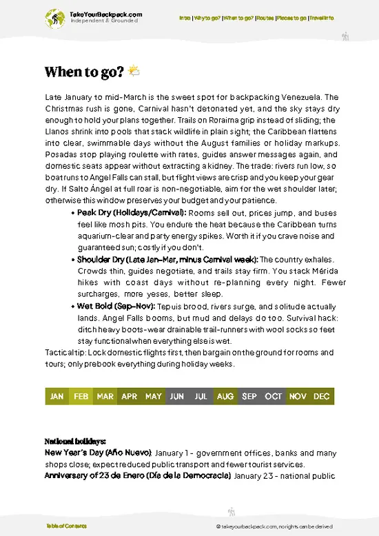
  • Weather: The dry season from December to March is your best bet. Trails firm up, rivers drop, and the relentless rain pauses. The wet season (May to October) turns paths into mudslides and waterfalls into roaring torrents—spectacular but brutal.

  • Temperature: Days hover between 20-25°C (68-77°F), perfect for hiking without overheating. Nights can dip to 10°C (50°F), so pack layers. The dry season offers more stable temps, while the wet season swings more wildly.

  • Daylight Hours: Expect roughly 11 to 12 hours of daylight year-round. The dry season’s clearer skies mean you’ll get more usable light for longer treks and early starts.

  • Crowds: Peak season brings a handful of other trekkers but never feels overrun. The wet season sees fewer visitors, giving you solitude at the cost of tougher
read more 👉

  • Weather: The dry season from December to March is your best bet. Trails firm up, rivers drop, and the relentless rain pauses. The wet season (May to October) turns paths into mudslides and waterfalls into roaring torrents—spectacular but brutal.

  • Temperature: Days hover between 20-25°C (68-77°F), perfect for hiking without overheating. Nights can dip to 10°C (50°F), so pack layers. The dry season offers more stable temps, while the wet season swings more wildly.

  • Daylight Hours: Expect roughly 11 to 12 hours of daylight year-round. The dry season’s clearer skies mean you’ll get more usable light for longer treks and early starts.

  • Crowds: Peak season brings a handful of other trekkers but never feels overrun. The wet season sees fewer visitors, giving you solitude at the cost of tougher conditions.

  • Seasonal Activities: Dry months open up multi-day hikes to iconic spots like Angel Falls and Tepuis. Wet months flood some trails but amplify waterfall flows—if you’re ready for a challenge.

  • Price Fluctuations: Expect higher costs during the dry season when demand peaks. Off-season offers better deals but brace for extra gear and patience.


Pro-tip: Aim for late dry season—March offers firm trails, manageable temps, and fewer crowds, letting you own the landscape before the rains reclaim it.


source: climatestotravel.comJANJanuary: excellent for travelingFEBFebruary: excellent for travelingMARMarch: excellent for travelingAPRApril: good for travelingMAYMay: fair for travelingJUNJune: fair for travelingJULJuly: fair for travelingAUGAugust: fair for travelingSEPSeptember: fair for travelingOCTOctober: fair for travelingNOVNovember: good for travelingDECDecember: excellent for traveling

✈️ The backpacker research shortcutVenezuela Travel Guide

An offline-friendly backpacking guide with optimized travel routes, ranked highlights, transport advice, and the best areas to stay.
example page 0 from our offline Travel Guide for Venezuela
example page 1 from our offline Travel Guide for Venezuela
example page 2 from our offline Travel Guide for Venezuela
example page 3 from our offline Travel Guide for Venezuela
example page 4 from our offline Travel Guide for Venezuela
example page 5 from our offline Travel Guide for Venezuela
example page 6 from our offline Travel Guide for Venezuela
example page 7 from our offline Travel Guide for Venezuela
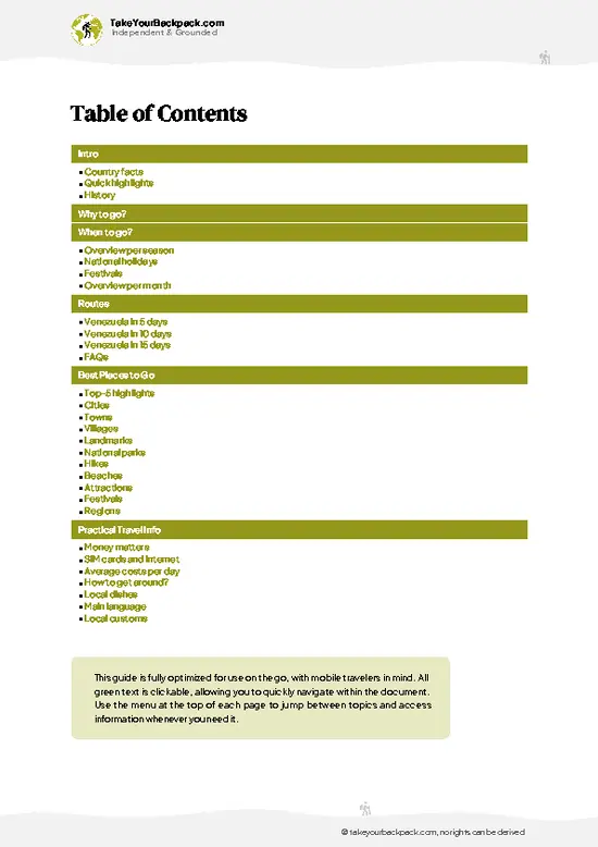
The digital guide (369 pages) contains:
99 highlights, ranked by travel appeal
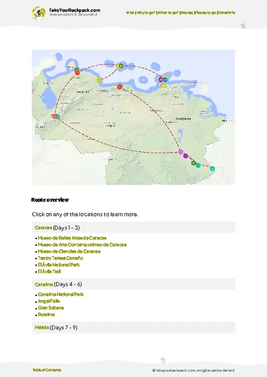
Optimized 5, 10 & 15-day travel routes
Cities, national parks, landmarks, beaches
How to get around
Offline-friendly for travel without Wi-Fi
👉 Click to see all 30+ guide features

📅 Plan smarter in minutes, not weeks
Month by month travel advice
Festivals & national holidays
Budget expectations

🗺️ Go to the right places, skip the overrated ones
Honest pros & cons of destinations
Top hikes, parks & viewpoints
Lesser-known places most travelers miss
Clear “worth it vs skip it” guidance

🛏️ Travel smoothly without rookie mistakes
Best areas to stay
Transport systems explained simply
Common scams & safety advice
SIM cards, money & practical tips

🌍 Understand the country, not just visit it
Culture & traditions
52 Essential phrases & customs
Festivals worth planning around
Traveler-friendly historical context
Insights that make places more meaningful

📱 Built for real travel conditions
Fully downloadable PDF
Works completely offline
Optimized for phone use
Useful in remote areas & buses
Everything in one place
Save weeks of stressful planning
Get instant access to your full guide. 30‑day money-back guarantee.
+ Add another guide for just US$7.80

By proceeding you agree to our terms.
Sent to your inbox immediately after payment • 100% Secure Checkout
Best Backpacking Travel Advisor 2025 tourism awardBest Backpacking
Travel Advisor
2025
What others say about Take Your Backpack Guides:
⭐⭐⭐⭐⭐
Fantastic, amazing amount of information!
⭐⭐⭐⭐⭐
My goodness this is amazing, it's what I've been looking for hats off too you!
⭐⭐⭐⭐⭐
I think this is absolutely BRILLIANT
⭐⭐⭐⭐
Very complete and informative. It's still missing places, but I gotta to commend you
⭐⭐⭐⭐⭐
This is truly amazing, thank you, can't wait to explore it with my kids!
⭐⭐⭐⭐⭐
Awesome resource, thank you!
⭐⭐⭐⭐⭐
This is amazing! Can't wait to explore the ones I haven't seen
⭐⭐⭐⭐
I love this! Well done, great idea.
⭐⭐⭐⭐⭐
Thanks for taking the time to make this gem!
⭐⭐⭐⭐⭐
This might be the best website I've ever seen.
⭐⭐⭐⭐⭐
Congratulations, and thank you so much for your work; it's incredibly valuable.
⭐⭐⭐⭐
In all seriousness I think you did a great job pointing out the important spots
⭐⭐⭐⭐⭐
10/10 very good
⭐⭐⭐⭐⭐
As someone who's only just starting to visit regularly this is awesome, thank you.
⭐⭐⭐⭐
Thank you very much! I'm going to visit my dad, it's going to be very useful!
⭐⭐⭐⭐⭐
This is really cool! We'll be travelling for the first time and this definitely come in handy.
⭐⭐⭐⭐⭐
You are now our minister of culture, congratulations 👨‍💼
⭐⭐⭐⭐⭐
Just wanted to tell you that this is a pearl! Going to follow your recommendations.
⭐⭐⭐⭐⭐
This is so cool. I'll definitely be using the resource for my travels soon.
⭐⭐⭐⭐⭐
This is very impressive! Good work.
⭐⭐⭐⭐⭐
This is an amazing and informative site. Very well done!

🛏️ Where to stay?Best areas and accommodation options

If you enjoy meeting fellow travelers, consider choosing hostels with high ratings for atmosphere. On the other hand, if you prefer having your own space, a hotel might be a better option.

🥾 Hike detailsRoute, distance, and difficulty explained

Total Distance: The Gran Sabana trail stretches approximately 50 kilometers (about 31 miles) if you take the full route, but many hikers choose shorter segments to suit their pace and time constraints.

Estimated Duration: Plan for about 3 to 5 days to complete the trail, depending on your fitness level and how often you stop to take in the breathtaking views.

Difficulty Level: This trail is considered moderate to challenging. You’ll encounter some steep sections and rocky paths, so a good level of fitness is recommended.

Starting Point: The trail typically begins in the town of Santa Elena … read more 👉
Total Distance: The Gran Sabana trail stretches approximately 50 kilometers (about 31 miles) if you take the full route, but many hikers choose shorter segments to suit their pace and time constraints.

Estimated Duration: Plan for about 3 to 5 days to complete the trail, depending on your fitness level and how often you stop to take in the breathtaking views.

Difficulty Level: This trail is considered moderate to challenging. You’ll encounter some steep sections and rocky paths, so a good level of fitness is recommended.

Starting Point: The trail typically begins in the town of Santa Elena de Uairén. To get there, you can take a bus from Caracas or Ciudad Bolivar to Santa Elena. Buses are frequent, but be prepared for a long journey—around 12 to 15 hours. Once you arrive in Santa Elena, you can arrange for a local guide or transport to the trailhead.

Major Landmarks Along the Route:
  • Mount Roraima: This iconic flat-topped mountain is a major highlight, offering stunning vistas and unique rock formations.
  • Angel Falls: Although not directly on the trail, it’s a short detour worth the trip for the world’s tallest waterfall.
  • Local Indigenous Communities: You’ll have the chance to interact with the Pemon people, who can share insights about the area and its history.

Type of Terrain and Scenery: Expect a mix of rocky paths, grassy plains, and occasional muddy spots, especially during the rainy season. The scenery is nothing short of spectacular, featuring vast savannas, towering tepuis (tabletop mountains), and lush valleys.

Typical Vegetation: The region is rich in biodiversity. You’ll see a variety of plants, including:
  • Orchids: These vibrant flowers are common and add a splash of color to the landscape.
  • Ferns: Often found in the cooler, shaded areas of the trail.
  • Bromeliads: These unique plants grow on rocks and trees, showcasing their resilience.

Wildlife: Keep your eyes peeled for some fascinating creatures, such as:
  • Capybaras: These large rodents are often seen near water sources.
  • Howler Monkeys: Their distinctive calls can be heard echoing through the forest.
  • Various Bird Species: Look out for toucans and other colorful birds that make this area their home.

This trail offers a blend of adventure and natural beauty, perfect for those looking to escape the everyday hustle. Just remember to pack plenty of water, snacks, and a good camera—you’re going to want to capture those views!
⚠️ Hiking info can sometimes be outdated or inaccurate. Before you hit the trail, check the latest conditions with locals. If you do spot anything that's off, I'd love to hear from you, so I can update it for fellow travelers.

🛡️ SafetyStaying Safe: What Travelers Should Know

Gran Sabana is a breathtaking expanse, but it demands respect. Weather can shift rapidly; sunny skies can morph into sudden downpours. Be prepared with a waterproof jacket and quick-drying gear. The trails are rugged, often steep and rocky, so sturdy footwear is non-negotiable. Navigation can be tricky; download offline maps and keep your compass handy.

Altitude can sap your energy, so pace yourself, especially on the ascents. Take breaks to hydrate and soak in the views—trust me, they’re worth it. River crossings can be a challenge, especially after rain, so scout for the safest spots and don’t rush.

Wildlife is part of the experience. Keep a respectful distance from creatures like snakes or the occasional jaguar. Stay calm and back away slowly if you encounter them.

Preparation is … read more 👉
Gran Sabana is a breathtaking expanse, but it demands respect. Weather can shift rapidly; sunny skies can morph into sudden downpours. Be prepared with a waterproof jacket and quick-drying gear. The trails are rugged, often steep and rocky, so sturdy footwear is non-negotiable. Navigation can be tricky; download offline maps and keep your compass handy.

Altitude can sap your energy, so pace yourself, especially on the ascents. Take breaks to hydrate and soak in the views—trust me, they’re worth it. River crossings can be a challenge, especially after rain, so scout for the safest spots and don’t rush.

Wildlife is part of the experience. Keep a respectful distance from creatures like snakes or the occasional jaguar. Stay calm and back away slowly if you encounter them.

Preparation is key. First-timers often underestimate the need for snacks and water. Carry enough to fuel your adventure. Embrace the grit of the trails, and the rewards will be all the sweeter.

FAQTraveler FAQ

The Gran Sabana hike typically takes between 4 to 7 days depending on the route and pace. Most popular treks cover around 70 to 100 kilometers through diverse landscapes. Plan for daily hikes of 10 to 20 kilometers with some steep sections.
The difficulty of the Gran Sabana hike is moderate to challenging due to uneven terrain, river crossings, and occasional steep climbs. Hikers should be in good physical condition and prepared for variable weather, including heavy rain. Altitude is generally low, but the remote nature adds to the challenge.
Yes, you need a guide and permits to hike in the Gran Sabana, especially for protected areas like Canaima National Park. Guides are mandatory to ensure safety and environmental protection, with permit costs varying but generally around $10 to $20 USD. Booking through authorized agencies is recommended.
⚠️ Things can change over time, so always validate details locally before you go.

Other Venezuelan hikes near Gran Sabana

Explore more nearby:

  • Roraima—tabletop summit, quartz fields, alien rock formations| 107 km away
  • Angel Falls—tepui cliffs, misty rainforest, remote river approach| 116 km away
  • Cueva del Guácharo Trail—limestone cave, nocturnal birds, lush foothills| 574 km away

💡 Not sure where to go next?
Create a personalized itinerary for Venezuela including Gran Sabana and the places that fit your trip.

Generate my itinerary

👉 Discover all hikes

Or checkout all Venezuela has to offer (think cities, towns, villages, national parks, hikes, beaches, festivals)
Country photo of Venezuela

We 💚 feedbackIs it worth it?

Gran Sabana is a wild symphony of nature and culture. The moment you step onto those trails, the air shifts—thick with the scent of earth and rain. The best surprise? Stumbling upon a hidden waterfall, where the roar drowns out everything else. But heed this: the roads can be rough, and the weather unpredictable. Pack your patience and a sense of adventure. When you finally sip that cold beer under the stars, you’ll know every step was worth it.

✍️ Help improve this page!
The information on this page is based on in-depth research, insights shared by experienced travelers, and feedback from the local travel community in Venezuela. While every effort is made to keep the information accurate and current, conditions can change — so if you spot anything incorrect or outdated, please get in touch.


🙋‍♂️ Give feedback

👋 Meet the founderWho’s Behind Take Your Backpack?

Johan, backpacker and founder of TakeYourBackpackHi, I’m Johan (Netherlands 🇳🇱), the creator of TakeYourBackpack. Over the past decade, I’ve backpacked through 80+ countries across six continents, gaining extensive experience with independent travel, long-term trips, and overland routes.

This site is built on a combination of firsthand travel experience and carefully curated insights from other backpackers. Many guides are based on places I’ve personally visited, while others bring together tips, observations, and practical advice shared by trusted travelers I’ve met along the way.

The goal is to provide realistic, experience-driven guidance — not generic itineraries — so you can explore destinations with better context, clearer expectations, and more confidence.

Get full Venezuela guide •
Instant download • 99 highlights • Full Offline guide