
×

Venezuela🇻🇪 | hikesLaguna de Mucubají Trailglacial lagoon, frailejón fields, mountain air | things to do and best time to go

Explore Cueva del Guácharo TrailExplore Canaima National Park

Backpacking in Laguna de Mucubají Trail
👌 Worth visitinghike ranked #7
By Johan Kruseman 🇳🇱 | Updated September 4, 2026

You have to choose, right at the trailhead, whether Laguna de Mucubají is just a quick postcard stop or a real leg-burner into the páramo, and that choice decides if this place is a roadside stroll or a full-body Andes experience. The trail sits in Venezuela’s Mérida state, inside Sierra Nevada National Park, high on the Trans-Andean highway. The hike itself is short-to-moderate, with options: a gentle loop around the main lagoon or longer pushes toward Laguna Negra and other lakes, where the air thins and the wind bites but the frailejones, mist, and wide-open ridgelines feel wild. It’s easy to reach by public transport from Mérida, far simpler than many Venezuelan treks, but that also means crowds, roadside food stalls, and less solitude than tougher nearby routes like Pico Bolívar approaches.

Discover everything you want to know in the 📖 Venezuela Travel Guide.
Best time to go: November - May
Duration: 6 hours
Distance: 12 kilometers
Total ascent: 600 meters
Safety warning

The current risk level for Venezuela is high. Check the advice before going.


Get your Venezuela guide
99 ranked highlights, routes & tips, works offline (369 pages)
Loading the map 🌍
CLICK TO FILTER
cities
towns
villages
landmarks
national parks
hikes
beaches
attractions
festivals
regions
SHOW COUNTRY’S BESTSHOW ALL

✨ Why go?
Ranked #7 hike in Venezuela
What makes it a must-see hike

The Laguna de Mucubají Trail in Venezuela is a backpacker’s dream, blending stunning scenery with a manageable effort. You’ll trek through lush paramo landscapes, where the air is crisp and the flora is a riot of color. The scenery-to-effort ratio is unbeatable; you’ll earn breathtaking views without exhausting yourself.

Getting there is a breeze—public transport whisks you from Mérida to the trailhead, making it accessible for anyone. The trail offers flexible distances, allowing you to customize your adventure based on your energy levels or time constraints.

Plus, it fits seamlessly into a longer backpacking route through the Andes, making it a perfect pit stop. After the hike, reward yourself with a cold beer at a nearby village, savoring the satisfaction of your effort. This trail … read more 👉
The Laguna de Mucubají Trail in Venezuela is a backpacker’s dream, blending stunning scenery with a manageable effort. You’ll trek through lush paramo landscapes, where the air is crisp and the flora is a riot of color. The scenery-to-effort ratio is unbeatable; you’ll earn breathtaking views without exhausting yourself.

Getting there is a breeze—public transport whisks you from Mérida to the trailhead, making it accessible for anyone. The trail offers flexible distances, allowing you to customize your adventure based on your energy levels or time constraints.

Plus, it fits seamlessly into a longer backpacking route through the Andes, making it a perfect pit stop. After the hike, reward yourself with a cold beer at a nearby village, savoring the satisfaction of your effort. This trail isn’t just a hike; it’s a celebration of nature and the thrill of exploration.
Want to include Laguna de Mucubají Trail in your Venezuela route?
Create a personalized Venezuela itinerary that includes Laguna de Mucubají Trail and the places that fit your trip — based on your travel style, budget, and available time. Get your route in seconds.

Generate my trip

💡 HighlightsEssential experiences to have while hiking the Laguna de Mucubají Trail

  1. Laguna de Mucubají (the lake itself) — A clear, glacier-fed lagoon with jewel-toned water that mirrors the sky and peaks; it’s the obvious showpiece and a perfect spot to sit, eat your sandwich, and pretend you’re a landscape photographer without spending a peso on equipment.
  2. The páramo and frailejones — This high-altitude moorland feels almost alien: spongy ground, low fog, and the iconic, cactus-like frailejones (Espeletia) dotting the scene. It’s an ecosystem you won’t find on lowland hikes, with plants adapted to cold and intense sun.
  3. Sweeping views of the Sierra Nevada peaks — On clear days the trail frames Venezuela’s big volcanic peaks (think Pico Bolívar and neighbors) with dramatic contrast to the lake below. Sunrises and late-afternoon light here make the whole valley pop—bring
read more 👉
  1. Laguna de Mucubají (the lake itself) — A clear, glacier-fed lagoon with jewel-toned water that mirrors the sky and peaks; it’s the obvious showpiece and a perfect spot to sit, eat your sandwich, and pretend you’re a landscape photographer without spending a peso on equipment.
  2. The páramo and frailejones — This high-altitude moorland feels almost alien: spongy ground, low fog, and the iconic, cactus-like frailejones (Espeletia) dotting the scene. It’s an ecosystem you won’t find on lowland hikes, with plants adapted to cold and intense sun.
  3. Sweeping views of the Sierra Nevada peaks — On clear days the trail frames Venezuela’s big volcanic peaks (think Pico Bolívar and neighbors) with dramatic contrast to the lake below. Sunrises and late-afternoon light here make the whole valley pop—bring layers and a camera.
  4. Birdlife and highland wildlife — Expect waterfowl, territorial ducks, and the odd raptor cruising the thermals; the mix of wetland and páramo attracts species you rarely see on lower trails. A pair of cheap binoculars pays off more than fancy gear on this route.
  5. Local pastoral culture and easy access — The trail runs past grazing fields, pack animals, and small mountain farms, so you get authentic highland life alongside the scenery. It’s also doable as a short, budget-friendly day hike, which makes it stand out from longer, gear-heavy Andean treks.
Spotted a mistake or missing something? Contact us.

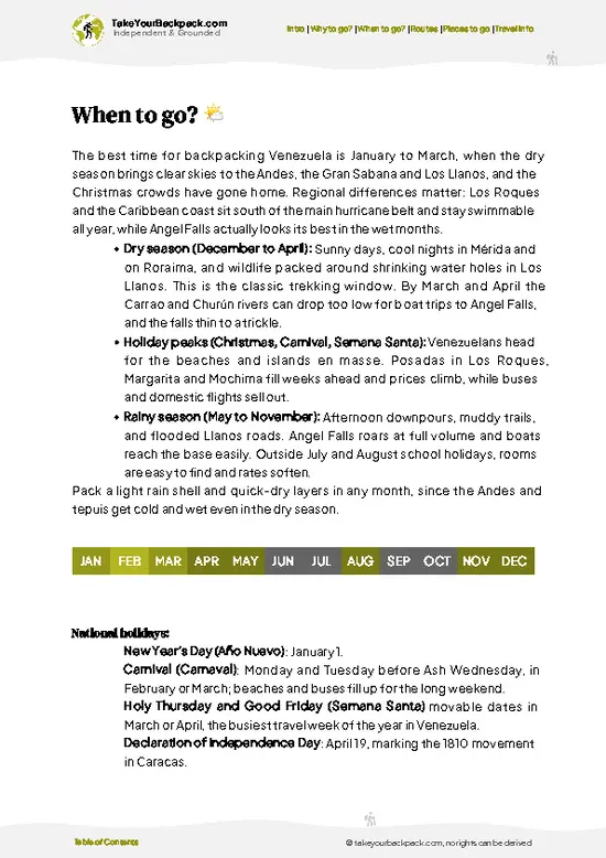
🌤️ When to go?Choosing the right time of year


  • Weather: The dry season from December to April is your best bet. Trails stay firm, skies clear, and rain won’t turn your trek into a mud slog. The wet season, May to November, brings frequent downpours that can wash out paths and chill your bones.

  • Temperature: Expect crisp mountain air. Daytime highs hover around 15-20°C (59-68°F), but nights plunge to near freezing, especially in the dry season. Pack layers—your body will thank you when the sun dips.

  • Daylight Hours: Roughly 11 to 12 hours of daylight year-round. Start early to maximize your hike and avoid afternoon clouds that roll in fast during the wet months.

  • Crowds: Peak season means more hikers, especially around holidays. For solitude, aim for shoulder months like November or May, but be ready for unpredictable weather.

  • Seasonal
read more 👉

  • Weather: The dry season from December to April is your best bet. Trails stay firm, skies clear, and rain won’t turn your trek into a mud slog. The wet season, May to November, brings frequent downpours that can wash out paths and chill your bones.

  • Temperature: Expect crisp mountain air. Daytime highs hover around 15-20°C (59-68°F), but nights plunge to near freezing, especially in the dry season. Pack layers—your body will thank you when the sun dips.

  • Daylight Hours: Roughly 11 to 12 hours of daylight year-round. Start early to maximize your hike and avoid afternoon clouds that roll in fast during the wet months.

  • Crowds: Peak season means more hikers, especially around holidays. For solitude, aim for shoulder months like November or May, but be ready for unpredictable weather.

  • Seasonal Activities: Dry months open up fishing and camping opportunities around Laguna de Mucubají. Wet season limits these but brings lush greenery and wildflowers if you don’t mind the damp.

  • Price Fluctuations: Expect higher prices for guides and lodging in the dry season when demand spikes. Off-season offers better deals but fewer services and tougher trail conditions.


Pro-tip: Hit the trail at dawn during the dry season—cool air, golden light, and a quiet lake waiting at the end make every step worth it.


source: climatestotravel.comJANJanuary: excellent for travelingFEBFebruary: excellent for travelingMARMarch: excellent for travelingAPRApril: excellent for travelingMAYMay: good for travelingJUNJune: fair for travelingJULJuly: fair for travelingAUGAugust: fair for travelingSEPSeptember: fair for travelingOCTOctober: fair for travelingNOVNovember: good for travelingDECDecember: excellent for traveling
venezuela-hike-laguna-de-mucubaji-trail
© Google |

✈️ The backpacker research shortcutVenezuela Travel Guide

An offline-friendly backpacking guide with optimized travel routes, ranked highlights, transport advice, and the best areas to stay.
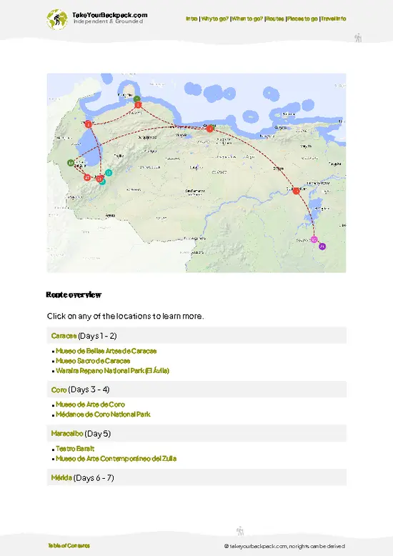
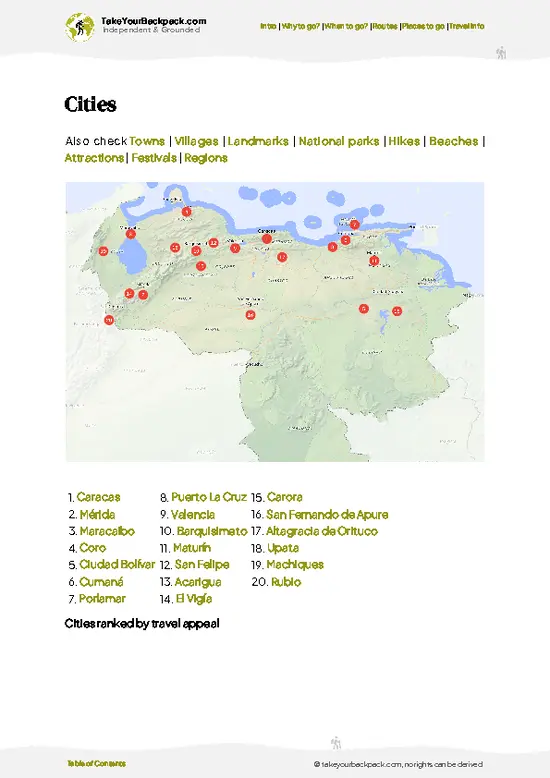
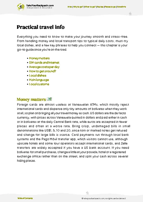
example page 0 from our offline Travel Guide for Venezuela
example page 1 from our offline Travel Guide for Venezuela
example page 2 from our offline Travel Guide for Venezuela
example page 3 from our offline Travel Guide for Venezuela
example page 4 from our offline Travel Guide for Venezuela
example page 5 from our offline Travel Guide for Venezuela
example page 6 from our offline Travel Guide for Venezuela
example page 7 from our offline Travel Guide for Venezuela
The digital guide (369 pages) contains:
99 highlights, ranked by travel appeal
Optimized 5, 10 & 15-day travel routes
Cities, national parks, landmarks, beaches
How to get around
Offline-friendly for travel without Wi-Fi
👉 Click to see all 30+ guide features

📅 Plan smarter in minutes, not weeks
Month by month travel advice
Festivals & national holidays
Budget expectations

🗺️ Go to the right places, skip the overrated ones
Honest pros & cons of destinations
Top hikes, parks & viewpoints
Lesser-known places most travelers miss
Clear “worth it vs skip it” guidance

🛏️ Travel smoothly without rookie mistakes
Best areas to stay
Transport systems explained simply
Common scams & safety advice
SIM cards, money & practical tips

🌍 Understand the country, not just visit it
Culture & traditions
52 Essential phrases & customs
Festivals worth planning around
Traveler-friendly historical context
Insights that make places more meaningful

📱 Built for real travel conditions
Fully downloadable PDF
Works completely offline
Optimized for phone use
Useful in remote areas & buses
Everything in one place
Save weeks of stressful planning
Get instant access to your full guide. 30‑day money-back guarantee.
+ Add another guide for just €6.50

By proceeding you agree to our terms.
Sent to your inbox immediately after payment • 100% Secure Checkout
Best Backpacking Travel Advisor 2025 tourism awardBest Backpacking
Travel Advisor
2025
What others say about Take Your Backpack Guides:
⭐⭐⭐⭐⭐
Fantastic, amazing amount of information!
⭐⭐⭐⭐⭐
My goodness this is amazing, it's what I've been looking for hats off too you!
⭐⭐⭐⭐⭐
I think this is absolutely BRILLIANT
⭐⭐⭐⭐
Very complete and informative. It's still missing places, but I gotta to commend you
⭐⭐⭐⭐⭐
This is truly amazing, thank you, can't wait to explore it with my kids!
⭐⭐⭐⭐⭐
Awesome resource, thank you!
⭐⭐⭐⭐⭐
This is amazing! Can't wait to explore the ones I haven't seen
⭐⭐⭐⭐
I love this! Well done, great idea.
⭐⭐⭐⭐⭐
Thanks for taking the time to make this gem!
⭐⭐⭐⭐⭐
This might be the best website I've ever seen.
⭐⭐⭐⭐⭐
Congratulations, and thank you so much for your work; it's incredibly valuable.
⭐⭐⭐⭐
In all seriousness I think you did a great job pointing out the important spots
⭐⭐⭐⭐⭐
10/10 very good
⭐⭐⭐⭐⭐
As someone who's only just starting to visit regularly this is awesome, thank you.
⭐⭐⭐⭐
Thank you very much! I'm going to visit my dad, it's going to be very useful!
⭐⭐⭐⭐⭐
This is really cool! We'll be travelling for the first time and this definitely come in handy.
⭐⭐⭐⭐⭐
You are now our minister of culture, congratulations 👨‍💼
⭐⭐⭐⭐⭐
Just wanted to tell you that this is a pearl! Going to follow your recommendations.
⭐⭐⭐⭐⭐
This is so cool. I'll definitely be using the resource for my travels soon.
⭐⭐⭐⭐⭐
This is very impressive! Good work.
⭐⭐⭐⭐⭐
This is an amazing and informative site. Very well done!

🛏️ Where to stay?Best areas and accommodation options

If you enjoy meeting fellow travelers, consider choosing hostels with high ratings for atmosphere. On the other hand, if you prefer having your own space, a hotel might be a better option.

🥾 Hike detailsRoute, distance, and difficulty explained

Total Distance: The Laguna de Mucubají Trail stretches about 10 kilometers (6.2 miles) round trip, making it a manageable hike for most adventurers.

Estimated Duration: Plan on spending around 3 to 5 hours on the trail. This includes time for breaks, taking in the views, and snapping photos, which you’ll definitely want to do.

Difficulty Level: This trail is generally considered moderate. While it’s not overly technical, some sections can be steep and rocky, so a decent level of fitness is helpful.

Starting Point: The trailhead is located near the small town of Mucubají. You can get there by … read more 👉
Total Distance: The Laguna de Mucubají Trail stretches about 10 kilometers (6.2 miles) round trip, making it a manageable hike for most adventurers.

Estimated Duration: Plan on spending around 3 to 5 hours on the trail. This includes time for breaks, taking in the views, and snapping photos, which you’ll definitely want to do.

Difficulty Level: This trail is generally considered moderate. While it’s not overly technical, some sections can be steep and rocky, so a decent level of fitness is helpful.

Starting Point: The trailhead is located near the small town of Mucubají. You can get there by taking a bus from Merida. Look for a bus heading to ”Mucuchies” or ”Mucubají,” which typically leaves from the main terminal. The ride takes about an hour, and from the bus stop, it’s a short walk to the trailhead.

Major Landmarks Along the Route:
  • Laguna de Mucubají: This stunning glacial lake is the highlight of the hike, offering breathtaking views and a perfect spot for a picnic.
  • Paramo Ecosystem: As you hike, you’ll traverse through unique wetland areas that are home to various flora and fauna.
  • Viewpoints: There are several spots along the way where you can stop and take in panoramic views of the surrounding mountains and valleys.

Type of Terrain and Scenery: Expect a mix of rocky paths, grassy fields, and some muddy sections, especially after rainfall. The scenery is a feast for the eyes, with towering mountains, vibrant green valleys, and the shimmering lake at the end of your journey.

Typical Vegetation and Wildlife:
  • Vegetation: You’ll see a variety of plants, including frailejones (a type of plant unique to the Andes) and colorful wildflowers that bloom in the warmer months.
  • Wildlife: Keep an eye out for birds like the Andean condor and various smaller species, as well as the occasional deer or rabbit darting through the underbrush.

If you’re looking for a trail that combines stunning landscapes with a bit of adventure, the Laguna de Mucubají Trail is a solid choice. Just pack some snacks, a good camera, and maybe a rain jacket, because weather in the Andes can be unpredictable!
⚠️ Hiking info can sometimes be outdated or inaccurate. Before you hit the trail, check the latest conditions with locals. If you do spot anything that's off, I'd love to hear from you, so I can update it for fellow travelers.

🛡️ SafetyScams, Hazards, and Annoyances

The Laguna de Mucubají Trail offers a straightforward yet invigorating hike, but don’t underestimate the elements. Weather can shift quickly; pack layers to adapt to the chill of the high altitude. The terrain is mostly well-defined, but expect some rocky patches and a few steep sections that demand focus.

Stay alert for wildlife—like curious birds or the occasional deer—but keep your distance. Respect their space, and don’t feed them.

Timing is key; early mornings are best to avoid afternoon storms. Bring sturdy footwear for grip on uneven ground, and don’t forget trekking poles for stability. Embrace the challenge, and when you reach that shimmering lake, the effort will feel like pure reward.

FAQFrequently asked questions about Laguna de Mucubají Trail

The Laguna de Mucubají Trail hike typically takes around 3 to 4 hours round trip. The trail covers approximately 8 kilometers (5 miles) and is usually completed in a single day. Timing can vary depending on pace and weather conditions.
The hike is considered moderate in difficulty. It involves some uneven terrain and gradual elevation changes but is accessible to most hikers with a reasonable fitness level. Proper footwear and water are recommended due to rocky sections and potential altitude effects.
No guide or permit is required to hike the Laguna de Mucubají Trail. The trail is located within Sierra Nevada National Park, which is open to the public without mandatory permits. However, hiring a local guide can enhance safety and provide valuable insights about the area.
⚠️ Things can change over time, so always validate details locally before you go.

Other Venezuelan hikes near Laguna de Mucubají Trail

Explore more nearby:

  • La Culata Trail—paramo grasslands, cold streams, rolling hills| 28 km away
  • Pico Humboldt—glacial lakes, high-altitude tundra, snow patches| 33 km away
  • Los Nevados Trail—Andean villages, mule tracks, patchwork farmland| 46 km away

💡 Not sure where to go next?
Create a personalized itinerary for Venezuela including Laguna de Mucubají Trail and the places that fit your trip.

Generate my itinerary

👉 Discover all hikes

Or checkout all Venezuela has to offer (think cities, towns, villages, national parks, hikes, beaches, festivals)
Country photo of Venezuela

We 💚 feedbackFinal thoughts on hiking the Laguna de Mucubají Trail

The Laguna de Mucubají Trail is a wild ride. You’ll feel the burn in your legs, but that crisp mountain air is a game-changer. The best surprise? The vibrant local culture at the trailhead—grab a fresh arepa before you hit the path. Just a heads-up: the weather can flip on you. Pack layers. The view at the lake? Worth every step. Trust me.

✍️ Help improve this page!
The information on this page is based on in-depth research, insights shared by experienced travelers, and feedback from the local travel community in Venezuela. While every effort is made to keep the information accurate and current, conditions can change — so if you spot anything incorrect or outdated, please get in touch.


🙋‍♂️ Give feedback

👋 Meet the founderWho’s Behind Take Your Backpack?

Johan, backpacker and founder of TakeYourBackpackHi, I’m Johan (Netherlands 🇳🇱), the creator of TakeYourBackpack. Over the past decade, I’ve backpacked through 80+ countries across six continents, gaining extensive experience with independent travel, long-term trips, and overland routes.

This site is built on a combination of firsthand travel experience and carefully curated insights from other backpackers. Many guides are based on places I’ve personally visited, while others bring together tips, observations, and practical advice shared by trusted travelers I’ve met along the way.

The goal is to provide realistic, experience-driven guidance — not generic itineraries — so you can explore destinations with better context, clearer expectations, and more confidence.

Get full Venezuela guide •
Instant download • 99 highlights • Full Offline guide