×

Venezuela🇻🇪 | hikesPico HumboldtGuided ascent, 4,940 meter summit, glacial lakes, Mérida departure | things to do and best time to go

Explore Los Nevados TrailExplore La Culata Trail

Backpacking in Pico Humboldt
🌟 Highlighthike ranked #5
By Johan Kruseman 🇳🇱 | Updated October 19, 2026

A guide is mandatory and the trip is organized from Mérida, so logistics are simpler than on most Andean peaks. Pico Humboldt (4,940 meters) sits in the Sierra Nevada de Mérida, in the Andes of western Venezuela, about 17 km from the city as the crow flies. The scenery is big: glacial lakes, frosty páramo, and the shrinking ice field left from Venezuela’s last glacier, which lost its glacier status in 2024. The climb is hard. Expect four to five days, serious altitude and cold nights, and a bad-weather day can cost you the summit. Skip it if you want a casual stroll. Go if you want real mountain country with a genuine summit and a proper team. Book through an agency in Mérida before you arrive.

Discover everything you want to know in the 📖 Venezuela Travel Guide.
Best time to go: November - May
Duration: 4 days
Distance: 40 kilometers
Total ascent: 2500 meters
Safety warning

The current risk level for Venezuela is high. Check the advice before going.


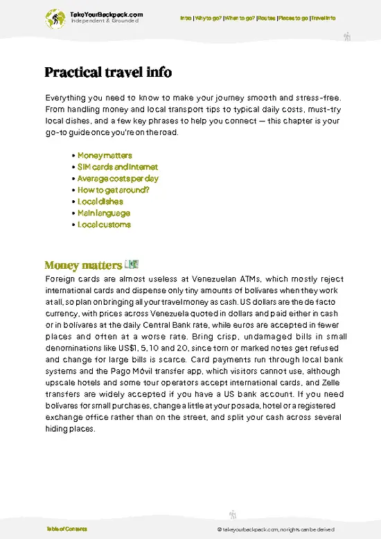
example page 0 from our offline Travel Guide for Venezuela
example page 1 from our offline Travel Guide for Venezuela
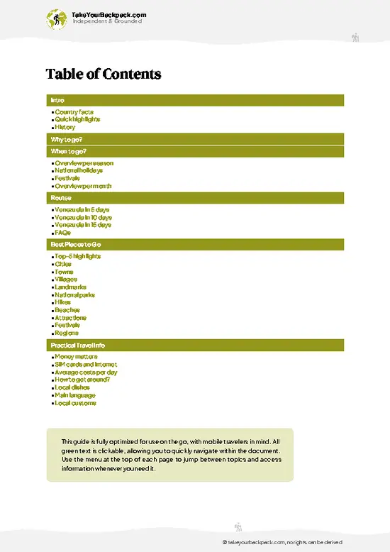
example page 2 from our offline Travel Guide for Venezuela
example page 3 from our offline Travel Guide for Venezuela
example page 4 from our offline Travel Guide for Venezuela
example page 5 from our offline Travel Guide for Venezuela
example page 6 from our offline Travel Guide for Venezuela
example page 7 from our offline Travel Guide for Venezuela
Loading the map 🌍
CLICK TO FILTER
cities
towns
villages
landmarks
national parks
hikes
beaches
attractions
festivals
regions
SHOW COUNTRY’S BESTSHOW ALL

✨ Why go?
Ranked #5 hike in Venezuela
Reasons people choose to hike the here

Pico Humboldt gives you a 4,900-meter summit in a country better known for beaches, and you get there from Mérida, a university town with plenty of agencies and cheap beds. The route climbs through cloud forest into páramo, past Laguna Verde and Laguna Coromoto, so the scenery changes almost every day. Because guides, porters and cooks are bundled into the trip, you carry less than on most multi-day treks and can spend your energy on the altitude. It also fits neatly into a longer Venezuelan route: a few days of acclimatizing in the Andes, then onward to the Caribbean coast or the Gran Sabana. Few peaks in South America this high are this lightly visited, so camps are quiet and the night sky is wide open.

💡 HighlightsDon't-miss highlights and experiences

  1. Pico Humboldt summit: The goal at 4,940 meters, reached on a final scramble over rock and ice remnants. On a clear morning you look across the range to Pico Bolívar and down to the lakes.
  2. Pico Bolívar: Venezuela’s highest peak at about 4,978 meters rises right beside Humboldt, and its dark, steep face dominates the skyline from the high camp.
  3. Laguna Verde: A glacial lake whose green-blue color shifts with the light. Camps nearby sit in a bowl of rock with cold, clean air.
  4. Laguna Coromoto: A smaller high lake on the approach, good for an acclimatization stroll and reflections of the ridges at dawn.
  5. Páramo of the Sierra Nevada: Open highland full of frailejones, the fuzzy silver-leaved plants that define the Andean landscape here. Walking through them at first light is a highlight in itself.
Most … read more 👉
  1. Pico Humboldt summit: The goal at 4,940 meters, reached on a final scramble over rock and ice remnants. On a clear morning you look across the range to Pico Bolívar and down to the lakes.
  2. Pico Bolívar: Venezuela’s highest peak at about 4,978 meters rises right beside Humboldt, and its dark, steep face dominates the skyline from the high camp.
  3. Laguna Verde: A glacial lake whose green-blue color shifts with the light. Camps nearby sit in a bowl of rock with cold, clean air.
  4. Laguna Coromoto: A smaller high lake on the approach, good for an acclimatization stroll and reflections of the ridges at dawn.
  5. Páramo of the Sierra Nevada: Open highland full of frailejones, the fuzzy silver-leaved plants that define the Andean landscape here. Walking through them at first light is a highlight in itself.
Most visitors fix their eyes on the summit and overlook the frailejones fields lower down, where the plants grow only a few centimeters a year and stand in silent groves.
Spotted a mistake or missing something? Contact us.

🌤️ When to go?Choosing the right time of year

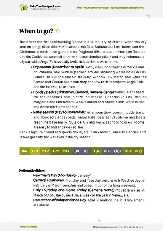
December to March is the best window for Pico Humboldt, with mostly clear mornings and the lowest chance of rain in the Sierra Nevada de Mérida.
  • Dry Season (December to March): Days reach 15 to 20°C (59 to 68°F) in the Mucubají and La Mucuy valleys, while nights at the high camps near 4,000 m drop to around 0°C (32°F) or below. Summit mornings are usually clear, and daylight runs about 11.5 to 12 hours.
  • Holiday Peaks (late December, Carnival, Easter): Venezuelan climbers fill the trails and camps, and guides and mules need booking well ahead. Prices for transport and guides tend to rise.
  • Transition Months (April and November): Afternoon cloud builds and showers start, but mornings are often still workable, with fewer people on the route.
  • Wet Season (May to October): Rain and fog arrive most afternoons,
… read more 👉
December to March is the best window for Pico Humboldt, with mostly clear mornings and the lowest chance of rain in the Sierra Nevada de Mérida.
  • Dry Season (December to March): Days reach 15 to 20°C (59 to 68°F) in the Mucubají and La Mucuy valleys, while nights at the high camps near 4,000 m drop to around 0°C (32°F) or below. Summit mornings are usually clear, and daylight runs about 11.5 to 12 hours.
  • Holiday Peaks (late December, Carnival, Easter): Venezuelan climbers fill the trails and camps, and guides and mules need booking well ahead. Prices for transport and guides tend to rise.
  • Transition Months (April and November): Afternoon cloud builds and showers start, but mornings are often still workable, with fewer people on the route.
  • Wet Season (May to October): Rain and fog arrive most afternoons, trails turn muddy, and the summit is often hidden. Temperatures are similar but feel colder when wet.
Start before dawn each day, since cloud usually rolls in by midday even in the dry months.


source: climatestotravel.comJANJanuary: excellent for travelingFEBFebruary: excellent for travelingMARMarch: excellent for travelingAPRApril: highly recommended for travelingMAYMay: good for travelingJUNJune: fair for travelingJULJuly: fair for travelingAUGAugust: fair for travelingSEPSeptember: fair for travelingOCTOctober: fair for travelingNOVNovember: good for travelingDECDecember: highly recommended for traveling
when-to-go

✈️ The backpacker research shortcutVenezuela Travel Guide

An offline-friendly backpacking guide with optimized travel routes, ranked highlights, transport advice, and the best areas to stay.
example page 0 from our offline Travel Guide for Venezuela
example page 1 from our offline Travel Guide for Venezuela
example page 2 from our offline Travel Guide for Venezuela
example page 3 from our offline Travel Guide for Venezuela
example page 4 from our offline Travel Guide for Venezuela
example page 5 from our offline Travel Guide for Venezuela
example page 6 from our offline Travel Guide for Venezuela
example page 7 from our offline Travel Guide for Venezuela
The digital guide (290 pages) contains:
✅ 91 highlights, ranked by travel appeal
✅ Optimized 5, 10 & 15-day travel routes
✅ Cities, national parks, landmarks, beaches
✅ How to get around
✅ Offline-friendly for travel without Wi-Fi
👉 Click to see all 30+ guide features

📅 Plan smarter in minutes, not weeks
✅ Month by month travel advice
✅ Festivals & national holidays
✅ Budget expectations

🗺️ Go to the right places, skip the overrated ones
✅ Honest pros & cons of destinations
✅ Top hikes, parks & viewpoints
✅ Lesser-known places most travelers miss
✅ Clear “worth it vs skip it” guidance

🛏️ Travel smoothly without rookie mistakes
✅ Best areas to stay
✅ Transport systems explained simply
✅ Common scams & safety advice
✅ SIM cards, money & practical tips

🌍 Understand the country, not just visit it
✅ Culture & traditions
✅ 52 Essential phrases & customs
✅ Festivals worth planning around
✅ Traveler-friendly historical context
✅ Insights that make places more meaningful

📱 Built for real travel conditions
✅ Fully downloadable PDF
✅ Works completely offline
✅ Optimized for phone use
✅ Useful in remote areas & buses
✅ Everything in one place
Stop searching, start planning
Get instant access to your full guide. 30‑day money-back guarantee.
+ Add another guide for just

By proceeding you agree to our terms.
Sent to your inbox immediately after payment • 100% Secure Checkout
Best Backpacking Travel Advisor 2025 tourism awardBest Backpacking
Travel Advisor
2025
What others say about Take Your Backpack Guides:
⭐⭐⭐⭐⭐
Fantastic, amazing amount of information!
⭐⭐⭐⭐⭐
My goodness this is amazing, it's what I've been looking for hats off too you!
⭐⭐⭐⭐⭐
I think this is absolutely BRILLIANT
⭐⭐⭐⭐
Very complete and informative. It's still missing places, but I gotta to commend you
⭐⭐⭐⭐⭐
This is truly amazing, thank you, can't wait to explore it with my kids!
⭐⭐⭐⭐⭐
Awesome resource, thank you!
⭐⭐⭐⭐⭐
This is amazing! Can't wait to explore the ones I haven't seen
⭐⭐⭐⭐
I love this! Well done, great idea.
⭐⭐⭐⭐⭐
Thanks for taking the time to make this gem!
⭐⭐⭐⭐⭐
This might be the best website I've ever seen.
⭐⭐⭐⭐⭐
Congratulations, and thank you so much for your work; it's incredibly valuable.
⭐⭐⭐⭐
In all seriousness I think you did a great job pointing out the important spots
⭐⭐⭐⭐⭐
10/10 very good
⭐⭐⭐⭐⭐
As someone who's only just starting to visit regularly this is awesome, thank you.
⭐⭐⭐⭐
Thank you very much! I'm going to visit my dad, it's going to be very useful!
⭐⭐⭐⭐⭐
This is really cool! We'll be travelling for the first time and this definitely come in handy.
⭐⭐⭐⭐⭐
You are now our minister of culture, congratulations 👨‍💼
⭐⭐⭐⭐⭐
Just wanted to tell you that this is a pearl! Going to follow your recommendations.
⭐⭐⭐⭐⭐
This is so cool. I'll definitely be using the resource for my travels soon.
⭐⭐⭐⭐⭐
This is very impressive! Good work.
⭐⭐⭐⭐⭐
This is an amazing and informative site. Very well done!

🛏️ Where to stay?Best areas and accommodation options

If you enjoy meeting fellow travelers, consider choosing hostels with high ratings for atmosphere. On the other hand, if you prefer having your own space, a hotel might be a better option.

🥾 Hike detailsRoute, distance, and difficulty explained

Pico Humboldt: The route climbs to the second highest summit in Venezuela, at roughly 4,940 meters in the Sierra Nevada de Mérida, above the city of Mérida.
Total Distance: About 35 kilometers round trip from La Mucuy.
Estimated Duration: Usually 3 to 4 days. Most groups sleep high, then summit and descend on a later day.
Difficulty: Demanding. Altitude is the main problem, plus a final rocky scramble and exposure on the upper ridge. Prior acclimatization helps.
Starting Point: The La Mucuy ranger station near Tabay, reached by jeep or taxi from Mérida.
Major Landmarks:
  • Laguna Verde: A high-altitude
… read more 👉
Pico Humboldt: The route climbs to the second highest summit in Venezuela, at roughly 4,940 meters in the Sierra Nevada de Mérida, above the city of Mérida.
Total Distance: About 35 kilometers round trip from La Mucuy.
Estimated Duration: Usually 3 to 4 days. Most groups sleep high, then summit and descend on a later day.
Difficulty: Demanding. Altitude is the main problem, plus a final rocky scramble and exposure on the upper ridge. Prior acclimatization helps.
Starting Point: The La Mucuy ranger station near Tabay, reached by jeep or taxi from Mérida.
Major Landmarks:
  • Laguna Verde: A high-altitude lake and common camp site below Pico Humboldt.
  • Pico Bolívar: The highest peak in Venezuela, dominating the skyline next to Humboldt.
  • Glacier remnants: Small ice patches near the summit, now much reduced.
Terrain and Scenery: Rocky trail, loose scree and boulder fields lead to steep granite faces. Views stretch over high lakes, ridges and, on clear mornings, far toward the plains.
Vegetation: Lower slopes hold cloud forest and shrubs. Higher up is páramo with frailejones, tough grasses and cushion plants, then bare rock near the top.
Wildlife: Andean condors may soar overhead. Spectacled bears live in the surrounding mountains but are rarely seen. Small birds and rodents are more likely sightings.
Practical Notes: Nights are freezing, so bring a warm sleeping bag, tent, rain layers and sun protection. Mornings are usually the clearest and safest time to climb.
⚠️ Hiking info can sometimes be outdated or inaccurate. Before you hit the trail, check the latest conditions with locals. If you do spot anything that's off, I'd love to hear from you, so I can update it for fellow travelers.

🛡️ SafetyTraveler Safety Guide

Altitude is the main issue on Pico Humboldt, which tops out at about 4,940 m (16,200 ft). Most hikers spend two nights climbing from La Mucuy toward Laguna Verde and Laguna El Suero, and that pacing helps acclimatization. Walk slowly, drink plenty, and turn back if headaches or nausea worsen. Weather swings quickly. Nights are freezing, wind is constant on the ridges, and fog can hide the trail, so bring a warm sleeping bag, waterproof layers, gloves and a hat. The upper section crosses rock and loose scree, and the summit area has a small, shrinking ice field with steep ground, so go with a guide who knows the route. Wildlife is minimal and not a concern, though keep your food secured at camp. Pack out all trash. Check road and fuel conditions in Mérida before heading out, and carry cash in US dollars for guides and park fees.

FAQTraveler FAQ

Pico Humboldt takes most hikers 4 to 5 days round trip from Mérida, usually with 2 nights going up and 1 or 2 coming down. The standard route starts at La Mucuy near Tabay and climbs to Laguna Verde and Laguna El Suero before the summit push. Fit, well-acclimatized groups can compress it into 3 days, but extra time gives you a better chance of a clear summit morning.
Pico Humboldt is a demanding high-altitude trek, not a technical climb for most of the route. You gain roughly 2,500 m over a few days and reach about 4,940 m, where cold, thin air and fatigue are the real challenges. The final stretch involves rocky terrain and some steep, exposed sections, so previous multi-day hiking experience helps a lot.
Yes, a guide is effectively required, and the park authority, INPARQUES, requires registration for entry. Most travelers book through agencies in Mérida, with packages commonly running about US$150 to 400 per person depending on group size, days and whether mules and meals are included. Park fees are small, usually a few dollars, and you should carry your passport for registration.
⚠️ Things can change over time, so always validate details locally before you go.

Other Venezuelan hikes near Pico Humboldt

Explore more nearby:

  • Los Nevados Trail—Multi-day páramo trek, Pico Bolívar views, mule-track village, posada nights| 13 km away
  • Laguna de Mucubají Trail—Alpine lakeshore loop, frailejón fields, Laguna Negra extension, mirror dawns| 33 km away
  • La Culata Trail—paramo grasslands, cold streams, rolling hills| 60 km away

💡 Not sure where to go next?
Create a personalized itinerary for Venezuela including Pico Humboldt and the places that fit your trip.

Generate my itinerary

👉 Discover all hikes

Or checkout all Venezuela has to offer (think cities, towns, villages, national parks, hikes, beaches, festivals)
Country photo of Venezuela

We 💚 feedbackKey takeaways before you go

Pico Humboldt punishes anyone who rushes the first days. Travelers often push the pace on easy lower trail, then arrive at the high camp wrecked and headachy. Walk slowly, drink constantly, and spend an extra night acclimatizing in Mérida beforehand. Bring a real winter sleeping bag, because rented ones can be thin.

✍️ Help improve this page!
The information on this page is based on in-depth research, insights shared by experienced travelers, and feedback from the local travel community in Venezuela. While every effort is made to keep the information accurate and current, conditions can change — so if you spot anything incorrect or outdated, please get in touch.


🙋‍♂️ Give feedback

👋 Meet the founderWho’s Behind Take Your Backpack?

Johan, backpacker and founder of TakeYourBackpackHi, I’m Johan (Netherlands 🇳🇱), the creator of TakeYourBackpack. Over the past 3 decades, I’ve backpacked through 90+ countries across six continents, gaining extensive experience with independent travel, long-term trips, and overland routes.

This site is built on a combination of firsthand travel experience and carefully curated insights from other backpackers. Many guides are based on places I’ve personally visited, while others bring together tips, observations, and practical advice shared by trusted travelers I’ve met along the way.

The goal is to provide realistic, experience-driven guidance — not generic itineraries — so you can explore destinations with better context, clearer expectations, and more confidence.