×

Venezuela🇻🇪 | national parksSierra de Perijá National ParkPerijá cloud forest, Yukpa communities, highland coffee farms, border páramo | things to do and best time to go

Explore El Tamá National ParkExplore Parima-Tapirapecó National Park

Backpacking in Sierra de Perijá
👌 Worth visitingnational park ranked #18
By Johan Kruseman 🇳🇱 | Updated October 19, 2026

Cold mist beads on your tent at 2,000 meters while a mule driver hauls coffee sacks past you on a muddy track. Perijá National Park sits in the Sierra de Perijá, in northwest Venezuela along the Colombian border, west of Maracaibo. Cloud forest, waterfalls and quetzal-rich ridges are real draws, but trails are poorly marked, access is rough, and border security is a live concern. Hire a local guide, carry cash, and skip solo treks. Experienced, self-reliant hikers will love it; anyone wanting infrastructure should stay away.

Discover everything you want to know in the 📖 Venezuela Travel Guide.
Safety warning

The current risk level for Venezuela is high. Check the advice before going.


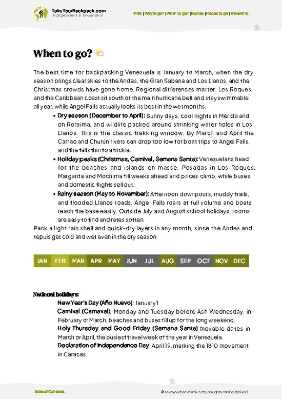
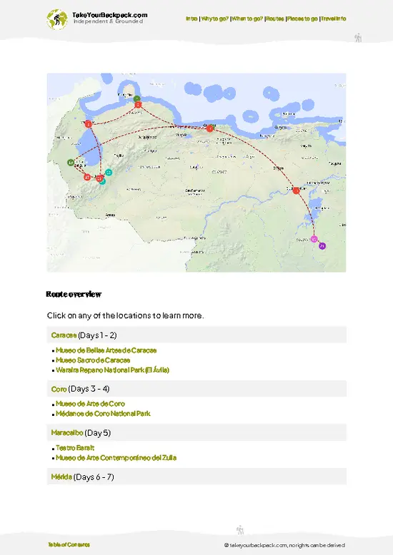
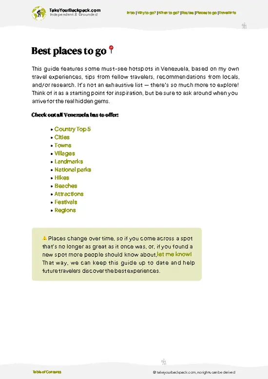
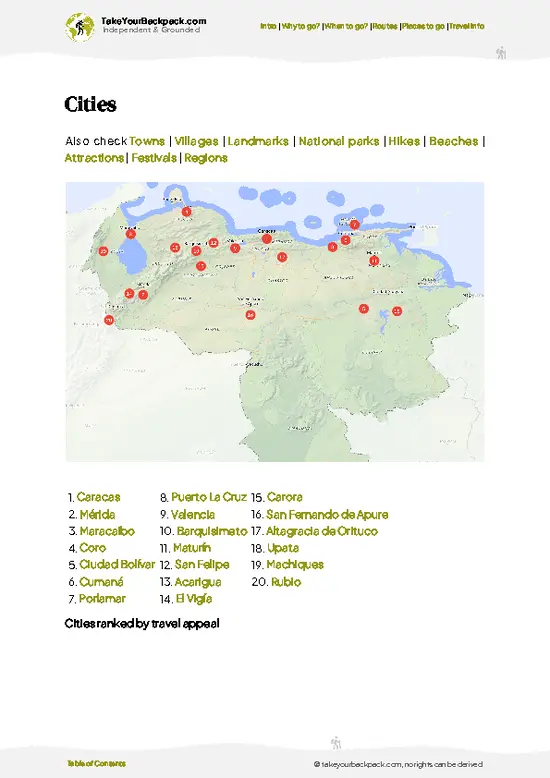
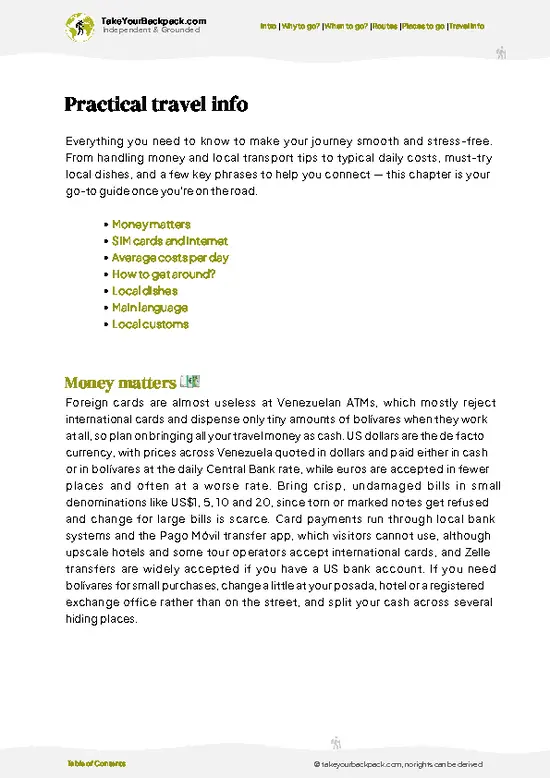
example page 0 from our offline Travel Guide for Venezuela
example page 1 from our offline Travel Guide for Venezuela
example page 2 from our offline Travel Guide for Venezuela
example page 3 from our offline Travel Guide for Venezuela
example page 4 from our offline Travel Guide for Venezuela
example page 5 from our offline Travel Guide for Venezuela
example page 6 from our offline Travel Guide for Venezuela
example page 7 from our offline Travel Guide for Venezuela
Loading the map 🌍
CLICK TO FILTER
cities
towns
villages
landmarks
national parks
hikes
beaches
attractions
festivals
regions
SHOW COUNTRY’S BESTSHOW ALL

✨ Why go?
Ranked #18 national park in Venezuela
The unique appeal for travelers

Perijá National Park draws backpackers who want cloud forest on the Colombian frontier without a single tour bus. Almost nobody else is on the ridges, so you choose your own pace and camp where farmers and guides point you. The terrain climbs from hot lowland ranch country to páramo-like peaks above 3,000 meters, giving real variety in a few days. This suits self-guided, Spanish-speaking travelers who are comfortable with improvised logistics. Formal tours barely exist, so independence is the only way in, ideally with a local contact from Machiques de Perijá or nearby villages.

💡 HighlightsMust-see experiences and standout moments

  1. Cloud forest of the Sierra de Perijá: dripping, moss-heavy forest on the upper slopes, with tree ferns, bromeliads and orchids.
  2. Páramo ridgelines: open, windy high terrain above the treeline with frailejón plants and long views toward Colombia.
  3. Río Negro valley: river headwaters with cold swimming holes and waterfalls fed by mountain rain.
  4. Bird watching: the range shelters endemic species and highland birds such as toucanets and tanagers, best at dawn.
  5. Yukpa communities: Indigenous Yukpa live around the park edges, and respectful visits arranged through local guides add cultural context.
  6. Coffee farms of the foothills: small plantations where you can taste freshly roasted beans and sleep on a farm.
  7. Lowland-to-highland transect: a climb through several vegetation belts in a single trek, from dry forest
… read more 👉
  1. Cloud forest of the Sierra de Perijá: dripping, moss-heavy forest on the upper slopes, with tree ferns, bromeliads and orchids.
  2. Páramo ridgelines: open, windy high terrain above the treeline with frailejón plants and long views toward Colombia.
  3. Río Negro valley: river headwaters with cold swimming holes and waterfalls fed by mountain rain.
  4. Bird watching: the range shelters endemic species and highland birds such as toucanets and tanagers, best at dawn.
  5. Yukpa communities: Indigenous Yukpa live around the park edges, and respectful visits arranged through local guides add cultural context.
  6. Coffee farms of the foothills: small plantations where you can taste freshly roasted beans and sleep on a farm.
  7. Lowland-to-highland transect: a climb through several vegetation belts in a single trek, from dry forest to mist.
Combine a dawn bird walk in the cloud forest with an afternoon at a Río Negro waterfall swimming hole.
Spotted a mistake or missing something? Contact us.

🌤️ When to go?Seasonal considerations and timing

  • Dry Season (December to March): Skies are clearest and trails firmest. Days reach 24 to 30°C (75 to 86°F) in the foothills, while nights above 2,500 m (8,200 ft) drop to 2 to 8°C (36 to 46°F). Daylight lasts about 11.5 to 12.5 hours.
  • Wet Season (April to November): Afternoon storms, mud and swollen rivers are routine, and cloud hides the Sierra ridgelines. Rain eases slightly in July and August.
  • Holidays: Carnival and Semana Santa bring local crowds and higher transport and lodging prices in Machiques and Maracaibo.
Start hikes at dawn, since cloud builds by midday even in the dry months.

source: climatestotravel.comJANJanuary: excellent for travelingFEBFebruary: excellent for travelingMARMarch: excellent for travelingAPRApril: excellent for travelingMAYMay: good for travelingJUNJune: fair for travelingJULJuly: fair for travelingAUGAugust: fair for travelingSEPSeptember: good for travelingOCTOctober: good for travelingNOVNovember: good for travelingDECDecember: excellent for traveling
when-to-go

✈️ The backpacker research shortcutVenezuela Travel Guide

An offline-friendly backpacking guide with optimized travel routes, ranked highlights, transport advice, and the best areas to stay.
example page 0 from our offline Travel Guide for Venezuela
example page 1 from our offline Travel Guide for Venezuela
example page 2 from our offline Travel Guide for Venezuela
example page 3 from our offline Travel Guide for Venezuela
example page 4 from our offline Travel Guide for Venezuela
example page 5 from our offline Travel Guide for Venezuela
example page 6 from our offline Travel Guide for Venezuela
example page 7 from our offline Travel Guide for Venezuela
The digital guide (290 pages) contains:
✅ 91 highlights, ranked by travel appeal
✅ Optimized 5, 10 & 15-day travel routes
✅ Cities, national parks, landmarks, beaches
✅ How to get around
✅ Offline-friendly for travel without Wi-Fi
👉 Click to see all 30+ guide features

📅 Plan smarter in minutes, not weeks
✅ Month by month travel advice
✅ Festivals & national holidays
✅ Budget expectations

🗺️ Go to the right places, skip the overrated ones
✅ Honest pros & cons of destinations
✅ Top hikes, parks & viewpoints
✅ Lesser-known places most travelers miss
✅ Clear “worth it vs skip it” guidance

🛏️ Travel smoothly without rookie mistakes
✅ Best areas to stay
✅ Transport systems explained simply
✅ Common scams & safety advice
✅ SIM cards, money & practical tips

🌍 Understand the country, not just visit it
✅ Culture & traditions
✅ 52 Essential phrases & customs
✅ Festivals worth planning around
✅ Traveler-friendly historical context
✅ Insights that make places more meaningful

📱 Built for real travel conditions
✅ Fully downloadable PDF
✅ Works completely offline
✅ Optimized for phone use
✅ Useful in remote areas & buses
✅ Everything in one place
Stop searching, start planning
Get instant access to your full guide. 30‑day money-back guarantee.
+ Add another guide for just

By proceeding you agree to our terms.
Sent to your inbox immediately after payment • 100% Secure Checkout
Best Backpacking Travel Advisor 2025 tourism awardBest Backpacking
Travel Advisor
2025
What others say about Take Your Backpack Guides:
⭐⭐⭐⭐⭐
Fantastic, amazing amount of information!
⭐⭐⭐⭐⭐
My goodness this is amazing, it's what I've been looking for hats off too you!
⭐⭐⭐⭐⭐
I think this is absolutely BRILLIANT
⭐⭐⭐⭐
Very complete and informative. It's still missing places, but I gotta to commend you
⭐⭐⭐⭐⭐
This is truly amazing, thank you, can't wait to explore it with my kids!
⭐⭐⭐⭐⭐
Awesome resource, thank you!
⭐⭐⭐⭐⭐
This is amazing! Can't wait to explore the ones I haven't seen
⭐⭐⭐⭐
I love this! Well done, great idea.
⭐⭐⭐⭐⭐
Thanks for taking the time to make this gem!
⭐⭐⭐⭐⭐
This might be the best website I've ever seen.
⭐⭐⭐⭐⭐
Congratulations, and thank you so much for your work; it's incredibly valuable.
⭐⭐⭐⭐
In all seriousness I think you did a great job pointing out the important spots
⭐⭐⭐⭐⭐
10/10 very good
⭐⭐⭐⭐⭐
As someone who's only just starting to visit regularly this is awesome, thank you.
⭐⭐⭐⭐
Thank you very much! I'm going to visit my dad, it's going to be very useful!
⭐⭐⭐⭐⭐
This is really cool! We'll be travelling for the first time and this definitely come in handy.
⭐⭐⭐⭐⭐
You are now our minister of culture, congratulations 👨‍💼
⭐⭐⭐⭐⭐
Just wanted to tell you that this is a pearl! Going to follow your recommendations.
⭐⭐⭐⭐⭐
This is so cool. I'll definitely be using the resource for my travels soon.
⭐⭐⭐⭐⭐
This is very impressive! Good work.
⭐⭐⭐⭐⭐
This is an amazing and informative site. Very well done!

🛏️ Where to stay?Where staying makes the most sense

No developed lodging or campgrounds exist inside Perijá National Park, so most backpackers sleep in Machiques de Perijá, the main gateway town, where simple posadas run US$10 to 25 a night. Maracaibo, a few hours by road, has more hostels and hotels (US$15 to 40) and works for stocking up and arranging transport. Villages near the foothills, such as those along the road toward Kasmera and Los Angeles del Tokuko, sometimes offer a basic room or a hammock spot with a local family. Wild camping is the norm on multi-day treks, so carry a tent and filter. Arrange guides and permits in advance, because … read more 👉
No developed lodging or campgrounds exist inside Perijá National Park, so most backpackers sleep in Machiques de Perijá, the main gateway town, where simple posadas run US$10 to 25 a night. Maracaibo, a few hours by road, has more hostels and hotels (US$15 to 40) and works for stocking up and arranging transport. Villages near the foothills, such as those along the road toward Kasmera and Los Angeles del Tokuko, sometimes offer a basic room or a hammock spot with a local family. Wild camping is the norm on multi-day treks, so carry a tent and filter. Arrange guides and permits in advance, because the park is remote and has little tourist infrastructure.

👛 Costs (as of 19 October 2026)Travel costs and budget guide for Sierra de Perijá

Expect to spend about US$55 a day on a guided trip to Perijá National Park. Costs rise sharply because guides and transport are essential.
CategoryBudget RangeLocal Reality
Entrance/PermitsUS$0 to 5Official fees are minimal, but permission from local authorities or communities may be needed.
Accommodation (high season)US$10 to 25Posadas in Machiques; wild camping on treks is free.
Local TransportUS$5 to 15Shared taxis and jeeps from Machiques; fares are often paid in bolívares or cash dollars.
Food/SuppliesUS$6 to 12Bakeries and small restaurants in town; bring trail food.
GuideUS$15 to 30Hired locally, with cost shared among a group.
Total Daily BudgetUS$55Per person, per day, in high season.
⚠️ Prices can change and everyone travels differently, so take this as a rough guide. Hope it helps you plan your adventure!

🥾 TrailsPlan your hike in Sierra de Perijá: routes, terrain, and sights

Perijá National Park has no signed, managed trail network, so walks follow farm tracks, mule paths and river valleys that local guides know. Most routes start at foothill villages and climb steadily through coffee plots into cloud forest.
  • Foothill farm tracks: half-day to full-day walks, easy to moderate, through coffee, cattle land and secondary forest.
  • Cloud forest ascents: one to two days up, steep, muddy and slippery, with dense fog and good birdlife.
  • High ridge treks: multi-day, hard, with cold nights, exposed páramo and no reliable water on some stretches.
  • River valley walks: moderate, with
… read more 👉
Perijá National Park has no signed, managed trail network, so walks follow farm tracks, mule paths and river valleys that local guides know. Most routes start at foothill villages and climb steadily through coffee plots into cloud forest.
  • Foothill farm tracks: half-day to full-day walks, easy to moderate, through coffee, cattle land and secondary forest.
  • Cloud forest ascents: one to two days up, steep, muddy and slippery, with dense fog and good birdlife.
  • High ridge treks: multi-day, hard, with cold nights, exposed páramo and no reliable water on some stretches.
  • River valley walks: moderate, with repeated crossings and waterfall stops, risky after heavy rain.
Wildlife includes howler monkeys, tapirs in remote zones, and many birds. Reaching the park means a bus to Machiques or nearby towns, then local jeeps or hired transport on rough roads. Crowds are essentially nonexistent. No meaningful entrance system exists, but guides expect payment. Check the security situation near the border before leaving, bring a water filter, and carry cash in bolívares or dollars.
⚠️ Hiking info can sometimes be outdated or inaccurate. Before you hit the trail, check the latest conditions with locals. If you do spot anything that's off, I'd love to hear from you, so I can update it for fellow travelers.

🛡️ SafetySafety Tips and Common Scams in Sierra de Perijá

Perijá National Park is remote, undeveloped and has no rescue network, so go with a local guide. Trails are steep, muddy and often unmarked, and river crossings swell fast after afternoon rain. Nights at altitude are cold, so pack a proper sleeping bag and rain shell. Carry a filter, offline maps and spare food. The border zone has smuggling and armed-group activity, so check current conditions in Machiques before setting out and avoid traveling after dark. Snakes and insects are the usual wildlife concerns; wear boots and keep your food sealed.

FAQCommon questions from travelers

Plan on 3 to 5 days for Perijá National Park if you want to reach the high Sierra. A day trip from Machiques only covers the foothills. Multi-day treks into the cloud forest need a guide and a tent, and the approach takes most of a day by road.
Going without a car is possible but slow in Perijá National Park. Shared taxis and buses run from Maracaibo to Machiques de Perijá in roughly 1.5 to 2.5 hours, and from there you hire a jeep or local driver to reach trailheads. Expect to pay about US$10 to 30 for the last leg.
Perijá National Park has no formal ticket booth, and entry costs are minimal, around US$0 to 5 where charged. Permission from Inparques or local communities is advisable, particularly for overnight treks. Arrange it in Machiques or Maracaibo before heading out, and carry ID.
⚠️ Things can change over time, so always validate details locally before you go.

Other Venezuelan national parks near Sierra de Perijá

Explore more nearby:


💡 Not sure where to go next?
Create a personalized itinerary for Venezuela including Sierra de Perijá and the places that fit your trip.

Generate my itinerary

👉 Discover all national parks

Or checkout all Venezuela has to offer (think cities, towns, villages, national parks, hikes, beaches, festivals)
Country photo of Venezuela

We 💚 feedbackWhat to keep in mind

Travelers often show up at Perijá National Park with no guide and no cash, then find nobody to lead them up the ridges. Arrange a local guide in Machiques first, bring small US dollar bills, and pack for cold rain.

✍️ Help improve this page!
The information on this page is based on in-depth research, insights shared by experienced travelers, and feedback from the local travel community in Venezuela. While every effort is made to keep the information accurate and current, conditions can change — so if you spot anything incorrect or outdated, please get in touch.


🙋‍♂️ Give feedback

👋 Meet the founderWho’s Behind Take Your Backpack?

Johan, backpacker and founder of TakeYourBackpackHi, I’m Johan (Netherlands 🇳🇱), the creator of TakeYourBackpack. Over the past 3 decades, I’ve backpacked through 90+ countries across six continents, gaining extensive experience with independent travel, long-term trips, and overland routes.

This site is built on a combination of firsthand travel experience and carefully curated insights from other backpackers. Many guides are based on places I’ve personally visited, while others bring together tips, observations, and practical advice shared by trusted travelers I’ve met along the way.

The goal is to provide realistic, experience-driven guidance — not generic itineraries — so you can explore destinations with better context, clearer expectations, and more confidence.