×

Venezuela🇻🇪 | national parksSierra de La Culata National ParkFrailejón páramo, glacial lagoons, condor cliffs, highland hamlets | things to do and best time to go

Explore Sierra Nevada National ParkExplore Cueva del Guácharo National Park

Backpacking in Sierra de La Culata
🌟 Highlightnational park ranked #10
By Johan Kruseman 🇳🇱 | Updated October 19, 2026

The big decision is whether to hike up from Mérida city on your own or hire a guide for the high páramo, and the weather and your altitude tolerance tip it: go guided above 4,000 meters, solo below. Sierra de La Culata National Park sits in the Andes of western Venezuela, running north of Mérida city. It offers frailejón-covered moorland, glacial lakes and condors, plus quiet trails. Roads are rough, fuel is hard to find, and cold mist arrives by midday, so start before 7 a.m. and carry a real jacket. Skip the lower cloud-forest roads if you want views. It suits fit, self-reliant hikers who like cold, empty heights. It won’t suit anyone wanting facilities, easy transport or beach-weather comfort.

Discover everything you want to know in the 📖 Venezuela Travel Guide.
Safety warning

The current risk level for Venezuela is high. Check the advice before going.


example page 0 from our offline Travel Guide for Venezuela
example page 1 from our offline Travel Guide for Venezuela
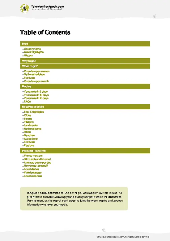
example page 2 from our offline Travel Guide for Venezuela
example page 3 from our offline Travel Guide for Venezuela
example page 4 from our offline Travel Guide for Venezuela
example page 5 from our offline Travel Guide for Venezuela
example page 6 from our offline Travel Guide for Venezuela
example page 7 from our offline Travel Guide for Venezuela
Loading the map 🌍
CLICK TO FILTER
cities
towns
villages
landmarks
national parks
hikes
beaches
attractions
festivals
regions
SHOW COUNTRY’S BESTSHOW ALL

✨ Why go?
Ranked #10 national park in Venezuela
What makes this national park worth exploring

Sierra de La Culata National Park works for backpackers because Mérida is the base, and the park starts right above the city. You can ride the Teleférico de Mérida to the high stations or head up toward the páramo on your own, with no permit-heavy tour package needed for the main routes. Trail variety is the second reason: the park covers 2,004 km² across Mérida and Trujillo, so you can pick a day walk through frailejón country or a multi-day trek to glacial-origin lagoons such as Laguna de La Calzona. Guides are easy to hire in Mérida if you want company on the longer routes, and prices are low compared with Andean parks elsewhere. The park suits people who like cold, thin air and big empty slopes more than polished visitor centers.

💡 HighlightsWhat this place is best known for

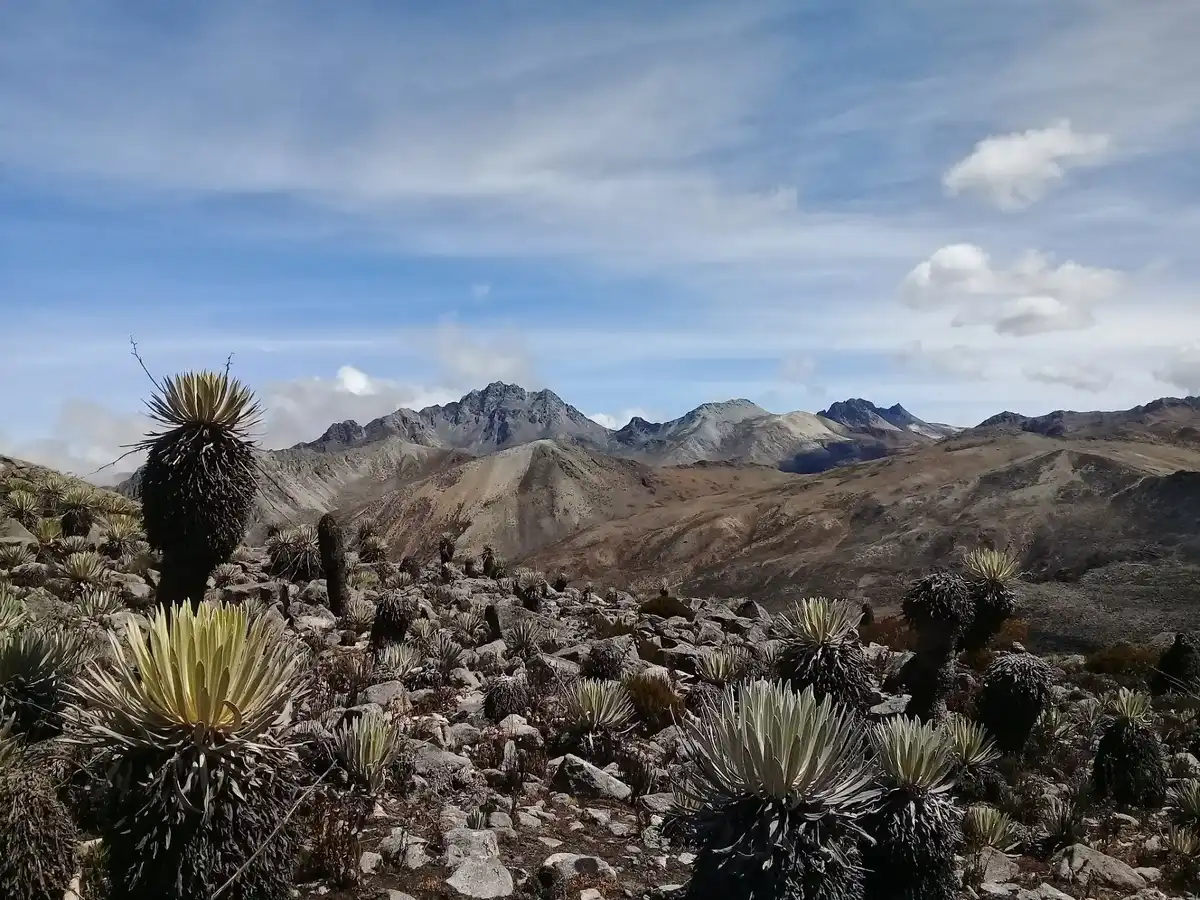
  1. Páramo de La Culata: the high plateau above the treeline, covered in frailejones, the silver-leaved plants that define the Venezuelan Andes. Wind, mist and long views are standard.
  2. Laguna de La Calzona: a remote high lagoon reached on a demanding trek. It is cold, quiet and surrounded by rock and tussock grass.
  3. Laguna Las Iglesias: another glacial lake in the high country, good for travelers who want a camp with few neighbors.
  4. Frailejón fields: Espeletia plants grow slowly and stand like furry candles on the slopes. Early light on the leaves is worth the cold start.
  5. Mountain views toward the Sierra Nevada: on clear days the high ridges look across the valley to the snow-capped peaks of the neighboring range, including Pico Bolívar.
  6. Andean cloud forest edges: lower slopes hold mossy trees, ferns
… read more 👉
  1. Páramo de La Culata: the high plateau above the treeline, covered in frailejones, the silver-leaved plants that define the Venezuelan Andes. Wind, mist and long views are standard.
  2. Laguna de La Calzona: a remote high lagoon reached on a demanding trek. It is cold, quiet and surrounded by rock and tussock grass.
  3. Laguna Las Iglesias: another glacial lake in the high country, good for travelers who want a camp with few neighbors.
  4. Frailejón fields: Espeletia plants grow slowly and stand like furry candles on the slopes. Early light on the leaves is worth the cold start.
  5. Mountain views toward the Sierra Nevada: on clear days the high ridges look across the valley to the snow-capped peaks of the neighboring range, including Pico Bolívar.
  6. Andean cloud forest edges: lower slopes hold mossy trees, ferns and bromeliads. Birders can look for hummingbirds and tanagers.
  7. Highland villages on the park fringe: farming hamlets with potato and vegetable terraces, where stone walls and wool ponchos are everyday sights.
  8. Andean condor country: the high cliffs belong to the region where Andean condors have been reintroduced, so look up on windless days.
Sierra de La Culata National Park pairs the páramo walk with the frailejón fields easily in one day, since the fields line the same high route.
Spotted a mistake or missing something? Contact us.
🌤️ When to go?When to go for the best experience

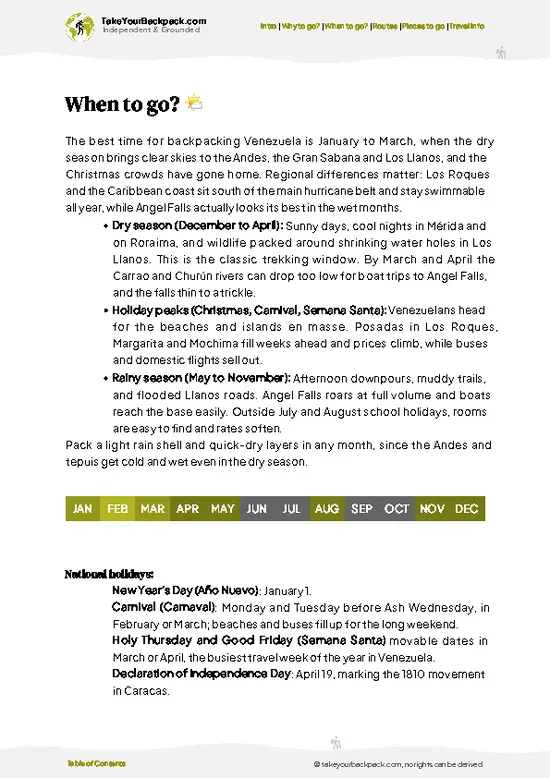
  • Dry Season (December to March): Clear mornings and the best views of the Mérida snow-capped peaks. Days reach 12 to 18°C (54 to 64°F) at 3,000 m, nights drop to 0 to 5°C (32 to 41°F), with frost on the páramo above 3,500 m.
  • Wet Season (May to October): Afternoon cloud and rain are routine, trails turn muddy and visibility closes in by midday. Highs sit around 10 to 15°C (50 to 59°F).
  • Holidays (Christmas, Carnival, Easter): Venezuelan families fill Mérida, so beds and rides cost more and fill up.
  • Daylight: Roughly 11.5 to 12.5 hours all year, so start hiking by 7 a.m.
Start every hike at first light, since cloud usually builds by noon in any season.

source: climatestotravel.comJANJanuary: highly recommended for travelingFEBFebruary: highly recommended for travelingMARMarch: excellent for travelingAPRApril: excellent for travelingMAYMay: fair for travelingJUNJune: fair for travelingJULJuly: fair for travelingAUGAugust: fair for travelingSEPSeptember: fair for travelingOCTOctober: fair for travelingNOVNovember: fair for travelingDECDecember: highly recommended for traveling
venezuela-national-park-sierra-de-la-culata-national-park
© Google | Giovanny G.

✈️ The backpacker research shortcutVenezuela Travel Guide

An offline-friendly backpacking guide with optimized travel routes, ranked highlights, transport advice, and the best areas to stay.
example page 0 from our offline Travel Guide for Venezuela
example page 1 from our offline Travel Guide for Venezuela
example page 2 from our offline Travel Guide for Venezuela
example page 3 from our offline Travel Guide for Venezuela
example page 4 from our offline Travel Guide for Venezuela
example page 5 from our offline Travel Guide for Venezuela
example page 6 from our offline Travel Guide for Venezuela
example page 7 from our offline Travel Guide for Venezuela
The digital guide (290 pages) contains:
✅ 91 highlights, ranked by travel appeal
✅ Optimized 5, 10 & 15-day travel routes
✅ Cities, national parks, landmarks, beaches
✅ How to get around
✅ Offline-friendly for travel without Wi-Fi
👉 Click to see all 30+ guide features

📅 Plan smarter in minutes, not weeks
✅ Month by month travel advice
✅ Festivals & national holidays
✅ Budget expectations

🗺️ Go to the right places, skip the overrated ones
✅ Honest pros & cons of destinations
✅ Top hikes, parks & viewpoints
✅ Lesser-known places most travelers miss
✅ Clear “worth it vs skip it” guidance

🛏️ Travel smoothly without rookie mistakes
✅ Best areas to stay
✅ Transport systems explained simply
✅ Common scams & safety advice
✅ SIM cards, money & practical tips

🌍 Understand the country, not just visit it
✅ Culture & traditions
✅ 52 Essential phrases & customs
✅ Festivals worth planning around
✅ Traveler-friendly historical context
✅ Insights that make places more meaningful

📱 Built for real travel conditions
✅ Fully downloadable PDF
✅ Works completely offline
✅ Optimized for phone use
✅ Useful in remote areas & buses
✅ Everything in one place
Stop searching, start planning
Get instant access to your full guide. 30‑day money-back guarantee.
+ Add another guide for just

By proceeding you agree to our terms.
Sent to your inbox immediately after payment • 100% Secure Checkout
Best Backpacking Travel Advisor 2025 tourism awardBest Backpacking
Travel Advisor
2025
What others say about Take Your Backpack Guides:
⭐⭐⭐⭐⭐
Fantastic, amazing amount of information!
⭐⭐⭐⭐⭐
My goodness this is amazing, it's what I've been looking for hats off too you!
⭐⭐⭐⭐⭐
I think this is absolutely BRILLIANT
⭐⭐⭐⭐
Very complete and informative. It's still missing places, but I gotta to commend you
⭐⭐⭐⭐⭐
This is truly amazing, thank you, can't wait to explore it with my kids!
⭐⭐⭐⭐⭐
Awesome resource, thank you!
⭐⭐⭐⭐⭐
This is amazing! Can't wait to explore the ones I haven't seen
⭐⭐⭐⭐
I love this! Well done, great idea.
⭐⭐⭐⭐⭐
Thanks for taking the time to make this gem!
⭐⭐⭐⭐⭐
This might be the best website I've ever seen.
⭐⭐⭐⭐⭐
Congratulations, and thank you so much for your work; it's incredibly valuable.
⭐⭐⭐⭐
In all seriousness I think you did a great job pointing out the important spots
⭐⭐⭐⭐⭐
10/10 very good
⭐⭐⭐⭐⭐
As someone who's only just starting to visit regularly this is awesome, thank you.
⭐⭐⭐⭐
Thank you very much! I'm going to visit my dad, it's going to be very useful!
⭐⭐⭐⭐⭐
This is really cool! We'll be travelling for the first time and this definitely come in handy.
⭐⭐⭐⭐⭐
You are now our minister of culture, congratulations 👨‍💼
⭐⭐⭐⭐⭐
Just wanted to tell you that this is a pearl! Going to follow your recommendations.
⭐⭐⭐⭐⭐
This is so cool. I'll definitely be using the resource for my travels soon.
⭐⭐⭐⭐⭐
This is very impressive! Good work.
⭐⭐⭐⭐⭐
This is an amazing and informative site. Very well done!

🛏️ Where to stay?How to pick the right area

Mérida city is the practical base, about 1 to 1.5 hours by road from the park's main access points, and it has the widest range of hostels and posadas. Dorm beds and simple posadas run US$8 to 25 a night, and many include breakfast and can arrange guides and transport. Nothing resembling a hostel operates inside Sierra de La Culata National Park itself, so plan to sleep outside or camp with a tent at your own risk and with proper cold-weather gear.
Closer to the park, the mountain villages of La Culata, Mucuchíes-side hamlets and Jají offer family-run posadas and cabins for roughly US$15 to 40. … read more 👉
Mérida city is the practical base, about 1 to 1.5 hours by road from the park's main access points, and it has the widest range of hostels and posadas. Dorm beds and simple posadas run US$8 to 25 a night, and many include breakfast and can arrange guides and transport. Nothing resembling a hostel operates inside Sierra de La Culata National Park itself, so plan to sleep outside or camp with a tent at your own risk and with proper cold-weather gear.
Closer to the park, the mountain villages of La Culata, Mucuchíes-side hamlets and Jají offer family-run posadas and cabins for roughly US$15 to 40. Tabay, a short ride from Mérida, sits at the foot of the road toward the high páramo and suits early starts. Book ahead for holiday weekends. Carry cash in US dollars in small bills, because card machines often fail in smaller villages.

👛 Costs (as of 19 October 2026)Money, prices, and spending tips

Expect roughly US$36 to 103 a day for Sierra de La Culata National Park, with a typical backpacker total near US$60 when staying in a Mérida hostel and hiring a guide only occasionally.
CategoryBudget RangeLocal Reality
Entrance feesUS$0 to 3Small or no fee at some access points; carry small bills.
Accommodation (high season)US$10 to 30Hostel dorms and posadas in Mérida or Tabay; prices rise at holidays.
Local transportUS$3 to 20Shared jeeps and buses to trailheads are cheap; private jeeps cost more.
Food and suppliesUS$8 to 20Arepas, soups and trout from local kitchens; stock up in Mérida.
GuidesUS$15 to 30Optional but wise for páramo routes and multi-day treks.
Total Daily BudgetUS$36 to 103Mid-range figure around US$60 for one day.


source: venezuelatuya.com
⚠️ Prices can change and everyone travels differently, so take this as a rough guide. Hope it helps you plan your adventure!

🥾 TrailsScenic routes and wildlife spotting in Sierra de La Culata

Sierra de La Culata National Park is best known for high-altitude walking, with terrain that moves from farmland and cloud forest to open páramo above roughly 3,000 meters. Altitude is the main difficulty, so a day in Mérida before climbing helps.
  • Páramo day walks: Routes start from the villages above Mérida and climb through potato fields into frailejón slopes. Expect 5 to 8 hours round trip, moderate to hard because of the thin air and steep, muddy paths.
  • Laguna de La Calzona trek: A multi-day route into the high lake country, with rocky terrain, river crossings and cold nights. Hard difficulty,
… read more 👉
Sierra de La Culata National Park is best known for high-altitude walking, with terrain that moves from farmland and cloud forest to open páramo above roughly 3,000 meters. Altitude is the main difficulty, so a day in Mérida before climbing helps.
  • Páramo day walks: Routes start from the villages above Mérida and climb through potato fields into frailejón slopes. Expect 5 to 8 hours round trip, moderate to hard because of the thin air and steep, muddy paths.
  • Laguna de La Calzona trek: A multi-day route into the high lake country, with rocky terrain, river crossings and cold nights. Hard difficulty, and a local guide is strongly advised because the paths are faint.
  • Laguna Las Iglesias route: A demanding high trek to a glacial lagoon, usually done over 2 to 3 days with a tent. Expect boggy ground, strong wind and rapid weather changes.
  • Wildlife: Andean condors, spectacled bears (rarely seen), hummingbirds and páramo birds live here. Early starts give the best chances.
Getting there is straightforward: local buses and shared taxis run from Mérida to the mountain villages that serve as trailheads, though the last stretches may need a hired jeep. Crowds are thin, even on weekends, with most people staying near the cable car area. Entry rules and fees vary by access point, and rangers or guides in Mérida can clarify the current arrangements. Bring warm layers, rain gear and sun protection, since conditions can change within an hour.
⚠️ Hiking info can sometimes be outdated or inaccurate. Before you hit the trail, check the latest conditions with locals. If you do spot anything that's off, I'd love to hear from you, so I can update it for fellow travelers.

🛡️ SafetySafety Tips and Common Scams in Sierra de La Culata

Altitude is the main issue here, since trails climb above 3,500 m and 4,000 m where headaches and fatigue hit newcomers. Spend a night or two in Mérida first, drink plenty of water and walk slowly. Weather turns fast: cold wind, fog and rain arrive by early afternoon, so carry a warm layer, a waterproof shell and gloves even on sunny mornings. Páramo trails are often unmarked and fog makes navigation hard, so hire a local guide for longer routes and download offline maps. Wildlife is low-risk; you may spot Andean condors or spectacled bears only rarely, so keep your distance. Robberies have occurred on isolated routes, so avoid hiking alone, keep valuables minimal and tell your posada your plans.

FAQTraveler FAQ

Plan on two to three days for Sierra de La Culata National Park. One day covers a páramo walk from the Mérida side, while a second or third lets you add a longer trek toward the high lagoons. Allow an extra day in Mérida first to adjust to altitude above 3,000 m.
Yes, Sierra de La Culata National Park is reachable without a car from Mérida. Shared jeeps and local buses run to villages such as La Culata and Tabay for roughly US$1 to 5, taking about 45 minutes to 1.5 hours. Private jeeps with drivers cost about US$30 to 60 a day for remote trailheads.
Sierra de La Culata National Park has little or no fixed entrance charge at most access points, though small local fees of up to about US$3 can apply. Some routes request registration with park rangers (INPARQUES), and guides are advisable for longer treks. Carry your passport and small US dollar bills in case a checkpoint asks for payment.
⚠️ Things can change over time, so always validate details locally before you go.

Other Venezuelan national parks near Sierra de La Culata

Explore more nearby:


💡 Not sure where to go next?
Create a personalized itinerary for Venezuela including Sierra de La Culata and the places that fit your trip.

Generate my itinerary

👉 Discover all national parks

Or checkout all Venezuela has to offer (think cities, towns, villages, national parks, hikes, beaches, festivals)
Country photo of Venezuela

We 💚 feedbackSumming up the experience

Sierra de La Culata National Park pairs well with a route through Mérida and onward to the Sierra Nevada, using Mérida as your gear-and-rest stop between two high-altitude hikes. I would keep the hike here to a clear morning and bring a warm hat for the afternoon chill.

✍️ Help improve this page!
The information on this page is based on in-depth research, insights shared by experienced travelers, and feedback from the local travel community in Venezuela. While every effort is made to keep the information accurate and current, conditions can change — so if you spot anything incorrect or outdated, please get in touch.


🙋‍♂️ Give feedback

👋 Meet the founderWho’s Behind Take Your Backpack?

Johan, backpacker and founder of TakeYourBackpackHi, I’m Johan (Netherlands 🇳🇱), the creator of TakeYourBackpack. Over the past 3 decades, I’ve backpacked through 90+ countries across six continents, gaining extensive experience with independent travel, long-term trips, and overland routes.

This site is built on a combination of firsthand travel experience and carefully curated insights from other backpackers. Many guides are based on places I’ve personally visited, while others bring together tips, observations, and practical advice shared by trusted travelers I’ve met along the way.

The goal is to provide realistic, experience-driven guidance — not generic itineraries — so you can explore destinations with better context, clearer expectations, and more confidence.