×

Australia🇦🇺 | hikesHeysen Trail1,200 km, sectional walking, Flinders Ranges, dry stretches | things to do and best time to go

Explore Great Ocean WalkExplore Kings Canyon Rim Walk

Backpacking in Heysen Trail
👍 Recommendedhike ranked #7
By Johan Kruseman 🇳🇱 | Updated October 15, 2026

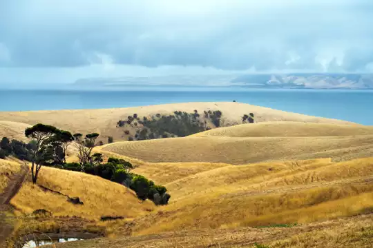
Most travelers assume the Heysen Trail is a single weekend walk, but it runs about 1,200 kilometers and is walked in sections. It starts at Cape Jervis and finishes at Parachilna Gorge in the Flinders Ranges, in South Australia, Australia. The northern stretch near Wilpena and Mount Remarkable has the best views, and it also has the longest gaps between water tanks. The distances are big, the shade is small, and the sheep are unimpressed by your itinerary. When I walked a ridge here, the loudest thing for an hour was the dry rattle of wind in gum leaves and a distant, indignant galah. Camp only in permitted spots, carry far more water than feels sensible, and check fire bans and trail closures before booking anything, because a closed section can wreck a tight schedule and a nonrefundable shuttle. Book your ride to the trailhead, and carry the printed maps.

Discover everything you want to know in the 📖 Australia Travel Guide.
Best time to go: March - November
Duration: 60 days
Distance: 1200 kilometers
Total ascent: 28000 meters


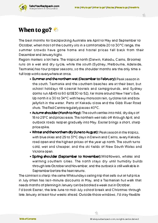
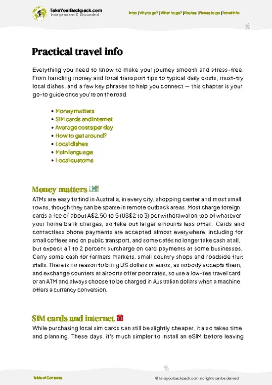
example page 0 from our offline Travel Guide for Australia
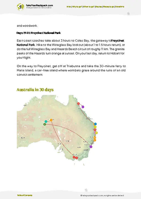
example page 1 from our offline Travel Guide for Australia
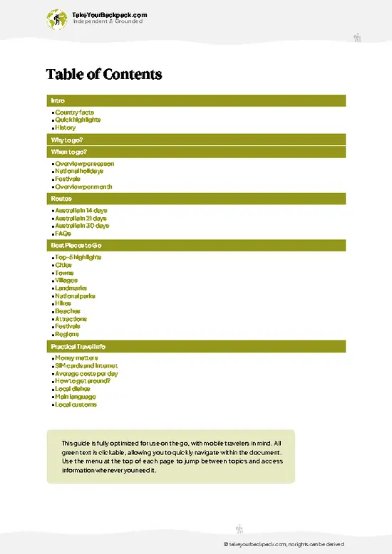
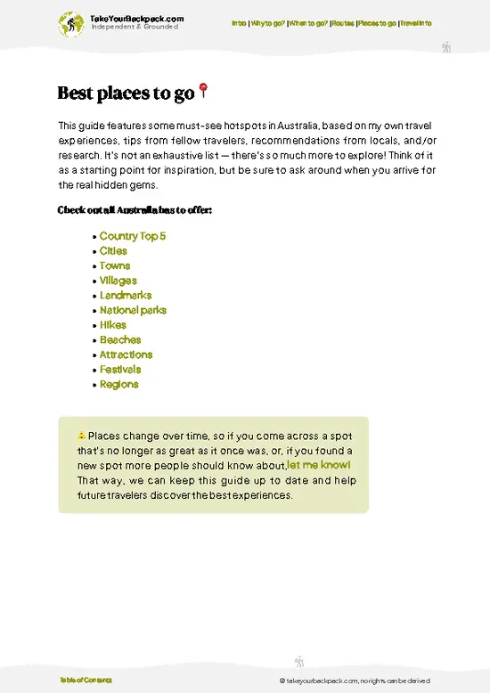
example page 2 from our offline Travel Guide for Australia
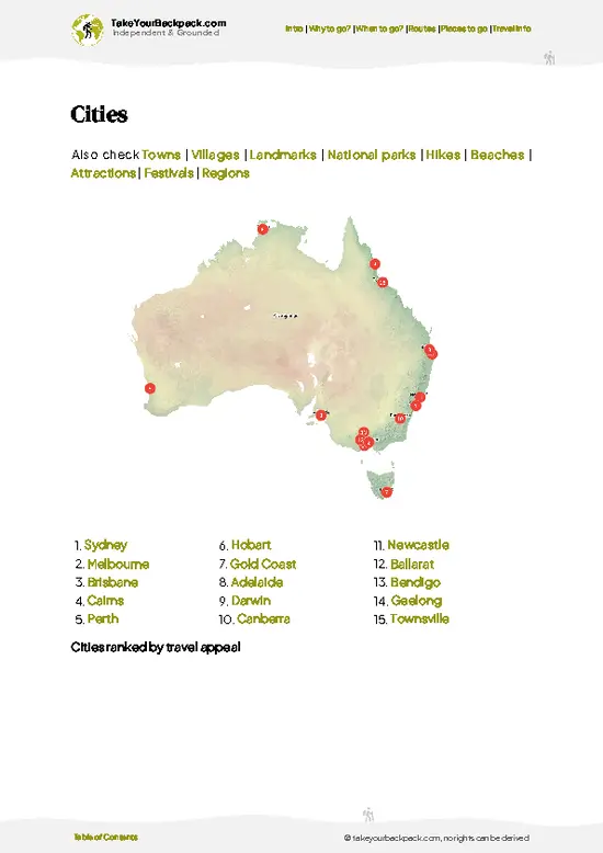
example page 3 from our offline Travel Guide for Australia
example page 4 from our offline Travel Guide for Australia
example page 5 from our offline Travel Guide for Australia
example page 6 from our offline Travel Guide for Australia
example page 7 from our offline Travel Guide for Australia
Loading the map 🌍
CLICK TO FILTER
cities
towns
villages
landmarks
national parks
hikes
beaches
attractions
festivals
regions
SHOW COUNTRY’S BESTSHOW ALL

✨ Why go?
Ranked #7 hike in Australia
The unique appeal for travelers

Backpackers come for the way the Heysen lets you pick your own size of adventure. You can walk a long day or a fortnight, then rejoin the route months later at the same signpost. The scenery shifts dramatically, from Fleurieu coast and Adelaide Hills farmland to the red, folded ranges near Wilpena Pound. Few Australian trails give you that much variety without a plane ticket between chapters. It is also cheap to walk. Camping on the trail is mostly low cost or free at designated huts and sites, and hut-to-hut planning keeps you light. The Heysen also fits neatly into a longer South Australia route, tying together Adelaide, the Barossa and the Flinders Ranges. You can step off at a small town for a pub meal, restock, and carry on. That flexibility, plus the Mount Remarkable climbs and big sky, is what keeps people returning.

💡 HighlightsWhat this place is best known for

  1. Wilpena Pound: A vast natural amphitheater of quartzite ranges in the Flinders Ranges. The trail climbs to ridgelines with huge views over the basin and the dry plains beyond.
  2. Mount Remarkable National Park: Steep gorges, eucalyptus forest and rock pools near Melrose. It is a rewarding stretch with a cool, shaded feel compared with the open north.
  3. Cape Jervis: The southern start of the trail, with a sign marking the beginning of the long walk. Coastal cliffs and sea breezes make a fitting first morning.
  4. Adelaide Hills sections: Rolling farmland, stringybark forest and small villages like Kuitpo and Hahndorf nearby. Walks are gentle, with good places for a pub lunch or bakery stop.
  5. Parachilna Gorge: The northern end of the trail, where rocky creek beds cut through red hills. Rock wallabies sometimes
… read more 👉
  1. Wilpena Pound: A vast natural amphitheater of quartzite ranges in the Flinders Ranges. The trail climbs to ridgelines with huge views over the basin and the dry plains beyond.
  2. Mount Remarkable National Park: Steep gorges, eucalyptus forest and rock pools near Melrose. It is a rewarding stretch with a cool, shaded feel compared with the open north.
  3. Cape Jervis: The southern start of the trail, with a sign marking the beginning of the long walk. Coastal cliffs and sea breezes make a fitting first morning.
  4. Adelaide Hills sections: Rolling farmland, stringybark forest and small villages like Kuitpo and Hahndorf nearby. Walks are gentle, with good places for a pub lunch or bakery stop.
  5. Parachilna Gorge: The northern end of the trail, where rocky creek beds cut through red hills. Rock wallabies sometimes appear on the slopes at dusk.
For a first visit, Wilpena Pound gives the most spectacular scenery for a day or two of walking.
Spotted a mistake or missing something? Contact us.

🌤️ When to go?Seasonal considerations and timing

  • Winter (June to August): Heysen Trail walkers get the best stretch for the Flinders Ranges in the cool, green months. Days run 12 to 18°C (54 to 64°F), nights can fall to 2 to 5°C (36 to 41°F), and daylight lasts about 10 hours.
  • Spring (September to November): Wildflowers and creek flow peak, with days of 18 to 26°C (64 to 79°F). School holidays bring more walkers and higher hut and campsite demand.
  • Summer (December to February): Days often reach 35 to 42°C (95 to 108°F), water sources dry up, and fire bans apply. Sections on private land close for the whole fire danger season, from November or December to April or May. Skip it.
  • Autumn (March to May): Days of 20 to 28°C (68 to 82°F) settle in from April, with about 11 to 12 hours of light and quiet trails.
Start walking in late June if you want empty trails, cold mornings and full creeks.

source: climatestotravel.comJANJanuary: fair for travelingFEBFebruary: fair for travelingMARMarch: highly recommended for travelingAPRApril: excellent for travelingMAYMay: excellent for travelingJUNJune: good for travelingJULJuly: good for travelingAUGAugust: good for travelingSEPSeptember: excellent for travelingOCTOctober: excellent for travelingNOVNovember: highly recommended for travelingDECDecember: fair for traveling
when-to-go

✈️ The backpacker research shortcutAustralia Travel Guide

An offline-friendly backpacking guide with optimized travel routes, ranked highlights, transport advice, and the best areas to stay.
example page 0 from our offline Travel Guide for Australia
example page 1 from our offline Travel Guide for Australia
example page 2 from our offline Travel Guide for Australia
example page 3 from our offline Travel Guide for Australia
example page 4 from our offline Travel Guide for Australia
example page 5 from our offline Travel Guide for Australia
example page 6 from our offline Travel Guide for Australia
example page 7 from our offline Travel Guide for Australia
The digital guide (414 pages) contains:
✅ 143 highlights, ranked by travel appeal
✅ Optimized 14, 21 & 30-day travel routes
✅ Cities, national parks, landmarks, beaches
✅ How to get around
✅ Offline-friendly for travel without Wi-Fi
👉 Click to see all 30+ guide features

📅 Plan smarter in minutes, not weeks
✅ Month by month travel advice
✅ Festivals & national holidays
✅ Budget expectations

🗺️ Go to the right places, skip the overrated ones
✅ Honest pros & cons of destinations
✅ Top hikes, parks & viewpoints
✅ Lesser-known places most travelers miss
✅ Clear “worth it vs skip it” guidance

🛏️ Travel smoothly without rookie mistakes
✅ Best areas to stay
✅ Transport systems explained simply
✅ Common scams & safety advice
✅ SIM cards, money & practical tips

🌍 Understand the country, not just visit it
✅ Culture & traditions
✅ Local customs
✅ Festivals worth planning around
✅ Traveler-friendly historical context
✅ Insights that make places more meaningful

📱 Built for real travel conditions
✅ Fully downloadable PDF
✅ Works completely offline
✅ Optimized for phone use
✅ Useful in remote areas & buses
✅ Everything in one place
Stop searching, start planning
Get instant access to your full guide. 30‑day money-back guarantee.
+ Add another guide for just

By proceeding you agree to our terms.
Sent to your inbox immediately after payment • 100% Secure Checkout
Best Backpacking Travel Advisor 2025 tourism awardBest Backpacking
Travel Advisor
2025
What others say about Take Your Backpack Guides:
⭐⭐⭐⭐⭐
Fantastic, amazing amount of information!
⭐⭐⭐⭐⭐
My goodness this is amazing, it's what I've been looking for hats off too you!
⭐⭐⭐⭐⭐
I think this is absolutely BRILLIANT
⭐⭐⭐⭐
Very complete and informative. It's still missing places, but I gotta to commend you
⭐⭐⭐⭐⭐
This is truly amazing, thank you, can't wait to explore it with my kids!
⭐⭐⭐⭐⭐
Awesome resource, thank you!
⭐⭐⭐⭐⭐
This is amazing! Can't wait to explore the ones I haven't seen
⭐⭐⭐⭐
I love this! Well done, great idea.
⭐⭐⭐⭐⭐
Thanks for taking the time to make this gem!
⭐⭐⭐⭐⭐
This might be the best website I've ever seen.
⭐⭐⭐⭐⭐
Congratulations, and thank you so much for your work; it's incredibly valuable.
⭐⭐⭐⭐
In all seriousness I think you did a great job pointing out the important spots
⭐⭐⭐⭐⭐
10/10 very good
⭐⭐⭐⭐⭐
As someone who's only just starting to visit regularly this is awesome, thank you.
⭐⭐⭐⭐
Thank you very much! I'm going to visit my dad, it's going to be very useful!
⭐⭐⭐⭐⭐
This is really cool! We'll be travelling for the first time and this definitely come in handy.
⭐⭐⭐⭐⭐
You are now our minister of culture, congratulations 👨‍💼
⭐⭐⭐⭐⭐
Just wanted to tell you that this is a pearl! Going to follow your recommendations.
⭐⭐⭐⭐⭐
This is so cool. I'll definitely be using the resource for my travels soon.
⭐⭐⭐⭐⭐
This is very impressive! Good work.
⭐⭐⭐⭐⭐
This is an amazing and informative site. Very well done!

🛏️ Where to stay?Best areas to stay in Australia

If you enjoy meeting fellow travelers, consider choosing hostels with high ratings for atmosphere. On the other hand, if you prefer having your own space, a hotel might be a better option.

🥾 Hike detailsEverything you need to know before hiking Heysen Trail

Total Distance: About 1,200 kilometers from Cape Jervis to Parachilna Gorge, usually walked in sections.
Estimated Duration: Around 50 to 60 days for the whole trail. Most walkers choose one to seven day sections.
Difficulty: Moderate to hard. Navigation is straightforward with markers, but heat, exposed stretches and long gaps between water sources demand preparation.
Starting Point: Cape Jervis on the Fleurieu Peninsula, reached by road from Adelaide. Public transport to the start is limited, so arrange a shuttle or transfer in advance.
Major Landmarks:
  • Fleurieu Peninsula: Coastal cliffs and farmland
… read more 👉
Total Distance: About 1,200 kilometers from Cape Jervis to Parachilna Gorge, usually walked in sections.
Estimated Duration: Around 50 to 60 days for the whole trail. Most walkers choose one to seven day sections.
Difficulty: Moderate to hard. Navigation is straightforward with markers, but heat, exposed stretches and long gaps between water sources demand preparation.
Starting Point: Cape Jervis on the Fleurieu Peninsula, reached by road from Adelaide. Public transport to the start is limited, so arrange a shuttle or transfer in advance.
Major Landmarks:
  • Fleurieu Peninsula: Coastal cliffs and farmland near the start.
  • Adelaide Hills: Forest tracks and small towns.
  • Mount Remarkable: Gorges and forested slopes.
  • Wilpena Pound: The big ridgelines of the Flinders Ranges.
Terrain and Scenery: Coastal paths, farm tracks, forest trails and rocky ridges. The north is open, dry and wide-skied, with red rock and creek beds.
Vegetation: Eucalypt woodland, native pine, grasses and saltbush. Spring brings wildflowers in many areas.
Wildlife: Kangaroos, emus, echidnas and yellow-footed rock wallabies in the north. Birdlife includes galahs, wedge-tailed eagles and parrots. Snakes are active in warm weather.
⚠️ Hiking info can sometimes be outdated or inaccurate. Before you hit the trail, check the latest conditions with locals. If you do spot anything that's off, I'd love to hear from you, so I can update it for fellow travelers.

🛡️ SafetySafety Tips and Common Scams in Heysen Trail

The main hazards on the Heysen Trail around the Flinders Ranges are heat, scarce water and fire. Carry at least 4 to 6 liters per person on remote sections, since many creeks and tanks run dry for months. Walk in the cooler months, start at first light, and check the Country Fire Service fire danger ratings before setting out, because the trail closes on total fire ban days. Ridge tops are exposed with little shade, so pack a hat, sunscreen and long sleeves. Footing is rocky and loose on steep ascents. The red Heysen Trail markers can be sparse, so carry maps and a GPS. Snakes are active in warm weather, so watch your step and give them space. Mobile coverage is patchy, so tell someone your itinerary and bring a personal locator beacon.

FAQTraveler FAQ

The full Heysen Trail takes about 8 to 12 weeks to walk end to end, covering roughly 1,200 kilometers from Cape Jervis to Parachilna Gorge. Most backpackers walk sections instead, such as a 5 to 7 day stretch through the Flinders Ranges near Wilpena Pound. Daily distances typically run 15 to 25 kilometers.
Difficulty ranges from moderate to hard, depending on the section and season. Flinders Ranges stretches have steep, rocky climbs and exposed ridges with limited shade, and water resupply is the real challenge. Walkers should be comfortable carrying 4 to 6 liters of water and covering 15 to 25 kilometers a day.
No guide is needed, but you must plan carefully, as the trail is self-guided and marked with arrows. The Heysen Trail is free to walk on public land. Camping at designated sites costs roughly A$5 to 15 per night, and you should check for fire closures before every section.
⚠️ Things can change over time, so always validate details locally before you go.

Other Australian hikes near Heysen Trail

Explore more nearby:


💡 Not sure where to go next?
Create a personalized itinerary for Australia including Heysen Trail and the places that fit your trip.

Generate my itinerary

👉 Discover all hikes

Or checkout all Australia has to offer (think cities, towns, villages, national parks, hikes, beaches, festivals)
Country photo of Australia

We 💚 feedbackKey takeaways before you go

The Heysen suits walkers who like slow progress, big skies and the satisfaction of finishing a long route in pieces. If you want constant dramatic peaks, skip the farmland sections. I would pick Wilpena and Mount Remarkable first, carry extra water, and treat the rest as a bonus.

✈️ When did I visit Australia?
On my trip to New Zealand in 1993, I had a short stop in Australia as well.

✍️ Help improve this page!
The information on this page is based on my own backpacking experience in Australia, supplemented with up-to-date research and feedback from other travelers. Travel details can change, so if you notice anything outdated or incomplete, feel free to let me know.


🙋‍♂️ Give feedback

👋 Meet the founderWho’s Behind Take Your Backpack?

Johan, backpacker and founder of TakeYourBackpackHi, I’m Johan (Netherlands 🇳🇱), the creator of TakeYourBackpack. Over the past 3 decades, I’ve backpacked through 90+ countries across six continents, gaining extensive experience with independent travel, long-term trips, and overland routes.

This site is built on a combination of firsthand travel experience and carefully curated insights from other backpackers. Many guides are based on places I’ve personally visited, while others bring together tips, observations, and practical advice shared by trusted travelers I’ve met along the way.

The goal is to provide realistic, experience-driven guidance — not generic itineraries — so you can explore destinations with better context, clearer expectations, and more confidence.