
×
Larapinta Trail

Australia🇦🇺 | hikesLarapinta Trailred rock ridges, West MacDonnell Ranges, dry riverbeds, remote campsites | things to do and best time to go

Explore Kings Canyon Rim WalkExplore Overland Track

Backpacking in Larapinta Trail
🏆 Top pickhike ranked #2
By Johan Kruseman 🇳🇱 | Updated September 4, 2026

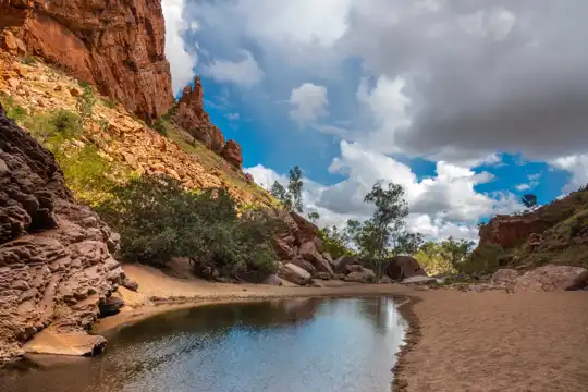
Your first real Larapinta decision hits before your boots touch dirt: do you commit to the full 223 km end‑to‑end, or cherry‑pick a few sections and keep your sanity (and toenails)? It matters, because this trail, running west from Alice Springs through the West MacDonnell Ranges in Central Australia, doesn’t care about your ego. The Larapinta is big-sky desert: red ridgelines, ghost gums, dry riverbeds, and gorges that feel carved with a knife. It’s logistically friendly by outback standards—trailheads link back to Alice via shuttles and limited public transport—but once you’re out there, it’s exposed, hot, and mentally grinding. Compared with nearby day hikes like Ormiston Gorge or Kings Canyon, Larapinta is the long, slow burn: less instant payoff, far deeper satisfaction. I still remember dropping into Serpentine Gorge after a brutal, sun-blasted ridge walk; that first plunge into cold water felt like a religious experience.

Discover everything you want to know in the 📖 Australia Travel Guide.
Best time to go: April - October
Duration: 12 to 14 days
Distance: 223 kilometers
Total ascent: 3,000 meters
Loading the map 🌍
CLICK TO FILTER
cities
towns
villages
landmarks
national parks
hikes
beaches
attractions
festivals
regions
SHOW COUNTRY’S BESTSHOW ALL

✨ Why go?
Ranked #2 hike in Australia
Why visitors keep coming back

The Larapinta Trail is a magnet for backpackers craving a mix of challenge and reward. Stretching over 223 kilometers through the West MacDonnell Ranges, this trail offers a scenery-to-effort ratio that’s hard to beat. You’ll sweat it out on rugged paths, but each ascent reveals jaw-dropping views of ochre cliffs and sprawling valleys that make every step worth it.

Getting here is a breeze. Public transport access from Alice Springs is straightforward, with shuttles and buses whisking you to various trailheads. Plus, it’s budget-friendly; you can camp along the way without breaking the bank. The trail’s layout allows for flexible distances, so you can tailor your hike to your pace—whether you’re a weekend warrior or a seasoned trekker.

What’s more, the Larapinta fits seamlessly into a longer … read more 👉
The Larapinta Trail is a magnet for backpackers craving a mix of challenge and reward. Stretching over 223 kilometers through the West MacDonnell Ranges, this trail offers a scenery-to-effort ratio that’s hard to beat. You’ll sweat it out on rugged paths, but each ascent reveals jaw-dropping views of ochre cliffs and sprawling valleys that make every step worth it.

Getting here is a breeze. Public transport access from Alice Springs is straightforward, with shuttles and buses whisking you to various trailheads. Plus, it’s budget-friendly; you can camp along the way without breaking the bank. The trail’s layout allows for flexible distances, so you can tailor your hike to your pace—whether you’re a weekend warrior or a seasoned trekker.

What’s more, the Larapinta fits seamlessly into a longer backpacking route across Australia. You can easily hop from the trail to other iconic spots, making it a perfect pit stop. The burn in your legs transforms into a cold beer at the end of the day, and that’s the real reward.
Want to include Larapinta Trail in your Australia route?
Create a personalized Australia itinerary that includes Larapinta Trail and the places that fit your trip — based on your travel style, budget, and available time. Get your route in seconds.

Generate my trip

💡 HighlightsTop highlights of Larapinta Trail

  1. Mount Sonder (summit) — The high point of the trail and the payoff for several long days: sweeping 360° views over the MacDonnell Ranges, brilliant sunrise/sunset colours and a real sense of remoteness. You earn those panoramas by walking alpine-like ridgelines and watching the landscape change from red rock to spinifex; it’s the “mountain moment” that makes Larapinta feel epic compared with most day-hikes.
  2. Ormiston Gorge and Ormiston Pound — A massive, bowl-like gorge with a reliable waterhole, layered cliffs and great birdwatching; it’s geology on display. The Pound’s amphitheatre shape creates dramatic light, shelter for wildlife, and one of the best swimming/rest stops on the trail — perfect for cooling off and spotting wedge-tailed eagles or perentie lizards.
  3. Simpsons Gap — One of
read more 👉
  1. Mount Sonder (summit) — The high point of the trail and the payoff for several long days: sweeping 360° views over the MacDonnell Ranges, brilliant sunrise/sunset colours and a real sense of remoteness. You earn those panoramas by walking alpine-like ridgelines and watching the landscape change from red rock to spinifex; it’s the “mountain moment” that makes Larapinta feel epic compared with most day-hikes.
  2. Ormiston Gorge and Ormiston Pound — A massive, bowl-like gorge with a reliable waterhole, layered cliffs and great birdwatching; it’s geology on display. The Pound’s amphitheatre shape creates dramatic light, shelter for wildlife, and one of the best swimming/rest stops on the trail — perfect for cooling off and spotting wedge-tailed eagles or perentie lizards.
  3. Simpsons Gap — One of those instantly recognisable red-rock gaps with a shady waterhole tucked in; it’s right near the trailhead and a classic introduction to the ranges. Dawn or dusk are the times to watch for black-footed rock-wallabies hopping the ledges — small encounters that stick with you longer than any panorama.
  4. Ochre Pits — A short detour with big cultural meaning: a multi-coloured band of ochre used for generations by the Western Arrernte people. It’s visually striking and a rare chance on the trail to touch a living cultural site, so slow down, read the signs, and treat it respectfully.
  5. Redbank Gorge — A narrow, steep-walled gorge near the trail’s western end where the cliffs grab the light and the water feels glorious after a long day. It’s quieter and more sculpted than some of the bigger pools, and evenings there have a surprisingly intimate, cinematic quality — great for a soak and watching rock shadows crawl.
Spotted a mistake or missing something? Contact us.

Things to do near Larapinta Trail

Ratings based on Tripadvisor reviews. When you book through this link, you support our work at no extra cost to you.

🌤️ When to go?Seasonal considerations and timing


  • Weather: The Larapinta Trail bakes under brutal heat in summer, often soaring above 40°C (104°F). This isn’t just uncomfortable—it’s dangerous. Winter months, from May to September, bring dry, crisp air and daytime temps between 20-25°C (68-77°F), perfect for pounding the red dirt without frying.

  • Temperature: Nights can plunge below freezing in winter, dipping to around 0°C (32°F), so pack layers. Summer nights barely cool off, sticking near 25°C (77°F), making sleep a sweaty challenge.

  • Daylight Hours: Winter offers shorter days—about 10 hours of light—meaning you need to start early and keep moving. Summer stretches daylight to 14 hours, but the heat demands slower pacing and midday breaks.

  • Crowds: Peak season is winter, when backpackers flood in chasing mild weather. Trails feel
read more 👉

  • Weather: The Larapinta Trail bakes under brutal heat in summer, often soaring above 40°C (104°F). This isn’t just uncomfortable—it’s dangerous. Winter months, from May to September, bring dry, crisp air and daytime temps between 20-25°C (68-77°F), perfect for pounding the red dirt without frying.

  • Temperature: Nights can plunge below freezing in winter, dipping to around 0°C (32°F), so pack layers. Summer nights barely cool off, sticking near 25°C (77°F), making sleep a sweaty challenge.

  • Daylight Hours: Winter offers shorter days—about 10 hours of light—meaning you need to start early and keep moving. Summer stretches daylight to 14 hours, but the heat demands slower pacing and midday breaks.

  • Crowds: Peak season is winter, when backpackers flood in chasing mild weather. Trails feel alive but not packed. Shoulder seasons see fewer hikers, offering solitude but riskier weather swings.

  • Seasonal Activities: Winter aligns with local festivals and Aboriginal cultural events, adding layers to your trek beyond the landscape. Summer’s off-season means fewer distractions but also fewer services open.

  • Price Fluctuations: Expect higher accommodation and tour prices in winter due to demand. Booking early can lock in better rates; summer offers bargains but at the cost of comfort and safety.


Pro-tip: Hit the trail in late May or early June—cool days, cold nights, fewer crowds, and the landscape’s burnt orange hues at their peak.


source: climatestotravel.comJANJanuary: below average for travelingFEBFebruary: below average for travelingMARMarch: fair for travelingAPRApril: good for travelingMAYMay: excellent for travelingJUNJune: excellent for travelingJULJuly: excellent for travelingAUGAugust: excellent for travelingSEPSeptember: highly recommended for travelingOCTOctober: good for travelingNOVNovember: fair for travelingDECDecember: below average for traveling
Australia - the Larapinta Trail

✈️ The backpacker research shortcutAustralia Travel Guide

An offline-friendly backpacking guide with optimized travel routes, ranked highlights, transport advice, and the best areas to stay.
example page 0 from our offline Travel Guide for Australia
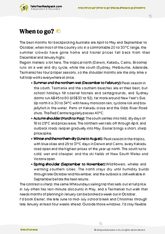
example page 1 from our offline Travel Guide for Australia
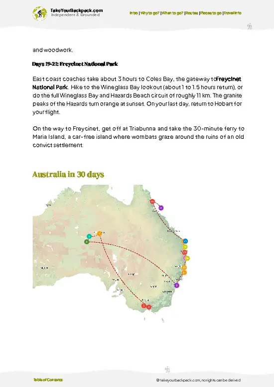
example page 2 from our offline Travel Guide for Australia
example page 3 from our offline Travel Guide for Australia
example page 4 from our offline Travel Guide for Australia
example page 5 from our offline Travel Guide for Australia
example page 6 from our offline Travel Guide for Australia
example page 7 from our offline Travel Guide for Australia
The digital guide (544 pages) contains:
149 highlights, ranked by travel appeal
Optimized 14, 21 & 30-day travel routes
Cities, national parks, landmarks, beaches
How to get around
Offline-friendly for travel without Wi-Fi
👉 Click to see all 30+ guide features

📅 Plan smarter in minutes, not weeks
Month by month travel advice
Festivals & national holidays
Budget expectations

🗺️ Go to the right places, skip the overrated ones
Honest pros & cons of destinations
Top hikes, parks & viewpoints
Lesser-known places most travelers miss
Clear “worth it vs skip it” guidance

🛏️ Travel smoothly without rookie mistakes
Best areas to stay
Transport systems explained simply
Common scams & safety advice
SIM cards, money & practical tips

🌍 Understand the country, not just visit it
Culture & traditions
Local customs
Festivals worth planning around
Traveler-friendly historical context
Insights that make places more meaningful

📱 Built for real travel conditions
Fully downloadable PDF
Works completely offline
Optimized for phone use
Useful in remote areas & buses
Everything in one place
Save weeks of stressful planning
Get instant access to your full guide. 30‑day money-back guarantee.
+ Add another guide for just US$7.80

By proceeding you agree to our terms.
Sent to your inbox immediately after payment • 100% Secure Checkout
Best Backpacking Travel Advisor 2025 tourism awardBest Backpacking
Travel Advisor
2025
What others say about Take Your Backpack Guides:
⭐⭐⭐⭐⭐
Fantastic, amazing amount of information!
⭐⭐⭐⭐⭐
My goodness this is amazing, it's what I've been looking for hats off too you!
⭐⭐⭐⭐⭐
I think this is absolutely BRILLIANT
⭐⭐⭐⭐
Very complete and informative. It's still missing places, but I gotta to commend you
⭐⭐⭐⭐⭐
This is truly amazing, thank you, can't wait to explore it with my kids!
⭐⭐⭐⭐⭐
Awesome resource, thank you!
⭐⭐⭐⭐⭐
This is amazing! Can't wait to explore the ones I haven't seen
⭐⭐⭐⭐
I love this! Well done, great idea.
⭐⭐⭐⭐⭐
Thanks for taking the time to make this gem!
⭐⭐⭐⭐⭐
This might be the best website I've ever seen.
⭐⭐⭐⭐⭐
Congratulations, and thank you so much for your work; it's incredibly valuable.
⭐⭐⭐⭐
In all seriousness I think you did a great job pointing out the important spots
⭐⭐⭐⭐⭐
10/10 very good
⭐⭐⭐⭐⭐
As someone who's only just starting to visit regularly this is awesome, thank you.
⭐⭐⭐⭐
Thank you very much! I'm going to visit my dad, it's going to be very useful!
⭐⭐⭐⭐⭐
This is really cool! We'll be travelling for the first time and this definitely come in handy.
⭐⭐⭐⭐⭐
You are now our minister of culture, congratulations 👨‍💼
⭐⭐⭐⭐⭐
Just wanted to tell you that this is a pearl! Going to follow your recommendations.
⭐⭐⭐⭐⭐
This is so cool. I'll definitely be using the resource for my travels soon.
⭐⭐⭐⭐⭐
This is very impressive! Good work.
⭐⭐⭐⭐⭐
This is an amazing and informative site. Very well done!

🛏️ Where to stay?Best areas to stay in Australia

If you enjoy meeting fellow travelers, consider choosing hostels with high ratings for atmosphere. On the other hand, if you prefer having your own space, a hotel might be a better option.

🥾 Hike detailsA practical overview of the hike

Total Distance: The Larapinta Trail stretches about 223 kilometers (139 miles) from Alice Springs to Mount Sonder, making it one of the longest and most famous trails in Australia.

Estimated Duration: Most hikers take around 12 to 14 days to complete the trail, depending on your pace and how many side trips you decide to take.

Difficulty Level: This trail is considered challenging. Expect steep climbs, rocky terrain, and sometimes extreme weather conditions. It’s not a walk in the park, but if you’re up for it, the views are worth the effort.

Starting Point: The trail kicks off in Alice Springs. … read more 👉
Total Distance: The Larapinta Trail stretches about 223 kilometers (139 miles) from Alice Springs to Mount Sonder, making it one of the longest and most famous trails in Australia.

Estimated Duration: Most hikers take around 12 to 14 days to complete the trail, depending on your pace and how many side trips you decide to take.

Difficulty Level: This trail is considered challenging. Expect steep climbs, rocky terrain, and sometimes extreme weather conditions. It’s not a walk in the park, but if you’re up for it, the views are worth the effort.

Starting Point: The trail kicks off in Alice Springs. You can easily get there by public transport. Take a bus from major cities like Darwin or Adelaide, or hop on a flight to Alice Springs Airport. From the airport, it’s a short taxi ride to the trailhead.

Major Landmarks Along the Route:
  • Simpsons Gap: A stunning gorge with towering cliffs and a waterhole, perfect for a cool dip.
  • Standley Chasm: Known for its dramatic rock formations and vibrant colors, especially at midday.
  • Ormiston Gorge: A great spot for swimming and wildlife watching, plus it has a beautiful lookout.
  • Mount Sonder: The highest peak in the West MacDonnell Ranges, offering breathtaking sunrise views.

Type of Terrain and Scenery: The trail features a mix of rugged ridges, sandy riverbeds, and rocky outcrops. You’ll hike through stunning landscapes, from red desert sands to lush riverbanks and dramatic cliffs. The scenery changes constantly, keeping things interesting.

Typical Vegetation and Wildlife:
  • Vegetation: Expect to see spinifex grass, ghost gums, and various shrubs. The flora varies significantly with elevation and moisture levels.
  • Wildlife: Keep an eye out for kangaroos, wallabies, and a variety of bird species, including emus and wedge-tailed eagles. Nighttime brings the chance to spot nocturnal critters like bilbies.

Pack plenty of water and snacks, and consider your timing—summer can be scorching, while winter nights can be pretty chilly. Happy hiking!
⚠️ Hiking info can sometimes be outdated or inaccurate. Before you hit the trail, check the latest conditions with locals. If you do spot anything that's off, I'd love to hear from you, so I can update it for fellow travelers.

🛡️ SafetyStaying Safe: What Travelers Should Know

The Larapinta Trail is a rugged beauty, but it demands respect. Weather can shift quickly; the sun scorches during the day, while nights can drop to chilly temps. Hydration is key—carry enough water and drink regularly. The terrain varies from rocky paths to steep ascents, so sturdy boots are non-negotiable. Navigation is straightforward, but keep an eye on trail markers; getting lost in the vastness can happen.

Wildlife encounters are part of the experience. You might spot kangaroos or the occasional snake. Keep your distance and don’t feed them; they’re wild and should stay that way.

Timing is crucial. Start early to beat the heat and plan for breaks. Trail etiquette matters—give way to those climbing up and keep noise to a minimum to soak in the serenity. Embrace the challenge, and when … read more 👉
The Larapinta Trail is a rugged beauty, but it demands respect. Weather can shift quickly; the sun scorches during the day, while nights can drop to chilly temps. Hydration is key—carry enough water and drink regularly. The terrain varies from rocky paths to steep ascents, so sturdy boots are non-negotiable. Navigation is straightforward, but keep an eye on trail markers; getting lost in the vastness can happen.

Wildlife encounters are part of the experience. You might spot kangaroos or the occasional snake. Keep your distance and don’t feed them; they’re wild and should stay that way.

Timing is crucial. Start early to beat the heat and plan for breaks. Trail etiquette matters—give way to those climbing up and keep noise to a minimum to soak in the serenity. Embrace the challenge, and when you reach those sweeping views, the effort will feel like a well-earned reward.

FAQCommon questions from travelers

The Larapinta Trail typically takes 12 to 14 days to complete the full 223-kilometer route. Most hikers plan for about two weeks to cover all 12 sections at a moderate pace. Some experienced hikers may finish faster, but 12-14 days is standard for a thorough experience.
The Larapinta Trail is rated as moderate to difficult due to its length, rugged terrain, and remote sections. Hikers should be prepared for steep climbs, rocky paths, and variable weather conditions, especially in the hotter months from October to March. Good fitness and hiking experience are recommended.
No guide is required to hike the Larapinta Trail, but permits are needed for camping in certain areas within the West MacDonnell National Park. Permits can be obtained from the Northern Territory Parks and Wildlife Commission, typically costing around AUD 20-30. Independent hiking is common, but guided tours are available for those who prefer support.
⚠️ Things can change over time, so always validate details locally before you go.

Other Australian hikes near Larapinta Trail

Explore more nearby:

  • Kings Canyon Rim Walk—sandstone domes, sheer cliffs, Garden of Eden, desert views| 95 km away
  • Heysen Trail—rolling hills, Flinders Ranges, native bushland, rural farmland| 1034 km away
  • Thorsborne Trail—tropical rainforest, granite peaks, secluded beaches, waterfalls| 1564 km away

💡 Not sure where to go next?
Create a personalized itinerary for Australia including Larapinta Trail and the places that fit your trip.

Generate my itinerary

👉 Discover all hikes

Or checkout all Australia has to offer (think cities, towns, villages, national parks, hikes, beaches, festivals)
Country photo of Australia

We 💚 feedbackSumming up the experience

The Larapinta Trail is a raw, unfiltered slice of Australia that demands your sweat but rewards you with jaw-dropping views of ochre landscapes and endless skies. You’ll feel the burn in your legs, but that first cold beer at the end? Worth every step. Just know: the isolation can be intense. Bring your own supplies and embrace the solitude; it’s part of the experience. This trail isn’t just a hike; it’s a rite of passage.

✈️ When did I visit Australia?
On my trip to New Zealand in 1993, I had a short stop in Australia as well.

✍️ Help improve this page!
The information on this page is based on my own backpacking experience in Australia, supplemented with up-to-date research and feedback from other travelers. Travel details can change, so if you notice anything outdated or incomplete, feel free to let me know.


🙋‍♂️ Give feedback

👋 Meet the founderWho’s Behind Take Your Backpack?

Johan, backpacker and founder of TakeYourBackpackHi, I’m Johan (Netherlands 🇳🇱), the creator of TakeYourBackpack. Over the past decade, I’ve backpacked through 80+ countries across six continents, gaining extensive experience with independent travel, long-term trips, and overland routes.

This site is built on a combination of firsthand travel experience and carefully curated insights from other backpackers. Many guides are based on places I’ve personally visited, while others bring together tips, observations, and practical advice shared by trusted travelers I’ve met along the way.

The goal is to provide realistic, experience-driven guidance — not generic itineraries — so you can explore destinations with better context, clearer expectations, and more confidence.

Get full Australia guide •
Instant download • 149 highlights • Full Offline guide