×
Overland Track

Australia🇦🇺 | hikesOverland Track65 km, button grass plains, Mount Ossa, permit season, hut-to-hut | things to do and best time to go

Explore Larapinta TrailExplore O’Shannassy Aqueduct Trail

Backpacking in Overland Track
🏆 Top pickhike ranked #1
By Johan Kruseman 🇳🇱 | Updated October 15, 2026

The big decision is when to go: in the booking season you need a permit and must walk north to south, Cradle Mountain to Lake St Clair, which suits the logistics and the downhill finish anyway. The Overland Track runs through Tasmania’s Central Highlands in Australia, roughly 65 kilometers of button grass plains, dolerite spires and pencil pine forest. It is gorgeous, hard to book, and weather swings from sunshine to sleet before lunch. Public transport to the trailheads is thin, so you rely on shuttles. At Windermere Hut a hot chocolate from a sachet in my own pack tasted like a sacrament. Unlike the shorter Cradle Valley day walks nearby, this one makes you carry a week of questionable decisions and dehydrated dinners, and you earn every view.

Discover everything you want to know in the 📖 Australia Travel Guide.
Best time to go: September - May
Duration: 6 days
Distance: 65 kilometers
Total ascent: 1500 meters


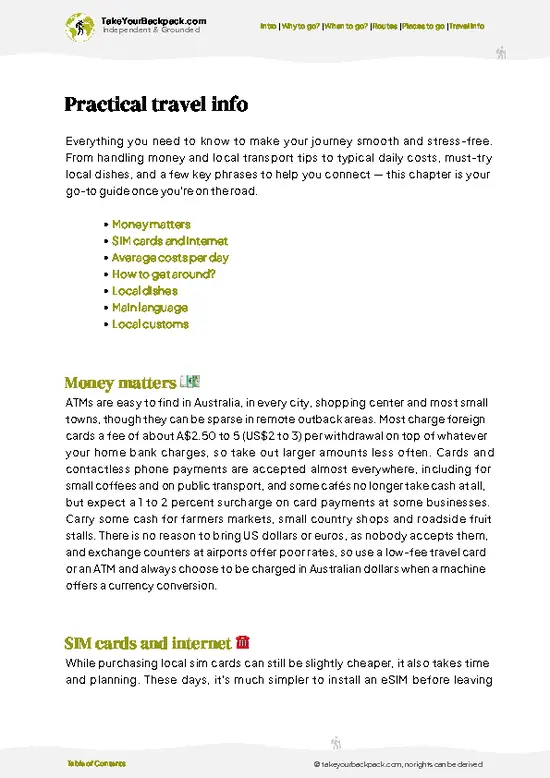
example page 0 from our offline Travel Guide for Australia
example page 1 from our offline Travel Guide for Australia
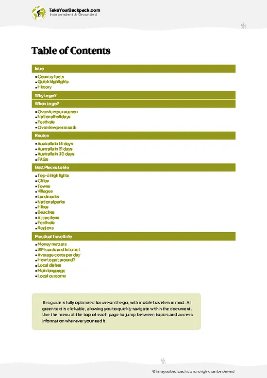
example page 2 from our offline Travel Guide for Australia
example page 3 from our offline Travel Guide for Australia
example page 4 from our offline Travel Guide for Australia
example page 5 from our offline Travel Guide for Australia
example page 6 from our offline Travel Guide for Australia
example page 7 from our offline Travel Guide for Australia
Loading the map 🌍
CLICK TO FILTER
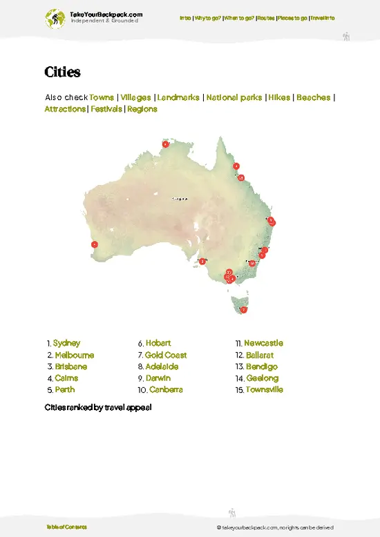
cities
towns
villages
landmarks
national parks
hikes
beaches
attractions
festivals
regions
SHOW COUNTRY’S BESTSHOW ALL

✨ Why go?
Ranked #1 hike in Australia
What sets this place apart

Backpackers chase the Overland Track for the sheer variety packed into a single week. In one walk you cross Cradle Mountain-Lake St Clair National Park, climb past alpine tarns, drop into mossy rainforest and finish beside Lake St Clair, Australia’s deepest freshwater lake. Few trails in the country change character that often.
The route is also unusually well organized. Huts with bunks and water tanks sit about a day apart, boardwalks keep boots out of the bog, and the walk runs one direction only, so you rarely meet anyone coming at you. That means a first multi-day hiker can manage it without a guide, while a veteran still gets a proper mountain traverse.
Flexibility helps too. Side trips such as Mount Ossa, Tasmania’s highest peak at 1,617 meters, add a bonus summit day if the cloud lifts. … read more 👉
Backpackers chase the Overland Track for the sheer variety packed into a single week. In one walk you cross Cradle Mountain-Lake St Clair National Park, climb past alpine tarns, drop into mossy rainforest and finish beside Lake St Clair, Australia’s deepest freshwater lake. Few trails in the country change character that often.
The route is also unusually well organized. Huts with bunks and water tanks sit about a day apart, boardwalks keep boots out of the bog, and the walk runs one direction only, so you rarely meet anyone coming at you. That means a first multi-day hiker can manage it without a guide, while a veteran still gets a proper mountain traverse.
Flexibility helps too. Side trips such as Mount Ossa, Tasmania’s highest peak at 1,617 meters, add a bonus summit day if the cloud lifts. Because the track starts and ends at roadside shuttle points, it fits neatly into a longer Tasmanian loop that includes Hobart, Launceston and the east coast beaches.

💡 HighlightsWhat this place is best known for

  1. Cradle Mountain and Marions Lookout: The start of the walk and the sight on every postcard. Marions Lookout gives a broad view over Dove Lake and the jagged dolerite crown of Cradle, and it is a steep, chain-assisted scramble in places.
  2. Mount Ossa: Tasmania’s highest point at 1,617 meters, reached by a side trail of a few hours return from the main track. On a clear day you see most of the park laid out below you, and on a bad day you see wet cloud.
  3. Pelion Plains and Mount Pelion West: Wide button grass flats ringed by peaks, with Pelion Hut as a handy base. Wombats graze here at dusk, and the summit side trip gives wide views over the central highlands.
  4. Waterfalls of the D’Alton, Fergusson and Hartnett Falls circuit: Short side walks off the track lead to three cascades in fern gullies. The
… read more 👉
  1. Cradle Mountain and Marions Lookout: The start of the walk and the sight on every postcard. Marions Lookout gives a broad view over Dove Lake and the jagged dolerite crown of Cradle, and it is a steep, chain-assisted scramble in places.
  2. Mount Ossa: Tasmania’s highest point at 1,617 meters, reached by a side trail of a few hours return from the main track. On a clear day you see most of the park laid out below you, and on a bad day you see wet cloud.
  3. Pelion Plains and Mount Pelion West: Wide button grass flats ringed by peaks, with Pelion Hut as a handy base. Wombats graze here at dusk, and the summit side trip gives wide views over the central highlands.
  4. Waterfalls of the D’Alton, Fergusson and Hartnett Falls circuit: Short side walks off the track lead to three cascades in fern gullies. The light is green and dim, the air smells of wet bark, and the contrast with the open plateau is sharp.
  5. Lake St Clair: The southern finish, the deepest freshwater lake in Australia, with a quiet shoreline and a ferry to cut the last 17 kilometers if your knees complain. Platypus sometimes surface in the shallows near the end.
Start with Cradle Mountain, because you will be there on day one anyway and the early clear mornings give the best chance of a clean view.
Spotted a mistake or missing something? Contact us.

Things to do near Overland Track

Ratings based on Tripadvisor reviews. When you book through this link, you support our work at no extra cost to you.

🌤️ When to go?Best time to hike the Overland Track

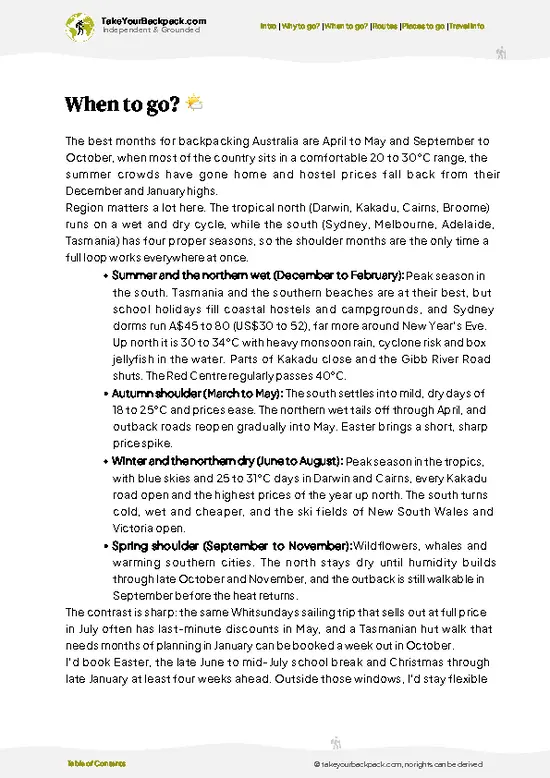
  • Peak Season (December to February): The warmest and most reliable window, with daytime highs of 15 to 22°C (59 to 72°F) and nights near 3 to 8°C (37 to 46°F). Daylight runs about 15 hours. The booking system caps walkers on the track, so expect full huts and campsites, and the highest fees.
  • Autumn (March to April): Cooler at 10 to 17°C (50 to 63°F), with crisp mornings, fewer people and the deciduous beech (fagus) turning gold in late April. Days shorten to about 11 to 12 hours.
  • Winter (June to August): Highs of 2 to 7°C (36 to 45°F), nights well below freezing, deep snow and about 9 hours of light. Only experienced snow walkers should go.
  • Spring (September to November): Thawing snow, mud, and wildflowers from November. Temperatures run 7 to 15°C (45 to 59°F), and the track is quiet until the
… read more 👉
  • Peak Season (December to February): The warmest and most reliable window, with daytime highs of 15 to 22°C (59 to 72°F) and nights near 3 to 8°C (37 to 46°F). Daylight runs about 15 hours. The booking system caps walkers on the track, so expect full huts and campsites, and the highest fees.
  • Autumn (March to April): Cooler at 10 to 17°C (50 to 63°F), with crisp mornings, fewer people and the deciduous beech (fagus) turning gold in late April. Days shorten to about 11 to 12 hours.
  • Winter (June to August): Highs of 2 to 7°C (36 to 45°F), nights well below freezing, deep snow and about 9 hours of light. Only experienced snow walkers should go.
  • Spring (September to November): Thawing snow, mud, and wildflowers from November. Temperatures run 7 to 15°C (45 to 59°F), and the track is quiet until the booking season begins.
Book your dates months ahead for summer, and consider a weekday start in March for the best balance of space and settled weather.


source: climatestotravel.comJANJanuary: excellent for travelingFEBFebruary: excellent for travelingMARMarch: highly recommended for travelingAPRApril: highly recommended for travelingMAYMay: good for travelingJUNJune: fair for travelingJULJuly: below average for travelingAUGAugust: below average for travelingSEPSeptember: good for travelingOCTOctober: highly recommended for travelingNOVNovember: highly recommended for travelingDECDecember: excellent for traveling
Australia - the Overland Track

✈️ The backpacker research shortcutAustralia Travel Guide

An offline-friendly backpacking guide with optimized travel routes, ranked highlights, transport advice, and the best areas to stay.
example page 0 from our offline Travel Guide for Australia
example page 1 from our offline Travel Guide for Australia
example page 2 from our offline Travel Guide for Australia
example page 3 from our offline Travel Guide for Australia
example page 4 from our offline Travel Guide for Australia
example page 5 from our offline Travel Guide for Australia
example page 6 from our offline Travel Guide for Australia
example page 7 from our offline Travel Guide for Australia
The digital guide (414 pages) contains:
✅ 143 highlights, ranked by travel appeal
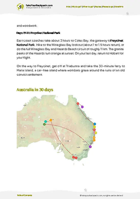
✅ Optimized 14, 21 & 30-day travel routes
✅ Cities, national parks, landmarks, beaches
✅ How to get around
✅ Offline-friendly for travel without Wi-Fi
👉 Click to see all 30+ guide features

📅 Plan smarter in minutes, not weeks
✅ Month by month travel advice
✅ Festivals & national holidays
✅ Budget expectations

🗺️ Go to the right places, skip the overrated ones
✅ Honest pros & cons of destinations
✅ Top hikes, parks & viewpoints
✅ Lesser-known places most travelers miss
✅ Clear “worth it vs skip it” guidance

🛏️ Travel smoothly without rookie mistakes
✅ Best areas to stay
✅ Transport systems explained simply
✅ Common scams & safety advice
✅ SIM cards, money & practical tips

🌍 Understand the country, not just visit it
✅ Culture & traditions
✅ Local customs
✅ Festivals worth planning around
✅ Traveler-friendly historical context
✅ Insights that make places more meaningful

📱 Built for real travel conditions
✅ Fully downloadable PDF
✅ Works completely offline
✅ Optimized for phone use
✅ Useful in remote areas & buses
✅ Everything in one place
Stop searching, start planning
Get instant access to your full guide. 30‑day money-back guarantee.
+ Add another guide for just

By proceeding you agree to our terms.
Sent to your inbox immediately after payment • 100% Secure Checkout
Best Backpacking Travel Advisor 2025 tourism awardBest Backpacking
Travel Advisor
2025
What others say about Take Your Backpack Guides:
⭐⭐⭐⭐⭐
Fantastic, amazing amount of information!
⭐⭐⭐⭐⭐
My goodness this is amazing, it's what I've been looking for hats off too you!
⭐⭐⭐⭐⭐
I think this is absolutely BRILLIANT
⭐⭐⭐⭐
Very complete and informative. It's still missing places, but I gotta to commend you
⭐⭐⭐⭐⭐
This is truly amazing, thank you, can't wait to explore it with my kids!
⭐⭐⭐⭐⭐
Awesome resource, thank you!
⭐⭐⭐⭐⭐
This is amazing! Can't wait to explore the ones I haven't seen
⭐⭐⭐⭐
I love this! Well done, great idea.
⭐⭐⭐⭐⭐
Thanks for taking the time to make this gem!
⭐⭐⭐⭐⭐
This might be the best website I've ever seen.
⭐⭐⭐⭐⭐
Congratulations, and thank you so much for your work; it's incredibly valuable.
⭐⭐⭐⭐
In all seriousness I think you did a great job pointing out the important spots
⭐⭐⭐⭐⭐
10/10 very good
⭐⭐⭐⭐⭐
As someone who's only just starting to visit regularly this is awesome, thank you.
⭐⭐⭐⭐
Thank you very much! I'm going to visit my dad, it's going to be very useful!
⭐⭐⭐⭐⭐
This is really cool! We'll be travelling for the first time and this definitely come in handy.
⭐⭐⭐⭐⭐
You are now our minister of culture, congratulations 👨‍💼
⭐⭐⭐⭐⭐
Just wanted to tell you that this is a pearl! Going to follow your recommendations.
⭐⭐⭐⭐⭐
This is so cool. I'll definitely be using the resource for my travels soon.
⭐⭐⭐⭐⭐
This is very impressive! Good work.
⭐⭐⭐⭐⭐
This is an amazing and informative site. Very well done!

🛏️ Where to stay?Best areas to stay in Australia

If you enjoy meeting fellow travelers, consider choosing hostels with high ratings for atmosphere. On the other hand, if you prefer having your own space, a hotel might be a better option.

🥾 Hike detailsTrail overview: what to expect on the hike

Total Distance: About 65 kilometers from Ronny Creek to Narcissus Bay, or around 82 kilometers if you walk the extra lakeside section to Cynthia Bay.
Estimated Duration: Usually 6 days, though fit walkers can do it in 5 and those adding side trips often take 7.
Difficulty: Moderate to challenging. The terrain is mostly well built, but weather can turn cold, wet and windy at any time of year, and you carry all your food and gear.
Starting Point: Ronny Creek, in Cradle Valley, inside the national park.
  • Public Transport Access: No regular public bus reaches the trailheads. Most walkers use private shuttle
… read more 👉
Total Distance: About 65 kilometers from Ronny Creek to Narcissus Bay, or around 82 kilometers if you walk the extra lakeside section to Cynthia Bay.
Estimated Duration: Usually 6 days, though fit walkers can do it in 5 and those adding side trips often take 7.
Difficulty: Moderate to challenging. The terrain is mostly well built, but weather can turn cold, wet and windy at any time of year, and you carry all your food and gear.
Starting Point: Ronny Creek, in Cradle Valley, inside the national park.
  • Public Transport Access: No regular public bus reaches the trailheads. Most walkers use private shuttle services from Launceston or Devonport to Cradle Valley and back from Cynthia Bay or Lake St Clair.
Major Landmarks:
  • Crater Lake and Marions Lookout: Early views over glacial lakes and the face of Cradle Mountain.
  • Windermere Hut: Usually the second overnight stop, after Waterfall Valley, beside Lake Windermere.
  • Pelion Plains and Mount Ossa: The central highlight and the highest peak in Tasmania.
  • Hartnett, Fergusson and D’Alton Falls: Waterfalls in rainforest gullies.
  • Lake St Clair: The southern finish at the lake’s edge.
Terrain and Scenery: Boardwalks cross wet plains, with rocky climbs over alpine plateaus and root-tangled tracks through forest. Views swing from glacial lakes to jagged dolerite peaks.
Vegetation: Button grass moorland, cushion plants and pencil pine at altitude, with myrtle beech, eucalypt and tree ferns lower down. The fagus, Tasmania’s only native deciduous tree, colors the slopes in autumn.
Wildlife: Wombats, pademelons, echidnas and Bennett’s wallabies are common near huts. Tiger snakes and other snakes can be on the track in warm weather, and platypus live in Lake St Clair. Possums will investigate any food left outside.
⚠️ Hiking info can sometimes be outdated or inaccurate. Before you hit the trail, check the latest conditions with locals. If you do spot anything that's off, I'd love to hear from you, so I can update it for fellow travelers.

🛡️ SafetySafety Tips and Common Scams in Overland Track

Weather is the main hazard on the Overland Track, because conditions in Tasmania’s Cradle Mountain-Lake St Clair National Park can swing from sunshine to sleet within an hour, even in midsummer. Pack waterproof jacket and pants, a warm layer, a hat, gloves and a pack liner, and keep them dry for camp. Hypothermia is the realistic risk, so stop and layer up early rather than pushing on cold. Boardwalks cover much of the route, but mud, tree roots and wet rock are slippery, and trekking poles help your knees on the descents. Creeks can rise quickly after heavy rain, so wait for levels to drop rather than wading. Tiger snakes, copperheads and white-lipped snakes are active in warm weather, so wear gaiters or long pants and give them room. Wombats and pademelons raid food, so keep food sealed … read more 👉
Weather is the main hazard on the Overland Track, because conditions in Tasmania’s Cradle Mountain-Lake St Clair National Park can swing from sunshine to sleet within an hour, even in midsummer. Pack waterproof jacket and pants, a warm layer, a hat, gloves and a pack liner, and keep them dry for camp. Hypothermia is the realistic risk, so stop and layer up early rather than pushing on cold. Boardwalks cover much of the route, but mud, tree roots and wet rock are slippery, and trekking poles help your knees on the descents. Creeks can rise quickly after heavy rain, so wait for levels to drop rather than wading. Tiger snakes, copperheads and white-lipped snakes are active in warm weather, so wear gaiters or long pants and give them room. Wombats and pademelons raid food, so keep food sealed inside your pack or the hut, and never feed any animal. Register at the ranger station, and carry a personal locator beacon.

FAQCommon questions from travelers

Most walkers take 5 to 6 days to cover the 65 km (40 miles) from Ronny Creek near Cradle Mountain to Narcissus Hut at the north end of Lake St Clair. Fit hikers sometimes finish in 4 days, while adding side trips such as Mount Ossa, Tasmania’s highest peak at 1,617 m, or Cradle Mountain summit needs an extra day or two. The ferry across Lake St Clair from Narcissus Hut saves about 17 km (10.5 miles) and roughly 2 to 3 hours of walking.
Moderate to hard, mainly because you carry 15 to 20 kg (33 to 44 lb) of food, a tent and cold-weather gear for several days. Daily distances run about 9 to 17 km (5.5 to 10.5 miles), and the highest climbs are near Marions Lookout and Mount Ossa side trips. The track is well formed with boardwalks, but weather can turn severe in any month. Reasonable fitness and a few practice overnight hikes with a loaded pack are enough preparation.
A park pass and a booking are both required, and a guide is not. During the peak season from October to May, walkers must book their start date online through Tasmania Parks and Wildlife Service, and everyone walks north to south. The track fee is around A$300 per adult, with a separate park entry pass on top. Outside the booking period you can walk in either direction without a fee, though you still need a park pass and should register at the trailhead.
⚠️ Things can change over time, so always validate details locally before you go.

Other Australian hikes near Overland Track

Explore more nearby:

  • Cradle Mountain—Dolerite peak, Dove Lake loop, Overland permits, boardwalk rainforest| 23 km away
  • Three Capes Track—Sea cliffs, Cape Pillar, hut comfort, boat start| 209 km away
  • Great Ocean Walk—104 km, Apollo Bay to Apostles, lighthouse, booked campsites| 402 km away

💡 Not sure where to go next?
Create a personalized itinerary for Australia including Overland Track and the places that fit your trip.

Generate my itinerary

👉 Discover all hikes

Or checkout all Australia has to offer (think cities, towns, villages, national parks, hikes, beaches, festivals)
Country photo of Australia

We 💚 feedbackSumming up the experience

The Overland Track suits fit first-timers who want a real mountain week with huts and boardwalks, and experienced walkers who like variety over remoteness. It is crowded in peak season, and weather can ruin the summits. I would book early, pack a good rain shell and carry a stove, then budget one spare day for Mount Ossa.

✈️ When did I visit Australia?
On my trip to New Zealand in 1993, I had a short stop in Australia as well.

✍️ Help improve this page!
The information on this page is based on my own backpacking experience in Australia, supplemented with up-to-date research and feedback from other travelers. Travel details can change, so if you notice anything outdated or incomplete, feel free to let me know.


🙋‍♂️ Give feedback

👋 Meet the founderWho’s Behind Take Your Backpack?

Johan, backpacker and founder of TakeYourBackpackHi, I’m Johan (Netherlands 🇳🇱), the creator of TakeYourBackpack. Over the past 3 decades, I’ve backpacked through 90+ countries across six continents, gaining extensive experience with independent travel, long-term trips, and overland routes.

This site is built on a combination of firsthand travel experience and carefully curated insights from other backpackers. Many guides are based on places I’ve personally visited, while others bring together tips, observations, and practical advice shared by trusted travelers I’ve met along the way.

The goal is to provide realistic, experience-driven guidance — not generic itineraries — so you can explore destinations with better context, clearer expectations, and more confidence.