×

Australia🇦🇺 | regionsK’gari (Fraser Island)Sand island, perched lakes, 4WD beach highway, shipwreck | things to do and best time to go

Explore KimberleyExplore Lord Howe Island

Backpacking in K’gari (Fraser Island)
UNESCO World Heritage site
🏆 Top pickregion ranked #2
By Johan Kruseman 🇳🇱 | Updated October 15, 2026

The barge ramp clanks down at Hook Point, the tires drop into soft sand, and the road ahead is a rutted strip with no tarmac anywhere. My first impression was that every rental-car rule I had ever learned was being politely ignored. K’gari sits off the southeast Queensland coast of Australia, the largest sand island on earth, and it is as beautiful as the postcards say: tea-colored creeks, rainforest growing out of dunes, freshwater lakes of startling clarity. The catch is logistics. Driving yourself means hire costs, permits, fuel and the quiet shame of being winched out of a bog. A guided tour costs less hassle but hands you a schedule. A multi-day group trip from the mainland gives a backpacker the most: shared costs, a driver who reads the tides, and no recovery bill. Midday crowds and strict dingo rules are part of the deal, and the ocean is too dangerous for swimming. Hikers, campers and sand-track enthusiasts will love it. Anyone who needs a flat road or a beach swim will not.

Discover everything you want to know in the 📖 Australia Travel Guide.


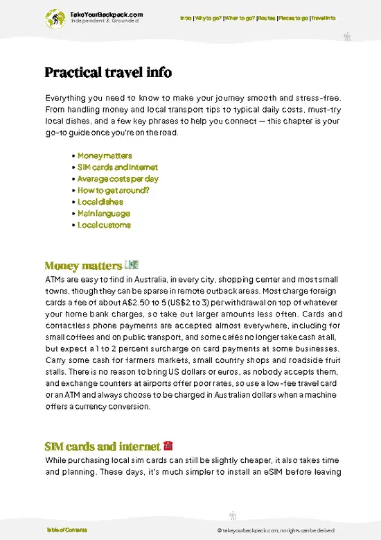
example page 0 from our offline Travel Guide for Australia
example page 1 from our offline Travel Guide for Australia
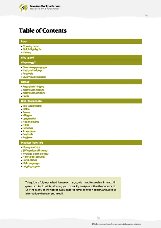
example page 2 from our offline Travel Guide for Australia
example page 3 from our offline Travel Guide for Australia
example page 4 from our offline Travel Guide for Australia
example page 5 from our offline Travel Guide for Australia
example page 6 from our offline Travel Guide for Australia
example page 7 from our offline Travel Guide for Australia
Loading the map 🌍
CLICK TO FILTER
cities
towns
villages
landmarks
national parks
hikes
beaches
attractions
festivals
regions
SHOW COUNTRY’S BESTSHOW ALL

✨ Why go?
Ranked #2 region in Australia
What makes this region worth visiting

Backpackers come to K’gari because the island packs several landscapes into one sandy strip, so you skip the usual shuffle between bus stations. In a single day you can float in the pale blue water of Lake McKenzie, walk beneath satinay trees in the rainforest at Central Station, then roll onto the east coast to drive along 75 Mile Beach, which doubles as a public highway and an aircraft landing strip. The second reason is how the island forces a slower rhythm. There is no timetable to chase. Tides decide when the beach is passable, so mornings tend to be spent at the inland lakes and afternoons on the coast, and you end up lingering at places you would normally rush past. Camping is the best way to feel it. Nights bring a sky with almost no light pollution, a dingo trotting the dune edge … read more 👉
Backpackers come to K’gari because the island packs several landscapes into one sandy strip, so you skip the usual shuffle between bus stations. In a single day you can float in the pale blue water of Lake McKenzie, walk beneath satinay trees in the rainforest at Central Station, then roll onto the east coast to drive along 75 Mile Beach, which doubles as a public highway and an aircraft landing strip. The second reason is how the island forces a slower rhythm. There is no timetable to chase. Tides decide when the beach is passable, so mornings tend to be spent at the inland lakes and afternoons on the coast, and you end up lingering at places you would normally rush past. Camping is the best way to feel it. Nights bring a sky with almost no light pollution, a dingo trotting the dune edge at dusk, and a campfire soundtrack of surf. If you want nature without a long list of stops, this island does the work for you.

💡 HighlightsPlaces and moments you shouldn't skip

  1. Lake McKenzie (Boorangoora): A perched freshwater lake with white silica sand and water that shifts from pale turquoise to deep blue. The sand is soft enough to polish your jewelry, and the lake has no creatures to worry about.
  2. SS Maheno Wreck: A rusting hospital ship, beached on the east coast since the 1935 cyclone. It is a photogenic ruin and stays open to walk around at low tide, though climbing it is discouraged.
  3. Eli Creek: A cold, clear freshwater stream that runs onto the beach. Walk up the boardwalk, then float back down on the current.
  4. Champagne Pools: Rock pools where waves spill over volcanic rock and create foaming, fizzing water. They are the only safe ocean swimming on the island, and best at mid to high tide.
  5. Indian Head: A rocky headland at the northern end of 75 Mile Beach. Climb
… read more 👉
  1. Lake McKenzie (Boorangoora): A perched freshwater lake with white silica sand and water that shifts from pale turquoise to deep blue. The sand is soft enough to polish your jewelry, and the lake has no creatures to worry about.
  2. SS Maheno Wreck: A rusting hospital ship, beached on the east coast since the 1935 cyclone. It is a photogenic ruin and stays open to walk around at low tide, though climbing it is discouraged.
  3. Eli Creek: A cold, clear freshwater stream that runs onto the beach. Walk up the boardwalk, then float back down on the current.
  4. Champagne Pools: Rock pools where waves spill over volcanic rock and create foaming, fizzing water. They are the only safe ocean swimming on the island, and best at mid to high tide.
  5. Indian Head: A rocky headland at the northern end of 75 Mile Beach. Climb it for the view, and look below for turtles, rays and sometimes sharks.
  6. Lake Wabby: A green lake held back by a huge, advancing sand blow. The walk through the dunes is half the fun, and you can roll down the sand into the water.
  7. Central Station and Wanggoolba Creek: The old logging site, now a quiet rainforest boardwalk. The creek is so clear it looks like there is no water at all.
  8. 75 Mile Beach: The island’s east coast highway, with a speed limit and a landing strip. Sunrise here, with the tide out and empty sand ahead, is worth the early alarm.
  9. Lake Birrabeen: A lesser-known lake with the same white sand as Lake McKenzie but far fewer visitors. Guided groups often skip it, so you may have the shoreline to yourself.
  10. The Pinnacles (Coloured Sands): Eroded cliffs on the east coast, banded in rust, ochre and cream. They are quick to check out and mostly overlooked by day trippers.
Start with Lake McKenzie early in the morning, before the tour buses arrive and the shoreline fills up.
Spotted a mistake or missing something? Contact us.

Things to do around K’gari (Fraser Island)

Ratings based on Tripadvisor reviews. When you book through this link, you support our work at no extra cost to you.

⌛️ 5 daysA smart one-week plan

The island runs on the tide, not the clock: you use the inland sand tracks in the morning and save the east beach for the hours around low tide, when it is firm enough to drive. Everything else bends around that.Day 1: Lake McKenzie: Arrive on the barge and head straight inland while the lakes are quiet. Swim at Lake McKenzie first, then continue through the rainforest at Central Station and its clear creek. The inland tracks are slow and bumpy, so the pace suits a day with only two or three stops. Camp or sleep nearby to cut out any backtracking.Day 2: Lake Wabby: Take the walk across the sand blow to Lake Wabby while temperatures are still manageable, then use the afternoon to cross to the east coast. The reason for this order is the tide: you reach 75 Mile Beach as the sand firms up, rather … read more 👉
The island runs on the tide, not the clock: you use the inland sand tracks in the morning and save the east beach for the hours around low tide, when it is firm enough to drive. Everything else bends around that.Day 1: Lake McKenzie: Arrive on the barge and head straight inland while the lakes are quiet. Swim at Lake McKenzie first, then continue through the rainforest at Central Station and its clear creek. The inland tracks are slow and bumpy, so the pace suits a day with only two or three stops. Camp or sleep nearby to cut out any backtracking.Day 2: Lake Wabby: Take the walk across the sand blow to Lake Wabby while temperatures are still manageable, then use the afternoon to cross to the east coast. The reason for this order is the tide: you reach 75 Mile Beach as the sand firms up, rather than fighting soft, wet approach tracks.Day 3: Eli Creek: This is the big coastal day. Float Eli Creek, walk out to the Maheno wreck, then push north to the Champagne Pools at the right tide for swimming. Stop for lunch at the beach, then end at Indian Head for the view as the light drops. Everything is lined up along one stretch of beach, so there is no wasted driving.Day 4: Lake Birrabeen: For the detour, cut back inland to Lake Birrabeen. It adds a quiet lake swim to the loop, and it sits close enough to the main track that you lose almost no time.Day 5: Pinnacles: Spend the final morning at the Coloured Sands, then head back to the barge with plenty of margin before the tide closes the beach.
If I had to keep one day, it would be Day 3. The beach, the wreck, the creek and the pools in a single run is the island at its best.

🌤️ When to go?Choosing the right time of year

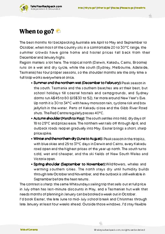
  • Winter (June to August): Dry, sunny days of 20 to 23°C (68 to 73°F) and cool nights around 10 to 13°C (50 to 55°F). Daylight runs roughly 5:30am to 5:30pm. Whale watching off the coast is the seasonal draw, and school holidays in July push crowds and prices up.
  • Spring (September to November): Warming to 24 to 28°C (75 to 82°F) with low rain and calm seas. Whales linger into September, and wildflowers bloom in the heathlands. This is the sweet spot for hiking the Great Walk without sweating through it.
  • Summer (December to February): Hot and humid at 29 to 31°C (84 to 88°F), with afternoon storms and daylight past 6:30pm. Lake swimming is at its best. Christmas and January holidays bring the highest vehicle permit demand and rates.
  • Autumn (March to May): Humidity eases and temperatures sit at 23
… read more 👉
  • Winter (June to August): Dry, sunny days of 20 to 23°C (68 to 73°F) and cool nights around 10 to 13°C (50 to 55°F). Daylight runs roughly 5:30am to 5:30pm. Whale watching off the coast is the seasonal draw, and school holidays in July push crowds and prices up.
  • Spring (September to November): Warming to 24 to 28°C (75 to 82°F) with low rain and calm seas. Whales linger into September, and wildflowers bloom in the heathlands. This is the sweet spot for hiking the Great Walk without sweating through it.
  • Summer (December to February): Hot and humid at 29 to 31°C (84 to 88°F), with afternoon storms and daylight past 6:30pm. Lake swimming is at its best. Christmas and January holidays bring the highest vehicle permit demand and rates.
  • Autumn (March to May): Humidity eases and temperatures sit at 23 to 28°C (73 to 82°F). Rain tapers off by April, and crowds thin out.
Book vehicle permits and barges months ahead for school holidays, and aim for mid-week in May or September for quieter tracks.


source: climatestotravel.comJANJanuary: fair for travelingFEBFebruary: fair for travelingMARMarch: good for travelingAPRApril: highly recommended for travelingMAYMay: excellent for travelingJUNJune: excellent for travelingJULJuly: excellent for travelingAUGAugust: excellent for travelingSEPSeptember: excellent for travelingOCTOctober: highly recommended for travelingNOVNovember: fair for travelingDECDecember: fair for traveling
when-to-go

✈️ The backpacker research shortcutAustralia Travel Guide

An offline-friendly backpacking guide with optimized travel routes, ranked highlights, transport advice, and the best areas to stay.
example page 0 from our offline Travel Guide for Australia
example page 1 from our offline Travel Guide for Australia
example page 2 from our offline Travel Guide for Australia
example page 3 from our offline Travel Guide for Australia
example page 4 from our offline Travel Guide for Australia
example page 5 from our offline Travel Guide for Australia
example page 6 from our offline Travel Guide for Australia
example page 7 from our offline Travel Guide for Australia
The digital guide (414 pages) contains:
✅ 143 highlights, ranked by travel appeal
✅ Optimized 14, 21 & 30-day travel routes
✅ Cities, national parks, landmarks, beaches
✅ How to get around
✅ Offline-friendly for travel without Wi-Fi
👉 Click to see all 30+ guide features

📅 Plan smarter in minutes, not weeks
✅ Month by month travel advice
✅ Festivals & national holidays
✅ Budget expectations

🗺️ Go to the right places, skip the overrated ones
✅ Honest pros & cons of destinations
✅ Top hikes, parks & viewpoints
✅ Lesser-known places most travelers miss
✅ Clear “worth it vs skip it” guidance

🛏️ Travel smoothly without rookie mistakes
✅ Best areas to stay
✅ Transport systems explained simply
✅ Common scams & safety advice
✅ SIM cards, money & practical tips

🌍 Understand the country, not just visit it
✅ Culture & traditions
✅ Local customs
✅ Festivals worth planning around
✅ Traveler-friendly historical context
✅ Insights that make places more meaningful

📱 Built for real travel conditions
✅ Fully downloadable PDF
✅ Works completely offline
✅ Optimized for phone use
✅ Useful in remote areas & buses
✅ Everything in one place
Stop searching, start planning
Get instant access to your full guide. 30‑day money-back guarantee.
+ Add another guide for just

By proceeding you agree to our terms.
Sent to your inbox immediately after payment • 100% Secure Checkout
Best Backpacking Travel Advisor 2025 tourism awardBest Backpacking
Travel Advisor
2025
What others say about Take Your Backpack Guides:
⭐⭐⭐⭐⭐
Fantastic, amazing amount of information!
⭐⭐⭐⭐⭐
My goodness this is amazing, it's what I've been looking for hats off too you!
⭐⭐⭐⭐⭐
I think this is absolutely BRILLIANT
⭐⭐⭐⭐
Very complete and informative. It's still missing places, but I gotta to commend you
⭐⭐⭐⭐⭐
This is truly amazing, thank you, can't wait to explore it with my kids!
⭐⭐⭐⭐⭐
Awesome resource, thank you!
⭐⭐⭐⭐⭐
This is amazing! Can't wait to explore the ones I haven't seen
⭐⭐⭐⭐
I love this! Well done, great idea.
⭐⭐⭐⭐⭐
Thanks for taking the time to make this gem!
⭐⭐⭐⭐⭐
This might be the best website I've ever seen.
⭐⭐⭐⭐⭐
Congratulations, and thank you so much for your work; it's incredibly valuable.
⭐⭐⭐⭐
In all seriousness I think you did a great job pointing out the important spots
⭐⭐⭐⭐⭐
10/10 very good
⭐⭐⭐⭐⭐
As someone who's only just starting to visit regularly this is awesome, thank you.
⭐⭐⭐⭐
Thank you very much! I'm going to visit my dad, it's going to be very useful!
⭐⭐⭐⭐⭐
This is really cool! We'll be travelling for the first time and this definitely come in handy.
⭐⭐⭐⭐⭐
You are now our minister of culture, congratulations 👨‍💼
⭐⭐⭐⭐⭐
Just wanted to tell you that this is a pearl! Going to follow your recommendations.
⭐⭐⭐⭐⭐
This is so cool. I'll definitely be using the resource for my travels soon.
⭐⭐⭐⭐⭐
This is very impressive! Good work.
⭐⭐⭐⭐⭐
This is an amazing and informative site. Very well done!

🛏️ Where to stay?Choosing the right base

Hervey Bay is the best base for most backpackers, with a lively hostel scene, a flat seafront promenade for easy cycling, and the tour operators and barge terminals nearby. It is safe, sunny and full of other travelers heading to the island, so finding a group to share a 4WD rental is easy. Whale-watching boats leave from the marina in season, and the beach cafés and supermarkets make stocking up simple.

Rainbow Beach is the other option, a small, laid-back surf town on the southern side. It is popular with solo travelers and has a few social hostels, a relaxed main street and good sunset views … read more 👉
Hervey Bay is the best base for most backpackers, with a lively hostel scene, a flat seafront promenade for easy cycling, and the tour operators and barge terminals nearby. It is safe, sunny and full of other travelers heading to the island, so finding a group to share a 4WD rental is easy. Whale-watching boats leave from the marina in season, and the beach cafés and supermarkets make stocking up simple.

Rainbow Beach is the other option, a small, laid-back surf town on the southern side. It is popular with solo travelers and has a few social hostels, a relaxed main street and good sunset views from the beach. Many Fraser tours and self-drive trips start from the Inskip Point barge to the south, so you can be on the island early. The Carlo Sand Blow and the coloured sands are a short walk or drive away.

On the island itself, Kingfisher Bay Resort village and Eurong are the main settlements, but most backpackers stay in the national park campgrounds instead. Sites at Central Station, Lake Boomanjin and along the east coast beach give you a night under very clear skies, with dingoes to keep you honest about food storage. Permits are needed in advance, and campsites are basic with limited facilities. Hervey Bay or Rainbow Beach suit the nights before and after your trip.

🚌 Getting aroundGetting around like a local

The island has no towns to stroll between, only a few small settlements, and the sand tracks make walking sensible only for short hops such as from your camp to a nearby lake or beach. Beyond that, the sand wins. Nearly everyone arrives by barge from Hervey Bay or Rainbow Beach, then moves around by 4WD or by tour, and both work well if you book ahead.
  • Guided group tour: About A$250 to 450 for a one-day trip and A$400 to 800 for multi-day tours that include a driver, meals and camping. You skip the stress of driving on sand. For a solo backpacker this gives the most, since someone else handles the tide tables and the sand bogs.
  • Rented 4WD: Roughly A$200 to 350 per vehicle per day, plus a vehicle access permit (about A$60 for a short stay) and barge fare (A$180 to 250 return for a vehicle). Split
… read more 👉
The island has no towns to stroll between, only a few small settlements, and the sand tracks make walking sensible only for short hops such as from your camp to a nearby lake or beach. Beyond that, the sand wins. Nearly everyone arrives by barge from Hervey Bay or Rainbow Beach, then moves around by 4WD or by tour, and both work well if you book ahead.
  • Guided group tour: About A$250 to 450 for a one-day trip and A$400 to 800 for multi-day tours that include a driver, meals and camping. You skip the stress of driving on sand. For a solo backpacker this gives the most, since someone else handles the tide tables and the sand bogs.
  • Rented 4WD: Roughly A$200 to 350 per vehicle per day, plus a vehicle access permit (about A$60 for a short stay) and barge fare (A$180 to 250 return for a vehicle). Split among four or five people it is the cheapest option and gives you total freedom. Your reward is stopping at Lake McKenzie when you like, and the trade-off is getting a vehicle stuck in front of a very amused audience.
  • Vehicle barge: Crossings take 10 to 15 minutes from Inskip Point or 30 to 50 minutes from River Heads, and they carry foot passengers too, for around A$25 to 50 return. They are punctual and slow, which is a small comfort when your mate is guarding the cooler.
  • Hiking the K’gari Great Walk: About 90 kilometers (56 miles) over six to eight days, with camping permits of around A$7 per person per night. It costs the least in money and the most in blisters, and the sand makes every kilometer feel like two.
Watch the tide: the 75 Mile Beach highway is only passable around low tide, so plan long drives for the two hours either side of it, and arrange your day around the tide chart rather than your appetite.

🍲 FoodEating & Drinking in K’gari (Fraser Island)

Food here splits in two: the mainland and the island camp kitchen. In Hervey Bay and Rainbow Beach, expect fresh prawns, barramundi and fish and chips eaten on the sand, salty and hot, with a squeeze of lemon and gulls circling. Queensland mud crab and Moreton Bay bugs turn up in casual seafood spots. Local cafés pour strong flat whites and sell meat pies and smashed avocado toast that fuels a sand-heavy morning.

For a budget bite, the Hervey Bay farmers’ market and supermarkets are where backpackers stock up. Most people cook on gas barbecues at campsites, so sausages, corn on the cob, damper and tinned beans are staples. Add a cold XXXX Gold or a local craft beer, and the evening smells of woodsmoke and charred onions. Pubs serve a parma (chicken parmigiana) and a pot of beer for a few … read more 👉
Food here splits in two: the mainland and the island camp kitchen. In Hervey Bay and Rainbow Beach, expect fresh prawns, barramundi and fish and chips eaten on the sand, salty and hot, with a squeeze of lemon and gulls circling. Queensland mud crab and Moreton Bay bugs turn up in casual seafood spots. Local cafés pour strong flat whites and sell meat pies and smashed avocado toast that fuels a sand-heavy morning.

For a budget bite, the Hervey Bay farmers’ market and supermarkets are where backpackers stock up. Most people cook on gas barbecues at campsites, so sausages, corn on the cob, damper and tinned beans are staples. Add a cold XXXX Gold or a local craft beer, and the evening smells of woodsmoke and charred onions. Pubs serve a parma (chicken parmigiana) and a pot of beer for a few dollars less on weekday specials.

The main rule on the island is dingo safety. Never leave food out, keep it locked in a vehicle or a dingo-proof container, and never feed them. Fines are heavy. Carry all your drinking water and rubbish out. On the mainland, tipping is optional and ordering is usually done at the counter. Bring cash for the few island kiosks, since stock is limited.

FAQCommon questions from travelers

Three to four days is enough to see the main sights. That gives you time for Lake McKenzie, Lake Wabby, the Maheno shipwreck and Eli Creek along 75 Mile Beach, with a night or two of camping. A one-day tour from Hervey Bay covers the highlights but is rushed. The full K’gari Great Walk takes six to eight days.
Without your own car, the simplest way is a guided tour from Hervey Bay or Rainbow Beach, costing around A$250 to 450 for a day and A$400 to 800 for multi-day trips. Barges carry foot passengers for about A$25 to 50 return, and the crossing takes 10 to 50 minutes depending on the departure point. Once on the island, you can also join shuttle services around Kingfisher Bay Resort or walk the Great Walk, about 90 kilometers long.
K’gari is known as the largest sand island in the world, about 123 kilometers (76 miles) long, and is World Heritage listed. It is famous for Lake McKenzie’s clear freshwater, the Maheno shipwreck, rainforest growing on sand and its dingoes. Humpback whales pass offshore from roughly July to October, and 75 Mile Beach serves as a sand highway for 4WD vehicles.
⚠️ Things can change over time, so always validate details locally before you go.

Other Australian regions near K’gari (Fraser Island)

Explore more nearby:

  • Lord Howe Island—Southern coral lagoon, cloud forest summit, visitor cap, bike transport| 911 km away
  • Greater Blue Mountains Area—Sandstone cliffs, fern gorges, cliff stairs, glow worm tunnel| 985 km away
  • Flinders Ranges—Quartzite ranges, rock engravings, gorge drives, outback pub| 1552 km away

💡 Not sure where to go next?
Create a personalized itinerary for Australia including K’gari (Fraser Island) and the places that fit your trip.

Generate my itinerary

👉 Discover all regions

Or checkout all Australia has to offer (think cities, towns, villages, national parks, hikes, beaches, festivals)
Country photo of Australia

We 💚 feedbackWhat to keep in mind

Most first-timers plan around the lakes and forget the tide table, yet it decides when the beach highway is passable and when it is not. I would check the tide times the night before and plan each driving day around them. I would also skip any midday stop at the busiest lake and save it for early morning.

✈️ When did I visit Australia?
On my trip to New Zealand in 1993, I had a short stop in Australia as well.

✍️ Help improve this page!
The information on this page is based on my own backpacking experience in Australia, supplemented with up-to-date research and feedback from other travelers. Travel details can change, so if you notice anything outdated or incomplete, feel free to let me know.


🙋‍♂️ Give feedback

👋 Meet the founderWho’s Behind Take Your Backpack?

Johan, backpacker and founder of TakeYourBackpackHi, I’m Johan (Netherlands 🇳🇱), the creator of TakeYourBackpack. Over the past 3 decades, I’ve backpacked through 90+ countries across six continents, gaining extensive experience with independent travel, long-term trips, and overland routes.

This site is built on a combination of firsthand travel experience and carefully curated insights from other backpackers. Many guides are based on places I’ve personally visited, while others bring together tips, observations, and practical advice shared by trusted travelers I’ve met along the way.

The goal is to provide realistic, experience-driven guidance — not generic itineraries — so you can explore destinations with better context, clearer expectations, and more confidence.