×

Bhutan🇧🇹 | hikesJomolhariglacial rivers, sacred peaks, remote yak pastures | things to do and best time to go

Explore Druk PathExplore Snowman Trek

Backpacking in Jomolhari
🌟 Highlighthike ranked #3
By Johan Kruseman 🇳🇱 | Updated September 4, 2026

Forget the fantasy of a gentle stroll to a postcard-perfect peak—Jomolhari is not a casual walk in the park. This trek, anchored in the northwestern corner of Bhutan near the Tibetan border, throws you straight into the raw, high-altitude drama of the Himalayas. The trail doesn’t coddle: you’ll grind up switchbacks, cross icy rivers on rickety bridges, and feel your lungs protest as you climb above 4,000 meters. But then—bam—the mountain reveals itself, a white fang slicing the sky, and suddenly every aching muscle feels like a badge of honor. The scenery is relentless: yak pastures, fortress-like dzongs, and villages that seem to cling to the edge of the world. The route is long (typically 8 days), tough, and remote, with no easy bus ride to the trailhead—expect a bumpy drive from Paro and little in the way of shortcuts. Compared to the more accessible Druk Path or the lush, lower-altitude Bumthang treks, Jomolhari is wilder, harder, and, for those who crave a challenge, infinitely more rewarding.

Discover everything you want to know in the 📖 Bhutan Travel Guide.
Best time to go: March - May, September - November
Duration: 10 to 12 days
Distance: 150 kilometers
Total ascent: 1,200 meters


Get your Bhutan guide
54 ranked highlights, routes & tips, works offline (222 pages)
Loading the map 🌍
CLICK TO FILTER
cities
towns
villages
landmarks
national parks
hikes
attractions
festivals
regions
SHOW COUNTRY’S BESTSHOW ALL

✨ Why go?
Ranked #3 hike in Bhutan
Why visitors keep coming back

The Jomolhari trek in Bhutan is a magnet for backpackers craving a blend of stunning scenery and manageable effort. Picture this: you’re winding through lush valleys, with the towering Jomolhari peak looming above, its snow-capped summit piercing the sky. The scenery-to-effort ratio is off the charts; you don’t need to be a seasoned mountaineer to soak in the breathtaking views.

Getting there is a breeze. Public transport whisks you from Thimphu to Paro, and from there, you’re on the trail in no time. The low cost of permits and accommodations makes it accessible, allowing you to stretch your budget without sacrificing experience.

What’s even better? You can tailor the trek to your pace. Whether you want a quick 4-day jaunt or a more leisurely week, the flexible distances cater to your … read more 👉
The Jomolhari trek in Bhutan is a magnet for backpackers craving a blend of stunning scenery and manageable effort. Picture this: you’re winding through lush valleys, with the towering Jomolhari peak looming above, its snow-capped summit piercing the sky. The scenery-to-effort ratio is off the charts; you don’t need to be a seasoned mountaineer to soak in the breathtaking views.

Getting there is a breeze. Public transport whisks you from Thimphu to Paro, and from there, you’re on the trail in no time. The low cost of permits and accommodations makes it accessible, allowing you to stretch your budget without sacrificing experience.

What’s even better? You can tailor the trek to your pace. Whether you want a quick 4-day jaunt or a more leisurely week, the flexible distances cater to your vibe. Plus, it fits seamlessly into a longer backpacking route through Bhutan, making it a perfect pit stop.

Every step is a reward, culminating in that first cold beer at the end of the day, as you soak in the beauty around you. The Jomolhari trek isn’t just a hike; it’s a celebration of the journey itself.
Want to include Jomolhari in your Bhutan route?
Create a personalized Bhutan itinerary that includes Jomolhari and the places that fit your trip — based on your travel style, budget, and available time. Get your route in seconds.

Generate my trip

💡 HighlightsPlaces and moments you shouldn't skip

  1. Jomolhari Base Camp / Jangothang meadows — An expansive alpine bowl where tents sit under the towering, glacier-clad face of Jomolhari; mornings here are unforgettable when the peak turns pink and the moraine streams glint, giving you a true “right under the mountain” vibe you won’t get on lower treks.
  2. Laya village and Layap culture — A highland settlement of yak-herding families with distinctive traditional dress and a slow, practical way of life; walking through the village gives you genuine cultural contact—tea with locals, yak cheese for sale, and children who still herd animals on foot.
  3. High alpine wildlife and birds — Open scree and meadows are prime habitat for bharal (blue sheep), marmots, and raptors; if you’re quiet at dawn or dusk there’s a real chance of spotting these hardy
read more 👉
  1. Jomolhari Base Camp / Jangothang meadows — An expansive alpine bowl where tents sit under the towering, glacier-clad face of Jomolhari; mornings here are unforgettable when the peak turns pink and the moraine streams glint, giving you a true “right under the mountain” vibe you won’t get on lower treks.
  2. Laya village and Layap culture — A highland settlement of yak-herding families with distinctive traditional dress and a slow, practical way of life; walking through the village gives you genuine cultural contact—tea with locals, yak cheese for sale, and children who still herd animals on foot.
  3. High alpine wildlife and birds — Open scree and meadows are prime habitat for bharal (blue sheep), marmots, and raptors; if you’re quiet at dawn or dusk there’s a real chance of spotting these hardy animals against stark mountain backdrops.
  4. Glacial streams, tarns and sweeping viewpoints — The trail threads turquoise meltwater pools, high tarns and dramatic ridgelines; every climb rewards you with wide, photogenic vistas of cirques and glacial lines that feel almost untracked compared to busier Himalayan routes.
  5. Prayer flags, chortens and remote spiritual spots — Small chortens, mani walls and fluttering prayer flags crop up at passes and camps; the mix of ritual sites and isolated hermitages gives the trek a quiet spiritual layer you notice in the wind and smoke from yak-dung stoves.
Spotted a mistake or missing something? Contact us.

Things to do near Jomolhari

Ratings based on Tripadvisor reviews. When you book through this link, you support our work at no extra cost to you.

🌤️ When to go?Weather, crowds, and seasonal trade-offs


  • Weather: The best window is spring (March to May) and autumn (September to November). These months bring clear skies and dry trails, avoiding the monsoon mud and winter’s icy grip.

  • Temperature: Daytime highs hover around 10-15°C (50-59°F) in spring and autumn, perfect for trekking without overheating. Nights dip below freezing, so pack layers for the chill that bites after sunset.

  • Daylight Hours: Expect roughly 10-12 hours of daylight, enough to push hard on the trail but not so long that you lose track of time. Early starts are key to beating afternoon clouds and maximizing views.

  • Crowds: Peak season means more trekkers, especially in autumn. Spring is slightly quieter but still lively. Winter and monsoon seasons see fewer people, but the trail conditions can be brutal.

  • Seasonal
read more 👉

  • Weather: The best window is spring (March to May) and autumn (September to November). These months bring clear skies and dry trails, avoiding the monsoon mud and winter’s icy grip.

  • Temperature: Daytime highs hover around 10-15°C (50-59°F) in spring and autumn, perfect for trekking without overheating. Nights dip below freezing, so pack layers for the chill that bites after sunset.

  • Daylight Hours: Expect roughly 10-12 hours of daylight, enough to push hard on the trail but not so long that you lose track of time. Early starts are key to beating afternoon clouds and maximizing views.

  • Crowds: Peak season means more trekkers, especially in autumn. Spring is slightly quieter but still lively. Winter and monsoon seasons see fewer people, but the trail conditions can be brutal.

  • Seasonal Activities: Autumn aligns with Bhutan’s vibrant festivals, adding cultural spice to your trek. Spring bursts with rhododendrons and wildflowers, turning the landscape into a living canvas.

  • Price Fluctuations: Peak trekking seasons push prices up—permits, guides, and accommodations cost more. Off-season offers savings but demands tougher gear and grit.


Pro-tip: Time your trek to hit early autumn for a sweet spot of weather, culture, and manageable crowds—where every step rewards you with crisp air and jaw-dropping Himalayan panoramas.


source: climatestotravel.comJANJanuary: fair for travelingFEBFebruary: fair for travelingMARMarch: highly recommended for travelingAPRApril: excellent for travelingMAYMay: highly recommended for travelingJUNJune: below average for travelingJULJuly: below average for travelingAUGAugust: below average for travelingSEPSeptember: excellent for travelingOCTOctober: excellent for travelingNOVNovember: highly recommended for travelingDECDecember: fair for traveling
bhutan-hike-jomolhari
© Google |

✈️ The backpacker research shortcutBhutan Travel Guide

An offline-friendly backpacking guide with optimized travel routes, ranked highlights, transport advice, and the best areas to stay.
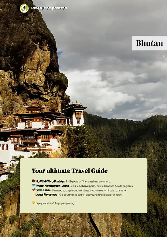
example page 0 from our offline Travel Guide for Bhutan
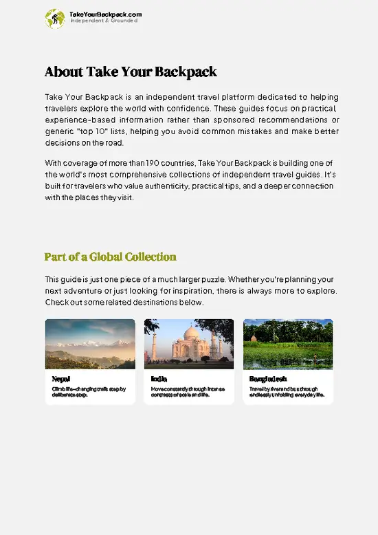
example page 1 from our offline Travel Guide for Bhutan
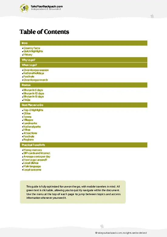
example page 2 from our offline Travel Guide for Bhutan
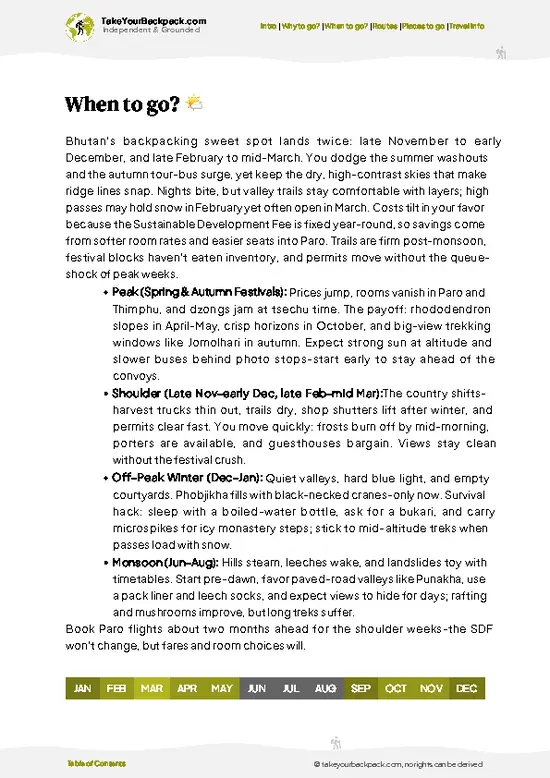
example page 3 from our offline Travel Guide for Bhutan
example page 4 from our offline Travel Guide for Bhutan
example page 5 from our offline Travel Guide for Bhutan
example page 6 from our offline Travel Guide for Bhutan
example page 7 from our offline Travel Guide for Bhutan
The digital guide (222 pages) contains:
54 highlights, ranked by travel appeal
Optimized 5, 10 & 15-day travel routes
Cities, national parks, landmarks, beaches
How to get around
Offline-friendly for travel without Wi-Fi
👉 Click to see all 30+ guide features

📅 Plan smarter in minutes, not weeks
Month by month travel advice
Festivals & national holidays
Budget expectations

🗺️ Go to the right places, skip the overrated ones
Honest pros & cons of destinations
Top hikes, parks & viewpoints
Lesser-known places most travelers miss
Clear “worth it vs skip it” guidance

🛏️ Travel smoothly without rookie mistakes
Best areas to stay
Transport systems explained simply
Common scams & safety advice
SIM cards, money & practical tips

🌍 Understand the country, not just visit it
Culture & traditions
52 Essential phrases & customs
Festivals worth planning around
Traveler-friendly historical context
Insights that make places more meaningful

📱 Built for real travel conditions
Fully downloadable PDF
Works completely offline
Optimized for phone use
Useful in remote areas & buses
Everything in one place
Save weeks of stressful planning
Get instant access to your full guide. 30‑day money-back guarantee.
+ Add another guide for just ₹667.00

By proceeding you agree to our terms.
Sent to your inbox immediately after payment • 100% Secure Checkout
Best Backpacking Travel Advisor 2025 tourism awardBest Backpacking
Travel Advisor
2025
What others say about Take Your Backpack Guides:
⭐⭐⭐⭐⭐
Fantastic, amazing amount of information!
⭐⭐⭐⭐⭐
My goodness this is amazing, it's what I've been looking for hats off too you!
⭐⭐⭐⭐⭐
I think this is absolutely BRILLIANT
⭐⭐⭐⭐
Very complete and informative. It's still missing places, but I gotta to commend you
⭐⭐⭐⭐⭐
This is truly amazing, thank you, can't wait to explore it with my kids!
⭐⭐⭐⭐⭐
Awesome resource, thank you!
⭐⭐⭐⭐⭐
This is amazing! Can't wait to explore the ones I haven't seen
⭐⭐⭐⭐
I love this! Well done, great idea.
⭐⭐⭐⭐⭐
Thanks for taking the time to make this gem!
⭐⭐⭐⭐⭐
This might be the best website I've ever seen.
⭐⭐⭐⭐⭐
Congratulations, and thank you so much for your work; it's incredibly valuable.
⭐⭐⭐⭐
In all seriousness I think you did a great job pointing out the important spots
⭐⭐⭐⭐⭐
10/10 very good
⭐⭐⭐⭐⭐
As someone who's only just starting to visit regularly this is awesome, thank you.
⭐⭐⭐⭐
Thank you very much! I'm going to visit my dad, it's going to be very useful!
⭐⭐⭐⭐⭐
This is really cool! We'll be travelling for the first time and this definitely come in handy.
⭐⭐⭐⭐⭐
You are now our minister of culture, congratulations 👨‍💼
⭐⭐⭐⭐⭐
Just wanted to tell you that this is a pearl! Going to follow your recommendations.
⭐⭐⭐⭐⭐
This is so cool. I'll definitely be using the resource for my travels soon.
⭐⭐⭐⭐⭐
This is very impressive! Good work.
⭐⭐⭐⭐⭐
This is an amazing and informative site. Very well done!

🛏️ Where to stay?Where staying makes the most sense

If you enjoy meeting fellow travelers, consider choosing hostels with high ratings for atmosphere. On the other hand, if you prefer having your own space, a hotel might be a better option.

🥾 Hike detailsKey facts about the Jomolhari hike

Total Distance: The Jomolhari trek covers approximately 150 kilometers (about 93 miles) round trip.

Estimated Duration: Most hikers take around 10 to 12 days to complete the trek, depending on your pace and how long you spend at various campsites.

Difficulty Level: This trail is considered moderate to challenging. While it’s manageable for those with some hiking experience, the altitude and weather can add a layer of difficulty.

Starting Point: The trek begins in the village of Drugyal Dzong. To get there by public transport, you can take a bus or shared taxi from Thimphu to Paro. From Paro, … read more 👉
Total Distance: The Jomolhari trek covers approximately 150 kilometers (about 93 miles) round trip.

Estimated Duration: Most hikers take around 10 to 12 days to complete the trek, depending on your pace and how long you spend at various campsites.

Difficulty Level: This trail is considered moderate to challenging. While it’s manageable for those with some hiking experience, the altitude and weather can add a layer of difficulty.

Starting Point: The trek begins in the village of Drugyal Dzong. To get there by public transport, you can take a bus or shared taxi from Thimphu to Paro. From Paro, you can catch a local taxi or another shared vehicle to Drugyal Dzong. The ride offers some stunning views, so keep your camera handy.

Major Landmarks Along the Route:
  • Drugyal Dzong: An ancient fortress that offers a glimpse into Bhutan’s history and stunning views of Jomolhari.
  • Jomolhari Base Camp: A breathtaking campsite with views of the towering Jomolhari mountain, perfect for a rest day.
  • Thangthangka: A beautiful meadow that’s often used as a campsite, surrounded by stunning peaks.
  • Jangothang: Another base camp with panoramic views and a great spot for acclimatization.

Type of Terrain and Scenery: The trail features a mix of well-trodden paths and rocky sections. You’ll traverse through lush valleys, dense forests, and alpine meadows. As you ascend, the scenery shifts dramatically, revealing towering peaks and glacial rivers. Expect to see some stunning waterfalls along the way, especially during the monsoon season.

Typical Vegetation and Wildlife: The vegetation varies with altitude. Lower sections are lush with rhododendrons, firs, and bamboo. As you climb higher, you’ll encounter alpine flowers and shrubs. Wildlife includes blue sheep, yaks, and if you’re lucky, you might spot the elusive snow leopard. Birdwatchers will enjoy spotting various species, including the colorful pheasants that call this area home.

This trek is a gem for those who love nature and culture, but make sure you’re well-prepared for the altitude and changing weather conditions. Happy trails!
⚠️ Hiking info can sometimes be outdated or inaccurate. Before you hit the trail, check the latest conditions with locals. If you do spot anything that's off, I'd love to hear from you, so I can update it for fellow travelers.

🛡️ SafetyTraveler Safety Guide

The Jomolhari trek in Bhutan is a breathtaking journey, but it comes with its own set of realities. Weather can shift quickly; one moment you’re basking in sun, the next, clouds roll in, bringing rain or even snow. Layer your clothing and pack a reliable rain jacket.

The terrain is a mix of steep ascents and rocky paths, so good footwear is essential. Trekking poles can help stabilize you on the uneven ground, especially during river crossings where the current can surprise you.

Altitude is a factor; acclimatization is key. Take your time, hydrate, and listen to your body. The views from the top are worth every step, but rushing can lead to headaches or fatigue.

Wildlife encounters are rare but possible. If you spot a yak or a blue sheep, keep your distance and enjoy the moment quietly. … read more 👉
The Jomolhari trek in Bhutan is a breathtaking journey, but it comes with its own set of realities. Weather can shift quickly; one moment you’re basking in sun, the next, clouds roll in, bringing rain or even snow. Layer your clothing and pack a reliable rain jacket.

The terrain is a mix of steep ascents and rocky paths, so good footwear is essential. Trekking poles can help stabilize you on the uneven ground, especially during river crossings where the current can surprise you.

Altitude is a factor; acclimatization is key. Take your time, hydrate, and listen to your body. The views from the top are worth every step, but rushing can lead to headaches or fatigue.

Wildlife encounters are rare but possible. If you spot a yak or a blue sheep, keep your distance and enjoy the moment quietly. Respect the environment and the local culture; leave no trace.

With thoughtful preparation, the Jomolhari trek rewards you with stunning vistas and a sense of accomplishment that lingers long after the hike.

FAQFrequently asked questions about Jomolhari

The Jomolhari hike typically takes 7 to 8 days to complete, covering around 70 kilometers. Most trekkers spend about a week on the trail to fully experience the route and acclimatize to the altitude.
The Jomolhari hike is moderately difficult, suitable for experienced hikers with good fitness. The trail reaches elevations up to 4,900 meters, requiring acclimatization and the ability to handle steep ascents and variable weather conditions.
Yes, you need both a guide and a permit to trek Jomolhari. Permits are issued by the Bhutanese government and must be arranged through a licensed tour operator, which also provides the mandatory guide.
⚠️ Things can change over time, so always validate details locally before you go.

Other Bhutanese hikes near Jomolhari

Explore more nearby:

  • Druk Path—ancient trade route, blue pine forests, ridge-top dzongs| 44 km away
  • Tiger’s Nest—cliffside monastery, pine forest, prayer flags| 52 km away
  • Bumthang Owl Trek—dense forest, mountain hamlets, birdlife| 53 km away

💡 Not sure where to go next?
Create a personalized itinerary for Bhutan including Jomolhari and the places that fit your trip.

Generate my itinerary

👉 Discover all hikes

Or checkout all Bhutan has to offer (think cities, towns, villages, national parks, hikes, beaches, festivals)
Country photo of Bhutan

We 💚 feedbackWhat to keep in mind

The Jomolhari trek isn’t just a hike; it’s a full-body experience. You’ll feel the burn in your legs, but the views? They’ll steal your breath away. The surprise? Those vibrant, local villages tucked away like secrets, where you can sip butter tea and chat with welcoming locals. Just a heads-up: altitude can hit hard, so pace yourself. Embrace the challenge, and when you finally catch that first glimpse of the peak, you’ll know every step was worth it.

✍️ Help improve this page!
The information on this page is based on in-depth research, insights shared by experienced travelers, and feedback from the local travel community in Bhutan. While every effort is made to keep the information accurate and current, conditions can change — so if you spot anything incorrect or outdated, please get in touch.


🙋‍♂️ Give feedback

👋 Meet the founderWho’s Behind Take Your Backpack?

Johan, backpacker and founder of TakeYourBackpackHi, I’m Johan (Netherlands 🇳🇱), the creator of TakeYourBackpack. Over the past decade, I’ve backpacked through 80+ countries across six continents, gaining extensive experience with independent travel, long-term trips, and overland routes.

This site is built on a combination of firsthand travel experience and carefully curated insights from other backpackers. Many guides are based on places I’ve personally visited, while others bring together tips, observations, and practical advice shared by trusted travelers I’ve met along the way.

The goal is to provide realistic, experience-driven guidance — not generic itineraries — so you can explore destinations with better context, clearer expectations, and more confidence.

Get full Bhutan guide •
Instant download • 54 highlights • Full Offline guide