
×
West Coast Trail

Canada🇨🇦 | hikesWest Coast TrailWooden ladders, Tsusiat Falls, Nitinat ferry, Owen Point caves | things to do and best time to go

Explore Sunshine Village to Mount AssiniboineExplore Fundy Footpath Trail

Backpacking in West Coast Trail
🏆 Top pickhike ranked #1
By Johan Kruseman 🇳🇱 | Updated October 23, 2026

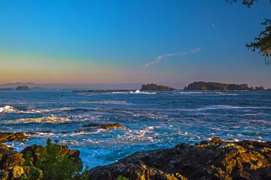
Dozens of wooden ladders, some climbing 30 rungs or more up muddy cliffs, are what the West Coast Trail is known for. The route runs along the southwest coast of Vancouver Island in Canada, northwest of Victoria, between Pachena Bay and Gordon River. Sea stacks, sandstone shelves, waterfalls and kelp-heavy air make the scenery superb, and the hard parts are part of it: roots grab boots, boardwalk planks turn greasy, and 75 kilometers takes most people six or seven days. Mistakes get expensive. Permits are limited and sell out, so book the day reservations open. The Nitinat Narrows ferry wants cash, so carry small bills. Headlands can trap you at high tide, so plan beach sections around a tide table. Shuttle buses reach both ends in season but run few times a day, so reserve seats early. I expected the Nitinat ferry to be a tour boat. It was a small open skiff, and the crab shack on the far shore sold sandwiches with the shells still on the counter.

Discover everything you want to know in the 📖 Canada Travel Guide.
Best time to go: May - September
Duration: 6 days
Distance: 75 kilometers
Total ascent: 1500 meters


example page 0 from our offline Travel Guide for Canada
example page 1 from our offline Travel Guide for Canada
example page 2 from our offline Travel Guide for Canada
example page 3 from our offline Travel Guide for Canada
example page 4 from our offline Travel Guide for Canada
example page 5 from our offline Travel Guide for Canada
example page 6 from our offline Travel Guide for Canada
example page 7 from our offline Travel Guide for Canada
Loading the map 🌍
CLICK TO FILTER
cities
towns
villages
landmarks
national parks
hikes
beaches
attractions
festivals
regions
SHOW COUNTRY’S BESTSHOW ALL

✨ Why go?
Ranked #1 hike in Canada
Why West Coast Trail should be on your travel list

The West Coast Trail gives you a rare ratio of wilderness to logistics: one long, committed walk with a clear start and finish, and none of the route-finding puzzles of a loop. The coast delivers constantly. You cross Tsusiat Falls pouring straight onto a beach, scramble around sea caves, and pass sea lions hauled out on offshore rocks, with gray whales often visible from the shoreline. The ladders and cable cars give it a character no other Canadian coastal route matches, and they make you feel like a proper expedition rather than a stroller.

Access works in your favor too. Seasonal shuttle buses serve both Pachena Bay and Gordon River, so you can walk one way and ride back without a car. That makes the trail easy to slot into a longer Vancouver Island loop through Victoria, Port Renfrew … read more 👉
The West Coast Trail gives you a rare ratio of wilderness to logistics: one long, committed walk with a clear start and finish, and none of the route-finding puzzles of a loop. The coast delivers constantly. You cross Tsusiat Falls pouring straight onto a beach, scramble around sea caves, and pass sea lions hauled out on offshore rocks, with gray whales often visible from the shoreline. The ladders and cable cars give it a character no other Canadian coastal route matches, and they make you feel like a proper expedition rather than a stroller.

Access works in your favor too. Seasonal shuttle buses serve both Pachena Bay and Gordon River, so you can walk one way and ride back without a car. That makes the trail easy to slot into a longer Vancouver Island loop through Victoria, Port Renfrew and Bamfield. Seasoned trekkers like the 75-kilometer length because it fits a single working week, while first-timers get bail-out points along the way and a mandatory orientation that explains the hazards before you start.

💡 HighlightsThe experiences that define the visit

  1. The Ladders: These are the signature of the trail. Long wooden ladders climb out of gullies and up bluffs throughout the route, and they are slick, steep, and often damp. They break the walk into short vertical puzzles, and carrying a full pack up them is the moment most hikers remember. Move slowly and keep three points of contact.
  2. Tsusiat Falls: A wide curtain of water drops roughly 15 meters from a mossy ledge directly onto the sand. A pool forms at the base, and the beach campsite here is one of the most popular on the trail. Arrive early to claim a flat tent spot.
  3. Nitinat Narrows: The trail crosses the narrow channel connecting Nitinat Lake to the Pacific by a small ferry run by the Ditidaht First Nation. Crab shacks on the far side sell fresh crab, making this the one real meal break between
… read more 👉
  1. The Ladders: These are the signature of the trail. Long wooden ladders climb out of gullies and up bluffs throughout the route, and they are slick, steep, and often damp. They break the walk into short vertical puzzles, and carrying a full pack up them is the moment most hikers remember. Move slowly and keep three points of contact.
  2. Tsusiat Falls: A wide curtain of water drops roughly 15 meters from a mossy ledge directly onto the sand. A pool forms at the base, and the beach campsite here is one of the most popular on the trail. Arrive early to claim a flat tent spot.
  3. Nitinat Narrows: The trail crosses the narrow channel connecting Nitinat Lake to the Pacific by a small ferry run by the Ditidaht First Nation. Crab shacks on the far side sell fresh crab, making this the one real meal break between the trailheads. The current here is strong, which is why a boat is needed.
  4. Pachena Point Lighthouse: The white tower, built in the early 1900s, stands on a bluff near the northern end. Lightkeepers once watched for wrecks along this coast, known as the Graveyard of the Pacific, and the trail follows the old telegraph route they used. Walking the clifftop meadow gives wide views over open ocean.
  5. Owen Point Sea Caves: Near the southern end, rock shelves lead to caves carved by the surf. They are reachable only at low tide, and sea lions often rest on the rocks nearby. Check the tide table before committing, because the shelf floods quickly.
On the West Coast Trail, the ladders cost nothing beyond your permit, while the Nitinat Narrows ferry adds a small cash fee.
Spotted a mistake or missing something? Contact us.

Things to do near West Coast Trail

Ratings based on Tripadvisor reviews. When you book through this link, you support our work at no extra cost to you.

🌤️ When to go?Best time to hike the West Coast Trail

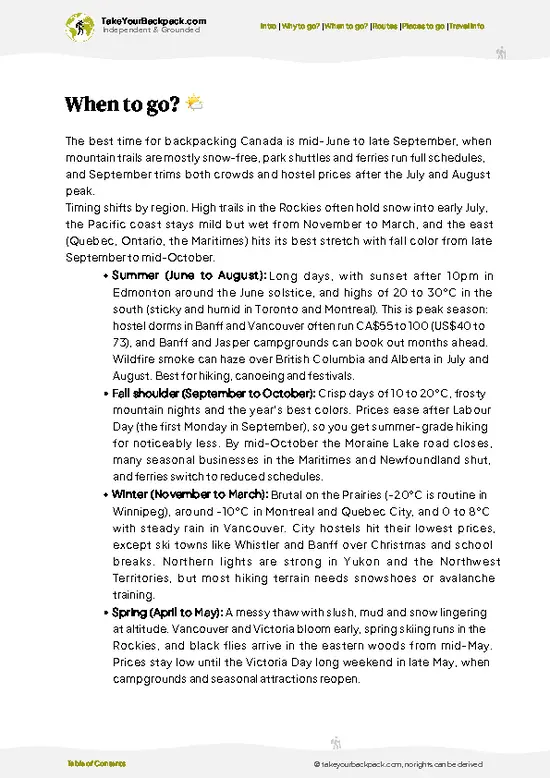
The West Coast Trail is only open for hiking from May 1 to September 30, and July and August are the driest and most reliable weeks.
  • Peak Summer (July to August): Days run roughly 14 to 22°C (57 to 72°F), with the lowest rain odds and fog that often burns off by midday. Daylight lasts about 15 to 16 hours. Permits sell out months ahead, and the trail is busiest.
  • Shoulder Months (May to June, September): Expect 8 to 17°C (46 to 63°F), more drizzle, muddier boardwalks and tougher creek crossings. Crowds thin, and quota spots are easier to get. September brings shorter days and bigger Pacific storms.
  • Closed Season (October to April): Winter storms, high surf and rising rivers shut the trail, and no ferry or rescue support runs in the cable cars and crossings.
  • Costs: Permit and fee totals stay the
… read more 👉
The West Coast Trail is only open for hiking from May 1 to September 30, and July and August are the driest and most reliable weeks.
  • Peak Summer (July to August): Days run roughly 14 to 22°C (57 to 72°F), with the lowest rain odds and fog that often burns off by midday. Daylight lasts about 15 to 16 hours. Permits sell out months ahead, and the trail is busiest.
  • Shoulder Months (May to June, September): Expect 8 to 17°C (46 to 63°F), more drizzle, muddier boardwalks and tougher creek crossings. Crowds thin, and quota spots are easier to get. September brings shorter days and bigger Pacific storms.
  • Closed Season (October to April): Winter storms, high surf and rising rivers shut the trail, and no ferry or rescue support runs in the cable cars and crossings.
  • Costs: Permit and fee totals stay the same all season, but Victoria and Port Renfrew lodging peaks in July and August.
Book your permit the day reservations open in winter, and pick a mid-week start to find lighter traffic.


source: climatestotravel.comJANJanuary: below average for travelingFEBFebruary: below average for travelingMARMarch: fair for travelingAPRApril: fair for travelingMAYMay: highly recommended for travelingJUNJune: excellent for travelingJULJuly: excellent for travelingAUGAugust: excellent for travelingSEPSeptember: highly recommended for travelingOCTOctober: fair for travelingNOVNovember: below average for travelingDECDecember: below average for traveling
Canada - the West Coast Trail

✈️ The backpacker research shortcutCanada Travel Guide

An offline-friendly backpacking guide with optimized travel routes, ranked highlights, transport advice, and the best areas to stay.
example page 0 from our offline Travel Guide for Canada
example page 1 from our offline Travel Guide for Canada
example page 2 from our offline Travel Guide for Canada
example page 3 from our offline Travel Guide for Canada
example page 4 from our offline Travel Guide for Canada
example page 5 from our offline Travel Guide for Canada
example page 6 from our offline Travel Guide for Canada
example page 7 from our offline Travel Guide for Canada
The digital guide (385 pages) contains:
✅ 125 highlights, ranked by travel appeal
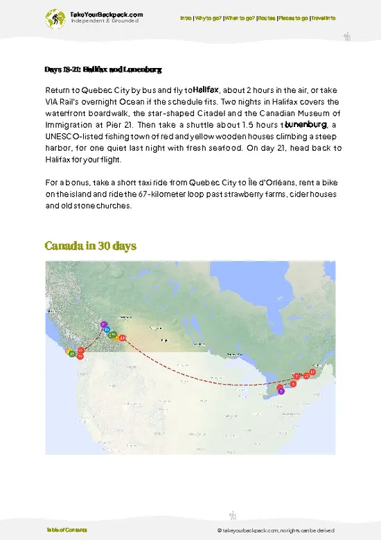
✅ Optimized 14, 21 & 30-day travel routes
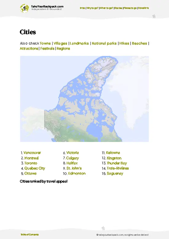
✅ Cities, national parks, landmarks, beaches
✅ How to get around
✅ Offline-friendly for travel without Wi-Fi
👉 Click to see all 30+ guide features

📅 Plan smarter in minutes, not weeks
✅ Month by month travel advice
✅ Festivals & national holidays
✅ Budget expectations

🗺️ Go to the right places, skip the overrated ones
✅ Honest pros & cons of destinations
✅ Top hikes, parks & viewpoints
✅ Lesser-known places most travelers miss
✅ Clear “worth it vs skip it” guidance

🛏️ Travel smoothly without rookie mistakes
✅ Best areas to stay
✅ Transport systems explained simply
✅ Common scams & safety advice
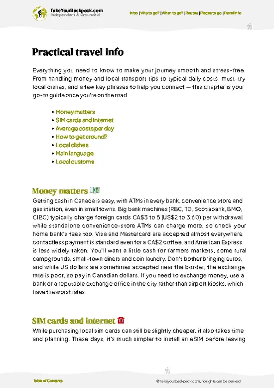
✅ SIM cards, money & practical tips

🌍 Understand the country, not just visit it
✅ Culture & traditions
✅ Local customs
✅ Festivals worth planning around
✅ Traveler-friendly historical context
✅ Insights that make places more meaningful

📱 Built for real travel conditions
✅ Fully downloadable PDF
✅ Works completely offline
✅ Optimized for phone use
✅ Useful in remote areas & buses
✅ Everything in one place
Stop searching, start planning
Get instant access to your full guide. 30‑day money-back guarantee.
+ Add another guide for just

By proceeding you agree to our terms.
Sent to your inbox immediately after payment • 100% Secure Checkout
Best Backpacking Travel Advisor 2025 tourism awardBest Backpacking
Travel Advisor
2025
What others say about Take Your Backpack Guides:
⭐⭐⭐⭐⭐
Fantastic, amazing amount of information!
⭐⭐⭐⭐⭐
My goodness this is amazing, it's what I've been looking for hats off too you!
⭐⭐⭐⭐⭐
I think this is absolutely BRILLIANT
⭐⭐⭐⭐
Very complete and informative. It's still missing places, but I gotta to commend you
⭐⭐⭐⭐⭐
This is truly amazing, thank you, can't wait to explore it with my kids!
⭐⭐⭐⭐⭐
Awesome resource, thank you!
⭐⭐⭐⭐⭐
This is amazing! Can't wait to explore the ones I haven't seen
⭐⭐⭐⭐
I love this! Well done, great idea.
⭐⭐⭐⭐⭐
Thanks for taking the time to make this gem!
⭐⭐⭐⭐⭐
This might be the best website I've ever seen.
⭐⭐⭐⭐⭐
Congratulations, and thank you so much for your work; it's incredibly valuable.
⭐⭐⭐⭐
In all seriousness I think you did a great job pointing out the important spots
⭐⭐⭐⭐⭐
10/10 very good
⭐⭐⭐⭐⭐
As someone who's only just starting to visit regularly this is awesome, thank you.
⭐⭐⭐⭐
Thank you very much! I'm going to visit my dad, it's going to be very useful!
⭐⭐⭐⭐⭐
This is really cool! We'll be travelling for the first time and this definitely come in handy.
⭐⭐⭐⭐⭐
You are now our minister of culture, congratulations 👨‍💼
⭐⭐⭐⭐⭐
Just wanted to tell you that this is a pearl! Going to follow your recommendations.
⭐⭐⭐⭐⭐
This is so cool. I'll definitely be using the resource for my travels soon.
⭐⭐⭐⭐⭐
This is very impressive! Good work.
⭐⭐⭐⭐⭐
This is an amazing and informative site. Very well done!

🛏️ Where to stay?Choosing the right base

If you enjoy meeting fellow travelers, consider choosing hostels with high ratings for atmosphere. On the other hand, if you prefer having your own space, a hotel might be a better option.

🥾 Hike detailsTrail overview: what to expect on the hike

The West Coast Trail is a 75-kilometer one-way route along the Pacific edge of Pacific Rim National Park Reserve, with permits required in the May to September season.
Total Distance: About 75 kilometers between the two trailheads.
Duration: Five to seven days for most hikers, with six the usual choice. Fast, fit groups sometimes finish in four.
Difficulty: Strenuous. Expect steep ladders, deep mud, slippery logs, creek crossings and long stretches of soft sand, all with a heavy pack.
Starting Point:
  • Pachena Bay (north): Near Bamfield, reached by seasonal shuttle buses that connect with Victoria and
… read more 👉
The West Coast Trail is a 75-kilometer one-way route along the Pacific edge of Pacific Rim National Park Reserve, with permits required in the May to September season.
Total Distance: About 75 kilometers between the two trailheads.
Duration: Five to seven days for most hikers, with six the usual choice. Fast, fit groups sometimes finish in four.
Difficulty: Strenuous. Expect steep ladders, deep mud, slippery logs, creek crossings and long stretches of soft sand, all with a heavy pack.
Starting Point:
  • Pachena Bay (north): Near Bamfield, reached by seasonal shuttle buses that connect with Victoria and Nanaimo.
  • Gordon River (south): Near Port Renfrew, also served by seasonal shuttle buses from Victoria. Most hikers join a mandatory orientation before setting off.
Major Landmarks:
  • Pachena Point Lighthouse: A white tower and cliff meadow close to the northern end.
  • Tsusiat Falls: A waterfall that lands directly on a beach.
  • Nitinat Narrows: A ferry crossing with crab shacks on the far side.
  • Carmanah Point Lighthouse: A staffed light station on the headland.
  • Owen Point: Tidal sea caves toward the southern end.
Terrain and Scenery: The route alternates between inland forest track with boardwalks and ladders and open beach walking on sand, gravel and sandstone shelves. Cliffs, sea stacks, surge channels and long Pacific views fill most days. Tides control some sections, so a tide table is as important as a map.
Vegetation: Temperate rainforest of western red cedar, Sitka spruce and hemlock, with thick moss, ferns and salal. Boardwalks cross bog patches, and wind-bent trees stand at the cliff edges.
Wildlife: Black bears, wolves and cougars live along the route, so food storage in the metal lockers at camps is required. Sea lions, harbor seals, bald eagles and gray whales are regularly seen from the shoreline.
⚠️ Hiking info can sometimes be outdated or inaccurate. Before you hit the trail, check the latest conditions with locals. If you do spot anything that's off, I'd love to hear from you, so I can update it for fellow travelers.

🛡️ SafetyStaying Safe: What Travelers Should Know

The West Coast Trail is a well-managed but physically demanding 75 km route, and most problems come from wet footing and underestimated pace. Roots, slick boardwalks and muddy sections cause the usual twisted ankles and falls, so slow down on the ladders (there are more than 100 ladder systems) and keep three points of contact. Rain can arrive in any month, so waterproof everything inside your pack and carry a real rain jacket, not a poncho. Tides matter: several beach sections and surge channels are only passable at low tide, so carry the Parks Canada tide table and plan your daily start around it. Cable car crossings of the Klanawa, Carmanah and Walbran rivers are self-operated, so practice with staff at the orientation before you rely on them. Black bears, cougars and wolves live here. … read more 👉
The West Coast Trail is a well-managed but physically demanding 75 km route, and most problems come from wet footing and underestimated pace. Roots, slick boardwalks and muddy sections cause the usual twisted ankles and falls, so slow down on the ladders (there are more than 100 ladder systems) and keep three points of contact. Rain can arrive in any month, so waterproof everything inside your pack and carry a real rain jacket, not a poncho. Tides matter: several beach sections and surge channels are only passable at low tide, so carry the Parks Canada tide table and plan your daily start around it. Cable car crossings of the Klanawa, Carmanah and Walbran rivers are self-operated, so practice with staff at the orientation before you rely on them. Black bears, cougars and wolves live here. Store all food and scented items in the metal bear lockers at campsites, cook on the beach, and make noise on forest sections. Cell coverage is absent, so carry a satellite messenger. Pack for a day or two longer than planned, and keep daily distances to 8 to 12 km.

FAQTraveler FAQ

Most hikers take 6 to 7 days to complete the West Coast Trail, though fit and experienced groups sometimes finish in 5. The route runs 75 km between Pachena Bay near Bamfield and Gordon River near Port Renfrew, and you can hike it in either direction. Daily distances of 8 to 14 km are typical because tide timing, ladders and mud slow progress considerably.
The West Coast Trail is strenuous and rated for experienced backpackers, mainly because of mud, roots, more than 100 ladders, cable car crossings and tide-dependent beach sections. Expect to carry a pack of 15 to 20 kg for a week, and expect rain even in summer. First-timers do complete it, but a few overnight trips with a full pack beforehand make a big difference. Anyone attempting it should be comfortable with self-reliance, since there is no cell coverage along the route.
Yes, the West Coast Trail requires a Parks Canada permit, and no guide is needed. Daily starts are capped, and reservations open in winter (February 5 for 2026) for the May to September season, with a reservation fee around US$20 to 30. The overnight use fee is around US$100 to 130 per person, plus a ferry fee of about US$15 for the Gordon River and Nitinat Narrows crossings. Everyone must attend an orientation session at the trailhead before setting off, and unreserved walk-up spots are limited.
⚠️ Things can change over time, so always validate details locally before you go.

Other Canadian hikes near West Coast Trail

Explore more nearby:

  • Juan de Fuca Trail—Botanical Beach tide pools, Sombrio surf, Mystic cave, rainforest ladders| 85 km away
  • Berg Lake Trail—Mount Robson, Kinney Lake turquoise, Valley of a Thousand Falls, calving glacier| 628 km away
  • Skyline Trail (Jasper)—The Notch, alpine ridgelines, Shovel Passes, Jasper backcountry| 684 km away

💡 Not sure where to go next?
Create a personalized itinerary for Canada including West Coast Trail and the places that fit your trip.

Generate my itinerary

👉 Discover all hikes

Or checkout all Canada has to offer (think cities, towns, villages, national parks, hikes, beaches, festivals)
Country photo of Canada

We 💚 feedbackFinal thoughts on hiking the West Coast Trail

West Coast Trail success depends on a small laminated tide table, not on your fitness. Many first-timers treat it as an afterthought, then reach a headland with water already swirling around it. I would plan each day's beach sections around the low tide, start early, and carry a spare hour of patience. Waiting for the sea costs less than a wet, rushed scramble.

✈️ When did I visit Canada?
As part of my 1.5 year travel around the world trip, I visited Canada in 2016.

✍️ Help improve this page!
The information on this page is based on my own backpacking experience in Canada, supplemented with up-to-date research and feedback from other travelers. Travel details can change, so if you notice anything outdated or incomplete, feel free to let me know.


🙋‍♂️ Give feedback

👋 Meet the founderWho’s Behind Take Your Backpack?

Johan, backpacker and founder of TakeYourBackpackHi, I’m Johan (Netherlands 🇳🇱), the creator of TakeYourBackpack. Over the past 3 decades, I’ve backpacked through 90+ countries across six continents, gaining extensive experience with independent travel, long-term trips, and overland routes.

This site is built on a combination of firsthand travel experience and carefully curated insights from other backpackers. Many guides are based on places I’ve personally visited, while others bring together tips, observations, and practical advice shared by trusted travelers I’ve met along the way.

The goal is to provide realistic, experience-driven guidance — not generic itineraries — so you can explore destinations with better context, clearer expectations, and more confidence.