×

Chile🇨🇱 | landmarksCerro San CristóbalFunicular and cable car, summit Virgin, city-basin views, hillside gardens and pools | things to do and best time to go

Explore Cañón del Río BlancoExplore Moai of Easter Island

Backpacking in Cerro San Cristóbal
🌟 Highlightunique site ranked #3
By Johan Kruseman 🇳🇱 | Updated October 19, 2026

Cerro San Cristóbal is a hill inside a city park, so it is not a remote summit: the Metropolitan Park of Santiago covers it, and it rises about 300 meters above the streets of Chile’s capital, just north of the Mapocho River in Providencia and Recoleta. Many travelers assume the Virgin statue is the whole point. Skip the idea of lingering at the summit. The view over the basin is the real draw, and the Andes frame it best on clear days after rain clears the smog. The funicular is worth taking once, mainly for the ride up through the trees. Walking up from Pedro de Valdivia Norte took me about an hour, and halfway a man on a bike offered me a swig of his mote con huesillo from a thermos. Steep sections exist, but the paved road is simple. A first day could mean a morning climb, a slow descent by funicular and an afternoon in Bellavista’s cafés below.

Discover everything you want to know in the 📖 Chile Travel Guide.


example page 0 from our offline Travel Guide for Chile
example page 1 from our offline Travel Guide for Chile
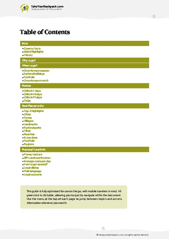
example page 2 from our offline Travel Guide for Chile
example page 3 from our offline Travel Guide for Chile
example page 4 from our offline Travel Guide for Chile
example page 5 from our offline Travel Guide for Chile
example page 6 from our offline Travel Guide for Chile
example page 7 from our offline Travel Guide for Chile
Loading the map 🌍
CLICK TO FILTER
cities
towns
villages
landmarks
national parks
hikes
beaches
attractions
festivals
regions
SHOW COUNTRY’S BESTSHOW ALL

✨ Why go?
Ranked #3 unique site in Chile
What makes it a must-see unique site

Cerro San Cristóbal gives you the quickest way to understand Santiago’s geography: a flat basin pinned between the Andes and the Coast Range, readable at a glance from the summit at roughly 880 meters above sea level. That orientation helps before you plan routes to Valparaíso, the Maipo Valley or the ski areas east of the city. The hill also holds a lot in one place. You can ride the Funicular de Santiago, which has run since 1925, or take the Teleférico cable car across to Pedro de Valdivia Norte, so your day does not need to backtrack. Swimming pools, a botanical garden and a zoo sit on its slopes for slower moments. Cost stays low, and trails and the bike-friendly roads let you pick your pace. Because the park sits next to Bellavista and its cheap eateries, it pairs easily with a wander … read more 👉
Cerro San Cristóbal gives you the quickest way to understand Santiago’s geography: a flat basin pinned between the Andes and the Coast Range, readable at a glance from the summit at roughly 880 meters above sea level. That orientation helps before you plan routes to Valparaíso, the Maipo Valley or the ski areas east of the city. The hill also holds a lot in one place. You can ride the Funicular de Santiago, which has run since 1925, or take the Teleférico cable car across to Pedro de Valdivia Norte, so your day does not need to backtrack. Swimming pools, a botanical garden and a zoo sit on its slopes for slower moments. Cost stays low, and trails and the bike-friendly roads let you pick your pace. Because the park sits next to Bellavista and its cheap eateries, it pairs easily with a wander through the neighborhood. Treat it as the opening move of a Santiago stay, then go farther afield once you know the lay of the land.

💡 HighlightsWhat this place is best known for

  1. Santuario de la Inmaculada Concepción: The white Virgin statue, about 14 meters tall, stands on the summit and is what most people search for. It was inaugurated in 1908, and the small amphitheater below hosts open-air masses, drawing pilgrims on feast days.
  2. Funicular de Santiago: Opened in 1925, this railway climbs from Pío Nono in Bellavista to the upper terminal in a few minutes. Its wooden-bench cars and the steep tracks through eucalyptus make it the classic way up.
  3. Teleférico: The cable car links the summit area with the Pedro de Valdivia Norte side, giving you a one-way ride that crosses the hill and wide views of Providencia’s towers.
  4. Mirador viewpoints: Along the summit road, terraces face the Andes and the city. Visibility is best in the morning after winter rains, when snow on the
… read more 👉
  1. Santuario de la Inmaculada Concepción: The white Virgin statue, about 14 meters tall, stands on the summit and is what most people search for. It was inaugurated in 1908, and the small amphitheater below hosts open-air masses, drawing pilgrims on feast days.
  2. Funicular de Santiago: Opened in 1925, this railway climbs from Pío Nono in Bellavista to the upper terminal in a few minutes. Its wooden-bench cars and the steep tracks through eucalyptus make it the classic way up.
  3. Teleférico: The cable car links the summit area with the Pedro de Valdivia Norte side, giving you a one-way ride that crosses the hill and wide views of Providencia’s towers.
  4. Mirador viewpoints: Along the summit road, terraces face the Andes and the city. Visibility is best in the morning after winter rains, when snow on the peaks stands sharp against the sky.
  5. Jardín Botánico Chagual: Dedicated to native Chilean flora, it lets you see species from the country’s different ecosystems, from desert shrubs to southern forest plants, in compact and shaded gardens.
  6. Piscina Tupahue: These outdoor pools on the slope are a popular cooling-off spot, with a long tradition among Santiago families and a pleasant tree-lined setting.
  7. Zoológico Nacional: Founded in 1925, the zoo spreads over steep hillside paths and holds mainly South American animals, including the Andean condor and the puma.
  8. Casa de la Cultura Anselmo Cádiz: An old house on the hill used for exhibitions and concerts, it is a quiet stop away from the main funicular crowd.
The funicular ride up pairs well with the Jardín Botánico Chagual in a single morning, and you can finish with the Teleférico down.
Spotted a mistake or missing something? Contact us.

Things to do around Cerro San Cristóbal

Ratings based on Tripadvisor reviews. When you book through this link, you support our work at no extra cost to you.

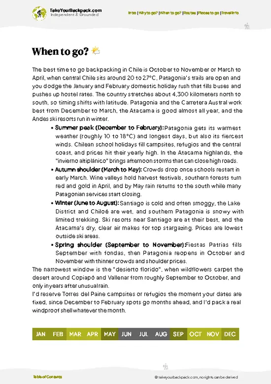
🌤️ When to go?Best time to visit Cerro San Cristóbal

Clear, dry months from September to April give Cerro San Cristóbal its sharpest views over Santiago and the Andes. Rain is rare in that stretch, and the smog that blurs the city is lighter.
  • Summer (December to February): Highs reach 29 to 32°C (84 to 90°F), with lows near 13°C (55°F). Days run about 14 hours, so late-afternoon climbs are easy. Midday on the exposed slopes is hot, and weekends draw the biggest crowds of local families.
  • Autumn (March to May): Highs of 17 to 26°C (63 to 79°F), crisp air, and the best visibility as the city clears. Crowds thin out.
  • Winter (June to August): Highs of 12 to 15°C (54 to 59°F), lows near 3°C (37°F), and daylight of about 10 hours. Rain is most likely here, but the sky after a front is often the clearest of the year, with snow on the Andes behind the city.
… read more 👉
Clear, dry months from September to April give Cerro San Cristóbal its sharpest views over Santiago and the Andes. Rain is rare in that stretch, and the smog that blurs the city is lighter.
  • Summer (December to February): Highs reach 29 to 32°C (84 to 90°F), with lows near 13°C (55°F). Days run about 14 hours, so late-afternoon climbs are easy. Midday on the exposed slopes is hot, and weekends draw the biggest crowds of local families.
  • Autumn (March to May): Highs of 17 to 26°C (63 to 79°F), crisp air, and the best visibility as the city clears. Crowds thin out.
  • Winter (June to August): Highs of 12 to 15°C (54 to 59°F), lows near 3°C (37°F), and daylight of about 10 hours. Rain is most likely here, but the sky after a front is often the clearest of the year, with snow on the Andes behind the city.
  • Spring (September to November): Highs of 20 to 26°C (68 to 79°F), blooming slopes, and moderate crowds.
Go on a weekday morning to avoid queues at the funicular and the busiest trails.


source: climatestotravel.comJANJanuary: highly recommended for travelingFEBFebruary: highly recommended for travelingMARMarch: highly recommended for travelingAPRApril: excellent for travelingMAYMay: excellent for travelingJUNJune: fair for travelingJULJuly: fair for travelingAUGAugust: fair for travelingSEPSeptember: excellent for travelingOCTOctober: excellent for travelingNOVNovember: highly recommended for travelingDECDecember: highly recommended for traveling
chile-unique-site-cerro-san-cristobal
© Google | Shyam Barú

✈️ The backpacker research shortcutChile Travel Guide

An offline-friendly backpacking guide with optimized travel routes, ranked highlights, transport advice, and the best areas to stay.
example page 0 from our offline Travel Guide for Chile
example page 1 from our offline Travel Guide for Chile
example page 2 from our offline Travel Guide for Chile
example page 3 from our offline Travel Guide for Chile
example page 4 from our offline Travel Guide for Chile
example page 5 from our offline Travel Guide for Chile
example page 6 from our offline Travel Guide for Chile
example page 7 from our offline Travel Guide for Chile
The digital guide (333 pages) contains:
✅ 107 highlights, ranked by travel appeal
✅ Optimized 7, 14 & 21-day travel routes
✅ Cities, national parks, landmarks, beaches
✅ How to get around
✅ Offline-friendly for travel without Wi-Fi
👉 Click to see all 30+ guide features

📅 Plan smarter in minutes, not weeks
✅ Month by month travel advice
✅ Festivals & national holidays
✅ Budget expectations

🗺️ Go to the right places, skip the overrated ones
✅ Honest pros & cons of destinations
✅ Top hikes, parks & viewpoints
✅ Lesser-known places most travelers miss
✅ Clear “worth it vs skip it” guidance

🛏️ Travel smoothly without rookie mistakes
✅ Best areas to stay
✅ Transport systems explained simply
✅ Common scams & safety advice
✅ SIM cards, money & practical tips

🌍 Understand the country, not just visit it
✅ Culture & traditions
✅ 52 Essential phrases & customs
✅ Festivals worth planning around
✅ Traveler-friendly historical context
✅ Insights that make places more meaningful

📱 Built for real travel conditions
✅ Fully downloadable PDF
✅ Works completely offline
✅ Optimized for phone use
✅ Useful in remote areas & buses
✅ Everything in one place
Stop searching, start planning
Get instant access to your full guide. 30‑day money-back guarantee.
+ Add another guide for just

By proceeding you agree to our terms.
Sent to your inbox immediately after payment • 100% Secure Checkout
Best Backpacking Travel Advisor 2025 tourism awardBest Backpacking
Travel Advisor
2025
What others say about Take Your Backpack Guides:
⭐⭐⭐⭐⭐
Fantastic, amazing amount of information!
⭐⭐⭐⭐⭐
My goodness this is amazing, it's what I've been looking for hats off too you!
⭐⭐⭐⭐⭐
I think this is absolutely BRILLIANT
⭐⭐⭐⭐
Very complete and informative. It's still missing places, but I gotta to commend you
⭐⭐⭐⭐⭐
This is truly amazing, thank you, can't wait to explore it with my kids!
⭐⭐⭐⭐⭐
Awesome resource, thank you!
⭐⭐⭐⭐⭐
This is amazing! Can't wait to explore the ones I haven't seen
⭐⭐⭐⭐
I love this! Well done, great idea.
⭐⭐⭐⭐⭐
Thanks for taking the time to make this gem!
⭐⭐⭐⭐⭐
This might be the best website I've ever seen.
⭐⭐⭐⭐⭐
Congratulations, and thank you so much for your work; it's incredibly valuable.
⭐⭐⭐⭐
In all seriousness I think you did a great job pointing out the important spots
⭐⭐⭐⭐⭐
10/10 very good
⭐⭐⭐⭐⭐
As someone who's only just starting to visit regularly this is awesome, thank you.
⭐⭐⭐⭐
Thank you very much! I'm going to visit my dad, it's going to be very useful!
⭐⭐⭐⭐⭐
This is really cool! We'll be travelling for the first time and this definitely come in handy.
⭐⭐⭐⭐⭐
You are now our minister of culture, congratulations 👨‍💼
⭐⭐⭐⭐⭐
Just wanted to tell you that this is a pearl! Going to follow your recommendations.
⭐⭐⭐⭐⭐
This is so cool. I'll definitely be using the resource for my travels soon.
⭐⭐⭐⭐⭐
This is very impressive! Good work.
⭐⭐⭐⭐⭐
This is an amazing and informative site. Very well done!

🛏️ Where to stay?Best areas and accommodation options

Bellavista and Providencia are the two best bases, both within walking distance of the Cerro San Cristóbal entrances. Bellavista sits right at the foot of the hill, beside the Pío Nono entrance where the funicular starts. It has the densest cluster of hostels in Santiago, plus murals, cheap empanada counters, and a late bar scene. It is the most social choice for solo travelers, and the streets are lively into the night. Keep an eye on your phone and bag after dark, as petty theft happens around the bars.

Providencia, on the hill’s southern and eastern side, is calmer and tidier. Metro Line 1 … read more 👉
Bellavista and Providencia are the two best bases, both within walking distance of the Cerro San Cristóbal entrances. Bellavista sits right at the foot of the hill, beside the Pío Nono entrance where the funicular starts. It has the densest cluster of hostels in Santiago, plus murals, cheap empanada counters, and a late bar scene. It is the most social choice for solo travelers, and the streets are lively into the night. Keep an eye on your phone and bag after dark, as petty theft happens around the bars.

Providencia, on the hill’s southern and eastern side, is calmer and tidier. Metro Line 1 and Line 5 stations are close, and the Pedro de Valdivia entrance to the park is a short walk away. Expect quieter hostels, cafés, and easy grocery runs, with a more residential feel. It suits those who want a good night’s sleep and safe walks home.

Barrio Lastarria and Barrio Brasil are worth considering if you want a younger, arty crowd. Both are a short Metro ride or a 20 to 30 minute walk from the park. Book dorms early for January and February, when Bellavista fills up first.

👛 Costs (as of 19 October 2026)What things cost and how to budget

Plan on roughly US$28 to 56 per day for Cerro San Cristóbal and a backpacker base nearby, with the park itself costing very little. Entry to the hill is free on foot, and you pay only for the funicular, cable car, and extras. Everything is paid in Chilean pesos, and cards are widely accepted at the larger attractions.
CategoryBudget RangeLocal Reality
Park entryUS$0Free for pedestrians through the Pío Nono and Pedro de Valdivia gates
Funicular and cable carUS$3 to 8Return tickets cost more at weekends and for the combined ride; walking up is free and takes about 45 to 60 minutes
Accommodation (high season)US$14 to 25Dorm bed in Bellavista or Providencia; low season often drops to US$10 to 18
FoodUS$8 to 15Set lunch menus cost US$5 to 8, with empanadas and sandwiches cheaper; the hill’s kiosks sell
… read more 👉
Plan on roughly US$28 to 56 per day for Cerro San Cristóbal and a backpacker base nearby, with the park itself costing very little. Entry to the hill is free on foot, and you pay only for the funicular, cable car, and extras. Everything is paid in Chilean pesos, and cards are widely accepted at the larger attractions.
CategoryBudget RangeLocal Reality
Park entryUS$0Free for pedestrians through the Pío Nono and Pedro de Valdivia gates
Funicular and cable carUS$3 to 8Return tickets cost more at weekends and for the combined ride; walking up is free and takes about 45 to 60 minutes
Accommodation (high season)US$14 to 25Dorm bed in Bellavista or Providencia; low season often drops to US$10 to 18
FoodUS$8 to 15Set lunch menus cost US$5 to 8, with empanadas and sandwiches cheaper; the hill’s kiosks sell mote con huesillo
Local transportUS$1 to 3Metro and bus fares run about US$0.90 to 1.30 per trip with a Bip! card
ExtrasUS$2 to 5Zoo entry, if you visit, costs more, around US$10 to 15; pool and water bottles add small costs
Total Daily BudgetUS$28 to 56Typically US$40 per day with a dorm bed, two cheap meals, and a funicular ride


source: chile.travel
⚠️ Prices can change and everyone travels differently, so take this as a rough guide. Hope it helps you plan your adventure!

FAQTraveler FAQ

Cerro San Cristóbal is an 880 meter (2,887 ft) hill rising about 300 meters above Santiago, set inside Parque Metropolitano, one of the largest urban parks in the world. At the summit stands a 14 meter statue of the Virgin Mary, with a small chapel and sweeping views to the Andes. The slopes also hold the zoo, two swimming pools, gardens, and a network of walking and cycling trails.
Allow 2 to 4 hours for a standard visit that combines the funicular, the summit, and a stroll to the viewpoints. Hikers walking up from Bellavista need about 45 to 60 minutes each way on the steeper trails. Add another 2 hours or so if you want to visit the zoo or the Tupahue pool area. Weekday mornings are the quietest.
From central Santiago, take Metro Line 1 to Baquedano and walk about 15 minutes north to the Pío Nono entrance in Bellavista, where the funicular starts. Alternatively, take Metro Line 1 to Pedro de Valdivia and walk to the cable car station, or use the Line 2 Cerro Blanco station for the north entrance. The metro fare is around US$1, and the funicular return costs roughly US$3 to 8.
⚠️ Things can change over time, so always validate details locally before you go.

Other Chilean landmarks near Cerro San Cristóbal

Explore more nearby:

  • Cascada de las Ánimas—Private canyon reserve, stream cascades, snowmelt pools, horseback and rafting| 45 km away
  • Cañón del Río Blanco—Milky glacial river, fractured canyon walls, gated valley road, hydroelectric works| 106 km away
  • Ojos del Salado—6,893 m summit, crater pond, Refugio Atacama, flamingo lagoons| 730 km away

💡 Not sure where to go next?
Create a personalized itinerary for Chile including Cerro San Cristóbal and the places that fit your trip.

Generate my itinerary

👉 Discover all landmarks

Or checkout all Chile has to offer (think cities, towns, villages, national parks, hikes, beaches, festivals)
Country photo of Chile

We 💚 feedbackParting advice and final tips

Cerro San Cristóbal works best as the first stop in Santiago, before you spend days elsewhere. Pair it with the Bellavista neighborhood below, then head west to Valparaíso or east to the Andes once you have read the city from above. I would walk up and ride the funicular down.

✈️ When did I visit Chile?
I have visited Chile, together with Argentina, in September 2012.

✍️ Help improve this page!
The information on this page is based on my own backpacking experience in Chile, supplemented with up-to-date research and feedback from other travelers. Travel details can change, so if you notice anything outdated or incomplete, feel free to let me know.


🙋‍♂️ Give feedback

👋 Meet the founderWho’s Behind Take Your Backpack?

Johan, backpacker and founder of TakeYourBackpackHi, I’m Johan (Netherlands 🇳🇱), the creator of TakeYourBackpack. Over the past 3 decades, I’ve backpacked through 90+ countries across six continents, gaining extensive experience with independent travel, long-term trips, and overland routes.

This site is built on a combination of firsthand travel experience and carefully curated insights from other backpackers. Many guides are based on places I’ve personally visited, while others bring together tips, observations, and practical advice shared by trusted travelers I’ve met along the way.

The goal is to provide realistic, experience-driven guidance — not generic itineraries — so you can explore destinations with better context, clearer expectations, and more confidence.