×

Chile🇨🇱 | landmarksOjos del Salado6,893 m summit, crater pond, Refugio Atacama, flamingo lagoons | things to do and best time to go

Explore Moai of Easter IslandExplore Punta de Choros

Backpacking in Ojos del Salado
🏆 Top pickunique site ranked #2
By Johan Kruseman 🇳🇱 | Updated October 19, 2026

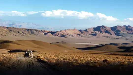
Ojos del Salado, the highest volcano on Earth at roughly 6,893 meters, is a walk-up for fit, acclimatized trekkers, and most of the route is a hike over scree and sand rather than ice and ropes. It sits in the Atacama Region in the north of Chile, east of Copiapó, right on the Argentine border. The dry air explains why it is so approachable: there is almost no snow to bury the trail, so the slopes stay climbable. On the ground, the dirt road to the base passes salt flats and turquoise lagoons, which gives you flamingos and a slow, useful acclimatization. I expected a pointed cone. Up close it is a broad, dark, rubbly mass that you only recognize as a giant by how long the walking takes. The cost is real: remote logistics, thin air, and a final scramble near the crater rim. Next to Aconcagua, it is quieter, drier and far less glaciated.

Discover everything you want to know in the 📖 Chile Travel Guide.


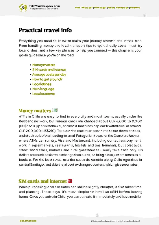
example page 0 from our offline Travel Guide for Chile
example page 1 from our offline Travel Guide for Chile
example page 2 from our offline Travel Guide for Chile
example page 3 from our offline Travel Guide for Chile
example page 4 from our offline Travel Guide for Chile
example page 5 from our offline Travel Guide for Chile
example page 6 from our offline Travel Guide for Chile
example page 7 from our offline Travel Guide for Chile
Loading the map 🌍
CLICK TO FILTER
cities
towns
villages
landmarks
national parks
hikes
beaches
attractions
festivals
regions
SHOW COUNTRY’S BESTSHOW ALL

✨ Why go?
Ranked #2 unique site in Chile
Why Ojos del Salado should be on your travel list

Ojos del Salado gives you a 6,000-meter-plus summit without the crowds, permit queues and glacier gear that come with the better-known giants. That is the main reason to go. The mountain is a proper high-altitude objective, yet the standard route is a long, steady grind, so a strong hiker who has done some multi-day trekking at altitude has a realistic shot. Acclimatization is built into the approach, because the road climbs past Laguna Verde and Laguna Santa Rosa, and those stops are rewards in themselves.
The other draw is the setting. This is the empty, high-desert side of Chile, where you share the landscape with vicuñas, flamingos and wind. It also fits a larger route neatly. You can pair it with the coastal desert around Copiapó, or cross the Andes to the Argentine side through Fiambalá, … read more 👉
Ojos del Salado gives you a 6,000-meter-plus summit without the crowds, permit queues and glacier gear that come with the better-known giants. That is the main reason to go. The mountain is a proper high-altitude objective, yet the standard route is a long, steady grind, so a strong hiker who has done some multi-day trekking at altitude has a realistic shot. Acclimatization is built into the approach, because the road climbs past Laguna Verde and Laguna Santa Rosa, and those stops are rewards in themselves.
The other draw is the setting. This is the empty, high-desert side of Chile, where you share the landscape with vicuñas, flamingos and wind. It also fits a larger route neatly. You can pair it with the coastal desert around Copiapó, or cross the Andes to the Argentine side through Fiambalá, where hot springs wait after the cold. If you only want a summit photo, there are easier peaks. If you want a quiet mountain at the roof of the Southern Hemisphere's volcanoes, with the highest crater lake on the planet near the top, this is it.

💡 HighlightsKey sights and experiences for travelers

  1. The summit of Ojos del Salado: The reason anyone comes. The final stretch ends with an exposed scramble up the crater rim, then you stand on the highest volcano on Earth, looking across to Argentina and down into the crater.
  2. The summit crater lake: A small frozen pond at roughly 6,480 meters, often cited as the highest lake in the world. Reaching it is a bonus of the summit push, and it makes the crater feel unlike any other.
  3. Refugio Atacama: The main base hut at about 5,200 meters, where most climbers sleep before the push. It gives you a heated room, other climbers' stories and the best view of the cone's long, dark flank.
  4. Refugio Tejos: A tiny emergency shelter at roughly 5,800 meters, among the highest in the world. It cuts hours off summit day for those who stay, and it is a good place to
… read more 👉
  1. The summit of Ojos del Salado: The reason anyone comes. The final stretch ends with an exposed scramble up the crater rim, then you stand on the highest volcano on Earth, looking across to Argentina and down into the crater.
  2. The summit crater lake: A small frozen pond at roughly 6,480 meters, often cited as the highest lake in the world. Reaching it is a bonus of the summit push, and it makes the crater feel unlike any other.
  3. Refugio Atacama: The main base hut at about 5,200 meters, where most climbers sleep before the push. It gives you a heated room, other climbers' stories and the best view of the cone's long, dark flank.
  4. Refugio Tejos: A tiny emergency shelter at roughly 5,800 meters, among the highest in the world. It cuts hours off summit day for those who stay, and it is a good place to appreciate how thin the air has become.
  5. Laguna Verde: A bright green-blue lagoon at around 4,300 meters, with thermal pools on the shore. It is the best place for an acclimatization stop, and a soak here is the best way to reward tired legs.
  6. Laguna Santa Rosa: A high salt lagoon in Nevado Tres Cruces National Park, with Andean flamingos feeding in the shallows. The mirrored peaks around it make this the best photo stop on the approach.
  7. Salar de Maricunga: A white salt flat on the way in, framed by volcanoes. It is the first place on the road where the landscape stops looking like ordinary desert and starts looking like the high Andes.
Together the road stops take two to three days, and with acclimatization and the summit push the full experience takes about a week to ten days.
Spotted a mistake or missing something? Contact us.

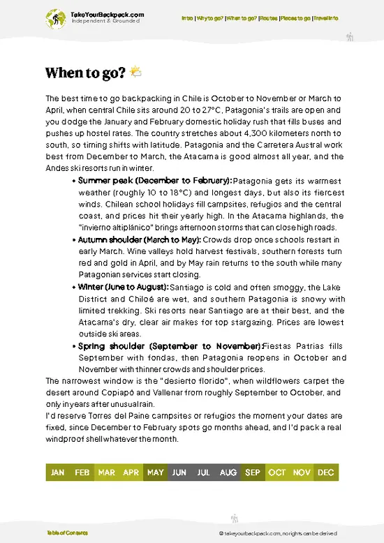
🌤️ When to go?Weather, crowds, and seasonal trade-offs

Ojos del Salado is climbed from December to March, when the high Atacama has its most settled weather and the mountain huts and the Chilean access road are open.
  • Peak Season (January to February): Days at the Atacama Refuge (5,200 m) run about 5 to 15°C (41 to 59°F). Nights drop to -10°C (14°F) or lower, and the summit sits near -15 to -25°C (5 to -13°F) with wind. Expect the most climbers and the highest guide prices.
  • Early Season (December): More snow on the upper route and quieter huts. Daylight is long, about 14 hours.
  • Late Season (March): Fewer people, clear skies, and slightly shorter days. Occasional storms can close the route.
  • Winter (June to September): Temperatures below -30°C (-22°F) and fierce wind. Expeditions are rare and the road is often snowbound.
  • Altiplanic Winter (January to
… read more 👉
Ojos del Salado is climbed from December to March, when the high Atacama has its most settled weather and the mountain huts and the Chilean access road are open.
  • Peak Season (January to February): Days at the Atacama Refuge (5,200 m) run about 5 to 15°C (41 to 59°F). Nights drop to -10°C (14°F) or lower, and the summit sits near -15 to -25°C (5 to -13°F) with wind. Expect the most climbers and the highest guide prices.
  • Early Season (December): More snow on the upper route and quieter huts. Daylight is long, about 14 hours.
  • Late Season (March): Fewer people, clear skies, and slightly shorter days. Occasional storms can close the route.
  • Winter (June to September): Temperatures below -30°C (-22°F) and fierce wind. Expeditions are rare and the road is often snowbound.
  • Altiplanic Winter (January to February): Afternoon storms occasionally reach the Argentine side, so check forecasts.
Book your acclimatization days in Copiapó or Fiambalá first, and schedule the summit attempt for a mid-week window to avoid weekend crowds at the refuges.


source: climatestotravel.comJANJanuary: excellent for travelingFEBFebruary: excellent for travelingMARMarch: highly recommended for travelingAPRApril: fair for travelingMAYMay: below average for travelingJUNJune: below average for travelingJULJuly: below average for travelingAUGAugust: below average for travelingSEPSeptember: fair for travelingOCTOctober: good for travelingNOVNovember: highly recommended for travelingDECDecember: excellent for traveling
chile-unique-site-ojos-del-salado
© Google | Betty Greg

✈️ The backpacker research shortcutChile Travel Guide

An offline-friendly backpacking guide with optimized travel routes, ranked highlights, transport advice, and the best areas to stay.
example page 0 from our offline Travel Guide for Chile
example page 1 from our offline Travel Guide for Chile
example page 2 from our offline Travel Guide for Chile
example page 3 from our offline Travel Guide for Chile
example page 4 from our offline Travel Guide for Chile
example page 5 from our offline Travel Guide for Chile
example page 6 from our offline Travel Guide for Chile
example page 7 from our offline Travel Guide for Chile
The digital guide (333 pages) contains:
✅ 107 highlights, ranked by travel appeal
✅ Optimized 7, 14 & 21-day travel routes
✅ Cities, national parks, landmarks, beaches
✅ How to get around
✅ Offline-friendly for travel without Wi-Fi
👉 Click to see all 30+ guide features

📅 Plan smarter in minutes, not weeks
✅ Month by month travel advice
✅ Festivals & national holidays
✅ Budget expectations

🗺️ Go to the right places, skip the overrated ones
✅ Honest pros & cons of destinations
✅ Top hikes, parks & viewpoints
✅ Lesser-known places most travelers miss
✅ Clear “worth it vs skip it” guidance

🛏️ Travel smoothly without rookie mistakes
✅ Best areas to stay
✅ Transport systems explained simply
✅ Common scams & safety advice
✅ SIM cards, money & practical tips

🌍 Understand the country, not just visit it
✅ Culture & traditions
✅ 52 Essential phrases & customs
✅ Festivals worth planning around
✅ Traveler-friendly historical context
✅ Insights that make places more meaningful

📱 Built for real travel conditions
✅ Fully downloadable PDF
✅ Works completely offline
✅ Optimized for phone use
✅ Useful in remote areas & buses
✅ Everything in one place
Stop searching, start planning
Get instant access to your full guide. 30‑day money-back guarantee.
+ Add another guide for just

By proceeding you agree to our terms.
Sent to your inbox immediately after payment • 100% Secure Checkout
Best Backpacking Travel Advisor 2025 tourism awardBest Backpacking
Travel Advisor
2025
What others say about Take Your Backpack Guides:
⭐⭐⭐⭐⭐
Fantastic, amazing amount of information!
⭐⭐⭐⭐⭐
My goodness this is amazing, it's what I've been looking for hats off too you!
⭐⭐⭐⭐⭐
I think this is absolutely BRILLIANT
⭐⭐⭐⭐
Very complete and informative. It's still missing places, but I gotta to commend you
⭐⭐⭐⭐⭐
This is truly amazing, thank you, can't wait to explore it with my kids!
⭐⭐⭐⭐⭐
Awesome resource, thank you!
⭐⭐⭐⭐⭐
This is amazing! Can't wait to explore the ones I haven't seen
⭐⭐⭐⭐
I love this! Well done, great idea.
⭐⭐⭐⭐⭐
Thanks for taking the time to make this gem!
⭐⭐⭐⭐⭐
This might be the best website I've ever seen.
⭐⭐⭐⭐⭐
Congratulations, and thank you so much for your work; it's incredibly valuable.
⭐⭐⭐⭐
In all seriousness I think you did a great job pointing out the important spots
⭐⭐⭐⭐⭐
10/10 very good
⭐⭐⭐⭐⭐
As someone who's only just starting to visit regularly this is awesome, thank you.
⭐⭐⭐⭐
Thank you very much! I'm going to visit my dad, it's going to be very useful!
⭐⭐⭐⭐⭐
This is really cool! We'll be travelling for the first time and this definitely come in handy.
⭐⭐⭐⭐⭐
You are now our minister of culture, congratulations 👨‍💼
⭐⭐⭐⭐⭐
Just wanted to tell you that this is a pearl! Going to follow your recommendations.
⭐⭐⭐⭐⭐
This is so cool. I'll definitely be using the resource for my travels soon.
⭐⭐⭐⭐⭐
This is very impressive! Good work.
⭐⭐⭐⭐⭐
This is an amazing and informative site. Very well done!

🛏️ Where to stay?Where staying makes the most sense

Copiapó is the best base for Ojos del Salado, because it is the nearest city with supermarkets, outfitters, and the tour agencies that run the 4x4 transfers to the mountain, about 5 to 6 hours away by road.
The center around Plaza de Armas has the cheapest beds, with dorms and simple private rooms at US$15 to 40. Mining-town energy keeps the streets lively in the evening, and this is where you meet other climbers sorting permits, gear, and shared rides. The area is walkable and reasonably safe by day. At night, stick to the main streets near the plaza.
For a quieter alternative, look at Caldera … read more 👉
Copiapó is the best base for Ojos del Salado, because it is the nearest city with supermarkets, outfitters, and the tour agencies that run the 4x4 transfers to the mountain, about 5 to 6 hours away by road.
The center around Plaza de Armas has the cheapest beds, with dorms and simple private rooms at US$15 to 40. Mining-town energy keeps the streets lively in the evening, and this is where you meet other climbers sorting permits, gear, and shared rides. The area is walkable and reasonably safe by day. At night, stick to the main streets near the plaza.
For a quieter alternative, look at Caldera on the coast, roughly an hour from Copiapó. Beachside guesthouses are cheaper off-season and good for resting before or after the expedition, though the social scene is thinner.
On the Argentine side, Fiambalá has simple guesthouses and campgrounds where overlanders and high-altitude climbers gather. It suits you if you are crossing from Catamarca, and the thermal springs help tired legs.
At the mountain, the refuges are basic and shared, with bunks or tent space around the Atacama and Tejos huts. Bring a sleeping bag rated to at least -15°C (5°F).

👛 Costs (as of 19 October 2026)How expensive it really is

Expect to spend around US$135 a day on an Ojos del Salado trip when you split a guided or semi-guided climb across the acclimatization days, and far more if you hire a full expedition.
CategoryBudget RangeLocal Reality
Accommodation (high season)US$15 to 40Dorms or simple rooms in Copiapó. Refuge bunks near the mountain cost a little more.
FoodUS$15 to 25Set lunch menus in Copiapó cost US$6 to 10. You carry freeze-dried meals and snacks higher up.
Local TransportUS$10 to 20Colectivos and buses around town. Shared 4x4 transfers to the mountain run US$100 to 250 per person.
Climbing PermitUS$0 to 10The Chilean side requires a registration with the border and mountain authorities, often handled by your agency.
Guide and GearUS$50 to 80Per day averaged over a typical 8 to 12 day program. Full guided
… read more 👉
Expect to spend around US$135 a day on an Ojos del Salado trip when you split a guided or semi-guided climb across the acclimatization days, and far more if you hire a full expedition.
CategoryBudget RangeLocal Reality
Accommodation (high season)US$15 to 40Dorms or simple rooms in Copiapó. Refuge bunks near the mountain cost a little more.
FoodUS$15 to 25Set lunch menus in Copiapó cost US$6 to 10. You carry freeze-dried meals and snacks higher up.
Local TransportUS$10 to 20Colectivos and buses around town. Shared 4x4 transfers to the mountain run US$100 to 250 per person.
Climbing PermitUS$0 to 10The Chilean side requires a registration with the border and mountain authorities, often handled by your agency.
Guide and GearUS$50 to 80Per day averaged over a typical 8 to 12 day program. Full guided expeditions total US$1,800 to 3,500. Rental boots and sleeping bags are around US$10 to 20 a day.
MiscellaneousUS$5 to 10Water, sunscreen, and gas canisters.
Total Daily BudgetUS$95 to 185Per person, per day, in high season.


source: chile.travel
⚠️ Prices can change and everyone travels differently, so take this as a rough guide. Hope it helps you plan your adventure!

FAQFrequently asked questions about Ojos del Salado

Ojos del Salado is the highest volcano on Earth at 6,893 meters, on the Chile and Argentina border in the Atacama Region. It is also the second-highest peak in the Americas after Aconcagua. The standard Chilean route is a non-technical walk-up in summer, with the Atacama Refuge at about 5,200 meters as the main high camp.
Plan 8 to 12 days for a safe Ojos del Salado climb, including acclimatization. Most expeditions spend 3 to 4 days at lower altitudes around Copiapó and the lagoons such as Laguna Verde (about 4,300 meters). The summit push itself is usually a long day of 8 to 10 hours from the high refuge, and a day trip is not realistic.
Fly or take a bus to Copiapó, then continue about 5 to 6 hours by 4x4 along the road past Laguna Verde to the Chilean base. Buses from Santiago take roughly 12 to 14 hours, and flights take about 1 hour 30 minutes. Most climbers book a transfer through an agency in Copiapó, costing US$100 to 250 per person shared, since there is no public transport to the mountain.
⚠️ Things can change over time, so always validate details locally before you go.

Other Chilean landmarks near Ojos del Salado

Explore more nearby:

  • Cañón del Río Blanco—Milky glacial river, fractured canyon walls, gated valley road, hydroelectric works| 624 km away
  • Cerro San Cristóbal—Funicular and cable car, summit Virgin, city-basin views, hillside gardens and pools| 730 km away
  • Cascada de las Ánimas—Private canyon reserve, stream cascades, snowmelt pools, horseback and rafting| 756 km away

💡 Not sure where to go next?
Create a personalized itinerary for Chile including Ojos del Salado and the places that fit your trip.

Generate my itinerary

👉 Discover all landmarks

Or checkout all Chile has to offer (think cities, towns, villages, national parks, hikes, beaches, festivals)
Country photo of Chile

We 💚 feedbackIs it worth it?

Ojos del Salado suits strong hikers who want a real 6,000-meter summit without a crowd, and anyone who loves empty high-desert landscapes. It is not for people short on time, since acclimatization cannot be rushed. I would book a guide for the first big peak, and spend extra days at Laguna Verde before heading up.

✈️ When did I visit Chile?
I have visited Chile, together with Argentina, in September 2012.

✍️ Help improve this page!
The information on this page is based on my own backpacking experience in Chile, supplemented with up-to-date research and feedback from other travelers. Travel details can change, so if you notice anything outdated or incomplete, feel free to let me know.


🙋‍♂️ Give feedback

👋 Meet the founderWho’s Behind Take Your Backpack?

Johan, backpacker and founder of TakeYourBackpackHi, I’m Johan (Netherlands 🇳🇱), the creator of TakeYourBackpack. Over the past 3 decades, I’ve backpacked through 90+ countries across six continents, gaining extensive experience with independent travel, long-term trips, and overland routes.

This site is built on a combination of firsthand travel experience and carefully curated insights from other backpackers. Many guides are based on places I’ve personally visited, while others bring together tips, observations, and practical advice shared by trusted travelers I’ve met along the way.

The goal is to provide realistic, experience-driven guidance — not generic itineraries — so you can explore destinations with better context, clearer expectations, and more confidence.