×

Chile🇨🇱 | national parksConguillío National ParkLlaima volcano, lava-dammed lake, monkey puzzle trees, Sierra Nevada trail | things to do and best time to go

Explore Cabo de Hornos National ParkExplore Patagonia National Park

Backpacking in Conguillío
🌟 Highlightnational park ranked #6
By Johan Kruseman 🇳🇱 | Updated October 19, 2026

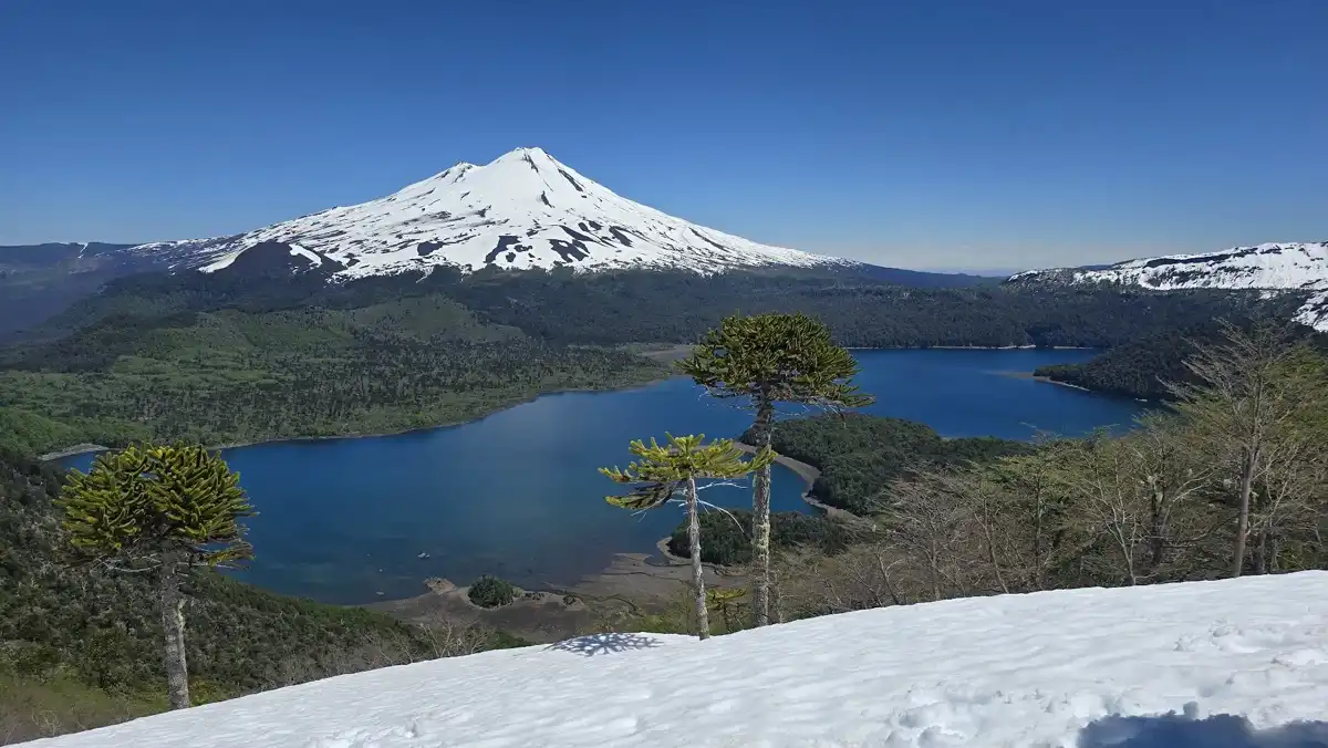
The practical advantage of Conguillío National Park is that one gravel road loops past the volcano, two lakes and the araucaria forests, so you can see most of it on foot from a single base. The park sits in the Araucanía Region in the south of Chile, east of Temuco and Curacautín. Trails run from short lake boardwalks to a full day on Volcán Llaima’s slopes, and the monkey puzzle forests hold Magellanic woodpeckers and the odd puma track. Access is the hard part: public transport stops short, the road is rough, and January fills the campgrounds. At the gate, the ranger tapped my map and said, “Sierra Nevada first, before the buses arrive.” I went, and had the trail to myself. Black lava fields lay beside the turquoise water of Laguna Captrén.

Discover everything you want to know in the 📖 Chile Travel Guide.


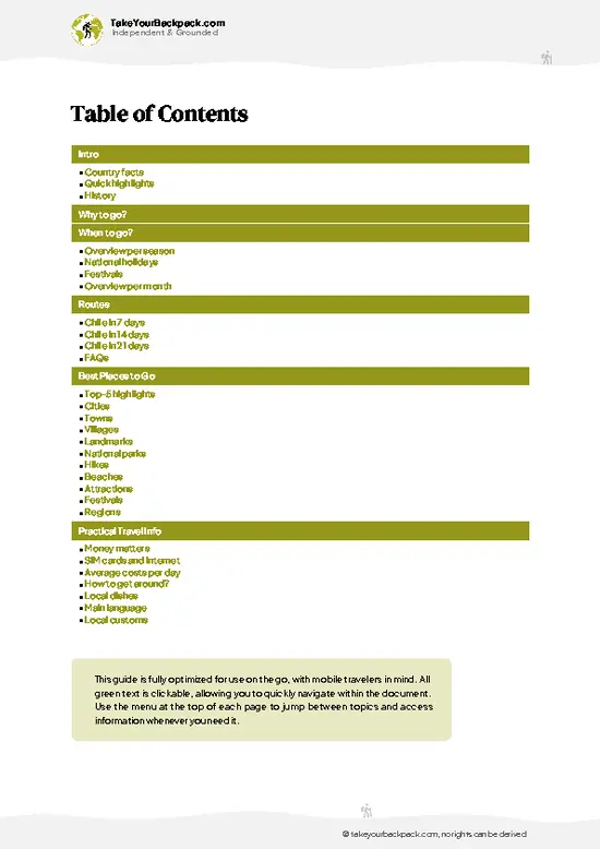
example page 0 from our offline Travel Guide for Chile
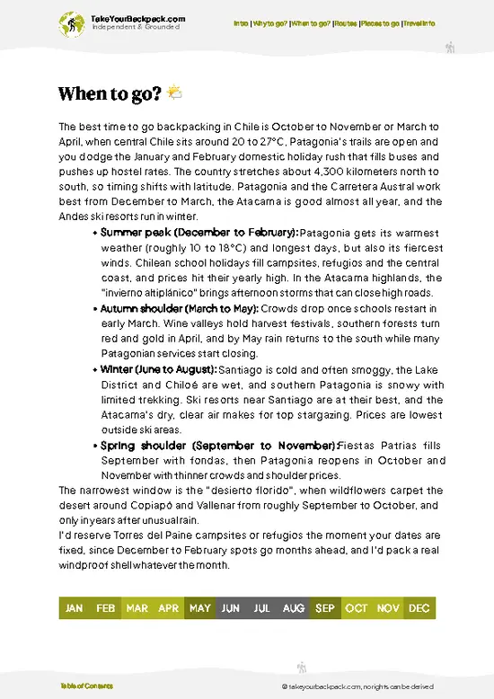
example page 1 from our offline Travel Guide for Chile
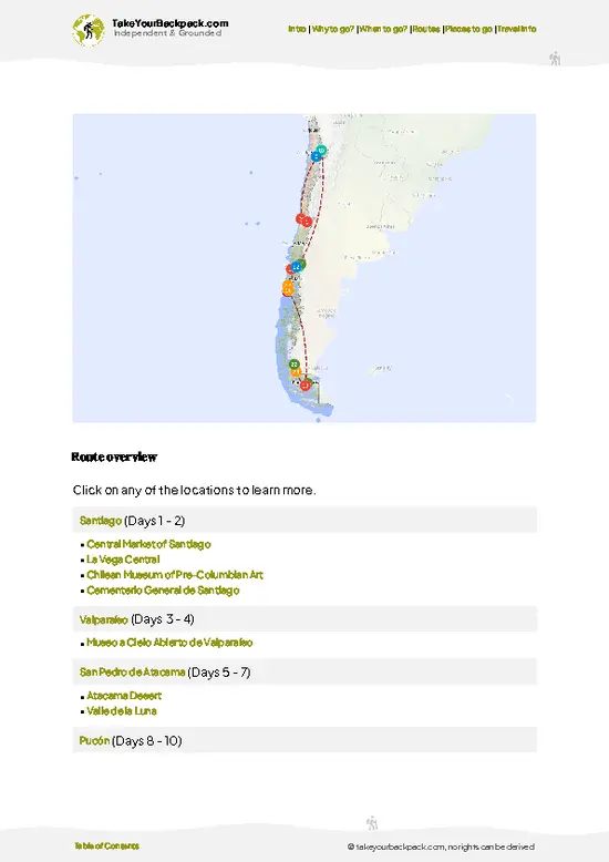
example page 2 from our offline Travel Guide for Chile
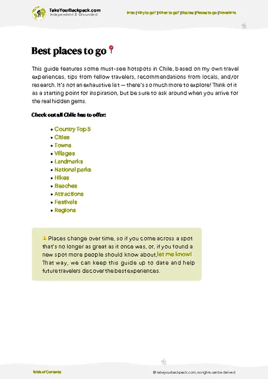
example page 3 from our offline Travel Guide for Chile
example page 4 from our offline Travel Guide for Chile
example page 5 from our offline Travel Guide for Chile
example page 6 from our offline Travel Guide for Chile
example page 7 from our offline Travel Guide for Chile
Loading the map 🌍
CLICK TO FILTER
cities
towns
villages
landmarks
national parks
hikes
beaches
attractions
festivals
regions
SHOW COUNTRY’S BESTSHOW ALL

✨ Why go?
Ranked #6 national park in Chile
The unique appeal for travelers

Conguillío National Park suits backpackers who like to string their own route together, because the trails connect directly to campgrounds and need no guide. The first draw is the Sierra Nevada trail, a long day that climbs through lenga forest to a lookout over lakes and volcanoes. Because the park has few services, you carry your food in and pick the stretches you want, which keeps the experience quiet outside peak weeks. The second draw is the araucaria forest, where trees that are centuries old grow right beside the paths, so you see them without a hard climb. Tours are possible from Temuco, but they cover only the lakeshore viewpoints in a few hours. Walking independently lets you stay for sunset light on Llaima, reach the far trailheads, and choose between easy lake loops and steeper … read more 👉
Conguillío National Park suits backpackers who like to string their own route together, because the trails connect directly to campgrounds and need no guide. The first draw is the Sierra Nevada trail, a long day that climbs through lenga forest to a lookout over lakes and volcanoes. Because the park has few services, you carry your food in and pick the stretches you want, which keeps the experience quiet outside peak weeks. The second draw is the araucaria forest, where trees that are centuries old grow right beside the paths, so you see them without a hard climb. Tours are possible from Temuco, but they cover only the lakeshore viewpoints in a few hours. Walking independently lets you stay for sunset light on Llaima, reach the far trailheads, and choose between easy lake loops and steeper volcano terrain depending on your legs and the weather.

💡 HighlightsDon't-miss highlights and experiences

  1. Volcán Llaima: One of South America’s most active volcanoes, its snowy cone dominates every view, and its lava flows shaped the lakes and the black ground around them.
  2. Sierra Nevada Trail: The park’s classic long hike, rising through forest to wide views of Llaima, Laguna Conguillío and the Andes beyond.
  3. Laguna Conguillío: A blue lake formed when lava dammed a valley, with drowned tree trunks still standing in the shallows and picnic beaches along the shore.
  4. Araucaria Forest: Ancient monkey puzzle trees with spiky, umbrella-like crowns, some of them very old, and a symbol of the region sacred to the Mapuche-Pehuenche people.
  5. Laguna Captrén: A smaller, quieter lake reached by a short walk, good for spotting birds and for calm reflections of the volcano.
  6. Los Carpinteros Trail: A gentle path through
… read more 👉
  1. Volcán Llaima: One of South America’s most active volcanoes, its snowy cone dominates every view, and its lava flows shaped the lakes and the black ground around them.
  2. Sierra Nevada Trail: The park’s classic long hike, rising through forest to wide views of Llaima, Laguna Conguillío and the Andes beyond.
  3. Laguna Conguillío: A blue lake formed when lava dammed a valley, with drowned tree trunks still standing in the shallows and picnic beaches along the shore.
  4. Araucaria Forest: Ancient monkey puzzle trees with spiky, umbrella-like crowns, some of them very old, and a symbol of the region sacred to the Mapuche-Pehuenche people.
  5. Laguna Captrén: A smaller, quieter lake reached by a short walk, good for spotting birds and for calm reflections of the volcano.
  6. Los Carpinteros Trail: A gentle path through old forest where you may hear or see Magellanic woodpeckers hammering on trunks.
  7. Truful-Truful River Area: A wide valley and viewpoint with waterfalls and broad volcanic vistas at the southern entrance near Melipeuco.
  8. Llaima lava fields: Dark, rough fields from past eruptions, crossed by the road north from Truful-Truful, where the contrast with green forest and blue water makes the park’s volcanic past easy to read.
Seeing everything above takes about three days, or two if you skip the long Sierra Nevada hike.
Spotted a mistake or missing something? Contact us.

Things to do near Conguillío National Park

Ratings based on Tripadvisor reviews. When you book through this link, you support our work at no extra cost to you.

🌤️ When to go?Choosing the right time of year

  • Summer (December to March): Dry, sunny days of roughly 22 to 28°C (72 to 82°F) with cool nights near 5 to 8°C (41 to 46°F), and light until late evening. This is peak season: Sierra Nevada trail and Laguna Captrén campsites fill up, and cabin prices rise.
  • Autumn (April to May): Lenga and ñirre forests turn red and gold, days run 12 to 18°C (54 to 64°F), and crowds thin out. Rain becomes more frequent by May.
  • Winter (June to August): Heavy snow, highs of 0 to 7°C (32 to 45°F), short days and closed or restricted high trails. Ski runs on Volcán Llaima operate in this period, but they are small and basic.
  • Spring (September to November): Snowmelt leaves upper trails muddy or snowbound until about November, with 8 to 16°C (46 to 61°F) and few people. Prices are at their lowest.
I would go in late January … read more 👉
  • Summer (December to March): Dry, sunny days of roughly 22 to 28°C (72 to 82°F) with cool nights near 5 to 8°C (41 to 46°F), and light until late evening. This is peak season: Sierra Nevada trail and Laguna Captrén campsites fill up, and cabin prices rise.
  • Autumn (April to May): Lenga and ñirre forests turn red and gold, days run 12 to 18°C (54 to 64°F), and crowds thin out. Rain becomes more frequent by May.
  • Winter (June to August): Heavy snow, highs of 0 to 7°C (32 to 45°F), short days and closed or restricted high trails. Ski runs on Volcán Llaima operate in this period, but they are small and basic.
  • Spring (September to November): Snowmelt leaves upper trails muddy or snowbound until about November, with 8 to 16°C (46 to 61°F) and few people. Prices are at their lowest.
I would go in late January or February for the Sierra Nevada hike, or mid-April for the colors and empty trails.


source: climatestotravel.comJANJanuary: excellent for travelingFEBFebruary: excellent for travelingMARMarch: highly recommended for travelingAPRApril: good for travelingMAYMay: fair for travelingJUNJune: below average for travelingJULJuly: below average for travelingAUGAugust: below average for travelingSEPSeptember: fair for travelingOCTOctober: good for travelingNOVNovember: highly recommended for travelingDECDecember: excellent for traveling

✈️ The backpacker research shortcutChile Travel Guide

An offline-friendly backpacking guide with optimized travel routes, ranked highlights, transport advice, and the best areas to stay.
example page 0 from our offline Travel Guide for Chile
example page 1 from our offline Travel Guide for Chile
example page 2 from our offline Travel Guide for Chile
example page 3 from our offline Travel Guide for Chile
example page 4 from our offline Travel Guide for Chile
example page 5 from our offline Travel Guide for Chile
example page 6 from our offline Travel Guide for Chile
example page 7 from our offline Travel Guide for Chile
The digital guide (333 pages) contains:
✅ 107 highlights, ranked by travel appeal
✅ Optimized 7, 14 & 21-day travel routes
✅ Cities, national parks, landmarks, beaches
✅ How to get around
✅ Offline-friendly for travel without Wi-Fi
👉 Click to see all 30+ guide features

📅 Plan smarter in minutes, not weeks
✅ Month by month travel advice
✅ Festivals & national holidays
✅ Budget expectations

🗺️ Go to the right places, skip the overrated ones
✅ Honest pros & cons of destinations
✅ Top hikes, parks & viewpoints
✅ Lesser-known places most travelers miss
✅ Clear “worth it vs skip it” guidance

🛏️ Travel smoothly without rookie mistakes
✅ Best areas to stay
✅ Transport systems explained simply
✅ Common scams & safety advice
✅ SIM cards, money & practical tips

🌍 Understand the country, not just visit it
✅ Culture & traditions
✅ 52 Essential phrases & customs
✅ Festivals worth planning around
✅ Traveler-friendly historical context
✅ Insights that make places more meaningful

📱 Built for real travel conditions
✅ Fully downloadable PDF
✅ Works completely offline
✅ Optimized for phone use
✅ Useful in remote areas & buses
✅ Everything in one place
Stop searching, start planning
Get instant access to your full guide. 30‑day money-back guarantee.
+ Add another guide for just

By proceeding you agree to our terms.
Sent to your inbox immediately after payment • 100% Secure Checkout
Best Backpacking Travel Advisor 2025 tourism awardBest Backpacking
Travel Advisor
2025
What others say about Take Your Backpack Guides:
⭐⭐⭐⭐⭐
Fantastic, amazing amount of information!
⭐⭐⭐⭐⭐
My goodness this is amazing, it's what I've been looking for hats off too you!
⭐⭐⭐⭐⭐
I think this is absolutely BRILLIANT
⭐⭐⭐⭐
Very complete and informative. It's still missing places, but I gotta to commend you
⭐⭐⭐⭐⭐
This is truly amazing, thank you, can't wait to explore it with my kids!
⭐⭐⭐⭐⭐
Awesome resource, thank you!
⭐⭐⭐⭐⭐
This is amazing! Can't wait to explore the ones I haven't seen
⭐⭐⭐⭐
I love this! Well done, great idea.
⭐⭐⭐⭐⭐
Thanks for taking the time to make this gem!
⭐⭐⭐⭐⭐
This might be the best website I've ever seen.
⭐⭐⭐⭐⭐
Congratulations, and thank you so much for your work; it's incredibly valuable.
⭐⭐⭐⭐
In all seriousness I think you did a great job pointing out the important spots
⭐⭐⭐⭐⭐
10/10 very good
⭐⭐⭐⭐⭐
As someone who's only just starting to visit regularly this is awesome, thank you.
⭐⭐⭐⭐
Thank you very much! I'm going to visit my dad, it's going to be very useful!
⭐⭐⭐⭐⭐
This is really cool! We'll be travelling for the first time and this definitely come in handy.
⭐⭐⭐⭐⭐
You are now our minister of culture, congratulations 👨‍💼
⭐⭐⭐⭐⭐
Just wanted to tell you that this is a pearl! Going to follow your recommendations.
⭐⭐⭐⭐⭐
This is so cool. I'll definitely be using the resource for my travels soon.
⭐⭐⭐⭐⭐
This is very impressive! Good work.
⭐⭐⭐⭐⭐
This is an amazing and informative site. Very well done!

🛏️ Where to stay?Where staying makes the most sense

The best bases are camping or cabins inside the park, plus guesthouses in Curacautín and Melipeuco if you want cheaper beds outside the gate.
Inside the park, Conaf and concession campgrounds sit at Laguna Captrén, Playa Linda by Lago Conguillío, and Los Paraguas. Sites run about US$15 to 30 per site in summer, with hot showers at the larger ones. Cabins around Lago Conguillío cost roughly US$60 to 140 a night and book out in January and February, so reserve ahead. Winter access can be limited, and some facilities close.
Melipeuco, about 30 km from the southern entrance, is the quieter option. It … read more 👉
The best bases are camping or cabins inside the park, plus guesthouses in Curacautín and Melipeuco if you want cheaper beds outside the gate.
Inside the park, Conaf and concession campgrounds sit at Laguna Captrén, Playa Linda by Lago Conguillío, and Los Paraguas. Sites run about US$15 to 30 per site in summer, with hot showers at the larger ones. Cabins around Lago Conguillío cost roughly US$60 to 140 a night and book out in January and February, so reserve ahead. Winter access can be limited, and some facilities close.
Melipeuco, about 30 km from the southern entrance, is the quieter option. It has hospedajes with private rooms at about US$20 to 40 per person and a few small shops. Curacautín, near the northern access, is larger, with hostels, hotels, supermarkets and hot springs nearby. Rooms there cost about US$25 to 60.
Both towns have taxis or transfers to the park, but public transport is limited, so staying inside saves time for dawn walks. Bring groceries from town, as supplies inside are minimal.

👛 Costs (as of 19 October 2026)Typical daily expenses

A realistic backpacking budget for Conguillío National Park is about US$62 to 89 per day in high season, including camping, self-catered food and transport from nearby towns.
CategoryBudget RangeLocal Reality
Entrance feeUS$10 to 14Foreign adults pay more than Chilean residents. Payment is at the gate, and cards are not always accepted, so carry pesos.
CampingUS$15 to 30Per site in summer at Conaf and concession campgrounds. Basic sites without showers can cost less.
Cabins or hospedaje (alternative)US$25 to 140Guesthouses in Melipeuco and Curacautín are cheaper than lakeside cabins in January and February.
Local transportUS$10 to 25Buses from Temuco reach Curacautín or Melipeuco, then a shared taxi or transfer to the gate costs extra. Few services run in the park itself.
Food and suppliesUS$12
… read more 👉
A realistic backpacking budget for Conguillío National Park is about US$62 to 89 per day in high season, including camping, self-catered food and transport from nearby towns.
CategoryBudget RangeLocal Reality
Entrance feeUS$10 to 14Foreign adults pay more than Chilean residents. Payment is at the gate, and cards are not always accepted, so carry pesos.
CampingUS$15 to 30Per site in summer at Conaf and concession campgrounds. Basic sites without showers can cost less.
Cabins or hospedaje (alternative)US$25 to 140Guesthouses in Melipeuco and Curacautín are cheaper than lakeside cabins in January and February.
Local transportUS$10 to 25Buses from Temuco reach Curacautín or Melipeuco, then a shared taxi or transfer to the gate costs extra. Few services run in the park itself.
Food and suppliesUS$12 to 20Stock up in Curacautín or Melipeuco, because inside the park there is only a small cafe or kiosk at times.
Total Daily BudgetUS$62 to 89Per person, per day, in high season.


source: conaf.cl
⚠️ Prices can change and everyone travels differently, so take this as a rough guide. Hope it helps you plan your adventure!

🥾 TrailsBest hikes in Conguillío national park

Conguillío National Park has trails for almost every ability, and most start near the lakes along the main park road.
  • Sierra Nevada: About 12 km round trip from the Conguillío area, 5 to 7 hours, moderate to demanding. It climbs through forest to a lookout with views of Llaima and the lake. The footing is loose volcanic soil.
  • Los Carpinteros: About 1 km, 30 to 40 minutes, easy. A short forest walk among old trees, with good chances to see woodpeckers.
  • Cañadón Truful-Truful: Short, easy walk, about 1 hour, to a canyon-like valley viewpoint and the river.
  • Laguna Captrén: Easy lakeside walk, 1 to 2 hours,
… read more 👉
Conguillío National Park has trails for almost every ability, and most start near the lakes along the main park road.
  • Sierra Nevada: About 12 km round trip from the Conguillío area, 5 to 7 hours, moderate to demanding. It climbs through forest to a lookout with views of Llaima and the lake. The footing is loose volcanic soil.
  • Los Carpinteros: About 1 km, 30 to 40 minutes, easy. A short forest walk among old trees, with good chances to see woodpeckers.
  • Cañadón Truful-Truful: Short, easy walk, about 1 hour, to a canyon-like valley viewpoint and the river.
  • Laguna Captrén: Easy lakeside walk, 1 to 2 hours, over flat ground and past araucarias.
Terrain shifts quickly between black lava, loose ash, mossy forest and lakeshore, so sturdy boots help. Wildlife includes Magellanic woodpeckers, foxes, pudú deer and, rarely, pumas. Weather can change fast near the volcano, and trails may close during volcanic alerts, so check at the ranger station. The park is reached by road from Curacautín or Melipeuco, and public transport only reaches the edges, so many visitors hitch, hire a taxi or drive. Crowds peak in January and February and thin out dramatically in autumn. A park entrance fee applies, payable at the gate in Chilean pesos.
⚠️ Hiking info can sometimes be outdated or inaccurate. Before you hit the trail, check the latest conditions with locals. If you do spot anything that's off, I'd love to hear from you, so I can update it for fellow travelers.

🛡️ SafetyScams, Hazards, and Annoyances

Conguillío is a well-managed park where the main risks are weather and trail conditions, not people or wildlife. Llaima is an active volcano monitored by Chilean authorities, so check Conaf alerts at the entrance and follow any closure signs. Weather turns quickly: sun can become wind, cold rain or snow within an hour, even in summer, so carry a waterproof shell, warm layers and extra food. The Sierra Nevada trail is long (about 12 km round trip) with loose volcanic footing, so start early. Trails are generally clearly marked, but fog hides junctions on higher sections. Fill bottles at designated points or treat lake water. Wildlife such as pumas and foxes are shy, and the main thing is to keep food sealed and camp in marked areas. Fires are strictly banned outside designated spots, since fire risk is high in dry summers.

FAQTraveler FAQ

Conguillío National Park needs two to three days for the main sights. That covers the Sierra Nevada trail (about 12 km round trip, 5 to 6 hours), the Laguna Captrén and Truful-Truful short walks, and time by Lago Conguillío. One day only allows a quick loop of the lake.
Conguillío National Park is possible without a car, but it takes planning. Buses run from Temuco (about 2 to 2.5 hours) to Curacautín or Melipeuco, and from there you need a taxi, transfer or hitchhiking for the remaining 30 to 40 km to the park. Inside, distances between trailheads are long, so staying at Lago Conguillío saves effort.
Conguillío National Park charges an entrance fee, roughly US$10 to 14 for foreign adults, with lower prices for children and Chilean residents. Pay at the gate in pesos, ideally in cash. No separate permit is required for day hikes, but camping needs a reservation or payment at the campground, about US$15 to 30 per site.
⚠️ Things can change over time, so always validate details locally before you go.

Other Chilean national parks near Conguillío

Explore more nearby:


💡 Not sure where to go next?
Create a personalized itinerary for Chile including Conguillío and the places that fit your trip.

Generate my itinerary

👉 Discover all national parks

Or checkout all Chile has to offer (think cities, towns, villages, national parks, hikes, beaches, festivals)
Country photo of Chile

We 💚 feedbackWhat to keep in mind

Pair Conguillío National Park with Villarrica, Pucón and the thermal springs near Curacautín to build a southern lakes and volcano route. I would do the Sierra Nevada hike first, then use the remaining days for rest, and I would bring all food in since supplies are thin. Go with good boots and a day to spare for weather.

✈️ When did I visit Chile?
I have visited Chile, together with Argentina, in September 2012.

✍️ Help improve this page!
The information on this page is based on my own backpacking experience in Chile, supplemented with up-to-date research and feedback from other travelers. Travel details can change, so if you notice anything outdated or incomplete, feel free to let me know.


🙋‍♂️ Give feedback

👋 Meet the founderWho’s Behind Take Your Backpack?

Johan, backpacker and founder of TakeYourBackpackHi, I’m Johan (Netherlands 🇳🇱), the creator of TakeYourBackpack. Over the past 3 decades, I’ve backpacked through 90+ countries across six continents, gaining extensive experience with independent travel, long-term trips, and overland routes.

This site is built on a combination of firsthand travel experience and carefully curated insights from other backpackers. Many guides are based on places I’ve personally visited, while others bring together tips, observations, and practical advice shared by trusted travelers I’ve met along the way.

The goal is to provide realistic, experience-driven guidance — not generic itineraries — so you can explore destinations with better context, clearer expectations, and more confidence.