×

Chile🇨🇱 | national parksHuerquehue National ParkSteep lake chain, Villarrica lookout, waterfalls, Pucón hike | things to do and best time to go

Explore Queulat National ParkExplore Radal Siete Tazas National Park

Backpacking in Huerquehue
👍 Recommendednational park ranked #9
By Johan Kruseman 🇳🇱 | Updated October 19, 2026

Huerquehue is a hiking park with lakes at trail's end, not a drive-up lake resort, and the main path climbs steeply from the first minute. It sits in Chile's Araucanía Region, east of Pucón, near the Argentine border. Trails cross araucaria forest, pass a chain of lakes and open onto volcano views, though the lower stretch gets busy on summer weekends. Day-trippers cluster there because the first waterfalls and Lago Chico are close to the gate, so an experienced walker starts early and keeps going. I expected silence beyond the first lake. Instead, at Lago Toro, I heard only wind in the araucarias and a woodpecker, with nobody else around. Hikers who like climbing and quiet will love it; anyone wanting a flat lakeside picnic will not.

Discover everything you want to know in the 📖 Chile Travel Guide.


example page 0 from our offline Travel Guide for Chile
example page 1 from our offline Travel Guide for Chile
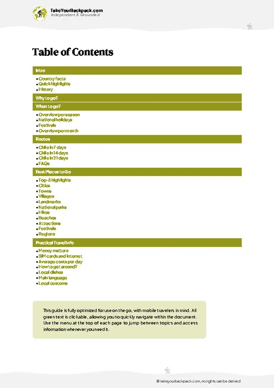
example page 2 from our offline Travel Guide for Chile
example page 3 from our offline Travel Guide for Chile
example page 4 from our offline Travel Guide for Chile
example page 5 from our offline Travel Guide for Chile
example page 6 from our offline Travel Guide for Chile
example page 7 from our offline Travel Guide for Chile
Loading the map 🌍
CLICK TO FILTER
cities
towns
villages
landmarks
national parks
hikes
beaches
attractions
festivals
regions
SHOW COUNTRY’S BESTSHOW ALL

✨ Why go?
Ranked #9 national park in Chile
What makes it a must-see national park

Huerquehue National Park suits backpackers because everything works on foot and without a guide. One trailhead near Lago Tinquilco gives you a ready-made network, so you can improvise a day or an overnight at your own pace. The big draw is the sequence of lakes: Lago Chico, Lago Toro and Lago Verde arrive one after another, each wilder and emptier than the last. Past the waterfalls, the crowds thin quickly, and the trail rarely needs a guide because signage is clear. For longer stays, the Los Huerquenes sector and its small lakes reward people willing to carry a tent and camp on site. Also, araucaria trees, some centuries old, line the higher ridges, giving walkers a forest that looks nothing like the lowlands around Pucón.

💡 HighlightsDon't-miss highlights and experiences

  1. Lago Chico: The first lake on the main trail, reached after a steady climb, with calm water ringed by lenga and coigüe forest.
  2. Salto Nido de Águila: A waterfall just off the early trail, an easy stop for those with limited time.
  3. Salto Trufulco: A second cascade nearby, quieter than the eagle's nest falls and good in wet months.
  4. Lago Toro: A broader lake farther up, with a shoreline where you can sit and often hear only birds.
  5. Lago Verde: A smaller lake with greener, shallower water and a strong sense of seclusion.
  6. Mirador San Sebastián: A viewpoint high on the ridge, with sight lines toward Villarrica Volcano and the surrounding lakes.
  7. Araucaria forest: Stands of monkey-puzzle trees along the upper trail, with spiky silhouettes and thick, scaly bark.
  8. Lago Tinquilco: The lake at the park's entrance,
… read more 👉
  1. Lago Chico: The first lake on the main trail, reached after a steady climb, with calm water ringed by lenga and coigüe forest.
  2. Salto Nido de Águila: A waterfall just off the early trail, an easy stop for those with limited time.
  3. Salto Trufulco: A second cascade nearby, quieter than the eagle's nest falls and good in wet months.
  4. Lago Toro: A broader lake farther up, with a shoreline where you can sit and often hear only birds.
  5. Lago Verde: A smaller lake with greener, shallower water and a strong sense of seclusion.
  6. Mirador San Sebastián: A viewpoint high on the ridge, with sight lines toward Villarrica Volcano and the surrounding lakes.
  7. Araucaria forest: Stands of monkey-puzzle trees along the upper trail, with spiky silhouettes and thick, scaly bark.
  8. Lago Tinquilco: The lake at the park's entrance, a flat spot to rest before or after the climb.
Lago Toro and Lago Verde combine well in one day, since the short link between them adds little extra distance.
Spotted a mistake or missing something? Contact us.

Things to do near Huerquehue National Park

Ratings based on Tripadvisor reviews. When you book through this link, you support our work at no extra cost to you.

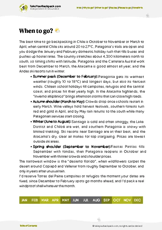
🌤️ When to go?Seasonal considerations and timing

  • Summer (December to February): Dry, stable weather is typical, with highs of 22 to 28°C (72 to 82°F) and lows of 8 to 12°C (46 to 54°F). Daylight runs long, the trails to Lago Chico, Lago Toro and Lago Verde are clear, and the lakes are warm enough for a quick swim. Crowds and prices peak, especially in January.
  • Autumn (March to May): Highs of 14 to 20°C (57 to 68°F). The araucaria and lenga forests turn gold and red in April, and the paths empty out. Rain becomes more frequent.
  • Winter (June to August): Highs of 6 to 10°C (43 to 50°F), lows near freezing, with snow on the upper trails to Laguna Abutillón and Laguna Huerquehue. Daylight is short and some services close. Prices drop.
  • Spring (September to November): Highs of 12 to 18°C (54 to 64°F), with snowmelt, mud and flowers.
Aim for February … read more 👉
  • Summer (December to February): Dry, stable weather is typical, with highs of 22 to 28°C (72 to 82°F) and lows of 8 to 12°C (46 to 54°F). Daylight runs long, the trails to Lago Chico, Lago Toro and Lago Verde are clear, and the lakes are warm enough for a quick swim. Crowds and prices peak, especially in January.
  • Autumn (March to May): Highs of 14 to 20°C (57 to 68°F). The araucaria and lenga forests turn gold and red in April, and the paths empty out. Rain becomes more frequent.
  • Winter (June to August): Highs of 6 to 10°C (43 to 50°F), lows near freezing, with snow on the upper trails to Laguna Abutillón and Laguna Huerquehue. Daylight is short and some services close. Prices drop.
  • Spring (September to November): Highs of 12 to 18°C (54 to 64°F), with snowmelt, mud and flowers.
Aim for February or early March, when the weather holds and the crowds thin out.


source: climatestotravel.comJANJanuary: excellent for travelingFEBFebruary: excellent for travelingMARMarch: highly recommended for travelingAPRApril: fair for travelingMAYMay: below average for travelingJUNJune: below average for travelingJULJuly: below average for travelingAUGAugust: below average for travelingSEPSeptember: fair for travelingOCTOctober: good for travelingNOVNovember: highly recommended for travelingDECDecember: excellent for traveling
when-to-go

✈️ The backpacker research shortcutChile Travel Guide

An offline-friendly backpacking guide with optimized travel routes, ranked highlights, transport advice, and the best areas to stay.
example page 0 from our offline Travel Guide for Chile
example page 1 from our offline Travel Guide for Chile
example page 2 from our offline Travel Guide for Chile
example page 3 from our offline Travel Guide for Chile
example page 4 from our offline Travel Guide for Chile
example page 5 from our offline Travel Guide for Chile
example page 6 from our offline Travel Guide for Chile
example page 7 from our offline Travel Guide for Chile
The digital guide (333 pages) contains:
✅ 107 highlights, ranked by travel appeal
✅ Optimized 7, 14 & 21-day travel routes
✅ Cities, national parks, landmarks, beaches
✅ How to get around
✅ Offline-friendly for travel without Wi-Fi
👉 Click to see all 30+ guide features

📅 Plan smarter in minutes, not weeks
✅ Month by month travel advice
✅ Festivals & national holidays
✅ Budget expectations

🗺️ Go to the right places, skip the overrated ones
✅ Honest pros & cons of destinations
✅ Top hikes, parks & viewpoints
✅ Lesser-known places most travelers miss
✅ Clear “worth it vs skip it” guidance

🛏️ Travel smoothly without rookie mistakes
✅ Best areas to stay
✅ Transport systems explained simply
✅ Common scams & safety advice
✅ SIM cards, money & practical tips

🌍 Understand the country, not just visit it
✅ Culture & traditions
✅ 52 Essential phrases & customs
✅ Festivals worth planning around
✅ Traveler-friendly historical context
✅ Insights that make places more meaningful

📱 Built for real travel conditions
✅ Fully downloadable PDF
✅ Works completely offline
✅ Optimized for phone use
✅ Useful in remote areas & buses
✅ Everything in one place
Stop searching, start planning
Get instant access to your full guide. 30‑day money-back guarantee.
+ Add another guide for just

By proceeding you agree to our terms.
Sent to your inbox immediately after payment • 100% Secure Checkout
Best Backpacking Travel Advisor 2025 tourism awardBest Backpacking
Travel Advisor
2025
What others say about Take Your Backpack Guides:
⭐⭐⭐⭐⭐
Fantastic, amazing amount of information!
⭐⭐⭐⭐⭐
My goodness this is amazing, it's what I've been looking for hats off too you!
⭐⭐⭐⭐⭐
I think this is absolutely BRILLIANT
⭐⭐⭐⭐
Very complete and informative. It's still missing places, but I gotta to commend you
⭐⭐⭐⭐⭐
This is truly amazing, thank you, can't wait to explore it with my kids!
⭐⭐⭐⭐⭐
Awesome resource, thank you!
⭐⭐⭐⭐⭐
This is amazing! Can't wait to explore the ones I haven't seen
⭐⭐⭐⭐
I love this! Well done, great idea.
⭐⭐⭐⭐⭐
Thanks for taking the time to make this gem!
⭐⭐⭐⭐⭐
This might be the best website I've ever seen.
⭐⭐⭐⭐⭐
Congratulations, and thank you so much for your work; it's incredibly valuable.
⭐⭐⭐⭐
In all seriousness I think you did a great job pointing out the important spots
⭐⭐⭐⭐⭐
10/10 very good
⭐⭐⭐⭐⭐
As someone who's only just starting to visit regularly this is awesome, thank you.
⭐⭐⭐⭐
Thank you very much! I'm going to visit my dad, it's going to be very useful!
⭐⭐⭐⭐⭐
This is really cool! We'll be travelling for the first time and this definitely come in handy.
⭐⭐⭐⭐⭐
You are now our minister of culture, congratulations 👨‍💼
⭐⭐⭐⭐⭐
Just wanted to tell you that this is a pearl! Going to follow your recommendations.
⭐⭐⭐⭐⭐
This is so cool. I'll definitely be using the resource for my travels soon.
⭐⭐⭐⭐⭐
This is very impressive! Good work.
⭐⭐⭐⭐⭐
This is an amazing and informative site. Very well done!

🛏️ Where to stay?Choosing the right base

The easiest base is Pucón, about 35 km (22 miles) from the park, with the widest choice of hostels (dorm beds US$12 to 25), plus cheap guesthouses and cafes. Buses and shared taxis run from there to the trailhead at Paillaco, so you can day hike without a car.

Inside the park you can camp at Lago Tinquilco, where Camping Lago Tinquilco and nearby sites charge roughly US$8 to 15 per person. Basic cabins and a few small lodges and hostels also sit around the lake, which suits a sunrise start on the Los Lagos trail. Book ahead in January and February. Bring most food from Pucón, since only small … read more 👉
The easiest base is Pucón, about 35 km (22 miles) from the park, with the widest choice of hostels (dorm beds US$12 to 25), plus cheap guesthouses and cafes. Buses and shared taxis run from there to the trailhead at Paillaco, so you can day hike without a car.

Inside the park you can camp at Lago Tinquilco, where Camping Lago Tinquilco and nearby sites charge roughly US$8 to 15 per person. Basic cabins and a few small lodges and hostels also sit around the lake, which suits a sunrise start on the Los Lagos trail. Book ahead in January and February. Bring most food from Pucón, since only small shops operate near the lake.

For quieter evenings, the lodgings along the road to Paillaco offer farm-style rooms. Villarrica is the cheaper alternative to Pucón, with a lower-key feel and good bus links.

👛 Costs (as of 19 October 2026)What things cost and how to budget

Expect to spend about US$55 per day at Huerquehue National Park on a typical backpacker budget in high season, with camping cutting that down.
CategoryBudget RangeLocal Reality
Entrance feeUS$8 to 12Foreign adults pay a daily fee at the Paillaco gate, lower for Chilean residents and children. Payment is in Chilean pesos.
Accommodation (high season)US$12 to 25Camping at Lago Tinquilco runs about US$8 to 15 per person, while dorm beds in Pucón cost US$12 to 25.
Accommodation (low season)US$8 to 18Dorm beds and campsites drop in price, but some close.
Local transportUS$4 to 8Buses and shared taxis run between Pucón and the Paillaco trailhead, usually in the morning with a late-afternoon return.
Food and suppliesUS$12 to 20Buy groceries in Pucón supermarkets. Meals at the lake are limited and pricier.
… read more 👉
Expect to spend about US$55 per day at Huerquehue National Park on a typical backpacker budget in high season, with camping cutting that down.
CategoryBudget RangeLocal Reality
Entrance feeUS$8 to 12Foreign adults pay a daily fee at the Paillaco gate, lower for Chilean residents and children. Payment is in Chilean pesos.
Accommodation (high season)US$12 to 25Camping at Lago Tinquilco runs about US$8 to 15 per person, while dorm beds in Pucón cost US$12 to 25.
Accommodation (low season)US$8 to 18Dorm beds and campsites drop in price, but some close.
Local transportUS$4 to 8Buses and shared taxis run between Pucón and the Paillaco trailhead, usually in the morning with a late-afternoon return.
Food and suppliesUS$12 to 20Buy groceries in Pucón supermarkets. Meals at the lake are limited and pricier.
Total Daily BudgetUS$36 to 65Roughly US$55 using the high-season dorm bed in Pucón.


source: conaf.cl
⚠️ Prices can change and everyone travels differently, so take this as a rough guide. Hope it helps you plan your adventure!

🥾 TrailsHiking Huerquehue national park: highlights and difficulty

Huerquehue National Park is mostly a network of well-marked trails radiating from the Tinquilco entrance, and the terrain moves from muddy forest floor to rocky ridge as you gain height.
  • Los Lagos: About 12 km round trip, 4 to 6 hours, moderate. A steady climb past waterfalls to Lago Chico, Lago Toro and Lago Verde through native forest.
  • San Sebastián: About 14 km round trip, 5 to 7 hours, moderate to hard. Steeper ground leads to a ridge viewpoint and araucaria groves.
  • Cascadas: Short walk of 1 to 2 hours, easy. Gentle forest path to Salto Trufulco and Salto Nido de Águila.
  • Los Huerquenes: Multi-day
… read more 👉
Huerquehue National Park is mostly a network of well-marked trails radiating from the Tinquilco entrance, and the terrain moves from muddy forest floor to rocky ridge as you gain height.
  • Los Lagos: About 12 km round trip, 4 to 6 hours, moderate. A steady climb past waterfalls to Lago Chico, Lago Toro and Lago Verde through native forest.
  • San Sebastián: About 14 km round trip, 5 to 7 hours, moderate to hard. Steeper ground leads to a ridge viewpoint and araucaria groves.
  • Cascadas: Short walk of 1 to 2 hours, easy. Gentle forest path to Salto Trufulco and Salto Nido de Águila.
  • Los Huerquenes: Multi-day option, hard. Remote lakes and campsites for those carrying full gear.
Wildlife includes woodpeckers, Chilean pudú deer in quiet corners, and many forest birds. Expect mud after rain, loose rock higher up, and wind on the ridges.
Public buses run from Pucón to Paillaco and Renahue, where shared taxis or local transfers finish the trip to the entrance. Summer weekends bring the biggest crowds on the first lake section, while weekdays and early mornings stay calm. An entrance fee applies and is paid in Chilean pesos at the ranger post.
⚠️ Hiking info can sometimes be outdated or inaccurate. Before you hit the trail, check the latest conditions with locals. If you do spot anything that's off, I'd love to hear from you, so I can update it for fellow travelers.

🛡️ SafetySafety Tips and Common Scams in Huerquehue

Huerquehue is a well-marked, well-managed park, and most problems come from weather and footing rather than wildlife. The Los Lagos trail climbs steadily from Lago Tinquilco through araucaria forest, with roots and stones that turn slick after rain. Wear boots with grip and carry a rain layer even on clear mornings, because conditions in the Araucanía shift fast. In winter, snow and ice make the upper sections tricky and a guide or microspikes help. Carry at least 1.5 liters of water per person and start before midday so you finish in daylight. There are no dangerous large animals to worry about. Pack out all trash, stay on the path, and keep fires to the designated camping zones, as wildfire risk is real in summer.

FAQCommon questions from travelers

One full day covers the main Los Lagos circuit in Huerquehue National Park, about 10 to 12 km (6 to 7 miles) and 5 to 7 hours return to Laguna Verde and Laguna Chico. Two days let you camp at Lago Tinquilco and add the longer climb to Laguna Huerquehue and Laguna Abutillón. Three days suit anyone linking the park with the Pucón area.
Yes, Huerquehue National Park is easy to reach without a car from Pucón, about 35 km (22 miles) away. Local buses and shared taxis run to the Paillaco trailhead, usually in the morning, taking around 1 hour and costing roughly US$4 to 8 each way. From there you walk, or you can arrange a transfer. Tour agencies in Pucón also run day trips.
Yes, Huerquehue National Park charges an entrance fee, paid at the Paillaco gate in Chilean pesos. Foreign adults pay about US$8 to 12, with lower rates for Chilean residents and children. No separate hiking permit is needed for the day trails, but camping inside the park is paid per person, around US$8 to 15.
⚠️ Things can change over time, so always validate details locally before you go.

Other Chilean national parks near Huerquehue

Explore more nearby:


💡 Not sure where to go next?
Create a personalized itinerary for Chile including Huerquehue and the places that fit your trip.

Generate my itinerary

👉 Discover all national parks

Or checkout all Chile has to offer (think cities, towns, villages, national parks, hikes, beaches, festivals)
Country photo of Chile

We 💚 feedbackParting advice and final tips

Huerquehue National Park deserves two days if you can manage it. One day covers the lakes, but sleeping in the park lets you see the upper trails before the day-trippers arrive. I would bring a tent, start at dawn, and keep the San Sebastián ridge for the clearest morning.

✈️ When did I visit Chile?
I have visited Chile, together with Argentina, in September 2012.

✍️ Help improve this page!
The information on this page is based on my own backpacking experience in Chile, supplemented with up-to-date research and feedback from other travelers. Travel details can change, so if you notice anything outdated or incomplete, feel free to let me know.


🙋‍♂️ Give feedback

👋 Meet the founderWho’s Behind Take Your Backpack?

Johan, backpacker and founder of TakeYourBackpackHi, I’m Johan (Netherlands 🇳🇱), the creator of TakeYourBackpack. Over the past 3 decades, I’ve backpacked through 90+ countries across six continents, gaining extensive experience with independent travel, long-term trips, and overland routes.

This site is built on a combination of firsthand travel experience and carefully curated insights from other backpackers. Many guides are based on places I’ve personally visited, while others bring together tips, observations, and practical advice shared by trusted travelers I’ve met along the way.

The goal is to provide realistic, experience-driven guidance — not generic itineraries — so you can explore destinations with better context, clearer expectations, and more confidence.