×

Colombia🇨🇴 | hikesCerro Machín Volcanoactive crater, cloud forest, steep ascent | things to do and best time to go

Explore Festival de la CumbiaExplore Lost City Trek (Ciudad Perdida)

Backpacking in Cerro Machín Volcano
👀 For curious travelershike ranked #8
By Johan Kruseman 🇳🇱 | Updated September 4, 2026

Your boots slide on damp clay as the cloud forest exhales around you, leaves dripping, birds firing off strange metallic calls while a faint sulfur smell rides the mist. Then the trees thin and the crater of Cerro Machín suddenly yawns below, green and menacingly quiet. This volcano sits in Tolima, in Colombia’s central cordillera, not far from Ibagué and Cajamarca. The hike is moderate but relentless—shorter and less punishing than Los Nevados routes, yet steep enough to sting your calves. Public transport gets you close via rural buses and moto-taxis, but you still feel the remoteness. Views swing from coffee fincas to jagged Andean ridges, and while it lacks the snow drama of Nevado del Tolima, Machín wins on raw, eerie volcano energy and low crowds.

Discover everything you want to know in the 📖 Colombia Travel Guide.
Best time to go: November - April
Duration: 2 to 3 days
Distance: 12 to 15 kilometers
Total ascent: 1,200 to 1,500 meters
Loading the map 🌍
CLICK TO FILTER
cities
towns
villages
landmarks
national parks
hikes
beaches
attractions
festivals
regions
SHOW COUNTRY’S BESTSHOW ALL

✨ Why go?
Ranked #8 hike in Colombia
What sets this place apart

Cerro Machín Volcano is a magnet for backpackers, and for good reason. The scenery-to-effort ratio is off the charts. You’ll sweat it out on the ascent, but the payoff? A panoramic view that stretches for miles, with lush valleys and distant peaks painting the horizon.

Getting there is a breeze. Public transport access is straightforward; hop on a bus from Manizales or Armenia, and you’re on your way. The cost? Minimal. You can tackle this adventure without breaking the bank.

What’s even better is the flexible distances. Whether you’re up for a quick day hike or a multi-day trek, you can tailor your experience. This hike fits seamlessly into a longer backpacking route, making it a perfect pit stop between other Colombian highlights.

The burn in your legs will fade, but that first cold … read more 👉
Cerro Machín Volcano is a magnet for backpackers, and for good reason. The scenery-to-effort ratio is off the charts. You’ll sweat it out on the ascent, but the payoff? A panoramic view that stretches for miles, with lush valleys and distant peaks painting the horizon.

Getting there is a breeze. Public transport access is straightforward; hop on a bus from Manizales or Armenia, and you’re on your way. The cost? Minimal. You can tackle this adventure without breaking the bank.

What’s even better is the flexible distances. Whether you’re up for a quick day hike or a multi-day trek, you can tailor your experience. This hike fits seamlessly into a longer backpacking route, making it a perfect pit stop between other Colombian highlights.

The burn in your legs will fade, but that first cold beer at the summit? That moment is pure bliss, a reward that makes every step worthwhile.
Want to include Cerro Machín Volcano in your Colombia route?
Create a personalized Colombia itinerary that includes Cerro Machín Volcano and the places that fit your trip — based on your travel style, budget, and available time. Get your route in seconds.

Generate my trip

💡 HighlightsKey sights and experiences for travelers

  1. Crater rim and fumarolic field — The raw heart of the volcano: steaming vents, sulfur scents and jagged volcanic rock right under your boots. Not a typical “pretty trail” viewpoint — it feels geological and alive, with close-up views into the crater and evidence of recent eruptions that you won’t get on ordinary mountain hikes. (Personal favorite — there’s nothing like standing on the rim watching steam curl out of the earth.)
  2. Panoramic views of the Central Volcanic Range — From several high points the trail opens onto sweeping vistas of neighboring giants like Nevado del Ruiz and Tolima. The layered silhouettes of snow-capped and volcanic peaks, deep valleys and patchwork farmland make for dramatic, long-distance scenery that feels more rugged than most Andean day-hikes.
  3. Cloud-forest
read more 👉
  1. Crater rim and fumarolic field — The raw heart of the volcano: steaming vents, sulfur scents and jagged volcanic rock right under your boots. Not a typical “pretty trail” viewpoint — it feels geological and alive, with close-up views into the crater and evidence of recent eruptions that you won’t get on ordinary mountain hikes. (Personal favorite — there’s nothing like standing on the rim watching steam curl out of the earth.)
  2. Panoramic views of the Central Volcanic Range — From several high points the trail opens onto sweeping vistas of neighboring giants like Nevado del Ruiz and Tolima. The layered silhouettes of snow-capped and volcanic peaks, deep valleys and patchwork farmland make for dramatic, long-distance scenery that feels more rugged than most Andean day-hikes.
  3. Cloud-forest to páramo transition — The hike crosses a rapid ecological change: mossy, fern-heavy cloud forest that gives way to open páramo with frailejones and tussock grass. That sharp shift in plants and light is visually striking and packs two very different high-Andean ecosystems into one walk.
  4. High-Andean birdlife and flora — Expect fast-moving hummingbirds, colorful tanagers and other highland specialists plus lots of orchids, mosses and paramo blooms. The biodiversity is compact and obvious; for birders and plant nerds this trail delivers encounters that feel rarer than on lower-elevation treks.
  5. Local mountain culture and working landscapes — You’ll pass campesino trails, grazing herds and small family farms where people still move livestock and grow high-altitude crops. That everyday mountain life—guides who know the land, hand-built stone walls, and rural tracks—gives the hike a lived-in, authentic atmosphere many pristine trails lack.
Spotted a mistake or missing something? Contact us.

Things to do near Cerro Machín Volcano

Ratings based on Tripadvisor reviews. When you book through this link, you support our work at no extra cost to you.

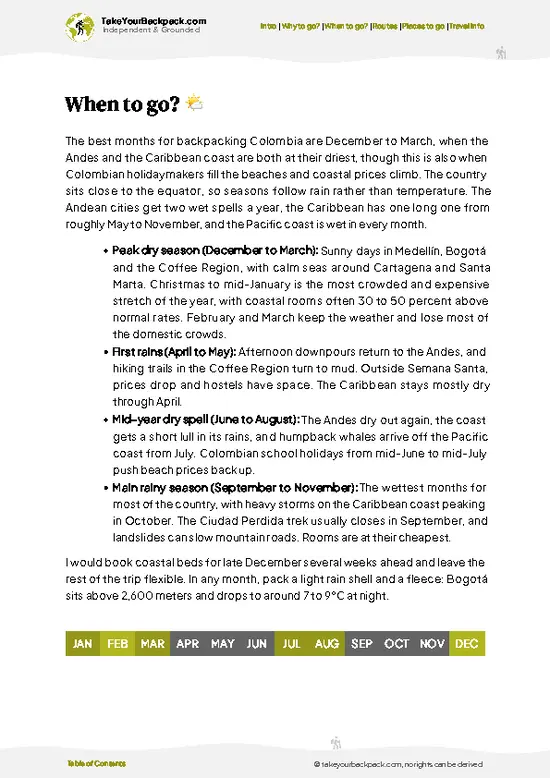
🌤️ When to go?When to go for the best experience


  • Weather: The dry season from December to March offers the clearest trails and views, with minimal mud and fewer slippery rocks. The rainy season, April to November, turns paths into slick challenges and clouds often swallow the summit.

  • Temperature: Expect daytime highs around 18-22°C (64-72°F) and chilly nights dropping to 5-8°C (41-46°F). Early mornings bite colder, so layer up before the sun warms the slopes.

  • Daylight Hours: Roughly 11 to 12 hours of daylight year-round, but starting your hike early is crucial to avoid afternoon fog and maximize summit time.

  • Crowds: Peak hiking months align with the dry season, so trails get busier then. For solitude, aim for shoulder months like November or April, when the weather teeters but the crowds thin.

  • Seasonal Activities: Dry months also
read more 👉

  • Weather: The dry season from December to March offers the clearest trails and views, with minimal mud and fewer slippery rocks. The rainy season, April to November, turns paths into slick challenges and clouds often swallow the summit.

  • Temperature: Expect daytime highs around 18-22°C (64-72°F) and chilly nights dropping to 5-8°C (41-46°F). Early mornings bite colder, so layer up before the sun warms the slopes.

  • Daylight Hours: Roughly 11 to 12 hours of daylight year-round, but starting your hike early is crucial to avoid afternoon fog and maximize summit time.

  • Crowds: Peak hiking months align with the dry season, so trails get busier then. For solitude, aim for shoulder months like November or April, when the weather teeters but the crowds thin.

  • Seasonal Activities: Dry months also coincide with local festivals and agricultural cycles, adding cultural layers to your trek if timed right.

  • Price Fluctuations: Accommodation and guide fees spike during the dry season’s peak; booking ahead can lock in better rates and secure spots on popular tours.


Pro-tip: Hit the trail at dawn during the dry season to catch the volcano’s raw silhouette against a waking sky—every step earns that crisp, panoramic payoff.


source: climatestotravel.comJANJanuary: excellent for travelingFEBFebruary: excellent for travelingMARMarch: excellent for travelingAPRApril: good for travelingMAYMay: fair for travelingJUNJune: fair for travelingJULJuly: fair for travelingAUGAugust: fair for travelingSEPSeptember: fair for travelingOCTOctober: fair for travelingNOVNovember: good for travelingDECDecember: excellent for traveling
colombia-hike-cerro-machin-volcano
© Google | Gabo Cruz

✈️ The backpacker research shortcutColombia Travel Guide

An offline-friendly backpacking guide with optimized travel routes, ranked highlights, transport advice, and the best areas to stay.
example page 0 from our offline Travel Guide for Colombia
example page 1 from our offline Travel Guide for Colombia
example page 2 from our offline Travel Guide for Colombia
example page 3 from our offline Travel Guide for Colombia
example page 4 from our offline Travel Guide for Colombia
example page 5 from our offline Travel Guide for Colombia
example page 6 from our offline Travel Guide for Colombia
example page 7 from our offline Travel Guide for Colombia
The digital guide (464 pages) contains:
122 highlights, ranked by travel appeal
Optimized 7, 14 & 21-day travel routes
Cities, national parks, landmarks, beaches
How to get around
Offline-friendly for travel without Wi-Fi
👉 Click to see all 30+ guide features

📅 Plan smarter in minutes, not weeks
Month by month travel advice
Festivals & national holidays
Budget expectations

🗺️ Go to the right places, skip the overrated ones
Honest pros & cons of destinations
Top hikes, parks & viewpoints
Lesser-known places most travelers miss
Clear “worth it vs skip it” guidance

🛏️ Travel smoothly without rookie mistakes
Best areas to stay
Transport systems explained simply
Common scams & safety advice
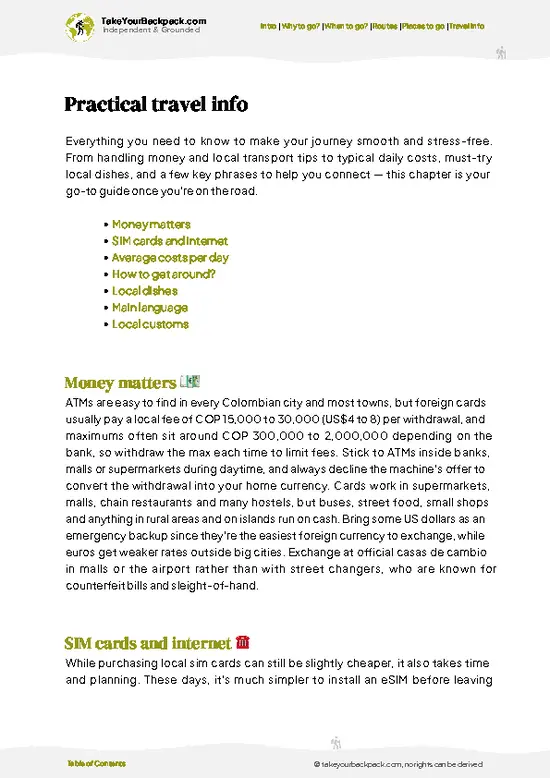
SIM cards, money & practical tips

🌍 Understand the country, not just visit it
Culture & traditions
52 Essential phrases & customs
Festivals worth planning around
Traveler-friendly historical context
Insights that make places more meaningful

📱 Built for real travel conditions
Fully downloadable PDF
Works completely offline
Optimized for phone use
Useful in remote areas & buses
Everything in one place
Save weeks of stressful planning
Get instant access to your full guide. 30‑day money-back guarantee.
+ Add another guide for just US$7.80

By proceeding you agree to our terms.
Sent to your inbox immediately after payment • 100% Secure Checkout
Best Backpacking Travel Advisor 2025 tourism awardBest Backpacking
Travel Advisor
2025
What others say about Take Your Backpack Guides:
⭐⭐⭐⭐⭐
Fantastic, amazing amount of information!
⭐⭐⭐⭐⭐
My goodness this is amazing, it's what I've been looking for hats off too you!
⭐⭐⭐⭐⭐
I think this is absolutely BRILLIANT
⭐⭐⭐⭐
Very complete and informative. It's still missing places, but I gotta to commend you
⭐⭐⭐⭐⭐
This is truly amazing, thank you, can't wait to explore it with my kids!
⭐⭐⭐⭐⭐
Awesome resource, thank you!
⭐⭐⭐⭐⭐
This is amazing! Can't wait to explore the ones I haven't seen
⭐⭐⭐⭐
I love this! Well done, great idea.
⭐⭐⭐⭐⭐
Thanks for taking the time to make this gem!
⭐⭐⭐⭐⭐
This might be the best website I've ever seen.
⭐⭐⭐⭐⭐
Congratulations, and thank you so much for your work; it's incredibly valuable.
⭐⭐⭐⭐
In all seriousness I think you did a great job pointing out the important spots
⭐⭐⭐⭐⭐
10/10 very good
⭐⭐⭐⭐⭐
As someone who's only just starting to visit regularly this is awesome, thank you.
⭐⭐⭐⭐
Thank you very much! I'm going to visit my dad, it's going to be very useful!
⭐⭐⭐⭐⭐
This is really cool! We'll be travelling for the first time and this definitely come in handy.
⭐⭐⭐⭐⭐
You are now our minister of culture, congratulations 👨‍💼
⭐⭐⭐⭐⭐
Just wanted to tell you that this is a pearl! Going to follow your recommendations.
⭐⭐⭐⭐⭐
This is so cool. I'll definitely be using the resource for my travels soon.
⭐⭐⭐⭐⭐
This is very impressive! Good work.
⭐⭐⭐⭐⭐
This is an amazing and informative site. Very well done!

🛏️ Where to stay?How to pick the right area

If you enjoy meeting fellow travelers, consider choosing hostels with high ratings for atmosphere. On the other hand, if you prefer having your own space, a hotel might be a better option.

🥾 Hike detailsTrail overview: what to expect on the hike

Total Distance: The hike around Cerro Machín Volcano is roughly 13 kilometers (about 8 miles) round trip.

Estimated Duration: Expect to spend around 6 to 8 hours on the trail, depending on your pace and how often you stop to take in the views or catch your breath.

Difficulty Level: This trail is considered moderate to challenging. There are steep sections, rocky paths, and some areas where you might need to scramble a bit.

Starting Point: The trailhead is located near the town of Cajamarca. To get there by public transport, take a bus from Pereira or Manizales to Cajamarca. Once in Cajamarca, … read more 👉
Total Distance: The hike around Cerro Machín Volcano is roughly 13 kilometers (about 8 miles) round trip.

Estimated Duration: Expect to spend around 6 to 8 hours on the trail, depending on your pace and how often you stop to take in the views or catch your breath.

Difficulty Level: This trail is considered moderate to challenging. There are steep sections, rocky paths, and some areas where you might need to scramble a bit.

Starting Point: The trailhead is located near the town of Cajamarca. To get there by public transport, take a bus from Pereira or Manizales to Cajamarca. Once in Cajamarca, you can catch a local jeep or taxi to the trailhead, which is about 30 minutes away.

Major Landmarks Along the Route:
  • Laguna de los Cuyos: A beautiful lagoon about halfway up, perfect for a snack break and some photos.
  • Summit: The top offers stunning panoramic views of the surrounding valleys and other peaks.
  • Old Lava Flows: You’ll pass by some fascinating rock formations that showcase the volcano’s past eruptions.

Type of Terrain and Scenery: The terrain varies quite a bit. You’ll encounter rocky paths, dense forest areas, and some open ridges. The scenery shifts from lush greenery at lower elevations to more rugged landscapes as you climb higher.

Typical Vegetation and Wildlife:
  • Vegetation: Expect to see a mix of cloud forest plants, including ferns, orchids, and various trees like oak and eucalyptus.
  • Wildlife: Keep an eye out for birds like the Andean condor and various species of hummingbirds, as well as small mammals like rabbits and the occasional deer.

This trail is a gem for independent hikers, offering a mix of challenge and beauty. Just make sure to pack enough water and snacks, and maybe a light jacket for the cooler summit air!
⚠️ Hiking info can sometimes be outdated or inaccurate. Before you hit the trail, check the latest conditions with locals. If you do spot anything that's off, I'd love to hear from you, so I can update it for fellow travelers.

🛡️ SafetyStaying Safe: What Travelers Should Know

Cerro Machín Volcano offers a thrilling challenge without unnecessary drama. The trail can be steep and rocky, so good footwear is essential. Expect some loose gravel underfoot, especially on the ascent. Navigation is straightforward, but keep an eye on trail markers to avoid wandering off course.

Weather can shift quickly. Mornings may start cool and clear, but clouds can roll in, bringing rain. Layer your clothing to adapt easily. Altitude isn’t extreme, but you might feel it; pace yourself, especially on the steeper sections.

Wildlife encounters are rare, but if you spot a snake or a curious bird, observe from a distance. Respect their space.

Pack enough water and snacks; the effort will leave you craving both. The reward? A panoramic view that stretches for miles, followed by the sweet taste of a cold beer at the trailhead.

FAQCommon questions from travelers

The Cerro Machín Volcano hike typically takes about 2 to 3 days to complete, depending on your pace and weather conditions. The main trail covers roughly 12 kilometers round trip. Most hikers camp overnight near the base or summit.
The hike is considered moderately difficult due to steep ascents and variable terrain. Elevation gain is around 1,500 meters, which can be challenging for those not acclimated to altitude. Proper fitness and hiking experience are recommended.
Yes, you need both a guide and a permit to hike Cerro Machín Volcano. Permits are issued by local authorities and guides are mandatory for safety and navigation. Hiring a guide usually costs around 100,000 to 150,000 COP per day.
⚠️ Things can change over time, so always validate details locally before you go.

Other Colombian hikes near Cerro Machín Volcano

Explore more nearby:


💡 Not sure where to go next?
Create a personalized itinerary for Colombia including Cerro Machín Volcano and the places that fit your trip.

Generate my itinerary

👉 Discover all hikes

Or checkout all Colombia has to offer (think cities, towns, villages, national parks, hikes, beaches, festivals)
Country photo of Colombia

We 💚 feedbackParting advice and final tips

Cerro Machín Volcano is a raw, untamed beauty that rewards your sweat with sweeping views of the Andes. The thrill of standing on the rim, feeling the earth’s pulse beneath your feet, is electric. But be ready for the challenge; the trail can be steep and rocky, testing your grit. It’s not a stroll in the park, but the payoff? Absolutely worth every step.

✈️ When did I visit Colombia?
Did a good 3-week trip around Colombia in August 2014.

✍️ Help improve this page!
The information on this page is based on my own backpacking experience in Colombia, supplemented with up-to-date research and feedback from other travelers. Travel details can change, so if you notice anything outdated or incomplete, feel free to let me know.


🙋‍♂️ Give feedback

👋 Meet the founderWho’s Behind Take Your Backpack?

Johan, backpacker and founder of TakeYourBackpackHi, I’m Johan (Netherlands 🇳🇱), the creator of TakeYourBackpack. Over the past decade, I’ve backpacked through 80+ countries across six continents, gaining extensive experience with independent travel, long-term trips, and overland routes.

This site is built on a combination of firsthand travel experience and carefully curated insights from other backpackers. Many guides are based on places I’ve personally visited, while others bring together tips, observations, and practical advice shared by trusted travelers I’ve met along the way.

The goal is to provide realistic, experience-driven guidance — not generic itineraries — so you can explore destinations with better context, clearer expectations, and more confidence.

Get full Colombia guide •
Instant download • 122 highlights • Full Offline guide