×

Dominican Republic🇩🇴 | national parksSalto de la Jalda National Park120 m waterfall, Río Magua wades, horse trail, Miches trailhead | things to do and best time to go

Explore Loma Quita Espuela Scientific ReserveExplore Parque Nacional Submarino La Caleta

Backpacking in Salto de la Jalda
👍 Recommendednational park ranked #9
By Johan Kruseman 🇳🇱 | Updated October 22, 2026

The Río Magua has to be crossed about eleven times on the way to the fall, so wet boots are part of the deal from the first hour. Salto de la Jalda National Park sits in the Cordillera Oriental near Miches, in the east of the Dominican Republic, and its 120 m waterfall is claimed to be the tallest in the Caribbean. The walk or horse ride takes 2 to 3 hours each way, with forest, cacao and river scenery and a good chance of birds. Crowds stay thin, but going without a local guide invites wrong turns, and cheap sandals fail on slick rocks. Bring sturdy water shoes, a dry bag and cash, since cards are useless out here. Start early so you are not hiking back in the dark. Fit hikers who enjoy getting soaked will love it. Anyone wanting a roadside viewpoint will be frustrated.

Discover everything you want to know in the 📖 Dominican Republic Travel Guide.


example page 0 from our offline Travel Guide for Dominican Republic
example page 1 from our offline Travel Guide for Dominican Republic
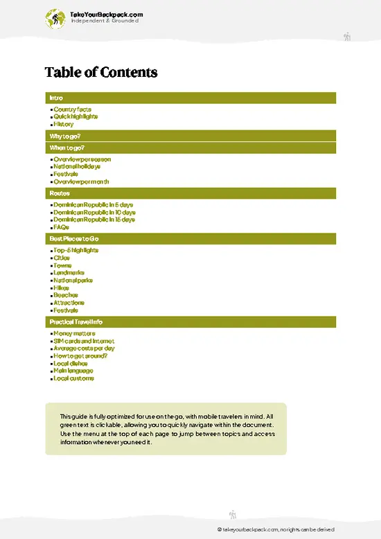
example page 2 from our offline Travel Guide for Dominican Republic
example page 3 from our offline Travel Guide for Dominican Republic
example page 4 from our offline Travel Guide for Dominican Republic
example page 5 from our offline Travel Guide for Dominican Republic
example page 6 from our offline Travel Guide for Dominican Republic
example page 7 from our offline Travel Guide for Dominican Republic
Loading the map 🌍
CLICK TO FILTER
cities
towns
landmarks
national parks
hikes
beaches
attractions
festivals
SHOW COUNTRY’S BESTSHOW ALL

✨ Why go?
Ranked #9 national park in Dominican Republic
Why visitors keep coming back

Salto de la Jalda National Park rewards people who like earning their scenery. The main draw is the 120 m waterfall, which is claimed to be the tallest in the Caribbean, and you reach it on foot or by horse rather than from a parking lot. The route follows the Río Magua with about eleven crossings, so the walk feels like an actual expedition instead of a stroll. Local guides from the Miches area know the crossings, the water levels and the best swimming spots, and hiring one is simple to arrange on arrival without booking a tour package. The park also pairs well with the quiet beaches and hills of the east coast, so independent travelers can build a few days around it without a rigid schedule. Expect a full day of effort, a lot of mud and a swim at the end.

💡 HighlightsPlaces and moments you shouldn't skip

  1. Salto de la Jalda waterfall: The park’s headline sight, a drop of about 120 m that is claimed to be the tallest in the Caribbean. The mist reaches you well before the base does.
  2. Río Magua crossings: About eleven wades along the route, some ankle deep, others reaching the knee or higher after rain. They turn the approach into the most entertaining part of the day.
  3. The plunge pool: A cold swimming spot below the fall where you can cool off after the long approach. The spray is heavy, so keep your camera in a dry bag.
  4. Horseback approach: Local horses carry riders along the trail for those who prefer saddles to blisters. The animals handle the river stones better than most hikers do.
  5. Cordillera Oriental forest: Humid hillside woodland with ferns, big trees and birdsong along the path. Keep an ear
… read more 👉
  1. Salto de la Jalda waterfall: The park’s headline sight, a drop of about 120 m that is claimed to be the tallest in the Caribbean. The mist reaches you well before the base does.
  2. Río Magua crossings: About eleven wades along the route, some ankle deep, others reaching the knee or higher after rain. They turn the approach into the most entertaining part of the day.
  3. The plunge pool: A cold swimming spot below the fall where you can cool off after the long approach. The spray is heavy, so keep your camera in a dry bag.
  4. Horseback approach: Local horses carry riders along the trail for those who prefer saddles to blisters. The animals handle the river stones better than most hikers do.
  5. Cordillera Oriental forest: Humid hillside woodland with ferns, big trees and birdsong along the path. Keep an ear out for calls above the sound of the river.
  6. Cacao and farm plots: Small rural holdings near the trailhead around Miches show how people here farm the foothills. Your guide can often explain what is growing.
  7. Miches trailhead area: A rural start where guides and horses gather in the morning. It is a good place to sort out gear and ask about river levels.
The waterfall and the plunge pool combine easily in one day, since the swim is the natural finish to the hike.
Spotted a mistake or missing something? Contact us.
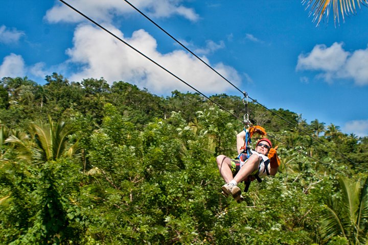
Things to do near Salto de la Jalda National Park

Ratings based on Tripadvisor reviews. When you book through this link, you support our work at no extra cost to you.

🌤️ When to go?Seasonal considerations and timing

  • Dry Season (December to April): The most reliable window for the walk to the 120 m fall. Days reach 28 to 30°C (82 to 86°F), nights drop to 19 to 22°C (66 to 72°F), and the eleven crossings of the Río Magua run lower and easier. Daylight lasts about 11 hours. Expect the most visitors on weekends and around Semana Santa, and guide and horse prices at their highest.
  • Shoulder Months (May to June, November): Showers arrive in the afternoons, the river rises somewhat, and trails get muddy. Temperatures stay 27 to 31°C (81 to 88°F). Crowds thin and prices ease.
  • Wet Season (July to October): Heavy downpours can swell the Magua enough to halt crossings. The fall looks fullest, but the 2 to 3 hour trek each way is slower and riskier. Hurricane season peaks August to October.
Plan the hike for a weekday … read more 👉
  • Dry Season (December to April): The most reliable window for the walk to the 120 m fall. Days reach 28 to 30°C (82 to 86°F), nights drop to 19 to 22°C (66 to 72°F), and the eleven crossings of the Río Magua run lower and easier. Daylight lasts about 11 hours. Expect the most visitors on weekends and around Semana Santa, and guide and horse prices at their highest.
  • Shoulder Months (May to June, November): Showers arrive in the afternoons, the river rises somewhat, and trails get muddy. Temperatures stay 27 to 31°C (81 to 88°F). Crowds thin and prices ease.
  • Wet Season (July to October): Heavy downpours can swell the Magua enough to halt crossings. The fall looks fullest, but the 2 to 3 hour trek each way is slower and riskier. Hurricane season peaks August to October.
Plan the hike for a weekday in February or March, when the river is low and the trail is quiet.


source: climatestotravel.comJANJanuary: excellent for travelingFEBFebruary: excellent for travelingMARMarch: excellent for travelingAPRApril: highly recommended for travelingMAYMay: fair for travelingJUNJune: fair for travelingJULJuly: fair for travelingAUGAugust: fair for travelingSEPSeptember: fair for travelingOCTOctober: good for travelingNOVNovember: good for travelingDECDecember: highly recommended for traveling
dominican-republic-national-park-salto-de-la-jalda-national-park
© Google |

✈️ The backpacker research shortcutDominican Republic Travel Guide

An offline-friendly backpacking guide with optimized travel routes, ranked highlights, transport advice, and the best areas to stay.
example page 0 from our offline Travel Guide for Dominican Republic
example page 1 from our offline Travel Guide for Dominican Republic
example page 2 from our offline Travel Guide for Dominican Republic
example page 3 from our offline Travel Guide for Dominican Republic
example page 4 from our offline Travel Guide for Dominican Republic
example page 5 from our offline Travel Guide for Dominican Republic
example page 6 from our offline Travel Guide for Dominican Republic
example page 7 from our offline Travel Guide for Dominican Republic
The digital guide (336 pages) contains:
✅ 108 highlights, ranked by travel appeal
✅ Optimized 5, 10 & 15-day travel routes
✅ Cities, national parks, landmarks, beaches
✅ How to get around
✅ Offline-friendly for travel without Wi-Fi
👉 Click to see all 30+ guide features

📅 Plan smarter in minutes, not weeks
✅ Month by month travel advice
✅ Festivals & national holidays
✅ Budget expectations

🗺️ Go to the right places, skip the overrated ones
✅ Honest pros & cons of destinations
✅ Top hikes, parks & viewpoints
✅ Lesser-known places most travelers miss
✅ Clear “worth it vs skip it” guidance

🛏️ Travel smoothly without rookie mistakes
✅ Best areas to stay
✅ Transport systems explained simply
✅ Common scams & safety advice
✅ SIM cards, money & practical tips

🌍 Understand the country, not just visit it
✅ Culture & traditions
✅ 52 Essential phrases & customs
✅ Festivals worth planning around
✅ Traveler-friendly historical context
✅ Insights that make places more meaningful

📱 Built for real travel conditions
✅ Fully downloadable PDF
✅ Works completely offline
✅ Optimized for phone use
✅ Useful in remote areas & buses
✅ Everything in one place
Stop searching, start planning
Get instant access to your full guide. 30‑day money-back guarantee.
+ Add another guide for just

By proceeding you agree to our terms.
Sent to your inbox immediately after payment • 100% Secure Checkout
Best Backpacking Travel Advisor 2025 tourism awardBest Backpacking
Travel Advisor
2025
What others say about Take Your Backpack Guides:
⭐⭐⭐⭐⭐
Fantastic, amazing amount of information!
⭐⭐⭐⭐⭐
My goodness this is amazing, it's what I've been looking for hats off too you!
⭐⭐⭐⭐⭐
I think this is absolutely BRILLIANT
⭐⭐⭐⭐
Very complete and informative. It's still missing places, but I gotta to commend you
⭐⭐⭐⭐⭐
This is truly amazing, thank you, can't wait to explore it with my kids!
⭐⭐⭐⭐⭐
Awesome resource, thank you!
⭐⭐⭐⭐⭐
This is amazing! Can't wait to explore the ones I haven't seen
⭐⭐⭐⭐
I love this! Well done, great idea.
⭐⭐⭐⭐⭐
Thanks for taking the time to make this gem!
⭐⭐⭐⭐⭐
This might be the best website I've ever seen.
⭐⭐⭐⭐⭐
Congratulations, and thank you so much for your work; it's incredibly valuable.
⭐⭐⭐⭐
In all seriousness I think you did a great job pointing out the important spots
⭐⭐⭐⭐⭐
10/10 very good
⭐⭐⭐⭐⭐
As someone who's only just starting to visit regularly this is awesome, thank you.
⭐⭐⭐⭐
Thank you very much! I'm going to visit my dad, it's going to be very useful!
⭐⭐⭐⭐⭐
This is really cool! We'll be travelling for the first time and this definitely come in handy.
⭐⭐⭐⭐⭐
You are now our minister of culture, congratulations 👨‍💼
⭐⭐⭐⭐⭐
Just wanted to tell you that this is a pearl! Going to follow your recommendations.
⭐⭐⭐⭐⭐
This is so cool. I'll definitely be using the resource for my travels soon.
⭐⭐⭐⭐⭐
This is very impressive! Good work.
⭐⭐⭐⭐⭐
This is an amazing and informative site. Very well done!

🛏️ Where to stay?Best areas and accommodation options

Most backpackers sleep in Miches, the coastal town about 30 to 40 minutes by road from the park area, or in Sabana de la Mar across the bay. There are no lodgings inside Salto de la Jalda National Park, so plan on day visits. Miches has simple guesthouses and small family-run hotels for US$25 to 50 a night, usually with fans or air-conditioning and hot water not guaranteed. A few beachfront places along the Miches coast cost US$40 to 80 and suit anyone wanting sea breezes after a muddy hike. Sabana de la Mar has basic rooms at US$20 to 40 and the ferry link to Samaná. Nearer the trailhead, a handful … read more 👉
Most backpackers sleep in Miches, the coastal town about 30 to 40 minutes by road from the park area, or in Sabana de la Mar across the bay. There are no lodgings inside Salto de la Jalda National Park, so plan on day visits. Miches has simple guesthouses and small family-run hotels for US$25 to 50 a night, usually with fans or air-conditioning and hot water not guaranteed. A few beachfront places along the Miches coast cost US$40 to 80 and suit anyone wanting sea breezes after a muddy hike. Sabana de la Mar has basic rooms at US$20 to 40 and the ferry link to Samaná. Nearer the trailhead, a handful of rural cabins and ranch-style stays exist, but book by phone or WhatsApp since online listings are thin. Hostels are scarce, so solo travelers meet people at guesthouse terraces and on guided tours. Reserve ahead over Christmas and Easter.

👛 Costs (as of 22 October 2026)Money, prices, and spending tips

Salto de la Jalda National Park costs about US$62 per day for a backpacker in high season, with lodging as the largest line. Prices below are for one person and you pay in Dominican pesos, though many guides quote US dollars.
CategoryBudget RangeLocal Reality
Entrance feeUS$2 to 5Small fee at the site, cash only; guided packages sometimes bundle it.
Guide and tourUS$10 to 25Local guide or horse ride to the falls, negotiated on the spot.
Accommodation (high season)US$25 to 50Guesthouses in Miches; off-season rooms run US$20 to 35.
Local transportUS$4 to 15Guagua minibuses and motoconcho rides from Miches; a private taxi costs more.
Food and suppliesUS$10 to 20Rice, beans and fish at comedores for US$4 to 8 a plate; bring snacks and water.
Total Daily BudgetUS$62Midpoint figures using high-season lodging.
⚠️ Prices can change and everyone travels differently, so take this as a rough guide. Hope it helps you plan your adventure!

🥾 TrailsHiking Salto de la Jalda national park: highlights and difficulty

Salto de la Jalda National Park is essentially one big hike, and it is a satisfying one. The trail runs from the Miches side through farmland and forest, following the Río Magua.
  • Salto de la Jalda trail: The walk or horse ride takes about 2 to 3 hours each way, so plan a full day. The difficulty is moderate, mostly because of footing rather than elevation.
  • Terrain: Rocky paths, mud after rain and about eleven river crossings where you will get wet. Water shoes with grip beat hiking boots here.
  • Scenery: Forested hills, cacao plots and a 120 m waterfall at the end, claimed to be the tallest in the
… read more 👉
Salto de la Jalda National Park is essentially one big hike, and it is a satisfying one. The trail runs from the Miches side through farmland and forest, following the Río Magua.
  • Salto de la Jalda trail: The walk or horse ride takes about 2 to 3 hours each way, so plan a full day. The difficulty is moderate, mostly because of footing rather than elevation.
  • Terrain: Rocky paths, mud after rain and about eleven river crossings where you will get wet. Water shoes with grip beat hiking boots here.
  • Scenery: Forested hills, cacao plots and a 120 m waterfall at the end, claimed to be the tallest in the Caribbean.
  • Wildlife: Mostly birds and the occasional lizard. Quiet groups see more.
  • Swimming: The pool at the base is cold and refreshing, though currents grow stronger after heavy rain.
Reaching the park by public transport means getting to Miches first, then arranging a local guide or a motorbike to the trailhead. Crowds are light, and you may have the fall to yourself on weekdays. Fees are small and paid locally in cash, usually together with the guide. Carry water, snacks and a dry bag, and start early so the return does not run into dusk. Avoid crossing when the river is high.
⚠️ Hiking info can sometimes be outdated or inaccurate. Before you hit the trail, check the latest conditions with locals. If you do spot anything that's off, I'd love to hear from you, so I can update it for fellow travelers.

🛡️ SafetyTraveler Safety Guide

Salto de la Jalda National Park is a straightforward, low-risk outing if you respect the water and the weather. The main hazards are slick rock and mud around the falls and the river crossings, which can swell fast after rain upstream even under blue skies. Wear shoes with real grip, not flip-flops, and skip the swim if the current looks brown and quick. Go with a local guide, who knows the safe pools and keeps the route clear where paths fork. Sun and humidity catch people out, so carry at least 2 liters of water, insect repellent, and a dry layer. Cell signal drops in the valley, so tell your guesthouse your plan. Wildlife is mostly birds and the odd horse on the trail, so give animals space.

FAQCommon questions from travelers

Plan on one full day for Salto de la Jalda National Park, since the walk or horse ride to the falls takes about 1 to 2 hours each way. Add a second day if you want to combine it with beaches near Miches or the coast around Sabana de la Mar. Sleeping in Miches lets you start early, before the midday heat and crowds.
Yes, but it takes planning to reach Salto de la Jalda National Park without a car. Guaguas run to Miches from Sabana de la Mar and from Higüey, and from Miches you can hire a motoconcho or taxi for roughly US$10 to 25 round trip to the trailhead. Many travelers instead book a guided tour from Miches or Punta Cana, which includes the ride.
Salto de la Jalda National Park charges a small entrance fee, generally US$2 to 5 per person, paid in cash at the entrance. No separate permit is required for a day hike. Guides cost extra, typically US$10 to 25, and rates are negotiable.
⚠️ Things can change over time, so always validate details locally before you go.

Other Dominican national parks near Salto de la Jalda

Explore more nearby:


💡 Not sure where to go next?
Create a personalized itinerary for Dominican Republic including Salto de la Jalda and the places that fit your trip.

Generate my itinerary

👉 Discover all national parks

Or checkout all Dominican Republic has to offer (think cities, towns, villages, national parks, hikes, beaches, festivals)
Country photo of Dominican Republic

We 💚 feedbackParting advice and final tips

Salto de la Jalda National Park fits neatly into a route along the east coast, between the quiet beaches around Miches and the road toward Samaná. Give the hike a full day, then rest on the sand afterward. I would bring spare dry socks and leave the good sneakers at your guesthouse.

✍️ Help improve this page!
The information on this page is based on in-depth research, insights shared by experienced travelers, and feedback from the local travel community in Dominican Republic. While every effort is made to keep the information accurate and current, conditions can change — so if you spot anything incorrect or outdated, please get in touch.


🙋‍♂️ Give feedback

👋 Meet the founderWho’s Behind Take Your Backpack?

Johan, backpacker and founder of TakeYourBackpackHi, I’m Johan (Netherlands 🇳🇱), the creator of TakeYourBackpack. Over the past 3 decades, I’ve backpacked through 90+ countries across six continents, gaining extensive experience with independent travel, long-term trips, and overland routes.

This site is built on a combination of firsthand travel experience and carefully curated insights from other backpackers. Many guides are based on places I’ve personally visited, while others bring together tips, observations, and practical advice shared by trusted travelers I’ve met along the way.

The goal is to provide realistic, experience-driven guidance — not generic itineraries — so you can explore destinations with better context, clearer expectations, and more confidence.