×

Ecuador🇪🇨 | hikesCajas Inca Trailstone paths, glacial lakes, high-altitude tundra | things to do and best time to go

Explore Laguna de CuicochaExplore Pailón del Diablo Trail

Backpacking in Cajas Inca Trail
👍 Recommendedhike ranked #5
By Johan Kruseman 🇳🇱 | Updated June 4, 2026

You have to choose, before your boots hit dirt: do you want a tidy half‑day photo walk, or are you willing to grind through a full, high-altitude traverse that actually feels like an Inca road? That choice matters, because the Cajas Inca Trail, in El Cajas National Park just west of Cuenca in Ecuador’s southern highlands, doesn’t really reward dabbling. This route strings together cold, wind‑slapped páramo, mirror lakes, and old stone causeway, but it’s longer and rougher than it looks on a map, with mud, boggy sections, and weather that flips from sun to sideways rain in minutes. Public buses from Cuenca drop you close to the trailheads, so access is easy, but the hike itself hits harder than most nearby Cuenca day walks and feels wilder than the more manicured routes around Quilotoa or Cotopaxi. I finished soaked, shivering, and grinning.

Discover everything you want to know in the 📖 Ecuador Travel Guide.
Best time to go: June - September
Duration: 4 days
Distance: 30 kilometers
Total ascent: 1,200 meters


Get your Ecuador guide
94 ranked highlights, routes & tips, works offline (362 pages)
Loading the map 🌍
CLICK TO FILTER
cities
towns
landmarks
national parks
hikes
beaches
attractions
festivals
regions
SHOW COUNTRY’S BESTSHOW ALL

✨ Why go?
Ranked #5 hike in Ecuador
What makes this hike worth hiking

The Cajas Inca Trail in Ecuador is a magnet for backpackers, and for good reason. First off, the scenery-to-effort ratio is off the charts. You’ll trek through stunning high-altitude landscapes, with shimmering lakes and rugged peaks that make every step feel like a reward. The trail’s accessibility via public transport from Cuenca means you can dive into this adventure without breaking the bank.

Cost? Minimal. You can hit the trail with just a few bucks for transport and maybe a snack or two. The flexible distances allow you to tailor your hike to your energy levels, whether you want a quick jaunt or a full-day challenge.

What’s more, the Cajas Inca Trail fits seamlessly into a longer backpacking route through Ecuador. It’s a perfect pit stop between Cuenca and the coast or the Amazon. … read more 👉
The Cajas Inca Trail in Ecuador is a magnet for backpackers, and for good reason. First off, the scenery-to-effort ratio is off the charts. You’ll trek through stunning high-altitude landscapes, with shimmering lakes and rugged peaks that make every step feel like a reward. The trail’s accessibility via public transport from Cuenca means you can dive into this adventure without breaking the bank.

Cost? Minimal. You can hit the trail with just a few bucks for transport and maybe a snack or two. The flexible distances allow you to tailor your hike to your energy levels, whether you want a quick jaunt or a full-day challenge.

What’s more, the Cajas Inca Trail fits seamlessly into a longer backpacking route through Ecuador. It’s a perfect pit stop between Cuenca and the coast or the Amazon.

As you navigate the rugged terrain, the burn in your legs is a small price to pay for the sweeping views and the thrill of conquering the wild. And when you finally crack open that first cold beer at the end, you’ll know every step was worth it.
Want to include Cajas Inca Trail in your Ecuador route?
Create a personalized Ecuador itinerary that includes Cajas Inca Trail and the places that fit your trip — based on your travel style, budget, and available time. Get your route in seconds.

Generate my trip

💡 HighlightsWhat this place is best known for

  • Laguna Toreadora — A small glacial lake that often looks like a polished mirror at sunrise. The water turns an unreal turquoise with the right light, and the steep moraine behind it makes for one of the most postcard-ready spots on the trail. (Personal favorite — I like to sit here and let the cold quiet sink in.)
  • High-pass panoramic viewpoint — The saddle or pass along the route opens onto a scatter of lakes across a high plain; you can see the Andes rolling off in layers and the patchwork of lagunas dotting the valley. It’s that wide, cinematic kind of view you don’t get on lower-elevation hikes.
  • Queñua (Polylepis) woodlands — Tiny, twisted high-elevation trees that look ancient and gnarly. These rare groves host specialized birds and feel like a different world compared with the open
read more 👉
  • Laguna Toreadora — A small glacial lake that often looks like a polished mirror at sunrise. The water turns an unreal turquoise with the right light, and the steep moraine behind it makes for one of the most postcard-ready spots on the trail. (Personal favorite — I like to sit here and let the cold quiet sink in.)
  • High-pass panoramic viewpoint — The saddle or pass along the route opens onto a scatter of lakes across a high plain; you can see the Andes rolling off in layers and the patchwork of lagunas dotting the valley. It’s that wide, cinematic kind of view you don’t get on lower-elevation hikes.
  • Queñua (Polylepis) woodlands — Tiny, twisted high-elevation trees that look ancient and gnarly. These rare groves host specialized birds and feel like a different world compared with the open páramo — great for a shady break and some quiet birdwatching.
  • Páramo and peatland mosaics — Vast cushion plants, tussock grasses and soggy peat bogs make up the bulk of the landscape. The ground here acts like a giant sponge feeding the lakes below, and the plant shapes (low, sculptural, often weird) are uniquely Andean.
  • Birdlife and highland wildlife — Expect Andean geese, waterfowl on the lagunas, bobbing coots and a squad of small, colorful birds. If you’re lucky you’ll spot wild camelids or a shy deer. The mixture of water, scrub and forest makes for surprisingly good wildlife stops compared with many other trails.
Spotted a mistake or missing something? Contact us.
🌤️ When to go?Best time to hike the Cajas Inca Trail


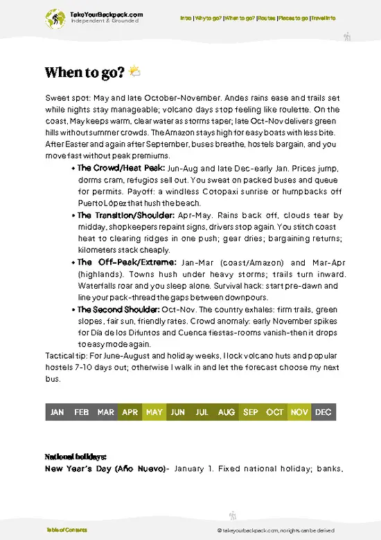
  • Weather: The dry season from June to September is your best bet—clear skies and minimal rain make the trail manageable and the views sharp. The wet season (October to May) turns the path slippery and the clouds thick, muting the landscape’s drama.

  • Temperature: Expect chilly mornings around 5°C (41°F) and daytime highs near 18°C (64°F) during the dry months. The wet season nudges temps slightly warmer but adds dampness that seeps into your bones.

  • Daylight Hours: Near the equator, daylight is steady year-round, roughly 12 hours. Start early to maximize light and avoid afternoon clouds that roll in fast.

  • Crowds: Peak season draws more hikers, especially July and August. The trail feels alive but less solitary. Off-season means fewer people but a higher chance of mud and mist.

  • Seasonal
read more 👉

  • Weather: The dry season from June to September is your best bet—clear skies and minimal rain make the trail manageable and the views sharp. The wet season (October to May) turns the path slippery and the clouds thick, muting the landscape’s drama.

  • Temperature: Expect chilly mornings around 5°C (41°F) and daytime highs near 18°C (64°F) during the dry months. The wet season nudges temps slightly warmer but adds dampness that seeps into your bones.

  • Daylight Hours: Near the equator, daylight is steady year-round, roughly 12 hours. Start early to maximize light and avoid afternoon clouds that roll in fast.

  • Crowds: Peak season draws more hikers, especially July and August. The trail feels alive but less solitary. Off-season means fewer people but a higher chance of mud and mist.

  • Seasonal Activities: Dry months align with local festivals and open markets nearby, adding cultural spice to your trek. Wet months quiet down, focusing your experience purely on nature’s raw pulse.

  • Price Fluctuations: Expect higher prices for guides and lodging during the dry season’s peak. Off-season offers bargains but comes with the trade-off of tougher trail conditions.


Pro-tip: Aim for late June or early September—dry trails, manageable crowds, and crisp air that rewards every step with a view that cuts through the Andes like a fresh breath.


source: climatestotravel.comJANJanuary: fair for travelingFEBFebruary: fair for travelingMARMarch: fair for travelingAPRApril: fair for travelingMAYMay: fair for travelingJUNJune: highly recommended for travelingJULJuly: excellent for travelingAUGAugust: excellent for travelingSEPSeptember: highly recommended for travelingOCTOctober: fair for travelingNOVNovember: fair for travelingDECDecember: fair for traveling
ecuador-hike-cajas-inca-trail
© Google |

✈️ The backpacker research shortcutEcuador Travel Guide

An offline-friendly backpacking guide with optimized travel routes, ranked highlights, transport advice, and the best areas to stay.
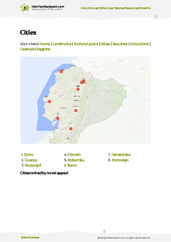
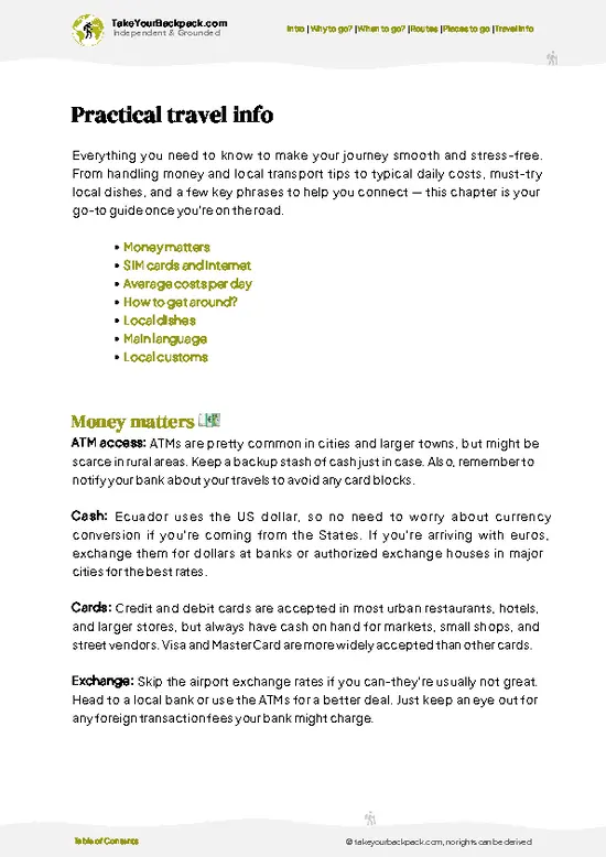
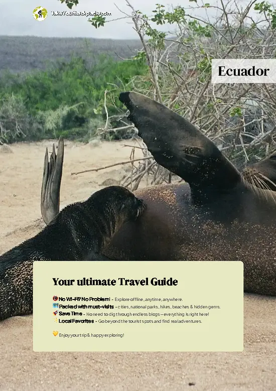
example page 0 from our offline Travel Guide for Ecuador
example page 1 from our offline Travel Guide for Ecuador
example page 2 from our offline Travel Guide for Ecuador
example page 3 from our offline Travel Guide for Ecuador
example page 4 from our offline Travel Guide for Ecuador
example page 5 from our offline Travel Guide for Ecuador
example page 6 from our offline Travel Guide for Ecuador
example page 7 from our offline Travel Guide for Ecuador
The digital guide (362 pages) contains:
94 highlights, ranked by travel appeal
Optimized 5, 10 & 15-day travel routes
Cities, national parks, landmarks, beaches
How to get around
Offline-friendly for travel without Wi-Fi
👉 Click to see all 30+ guide features

📅 Plan smarter in minutes, not weeks
Month by month travel advice
Festivals & national holidays
Budget expectations

🗺️ Go to the right places, skip the overrated ones
Honest pros & cons of destinations
Top hikes, parks & viewpoints
Lesser-known places most travelers miss
Clear “worth it vs skip it” guidance

🛏️ Travel smoothly without rookie mistakes
Best areas to stay
Transport systems explained simply
Common scams & safety advice
SIM cards, money & practical tips

🌍 Understand the country, not just visit it
Culture & traditions
52 Essential phrases & customs
Festivals worth planning around
Traveler-friendly historical context
Insights that make places more meaningful

📱 Built for real travel conditions
Fully downloadable PDF
Works completely offline
Optimized for phone use
Useful in remote areas & buses
Everything in one place
Save weeks of stressful planning
Get instant access to your full guide. 30‑day money-back guarantee.


By proceeding you agree to our terms.
Sent to your inbox immediately after payment • 100% Secure Checkout
Best Backpacking Travel Advisor 2025 tourism awardBest Backpacking
Travel Advisor
2025
What others say about Take Your Backpack Guides:
⭐⭐⭐⭐⭐
Fantastic, amazing amount of information!
⭐⭐⭐⭐⭐
My goodness this is amazing, it's what I've been looking for hats off too you!
⭐⭐⭐⭐⭐
I think this is absolutely BRILLIANT
⭐⭐⭐⭐
Very complete and informative. It's still missing places, but I gotta to commend you
⭐⭐⭐⭐⭐
This is truly amazing, thank you, can't wait to explore it with my kids!
⭐⭐⭐⭐⭐
Awesome resource, thank you!
⭐⭐⭐⭐⭐
This is amazing! Can't wait to explore the ones I haven't seen
⭐⭐⭐⭐
I love this! Well done, great idea.
⭐⭐⭐⭐⭐
Thanks for taking the time to make this gem!
⭐⭐⭐⭐⭐
This might be the best website I've ever seen.
⭐⭐⭐⭐⭐
Congratulations, and thank you so much for your work; it's incredibly valuable.
⭐⭐⭐⭐
In all seriousness I think you did a great job pointing out the important spots
⭐⭐⭐⭐⭐
10/10 very good
⭐⭐⭐⭐⭐
As someone who's only just starting to visit regularly this is awesome, thank you.
⭐⭐⭐⭐
Thank you very much! I'm going to visit my dad, it's going to be very useful!
⭐⭐⭐⭐⭐
This is really cool! We'll be travelling for the first time and this definitely come in handy.
⭐⭐⭐⭐⭐
You are now our minister of culture, congratulations 👨‍💼
⭐⭐⭐⭐⭐
Just wanted to tell you that this is a pearl! Going to follow your recommendations.
⭐⭐⭐⭐⭐
This is so cool. I'll definitely be using the resource for my travels soon.
⭐⭐⭐⭐⭐
This is very impressive! Good work.
⭐⭐⭐⭐⭐
This is an amazing and informative site. Very well done!

🛏️ Where to stay?Where staying makes the most sense

If you enjoy meeting fellow travelers, consider choosing hostels with high ratings for atmosphere. On the other hand, if you prefer having your own space, a hotel might be a better option.

🥾 Hike detailsA practical overview of the hike

Total Distance: The Cajas Inca Trail stretches about 12 kilometers (7.5 miles) one way, making it a solid trek for a day hike or a two-day adventure if you want to take your time.

Estimated Duration: Expect to spend around 5 to 7 hours on the trail, depending on your pace and how often you stop to take in the breathtaking views or catch your breath.

Difficulty Level: This trail is generally rated as moderate. It has its steep sections and some rocky paths, but nothing too extreme if you’re used to hiking. Just be prepared for altitude; the trail sits at around 3,200 to 4,000 meters (10,500 to … read more 👉
Total Distance: The Cajas Inca Trail stretches about 12 kilometers (7.5 miles) one way, making it a solid trek for a day hike or a two-day adventure if you want to take your time.

Estimated Duration: Expect to spend around 5 to 7 hours on the trail, depending on your pace and how often you stop to take in the breathtaking views or catch your breath.

Difficulty Level: This trail is generally rated as moderate. It has its steep sections and some rocky paths, but nothing too extreme if you’re used to hiking. Just be prepared for altitude; the trail sits at around 3,200 to 4,000 meters (10,500 to 13,100 feet), so take it slow if you’re not acclimatized.

Starting Point: The hike begins at the Cajas National Park entrance. To get there from Cuenca, hop on a bus heading to the park. These buses leave from the Terminal Terrestre in Cuenca, and the ride takes about an hour. Just let the driver know you’re going to Cajas, and they’ll drop you off right at the entrance.

Major Landmarks Along the Route:
  • Laguna La Toreadora: This stunning lake is a popular first stop, perfect for a quick snack or photo op.
  • Inca Ruins: Keep an eye out for remnants of ancient Inca structures along the trail, adding a historical twist to your hike.
  • Various Lagoons: You’ll cross several small lagoons, each with its own charm, surrounded by unique rock formations.

Type of Terrain and Scenery: The trail features a mix of rocky paths, grassy areas, and some muddy spots, especially after rain. The scenery is absolutely stunning, with rolling hills, shimmering lakes, and rugged mountains. The ever-changing landscapes keep things interesting, so be ready to whip out your camera often.

Typical Vegetation and Wildlife:
  • Vegetation: Expect to see a variety of plants, including the iconic polylepis trees, which are known for their twisted trunks and unique appearance. The high-altitude grasslands are home to many endemic species.
  • Wildlife: Keep your eyes peeled for wildlife like the Andean condor soaring overhead, as well as other birds and maybe even a shy rabbit or two. The area is rich in biodiversity, so you might spot some interesting critters if you’re patient.

This trail is a gem for independent hikers. Just make sure you bring enough water, snacks, and a good camera to capture the stunning vistas. Happy hiking!
⚠️ Hiking info can sometimes be outdated or inaccurate. Before you hit the trail, check the latest conditions with locals. If you do spot anything that's off, I'd love to hear from you, so I can update it for fellow travelers.

🛡️ SafetyScams, Hazards, and Annoyances

The Cajas Inca Trail offers a thrilling blend of challenge and reward. Expect weather shifts that can swing from sunny to drizzly in minutes. Dress in layers; a good rain jacket and moisture-wicking base layers will keep you comfortable.

The terrain can be rugged, with steep ascents and rocky paths. Focus on your footing, especially in the wet season when trails can become slippery. Navigation is straightforward, but keep an eye on trail markers to avoid wandering off course.

Altitude can be a factor, so pace yourself and stay hydrated. Take breaks to acclimatize; the views from the high points are worth every step.

Wildlife encounters are rare but magical. If you spot a llama or a condor, admire from a distance. Remember, this is their home.

Preparation is key. First-timers often … read more 👉
The Cajas Inca Trail offers a thrilling blend of challenge and reward. Expect weather shifts that can swing from sunny to drizzly in minutes. Dress in layers; a good rain jacket and moisture-wicking base layers will keep you comfortable.

The terrain can be rugged, with steep ascents and rocky paths. Focus on your footing, especially in the wet season when trails can become slippery. Navigation is straightforward, but keep an eye on trail markers to avoid wandering off course.

Altitude can be a factor, so pace yourself and stay hydrated. Take breaks to acclimatize; the views from the high points are worth every step.

Wildlife encounters are rare but magical. If you spot a llama or a condor, admire from a distance. Remember, this is their home.

Preparation is key. First-timers often underestimate the chill at higher elevations, so pack a warm hat and gloves. Embrace the grit of the trail, and you’ll find the journey is as rewarding as the destination.

Other Ecuadorian hikes near Cajas Inca Trail

Explore more nearby:


💡 Not sure where to go next?
Create a personalized itinerary for Ecuador including Cajas Inca Trail and the places that fit your trip.

Generate my itinerary

👉 Discover all hikes

Or checkout all Ecuador has to offer (think cities, towns, villages, national parks, hikes, beaches, festivals)
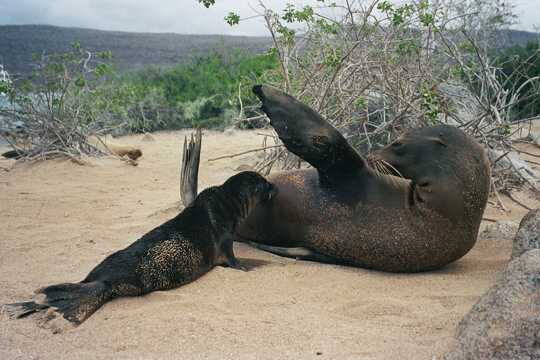
Country photo of Ecuador

We 💚 feedbackWhat to keep in mind

The Cajas Inca Trail is a wild ride through breathtaking landscapes, where every step reveals a new vista. The thrill of navigating its rugged terrain is matched only by the moment you reach a high point and catch your breath while soaking in the sweeping views. But be ready: the altitude can hit hard, and acclimatization is key. Embrace the challenge, and the rewards will be worth every labored breath.

✈️ When did I visit Ecuador?
Ecuador I visited during my half year trip through South and Central America back in 2003

✍️ Help improve this page!
The information on this page is based on my own backpacking experience in Ecuador, supplemented with up-to-date research and feedback from other travelers. Travel details can change, so if you notice anything outdated or incomplete, feel free to let me know.


🙋‍♂️ Give feedback

👋 Meet the founderWho’s Behind Take Your Backpack?

Johan, backpacker and founder of TakeYourBackpackHi, I’m Johan (Netherlands 🇳🇱), the creator of TakeYourBackpack. Over the past decade, I’ve backpacked through 80+ countries across six continents, gaining extensive experience with independent travel, long-term trips, and overland routes.

This site is built on a combination of firsthand travel experience and carefully curated insights from other backpackers. Many guides are based on places I’ve personally visited, while others bring together tips, observations, and practical advice shared by trusted travelers I’ve met along the way.

The goal is to provide realistic, experience-driven guidance — not generic itineraries — so you can explore destinations with better context, clearer expectations, and more confidence.

Get full Ecuador guide •
Instant download • 94 highlights • Full Offline guide