×

Equatorial Guinea🇬🇶 | regionsAnnobónFa d’Ambu creole, crater lake, Quioveo climb, humpback season | things to do and best time to go

Explore Isla de CoriscoExplore Aconibe

Backpacking in Annobón
🌟 Highlightregion ranked #2
By Johan Kruseman 🇳🇱 | Updated October 22, 2026

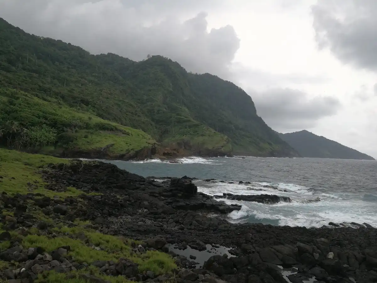
Annobón has no regular scheduled passenger service, so getting there means catching an occasional flight or supply boat and being ready to wait for the return. The island sits in the Gulf of Guinea, the southernmost territory of Equatorial Guinea, a small volcanic speck far from the mainland and from Malabo. Its roughly five thousand people speak Fa d’Ambu, a Portuguese-based creole you will hear nowhere else. Steep green slopes rise straight from the sea, and the only sizable settlement, San Antonio de Palé, hugs a bay where wooden canoes are pulled up on the shore. The good side is real isolation, forest trails and a crater lake. The bad side is thin infrastructure, few places to sleep and almost no organized tourism, so you arrange everything locally. A first day can start with a slow walk along the Palé waterfront, watching the fishing canoes come in and buying fresh fish from whoever has it.

Discover everything you want to know in the 📖 Equatorial Guinea Travel Guide.


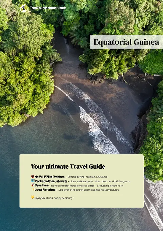
example page 0 from our offline Travel Guide for Equatorial Guinea
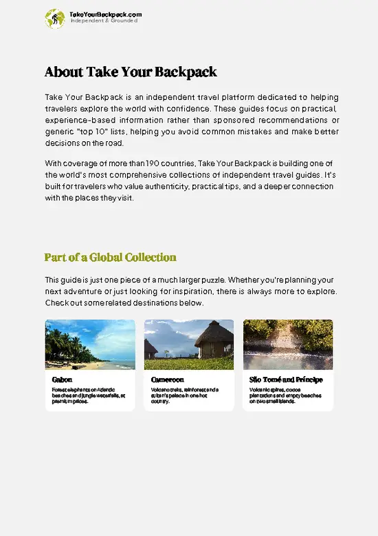
example page 1 from our offline Travel Guide for Equatorial Guinea
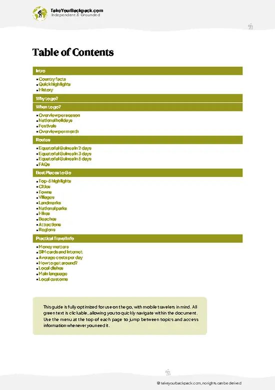
example page 2 from our offline Travel Guide for Equatorial Guinea
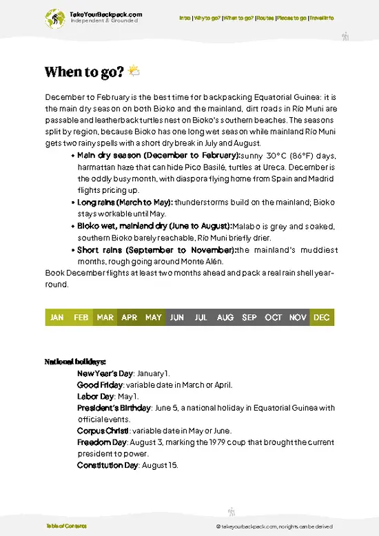
example page 3 from our offline Travel Guide for Equatorial Guinea
example page 4 from our offline Travel Guide for Equatorial Guinea
example page 5 from our offline Travel Guide for Equatorial Guinea
example page 6 from our offline Travel Guide for Equatorial Guinea
example page 7 from our offline Travel Guide for Equatorial Guinea
Loading the map 🌍
CLICK TO FILTER
cities
towns
villages
landmarks
national parks
hikes
beaches
attractions
regions
SHOW COUNTRY’S BESTSHOW ALL

✨ Why go?
Ranked #2 region in Equatorial Guinea
What makes this region worth visiting

Annobón rewards backpackers who like getting somewhere few others reach, and the reasons are concrete. First, the island packs a lot into a small area: a crater lake called Lago A Pot, a forested volcanic ridge crowned by Quioveo peak at about 598 meters, and a bay-side capital, all reachable on foot without any vehicle. You can sleep in one place and still see the interior, the coast and village life.

Second, the culture is distinct from the rest of the country. Fa d’Ambu, the island’s creole, and a local Catholic tradition built around San Antonio de Padua set Annobón apart from mainland Equatorial Guinea, and a few days of talking with fishermen and walking between houses teaches you more than a museum could.

Third, the sea. Humpback whales pass these waters in the southern winter months, … read more 👉
Annobón rewards backpackers who like getting somewhere few others reach, and the reasons are concrete. First, the island packs a lot into a small area: a crater lake called Lago A Pot, a forested volcanic ridge crowned by Quioveo peak at about 598 meters, and a bay-side capital, all reachable on foot without any vehicle. You can sleep in one place and still see the interior, the coast and village life.

Second, the culture is distinct from the rest of the country. Fa d’Ambu, the island’s creole, and a local Catholic tradition built around San Antonio de Padua set Annobón apart from mainland Equatorial Guinea, and a few days of talking with fishermen and walking between houses teaches you more than a museum could.

Third, the sea. Humpback whales pass these waters in the southern winter months, and local canoe fishermen know where to look. Slow travel is not a style here, it is the only option, and that suits anyone who wants a place with no queue of other visitors.

💡 HighlightsPlaces and moments you shouldn't skip

  1. Lago A Pot: a freshwater lake sitting in an old volcanic crater, ringed by dense forest and quiet apart from birds. The trail climbs from the lowlands and gives you a rare swim-or-sit spot with no one else around.
  2. San Antonio de Palé: the island’s capital, strung along a sheltered bay. Low houses, a small harbor and a church make it the natural base, and the landing of boats is the main event of any day.
  3. Quioveo peak: the island’s highest point at about 598 meters. The climb goes through humid forest, and from the top you see the whole island edged by open ocean, which makes its size obvious.
  4. Feast of San Antonio de Padua: the patron saint’s celebration in mid June, with processions, singing and dancing in Palé. It is the best time to see community life at full volume.
  5. Palé fishing canoes: dugout
… read more 👉
  1. Lago A Pot: a freshwater lake sitting in an old volcanic crater, ringed by dense forest and quiet apart from birds. The trail climbs from the lowlands and gives you a rare swim-or-sit spot with no one else around.
  2. San Antonio de Palé: the island’s capital, strung along a sheltered bay. Low houses, a small harbor and a church make it the natural base, and the landing of boats is the main event of any day.
  3. Quioveo peak: the island’s highest point at about 598 meters. The climb goes through humid forest, and from the top you see the whole island edged by open ocean, which makes its size obvious.
  4. Feast of San Antonio de Padua: the patron saint’s celebration in mid June, with processions, singing and dancing in Palé. It is the best time to see community life at full volume.
  5. Palé fishing canoes: dugout and plank canoes launched from the shoreline each morning. Lesser known to outsiders, but locals will often show you the catch and explain how they read the water.
  6. Evenings of Fa d’Ambu music: informal singing and drumming in village courtyards, in a creole unique to this island. Ask politely and sit at the edge, and you often get invited in.
  7. Whale season off the coast: humpbacks pass the island roughly from July to September. A fisherman’s canoe or boat outing is the way to see them, with no crowds and no operator logo.
Annobón is small enough that Quioveo peak and Lago A Pot fit together in one long day on foot, since the lake trail and the ridge both start from the interior forest.
Spotted a mistake or missing something? Contact us.
⌛️ 5 daysWhat you can realistically do in a week

Day 1: San Antonio de Palé: A landing day, because boats and the occasional flight set your arrival, and nothing else on the island is timed. Spend the afternoon on the Palé waterfront, find a bed, introduce yourself to a household or the local authorities and check the next boat out. Everything on Annobón runs through who you know, so this first contact decides how smoothly the rest goes.
Day 2: San Antonio de Palé: Stay in town to watch the canoes launch and return, eat what the fishermen bring in and listen for an evening of Fa d’Ambu singing. A second day here lets you hire a guide for the climbs, which is worth doing since trails are not signed.
Day 3: Lago A Pot: Start early for the crater lake, going up while the forest is still cool. The trail is steep and muddy after rain, so bring … read more 👉
Day 1: San Antonio de Palé: A landing day, because boats and the occasional flight set your arrival, and nothing else on the island is timed. Spend the afternoon on the Palé waterfront, find a bed, introduce yourself to a household or the local authorities and check the next boat out. Everything on Annobón runs through who you know, so this first contact decides how smoothly the rest goes.
Day 2: San Antonio de Palé: Stay in town to watch the canoes launch and return, eat what the fishermen bring in and listen for an evening of Fa d’Ambu singing. A second day here lets you hire a guide for the climbs, which is worth doing since trails are not signed.
Day 3: Lago A Pot: Start early for the crater lake, going up while the forest is still cool. The trail is steep and muddy after rain, so bring shoes with grip and plenty of water. Sit by the lake for a while, since the walk is the point as much as the arrival.
Day 4: Quioveo peak: Tackle the island’s highest point with a local guide. The path climbs through thick vegetation, and on a clear morning the summit view shows the sea on every side. Rest in the afternoon, because legs are tired.
Day 5: Coast and departure: Use the last day for a canoe outing along the shore, and if it falls between July and September, a whale-spotting trip makes a good detour that costs no extra days because it runs from Palé itself. Keep the afternoon flexible, since the transport home can shift with weather and cargo.

If you only get one day, make it Day 4: Quioveo peak, where the whole island and the ocean around it finally make sense.

🌤️ When to go?Weather, crowds, and seasonal trade-offs

  • Dry Season (June to September): Rain eases and the sea is calmer, which matters when a ship or small boat is your link to the island. Days sit around 24 to 29°C (75 to 84°F), with cloud often covering the crater peaks. Humpback whales may pass offshore in these cooler months.
  • Wet Season (October to May): Downpours come in heavy bursts, trails to the crater lake turn to slick red mud, and rough seas can delay or cancel crossings. Temperatures run 26 to 31°C (79 to 88°F) with thick humidity.
  • Turtle Nesting (roughly November to February): Turtles come ashore on quiet beaches at night, though this overlaps with the rainiest weeks.
  • Crowds and Prices: Visitors are almost nonexistent in every month, so prices barely move. Fares by sea or air depend on the schedule, not the season.
Daylight stays close … read more 👉
  • Dry Season (June to September): Rain eases and the sea is calmer, which matters when a ship or small boat is your link to the island. Days sit around 24 to 29°C (75 to 84°F), with cloud often covering the crater peaks. Humpback whales may pass offshore in these cooler months.
  • Wet Season (October to May): Downpours come in heavy bursts, trails to the crater lake turn to slick red mud, and rough seas can delay or cancel crossings. Temperatures run 26 to 31°C (79 to 88°F) with thick humidity.
  • Turtle Nesting (roughly November to February): Turtles come ashore on quiet beaches at night, though this overlaps with the rainiest weeks.
  • Crowds and Prices: Visitors are almost nonexistent in every month, so prices barely move. Fares by sea or air depend on the schedule, not the season.
Daylight stays close to twelve hours all year, so plan hikes for early morning before the cloud builds. Travel in the dry months and leave several spare days for delays.


source: climatestotravel.comJANJanuary: fair for travelingFEBFebruary: fair for travelingMARMarch: fair for travelingAPRApril: fair for travelingMAYMay: fair for travelingJUNJune: excellent for travelingJULJuly: excellent for travelingAUGAugust: excellent for travelingSEPSeptember: excellent for travelingOCTOctober: good for travelingNOVNovember: good for travelingDECDecember: good for traveling
equatorial-guinea-region-annobon
© Google |

✈️ The backpacker research shortcutEquatorial Guinea Travel Guide

An offline-friendly backpacking guide with optimized travel routes, ranked highlights, transport advice, and the best areas to stay.
example page 0 from our offline Travel Guide for Equatorial Guinea
example page 1 from our offline Travel Guide for Equatorial Guinea
example page 2 from our offline Travel Guide for Equatorial Guinea
example page 3 from our offline Travel Guide for Equatorial Guinea
example page 4 from our offline Travel Guide for Equatorial Guinea
example page 5 from our offline Travel Guide for Equatorial Guinea
example page 6 from our offline Travel Guide for Equatorial Guinea
example page 7 from our offline Travel Guide for Equatorial Guinea
The digital guide (174 pages) contains:
✅ 36 highlights, ranked by travel appeal
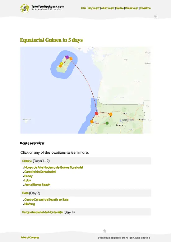
✅ Optimized 2, 3 & 5-day travel routes
✅ Cities, national parks, landmarks, beaches
✅ How to get around
✅ Offline-friendly for travel without Wi-Fi
👉 Click to see all 30+ guide features

📅 Plan smarter in minutes, not weeks
✅ Month by month travel advice
✅ Festivals & national holidays
✅ Budget expectations

🗺️ Go to the right places, skip the overrated ones
✅ Honest pros & cons of destinations
✅ Top hikes, parks & viewpoints
✅ Lesser-known places most travelers miss
✅ Clear “worth it vs skip it” guidance

🛏️ Travel smoothly without rookie mistakes
✅ Best areas to stay
✅ Transport systems explained simply
✅ Common scams & safety advice
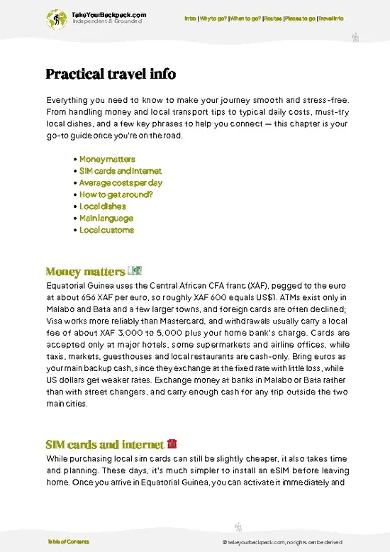
✅ SIM cards, money & practical tips

🌍 Understand the country, not just visit it
✅ Culture & traditions
✅ 52 Essential phrases & customs
✅ Festivals worth planning around
✅ Traveler-friendly historical context
✅ Insights that make places more meaningful

📱 Built for real travel conditions
✅ Fully downloadable PDF
✅ Works completely offline
✅ Optimized for phone use
✅ Useful in remote areas & buses
✅ Everything in one place
Stop searching, start planning
Get instant access to your full guide. 30‑day money-back guarantee.
+ Add another guide for just

By proceeding you agree to our terms.
Sent to your inbox immediately after payment • 100% Secure Checkout
Best Backpacking Travel Advisor 2025 tourism awardBest Backpacking
Travel Advisor
2025
What others say about Take Your Backpack Guides:
⭐⭐⭐⭐⭐
Fantastic, amazing amount of information!
⭐⭐⭐⭐⭐
My goodness this is amazing, it's what I've been looking for hats off too you!
⭐⭐⭐⭐⭐
I think this is absolutely BRILLIANT
⭐⭐⭐⭐
Very complete and informative. It's still missing places, but I gotta to commend you
⭐⭐⭐⭐⭐
This is truly amazing, thank you, can't wait to explore it with my kids!
⭐⭐⭐⭐⭐
Awesome resource, thank you!
⭐⭐⭐⭐⭐
This is amazing! Can't wait to explore the ones I haven't seen
⭐⭐⭐⭐
I love this! Well done, great idea.
⭐⭐⭐⭐⭐
Thanks for taking the time to make this gem!
⭐⭐⭐⭐⭐
This might be the best website I've ever seen.
⭐⭐⭐⭐⭐
Congratulations, and thank you so much for your work; it's incredibly valuable.
⭐⭐⭐⭐
In all seriousness I think you did a great job pointing out the important spots
⭐⭐⭐⭐⭐
10/10 very good
⭐⭐⭐⭐⭐
As someone who's only just starting to visit regularly this is awesome, thank you.
⭐⭐⭐⭐
Thank you very much! I'm going to visit my dad, it's going to be very useful!
⭐⭐⭐⭐⭐
This is really cool! We'll be travelling for the first time and this definitely come in handy.
⭐⭐⭐⭐⭐
You are now our minister of culture, congratulations 👨‍💼
⭐⭐⭐⭐⭐
Just wanted to tell you that this is a pearl! Going to follow your recommendations.
⭐⭐⭐⭐⭐
This is so cool. I'll definitely be using the resource for my travels soon.
⭐⭐⭐⭐⭐
This is very impressive! Good work.
⭐⭐⭐⭐⭐
This is an amazing and informative site. Very well done!

🛏️ Where to stay?Best areas to stay in Equatorial Guinea

San Antonio de Palea is the only practical base on Annobón, since it holds the main port, the administrative buildings, the market stalls and nearly every place a visitor can sleep. The island is small, so every beach and trailhead is within a short walk or boat ride of town. Staying here means you are among people from the first evening, and that is the real social scene.
The town sits on a sloping shoreline beneath green volcanic hills. Rooms are basic, usually in guesthouses or private homes, and cost roughly €15 to 40 a night. Expect cold-water washing, intermittent electricity and limited … read more 👉
San Antonio de Palea is the only practical base on Annobón, since it holds the main port, the administrative buildings, the market stalls and nearly every place a visitor can sleep. The island is small, so every beach and trailhead is within a short walk or boat ride of town. Staying here means you are among people from the first evening, and that is the real social scene.
The town sits on a sloping shoreline beneath green volcanic hills. Rooms are basic, usually in guesthouses or private homes, and cost roughly €15 to 40 a night. Expect cold-water washing, intermittent electricity and limited internet. Bring a flashlight, a power bank and a mosquito net.
There are no hostels and no backpacker bars. The company comes from fishermen unloading the day’s catch, families on their porches and neighbors who will ask where you are from within minutes. Learn a few words of Portuguese or Spanish, since many islanders speak the local Portuguese-based creole at home and Spanish in public.
Safety is rarely a concern in town. Official permission and a local contact matter more than street awareness, and checking in with the authorities on arrival keeps things smooth. For quieter nights, ask for a room on the upper side of town, away from the harbor and its early-morning engines.

🚌 Getting aroundHow to get from A to B

Annobón is easiest to get around on foot, because the island measures only about 17 square kilometers and its settlements sit close together on the northern side. Walking costs nothing and puts you in the middle of daily life, with fishermen mending nets and children playing along the shore. Reaching the island is the hard part, and schedules are irregular. Expect to plan around the ship or flight and not the other way around.
  • Walking: Free, and the main way to move between San Antonio de Palea and nearby neighborhoods in about 20 to 40 minutes. Paths are steep and muddy after rain, so bring shoes with grip. You get close views of the volcanic hills and the Atlantic dropping away below.
  • Hiking to the crater lake: The trail climbs inland toward the volcanic interior and its crater lake. Count
… read more 👉
Annobón is easiest to get around on foot, because the island measures only about 17 square kilometers and its settlements sit close together on the northern side. Walking costs nothing and puts you in the middle of daily life, with fishermen mending nets and children playing along the shore. Reaching the island is the hard part, and schedules are irregular. Expect to plan around the ship or flight and not the other way around.
  • Walking: Free, and the main way to move between San Antonio de Palea and nearby neighborhoods in about 20 to 40 minutes. Paths are steep and muddy after rain, so bring shoes with grip. You get close views of the volcanic hills and the Atlantic dropping away below.
  • Hiking to the crater lake: The trail climbs inland toward the volcanic interior and its crater lake. Count on 3 to 5 hours round trip and ask a local to guide you for around €10 to 20. The climb ends at still, green water in a forested bowl.
  • Local boats and canoes: Fishermen sometimes take passengers along the coast to reach beaches and coves that have no road. Agree on a price first, usually €15 to 40 depending on distance and fuel. The ride gives you the cliffs and black rock shoreline from the water.
  • Motorbikes and the odd pickup: A few vehicles run on the short stretches of road. Rides are informal, so ask around and pay a few euros. You save your legs on the way back from the far side of the island, and you see the roadside gardens of cassava and banana.
  • Ship or flight from the mainland: The cargo and passenger ship from Malabo takes roughly two to three days and costs around €60 to 120. Flights, when operating, cost roughly €250 to 400 and are far quicker. Either way you arrive to a rocky landing and a crowd of curious locals.
Arrange permission and accommodation before departing, and keep cash in euros, since there are no ATMs. Carry extra food and water, because supplies on the island run low between ship arrivals.

🍲 FoodEating & Drinking in Annobón

Food on Annobón comes from the sea first. Expect fresh grilled fish with charred skin and a squeeze of lime, lobster when the boats get lucky, and fish stew simmered with palm oil, chili and onion until the broth turns orange. On the side come cassava, boiled plantain and breadfruit, starchy and filling after a muddy hike. Leafy stews like calalú, made with greens, are often cooked slowly and served over rice.
Drink palm wine if it is offered. It is milky, lightly sweet and fizzy when fresh, turning sour and sharp by evening. Fresh coconut water is cut open on the spot, and bottled drinks are sold in small shops at inflated prices.
There are no restaurants in the usual sense. You eat at home kitchens that take meals for visitors, from market stalls near the port, or at small shops selling bread, … read more 👉
Food on Annobón comes from the sea first. Expect fresh grilled fish with charred skin and a squeeze of lime, lobster when the boats get lucky, and fish stew simmered with palm oil, chili and onion until the broth turns orange. On the side come cassava, boiled plantain and breadfruit, starchy and filling after a muddy hike. Leafy stews like calalú, made with greens, are often cooked slowly and served over rice.
Drink palm wine if it is offered. It is milky, lightly sweet and fizzy when fresh, turning sour and sharp by evening. Fresh coconut water is cut open on the spot, and bottled drinks are sold in small shops at inflated prices.
There are no restaurants in the usual sense. You eat at home kitchens that take meals for visitors, from market stalls near the port, or at small shops selling bread, canned goods and fried snacks. A meal usually costs €4 to 10. Order early, since food is cooked fresh and supplies can be limited.
Greet everyone before you sit down, and accept a shared plate when it is offered. Eating with your right hand is normal, and refusing food outright can seem rude. Bring snacks from the mainland, because shelves empty between ship arrivals.

FAQCommon questions from travelers

Plan on 4 to 7 days for Annobón, and most of that is dictated by transport rather than sightseeing. The island is about 17 square kilometers with one main settlement, San Antonio de Palé, and a crater lake, Lago A Pot, in the interior. Reaching it depends on irregular boats or flights from Malabo, so a visit can stretch if a departure is delayed. Bring a buffer of extra days and cash in euros or the local currency.
Walking is the main way to get around Annobón, since the island has no public bus system and almost no cars. San Antonio de Palé can be crossed on foot in well under an hour, and steep footpaths climb toward the crater lake and the forested interior, taking roughly 2 to 3 hours round trip depending on your pace. Local fishermen run wooden canoes and small boats along the coast, and a ride usually costs about €5 to 20 if you agree on the price first. Hire a local guide for the interior trails, usually around €10 to 25 a day.
Annobón is known for being Equatorial Guinea’s most remote territory, a volcanic island in the Gulf of Guinea roughly 600 kilometers southwest of the mainland and far from Malabo. Its Portuguese-influenced Fa d’Ambu creole, spoken by the Annobonese, sets it apart from the rest of the country. The landscape includes the crater lake Lago A Pot, steep green slopes and fishing grounds where whales pass in season. Because getting there is hard and visitors are few, the island offers a quiet, rarely seen side of the country.
⚠️ Things can change over time, so always validate details locally before you go.

Other Equatoguinean regions near Annobón

Explore more nearby:

  • Isla de Corisco—Elobey ruins, Benga fishing landings, palm tracks, empty Atlantic beaches| 488 km away
  • Isla de Bioko—Pico Basilé, Malabo cathedral, Moka highlands, turtle beaches| 675 km away

💡 Not sure where to go next?
Create a personalized itinerary for Equatorial Guinea including Annobón and the places that fit your trip.

Generate my itinerary

👉 Discover all regions

Or checkout all Equatorial Guinea has to offer (think cities, towns, villages, national parks, hikes, beaches, festivals)
Country photo of Equatorial Guinea

We 💚 feedbackParting advice and final tips

Annobón works best as the far end of a longer Equatorial Guinea trip, after Malabo or Bata, with a generous buffer so a delayed boat does not wreck your plans. I would carry cash in small bills, a rain shell and a few gifts or supplies for your hosts, and I would never book a connection within days of leaving.

✍️ Help improve this page!
The information on this page is based on in-depth research, insights shared by experienced travelers, and feedback from the local travel community in Equatorial Guinea. While every effort is made to keep the information accurate and current, conditions can change — so if you spot anything incorrect or outdated, please get in touch.


🙋‍♂️ Give feedback

👋 Meet the founderWho’s Behind Take Your Backpack?

Johan, backpacker and founder of TakeYourBackpackHi, I’m Johan (Netherlands 🇳🇱), the creator of TakeYourBackpack. Over the past 3 decades, I’ve backpacked through 90+ countries across six continents, gaining extensive experience with independent travel, long-term trips, and overland routes.

This site is built on a combination of firsthand travel experience and carefully curated insights from other backpackers. Many guides are based on places I’ve personally visited, while others bring together tips, observations, and practical advice shared by trusted travelers I’ve met along the way.

The goal is to provide realistic, experience-driven guidance — not generic itineraries — so you can explore destinations with better context, clearer expectations, and more confidence.