


×

Ethiopia🇪🇹 | hikesLalibela to HudadMulti-day ridges, mountaintop monasteries, terraced barley, Lasta highlands | things to do and best time to go

Explore Blue Nile GorgeExplore Tis Issat Falls

Backpacking in Lalibela to Hudad
🌟 Highlighthike ranked #4
By Johan Kruseman 🇳🇱 | Updated October 22, 2026

The decision is whether to hike this stretch with a guide and mule or to take a vehicle toward Hudad and walk only the final section, and the lack of waymarks and the steep, rocky ground tip it toward going guided. Lalibela to Hudad lies in the Lasta highlands of the north of Ethiopia, heading north-east of town along ridges and into deep valleys. Scenery is the draw: terraced barley, juniper-dotted escarpments, rock-hewn churches clinging to cliffs. Expect several days, a hard climb out of each valley, and rough stony paths. Buses reach Lalibela easily, but trailheads need a bajaj or a pickup. My host in Lalibela once told me, laughing, “Walk slowly, the mountain is not going anywhere,” while she roasted coffee beans and the smoke curled through the doorway. Bring cash in small bills, since there are no ATMs or shops once you leave town.

Discover everything you want to know in the 📖 Ethiopia Travel Guide.
Best time to go: October - March
Duration: 3 days
Distance: 45 kilometers
Total ascent: 1800 meters
Safety warning

The current risk level for Ethiopia is high. Check the advice before going.


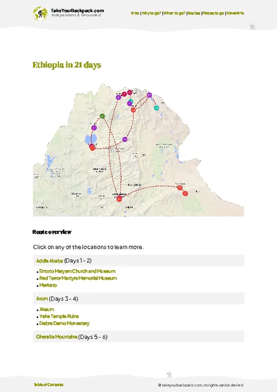
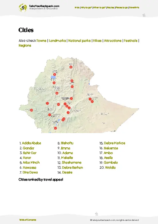
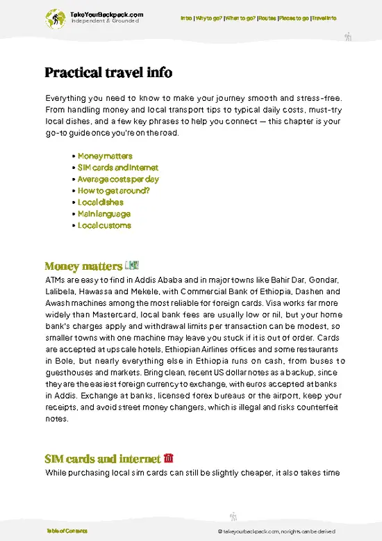
example page 0 from our offline Travel Guide for Ethiopia
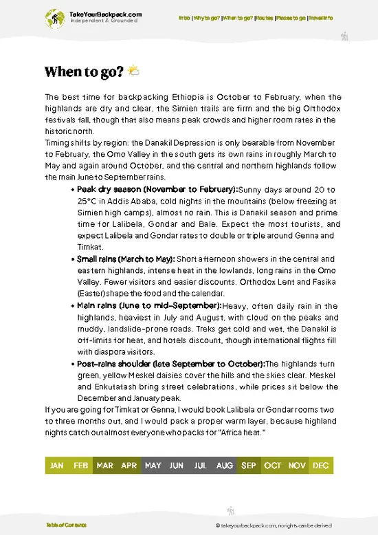
example page 1 from our offline Travel Guide for Ethiopia
example page 2 from our offline Travel Guide for Ethiopia
example page 3 from our offline Travel Guide for Ethiopia
example page 4 from our offline Travel Guide for Ethiopia
example page 5 from our offline Travel Guide for Ethiopia
example page 6 from our offline Travel Guide for Ethiopia
example page 7 from our offline Travel Guide for Ethiopia
Loading the map 🌍
CLICK TO FILTER
cities
towns
landmarks
national parks
hikes
attractions
festivals
regions
SHOW COUNTRY’S BESTSHOW ALL

✨ Why go?
Ranked #4 hike in Ethiopia
Reasons people choose to hike the here

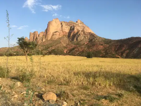
Lalibela to Hudad gives you the Lasta highlands at walking pace, a landscape that most visitors only glimpse from a car window. The big reason is the Abuna Yemata-style cliff country of the Lasta massif, where villages sit on ridge tops above 3,000 meters and you sleep in a farmer’s home or a basic lodge. Mornings smell of woodsmoke and fresh barley bread, and kids appear on the path asking your name. A second reason is flexibility. You can stop at Hudad after a short route or push on to link other highland villages, and local guides can adjust the days to your pace. The third is the hosting culture. Families serve coffee in a full ceremony, and a small payment per night keeps money in the community instead of the big hotels. Add Lalibela’s famous churches before or after and you have a route … read more 👉
Lalibela to Hudad gives you the Lasta highlands at walking pace, a landscape that most visitors only glimpse from a car window. The big reason is the Abuna Yemata-style cliff country of the Lasta massif, where villages sit on ridge tops above 3,000 meters and you sleep in a farmer’s home or a basic lodge. Mornings smell of woodsmoke and fresh barley bread, and kids appear on the path asking your name. A second reason is flexibility. You can stop at Hudad after a short route or push on to link other highland villages, and local guides can adjust the days to your pace. The third is the hosting culture. Families serve coffee in a full ceremony, and a small payment per night keeps money in the community instead of the big hotels. Add Lalibela’s famous churches before or after and you have a route that blends history and mountain walking with no complicated logistics.

💡 HighlightsEssential experiences to have while hiking the Lalibela to Hudad

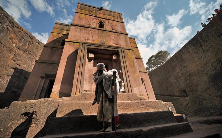
  1. Rock-hewn churches of Lalibela: The trailhead town holds eleven monolithic churches carved down into volcanic tuff, including Bete Giyorgis in the shape of a cross. Visit before you set off, as the carving is the reason this region is famous.
  2. Asheton Maryam Monastery: A mountaintop monastery above Lalibela reached by a steady climb, with broad views over the valley and a priest who shows old manuscripts and crosses.
  3. Na’akuto La’ab Monastery: A church built into a cave beneath a rock overhang, with stonework and a calm, dim interior reached on a short walk from the route.
  4. Highland ridge viewpoints: Along the way, the escarpment edges drop hundreds of meters into the valleys, with Afro-alpine grass and giant lobelia on the high ground.
  5. Hudad village: The end of the route is a small highland settlement
… read more 👉
  1. Rock-hewn churches of Lalibela: The trailhead town holds eleven monolithic churches carved down into volcanic tuff, including Bete Giyorgis in the shape of a cross. Visit before you set off, as the carving is the reason this region is famous.
  2. Asheton Maryam Monastery: A mountaintop monastery above Lalibela reached by a steady climb, with broad views over the valley and a priest who shows old manuscripts and crosses.
  3. Na’akuto La’ab Monastery: A church built into a cave beneath a rock overhang, with stonework and a calm, dim interior reached on a short walk from the route.
  4. Highland ridge viewpoints: Along the way, the escarpment edges drop hundreds of meters into the valleys, with Afro-alpine grass and giant lobelia on the high ground.
  5. Hudad village: The end of the route is a small highland settlement of stone and thatch homes, where the market, farm life and coffee ceremony show daily life above the clouds.
Hiking the ridgelines and viewpoints costs nothing, while the Lalibela churches have the steepest entry fee.
Spotted a mistake or missing something? Contact us.

Things to do around Lalibela to Hudad

Ratings based on Tripadvisor reviews. When you book through this link, you support our work at no extra cost to you.

🌤️ When to go?Weather, crowds, and seasonal trade-offs

October to February is the window for walking from Lalibela to Hudad, with dry trails and clear mornings. Here is how the year breaks down.
  • Dry Season (October to February): Days run 22 to 27°C (72 to 81°F), nights on the highlands drop to 6 to 10°C (43 to 50°F). Trails are firm and views carry for miles. Expect the most trekkers, especially around Ethiopian Christmas (Genna) in early January and Timkat later that month, when Lalibela prices for beds can double.
  • Hot Season (March to May): Midday reaches 28 to 32°C (82 to 90°F) on exposed sections, and dust haze flattens the views. Short rains can start in April. Crowds thin and rooms are easier to book.
  • Rainy Season (June to September): Cool, 15 to 22°C (59 to 72°F), with afternoon downpours. Paths turn slick, streams swell, and clouds hide the
… read more 👉
October to February is the window for walking from Lalibela to Hudad, with dry trails and clear mornings. Here is how the year breaks down.
  • Dry Season (October to February): Days run 22 to 27°C (72 to 81°F), nights on the highlands drop to 6 to 10°C (43 to 50°F). Trails are firm and views carry for miles. Expect the most trekkers, especially around Ethiopian Christmas (Genna) in early January and Timkat later that month, when Lalibela prices for beds can double.
  • Hot Season (March to May): Midday reaches 28 to 32°C (82 to 90°F) on exposed sections, and dust haze flattens the views. Short rains can start in April. Crowds thin and rooms are easier to book.
  • Rainy Season (June to September): Cool, 15 to 22°C (59 to 72°F), with afternoon downpours. Paths turn slick, streams swell, and clouds hide the escarpment. Harvest greens the fields in September, and guide rates sometimes soften.
Start walking at first light in any season, since afternoon heat or cloud builds fast.


source: climatestotravel.comJANJanuary: excellent for travelingFEBFebruary: excellent for travelingMARMarch: highly recommended for travelingAPRApril: fair for travelingMAYMay: fair for travelingJUNJune: below average for travelingJULJuly: below average for travelingAUGAugust: below average for travelingSEPSeptember: fair for travelingOCTOctober: highly recommended for travelingNOVNovember: good for travelingDECDecember: excellent for traveling
ethiopia-hike-lalibela-to-hudad v1
© Google |

✈️ The backpacker research shortcutEthiopia Travel Guide

An offline-friendly backpacking guide with optimized travel routes, ranked highlights, transport advice, and the best areas to stay.
example page 0 from our offline Travel Guide for Ethiopia
example page 1 from our offline Travel Guide for Ethiopia
example page 2 from our offline Travel Guide for Ethiopia
example page 3 from our offline Travel Guide for Ethiopia
example page 4 from our offline Travel Guide for Ethiopia
example page 5 from our offline Travel Guide for Ethiopia
example page 6 from our offline Travel Guide for Ethiopia
example page 7 from our offline Travel Guide for Ethiopia
The digital guide (380 pages) contains:
✅ 98 highlights, ranked by travel appeal
✅ Optimized 7, 14 & 21-day travel routes
✅ Cities, national parks, landmarks, beaches
✅ How to get around
✅ Offline-friendly for travel without Wi-Fi
👉 Click to see all 30+ guide features

📅 Plan smarter in minutes, not weeks
✅ Month by month travel advice
✅ Festivals & national holidays
✅ Budget expectations

🗺️ Go to the right places, skip the overrated ones
✅ Honest pros & cons of destinations
✅ Top hikes, parks & viewpoints
✅ Lesser-known places most travelers miss
✅ Clear “worth it vs skip it” guidance

🛏️ Travel smoothly without rookie mistakes
✅ Best areas to stay
✅ Transport systems explained simply
✅ Common scams & safety advice
✅ SIM cards, money & practical tips

🌍 Understand the country, not just visit it
✅ Culture & traditions
✅ 52 Essential phrases & customs
✅ Festivals worth planning around
✅ Traveler-friendly historical context
✅ Insights that make places more meaningful

📱 Built for real travel conditions
✅ Fully downloadable PDF
✅ Works completely offline
✅ Optimized for phone use
✅ Useful in remote areas & buses
✅ Everything in one place
Stop searching, start planning
Get instant access to your full guide. 30‑day money-back guarantee.
+ Add another guide for just

By proceeding you agree to our terms.
Sent to your inbox immediately after payment • 100% Secure Checkout
Best Backpacking Travel Advisor 2025 tourism awardBest Backpacking
Travel Advisor
2025
What others say about Take Your Backpack Guides:
⭐⭐⭐⭐⭐
Fantastic, amazing amount of information!
⭐⭐⭐⭐⭐
My goodness this is amazing, it's what I've been looking for hats off too you!
⭐⭐⭐⭐⭐
I think this is absolutely BRILLIANT
⭐⭐⭐⭐
Very complete and informative. It's still missing places, but I gotta to commend you
⭐⭐⭐⭐⭐
This is truly amazing, thank you, can't wait to explore it with my kids!
⭐⭐⭐⭐⭐
Awesome resource, thank you!
⭐⭐⭐⭐⭐
This is amazing! Can't wait to explore the ones I haven't seen
⭐⭐⭐⭐
I love this! Well done, great idea.
⭐⭐⭐⭐⭐
Thanks for taking the time to make this gem!
⭐⭐⭐⭐⭐
This might be the best website I've ever seen.
⭐⭐⭐⭐⭐
Congratulations, and thank you so much for your work; it's incredibly valuable.
⭐⭐⭐⭐
In all seriousness I think you did a great job pointing out the important spots
⭐⭐⭐⭐⭐
10/10 very good
⭐⭐⭐⭐⭐
As someone who's only just starting to visit regularly this is awesome, thank you.
⭐⭐⭐⭐
Thank you very much! I'm going to visit my dad, it's going to be very useful!
⭐⭐⭐⭐⭐
This is really cool! We'll be travelling for the first time and this definitely come in handy.
⭐⭐⭐⭐⭐
You are now our minister of culture, congratulations 👨‍💼
⭐⭐⭐⭐⭐
Just wanted to tell you that this is a pearl! Going to follow your recommendations.
⭐⭐⭐⭐⭐
This is so cool. I'll definitely be using the resource for my travels soon.
⭐⭐⭐⭐⭐
This is very impressive! Good work.
⭐⭐⭐⭐⭐
This is an amazing and informative site. Very well done!

🛏️ Where to stay?Best areas and accommodation options

If you enjoy meeting fellow travelers, consider choosing hostels with high ratings for atmosphere. On the other hand, if you prefer having your own space, a hotel might be a better option.

🥾 Hike detailsKey facts about the Lalibela to Hudad hike

Total Distance: Lalibela to Hudad is roughly 45 to 55 kilometers one way, depending on the route you pick across the plateau and the villages you link. Most hikers treat it as a point-to-point trek.
Estimated Duration: Plan on 2 to 3 days of walking at a steady pace, with 5 to 7 hours on the trail each day.
Difficulty: Moderate to demanding. The route stays high, mostly between 2,400 and 3,200 meters, and several steep gorge crossings add up. Trails are rocky and often unmarked, so a local guide is the sensible choice.
Starting Point: Lalibela town, in the Amhara highlands of Ethiopia. Minibuses,
… read more 👉
Total Distance: Lalibela to Hudad is roughly 45 to 55 kilometers one way, depending on the route you pick across the plateau and the villages you link. Most hikers treat it as a point-to-point trek.
Estimated Duration: Plan on 2 to 3 days of walking at a steady pace, with 5 to 7 hours on the trail each day.
Difficulty: Moderate to demanding. The route stays high, mostly between 2,400 and 3,200 meters, and several steep gorge crossings add up. Trails are rocky and often unmarked, so a local guide is the sensible choice.
Starting Point: Lalibela town, in the Amhara highlands of Ethiopia. Minibuses, bajaj rides and flights reach Lalibela from Addis Ababa and Bahir Dar, and the walk starts on foot from the edge of town, so you need no further transport to begin.
Major Landmarks:
  • Lalibela rock-hewn churches: The send-off point, with the carved church complexes sitting just behind you as you leave.
  • Highland farm villages: Clusters of round stone and thatch houses where you can ask for coffee, and where local guides often arrange a bed.
  • Escarpment edges: Cliff-top viewpoints looking over deep valleys and layered ridgelines.
  • Hudad: The end of the route, a small highland settlement reached after a final descent and climb.
Terrain and Scenery: Expect stony footpaths, terraced barley fields, dry stream beds and sharp drops off the plateau rim. Views stretch across folded ridges and flat-topped mountains. Livestock trails crisscross the slopes, and the path can split without warning.
Vegetation: Fields of barley, teff and wheat dominate at lower altitudes, with eucalyptus groves near villages, scattered acacia and euphorbia on dry slopes, and tough highland grass higher up.
Wildlife: Gelada monkeys live on some highland cliffs in this region, and you may spot raptors and lammergeiers riding the thermals. Hyenas are present at night, and village life brings plenty of donkeys, goats and cattle.
Practical Notes: Carry enough water and purification tablets, since sources are shared with livestock. Bring cash in small bills, a warm layer for the cold nights, and sun protection for the exposed ridges.
⚠️ Hiking info can sometimes be outdated or inaccurate. Before you hit the trail, check the latest conditions with locals. If you do spot anything that's off, I'd love to hear from you, so I can update it for fellow travelers.

🛡️ SafetyStaying Safe: What Travelers Should Know

The route is generally straightforward and calmly managed by local guides, but altitude and exposure deserve respect. Lalibela sits around 2,500 meters (8,200 feet), so go easy on the first climb and drink steadily, as shade is scarce and midday sun is strong. Footing is loose rock and dusty switchbacks, which get slippery after rain, so wear boots with grip rather than sandals. Afternoon storms in the wetter months can swell streams quickly, so wait rather than force a crossing. Trails cross farmland and unmarked tracks, which is why a local guide helps with navigation. Baboons and hyenas live in the highlands but rarely bother hikers. Keep food packed away and never feed animals. Children often ask for pens or money, so greet them kindly, and ask before photographing people. Carry more water … read more 👉
The route is generally straightforward and calmly managed by local guides, but altitude and exposure deserve respect. Lalibela sits around 2,500 meters (8,200 feet), so go easy on the first climb and drink steadily, as shade is scarce and midday sun is strong. Footing is loose rock and dusty switchbacks, which get slippery after rain, so wear boots with grip rather than sandals. Afternoon storms in the wetter months can swell streams quickly, so wait rather than force a crossing. Trails cross farmland and unmarked tracks, which is why a local guide helps with navigation. Baboons and hyenas live in the highlands but rarely bother hikers. Keep food packed away and never feed animals. Children often ask for pens or money, so greet them kindly, and ask before photographing people. Carry more water than you expect, a hat, sunscreen, and a basic first-aid kit, since villages en route offer little beyond tea and bread.

FAQCommon questions from travelers

Plan on one long day or about two days, depending on the route your guide chooses from Lalibela toward Hudad. The walk covers roughly 20 to 30 kilometers (12 to 19 miles) of highland tracks, usually 6 to 9 hours of walking per day. Many trekkers add a night in a village homestay or camp to avoid rushing.
Moderate, mainly because of altitude and heat rather than technical terrain. Expect long ascents and descents on loose, rocky paths at 2,400 to 3,000 meters (7,900 to 9,800 feet). Reasonable fitness and sturdy boots are enough, and no climbing skills are needed. The rainy months from June to September make the steeper sections slippery.
A local guide is strongly recommended, since tracks branch through farmland and are not signposted. Guides in Lalibela typically charge about US$25 to 50 per day, with scouts, mules, and meals extra if you camp. There is no formal trekking permit, but you may pay small community or area fees of a few dollars. Arrange everything through your Lalibela guesthouse or the local guides association.
⚠️ Things can change over time, so always validate details locally before you go.

Other Ethiopian hikes near Lalibela to Hudad

Explore more nearby:


💡 Not sure where to go next?
Create a personalized itinerary for Ethiopia including Lalibela to Hudad and the places that fit your trip.

Generate my itinerary

👉 Discover all hikes

Or checkout all Ethiopia has to offer (think cities, towns, villages, national parks, hikes, beaches, festivals)
Country photo of Ethiopia

We 💚 feedbackWhat to keep in mind

Lalibela to Hudad is won by those who notice the farmland itself. Terraces here are tended by hand, and the paths you walk are the villagers’ daily roads, so greet everyone you pass. I would hire a local guide from the community, carry extra water, and leave room in the schedule for a second coffee at every home.

✈️ When did I visit Ethiopia?
Ethiopia I visited back in October 2017. I combined the trip with a visit to Sudan. Ethiopia was a pure surprise with the magical scenery like the Danakil Depression and the Simien Mountains.

✍️ Help improve this page!
The information on this page is based on my own backpacking experience in Ethiopia, supplemented with up-to-date research and feedback from other travelers. Travel details can change, so if you notice anything outdated or incomplete, feel free to let me know.


🙋‍♂️ Give feedback

👋 Meet the founderWho’s Behind Take Your Backpack?

Johan, backpacker and founder of TakeYourBackpackHi, I’m Johan (Netherlands 🇳🇱), the creator of TakeYourBackpack. Over the past 3 decades, I’ve backpacked through 90+ countries across six continents, gaining extensive experience with independent travel, long-term trips, and overland routes.

This site is built on a combination of firsthand travel experience and carefully curated insights from other backpackers. Many guides are based on places I’ve personally visited, while others bring together tips, observations, and practical advice shared by trusted travelers I’ve met along the way.

The goal is to provide realistic, experience-driven guidance — not generic itineraries — so you can explore destinations with better context, clearer expectations, and more confidence.