×

Ethiopia🇪🇹 | hikesBlue Nile GorgeSwitchback road, canyon floor bridge, olive baboons, shadeless climb | things to do and best time to go

Explore SigdExplore Lalibela to Hudad

Backpacking in Blue Nile Gorge
👍 Recommendedhike ranked #6
By Johan Kruseman 🇳🇱 | Updated October 22, 2026

The gorge is not a day-hike loop with a trail head and a sign; most walkers simply follow the old switchback road and the footpaths that cut across it. Blue Nile Gorge sits in the northwest of Ethiopia, roughly north of Addis Ababa on the highway toward Bahir Dar, where the plateau drops about 1,000 meters to the river and climbs again. Expect dust, diesel trucks grinding in low gear, baboons on the rock walls and a steep, shadeless ascent. Buses pass the rim, so reaching the start is easy. At the bridge a tea seller told me, “Walk down in the morning, ride up in the afternoon.” I took the advice, and the thermos tea tasted of cardamom and smoke. Unlike the Simien Mountains, this is a short, raw road-and-river walk with no park fees or permits.

Discover everything you want to know in the 📖 Ethiopia Travel Guide.
Best time to go: October - May
Duration: 6 hours
Distance: 13 kilometers
Total ascent: 1000 meters
Safety warning

The current risk level for Ethiopia is high. Check the advice before going.


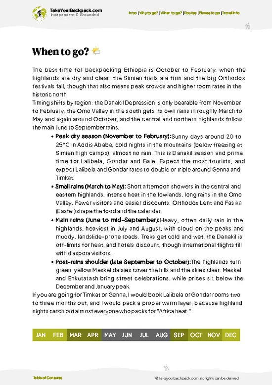
example page 0 from our offline Travel Guide for Ethiopia
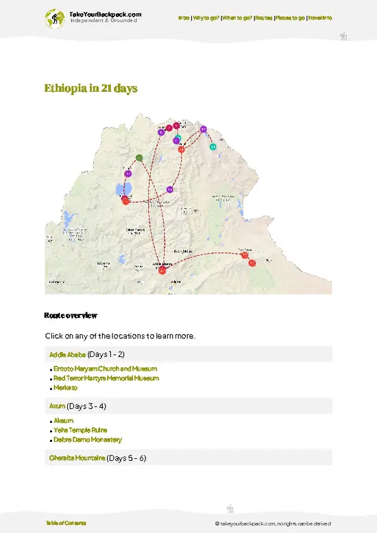
example page 1 from our offline Travel Guide for Ethiopia
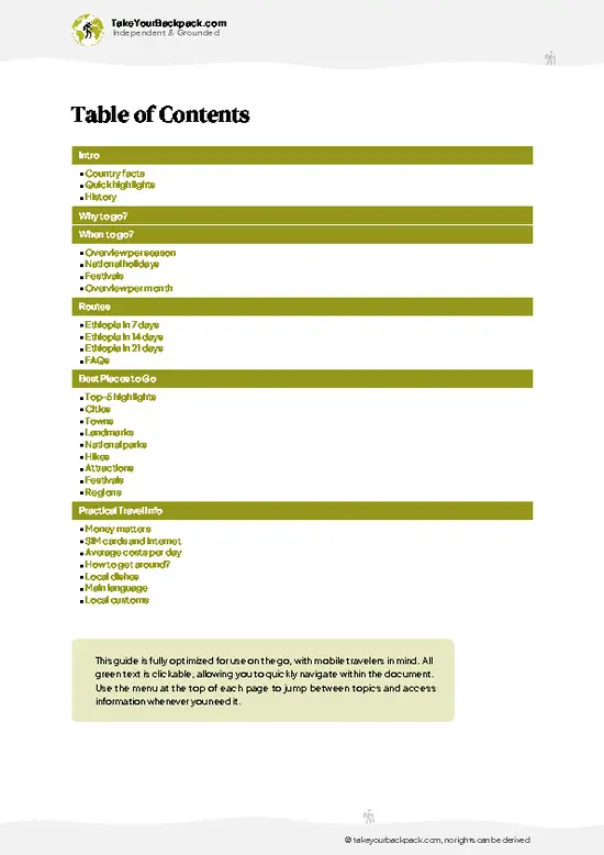
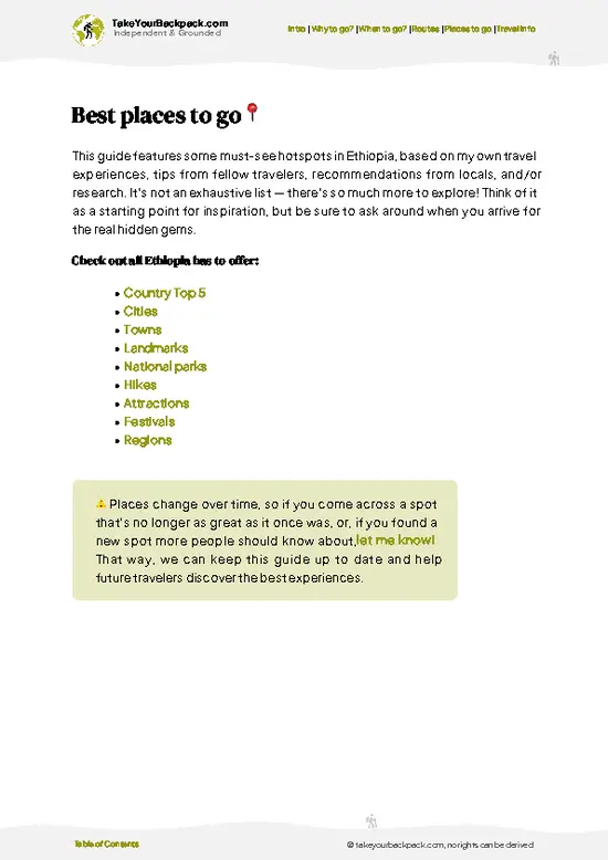
example page 2 from our offline Travel Guide for Ethiopia
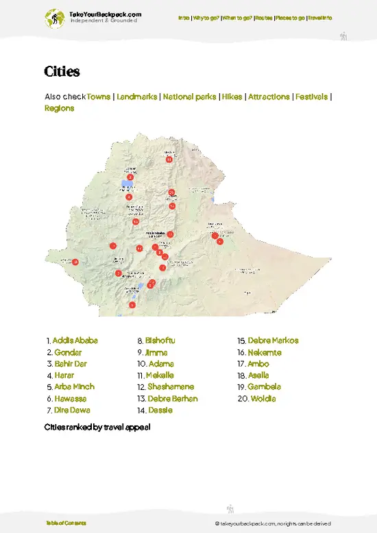
example page 3 from our offline Travel Guide for Ethiopia
example page 4 from our offline Travel Guide for Ethiopia
example page 5 from our offline Travel Guide for Ethiopia
example page 6 from our offline Travel Guide for Ethiopia
example page 7 from our offline Travel Guide for Ethiopia
Loading the map 🌍
CLICK TO FILTER
cities
towns
landmarks
national parks
hikes
attractions
festivals
regions
SHOW COUNTRY’S BESTSHOW ALL

✨ Why go?
Ranked #6 hike in Ethiopia
What sets this place apart

Blue Nile Gorge gives you a canyon descent of roughly 1,000 meters without a guide, a permit or a multi-day commitment. Backpackers heading between Addis Ababa and Bahir Dar can break the road trip here, hop off a minibus at the rim, walk down, and flag another one on the way up.

The Abay Bridge at the bottom is the focal point: a Japanese-built span across the river the Ethiopians call Abay, with the original Italian-era bridge still visible nearby. Distances are flexible, so you can stroll a few switchbacks for the view or commit to the full descent. It costs almost nothing, and you share the road with villagers, goats and the trucks. Baboon troops on the rock faces add a wildlife bonus that most road stops cannot match.

💡 HighlightsEssential experiences to have while hiking the Blue Nile Gorge

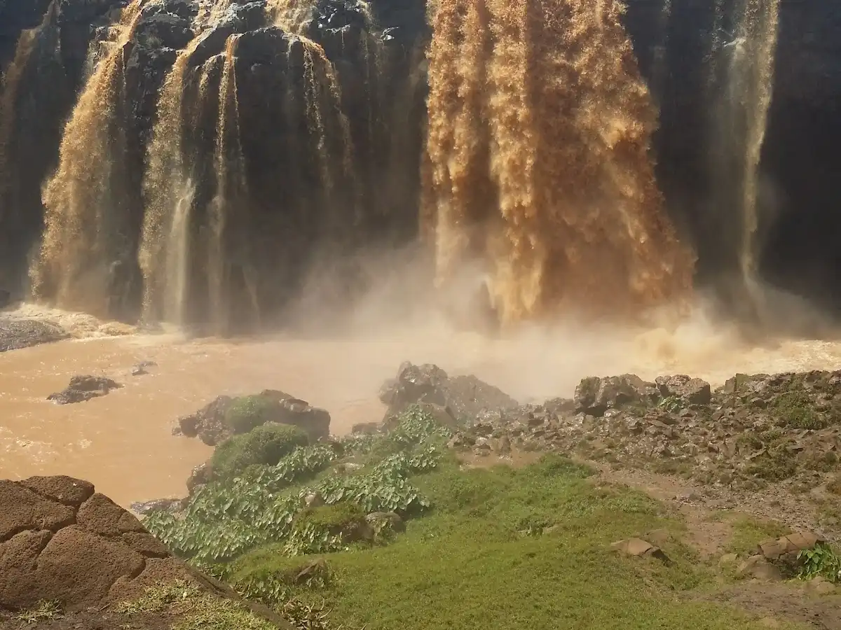
  1. Abay Bridge: The river crossing at the canyon floor, where the Blue Nile runs brown and fast in the rainy months. Photography near the bridge can attract attention from soldiers, so ask before pointing a camera at it.
  2. Old Italian-era bridge: A smaller historic span near the modern crossing, a reminder of the road engineering that first threaded this wall.
  3. Rim viewpoints: Pull-offs on the plateau edge show the full depth of the canyon, layered in basalt and green terraces, with hawks riding the thermals below you.
  4. Switchback road: The winding descent itself, with footpaths cutting corners between the hairpins. Walking it lets you hear the engines echo off the cliffs and smell the hot brakes of trucks.
  5. Baboon troops: Gelada and hamadryas-type troops are not reliably here, but olive baboons gather
… read more 👉
  1. Abay Bridge: The river crossing at the canyon floor, where the Blue Nile runs brown and fast in the rainy months. Photography near the bridge can attract attention from soldiers, so ask before pointing a camera at it.
  2. Old Italian-era bridge: A smaller historic span near the modern crossing, a reminder of the road engineering that first threaded this wall.
  3. Rim viewpoints: Pull-offs on the plateau edge show the full depth of the canyon, layered in basalt and green terraces, with hawks riding the thermals below you.
  4. Switchback road: The winding descent itself, with footpaths cutting corners between the hairpins. Walking it lets you hear the engines echo off the cliffs and smell the hot brakes of trucks.
  5. Baboon troops: Gelada and hamadryas-type troops are not reliably here, but olive baboons gather on the roadside rocks and watch walkers with calm suspicion. Keep food packed away.
Blue Nile Gorge costs nothing to walk, so every item here is free.
Spotted a mistake or missing something? Contact us.
🌤️ When to go?Choosing the right time of year

  • Dry Season (November to February): Skies are clear and the trail is firm underfoot. The canyon floor is hot, around 30 to 36°C (86 to 97°F), while the plateau rim stays near 18 to 24°C (64 to 75°F). Mornings on the rim can be chilly.
  • Hot Build-Up (March to May): The gorge floor can pass 38°C (100°F), so start at first light and be climbing before midday. Haze reduces views, and the occasional afternoon shower begins.
  • Rainy Season (June to September): Heavy rain turns the clay paths slick and the river runs brown and high. Cloud hides the canyon walls, though the plateau turns green. Few hikers come, and guides are easy to find.
  • Shoulder Weeks (October): Greenery lingers, the rain has mostly stopped, and the light is soft.
Daylight stays at about 12 hours all year, so plan to finish the climb by … read more 👉
  • Dry Season (November to February): Skies are clear and the trail is firm underfoot. The canyon floor is hot, around 30 to 36°C (86 to 97°F), while the plateau rim stays near 18 to 24°C (64 to 75°F). Mornings on the rim can be chilly.
  • Hot Build-Up (March to May): The gorge floor can pass 38°C (100°F), so start at first light and be climbing before midday. Haze reduces views, and the occasional afternoon shower begins.
  • Rainy Season (June to September): Heavy rain turns the clay paths slick and the river runs brown and high. Cloud hides the canyon walls, though the plateau turns green. Few hikers come, and guides are easy to find.
  • Shoulder Weeks (October): Greenery lingers, the rain has mostly stopped, and the light is soft.
Daylight stays at about 12 hours all year, so plan to finish the climb by mid-afternoon. Prices barely move with the seasons, except around Timkat and Meskel, when transport and rooms fill up. Book early for those dates.


source: climatestotravel.comJANJanuary: excellent for travelingFEBFebruary: excellent for travelingMARMarch: excellent for travelingAPRApril: highly recommended for travelingMAYMay: good for travelingJUNJune: below average for travelingJULJuly: below average for travelingAUGAugust: below average for travelingSEPSeptember: fair for travelingOCTOctober: excellent for travelingNOVNovember: excellent for travelingDECDecember: excellent for traveling
ethiopia-hike-blue-nile-gorge v1
© Google |

✈️ The backpacker research shortcutEthiopia Travel Guide

An offline-friendly backpacking guide with optimized travel routes, ranked highlights, transport advice, and the best areas to stay.
example page 0 from our offline Travel Guide for Ethiopia
example page 1 from our offline Travel Guide for Ethiopia
example page 2 from our offline Travel Guide for Ethiopia
example page 3 from our offline Travel Guide for Ethiopia
example page 4 from our offline Travel Guide for Ethiopia
example page 5 from our offline Travel Guide for Ethiopia
example page 6 from our offline Travel Guide for Ethiopia
example page 7 from our offline Travel Guide for Ethiopia
The digital guide (380 pages) contains:
✅ 98 highlights, ranked by travel appeal
✅ Optimized 7, 14 & 21-day travel routes
✅ Cities, national parks, landmarks, beaches
✅ How to get around
✅ Offline-friendly for travel without Wi-Fi
👉 Click to see all 30+ guide features

📅 Plan smarter in minutes, not weeks
✅ Month by month travel advice
✅ Festivals & national holidays
✅ Budget expectations

🗺️ Go to the right places, skip the overrated ones
✅ Honest pros & cons of destinations
✅ Top hikes, parks & viewpoints
✅ Lesser-known places most travelers miss
✅ Clear “worth it vs skip it” guidance

🛏️ Travel smoothly without rookie mistakes
✅ Best areas to stay
✅ Transport systems explained simply
✅ Common scams & safety advice
✅ SIM cards, money & practical tips

🌍 Understand the country, not just visit it
✅ Culture & traditions
✅ 52 Essential phrases & customs
✅ Festivals worth planning around
✅ Traveler-friendly historical context
✅ Insights that make places more meaningful

📱 Built for real travel conditions
✅ Fully downloadable PDF
✅ Works completely offline
✅ Optimized for phone use
✅ Useful in remote areas & buses
✅ Everything in one place
Stop searching, start planning
Get instant access to your full guide. 30‑day money-back guarantee.
+ Add another guide for just

By proceeding you agree to our terms.
Sent to your inbox immediately after payment • 100% Secure Checkout
Best Backpacking Travel Advisor 2025 tourism awardBest Backpacking
Travel Advisor
2025
What others say about Take Your Backpack Guides:
⭐⭐⭐⭐⭐
Fantastic, amazing amount of information!
⭐⭐⭐⭐⭐
My goodness this is amazing, it's what I've been looking for hats off too you!
⭐⭐⭐⭐⭐
I think this is absolutely BRILLIANT
⭐⭐⭐⭐
Very complete and informative. It's still missing places, but I gotta to commend you
⭐⭐⭐⭐⭐
This is truly amazing, thank you, can't wait to explore it with my kids!
⭐⭐⭐⭐⭐
Awesome resource, thank you!
⭐⭐⭐⭐⭐
This is amazing! Can't wait to explore the ones I haven't seen
⭐⭐⭐⭐
I love this! Well done, great idea.
⭐⭐⭐⭐⭐
Thanks for taking the time to make this gem!
⭐⭐⭐⭐⭐
This might be the best website I've ever seen.
⭐⭐⭐⭐⭐
Congratulations, and thank you so much for your work; it's incredibly valuable.
⭐⭐⭐⭐
In all seriousness I think you did a great job pointing out the important spots
⭐⭐⭐⭐⭐
10/10 very good
⭐⭐⭐⭐⭐
As someone who's only just starting to visit regularly this is awesome, thank you.
⭐⭐⭐⭐
Thank you very much! I'm going to visit my dad, it's going to be very useful!
⭐⭐⭐⭐⭐
This is really cool! We'll be travelling for the first time and this definitely come in handy.
⭐⭐⭐⭐⭐
You are now our minister of culture, congratulations 👨‍💼
⭐⭐⭐⭐⭐
Just wanted to tell you that this is a pearl! Going to follow your recommendations.
⭐⭐⭐⭐⭐
This is so cool. I'll definitely be using the resource for my travels soon.
⭐⭐⭐⭐⭐
This is very impressive! Good work.
⭐⭐⭐⭐⭐
This is an amazing and informative site. Very well done!

🛏️ Where to stay?Best areas and accommodation options

If you enjoy meeting fellow travelers, consider choosing hostels with high ratings for atmosphere. On the other hand, if you prefer having your own space, a hotel might be a better option.

🥾 Hike detailsRoute, distance, and difficulty explained

Blue Nile Gorge trail overview: This is a road-and-footpath descent rather than a marked trail, ideal for independent walkers.
Total Distance: About 12 to 15 kilometers one way down, depending on how many footpath shortcuts you take.
Estimated Duration: 3 to 4 hours down and 5 to 6 hours back up on foot; most people ride up.
Difficulty: Moderate on the way down, hard on the way up because of the heat and lack of shade.
Starting Point: The plateau rim along the main highway between Addis Ababa and Bahir Dar. Buses and minibuses on that route can drop you at the rim.
Major Landmarks:
  • Rim viewpoint: The
… read more 👉
Blue Nile Gorge trail overview: This is a road-and-footpath descent rather than a marked trail, ideal for independent walkers.
Total Distance: About 12 to 15 kilometers one way down, depending on how many footpath shortcuts you take.
Estimated Duration: 3 to 4 hours down and 5 to 6 hours back up on foot; most people ride up.
Difficulty: Moderate on the way down, hard on the way up because of the heat and lack of shade.
Starting Point: The plateau rim along the main highway between Addis Ababa and Bahir Dar. Buses and minibuses on that route can drop you at the rim.
Major Landmarks:
  • Rim viewpoint: The best overview of the canyon before you start.
  • Hairpin bends: Dozens of tight switchbacks with village footpaths between them.
  • Abay Bridge: The river crossing at the bottom.
Terrain and Scenery: Paved road with loose gravel on the footpaths, basalt walls, terraced fields and a brown river at the base.
Vegetation: Dry scrub and acacia at the lower, hotter levels, with eucalyptus and farmland near the rim.
Wildlife: Olive baboons, raptors and a variety of birds. Carry water, sun protection and small change for roadside tea.
⚠️ Hiking info can sometimes be outdated or inaccurate. Before you hit the trail, check the latest conditions with locals. If you do spot anything that's off, I'd love to hear from you, so I can update it for fellow travelers.

🛡️ SafetyStaying Safe: What Travelers Should Know

The main hazards in Blue Nile Gorge are heat and the long climb, not dangerous terrain. The canyon floor sits roughly 1,000 meters below the rim, and the return ascent in full sun catches first-timers out. Start early, carry at least 3 liters of water per person, and add a hat and sun protection. Paths are loose and dusty on the descents, so shoes with real grip matter, especially after rain, when clay gets slick. Navigation is simple along the main road, but side trails are easy to lose, so a local guide helps. Baboons and hyenas live in the area. Keep food packed away, never feed animals, and avoid walking at night. Heavy trucks use the winding road, so walk on the inside of bends and stay visible. Ask locals about the river before swimming, since currents are strong and the water carries parasites.

FAQTraveler FAQ

Most hikers take 6 to 9 hours for a round trip from the rim to the Blue Nile bridge and back, covering roughly 12 to 16 kilometers. The descent takes about 2 to 3 hours and the climb back up 3 to 5 hours. Some people split it over two days and camp or sleep near the bridge, then climb the next morning.
Expect a moderate to strenuous day, mostly because of the heat and the roughly 1,000 meter elevation change on the way back up. The trail is not technical, but the road and footpaths are steep, dusty and shadeless in places. Fit walkers manage it comfortably if they start by dawn and carry 3 liters of water. Beginners can walk only the upper section and turn around.
No permit is needed for walking the gorge road, and there is no national park entry fee at the rim. A local guide is optional but useful for side trails and safety, and typically costs US$10 to 25 for the day, arranged in Debre Markos or Dejen. Agree on the price beforehand. Photography near the bridge may be discouraged by soldiers, so ask before shooting.
⚠️ Things can change over time, so always validate details locally before you go.

Other Ethiopian hikes near Blue Nile Gorge

Explore more nearby:


💡 Not sure where to go next?
Create a personalized itinerary for Ethiopia including Blue Nile Gorge and the places that fit your trip.

Generate my itinerary

👉 Discover all hikes

Or checkout all Ethiopia has to offer (think cities, towns, villages, national parks, hikes, beaches, festivals)
Country photo of Ethiopia

We 💚 feedbackIs it worth it?

Blue Nile Gorge is hottest at the bottom, a fact first-timers overlook until they are sweating on the climb. I would start at first light, walk down, and plan to ride back up. Carry more water than you think you need, and keep the camera pointed at the canyon, not the bridge.

✈️ When did I visit Ethiopia?
Ethiopia I visited back in October 2017. I combined the trip with a visit to Sudan. Ethiopia was a pure surprise with the magical scenery like the Danakil Depression and the Simien Mountains.

✍️ Help improve this page!
The information on this page is based on my own backpacking experience in Ethiopia, supplemented with up-to-date research and feedback from other travelers. Travel details can change, so if you notice anything outdated or incomplete, feel free to let me know.


🙋‍♂️ Give feedback

👋 Meet the founderWho’s Behind Take Your Backpack?

Johan, backpacker and founder of TakeYourBackpackHi, I’m Johan (Netherlands 🇳🇱), the creator of TakeYourBackpack. Over the past 3 decades, I’ve backpacked through 90+ countries across six continents, gaining extensive experience with independent travel, long-term trips, and overland routes.

This site is built on a combination of firsthand travel experience and carefully curated insights from other backpackers. Many guides are based on places I’ve personally visited, while others bring together tips, observations, and practical advice shared by trusted travelers I’ve met along the way.

The goal is to provide realistic, experience-driven guidance — not generic itineraries — so you can explore destinations with better context, clearer expectations, and more confidence.