
×

Ghana🇬🇭 | hikesWli WaterfallWaterfall pool, forest approach, Agumatsa, Lower and Upper Falls | things to do and best time to go

Explore Busua to ButreExplore Mount Afadjato

Backpacking in Wli Waterfall
By Johan Kruseman 🇳🇱 | Updated October 15, 2026

Most online summaries call Wli a quick stroll to a waterfall, but the upper falls are a separate guided hike of roughly 3 to 4 hours return, with repeated stream crossings. Wli sits in the Volta Region, near the Togo border, about 25 km northwest of Hohoe. The lower falls trail is flat and shady, around 45 minutes each way through forest that smells of wet leaves and cocoa. The upper route climbs over slick roots and rock, and you will get wet to the knees. Getting there takes a long tro-tro ride from Accra to Hohoe, then a shared taxi or minibus to Wli village, which is easy but slow. Nearby Mount Afadjato is a shorter, drier summit walk, while Wli demands more splashing. I stood in the lower pool with a mist so fine it coated my eyelashes, while the roar blotted out every thought, and the cold water on my sunburnt neck was the best moment of the whole Volta trip.

Discover everything you want to know in the 📖 Ghana Travel Guide.


example page 0 from our offline Travel Guide for Ghana
example page 1 from our offline Travel Guide for Ghana
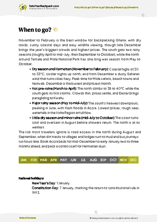
example page 2 from our offline Travel Guide for Ghana
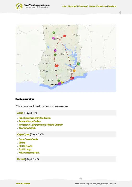
example page 3 from our offline Travel Guide for Ghana
example page 4 from our offline Travel Guide for Ghana
example page 5 from our offline Travel Guide for Ghana
example page 6 from our offline Travel Guide for Ghana
example page 7 from our offline Travel Guide for Ghana
Loading the map 🌍
CLICK TO FILTER
cities
towns
villages
landmarks
national parks
hikes
beaches
attractions
festivals
regions
SHOW COUNTRY’S BESTSHOW ALL

✨ Why go?
Ranked #99 hike in Ghana
Why visitors keep coming back

Backpackers come to Wli because it packs a huge amount of scenery into one day. The lower falls need only a gentle 45-minute walk, and the upper falls, reported at around 80 m and among the tallest in West Africa, add a proper half-day adventure. Public transport works: tro-tros run from Accra to Hohoe, and shared vehicles continue to Wli village in under an hour. Costs stay low, since entry and a mandatory local guide are priced in cedis rather than dollars, and village guesthouses and chop bars are cheap. The flexible distance is a real advantage: do just the lower falls and swim, or push on to the upper tier if your legs and daylight allow. Wli also fits neatly into a longer Volta Region route with Mount Afadjato, Tafi Atome monkey sanctuary and Lake Volta towns, and onward travel toward … read more 👉
Backpackers come to Wli because it packs a huge amount of scenery into one day. The lower falls need only a gentle 45-minute walk, and the upper falls, reported at around 80 m and among the tallest in West Africa, add a proper half-day adventure. Public transport works: tro-tros run from Accra to Hohoe, and shared vehicles continue to Wli village in under an hour. Costs stay low, since entry and a mandatory local guide are priced in cedis rather than dollars, and village guesthouses and chop bars are cheap. The flexible distance is a real advantage: do just the lower falls and swim, or push on to the upper tier if your legs and daylight allow. Wli also fits neatly into a longer Volta Region route with Mount Afadjato, Tafi Atome monkey sanctuary and Lake Volta towns, and onward travel toward Togo is close. You finish with a swim, a plate of fufu or banku, and a cold drink.

💡 HighlightsKey sights and experiences for travelers

  1. Lower Falls Plunge Pool: A roughly 45-minute walk from the visitor center ends at a broad curtain of water dropping into a swimmable pool. The spray is cold, constant and loud, and the rock walls turn the sound into a physical pressure on your chest. It is the easiest swim in the Volta Region.
  2. Upper Falls: Reached on a guided climb of about 3 to 4 hours return, this is the taller tier, often cited around 80 m, which makes it among the highest in West Africa. The trail crosses the stream several times and rewards you with a deep, cold pool beneath a thin white ribbon of water. Fewer visitors make it up here, which changes the whole mood.
  3. Fruit Bat Colony: Thousands of straw-colored fruit bats roost on the cliffs by the lower falls. They hang in dense, chattering clusters by day, and at dusk they
… read more 👉
  1. Lower Falls Plunge Pool: A roughly 45-minute walk from the visitor center ends at a broad curtain of water dropping into a swimmable pool. The spray is cold, constant and loud, and the rock walls turn the sound into a physical pressure on your chest. It is the easiest swim in the Volta Region.
  2. Upper Falls: Reached on a guided climb of about 3 to 4 hours return, this is the taller tier, often cited around 80 m, which makes it among the highest in West Africa. The trail crosses the stream several times and rewards you with a deep, cold pool beneath a thin white ribbon of water. Fewer visitors make it up here, which changes the whole mood.
  3. Fruit Bat Colony: Thousands of straw-colored fruit bats roost on the cliffs by the lower falls. They hang in dense, chattering clusters by day, and at dusk they stream out across the valley. The smell is strong, but the sight is memorable and rare on a waterfall hike.
  4. Forest Trail and Butterflies: The approach follows a shaded path past farm plots, bamboo and big forest trees. Butterflies gather on damp patches along the stream, and you may hear monkeys or hornbills overhead. The trail is flat, soft underfoot and pleasantly cool compared with the village.
  5. Wli Village and Mount Afadjato Views: Wli Todome sits beneath the Agumatsa range on the Togo border, and the surrounding ridges frame the valley. Afadjato, Ghana’s highest peak at about 885 m, lies close by and makes a good partner walk. Evening meals of banku and tilapia taste even better after a day of wet boots.
I would pick the upper falls first, because the extra effort strips away the crowds, and standing in that cold basin after crossing the stream several times feels earned in a way the lower pool does not.
Spotted a mistake or missing something? Contact us.

🌤️ When to go?Choosing the right time of year

The best window is November to March, when trails are firmest and skies are clear, though the falls run lighter at the end of that dry spell.
  • Dry Season (November to March): Days reach 30 to 34°C (86 to 93°F), nights drop to 20 to 23°C (68 to 73°F). Stream crossings are easiest, but flow is thinner by February and March. December to February brings dusty harmattan haze that dulls views.
  • Major Rains (April to July): Temperatures sit at 23 to 31°C (73 to 88°F). Expect afternoon downpours, muddy trails, strong flow and fewer visitors. Start early.
  • Minor Rains (September to October): The falls are at their fullest, the forest is lush, and showers are shorter than in June.
  • Daylight and Crowds: Daylight lasts about 11.5 to 12.5 hours year round, with sunset near 6 pm. Weekends and Christmas to New Year
… read more 👉
The best window is November to March, when trails are firmest and skies are clear, though the falls run lighter at the end of that dry spell.
  • Dry Season (November to March): Days reach 30 to 34°C (86 to 93°F), nights drop to 20 to 23°C (68 to 73°F). Stream crossings are easiest, but flow is thinner by February and March. December to February brings dusty harmattan haze that dulls views.
  • Major Rains (April to July): Temperatures sit at 23 to 31°C (73 to 88°F). Expect afternoon downpours, muddy trails, strong flow and fewer visitors. Start early.
  • Minor Rains (September to October): The falls are at their fullest, the forest is lush, and showers are shorter than in June.
  • Daylight and Crowds: Daylight lasts about 11.5 to 12.5 hours year round, with sunset near 6 pm. Weekends and Christmas to New Year draw Ghanaian groups. Prices barely change, but guesthouses fill during holidays.
Arrive by 8 am to hike the upper falls comfortably and have the pools mostly to yourself.


source: climatestotravel.comJANJanuary: highly recommended for travelingFEBFebruary: highly recommended for travelingMARMarch: excellent for travelingAPRApril: fair for travelingMAYMay: fair for travelingJUNJune: fair for travelingJULJuly: fair for travelingAUGAugust: fair for travelingSEPSeptember: fair for travelingOCTOctober: fair for travelingNOVNovember: excellent for travelingDECDecember: highly recommended for traveling
when-to-go

✈️ The backpacker research shortcutGhana Travel Guide

An offline-friendly backpacking guide with optimized travel routes, ranked highlights, transport advice, and the best areas to stay.
example page 0 from our offline Travel Guide for Ghana
example page 1 from our offline Travel Guide for Ghana
example page 2 from our offline Travel Guide for Ghana
example page 3 from our offline Travel Guide for Ghana
example page 4 from our offline Travel Guide for Ghana
example page 5 from our offline Travel Guide for Ghana
example page 6 from our offline Travel Guide for Ghana
example page 7 from our offline Travel Guide for Ghana
The digital guide (321 pages) contains:
✅ 105 highlights, ranked by travel appeal
✅ Optimized 5, 10 & 15-day travel routes
✅ Cities, national parks, landmarks, beaches
✅ How to get around
✅ Offline-friendly for travel without Wi-Fi
👉 Click to see all 30+ guide features

📅 Plan smarter in minutes, not weeks
✅ Month by month travel advice
✅ Festivals & national holidays
✅ Budget expectations

🗺️ Go to the right places, skip the overrated ones
✅ Honest pros & cons of destinations
✅ Top hikes, parks & viewpoints
✅ Lesser-known places most travelers miss
✅ Clear “worth it vs skip it” guidance

🛏️ Travel smoothly without rookie mistakes
✅ Best areas to stay
✅ Transport systems explained simply
✅ Common scams & safety advice
✅ SIM cards, money & practical tips

🌍 Understand the country, not just visit it
✅ Culture & traditions
✅ 52 Essential phrases & customs
✅ Festivals worth planning around
✅ Traveler-friendly historical context
✅ Insights that make places more meaningful

📱 Built for real travel conditions
✅ Fully downloadable PDF
✅ Works completely offline
✅ Optimized for phone use
✅ Useful in remote areas & buses
✅ Everything in one place
Stop searching, start planning
Get instant access to your full guide. 30‑day money-back guarantee.
+ Add another guide for just

By proceeding you agree to our terms.
Sent to your inbox immediately after payment • 100% Secure Checkout
Best Backpacking Travel Advisor 2025 tourism awardBest Backpacking
Travel Advisor
2025
What others say about Take Your Backpack Guides:
⭐⭐⭐⭐⭐
Fantastic, amazing amount of information!
⭐⭐⭐⭐⭐
My goodness this is amazing, it's what I've been looking for hats off too you!
⭐⭐⭐⭐⭐
I think this is absolutely BRILLIANT
⭐⭐⭐⭐
Very complete and informative. It's still missing places, but I gotta to commend you
⭐⭐⭐⭐⭐
This is truly amazing, thank you, can't wait to explore it with my kids!
⭐⭐⭐⭐⭐
Awesome resource, thank you!
⭐⭐⭐⭐⭐
This is amazing! Can't wait to explore the ones I haven't seen
⭐⭐⭐⭐
I love this! Well done, great idea.
⭐⭐⭐⭐⭐
Thanks for taking the time to make this gem!
⭐⭐⭐⭐⭐
This might be the best website I've ever seen.
⭐⭐⭐⭐⭐
Congratulations, and thank you so much for your work; it's incredibly valuable.
⭐⭐⭐⭐
In all seriousness I think you did a great job pointing out the important spots
⭐⭐⭐⭐⭐
10/10 very good
⭐⭐⭐⭐⭐
As someone who's only just starting to visit regularly this is awesome, thank you.
⭐⭐⭐⭐
Thank you very much! I'm going to visit my dad, it's going to be very useful!
⭐⭐⭐⭐⭐
This is really cool! We'll be travelling for the first time and this definitely come in handy.
⭐⭐⭐⭐⭐
You are now our minister of culture, congratulations 👨‍💼
⭐⭐⭐⭐⭐
Just wanted to tell you that this is a pearl! Going to follow your recommendations.
⭐⭐⭐⭐⭐
This is so cool. I'll definitely be using the resource for my travels soon.
⭐⭐⭐⭐⭐
This is very impressive! Good work.
⭐⭐⭐⭐⭐
This is an amazing and informative site. Very well done!

🛏️ Where to stay?How to pick the right area

If you enjoy meeting fellow travelers, consider choosing hostels with high ratings for atmosphere. On the other hand, if you prefer having your own space, a hotel might be a better option.

🥾 Hike detailsKey facts about the Wli Waterfall hike

Total Distance: Roughly 3 km one way to the lower falls, and around 7 to 10 km return if you continue to the upper falls. Local guides give slightly different figures.
Estimated Duration: About 1.5 to 2 hours return for the lower falls, plus swimming time. Allow 3 to 5 hours return for the upper falls, depending on pace and how long you linger.
Difficulty: Easy to the lower falls, moderate to the upper falls because of steep sections, wet rock and repeated stream crossings. No technical skills are needed, but sure footing helps.
Starting Point: The Wli Waterfalls visitor center in Wli Todome, where
… read more 👉
Total Distance: Roughly 3 km one way to the lower falls, and around 7 to 10 km return if you continue to the upper falls. Local guides give slightly different figures.
Estimated Duration: About 1.5 to 2 hours return for the lower falls, plus swimming time. Allow 3 to 5 hours return for the upper falls, depending on pace and how long you linger.
Difficulty: Easy to the lower falls, moderate to the upper falls because of steep sections, wet rock and repeated stream crossings. No technical skills are needed, but sure footing helps.
Starting Point: The Wli Waterfalls visitor center in Wli Todome, where you register, pay entry and arrange a guide.
  • From Accra: Take a tro-tro or long-distance bus to Hohoe, about 5 to 6 hours depending on traffic.
  • From Hohoe: Shared taxis and minibuses run to Wli village in roughly 30 to 60 minutes, though they leave when full. Pay a little extra or leave early to avoid waiting.
Major Landmarks:
  • Visitor Center: Ticketing, guides and basic refreshments.
  • Lower Falls: The main swimming pool and the bat roost.
  • Stream Crossings: Several fords on the climb, where water may reach your knees after rain.
  • Upper Falls: The tallest drop, with a cold pool and strong spray.
Terrain and Scenery: A flat, shaded path leads to the lower falls, then the route steepens into rocky, root-tangled climbing alongside the stream. Cliff walls close in around each cascade.
Vegetation: Semi-deciduous forest, bamboo stands, farmland edges, ferns and moss near the water, with large trees providing steady shade.
Wildlife: Straw-colored fruit bats, many butterflies, forest birds and occasional monkeys. Snakes are present but rarely seen on busy paths.
⚠️ Hiking info can sometimes be outdated or inaccurate. Before you hit the trail, check the latest conditions with locals. If you do spot anything that's off, I'd love to hear from you, so I can update it for fellow travelers.

🛡️ SafetyTraveler Safety Guide

The main hazards at Wli are slippery rock, stream crossings and heat, and none are serious if you hike at a steady pace with your guide. Wear shoes with real grip, since flip-flops fail on wet stones and roots, and carry a dry bag for your phone and documents. After heavy rain, crossings rise and mud thickens, so allow extra time and turn back if the guide advises it. Start before 9 am for cooler temperatures and to leave a margin before sunset, as the forest darkens quickly. Take at least 1.5 liters of water per person, plus a snack, and wear sunscreen for the open sections. Be careful at the plunge pools, where falling spray and rocks make footing unreliable and the cold water can surprise tired legs. Bats are harmless if you do not disturb the roost, so keep voices low and avoid shining … read more 👉
The main hazards at Wli are slippery rock, stream crossings and heat, and none are serious if you hike at a steady pace with your guide. Wear shoes with real grip, since flip-flops fail on wet stones and roots, and carry a dry bag for your phone and documents. After heavy rain, crossings rise and mud thickens, so allow extra time and turn back if the guide advises it. Start before 9 am for cooler temperatures and to leave a margin before sunset, as the forest darkens quickly. Take at least 1.5 liters of water per person, plus a snack, and wear sunscreen for the open sections. Be careful at the plunge pools, where falling spray and rocks make footing unreliable and the cold water can surprise tired legs. Bats are harmless if you do not disturb the roost, so keep voices low and avoid shining lights. Hiring the local guide is required and worthwhile, and it supports the village.

FAQFrequently asked questions about Wli Waterfall

The lower falls take about 1.5 to 2 hours return from the visitor center in Wli Todome, with extra time for swimming. The upper falls add a guided hike of roughly 3 to 4 hours return, sometimes 5 with a long rest. Most travelers do the upper falls as a half-day outing and start by 8 or 9 am.
The lower falls are easy, on a mostly flat and shaded path of about 3 km each way. The upper falls are moderate, with steep sections, slippery rock and several stream crossings that can reach knee height after rain. You do not need technical skill, but you need sturdy shoes and reasonable fitness for 7 to 10 km round trip.
Yes, you pay an entry fee at the Wli Waterfalls visitor center, and a local guide is required for the hike. Both are arranged on arrival, so no advance permit is needed, and prices are in cedis and modest by international standards. Bring cash, as there are no banks in Wli village, and the nearest ATMs are in Hohoe, about 25 km away.
⚠️ Things can change over time, so always validate details locally before you go.

Other Ghanaian hikes near Wli Waterfall

Explore more nearby:


💡 Not sure where to go next?
Create a personalized itinerary for Ghana including Wli Waterfall and the places that fit your trip.

Generate my itinerary

👉 Discover all hikes

Or checkout all Ghana has to offer (think cities, towns, villages, national parks, hikes, beaches, festivals)
Country photo of Ghana

We 💚 feedbackKey takeaways before you go

Wli is the Volta Region’s best reason to get wet. The upper falls hike feels like a real day out, and that cold pool at the top is a ridiculous treat after the sticky climb. The drawback is the journey: tro-tros to Wli leave only when full, so a morning start can quietly become a midday one. Plan an overnight in Wli village and you avoid the rush.

✈️ When did I visit Ghana?
Ghana I visited in December 2024, starting in Accra following the coast, then up north to Mole National park to finish in the Volta Region.

✍️ Help improve this page!
The information on this page is based on my own backpacking experience in Ghana, supplemented with up-to-date research and feedback from other travelers. Travel details can change, so if you notice anything outdated or incomplete, feel free to let me know.


🙋‍♂️ Give feedback

👋 Meet the founderWho’s Behind Take Your Backpack?

Johan, backpacker and founder of TakeYourBackpackHi, I’m Johan (Netherlands 🇳🇱), the creator of TakeYourBackpack. Over the past 3 decades, I’ve backpacked through 90+ countries across six continents, gaining extensive experience with independent travel, long-term trips, and overland routes.

This site is built on a combination of firsthand travel experience and carefully curated insights from other backpackers. Many guides are based on places I’ve personally visited, while others bring together tips, observations, and practical advice shared by trusted travelers I’ve met along the way.

The goal is to provide realistic, experience-driven guidance — not generic itineraries — so you can explore destinations with better context, clearer expectations, and more confidence.