×

Ghana🇬🇭 | national parksKyabobo National ParkTogo Hills, eastern ridges, Oti valley, rock outcrops | things to do and best time to go

Explore Shai Hills Resource ReserveExplore Kogyae Strict Nature Reserve

Backpacking in Kyabobo
👍 Recommendednational park ranked #10
By Johan Kruseman 🇳🇱 | Updated October 2, 2026

Listen for the drums and look for the stone-built shrines tied to the Chakosi, Akyode and Ewe communities on the park’s edges; locals treat parts of the hills as ancestral ground, so greet people before wandering. Kyabobo sits in Ghana’s Oti Region, along the Togo border near Nkwanta and Kute. I remember red dust on my boots and a hot, sweet wave of mango from a roadside stall before the first climb. Pros: quiet trails, cool forested hills, butterflies, and almost no other hikers. Cons: elephants are rarely seen, roads are rough, and transport is thin. Mole is easier to reach, Digya is wilder and harder. Book the ranger guide ahead and carry cash, since the nearest ATM can be hours away.

Discover everything you want to know in the 📖 Ghana Travel Guide.


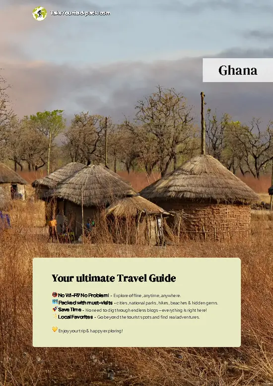
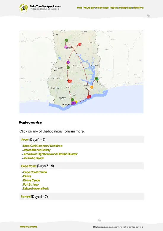
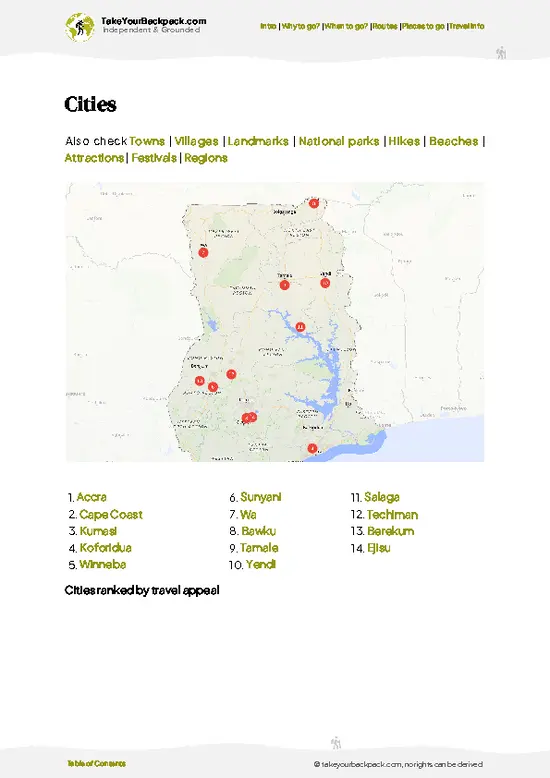
example page 0 from our offline Travel Guide for Ghana
example page 1 from our offline Travel Guide for Ghana
example page 2 from our offline Travel Guide for Ghana
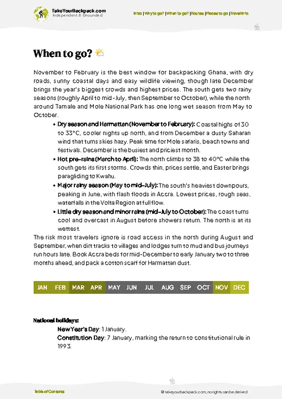
example page 3 from our offline Travel Guide for Ghana
example page 4 from our offline Travel Guide for Ghana
example page 5 from our offline Travel Guide for Ghana
example page 6 from our offline Travel Guide for Ghana
example page 7 from our offline Travel Guide for Ghana
Loading the map 🌍
CLICK TO FILTER
cities
towns
villages
landmarks
national parks
hikes
beaches
attractions
festivals
regions
SHOW COUNTRY’S BESTSHOW ALL

✨ Why go?
Ranked #10 national park in Ghana
Why Kyabobo should be on your travel list

Independent exploration is the draw here. Kyabobo has quiet trails through hills that reach about 800 meters, and you will often share them only with a ranger and a few butterflies. A guide is required, but that is a guide, not a package tour, so you set the pace and the route. Budget camping is simple: pitch a tent or take a basic room at the park’s Brewery camp area, then buy rice, yams and kebabs in nearby villages. The park suits self-guided travelers who like arranging their own transport and do not mind slow days. Trail variety covers waterfalls, forest walks, rocky ridges and viewpoints over Togo. Compared with busy Mole, Kyabobo feels private, cool and refreshingly unpolished. You will earn every view, and nobody will rush you.

💡 HighlightsThe experiences that define the visit

  1. Kyabobo Summit Hike: The park’s high hills rise to roughly 800 meters, and the climb through forest and rock opens to long views over the Togo border. It is the headline trek.
  2. Waterfall Walks: Streams drop through shaded forest, and flow is best in or just after the rainy season. Swimming is possible where rangers say it is safe.
  3. Butterfly Watching: Kyabobo is known for its butterfly variety, with many species clustered along damp forest paths and streambanks in the morning.
  4. Birdwatching: Forest and savanna edges give you a mix of habitats, so hornbills and colorful forest birds are realistic targets with an early start and a patient guide.
  5. Brewery Camp Area: The base for most visitors, with a campsite, simple facilities and easy access to the ranger office and trailheads. It is a decent place
… read more 👉
  1. Kyabobo Summit Hike: The park’s high hills rise to roughly 800 meters, and the climb through forest and rock opens to long views over the Togo border. It is the headline trek.
  2. Waterfall Walks: Streams drop through shaded forest, and flow is best in or just after the rainy season. Swimming is possible where rangers say it is safe.
  3. Butterfly Watching: Kyabobo is known for its butterfly variety, with many species clustered along damp forest paths and streambanks in the morning.
  4. Birdwatching: Forest and savanna edges give you a mix of habitats, so hornbills and colorful forest birds are realistic targets with an early start and a patient guide.
  5. Brewery Camp Area: The base for most visitors, with a campsite, simple facilities and easy access to the ranger office and trailheads. It is a decent place to organize your days.
  6. Viewpoints over Togo: Ridge sections show folded hills and farmland across the border, especially golden in the early morning light.
  7. Village Visits: Communities around the park, including Chakosi, Akyode and Ewe groups, give context to the landscape. Go with your guide and ask before taking photos.
I would pick the summit hike first. It gives you forest, rock, views and the best sense of the park’s scale in one long day, and you can do it before the heat builds.
Spotted a mistake or missing something? Contact us.

🌤️ When to go?Weather, crowds, and seasonal trade-offs

  • Dry Season (November to March): Best for hiking, with clear skies and trails firm underfoot. Days reach 30 to 35°C (86 to 95°F), nights 18 to 22°C (64 to 72°F). Harmattan haze can flatten views from December to February, and dawn is cool and dusty.
  • Hot Transition (March to April): Peak heat of 35 to 38°C (95 to 100°F) makes midday climbs rough. Start at sunrise.
  • Rainy Season (May to October): Showers bring 25 to 30°C (77 to 86°F), slick red clay, swollen streams and difficult dirt roads. Waterfalls are strongest and the forest greenest, but leeches and mud are common.
  • Crowds and Prices: Visitor numbers stay low all year. Prices are steady, and daylight is roughly 11.5 to 12.5 hours.
Aim for late November or early December, after the rains and before the haze thickens.

source: climatestotravel.comJANJanuary: excellent for travelingFEBFebruary: excellent for travelingMARMarch: highly recommended for travelingAPRApril: fair for travelingMAYMay: fair for travelingJUNJune: fair for travelingJULJuly: fair for travelingAUGAugust: fair for travelingSEPSeptember: fair for travelingOCTOctober: good for travelingNOVNovember: excellent for travelingDECDecember: excellent for traveling
ghana-national-park-kyabobo-national-park
© Google |

✈️ The backpacker research shortcutGhana Travel Guide

An offline-friendly backpacking guide with optimized travel routes, ranked highlights, transport advice, and the best areas to stay.
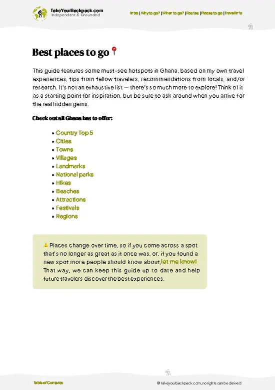
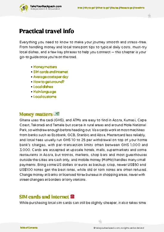
example page 0 from our offline Travel Guide for Ghana
example page 1 from our offline Travel Guide for Ghana
example page 2 from our offline Travel Guide for Ghana
example page 3 from our offline Travel Guide for Ghana
example page 4 from our offline Travel Guide for Ghana
example page 5 from our offline Travel Guide for Ghana
example page 6 from our offline Travel Guide for Ghana
example page 7 from our offline Travel Guide for Ghana
The digital guide (321 pages) contains:
✅ 105 highlights, ranked by travel appeal
✅ Optimized 5, 10 & 15-day travel routes
✅ Cities, national parks, landmarks, beaches
✅ How to get around
✅ Offline-friendly for travel without Wi-Fi
👉 Click to see all 30+ guide features

📅 Plan smarter in minutes, not weeks
✅ Month by month travel advice
✅ Festivals & national holidays
✅ Budget expectations

🗺️ Go to the right places, skip the overrated ones
✅ Honest pros & cons of destinations
✅ Top hikes, parks & viewpoints
✅ Lesser-known places most travelers miss
✅ Clear “worth it vs skip it” guidance

🛏️ Travel smoothly without rookie mistakes
✅ Best areas to stay
✅ Transport systems explained simply
✅ Common scams & safety advice
✅ SIM cards, money & practical tips

🌍 Understand the country, not just visit it
✅ Culture & traditions
✅ 52 Essential phrases & customs
✅ Festivals worth planning around
✅ Traveler-friendly historical context
✅ Insights that make places more meaningful

📱 Built for real travel conditions
✅ Fully downloadable PDF
✅ Works completely offline
✅ Optimized for phone use
✅ Useful in remote areas & buses
✅ Everything in one place
Stop searching, start planning
Get instant access to your full guide. 30‑day money-back guarantee.
+ Add another guide for just

By proceeding you agree to our terms.
Sent to your inbox immediately after payment • 100% Secure Checkout
Best Backpacking Travel Advisor 2025 tourism awardBest Backpacking
Travel Advisor
2025
What others say about Take Your Backpack Guides:
⭐⭐⭐⭐⭐
Fantastic, amazing amount of information!
⭐⭐⭐⭐⭐
My goodness this is amazing, it's what I've been looking for hats off too you!
⭐⭐⭐⭐⭐
I think this is absolutely BRILLIANT
⭐⭐⭐⭐
Very complete and informative. It's still missing places, but I gotta to commend you
⭐⭐⭐⭐⭐
This is truly amazing, thank you, can't wait to explore it with my kids!
⭐⭐⭐⭐⭐
Awesome resource, thank you!
⭐⭐⭐⭐⭐
This is amazing! Can't wait to explore the ones I haven't seen
⭐⭐⭐⭐
I love this! Well done, great idea.
⭐⭐⭐⭐⭐
Thanks for taking the time to make this gem!
⭐⭐⭐⭐⭐
This might be the best website I've ever seen.
⭐⭐⭐⭐⭐
Congratulations, and thank you so much for your work; it's incredibly valuable.
⭐⭐⭐⭐
In all seriousness I think you did a great job pointing out the important spots
⭐⭐⭐⭐⭐
10/10 very good
⭐⭐⭐⭐⭐
As someone who's only just starting to visit regularly this is awesome, thank you.
⭐⭐⭐⭐
Thank you very much! I'm going to visit my dad, it's going to be very useful!
⭐⭐⭐⭐⭐
This is really cool! We'll be travelling for the first time and this definitely come in handy.
⭐⭐⭐⭐⭐
You are now our minister of culture, congratulations 👨‍💼
⭐⭐⭐⭐⭐
Just wanted to tell you that this is a pearl! Going to follow your recommendations.
⭐⭐⭐⭐⭐
This is so cool. I'll definitely be using the resource for my travels soon.
⭐⭐⭐⭐⭐
This is very impressive! Good work.
⭐⭐⭐⭐⭐
This is an amazing and informative site. Very well done!

🛏️ Where to stay?Best areas to stay in Ghana

The easiest place to stay is inside the park at the Brewery camp area, which offers camping and basic rooms close to the ranger office and trailheads. Facilities are simple, so bring a headlamp, bug repellent and your own food or arrange meals ahead. For more choice, stay in Nkwanta, the nearest main town, which has guesthouses, chop bars, a market and transport links. Kute and nearby villages may offer local options, but expect little signage and limited power. Hohoe and Ho are farther south and work better as transit stops than park bases. If you rely on budget lodging, call the park office … read more 👉
The easiest place to stay is inside the park at the Brewery camp area, which offers camping and basic rooms close to the ranger office and trailheads. Facilities are simple, so bring a headlamp, bug repellent and your own food or arrange meals ahead. For more choice, stay in Nkwanta, the nearest main town, which has guesthouses, chop bars, a market and transport links. Kute and nearby villages may offer local options, but expect little signage and limited power. Hohoe and Ho are farther south and work better as transit stops than park bases. If you rely on budget lodging, call the park office before arrival, carry cash, and arrive by early afternoon so nobody has to prepare a campsite for you in the dark.

👛 Costs (as of 2 October 2026)Money, prices, and spending tips

Kyabobo is inexpensive, with most spending going to transport, guide fees and food. Expect about US$25 to 55 a day for a budget traveler. Prices below are estimates and change, so confirm at the park office.
CategoryBudget RangeLocal Reality
Entrance feeUS$5 to 12Lower for Ghanaian residents, paid at the office
GuideUS$5 to 15Required on trails, with price depending on route and group size
Camping or roomsUS$5 to 25Camping is cheapest, and basic rooms cost more
Local transportUS$3 to 15Shared taxis and motorbikes from Nkwanta, with fewer vehicles late in the day
Food and suppliesUS$5 to 12Rice, yam and grilled meat from local stalls, plus limited shop stock
⚠️ Prices can change and everyone travels differently, so take this as a rough guide. Hope it helps you plan your adventure!

🥾 TrailsPlan your hike in Kyabobo: routes, terrain, and sights

Kyabobo’s terrain is hilly forest, rocky ridge and savanna, with red clay paths that turn slick after rain. Most walks are moderate, and fitness matters more than technical skill. Expect heat, steep sections and uneven footing. Wildlife is subtle: butterflies, birds, monkeys, baboons and signs of larger animals. Elephants exist but are rarely seen.

Trail names and exact lengths vary by ranger, so confirm the route, distance and timing at the office before you set off.

Summit Hike
  • Length: roughly 8 to 14 km depending on route
  • Duration: 4 to 7 hours
  • Difficulty: Moderate to hard
  • Key features: Forest
… read more 👉
Kyabobo’s terrain is hilly forest, rocky ridge and savanna, with red clay paths that turn slick after rain. Most walks are moderate, and fitness matters more than technical skill. Expect heat, steep sections and uneven footing. Wildlife is subtle: butterflies, birds, monkeys, baboons and signs of larger animals. Elephants exist but are rarely seen.

Trail names and exact lengths vary by ranger, so confirm the route, distance and timing at the office before you set off.

Summit Hike
  • Length: roughly 8 to 14 km depending on route
  • Duration: 4 to 7 hours
  • Difficulty: Moderate to hard
  • Key features: Forest climb, rock sections, border views
  • Terrain: Steep clay and stone paths

Waterfall and Forest Walk
  • Length: roughly 3 to 8 km
  • Duration: 2 to 4 hours
  • Difficulty: Easy to moderate
  • Key features: Streams, butterflies, shaded trails
  • Terrain: Forest paths, some creek crossings

Getting there takes effort. Reach Nkwanta from Accra or Kumasi by long bus connections via Ho, Hohoe or Tamale, then take a taxi, motorbike or shared ride to the park gate area. Allow a full day or more. Crowds are close to nonexistent, so you may be the only visitors. There is an entrance fee, paid at the office, and a guide is required. Bring cash, water and snacks.
⚠️ Hiking info can sometimes be outdated or inaccurate. Before you hit the trail, check the latest conditions with locals. If you do spot anything that's off, I'd love to hear from you, so I can update it for fellow travelers.

🛡️ SafetyTraveler Safety Guide

Kyabobo is generally straightforward, but heat and mud cause most problems. Start at dawn, carry at least 2 to 3 liters of water, and wear shoes with real grip, because clay slopes turn slick after rain. Navigation is easier with the required ranger guide, so stay with them. Wildlife is low risk. Keep distance from baboons and never feed monkeys, and give any elephants or buffalo wide space. Use repellent against mosquitoes and tsetse flies, take malaria prevention, and cover your ankles in grass. Phone signal is patchy, so tell your guesthouse your route and return time. Pack snacks, a basic first-aid kit and cash, because help and ATMs are far away.

FAQCommon questions from travelers

Two to three days is enough for most backpackers. That gives you one day for the summit hike, another for waterfalls and forest walks, and a buffer for slow transport from Nkwanta. Add a fourth day if you want village visits or extra birdwatching.
Yes, but it takes patience. Take buses to Nkwanta, usually via Ho, Hohoe or Tamale, then a taxi or motorbike to the park area, which can take several hours. Once there, trails are walked with a ranger, so you do not need a car inside the park.
Yes, you pay an entrance fee at the park office, and a ranger guide is required on trails. Expect roughly US$5 to 12 for entry and US$5 to 15 for a guide, depending on route and group size. Carry cash, since card payment is unlikely.
⚠️ Things can change over time, so always validate details locally before you go.

Other Ghanaian national parks near Kyabobo

Explore more nearby:


💡 Not sure where to go next?
Create a personalized itinerary for Ghana including Kyabobo and the places that fit your trip.

Generate my itinerary

👉 Discover all national parks

Or checkout all Ghana has to offer (think cities, towns, villages, national parks, hikes, beaches, festivals)
Country photo of Ghana

We 💚 feedbackParting advice and final tips

Kyabobo is worth it for the quiet. You can climb through cool forest, hear nothing but insects and birds, then look across into Togo without sharing the view. The drawback is logistics. Getting to Nkwanta and then the park takes patience, and rainy-season roads can wreck your schedule. Bring cash, give yourself extra days, and expect to work for it.

✈️ When did I visit Ghana?
Ghana I visited in December 2024, starting in Accra following the coast, then up north to Mole National park to finish in the Volta Region.

✍️ Help improve this page!
The information on this page is based on my own backpacking experience in Ghana, supplemented with up-to-date research and feedback from other travelers. Travel details can change, so if you notice anything outdated or incomplete, feel free to let me know.


🙋‍♂️ Give feedback

👋 Meet the founderWho’s Behind Take Your Backpack?

Johan, backpacker and founder of TakeYourBackpackHi, I’m Johan (Netherlands 🇳🇱), the creator of TakeYourBackpack. Over the past 3 decades, I’ve backpacked through 90+ countries across six continents, gaining extensive experience with independent travel, long-term trips, and overland routes.

This site is built on a combination of firsthand travel experience and carefully curated insights from other backpackers. Many guides are based on places I’ve personally visited, while others bring together tips, observations, and practical advice shared by trusted travelers I’ve met along the way.

The goal is to provide realistic, experience-driven guidance — not generic itineraries — so you can explore destinations with better context, clearer expectations, and more confidence.