



×

Indonesia🇮🇩 | hikesAlas PurwoCoastal jungle, banteng herds, Sadengan savanna, turtle beaches | things to do and best time to go

Explore Bukit KursiExplore Bali Barat National Park

Backpacking in Alas Purwo
By Johan Kruseman 🇳🇱 | Updated October 15, 2026

The trail opens onto a ridge where the wind cuts through your shirt, and suddenly the Indian Ocean sprawls below in shades of blue you didn't know existed. Alas Purwo sits at the far eastern tip of Java, Indonesia, where the landscape shifts from cultivated farmland into raw coastal wilderness. This 3-day trek rewards effort with genuine solitude: dramatic cliffs, hidden beaches, and forest thick enough to muffle the world. The hike is moderately challenging, with steep descents and uneven terrain, but public transport reaches the park entrance reliably. Compared to Java's crowded volcano routes, Alas Purwo demands more self-reliance and delivers far fewer hikers. I remember standing at Trianggulasi Point at dusk, watching the light drain from the water while a single fishing boat moved across the horizon, and feeling the kind of quiet that makes you understand why people travel.

Discover everything you want to know in the 📖 Indonesia Travel Guide.


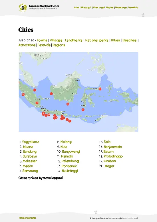
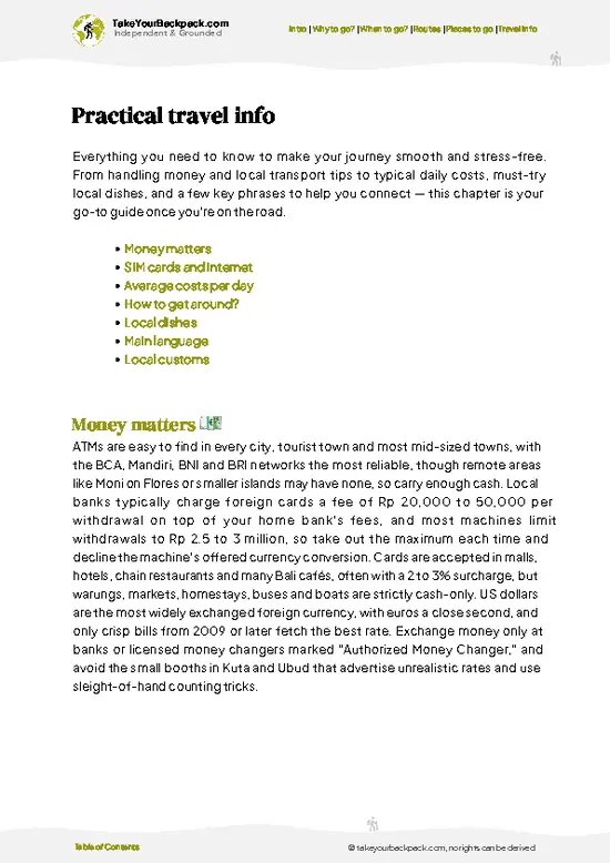
example page 0 from our offline Travel Guide for Indonesia
example page 1 from our offline Travel Guide for Indonesia
example page 2 from our offline Travel Guide for Indonesia
example page 3 from our offline Travel Guide for Indonesia
example page 4 from our offline Travel Guide for Indonesia
example page 5 from our offline Travel Guide for Indonesia
example page 6 from our offline Travel Guide for Indonesia
example page 7 from our offline Travel Guide for Indonesia
Loading the map 🌍
CLICK TO FILTER
cities
towns
villages
landmarks
national parks
hikes
beaches
attractions
festivals
regions
SHOW COUNTRY’S BESTSHOW ALL

✨ Why go?
Ranked #99 hike in Indonesia
What makes this hike worth hiking

Alas Purwo delivers raw coastal scenery without the crowds that pack Java's famous peaks. The moderate difficulty and flexible 2 to 4-day options suit backpackers who want genuine wilderness without extreme technical climbing. Public transport reaches the park entrance from Banyuwangi in under two hours, making it easy to slot into a longer Java route. The low cost of permits and basic accommodation means you can spend more days exploring. Most importantly, the trail offers genuine solitude and a sense of discovery that's rare on Java's well-trodden paths.

💡 HighlightsEssential experiences to have while hiking the Alas Purwo

  1. Trianggulasi Point: The highest viewpoint on the trail, offering panoramic views of the Indian Ocean and the eastern coastline. On clear days, the vista extends for kilometers, making it the most rewarding vantage point of the hike.
  2. Teluk Hijau (Green Bay): A sheltered cove with turquoise water and a small sandy beach, accessible via a steep descent. The contrast between the rugged cliffs and calm bay makes it a memorable swimming and camping spot.
  3. Sadengan Savanna: An open grassland plateau with scattered trees, offering a different landscape from the forested sections. Wildlife sightings, including deer and wild boar, are more common here than elsewhere on the trail.
  4. Blambangan Strait Views: Coastal sections where the trail hugs cliffs overlooking the narrow strait separating Java from Bali.
… read more 👉
  1. Trianggulasi Point: The highest viewpoint on the trail, offering panoramic views of the Indian Ocean and the eastern coastline. On clear days, the vista extends for kilometers, making it the most rewarding vantage point of the hike.
  2. Teluk Hijau (Green Bay): A sheltered cove with turquoise water and a small sandy beach, accessible via a steep descent. The contrast between the rugged cliffs and calm bay makes it a memorable swimming and camping spot.
  3. Sadengan Savanna: An open grassland plateau with scattered trees, offering a different landscape from the forested sections. Wildlife sightings, including deer and wild boar, are more common here than elsewhere on the trail.
  4. Blambangan Strait Views: Coastal sections where the trail hugs cliffs overlooking the narrow strait separating Java from Bali. The dramatic drop and shifting light create some of the most photogenic moments on the hike.
  5. Pancur Waterfall: A freshwater cascade in the forest interior, providing a cool respite and a reliable water source. The lush vegetation around the falls contrasts sharply with the drier coastal sections.
I'd pick Trianggulasi Point first because it sets the tone for the entire hike. Standing there at sunrise, with the ocean stretching endlessly below and the forest at your back, you understand immediately why the effort is worth it.
Spotted a mistake or missing something? Contact us.

Things to do near Alas Purwo

Ratings based on Tripadvisor reviews. When you book through this link, you support our work at no extra cost to you.

🌤️ When to go?Choosing the right time of year

  • Dry Season (May to September): The best window for hiking, with stable weather, clear skies, and temperatures between 24 to 32°C (75 to 90°F). Trails are passable and visibility is excellent for coastal views.
  • Wet Season (October to April): Heavy rainfall makes trails slippery and muddy, with temperatures around 25 to 31°C (77 to 88°F). Streams swell and some sections become hazardous; hiking is possible but requires caution.
  • Shoulder Months (April and September): Unpredictable weather but fewer crowds and lower prices than peak dry season.
Plan your hike for May through August to avoid rain and maximize daylight hours.

source: climatestotravel.comJANJanuary: fair for travelingFEBFebruary: fair for travelingMARMarch: fair for travelingAPRApril: fair for travelingMAYMay: highly recommended for travelingJUNJune: highly recommended for travelingJULJuly: excellent for travelingAUGAugust: excellent for travelingSEPSeptember: highly recommended for travelingOCTOctober: fair for travelingNOVNovember: fair for travelingDECDecember: fair for traveling
when-to-go

✈️ The backpacker research shortcutIndonesia Travel Guide

An offline-friendly backpacking guide with optimized travel routes, ranked highlights, transport advice, and the best areas to stay.
example page 0 from our offline Travel Guide for Indonesia
example page 1 from our offline Travel Guide for Indonesia
example page 2 from our offline Travel Guide for Indonesia
example page 3 from our offline Travel Guide for Indonesia
example page 4 from our offline Travel Guide for Indonesia
example page 5 from our offline Travel Guide for Indonesia
example page 6 from our offline Travel Guide for Indonesia
example page 7 from our offline Travel Guide for Indonesia
The digital guide (460 pages) contains:
✅ 153 highlights, ranked by travel appeal
✅ Optimized 14, 21 & 30-day travel routes
✅ Cities, national parks, landmarks, beaches
✅ How to get around
✅ Offline-friendly for travel without Wi-Fi
👉 Click to see all 30+ guide features

📅 Plan smarter in minutes, not weeks
✅ Month by month travel advice
✅ Festivals & national holidays
✅ Budget expectations

🗺️ Go to the right places, skip the overrated ones
✅ Honest pros & cons of destinations
✅ Top hikes, parks & viewpoints
✅ Lesser-known places most travelers miss
✅ Clear “worth it vs skip it” guidance

🛏️ Travel smoothly without rookie mistakes
✅ Best areas to stay
✅ Transport systems explained simply
✅ Common scams & safety advice
✅ SIM cards, money & practical tips

🌍 Understand the country, not just visit it
✅ Culture & traditions
✅ 52 Essential phrases & customs
✅ Festivals worth planning around
✅ Traveler-friendly historical context
✅ Insights that make places more meaningful

📱 Built for real travel conditions
✅ Fully downloadable PDF
✅ Works completely offline
✅ Optimized for phone use
✅ Useful in remote areas & buses
✅ Everything in one place
Stop searching, start planning
Get instant access to your full guide. 30‑day money-back guarantee.
+ Add another guide for just

By proceeding you agree to our terms.
Sent to your inbox immediately after payment • 100% Secure Checkout
Best Backpacking Travel Advisor 2025 tourism awardBest Backpacking
Travel Advisor
2025
What others say about Take Your Backpack Guides:
⭐⭐⭐⭐⭐
Fantastic, amazing amount of information!
⭐⭐⭐⭐⭐
My goodness this is amazing, it's what I've been looking for hats off too you!
⭐⭐⭐⭐⭐
I think this is absolutely BRILLIANT
⭐⭐⭐⭐
Very complete and informative. It's still missing places, but I gotta to commend you
⭐⭐⭐⭐⭐
This is truly amazing, thank you, can't wait to explore it with my kids!
⭐⭐⭐⭐⭐
Awesome resource, thank you!
⭐⭐⭐⭐⭐
This is amazing! Can't wait to explore the ones I haven't seen
⭐⭐⭐⭐
I love this! Well done, great idea.
⭐⭐⭐⭐⭐
Thanks for taking the time to make this gem!
⭐⭐⭐⭐⭐
This might be the best website I've ever seen.
⭐⭐⭐⭐⭐
Congratulations, and thank you so much for your work; it's incredibly valuable.
⭐⭐⭐⭐
In all seriousness I think you did a great job pointing out the important spots
⭐⭐⭐⭐⭐
10/10 very good
⭐⭐⭐⭐⭐
As someone who's only just starting to visit regularly this is awesome, thank you.
⭐⭐⭐⭐
Thank you very much! I'm going to visit my dad, it's going to be very useful!
⭐⭐⭐⭐⭐
This is really cool! We'll be travelling for the first time and this definitely come in handy.
⭐⭐⭐⭐⭐
You are now our minister of culture, congratulations 👨‍💼
⭐⭐⭐⭐⭐
Just wanted to tell you that this is a pearl! Going to follow your recommendations.
⭐⭐⭐⭐⭐
This is so cool. I'll definitely be using the resource for my travels soon.
⭐⭐⭐⭐⭐
This is very impressive! Good work.
⭐⭐⭐⭐⭐
This is an amazing and informative site. Very well done!

🛏️ Where to stay?Choosing the right base

If you enjoy meeting fellow travelers, consider choosing hostels with high ratings for atmosphere. On the other hand, if you prefer having your own space, a hotel might be a better option.

🥾 Hike detailsRoute, distance, and difficulty explained

Total Distance: Approximately 35 to 40 kilometers, depending on your exact route and detours to side attractions.
Duration: 3 to 4 days for most hikers, though experienced trekkers can compress it to 2 days.
Difficulty: Moderate to moderately challenging. Steep descents, uneven footing, and exposed sections demand careful footwork and steady pace.
Starting Point: Alas Purwo National Park entrance near Banyuwangi. Public transport (minibuses and local buses) from Banyuwangi town reaches the entrance in 1.5 to 2 hours; arrange a ride or join a shared shuttle.
Terrain and Scenery:
  • Coastal cliffs: Dramatic
… read more 👉
Total Distance: Approximately 35 to 40 kilometers, depending on your exact route and detours to side attractions.
Duration: 3 to 4 days for most hikers, though experienced trekkers can compress it to 2 days.
Difficulty: Moderate to moderately challenging. Steep descents, uneven footing, and exposed sections demand careful footwork and steady pace.
Starting Point: Alas Purwo National Park entrance near Banyuwangi. Public transport (minibuses and local buses) from Banyuwangi town reaches the entrance in 1.5 to 2 hours; arrange a ride or join a shared shuttle.
Terrain and Scenery:
  • Coastal cliffs: Dramatic limestone and volcanic rock formations rising 100 to 300 meters above the ocean.
  • Forest sections: Dense tropical woodland with uneven, root-strewn paths.
  • Grassland plateaus: Open savanna-like areas with scattered trees and long-distance views.
  • Beaches and coves: Small sandy bays accessible via steep trails.
Vegetation: Tropical dry forest, coastal scrub, and grassland. Trees are lower and more sparse than inland Java forests.
Wildlife: Deer, wild boar, monitor lizards, and various bird species. Encounters are common but animals typically avoid hikers.
⚠️ Hiking info can sometimes be outdated or inaccurate. Before you hit the trail, check the latest conditions with locals. If you do spot anything that's off, I'd love to hear from you, so I can update it for fellow travelers.

🛡️ SafetySafety Tips and Common Scams in Alas Purwo

Weather shifts quickly on the exposed ridge sections, so start early and monitor clouds. The steep descents demand careful footing, especially after rain when rocks become slippery. Bring sturdy hiking boots with good ankle support. Water sources exist but are unreliable; carry at least 2 liters and refill at known points like Pancur Waterfall. The trail is generally well-marked, but navigation can be confusing in dense forest sections. Deer and wild boar are present but pose no real threat if you maintain distance. Most injuries stem from twisted ankles on uneven terrain rather than wildlife or weather. Acclimatize to the heat on day one and pace yourself accordingly.

FAQCommon questions from travelers

The hike typically takes 3 to 4 days to complete the full circuit, though fit hikers can finish in 2 days. Most backpackers spend 3 days to enjoy the scenery without rushing. The trail covers 35 to 40 kilometers with significant elevation changes, so pacing matters more than speed.
Alas Purwo is moderately challenging, with steep descents, uneven footing, and exposed ridge sections that demand careful footwork. The difficulty lies not in technical climbing but in sustained terrain and heat exposure. Hikers comfortable with 4 to 6 hours of daily walking on rough ground will manage well.
No guide is required, though hiring one from Banyuwangi costs around 400,000 to 600,000 Indonesian Rupiah per day and is optional for confident navigators. A permit is mandatory and costs approximately 150,000 Rupiah per person, purchased at the park entrance. The trail is marked but navigation can be tricky in forest sections, so a map or GPS app is wise.
⚠️ Things can change over time, so always validate details locally before you go.

Other Indonesian hikes near Alas Purwo

Explore more nearby:

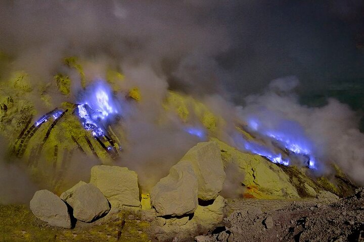
  • Ijen Crater—Blue fire, turquoise acid lake, sulfur miners, 1 a.m. start| 73 km away
  • Red Coral Waterfall—multi-level falls, forest pool, shaded glen| 83 km away
  • Gunung Agung—Bali's highest peak, sacred volcano, night ascent, Besakih route| 122 km away

💡 Not sure where to go next?
Create a personalized itinerary for Indonesia including Alas Purwo and the places that fit your trip.

Generate my itinerary

👉 Discover all hikes

Or checkout all Indonesia has to offer (think cities, towns, villages, national parks, hikes, beaches, festivals)
Country photo of Indonesia

We 💚 feedbackKey takeaways before you go

Alas Purwo's isolation and raw coastline make it genuinely special for backpackers seeking something untouched. The trade-off is real: getting there demands patience, and the infrastructure remains sparse. Worth the effort if you value solitude over comfort.

✈️ When did I visit Indonesia?
As part of my 1.5 year travel around the world trip, I visited Indonesia twice (and it was worth it): first in September 2015 and a bit later again in January and February 2016.

✍️ Help improve this page!
The information on this page is based on my own backpacking experience in Indonesia, supplemented with up-to-date research and feedback from other travelers. Travel details can change, so if you notice anything outdated or incomplete, feel free to let me know.


🙋‍♂️ Give feedback

👋 Meet the founderWho’s Behind Take Your Backpack?

Johan, backpacker and founder of TakeYourBackpackHi, I’m Johan (Netherlands 🇳🇱), the creator of TakeYourBackpack. Over the past 3 decades, I’ve backpacked through 90+ countries across six continents, gaining extensive experience with independent travel, long-term trips, and overland routes.

This site is built on a combination of firsthand travel experience and carefully curated insights from other backpackers. Many guides are based on places I’ve personally visited, while others bring together tips, observations, and practical advice shared by trusted travelers I’ve met along the way.

The goal is to provide realistic, experience-driven guidance — not generic itineraries — so you can explore destinations with better context, clearer expectations, and more confidence.