×

Indonesia🇮🇩 | hikesBukit KursiSavanna ridge, Bromo views, sunrise viewpoint, Tengger Caldera | things to do and best time to go

Explore Red Coral WaterfallExplore Alas Purwo

Backpacking in Bukit Kursi
👀 For curious travelershike ranked #21
By Johan Kruseman 🇳🇱 | Updated October 15, 2026

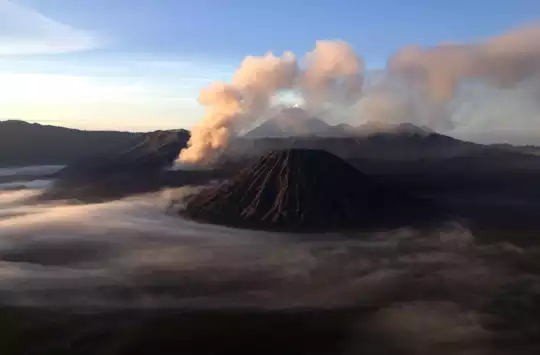
The real choice at Bukit Kursi isn't whether to climb it, but when: sunrise or sunset. Perched in West Java near Bandung, this modest peak rewards either decision with sweeping views across tea plantations and distant volcanic ridges. The hike itself is short and steep, rarely exceeding two hours, making it perfect for travelers squeezing adventure into a city stopover. I remember the moment the mist lifted mid-climb, revealing terraced green slopes falling away in every direction, the air cool and sharp with altitude. It's easier to reach than nearby Tangkuban Perahu and less crowded, though the payoff feels equally earned.

Discover everything you want to know in the 📖 Indonesia Travel Guide.


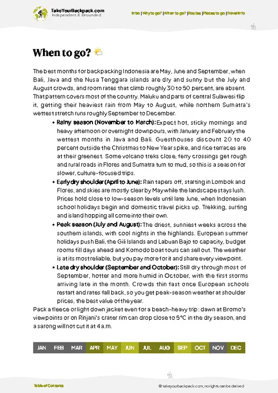
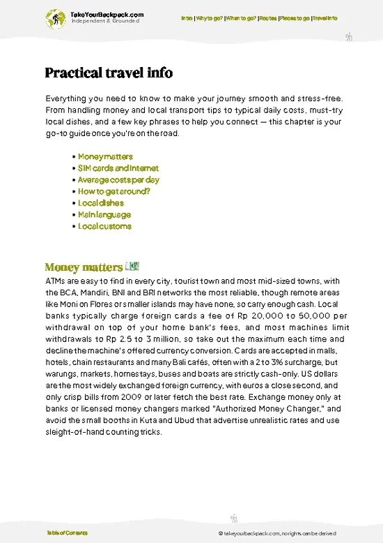
example page 0 from our offline Travel Guide for Indonesia
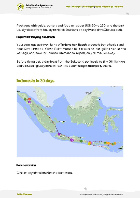
example page 1 from our offline Travel Guide for Indonesia
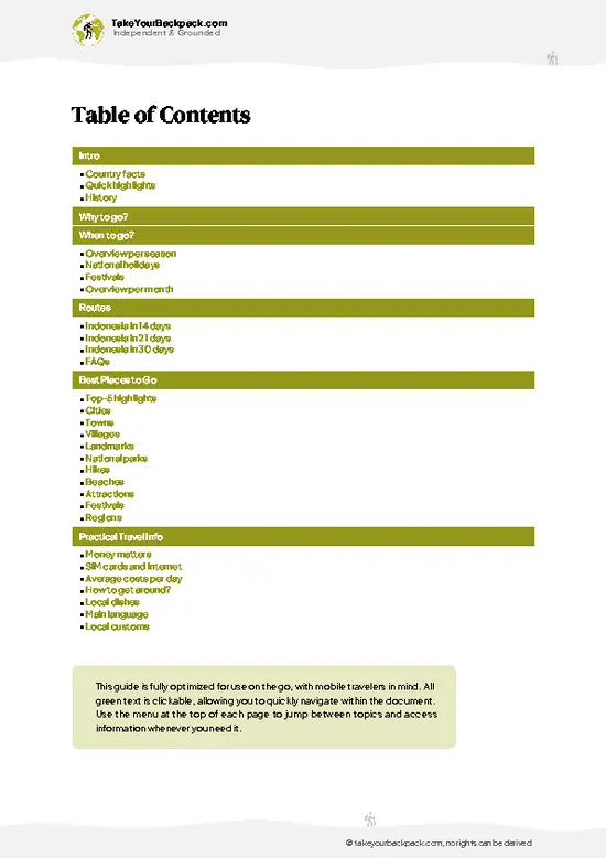
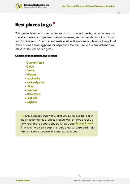
example page 2 from our offline Travel Guide for Indonesia
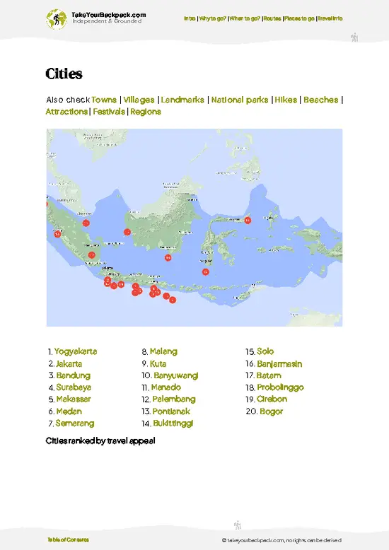
example page 3 from our offline Travel Guide for Indonesia
example page 4 from our offline Travel Guide for Indonesia
example page 5 from our offline Travel Guide for Indonesia
example page 6 from our offline Travel Guide for Indonesia
example page 7 from our offline Travel Guide for Indonesia
Loading the map 🌍
CLICK TO FILTER
cities
towns
villages
landmarks
national parks
hikes
beaches
attractions
festivals
regions
SHOW COUNTRY’S BESTSHOW ALL

✨ Why go?
Ranked #21 hike in Indonesia
What makes it a must-see hike

Bukit Kursi delivers maximum scenery for minimal time, a rare combination in West Java. The short duration and accessible trailhead make it ideal for backpackers based in Bandung or passing through. Public transport from the city center takes 45 minutes to an hour. The low cost and flexible timing mean you can chase sunrise or sunset without derailing your itinerary. It fits smoothly into a longer route through Java's volcanic highlands, offering genuine reward without the commitment of a multi-day trek.

💡 HighlightsThe experiences that define the visit

Bukit Kursi Summit Ridge
You earn every meter of this climb. The trail is a relentless, sun-baked staircase, cut into the dry, red earth of Bali’s northwest. Your calves will protest, sweat will sting your eyes, and the wind will snatch your breath as you crest the final rise. But the summit delivers: a 360-degree panorama that feels like you’ve stepped onto the prow of a ship. To the north, the Bali Sea glimmers, impossibly blue, and the curve of Menjangan Island floats on the horizon. To the south, the volcanic spine of Bali cuts a jagged silhouette. There’s no crowd, no vendors, just the wind and the sense that you’ve found the edge of the island. This is my personal favorite—there’s nothing like the raw, earned silence up here.


Sunrise Over Menjangan Island
If you hit the trail before … read more 👉
Bukit Kursi Summit Ridge
You earn every meter of this climb. The trail is a relentless, sun-baked staircase, cut into the dry, red earth of Bali’s northwest. Your calves will protest, sweat will sting your eyes, and the wind will snatch your breath as you crest the final rise. But the summit delivers: a 360-degree panorama that feels like you’ve stepped onto the prow of a ship. To the north, the Bali Sea glimmers, impossibly blue, and the curve of Menjangan Island floats on the horizon. To the south, the volcanic spine of Bali cuts a jagged silhouette. There’s no crowd, no vendors, just the wind and the sense that you’ve found the edge of the island. This is my personal favorite—there’s nothing like the raw, earned silence up here.


Sunrise Over Menjangan Island
If you hit the trail before dawn, the payoff is a sunrise that doesn’t just light up the sky—it ignites the whole coastline. The first rays catch the salt haze, turning the sea into a sheet of hammered gold. Menjangan Island, famous for its reefs, sits just offshore, and in the early light, it looks close enough to swim to. The air is cool, the birds are just waking up, and for a few minutes, the world feels brand new. You’ll want to linger, but the sun climbs fast, and the heat will chase you down the ridge.


Dry Forest and Savanna Wildlife
Bukit Kursi isn’t the Bali of lush rice paddies and jungle. The trail cuts through a dry, open savanna—think acacia trees, brittle grass, and the occasional flash of a monitor lizard darting for cover. If you’re lucky, you’ll spot wild macaques picking through the undergrowth or hear the shrill call of a black-winged starling overhead. The landscape feels wild and exposed, with none of the manicured feel of southern Bali. Every step reminds you that this is the island’s arid frontier.


Traditional Balinese Shrine
About halfway up, the trail passes a small, weathered shrine draped in yellow cloth. Incense sticks poke from the stones, and offerings—flowers, rice, a splash of arak—dot the altar. It’s a reminder that every hill in Bali is sacred to someone. Pause here, catch your breath, and listen to the wind. The place hums with quiet reverence, a living link between the sweat of the climb and the spiritual pulse of the island.


Descent With a View
The descent is no afterthought. The trail drops steeply, and every step down gives you a new angle on the coastline. The sea shifts from blue to silver as the sun climbs, and the villages below wake up—roosters crow, smoke curls from breakfast fires, and the world feels wide open. Your legs will shake, your shirt will cling, but the promise of a cold drink at the trailhead is real. This is the kind of hike that leaves you gritty, sunburned, and grinning.
Spotted a mistake or missing something? Contact us.

🌤️ When to go?Seasonal considerations and timing

  • Dry Season (May to September): Best visibility and stable weather. Temperatures range from 15 to 22°C (59 to 72°F). Trails are firm and safe. Crowds increase on weekends.
  • Wet Season (October to April): Frequent rain and low clouds obscure views. Temperatures stay around 18 to 24°C (64 to 75°F). Trails become slippery; morning hikes are safer than afternoon ones.
  • Early Morning (5 to 7 AM): Clearest views and fewest crowds. Sunrise timing varies; check local sunrise times before you go.
Start your hike by 6 AM during dry season to catch the best light and avoid afternoon cloud cover.

source: climatestotravel.comJANJanuary: below average for travelingFEBFebruary: below average for travelingMARMarch: below average for travelingAPRApril: fair for travelingMAYMay: excellent for travelingJUNJune: highly recommended for travelingJULJuly: highly recommended for travelingAUGAugust: highly recommended for travelingSEPSeptember: excellent for travelingOCTOctober: fair for travelingNOVNovember: below average for travelingDECDecember: below average for traveling
when-to-go

✈️ The backpacker research shortcutIndonesia Travel Guide

An offline-friendly backpacking guide with optimized travel routes, ranked highlights, transport advice, and the best areas to stay.
example page 0 from our offline Travel Guide for Indonesia
example page 1 from our offline Travel Guide for Indonesia
example page 2 from our offline Travel Guide for Indonesia
example page 3 from our offline Travel Guide for Indonesia
example page 4 from our offline Travel Guide for Indonesia
example page 5 from our offline Travel Guide for Indonesia
example page 6 from our offline Travel Guide for Indonesia
example page 7 from our offline Travel Guide for Indonesia
The digital guide (460 pages) contains:
✅ 153 highlights, ranked by travel appeal
✅ Optimized 14, 21 & 30-day travel routes
✅ Cities, national parks, landmarks, beaches
✅ How to get around
✅ Offline-friendly for travel without Wi-Fi
👉 Click to see all 30+ guide features

📅 Plan smarter in minutes, not weeks
✅ Month by month travel advice
✅ Festivals & national holidays
✅ Budget expectations

🗺️ Go to the right places, skip the overrated ones
✅ Honest pros & cons of destinations
✅ Top hikes, parks & viewpoints
✅ Lesser-known places most travelers miss
✅ Clear “worth it vs skip it” guidance

🛏️ Travel smoothly without rookie mistakes
✅ Best areas to stay
✅ Transport systems explained simply
✅ Common scams & safety advice
✅ SIM cards, money & practical tips

🌍 Understand the country, not just visit it
✅ Culture & traditions
✅ 52 Essential phrases & customs
✅ Festivals worth planning around
✅ Traveler-friendly historical context
✅ Insights that make places more meaningful

📱 Built for real travel conditions
✅ Fully downloadable PDF
✅ Works completely offline
✅ Optimized for phone use
✅ Useful in remote areas & buses
✅ Everything in one place
Stop searching, start planning
Get instant access to your full guide. 30‑day money-back guarantee.
+ Add another guide for just

By proceeding you agree to our terms.
Sent to your inbox immediately after payment • 100% Secure Checkout
Best Backpacking Travel Advisor 2025 tourism awardBest Backpacking
Travel Advisor
2025
What others say about Take Your Backpack Guides:
⭐⭐⭐⭐⭐
Fantastic, amazing amount of information!
⭐⭐⭐⭐⭐
My goodness this is amazing, it's what I've been looking for hats off too you!
⭐⭐⭐⭐⭐
I think this is absolutely BRILLIANT
⭐⭐⭐⭐
Very complete and informative. It's still missing places, but I gotta to commend you
⭐⭐⭐⭐⭐
This is truly amazing, thank you, can't wait to explore it with my kids!
⭐⭐⭐⭐⭐
Awesome resource, thank you!
⭐⭐⭐⭐⭐
This is amazing! Can't wait to explore the ones I haven't seen
⭐⭐⭐⭐
I love this! Well done, great idea.
⭐⭐⭐⭐⭐
Thanks for taking the time to make this gem!
⭐⭐⭐⭐⭐
This might be the best website I've ever seen.
⭐⭐⭐⭐⭐
Congratulations, and thank you so much for your work; it's incredibly valuable.
⭐⭐⭐⭐
In all seriousness I think you did a great job pointing out the important spots
⭐⭐⭐⭐⭐
10/10 very good
⭐⭐⭐⭐⭐
As someone who's only just starting to visit regularly this is awesome, thank you.
⭐⭐⭐⭐
Thank you very much! I'm going to visit my dad, it's going to be very useful!
⭐⭐⭐⭐⭐
This is really cool! We'll be travelling for the first time and this definitely come in handy.
⭐⭐⭐⭐⭐
You are now our minister of culture, congratulations 👨‍💼
⭐⭐⭐⭐⭐
Just wanted to tell you that this is a pearl! Going to follow your recommendations.
⭐⭐⭐⭐⭐
This is so cool. I'll definitely be using the resource for my travels soon.
⭐⭐⭐⭐⭐
This is very impressive! Good work.
⭐⭐⭐⭐⭐
This is an amazing and informative site. Very well done!

🛏️ Where to stay?Best areas to stay in Indonesia

If you enjoy meeting fellow travelers, consider choosing hostels with high ratings for atmosphere. On the other hand, if you prefer having your own space, a hotel might be a better option.

🥾 Hike detailsEverything you need to know before hiking Bukit Kursi

Total Distance: 3.2 kilometers round trip, though the trail’s switchbacks and loose terrain make it feel longer than the numbers suggest.

Estimated Duration: 2 to 2.5 hours for most hikers, including breaks at the summit. Faster if you’re used to steep scrambles; slower if you’re stopping for photos or catching your breath.

Difficulty: Moderate to challenging. The elevation gain is roughly 400 meters packed into a short distance, meaning the grade doesn’t ease up much. Footing is loose volcanic rock and tree roots that demand focus.

Starting Point: Bukit Kursi sits near Bandung in West Java. … read more 👉
Total Distance: 3.2 kilometers round trip, though the trail’s switchbacks and loose terrain make it feel longer than the numbers suggest.

Estimated Duration: 2 to 2.5 hours for most hikers, including breaks at the summit. Faster if you’re used to steep scrambles; slower if you’re stopping for photos or catching your breath.

Difficulty: Moderate to challenging. The elevation gain is roughly 400 meters packed into a short distance, meaning the grade doesn’t ease up much. Footing is loose volcanic rock and tree roots that demand focus.

Starting Point: Bukit Kursi sits near Bandung in West Java. From Bandung city center, take a local minibus (angkot) heading toward the Lembang area, then switch to a second minibus or negotiate a ride to the trailhead parking area. Allow 45 minutes to an hour from downtown. GPS coordinates and local signage are your friends here.

Major Landmarks: The summit’s stone shelter shaped like a chair (hence the name), with a panoramic view across green ridgelines and rice paddies below.

Terrain and Scenery: Steep forest trail transitioning to open ridge. Views shift from dense canopy to expansive valley landscape near the top.

Vegetation: Secondary growth forest with occasional large trees, ferns, and low scrub at higher elevations.

Wildlife: Monkeys, various bird species, and occasional snakes. Encounters are usually brief; most animals avoid the noise.
⚠️ Hiking info can sometimes be outdated or inaccurate. Before you hit the trail, check the latest conditions with locals. If you do spot anything that's off, I'd love to hear from you, so I can update it for fellow travelers.

🛡️ SafetyStaying Safe: What Travelers Should Know

The hike is straightforward and well-trodden, with minimal technical difficulty or exposure. Steep sections demand steady footing, especially on descent when loose soil can shift underfoot; take your time and use trekking poles if you have them. Weather changes fast at altitude; morning mist can roll in suddenly, reducing visibility to a few meters. Bring a light rain jacket even on clear days. The trail is popular enough that navigation is simple, but start early to avoid hiking in fading light. No significant wildlife hazards exist on this route. Wear proper footwear with grip, carry water, and pace yourself on the steeper pitches to avoid fatigue.

FAQCommon questions from travelers

The hike typically takes 1.5 to 2 hours to reach the summit and another 1 to 1.5 hours to descend, depending on your pace and fitness. Most hikers complete the round trip in 3 to 4 hours total, including short rest stops at the top. Starting early from Bandung (45 minutes to 1 hour by public transport or taxi) allows you to finish by mid-morning and explore other sites in the region.
Bukit Kursi is moderately difficult, with a steep but short climb over 2 to 3 kilometers. The main challenge is the gradient rather than distance or technical terrain. First-time hikers and those with basic fitness can manage it, though the final 200 meters are noticeably steep. Trekking poles help on the descent, especially if the trail is wet.
No permit or guide is required for Bukit Kursi. The trail is open to the public and well-maintained by local communities. A guide is optional but not necessary if you start early and stick to the main path. Local guides are available in Bandung if you prefer company or want context about the tea plantations and local history.
⚠️ Things can change over time, so always validate details locally before you go.

Other Indonesian hikes near Bukit Kursi

Explore more nearby:

  • Mount Rinjani—high-altitude crater lake, steep ascent, hot springs
  • Mount Bromo—sea of sand, smoking caldera, Tengger culture
  • Ijen Crater—Blue fire, turquoise acid lake, sulfur miners, 1 a.m. start

💡 Not sure where to go next?
Create a personalized itinerary for Indonesia including Bukit Kursi and the places that fit your trip.

Generate my itinerary

👉 Discover all hikes

Or checkout all Indonesia has to offer (think cities, towns, villages, national parks, hikes, beaches, festivals)
Country photo of Indonesia

We 💚 feedbackIs it worth it?

Bukit Kursi delivers genuine solitude and sweeping views across Lombok's interior without the crowds of Rinjani. The trade-off is a rougher trail with minimal signage, so come prepared for navigation challenges and bring a local guide if you're uncertain about route-finding.

✈️ When did I visit Indonesia?
As part of my 1.5 year travel around the world trip, I visited Indonesia twice (and it was worth it): first in September 2015 and a bit later again in January and February 2016.

✍️ Help improve this page!
The information on this page is based on my own backpacking experience in Indonesia, supplemented with up-to-date research and feedback from other travelers. Travel details can change, so if you notice anything outdated or incomplete, feel free to let me know.


🙋‍♂️ Give feedback

👋 Meet the founderWho’s Behind Take Your Backpack?

Johan, backpacker and founder of TakeYourBackpackHi, I’m Johan (Netherlands 🇳🇱), the creator of TakeYourBackpack. Over the past 3 decades, I’ve backpacked through 90+ countries across six continents, gaining extensive experience with independent travel, long-term trips, and overland routes.

This site is built on a combination of firsthand travel experience and carefully curated insights from other backpackers. Many guides are based on places I’ve personally visited, while others bring together tips, observations, and practical advice shared by trusted travelers I’ve met along the way.

The goal is to provide realistic, experience-driven guidance — not generic itineraries — so you can explore destinations with better context, clearer expectations, and more confidence.