

×

Japan🇯🇵 | hikesMount Hakkodahot springs, deep snow, beech forests, volcanic plateaus | things to do and best time to go

Explore Mount AsahiExplore Mount Rishiri

Backpacking in Mount Hakkoda
👀 For curious travelershike ranked #14
By Johan Kruseman 🇳🇱 | Updated September 4, 2026

Your crampons scrape metal as you step off the ropeway platform into a white wall of wind, sulfur on the air from distant vents, snow crystals stinging any skin you forgot to cover. This is Mount Hakkoda, rising south of Aomori City in Japan’s far north, and it feels closer to Siberia than Tokyo. The classic traverse is gorgeous and brutal: rime-coated trees, wide ridgelines, sudden whiteouts. It’s well-marked but exposed, with weather that turns fast and buries tracks in minutes. The upside: access is absurdly easy—train to Aomori, bus to the ropeway, and you’re climbing. Compared to gentler Honshu hikes like Oze or even parts of the Northern Alps, Hakkoda hits harder in winter but shorter in distance, more about managing conditions than racking up kilometers. I’ve bailed here once when the wind shoved me sideways; the beer back in Aomori tasted earned, not casual.

Discover everything you want to know in the 📖 Japan Travel Guide.
Best time to go: March - November
Duration: 2 days
Distance: 12 kilometers
Total ascent: 1,200 meters


Get your Japan guide
140 ranked highlights, routes & tips, works offline (482 pages)
Loading the map 🌍
CLICK TO FILTER
cities
towns
villages
landmarks
national parks
hikes
beaches
attractions
festivals
regions
SHOW COUNTRY’S BESTSHOW ALL

✨ Why go?
Ranked #14 hike in Japan
What makes it a must-see hike

Mount Hakkoda draws backpackers for its scenery-to-effort ratio that feels like a cheat code. You can tackle trails that range from easy strolls to challenging scrambles, all while soaking in breathtaking views of rugged peaks and lush forests. The public transport access is a game-changer; hop on a bus from Aomori City, and you’re on your way to adventure without breaking the bank.

Costs are low, making it a perfect stop on a budget-friendly journey through Japan. You can easily fit Hakkoda into a longer backpacking route, linking it with other stunning spots in Tohoku.

The flexible distances mean you can customize your day—whether you want a quick ascent or a full-day trek, it’s all there. And when you finally reach the summit, the reward is palpable: a sweeping panorama that makes every … read more 👉
Mount Hakkoda draws backpackers for its scenery-to-effort ratio that feels like a cheat code. You can tackle trails that range from easy strolls to challenging scrambles, all while soaking in breathtaking views of rugged peaks and lush forests. The public transport access is a game-changer; hop on a bus from Aomori City, and you’re on your way to adventure without breaking the bank.

Costs are low, making it a perfect stop on a budget-friendly journey through Japan. You can easily fit Hakkoda into a longer backpacking route, linking it with other stunning spots in Tohoku.

The flexible distances mean you can customize your day—whether you want a quick ascent or a full-day trek, it’s all there. And when you finally reach the summit, the reward is palpable: a sweeping panorama that makes every step worth it. Grab that first cold beer at the lodge afterward, and you’ll know you’ve earned it.
Want to include Mount Hakkoda in your Japan route?
Create a personalized Japan itinerary that includes Mount Hakkoda and the places that fit your trip — based on your travel style, budget, and available time. Get your route in seconds.

Generate my trip

💡 HighlightsTop highlights of Mount Hakkoda

  • Juhyo (“snow monsters”) — Trees coated in wind-pressed rime ice that turn the ridge into a forest of bizarre, white sculptures in mid-winter. You won’t see landscapes like this in most hikes: it’s spooky, photogenic, and totally unique to Hakkoda’s brutal snow and wind conditions (my personal favorite).
  • Hakkoda Ropeway & Sennindaira plateau — The ropeway zips you up to a high, open plateau that feels alpine rather than forested, so you get big-sky views with little effort. Great for catching sunrises, quick high-altitude walks, or using as a launch point for longer hikes without the brutal first climb.
  • Volcanic terrain and fumaroles — Patches of barren, rocky ground, steam vents and sulfur smells remind you this is a live volcanic range, not just pretty trees. That raw geology makes the
read more 👉
  • Juhyo (“snow monsters”) — Trees coated in wind-pressed rime ice that turn the ridge into a forest of bizarre, white sculptures in mid-winter. You won’t see landscapes like this in most hikes: it’s spooky, photogenic, and totally unique to Hakkoda’s brutal snow and wind conditions (my personal favorite).
  • Hakkoda Ropeway & Sennindaira plateau — The ropeway zips you up to a high, open plateau that feels alpine rather than forested, so you get big-sky views with little effort. Great for catching sunrises, quick high-altitude walks, or using as a launch point for longer hikes without the brutal first climb.
  • Volcanic terrain and fumaroles — Patches of barren, rocky ground, steam vents and sulfur smells remind you this is a live volcanic range, not just pretty trees. That raw geology makes the scenery strikingly different from typical forest trails and gives you small, lunar-like sections to explore.
  • Alpine flora and seasonal color — In summer the ridges bloom with hardy alpine plants and azaleas, turning parts of the mountain into carpets of color. The contrast between lush summer meadows and the winter “monsters” is one of the reasons Hakkoda stands out year-round.
  • Sukayu Onsen & Hakkoda history — The old Sukayu bathhouse (famous for its massive communal tub) sits near the trailhead and is perfect post-hike medicine. Nearby you’ll also find plaques and quiet spots that mark the 1902 Hakkoda Incident—so the hike mixes natural spectacle with real, human history.
Spotted a mistake or missing something? Contact us.

🌤️ When to go?Seasonal considerations and timing


  • Weather: Spring and autumn offer crisp, clear days perfect for hiking, while winter blankets the trails in deep snow, turning the area into a hardcore ski and snowshoe zone.

  • Temperature: Summer highs hover around 20-25°C (68-77°F), comfortable but sometimes humid; winter plunges to -10°C (14°F) or colder, demanding serious gear.

  • Daylight Hours: Late spring to early autumn stretches daylight up to 14-15 hours, giving you plenty of time to cover ground without rushing.

  • Crowds: Peak hiking season in summer and autumn draws more locals and tourists; spring and winter are quieter but come with their own challenges.

  • Seasonal Activities: Autumn paints the forests in fiery reds and golds, while winter transforms the landscape into a snow-covered playground for backcountry adventurers.

read more 👉

  • Weather: Spring and autumn offer crisp, clear days perfect for hiking, while winter blankets the trails in deep snow, turning the area into a hardcore ski and snowshoe zone.

  • Temperature: Summer highs hover around 20-25°C (68-77°F), comfortable but sometimes humid; winter plunges to -10°C (14°F) or colder, demanding serious gear.

  • Daylight Hours: Late spring to early autumn stretches daylight up to 14-15 hours, giving you plenty of time to cover ground without rushing.

  • Crowds: Peak hiking season in summer and autumn draws more locals and tourists; spring and winter are quieter but come with their own challenges.

  • Seasonal Activities: Autumn paints the forests in fiery reds and golds, while winter transforms the landscape into a snow-covered playground for backcountry adventurers.

  • Price Fluctuations: Accommodation and transport costs spike during peak autumn foliage and winter ski season; spring and early summer offer better deals.


Pro-tip: Aim for late September to early October—cool air, vivid colors, manageable crowds, and extended daylight combine for a hike that rewards every step.


source: climatestotravel.comJANJanuary: fair for travelingFEBFebruary: fair for travelingMARMarch: good for travelingAPRApril: highly recommended for travelingMAYMay: highly recommended for travelingJUNJune: good for travelingJULJuly: good for travelingAUGAugust: good for travelingSEPSeptember: excellent for travelingOCTOctober: excellent for travelingNOVNovember: highly recommended for travelingDECDecember: fair for traveling
japan-hike-mount-hakkoda
© Google |

✈️ The backpacker research shortcutJapan Travel Guide

An offline-friendly backpacking guide with optimized travel routes, ranked highlights, transport advice, and the best areas to stay.
example page 0 from our offline Travel Guide for Japan
example page 1 from our offline Travel Guide for Japan
example page 2 from our offline Travel Guide for Japan
example page 3 from our offline Travel Guide for Japan
example page 4 from our offline Travel Guide for Japan
example page 5 from our offline Travel Guide for Japan
example page 6 from our offline Travel Guide for Japan
example page 7 from our offline Travel Guide for Japan
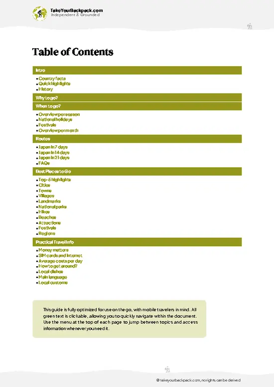
The digital guide (482 pages) contains:
140 highlights, ranked by travel appeal
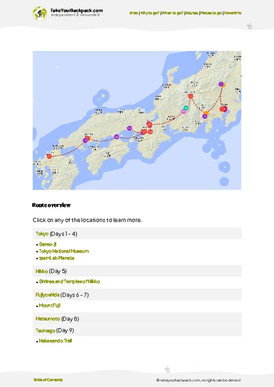
Optimized 7, 14 & 21-day travel routes
Cities, national parks, landmarks, beaches
How to get around
Offline-friendly for travel without Wi-Fi
👉 Click to see all 30+ guide features

📅 Plan smarter in minutes, not weeks
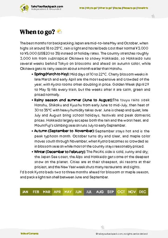
Month by month travel advice
Festivals & national holidays
Budget expectations

🗺️ Go to the right places, skip the overrated ones
Honest pros & cons of destinations
Top hikes, parks & viewpoints
Lesser-known places most travelers miss
Clear “worth it vs skip it” guidance

🛏️ Travel smoothly without rookie mistakes
Best areas to stay
Transport systems explained simply
Common scams & safety advice
SIM cards, money & practical tips

🌍 Understand the country, not just visit it
Culture & traditions
52 Essential phrases & customs
Festivals worth planning around
Traveler-friendly historical context
Insights that make places more meaningful

📱 Built for real travel conditions
Fully downloadable PDF
Works completely offline
Optimized for phone use
Useful in remote areas & buses
Everything in one place
Save weeks of stressful planning
Get instant access to your full guide. 30‑day money-back guarantee.
+ Add another guide for just US$7.80

By proceeding you agree to our terms.
Sent to your inbox immediately after payment • 100% Secure Checkout
Best Backpacking Travel Advisor 2025 tourism awardBest Backpacking
Travel Advisor
2025
What others say about Take Your Backpack Guides:
⭐⭐⭐⭐⭐
Fantastic, amazing amount of information!
⭐⭐⭐⭐⭐
My goodness this is amazing, it's what I've been looking for hats off too you!
⭐⭐⭐⭐⭐
I think this is absolutely BRILLIANT
⭐⭐⭐⭐
Very complete and informative. It's still missing places, but I gotta to commend you
⭐⭐⭐⭐⭐
This is truly amazing, thank you, can't wait to explore it with my kids!
⭐⭐⭐⭐⭐
Awesome resource, thank you!
⭐⭐⭐⭐⭐
This is amazing! Can't wait to explore the ones I haven't seen
⭐⭐⭐⭐
I love this! Well done, great idea.
⭐⭐⭐⭐⭐
Thanks for taking the time to make this gem!
⭐⭐⭐⭐⭐
This might be the best website I've ever seen.
⭐⭐⭐⭐⭐
Congratulations, and thank you so much for your work; it's incredibly valuable.
⭐⭐⭐⭐
In all seriousness I think you did a great job pointing out the important spots
⭐⭐⭐⭐⭐
10/10 very good
⭐⭐⭐⭐⭐
As someone who's only just starting to visit regularly this is awesome, thank you.
⭐⭐⭐⭐
Thank you very much! I'm going to visit my dad, it's going to be very useful!
⭐⭐⭐⭐⭐
This is really cool! We'll be travelling for the first time and this definitely come in handy.
⭐⭐⭐⭐⭐
You are now our minister of culture, congratulations 👨‍💼
⭐⭐⭐⭐⭐
Just wanted to tell you that this is a pearl! Going to follow your recommendations.
⭐⭐⭐⭐⭐
This is so cool. I'll definitely be using the resource for my travels soon.
⭐⭐⭐⭐⭐
This is very impressive! Good work.
⭐⭐⭐⭐⭐
This is an amazing and informative site. Very well done!

🛏️ Where to stay?How to pick the right area

If you enjoy meeting fellow travelers, consider choosing hostels with high ratings for atmosphere. On the other hand, if you prefer having your own space, a hotel might be a better option.

🥾 Hike detailsRoute, distance, and difficulty explained

Total Distance: Approximately 10 kilometers (6.2 miles) round trip, depending on the specific route you take.

Estimated Duration: Expect around 4 to 6 hours. This can vary based on your pace and how long you stop to soak in the views or snap photos.

Difficulty Level: Moderate to challenging. There are some steep sections, especially as you approach the summit, but it’s manageable for those with a decent fitness level.

Starting Point: The trailhead is at the Hakkoda Ropeway Station.
How to Get There by Public Transport: From Aomori City, take a bus to the Hakkoda Ropeway Station. Buses run … read more 👉
Total Distance: Approximately 10 kilometers (6.2 miles) round trip, depending on the specific route you take.

Estimated Duration: Expect around 4 to 6 hours. This can vary based on your pace and how long you stop to soak in the views or snap photos.

Difficulty Level: Moderate to challenging. There are some steep sections, especially as you approach the summit, but it’s manageable for those with a decent fitness level.

Starting Point: The trailhead is at the Hakkoda Ropeway Station.
How to Get There by Public Transport: From Aomori City, take a bus to the Hakkoda Ropeway Station. Buses run regularly, but check the schedule ahead of time, especially in winter.

Major Landmarks Along the Route:
  • Hakkoda Ropeway: This is the starting point and a great way to get a panoramic view of the area before you hike.
  • Mount Tamoyachi: A notable peak along the trail that offers stunning views.
  • Juhyo (Snow Monsters): In winter, you’ll encounter these bizarre ice formations that make for a surreal landscape.

Type of Terrain and Scenery: The trail features a mix of rocky paths, forested areas, and some steep climbs. You’ll be surrounded by lush greenery in the warmer months, and in autumn, the foliage is a riot of colors. If you hike in winter, be prepared for snow and ice, which can add to the challenge.

Typical Vegetation and Wildlife:
  • Vegetation: Expect to see a mix of coniferous trees, like Japanese cedar and fir, along with alpine plants as you gain elevation.
  • Wildlife: Keep an eye out for Japanese macaques, various bird species, and if you’re lucky, you might spot a Japanese black bear from a distance (they usually avoid humans).

For independent hikers, it’s a good idea to bring plenty of water and snacks, as there are no facilities along the trail. Also, check the weather before you head out, as conditions can change quickly in the mountains. Enjoy the hike!
⚠️ Hiking info can sometimes be outdated or inaccurate. Before you hit the trail, check the latest conditions with locals. If you do spot anything that's off, I'd love to hear from you, so I can update it for fellow travelers.

🛡️ SafetyScams, Hazards, and Annoyances

Mount Hakkoda offers a thrilling mix of challenge and beauty. The trails are well-marked, but don’t underestimate the weather. Conditions can shift rapidly; a sunny morning can morph into a misty afternoon. Dress in layers and keep an eye on the forecast.

The terrain varies, with steep sections that demand focus. Watch your footing on rocky paths, especially after rain. Navigation is straightforward, but a map or GPS can be your best friend if the fog rolls in.

Wildlife encounters are rare but possible. If you spot a bear, back away slowly and make noise—don’t run. Most importantly, respect the trail. Stay on marked paths to protect the ecosystem and enjoy the serenity of your surroundings. The reward? A breathtaking view from the summit and the first cold beer at the base.

FAQCommon questions from travelers

The Mount Hakkoda hike typically takes 6 to 8 hours for a round trip, depending on the chosen route and pace. The most popular trail covers about 14 kilometers. Plan for a full day to complete the hike safely.
The hike is considered moderate to difficult due to steep sections and variable weather conditions. Elevation gain is around 1,200 meters, which can be challenging for inexperienced hikers. Proper fitness and preparation are recommended.
No guide or permit is required for hiking Mount Hakkoda during the main season from late spring to early autumn. However, hiring a guide is advisable in winter or for unfamiliar hikers due to snow and avalanche risks. Always check local conditions before your trip.
⚠️ Things can change over time, so always validate details locally before you go.

Other Japanese hikes near Mount Hakkoda

Explore more nearby:

  • Shirakami Sanchi—primeval beech forest, UNESCO wilderness, hidden lakes, wildlife habitat| 65 km away
  • Mount Asahi—active volcano, sulfur vents, alpine flora, Hokkaido’s highest| 370 km away
  • Daisetsuzan Grand Traverse—volcanic ridges, alpine meadows, remote huts, Hokkaido wilderness| 370 km away

💡 Not sure where to go next?
Create a personalized itinerary for Japan including Mount Hakkoda and the places that fit your trip.

Generate my itinerary

👉 Discover all hikes

Or checkout all Japan has to offer (think cities, towns, villages, national parks, hikes, beaches, festivals)
Country photo of Japan

We 💚 feedbackKey takeaways before you go

Mount Hakkoda is a wild playground, where the trails twist through ancient forests and lead to breathtaking views that make every step worth it. But be ready for the weather—it’s unpredictable. One moment, you’re basking in sunshine; the next, you’re battling fog and rain. Embrace the challenge, though. The sense of accomplishment when you finally reach the summit? That’s the real reward.

✈️ When did I visit Japan?
As part of my 1.5 year travel around the world trip, I visited Japan in August 2015.

✍️ Help improve this page!
The information on this page is based on my own backpacking experience in Japan, supplemented with up-to-date research and feedback from other travelers. Travel details can change, so if you notice anything outdated or incomplete, feel free to let me know.


🙋‍♂️ Give feedback

👋 Meet the founderWho’s Behind Take Your Backpack?

Johan, backpacker and founder of TakeYourBackpackHi, I’m Johan (Netherlands 🇳🇱), the creator of TakeYourBackpack. Over the past decade, I’ve backpacked through 80+ countries across six continents, gaining extensive experience with independent travel, long-term trips, and overland routes.

This site is built on a combination of firsthand travel experience and carefully curated insights from other backpackers. Many guides are based on places I’ve personally visited, while others bring together tips, observations, and practical advice shared by trusted travelers I’ve met along the way.

The goal is to provide realistic, experience-driven guidance — not generic itineraries — so you can explore destinations with better context, clearer expectations, and more confidence.

Get full Japan guide •
Instant download • 140 highlights • Full Offline guide