×

Kyrgyzstan🇰🇬 | hikesSary-Chelek LakeReserve permit, turquoise lakes, walnut and apple forests, twin waterfall valleys | things to do and best time to go

Explore Kol TorExplore Song Kol Lake

Backpacking in Sary-Chelek Lake
By Johan Kruseman 🇳🇱 | Updated October 15, 2026

Book your permit and a ride before you leave Jalal-Abad or Arkit, because Sary-Chelek sits inside a strictly protected biosphere reserve in the Chatkal range of western Kyrgyzstan, and you cannot simply show up and walk in. Tickets for the reserve (a few hundred som per day) are sold at the gate, and shared taxis and marshrutkas from Jalal-Abad take about 5 to 6 hours to reach Arkit village, then you hire a car for the final stretch. I stepped out of a battered Lada at the shore, and the lake hit me at once: deep turquoise water ringed by spruce, absolutely silent apart from a woodpecker. The trails are easy. Loop to Lake Iri-Kol or Bahsy-Kol (roughly 4 to 8 km) over soft forest paths, and swim, picnic, or camp. Transport is slow and costly compared with Song-Kol or Ala-Kul. The payoff is solitude those busier hikes rarely give you.

Discover everything you want to know in the 📖 Kyrgyzstan Travel Guide.
Best time to go: May - September
Duration: 2 days
Distance: 20 kilometers
Total ascent: 600 meters


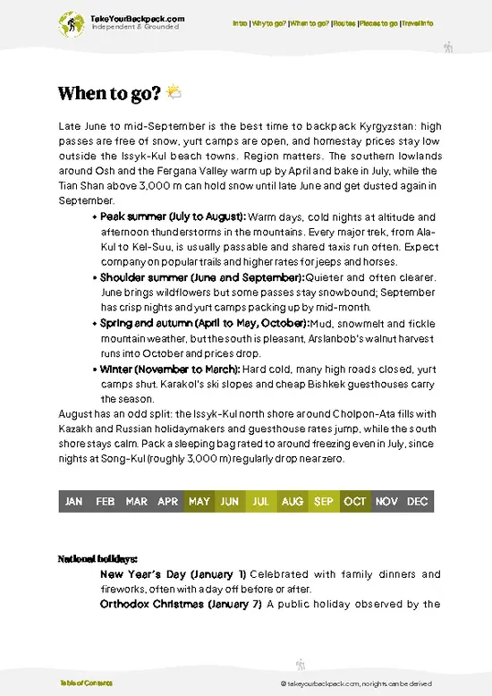
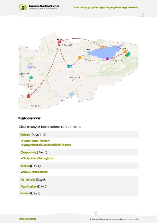
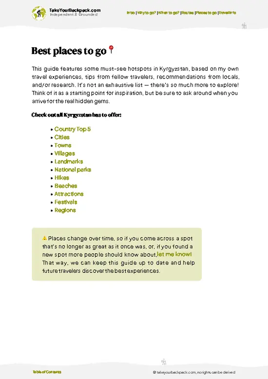
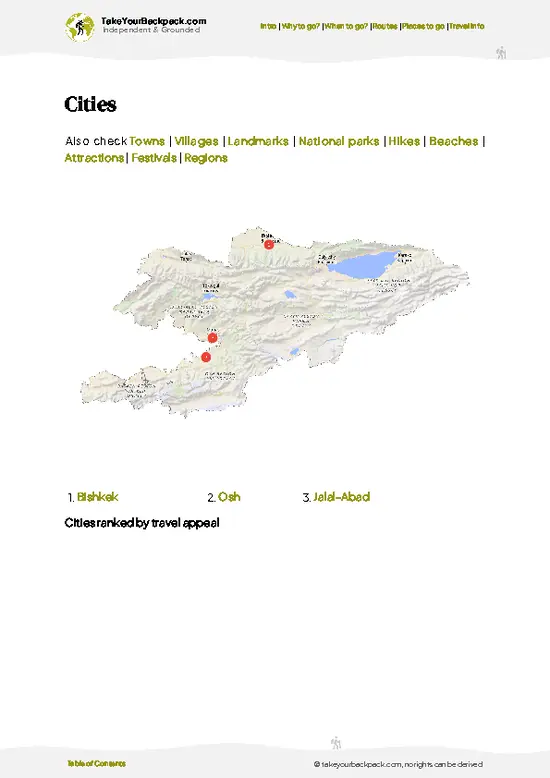
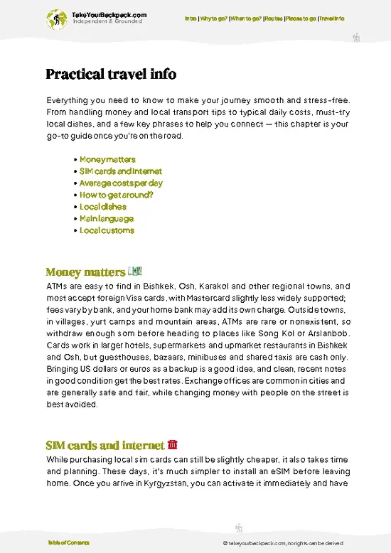
example page 0 from our offline Travel Guide for Kyrgyzstan
example page 1 from our offline Travel Guide for Kyrgyzstan
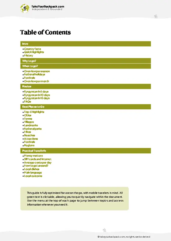
example page 2 from our offline Travel Guide for Kyrgyzstan
example page 3 from our offline Travel Guide for Kyrgyzstan
example page 4 from our offline Travel Guide for Kyrgyzstan
example page 5 from our offline Travel Guide for Kyrgyzstan
example page 6 from our offline Travel Guide for Kyrgyzstan
example page 7 from our offline Travel Guide for Kyrgyzstan
Loading the map 🌍
CLICK TO FILTER
cities
towns
villages
landmarks
national parks
hikes
beaches
attractions
festivals
regions
SHOW COUNTRY’S BESTSHOW ALL

✨ Why go?
Ranked #99 hike in Kyrgyzstan
What makes this hike worth hiking

Backpackers come for big scenery without big mileage. Lakes, forest and ridgelines pack into day hikes of 2 to 6 hours, so you can set your own pace. Public transport gets you as far as Arkit or Jalal-Abad, and a shared 4x4 split among travelers keeps the last leg manageable. Costs stay modest if you camp or use a basic homestay, with the reserve fee paid at the gate. Flexible distances mean you can do a short loop to Lake Sary-Chelek, push on to Aigul-Köl and Kyldyrama, or string several days together. The reserve fits neatly into a longer Kyrgyz route, either as a detour from the Fergana Valley or a western counterpart to Issyk-Kul and Song-Kul. You also get real wilderness, with wild fruit forests, few other hikers and a good chance of hearing more birds than people.

💡 HighlightsWhat this place is best known for

  1. Lake Sary-Chelek: The largest lake, at about 1,873 meters, glows deep turquoise and is ringed by spruce-covered slopes. It sits roughly 7 km long and is the natural start for any visit, with calm shoreline paths and picnic spots.
  2. Aigul-Köl: A smaller lake reached on a trail past the main lake, it is quieter and its clear water reflects the steep forested hillsides. It is a rewarding add-on for hikers who want solitude.
  3. Wild fruit and nut forests: The reserve protects ancient groves of wild apple, walnut and other trees. In autumn you can eat fallen apples on the trail, which is a rare treat in Central Asia.
  4. Kyldyrama and Kyzyl-Köl waterfalls and valleys: Side valleys lead to cascades and views across the Chatkal ridgelines. The paths are rougher, so they suit those who want a longer day.
  5. Wildlife
… read more 👉
  1. Lake Sary-Chelek: The largest lake, at about 1,873 meters, glows deep turquoise and is ringed by spruce-covered slopes. It sits roughly 7 km long and is the natural start for any visit, with calm shoreline paths and picnic spots.
  2. Aigul-Köl: A smaller lake reached on a trail past the main lake, it is quieter and its clear water reflects the steep forested hillsides. It is a rewarding add-on for hikers who want solitude.
  3. Wild fruit and nut forests: The reserve protects ancient groves of wild apple, walnut and other trees. In autumn you can eat fallen apples on the trail, which is a rare treat in Central Asia.
  4. Kyldyrama and Kyzyl-Köl waterfalls and valleys: Side valleys lead to cascades and views across the Chatkal ridgelines. The paths are rougher, so they suit those who want a longer day.
  5. Wildlife and birdlife: The reserve shelters brown bears, lynx, maral deer and many bird species. Sightings are uncommon, but tracks and birdsong make the forest feel alive.
I would pick Lake Sary-Chelek first. It is the easiest way to feel the reserve's scale, and dawn light on that water sets up everything else.
Spotted a mistake or missing something? Contact us.

🌤️ When to go?Choosing the right time of year

  • Summer (June to August): The best window for hiking, with daytime highs of 22 to 28°C (72 to 82°F) at lake level and cool nights of 8 to 12°C (46 to 54°F). Days run about 14 to 15 hours long. Expect the most Kyrgyz and foreign visitors in July and August, plus the highest guesthouse and permit-linked prices.
  • Early Autumn (September to mid-October): Walnut and apple forests turn gold, crowds thin out, and highs sit around 12 to 20°C (54 to 68°F). Nights drop toward 0°C (32°F) at higher elevations. Days shorten to about 11 to 12 hours.
  • Spring (May): Greener and quieter, with highs of 12 to 20°C (54 to 68°F), but rain is frequent and the access road can turn muddy. Some higher trails still hold snow.
  • Winter (November to March): Heavy snow often closes the road and reserve services, and temperatures
… read more 👉
  • Summer (June to August): The best window for hiking, with daytime highs of 22 to 28°C (72 to 82°F) at lake level and cool nights of 8 to 12°C (46 to 54°F). Days run about 14 to 15 hours long. Expect the most Kyrgyz and foreign visitors in July and August, plus the highest guesthouse and permit-linked prices.
  • Early Autumn (September to mid-October): Walnut and apple forests turn gold, crowds thin out, and highs sit around 12 to 20°C (54 to 68°F). Nights drop toward 0°C (32°F) at higher elevations. Days shorten to about 11 to 12 hours.
  • Spring (May): Greener and quieter, with highs of 12 to 20°C (54 to 68°F), but rain is frequent and the access road can turn muddy. Some higher trails still hold snow.
  • Winter (November to March): Heavy snow often closes the road and reserve services, and temperatures fall well below freezing, so this is not a backpacking season.
Book a late June or early September visit to get stable weather without the peak-summer crowds and prices.


source: climatestotravel.comJANJanuary: below average for travelingFEBFebruary: below average for travelingMARMarch: fair for travelingAPRApril: fair for travelingMAYMay: good for travelingJUNJune: highly recommended for travelingJULJuly: excellent for travelingAUGAugust: excellent for travelingSEPSeptember: highly recommended for travelingOCTOctober: fair for travelingNOVNovember: below average for travelingDECDecember: below average for traveling
when-to-go

✈️ The backpacker research shortcutKyrgyzstan Travel Guide

An offline-friendly backpacking guide with optimized travel routes, ranked highlights, transport advice, and the best areas to stay.
example page 0 from our offline Travel Guide for Kyrgyzstan
example page 1 from our offline Travel Guide for Kyrgyzstan
example page 2 from our offline Travel Guide for Kyrgyzstan
example page 3 from our offline Travel Guide for Kyrgyzstan
example page 4 from our offline Travel Guide for Kyrgyzstan
example page 5 from our offline Travel Guide for Kyrgyzstan
example page 6 from our offline Travel Guide for Kyrgyzstan
example page 7 from our offline Travel Guide for Kyrgyzstan
The digital guide (242 pages) contains:
✅ 73 highlights, ranked by travel appeal
✅ Optimized 5, 10 & 15-day travel routes
✅ Cities, national parks, landmarks, beaches
✅ How to get around
✅ Offline-friendly for travel without Wi-Fi
👉 Click to see all 30+ guide features

📅 Plan smarter in minutes, not weeks
✅ Month by month travel advice
✅ Festivals & national holidays
✅ Budget expectations

🗺️ Go to the right places, skip the overrated ones
✅ Honest pros & cons of destinations
✅ Top hikes, parks & viewpoints
✅ Lesser-known places most travelers miss
✅ Clear “worth it vs skip it” guidance

🛏️ Travel smoothly without rookie mistakes
✅ Best areas to stay
✅ Transport systems explained simply
✅ Common scams & safety advice
✅ SIM cards, money & practical tips

🌍 Understand the country, not just visit it
✅ Culture & traditions
✅ 52 Essential phrases & customs
✅ Festivals worth planning around
✅ Traveler-friendly historical context
✅ Insights that make places more meaningful

📱 Built for real travel conditions
✅ Fully downloadable PDF
✅ Works completely offline
✅ Optimized for phone use
✅ Useful in remote areas & buses
✅ Everything in one place
Stop searching, start planning
Get instant access to your full guide. 30‑day money-back guarantee.
+ Add another guide for just

By proceeding you agree to our terms.
Sent to your inbox immediately after payment • 100% Secure Checkout
Best Backpacking Travel Advisor 2025 tourism awardBest Backpacking
Travel Advisor
2025
What others say about Take Your Backpack Guides:
⭐⭐⭐⭐⭐
Fantastic, amazing amount of information!
⭐⭐⭐⭐⭐
My goodness this is amazing, it's what I've been looking for hats off too you!
⭐⭐⭐⭐⭐
I think this is absolutely BRILLIANT
⭐⭐⭐⭐
Very complete and informative. It's still missing places, but I gotta to commend you
⭐⭐⭐⭐⭐
This is truly amazing, thank you, can't wait to explore it with my kids!
⭐⭐⭐⭐⭐
Awesome resource, thank you!
⭐⭐⭐⭐⭐
This is amazing! Can't wait to explore the ones I haven't seen
⭐⭐⭐⭐
I love this! Well done, great idea.
⭐⭐⭐⭐⭐
Thanks for taking the time to make this gem!
⭐⭐⭐⭐⭐
This might be the best website I've ever seen.
⭐⭐⭐⭐⭐
Congratulations, and thank you so much for your work; it's incredibly valuable.
⭐⭐⭐⭐
In all seriousness I think you did a great job pointing out the important spots
⭐⭐⭐⭐⭐
10/10 very good
⭐⭐⭐⭐⭐
As someone who's only just starting to visit regularly this is awesome, thank you.
⭐⭐⭐⭐
Thank you very much! I'm going to visit my dad, it's going to be very useful!
⭐⭐⭐⭐⭐
This is really cool! We'll be travelling for the first time and this definitely come in handy.
⭐⭐⭐⭐⭐
You are now our minister of culture, congratulations 👨‍💼
⭐⭐⭐⭐⭐
Just wanted to tell you that this is a pearl! Going to follow your recommendations.
⭐⭐⭐⭐⭐
This is so cool. I'll definitely be using the resource for my travels soon.
⭐⭐⭐⭐⭐
This is very impressive! Good work.
⭐⭐⭐⭐⭐
This is an amazing and informative site. Very well done!

🛏️ Where to stay?Choosing the right base

If you enjoy meeting fellow travelers, consider choosing hostels with high ratings for atmosphere. On the other hand, if you prefer having your own space, a hotel might be a better option.

🥾 Hike detailsEverything you need to know before hiking Sary-Chelek Lake

Total Distance: Roughly 5 to 25 km depending on how many lakes you link.
Estimated Duration: Half a day for the main lake, 1 to 3 days for multiple lakes.
Difficulty: Easy to moderate, with some rough, steep forest tracks to the far lakes.
Starting Point: Reserve gate near Lake Sary-Chelek.
  • Public transport: Shared taxis or minibuses run to Arkit from Jalal-Abad and Kazarman.
  • Last stretch: Hire a 4x4 or arrange a homestay transfer on the dirt road.
Major Landmarks:
  • Sary-Chelek Lake: The main turquoise lake.
  • Aigul-Köl: A quieter lake farther along the trail.
  • Kyldyrama: Side valley with waterfalls and forest.
… read more 👉
Total Distance: Roughly 5 to 25 km depending on how many lakes you link.
Estimated Duration: Half a day for the main lake, 1 to 3 days for multiple lakes.
Difficulty: Easy to moderate, with some rough, steep forest tracks to the far lakes.
Starting Point: Reserve gate near Lake Sary-Chelek.
  • Public transport: Shared taxis or minibuses run to Arkit from Jalal-Abad and Kazarman.
  • Last stretch: Hire a 4x4 or arrange a homestay transfer on the dirt road.
Major Landmarks:
  • Sary-Chelek Lake: The main turquoise lake.
  • Aigul-Köl: A quieter lake farther along the trail.
  • Kyldyrama: Side valley with waterfalls and forest.
Terrain and Scenery: Forest paths, lakeshore tracks, steep slopes and ridge views across the western Tien Shan.
Vegetation: Spruce, walnut, wild apple, juniper and meadow flowers in summer.
Wildlife: Brown bears, lynx, maral deer and many birds. Keep food stored and hike in groups.
⚠️ Hiking info can sometimes be outdated or inaccurate. Before you hit the trail, check the latest conditions with locals. If you do spot anything that's off, I'd love to hear from you, so I can update it for fellow travelers.

🛡️ SafetyScams, Hazards, and Annoyances

Sary-Chelek is a moderate, well-trodden reserve where the main hazards are weather and logistics, not danger. Afternoon thunderstorms are common in summer, and temperatures drop quickly after dark, so pack a rain shell and a warm layer even in July. Trails to the smaller lakes are steep and can be slick after rain, so trekking poles and shoes with real grip help. Navigation is mostly straightforward, but side paths fork in the forest, so download an offline map. Brown bears live in the reserve but rarely meet hikers. Make noise on blind corners, store food away from your tent, and never approach cubs. Entry requires a reserve permit and, for foreigners, a border-zone permit arranged in advance, which catches many first-timers out. Mobile coverage is patchy, so tell your guesthouse your route and carry water treatment.

FAQCommon questions from travelers

Plan on half a day for the main lake or two to three days for the longer lake circuit. Walking around Lake Sary-Chelek takes about 2 to 4 hours. Reaching Aigul-Köl and other side valleys adds a full day or an overnight at a lakeside homestay or campsite.
Most routes are easy to moderate. The lakeshore paths are flat, while the trails to Aigul-Köl and Kyldyrama climb through forest on uneven tracks. Altitude is about 1,800 to 2,000 meters at the lakes, so it is less taxing than Kyrgyzstan's high passes.
A permit is required, but a guide usually is not. Entry to the biosphere reserve is paid at the gate, and visiting the border zone may need a separate permit arranged through the reserve office or a local operator. Many travelers hire a driver or homestay host from Arkit or Jalal-Abad to handle the paperwork and transport.
⚠️ Things can change over time, so always validate details locally before you go.

Other Kyrgyz hikes near Sary-Chelek Lake

Explore more nearby:

  • Arslanbob Walnut Forest—Walnut groves, twin waterfalls, village homestays, Jalal-Abad hills| 102 km away
  • Bant Suusu—Remote valley, high meadows, shepherd tracks, self-sufficient stages| 210 km away
  • Belogorka Waterfall—Bishkek day trip, narrow gorge, short waterfall, village trailhead| 211 km away

💡 Not sure where to go next?
Create a personalized itinerary for Kyrgyzstan including Sary-Chelek Lake and the places that fit your trip.

Generate my itinerary

👉 Discover all hikes

Or checkout all Kyrgyzstan has to offer (think cities, towns, villages, national parks, hikes, beaches, festivals)
Country photo of Kyrgyzstan

We 💚 feedbackParting advice and final tips

Sary-Chelek is worth it for the quiet. Standing beside turquoise water with only birds and wind for company is rare, even in Kyrgyzstan. The honest catch is access: no easy bus to the gate, a gate fee, and a bumpy 4x4 ride. If you want a quick, cheap, spontaneous day hike, this will frustrate you.

✈️ When did I visit Kyrgyzstan?
I started my 1.5 year travel around the world trip in June 2015 in Kyrgyzstan.

✍️ Help improve this page!
The information on this page is based on my own backpacking experience in Kyrgyzstan, supplemented with up-to-date research and feedback from other travelers. Travel details can change, so if you notice anything outdated or incomplete, feel free to let me know.


🙋‍♂️ Give feedback

👋 Meet the founderWho’s Behind Take Your Backpack?

Johan, backpacker and founder of TakeYourBackpackHi, I’m Johan (Netherlands 🇳🇱), the creator of TakeYourBackpack. Over the past 3 decades, I’ve backpacked through 90+ countries across six continents, gaining extensive experience with independent travel, long-term trips, and overland routes.

This site is built on a combination of firsthand travel experience and carefully curated insights from other backpackers. Many guides are based on places I’ve personally visited, while others bring together tips, observations, and practical advice shared by trusted travelers I’ve met along the way.

The goal is to provide realistic, experience-driven guidance — not generic itineraries — so you can explore destinations with better context, clearer expectations, and more confidence.