×

Kyrgyzstan🇰🇬 | hikesBant Suusualpine meadows, wildflower slopes, panoramic ridges | things to do and best time to go

Explore Köl-Suu LakeExplore Ak Kayyn

Backpacking in Bant Suusu
👀 For curious travelershike ranked #11
By Johan Kruseman 🇳🇱 | Updated June 11, 2026

Most travelers only realize after the fact: Bant Suusu’s trailhead sits close enough to Karakol that you can skip the expensive jeep hire and just hop a marshrutka, saving your cash for the post-hike feast. Tucked in the northeast corner of Kyrgyzstan, Bant Suusu is a punchy, lesser-known alternative to the overrun Ala-Kul circuit. The hike itself is a test—steep switchbacks, loose scree, and the kind of altitude that makes your lungs sting, but the payoff is a high-mountain valley where wildflowers riot and the air tastes like snowmelt. You’ll pass herders’ yurts and, if you’re lucky, get offered kumis that’ll make your eyes water. The route isn’t long—about 16 km round-trip—but the elevation gain is real, and the weather can turn on you fast. Unlike the Instagram parade at Jeti-Ögüz, here you’ll earn your solitude. Bant Suusu isn’t easy, but it’s honest, and the silence at the top is worth every burning calf.

Discover everything you want to know in the 📖 Kyrgyzstan Travel Guide.
Loading the map 🌍
CLICK TO FILTER
cities
towns
villages
landmarks
national parks
hikes
beaches
attractions
festivals
regions
SHOW COUNTRY’S BESTSHOW ALL

✨ Why go?
Ranked #11 hike in Kyrgyzstan
Reasons people choose to hike the here

Bant Suusu in Kyrgyzstan pulls backpackers because it hits the sweet spot between challenge and reward. The trail demands grit—expect rocky paths, sudden climbs, and the kind of burn in your legs that reminds you you’re alive. But the payoff? Jaw-dropping mountain panoramas that stretch wide and wild, untouched by crowds or commercial polish. The scenery-to-effort ratio here is no joke: every step forward earns you a fresh, raw view of Kyrgyzstan’s rugged spine.

Getting there is straightforward. Public transport from Bishkek or Karakol drops you close enough to start without hassle or high cost. This low barrier means you can slot Bant Suusu into a longer trek without breaking your budget or your schedule. The trail’s flexible distances let you tailor the hike—whether you want a quick day … read more 👉
Bant Suusu in Kyrgyzstan pulls backpackers because it hits the sweet spot between challenge and reward. The trail demands grit—expect rocky paths, sudden climbs, and the kind of burn in your legs that reminds you you’re alive. But the payoff? Jaw-dropping mountain panoramas that stretch wide and wild, untouched by crowds or commercial polish. The scenery-to-effort ratio here is no joke: every step forward earns you a fresh, raw view of Kyrgyzstan’s rugged spine.

Getting there is straightforward. Public transport from Bishkek or Karakol drops you close enough to start without hassle or high cost. This low barrier means you can slot Bant Suusu into a longer trek without breaking your budget or your schedule. The trail’s flexible distances let you tailor the hike—whether you want a quick day trip or a multi-day push through alpine meadows and crystal-clear streams.

Bant Suusu isn’t just a hike; it’s a gritty, authentic slice of Central Asia that fits seamlessly into a broader backpacking route. It’s the kind of trail where the sweat and sore muscles fade the moment you crack open a cold drink at camp, knowing you earned every inch of that view.
Want to include Bant Suusu in your Kyrgyzstan route?
Create a personalized Kyrgyzstan itinerary that includes Bant Suusu and the places that fit your trip — based on your travel style, budget, and available time. Get your route in seconds.

Generate my trip

💡 HighlightsMust-see experiences and standout moments

1. The High Alpine Pass (Ala-Bel Ashuu)
You earn every meter of this climb. The trail grinds upward through switchbacks, your calves screaming, the air thinning, and the wind biting through your jacket. But then you crest the pass and the world splits open—jagged peaks, snowfields, and a silence so complete it feels like you’ve stepped off the map. This isn’t a view you get from a bus window. You feel it in your lungs, your legs, your sweat-soaked shirt. The reward: a panorama that makes you forget the ache and reminds you why you hike. This is the moment you realize you’re in the heart of the Tien Shan, not just looking at it.

2. Wild Horse Meadows
You drop down from the pass and the landscape softens. The trail cuts through rolling grasslands where herds of Kyrgyz horses graze, manes tangled … read more 👉
1. The High Alpine Pass (Ala-Bel Ashuu)
You earn every meter of this climb. The trail grinds upward through switchbacks, your calves screaming, the air thinning, and the wind biting through your jacket. But then you crest the pass and the world splits open—jagged peaks, snowfields, and a silence so complete it feels like you’ve stepped off the map. This isn’t a view you get from a bus window. You feel it in your lungs, your legs, your sweat-soaked shirt. The reward: a panorama that makes you forget the ache and reminds you why you hike. This is the moment you realize you’re in the heart of the Tien Shan, not just looking at it.

2. Wild Horse Meadows
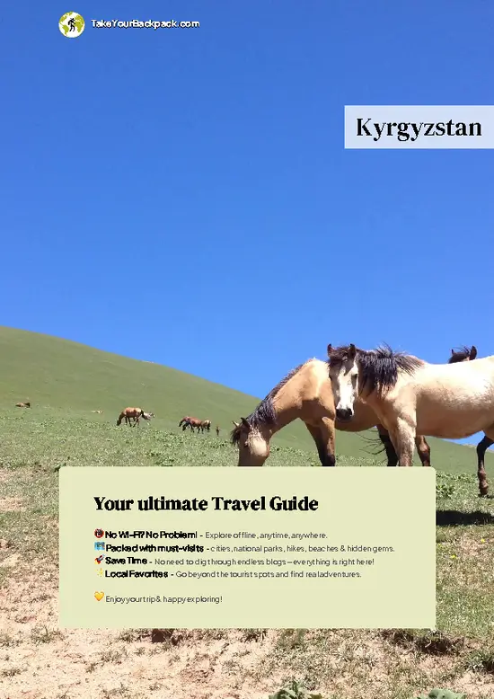
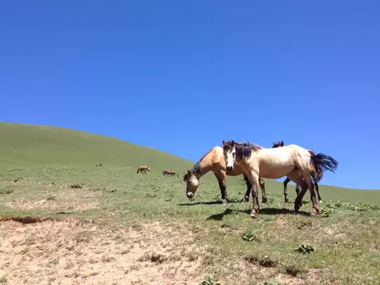
You drop down from the pass and the landscape softens. The trail cuts through rolling grasslands where herds of Kyrgyz horses graze, manes tangled by the wind. There’s no fence, no sign of civilization—just the thud of hooves and the occasional snort as a stallion eyes you from a distance. The horses here aren’t just scenery; they’re part of the story, living echoes of nomadic life. If you’re lucky, you’ll catch a foal wobbling on new legs or a herder riding bareback, moving with the kind of ease that only comes from a lifetime in the saddle.

3. Yurt Encampments
You round a bend and suddenly there’s smoke curling from a felt yurt, the smell of woodfire and boiling tea drifting on the breeze. The families here might wave you over—don’t be shy. Inside, you’ll find warmth, salty ayran, and maybe a bowl of laghman noodles if you’re lucky. The hospitality is real, not staged for tourists. You sit cross-legged, boots off, and trade stories with people who measure distance in days, not kilometers. This is where the trail’s grit pays off: you’re not just passing through, you’re part of the rhythm of the land, if only for a night. This one’s my personal favorite—nothing beats the feeling of being welcomed as a stranger and leaving as a friend.

4. The Glacial Tarn
The trail veers off the main valley, and suddenly you’re scrambling over scree, boots scraping rock, until you reach a bowl of turquoise water cradled by cliffs. The lake is icy, fed by meltwater, and so clear you can count the stones on the bottom. Dip your hands in—instant brain freeze. The air smells of lichen and cold stone. It’s the kind of place that feels secret, like you’ve stumbled onto something ancient and untouched. The silence here is total, broken only by the distant crack of shifting ice.

5. Edelweiss Ridge
Late in the season, the slopes explode with wildflowers, but Edelweiss steals the show. You spot the fuzzy white stars clinging to the rocks, a living badge of altitude. The ridge itself is exposed, the wind relentless, but the flowers are stubborn—thriving where most things give up. You press on, boots crunching over gravel, and realize you’re walking through a living postcard. The reward isn’t just the view, but the sense of being somewhere rare, somewhere that demands effort and pays it back in spades.
Spotted a mistake or missing something? Contact us.

Things to do near Bant Suusu

Ratings based on Tripadvisor reviews. When you book through this link, you support our work at no extra cost to you.

🌤️ When to go?When to go for the best experience


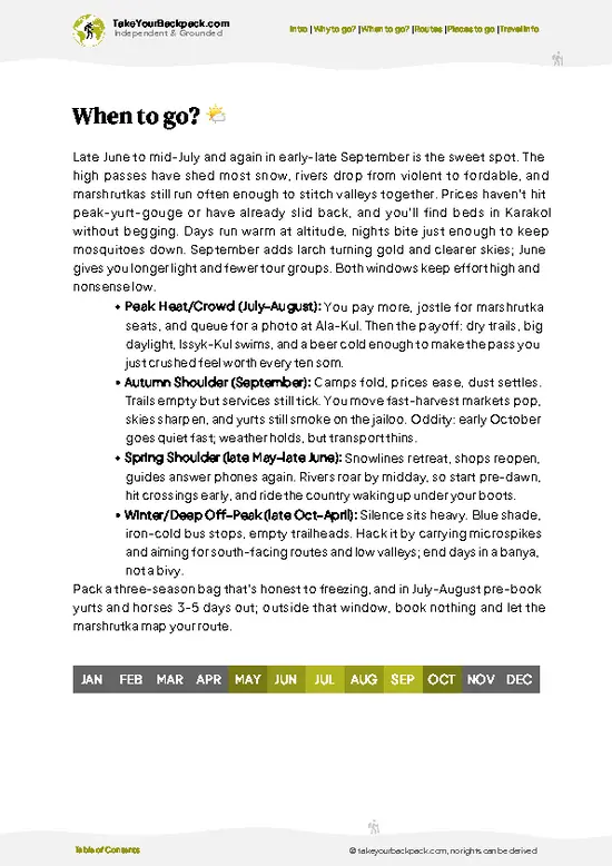
  • Topic: Weather – The prime window for Bant Suusu is June through September. Early summer brings melting snow and soggy trails, while July and August offer dry, stable conditions perfect for pounding the dirt. By late September, expect crisp air and the first hints of frost.

  • Topic: Temperature – Daytime highs in summer hover around 20-25°C (68-77°F), comfortable for long hikes without overheating. Nights dip to 5-10°C (41-50°F), so pack layers. Outside this window, temperatures can plunge below freezing, turning the trail into a slippery challenge.

  • Topic: Daylight Hours – Peak summer grants up to 15 hours of daylight, stretching your trekking window and letting you chase the sun without rushing. Early June is golden for early starts and late finishes; by September, days shrink to about
read more 👉

  • Topic: Weather – The prime window for Bant Suusu is June through September. Early summer brings melting snow and soggy trails, while July and August offer dry, stable conditions perfect for pounding the dirt. By late September, expect crisp air and the first hints of frost.

  • Topic: Temperature – Daytime highs in summer hover around 20-25°C (68-77°F), comfortable for long hikes without overheating. Nights dip to 5-10°C (41-50°F), so pack layers. Outside this window, temperatures can plunge below freezing, turning the trail into a slippery challenge.

  • Topic: Daylight Hours – Peak summer grants up to 15 hours of daylight, stretching your trekking window and letting you chase the sun without rushing. Early June is golden for early starts and late finishes; by September, days shrink to about 11 hours, demanding tighter planning.

  • Topic: Crowds – July and August attract the bulk of backpackers and local hikers, especially weekends. If you crave solitude, aim for June or early September when the trail thins out but conditions remain solid.

  • Topic: Seasonal Activities – Summer opens up opportunities beyond hiking—horseback rides, fishing, and local festivals. These add layers to your trip but also bump up demand and prices.

  • Topic: Price Fluctuations – Accommodation and guide fees peak mid-summer. Booking in June or September can save you cash without sacrificing much on trail quality or weather.


Pro-tip: Hit Bant Suusu in early September for a sweet spot of thinning crowds, stable weather, and wallet-friendly rates—plus the trail’s colors start shifting, rewarding your effort with a fresh palette.


source: climatestotravel.comJANJanuary: below average for travelingFEBFebruary: below average for travelingMARMarch: fair for travelingAPRApril: fair for travelingMAYMay: good for travelingJUNJune: highly recommended for travelingJULJuly: excellent for travelingAUGAugust: excellent for travelingSEPSeptember: highly recommended for travelingOCTOctober: fair for travelingNOVNovember: below average for travelingDECDecember: below average for traveling
when-to-go

✈️ The backpacker research shortcutKyrgyzstan Travel Guide

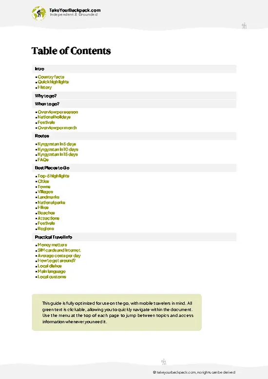
An offline-friendly backpacking guide with optimized travel routes, ranked highlights, transport advice, and the best areas to stay.
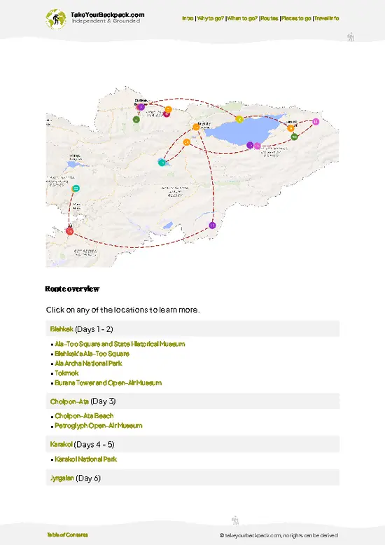
example page 0 from our offline Travel Guide for Kyrgyzstan
example page 1 from our offline Travel Guide for Kyrgyzstan
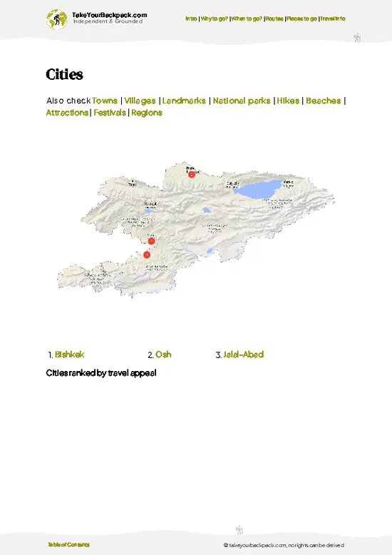
example page 2 from our offline Travel Guide for Kyrgyzstan
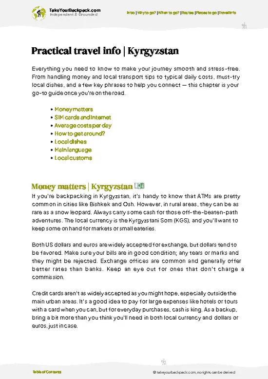
example page 3 from our offline Travel Guide for Kyrgyzstan
example page 4 from our offline Travel Guide for Kyrgyzstan
example page 5 from our offline Travel Guide for Kyrgyzstan
example page 6 from our offline Travel Guide for Kyrgyzstan
example page 7 from our offline Travel Guide for Kyrgyzstan
The digital guide (322 pages) contains:
83 highlights, ranked by travel appeal
Optimized 5, 10 & 15-day travel routes
Cities, national parks, landmarks, beaches
How to get around
Offline-friendly for travel without Wi-Fi
👉 Click to see all 30+ guide features

📅 Plan smarter in minutes, not weeks
Month by month travel advice
Festivals & national holidays
Budget expectations

🗺️ Go to the right places, skip the overrated ones
Honest pros & cons of destinations
Top hikes, parks & viewpoints
Lesser-known places most travelers miss
Clear “worth it vs skip it” guidance

🛏️ Travel smoothly without rookie mistakes
Best areas to stay
Transport systems explained simply
Common scams & safety advice
SIM cards, money & practical tips

🌍 Understand the country, not just visit it
Culture & traditions
52 Essential phrases & customs
Festivals worth planning around
Traveler-friendly historical context
Insights that make places more meaningful

📱 Built for real travel conditions
Fully downloadable PDF
Works completely offline
Optimized for phone use
Useful in remote areas & buses
Everything in one place
Save weeks of stressful planning
Get instant access to your full guide. 30‑day money-back guarantee.


By proceeding you agree to our terms.
Sent to your inbox immediately after payment • 100% Secure Checkout
Best Backpacking Travel Advisor 2025 tourism awardBest Backpacking
Travel Advisor
2025
What others say about Take Your Backpack Guides:
⭐⭐⭐⭐⭐
Fantastic, amazing amount of information!
⭐⭐⭐⭐⭐
My goodness this is amazing, it's what I've been looking for hats off too you!
⭐⭐⭐⭐⭐
I think this is absolutely BRILLIANT
⭐⭐⭐⭐
Very complete and informative. It's still missing places, but I gotta to commend you
⭐⭐⭐⭐⭐
This is truly amazing, thank you, can't wait to explore it with my kids!
⭐⭐⭐⭐⭐
Awesome resource, thank you!
⭐⭐⭐⭐⭐
This is amazing! Can't wait to explore the ones I haven't seen
⭐⭐⭐⭐
I love this! Well done, great idea.
⭐⭐⭐⭐⭐
Thanks for taking the time to make this gem!
⭐⭐⭐⭐⭐
This might be the best website I've ever seen.
⭐⭐⭐⭐⭐
Congratulations, and thank you so much for your work; it's incredibly valuable.
⭐⭐⭐⭐
In all seriousness I think you did a great job pointing out the important spots
⭐⭐⭐⭐⭐
10/10 very good
⭐⭐⭐⭐⭐
As someone who's only just starting to visit regularly this is awesome, thank you.
⭐⭐⭐⭐
Thank you very much! I'm going to visit my dad, it's going to be very useful!
⭐⭐⭐⭐⭐
This is really cool! We'll be travelling for the first time and this definitely come in handy.
⭐⭐⭐⭐⭐
You are now our minister of culture, congratulations 👨‍💼
⭐⭐⭐⭐⭐
Just wanted to tell you that this is a pearl! Going to follow your recommendations.
⭐⭐⭐⭐⭐
This is so cool. I'll definitely be using the resource for my travels soon.
⭐⭐⭐⭐⭐
This is very impressive! Good work.
⭐⭐⭐⭐⭐
This is an amazing and informative site. Very well done!

🛏️ Where to stay?How to pick the right area

If you enjoy meeting fellow travelers, consider choosing hostels with high ratings for atmosphere. On the other hand, if you prefer having your own space, a hotel might be a better option.

🥾 Hike detailsA practical overview of the hike

Total Distance: Roughly 18 kilometers round trip. This isn’t a stroll in the park; it demands commitment but rewards with every step.

Estimated Duration: Plan for 6 to 8 hours. The trail’s pace depends on your fitness and how often you stop to soak in the views or catch your breath.

Difficulty: Moderate to challenging. Expect steep ascents, rocky paths, and some scrambling. It’s not for the faint-hearted but manageable for anyone with decent hiking experience and a good pair of boots.

Starting Point: The trail kicks off at the village of Sary-Bulak, accessible by marshrutka (shared minibus) … read more 👉
Total Distance: Roughly 18 kilometers round trip. This isn’t a stroll in the park; it demands commitment but rewards with every step.

Estimated Duration: Plan for 6 to 8 hours. The trail’s pace depends on your fitness and how often you stop to soak in the views or catch your breath.

Difficulty: Moderate to challenging. Expect steep ascents, rocky paths, and some scrambling. It’s not for the faint-hearted but manageable for anyone with decent hiking experience and a good pair of boots.

Starting Point: The trail kicks off at the village of Sary-Bulak, accessible by marshrutka (shared minibus) from Karakol. The ride takes about 1.5 hours, weaving through mountain roads that set the tone for what’s ahead. From the village center, the trailhead is a short walk—look for worn signs and local chatter.

Major Landmarks:
  • Altyn Arashan Hot Springs: The trail’s highlight. Natural thermal pools steaming against a backdrop of snow-capped peaks. Perfect for a post-hike soak that melts every ache.
  • Waterfalls: Several cascades punctuate the route, their roar a constant companion. The biggest drop near the midpoint is a prime spot for a break.
  • Alpine Meadows: Wide, flower-strewn expanses that open up after the forested lower slopes. They offer panoramic views of the Terskey Alatau range.

Terrain and Scenery: The trail shifts from dense spruce and fir forests to open alpine zones. Expect rocky stretches, muddy patches after rain, and narrow ledges hugging cliffs. The air thins as you climb, sharpening your senses. The payoff is a sweeping vista of jagged peaks and glacial valleys that feel like the edge of the world.

Vegetation: Lower sections are thick with conifers and wild raspberries. Higher up, the forest gives way to hardy shrubs and wildflowers like edelweiss and alpine asters, clinging to rocky soil.

Wildlife: Keep your eyes peeled for marmots whistling from rocks, nimble ibex scaling cliffs, and the occasional golden eagle circling overhead. Birdsong and the rustle of small mammals add life to the silence.

This trail demands grit but delivers a raw, unfiltered slice of Kyrgyzstan’s wild heart. The burn in your legs fades when you slide into those hot springs, the steam rising as the mountain sun dips behind the peaks. That’s the moment you know every step was worth it.
⚠️ Hiking info can sometimes be outdated or inaccurate. Before you hit the trail, check the latest conditions with locals. If you do spot anything that's off, I'd love to hear from you, so I can update it for fellow travelers.

🛡️ SafetyTraveler Safety Guide

Bant Suusu’s trail demands respect but doesn’t punish recklessness with drama. Weather shifts fast here—sun can scorch by midday, then clouds roll in, dropping temps and slickening rocks. Layer smart: a breathable shell and sturdy boots with solid grip are your best friends. The trail’s steep in spots, especially near river crossings where footing gets tricky on wet stones. Take your time; rushing invites slips. Navigation is straightforward, marked well enough to keep you on track without a guide, but a map or GPS app is a wise backup.

Altitude isn’t extreme but expect thinner air to sap energy faster than you’d think. Pace yourself—start early to avoid afternoon heat and sudden storms. Wildlife is shy; you might spot marmots or birds, but larger animals keep their distance. Respect their … read more 👉
Bant Suusu’s trail demands respect but doesn’t punish recklessness with drama. Weather shifts fast here—sun can scorch by midday, then clouds roll in, dropping temps and slickening rocks. Layer smart: a breathable shell and sturdy boots with solid grip are your best friends. The trail’s steep in spots, especially near river crossings where footing gets tricky on wet stones. Take your time; rushing invites slips. Navigation is straightforward, marked well enough to keep you on track without a guide, but a map or GPS app is a wise backup.

Altitude isn’t extreme but expect thinner air to sap energy faster than you’d think. Pace yourself—start early to avoid afternoon heat and sudden storms. Wildlife is shy; you might spot marmots or birds, but larger animals keep their distance. Respect their space, stash food securely, and don’t feed anything. The biggest surprise for newcomers is underestimating the trail’s physical demands and overpacking. Travel light, stay hydrated, and savor the payoff: the crisp mountain air and sweeping views that make every step worth it.

Other Kyrgyz hikes near Bant Suusu

Explore more nearby:


💡 Not sure where to go next?
Create a personalized itinerary for Kyrgyzstan including Bant Suusu and the places that fit your trip.

Generate my itinerary

👉 Discover all hikes

Or checkout all Kyrgyzstan has to offer (think cities, towns, villages, national parks, hikes, beaches, festivals)
Country photo of Kyrgyzstan

We 💚 feedbackIs it worth it?

Bant Suusu grabs you with its raw, unfiltered mountain energy—every step kicks up dust, every breath pulls in sharp, cold air that wakes your senses. The payoff? A sweeping panorama that feels like you’ve climbed into the spine of the world itself. But don’t expect cushy trails or crowds; the path is rugged and remote, demanding grit and a good sense of direction. If you’re ready to earn your views, this hike delivers in full force.

✈️ When did I visit Kyrgyzstan?
I started my 1.5 year travel around the world trip in June 2015 in Kyrgyzstan.

✍️ Help improve this page!
The information on this page is based on my own backpacking experience in Kyrgyzstan, supplemented with up-to-date research and feedback from other travelers. Travel details can change, so if you notice anything outdated or incomplete, feel free to let me know.


🙋‍♂️ Give feedback

👋 Meet the founderWho’s Behind Take Your Backpack?

Johan, backpacker and founder of TakeYourBackpackHi, I’m Johan (Netherlands 🇳🇱), the creator of TakeYourBackpack. Over the past decade, I’ve backpacked through 80+ countries across six continents, gaining extensive experience with independent travel, long-term trips, and overland routes.

This site is built on a combination of firsthand travel experience and carefully curated insights from other backpackers. Many guides are based on places I’ve personally visited, while others bring together tips, observations, and practical advice shared by trusted travelers I’ve met along the way.

The goal is to provide realistic, experience-driven guidance — not generic itineraries — so you can explore destinations with better context, clearer expectations, and more confidence.

Get full Kyrgyzstan guide •
Instant download • 83 highlights • Full Offline guide