×

Lesotho🇱🇸 | hikesMaletsunyane Falls192-meter single drop, Semonkong base, slick gorge descent, abseil option | things to do and best time to go

Explore Thaba-Bosiu Arts and Cultural FestivalExplore Sani Pass

Backpacking in Maletsunyane Falls
🏆 Top pickhike ranked #1
By Johan Kruseman 🇳🇱 | Updated October 22, 2026

Spray hits your face before the sound registers, a low roar rising from a basalt gorge as the Maletsunyane River drops 192 meters in one ribbon. The air smells of cold wet stone, and the rim grass is slick underfoot. Maletsunyane Falls lies just outside the village of Semonkong, southeast of Maseru in the highlands of Lesotho. The scenery is huge and almost empty, the walk to the rim is gentle, and the descent to the base is steep enough to make your thighs complain. Minibus taxis from Maseru leave only when full, so start early or lose the afternoon waiting. Carry maloti cash, because cards and machines are unreliable in the village. Fog and rain turn the gorge trail greasy, so check the sky before dropping down and hire a local guide for the bottom. Hikers and photographers who like quiet will love it. Anyone who wants facilities, fixed schedules or a quick tick-off will not.

Discover everything you want to know in the 📖 Lesotho Travel Guide.
Best time to go: October - April
Duration: 5 hours
Distance: 10 kilometers
Total ascent: 400 meters


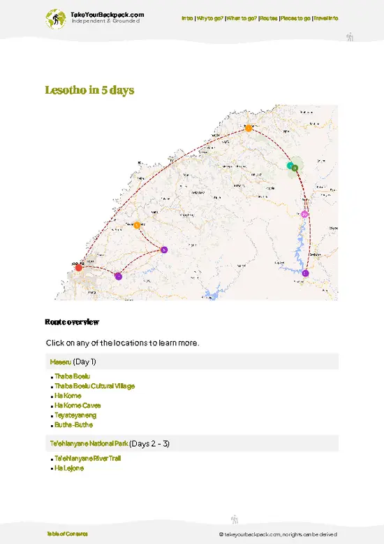
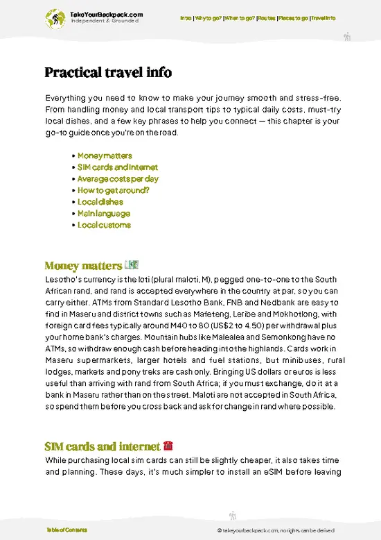
example page 0 from our offline Travel Guide for Lesotho
example page 1 from our offline Travel Guide for Lesotho
example page 2 from our offline Travel Guide for Lesotho
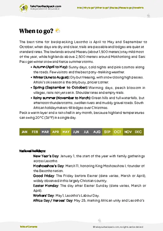
example page 3 from our offline Travel Guide for Lesotho
example page 4 from our offline Travel Guide for Lesotho
example page 5 from our offline Travel Guide for Lesotho
example page 6 from our offline Travel Guide for Lesotho
example page 7 from our offline Travel Guide for Lesotho
Loading the map 🌍
CLICK TO FILTER
cities
towns
villages
landmarks
national parks
hikes
attractions
festivals
regions
SHOW COUNTRY’S BESTSHOW ALL

✨ Why go?
Ranked #1 hike in Lesotho
Why Maletsunyane Falls should be on your travel list

Maletsunyane Falls gives you a very large payload of scenery for a short walk. From the rim you look straight at a 192-meter single drop into a sandstone and basalt amphitheater, and you can be standing there within an hour of leaving the village. Few places in the Lesotho highlands put something this dramatic so close to a road.
The second draw is flexibility. You can stop at the viewpoint, scramble down to the plunge pool, or stretch the day into a longer valley walk. Those who want more can join a pony trek from Semonkong, or tie the falls to other highland routes, since the village works as a natural pause between longer treks in the Maloti.
Then there is the atmosphere of Semonkong, the “Place of Smoke”, named for the mist that rises from the falls. Herders on horseback pass you on the … read more 👉
Maletsunyane Falls gives you a very large payload of scenery for a short walk. From the rim you look straight at a 192-meter single drop into a sandstone and basalt amphitheater, and you can be standing there within an hour of leaving the village. Few places in the Lesotho highlands put something this dramatic so close to a road.
The second draw is flexibility. You can stop at the viewpoint, scramble down to the plunge pool, or stretch the day into a longer valley walk. Those who want more can join a pony trek from Semonkong, or tie the falls to other highland routes, since the village works as a natural pause between longer treks in the Maloti.
Then there is the atmosphere of Semonkong, the “Place of Smoke”, named for the mist that rises from the falls. Herders on horseback pass you on the path, blanket-wrapped and unhurried. Add the option of the 204-meter abseil beside the water, and you have a stop that suits hikers on a tight schedule as well as those with weeks to spare.

💡 HighlightsPlaces and moments you shouldn't skip

  1. The Main Rim Viewpoint: This is the sight everyone comes for. The Maletsunyane River leaps 192 meters in one clean fall, and from the rim you see the whole drop framed by dark cliffs. After heavy summer rain it thunders and throws spray over the grass. In dry winter it thins to a silver thread, and in the coldest spells ice forms around the edges.
  2. The Gorge Descent to the Plunge Pool: A steep, rocky path drops toward the base, where the scale finally sinks in. You look straight up at the water coming down, and the mist soaks your jacket within minutes. Allow extra time for the climb back, and expect wet footing after rain.
  3. Semonkong Village: The name means “Place of Smoke,” a reference to the falls’ mist. Basotho herders in wool blankets, horses tied outside small shops and corrugated rooftops
… read more 👉
  1. The Main Rim Viewpoint: This is the sight everyone comes for. The Maletsunyane River leaps 192 meters in one clean fall, and from the rim you see the whole drop framed by dark cliffs. After heavy summer rain it thunders and throws spray over the grass. In dry winter it thins to a silver thread, and in the coldest spells ice forms around the edges.
  2. The Gorge Descent to the Plunge Pool: A steep, rocky path drops toward the base, where the scale finally sinks in. You look straight up at the water coming down, and the mist soaks your jacket within minutes. Allow extra time for the climb back, and expect wet footing after rain.
  3. Semonkong Village: The name means “Place of Smoke,” a reference to the falls’ mist. Basotho herders in wool blankets, horses tied outside small shops and corrugated rooftops give the place its character. It is where you buy supplies, find guides and ask about conditions on the trail.
  4. The Abseil Beside the Falls: Operators in Semonkong run a 204-meter rappel next to the water, advertised as one of the longest commercial single-drop abseils in the world. You step off the rim and slide down the cliff face with the river roaring beside you. It is a serious splurge, so book ahead and check the weather before committing.
  5. Pony Trekking in the Maletsunyane Valley: Basotho ponies are sure-footed on the rough tracks, and guided rides cross high grassland and small villages around the falls. You pass stone-and-thatch rondavels, herd boys with their flocks and long views over empty ridges. It is a gentle option if your knees have had enough of the gorge path.
Maletsunyane Falls is best met first from the rim viewpoint, since it delivers the full 192-meter drop with almost no effort and lets you judge the weather before deciding on the descent.
Spotted a mistake or missing something? Contact us.

Things to do near Maletsunyane Falls

Ratings based on Tripadvisor reviews. When you book through this link, you support our work at no extra cost to you.

🌤️ When to go?Choosing the right time of year

  • Summer (November to February): Water volume peaks after afternoon thunderstorms, so the 192 m drop looks and sounds its biggest. Days run 20 to 28°C (68 to 82°F) at about 2,200 m, with daylight lasting roughly 14 hours. Expect lightning, muddy tracks and the highest guesthouse rates around December holidays.
  • Autumn (March to May): Rain tapers off, skies clear and temperatures sit at 12 to 22°C (54 to 72°F). Flow is still good, crowds thin and the hiking is comfortable.
  • Winter (June to August): Mornings often fall to -5°C (23°F) or lower, daytime reaches 8 to 15°C (46 to 59°F), and the falls can ice at the edges. Daylight shrinks to about 10 hours. Snow can close the access road, but beds are cheapest and you will likely be alone at the viewpoint.
  • Spring (September to October): Flow is lowest
… read more 👉
  • Summer (November to February): Water volume peaks after afternoon thunderstorms, so the 192 m drop looks and sounds its biggest. Days run 20 to 28°C (68 to 82°F) at about 2,200 m, with daylight lasting roughly 14 hours. Expect lightning, muddy tracks and the highest guesthouse rates around December holidays.
  • Autumn (March to May): Rain tapers off, skies clear and temperatures sit at 12 to 22°C (54 to 72°F). Flow is still good, crowds thin and the hiking is comfortable.
  • Winter (June to August): Mornings often fall to -5°C (23°F) or lower, daytime reaches 8 to 15°C (46 to 59°F), and the falls can ice at the edges. Daylight shrinks to about 10 hours. Snow can close the access road, but beds are cheapest and you will likely be alone at the viewpoint.
  • Spring (September to October): Flow is lowest and winds are strong, with 10 to 20°C (50 to 68°F) days. Prices stay modest and the abseil operator runs quieter days.
Book the abseil early if you come in December or January, since slots fill first.


source: climatestotravel.comJANJanuary: highly recommended for travelingFEBFebruary: highly recommended for travelingMARMarch: excellent for travelingAPRApril: excellent for travelingMAYMay: fair for travelingJUNJune: below average for travelingJULJuly: below average for travelingAUGAugust: below average for travelingSEPSeptember: fair for travelingOCTOctober: excellent for travelingNOVNovember: highly recommended for travelingDECDecember: highly recommended for traveling
lesotho-hike-maletsunyane-falls
© Google |

✈️ The backpacker research shortcutLesotho Travel Guide

An offline-friendly backpacking guide with optimized travel routes, ranked highlights, transport advice, and the best areas to stay.
example page 0 from our offline Travel Guide for Lesotho
example page 1 from our offline Travel Guide for Lesotho
example page 2 from our offline Travel Guide for Lesotho
example page 3 from our offline Travel Guide for Lesotho
example page 4 from our offline Travel Guide for Lesotho
example page 5 from our offline Travel Guide for Lesotho
example page 6 from our offline Travel Guide for Lesotho
example page 7 from our offline Travel Guide for Lesotho
The digital guide (154 pages) contains:
✅ 35 highlights, ranked by travel appeal
✅ Optimized 2, 3 & 5-day travel routes
✅ Cities, national parks, landmarks, beaches
✅ How to get around
✅ Offline-friendly for travel without Wi-Fi
👉 Click to see all 30+ guide features

📅 Plan smarter in minutes, not weeks
✅ Month by month travel advice
✅ Festivals & national holidays
✅ Budget expectations

🗺️ Go to the right places, skip the overrated ones
✅ Honest pros & cons of destinations
✅ Top hikes, parks & viewpoints
✅ Lesser-known places most travelers miss
✅ Clear “worth it vs skip it” guidance

🛏️ Travel smoothly without rookie mistakes
✅ Best areas to stay
✅ Transport systems explained simply
✅ Common scams & safety advice
✅ SIM cards, money & practical tips

🌍 Understand the country, not just visit it
✅ Culture & traditions
✅ 52 Essential phrases & customs
✅ Festivals worth planning around
✅ Traveler-friendly historical context
✅ Insights that make places more meaningful

📱 Built for real travel conditions
✅ Fully downloadable PDF
✅ Works completely offline
✅ Optimized for phone use
✅ Useful in remote areas & buses
✅ Everything in one place
Stop searching, start planning
Get instant access to your full guide. 30‑day money-back guarantee.
+ Add another guide for just

By proceeding you agree to our terms.
Sent to your inbox immediately after payment • 100% Secure Checkout
Best Backpacking Travel Advisor 2025 tourism awardBest Backpacking
Travel Advisor
2025
What others say about Take Your Backpack Guides:
⭐⭐⭐⭐⭐
Fantastic, amazing amount of information!
⭐⭐⭐⭐⭐
My goodness this is amazing, it's what I've been looking for hats off too you!
⭐⭐⭐⭐⭐
I think this is absolutely BRILLIANT
⭐⭐⭐⭐
Very complete and informative. It's still missing places, but I gotta to commend you
⭐⭐⭐⭐⭐
This is truly amazing, thank you, can't wait to explore it with my kids!
⭐⭐⭐⭐⭐
Awesome resource, thank you!
⭐⭐⭐⭐⭐
This is amazing! Can't wait to explore the ones I haven't seen
⭐⭐⭐⭐
I love this! Well done, great idea.
⭐⭐⭐⭐⭐
Thanks for taking the time to make this gem!
⭐⭐⭐⭐⭐
This might be the best website I've ever seen.
⭐⭐⭐⭐⭐
Congratulations, and thank you so much for your work; it's incredibly valuable.
⭐⭐⭐⭐
In all seriousness I think you did a great job pointing out the important spots
⭐⭐⭐⭐⭐
10/10 very good
⭐⭐⭐⭐⭐
As someone who's only just starting to visit regularly this is awesome, thank you.
⭐⭐⭐⭐
Thank you very much! I'm going to visit my dad, it's going to be very useful!
⭐⭐⭐⭐⭐
This is really cool! We'll be travelling for the first time and this definitely come in handy.
⭐⭐⭐⭐⭐
You are now our minister of culture, congratulations 👨‍💼
⭐⭐⭐⭐⭐
Just wanted to tell you that this is a pearl! Going to follow your recommendations.
⭐⭐⭐⭐⭐
This is so cool. I'll definitely be using the resource for my travels soon.
⭐⭐⭐⭐⭐
This is very impressive! Good work.
⭐⭐⭐⭐⭐
This is an amazing and informative site. Very well done!

🛏️ Where to stay?Best areas to stay in Lesotho

If you enjoy meeting fellow travelers, consider choosing hostels with high ratings for atmosphere. On the other hand, if you prefer having your own space, a hotel might be a better option.

🥾 Hike detailsKey facts about the Maletsunyane Falls hike

Maletsunyane Falls Overview: The standard hike runs from Semonkong village to the falls and back, with an optional drop into the gorge.
Total Distance: About 10 kilometers round trip, including the descent to the base. A rim-only walk is shorter.
Estimated Duration: 4 to 5 hours at a steady pace, longer if you linger at the bottom or the path is wet.
Difficulty: Moderate. The approach is easy, but the gorge path is steep, loose and slippery after rain, and the return climb is tiring.
Starting Point: Semonkong village. Minibus taxis serve Semonkong from Maseru, usually leaving when full, so an early
… read more 👉
Maletsunyane Falls Overview: The standard hike runs from Semonkong village to the falls and back, with an optional drop into the gorge.
Total Distance: About 10 kilometers round trip, including the descent to the base. A rim-only walk is shorter.
Estimated Duration: 4 to 5 hours at a steady pace, longer if you linger at the bottom or the path is wet.
Difficulty: Moderate. The approach is easy, but the gorge path is steep, loose and slippery after rain, and the return climb is tiring.
Starting Point: Semonkong village. Minibus taxis serve Semonkong from Maseru, usually leaving when full, so an early start matters. You can walk to the trailhead from the village, and local guides are available there.
Major Landmarks:
  • Semonkong Village: Starting point with small shops, lodges and guide contacts.
  • Rim Viewpoint: The first full view of the 192-meter drop.
  • Gorge Path: A steep descent along the cliff toward the river below the falls.
  • Plunge Pool: A misty basin at the foot of the falls where the roar is loudest.
Terrain and Scenery: Open highland tracks lead to a rocky rim, then a stepped descent over boulders and loose soil. The gorge walls are dark basalt and sandstone, streaked with water. Views are wide, empty and exposed to wind.
Vegetation: Tussock grassland covers most of the plateau. Willows and a few planted trees grow near the village, with hardy shrubs and moss clinging to damp rock in the gorge.
Wildlife: Cape vultures and other raptors ride the updrafts along the cliffs. You will also meet far more livestock than wild animals, including sheep, goats, donkeys and horses led by herders.
Practical Notes: Bring layers, since the gorge is cool and wet even on warm days. Wear boots with good grip, carry water and cash in maloti, and start early so you are back on the rim in daylight.
⚠️ Hiking info can sometimes be outdated or inaccurate. Before you hit the trail, check the latest conditions with locals. If you do spot anything that's off, I'd love to hear from you, so I can update it for fellow travelers.

🛡️ SafetyScams, Hazards, and Annoyances

The main hazards at Maletsunyane Falls are weather and loose ground, not wildlife. Summer afternoon thunderstorms build fast on the plateau, so start early and be off exposed ridges by midafternoon. Winter brings hard frost and occasional snow, which makes the gorge-edge paths slick. The viewpoints near the drop have little or no fencing, so keep a few steps back from crumbling edges, and never scramble for photos. Trails down into the gorge are steep, with loose rock and no waymarking, so a local guide from Semonkong is useful if you plan to reach the base. Wear boots with real grip, carry a rain layer even on clear mornings, and bring at least 2 liters of water since there are no shops on the route. Cell coverage is patchy, so tell your guesthouse where you are going. Shepherds and herd … read more 👉
The main hazards at Maletsunyane Falls are weather and loose ground, not wildlife. Summer afternoon thunderstorms build fast on the plateau, so start early and be off exposed ridges by midafternoon. Winter brings hard frost and occasional snow, which makes the gorge-edge paths slick. The viewpoints near the drop have little or no fencing, so keep a few steps back from crumbling edges, and never scramble for photos. Trails down into the gorge are steep, with loose rock and no waymarking, so a local guide from Semonkong is useful if you plan to reach the base. Wear boots with real grip, carry a rain layer even on clear mornings, and bring at least 2 liters of water since there are no shops on the route. Cell coverage is patchy, so tell your guesthouse where you are going. Shepherds and herd boys are friendly; greet them, and keep dogs at a distance.

FAQFrequently asked questions about Maletsunyane Falls

Maletsunyane Falls can be seen in 1 to 2 hours on foot from Semonkong village, about 4 to 5 km round trip to the main viewpoint. Reaching the base of the gorge adds roughly 3 to 4 hours for the descent and climb back. Many backpackers also add a second day for a pony trek or the 204 m commercial abseil, which takes about half a day with transfers.
Moderate is the fair rating for Maletsunyane Falls, since the walk to the viewpoint is mostly flat to rolling grassland. The descent to the pool is steep, loose and unmarked, and the climb back takes about 1.5 to 2 hours. Altitude near 2,200 m, sudden storms and cold winters make fitness and preparation matter more than technical skill.
No permit is needed for Maletsunyane Falls, and you can walk to the main viewpoint on your own from Semonkong. A local guide for the gorge descent is worth hiring and usually costs around US$10 to 25 for a half day, arranged through your guesthouse. The abseil and pony trekking must be booked with the local operator, with abseil pricing typically around US$60 to 90.
⚠️ Things can change over time, so always validate details locally before you go.

Other Basotho hikes near Maletsunyane Falls

Explore more nearby:

  • Sehlabathebe Plateau—sandstone outcrops, alpine grasslands, remote wilderness| 97 km away
  • Ts’ehlanyane River Trail—Cold river crossings, native forest, basalt plunge pools, park camping| 113 km away
  • Sani Pass—Gravel hairpins, border post summit, 2,800-meter pub, bearded vultures| 124 km away

💡 Not sure where to go next?
Create a personalized itinerary for Lesotho including Maletsunyane Falls and the places that fit your trip.

Generate my itinerary

👉 Discover all hikes

Or checkout all Lesotho has to offer (think cities, towns, villages, national parks, hikes, beaches, festivals)
Country photo of Lesotho

We 💚 feedbackKey takeaways before you go

Maletsunyane Falls looks its best in the rainy summer months, when the river is full and the gorge roars, and in the early morning when the rim is quiet and the mist glows. I would go then, in boots with proper grip. Skip the descent if fog has settled, and bring a warm layer, because the highland wind finds every gap.

✍️ Help improve this page!
The information on this page is based on in-depth research, insights shared by experienced travelers, and feedback from the local travel community in Lesotho. While every effort is made to keep the information accurate and current, conditions can change — so if you spot anything incorrect or outdated, please get in touch.


🙋‍♂️ Give feedback

👋 Meet the founderWho’s Behind Take Your Backpack?

Johan, backpacker and founder of TakeYourBackpackHi, I’m Johan (Netherlands 🇳🇱), the creator of TakeYourBackpack. Over the past 3 decades, I’ve backpacked through 90+ countries across six continents, gaining extensive experience with independent travel, long-term trips, and overland routes.

This site is built on a combination of firsthand travel experience and carefully curated insights from other backpackers. Many guides are based on places I’ve personally visited, while others bring together tips, observations, and practical advice shared by trusted travelers I’ve met along the way.

The goal is to provide realistic, experience-driven guidance — not generic itineraries — so you can explore destinations with better context, clearer expectations, and more confidence.