
×

Lesotho🇱🇸 | hikesTs’ehlanyane River TrailCold river crossings, native forest, basalt plunge pools, park camping | things to do and best time to go

Explore Sehlabathebe PlateauExplore Bokong Nature Reserve

Backpacking in Ts’ehlanyane River Trail
🌟 Highlighthike ranked #3
By Johan Kruseman 🇳🇱 | Updated October 22, 2026

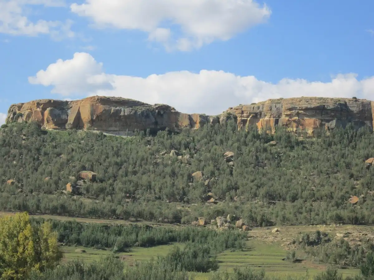
Ts’ehlanyane River Trail gives you a proper Maloti mountain walk with a camping base and a dependable water source, so you can skip the logistics of carrying everything. It lies in the north of Lesotho, inside Ts’ehlanyane National Park, in the highlands above the lowland towns of Leribe and Butha-Buthe. The trail follows a cold, clear river upstream through one of the country’s few patches of native forest, then climbs onto open grassland and rock. You hear water almost constantly. Smells of wild olive, damp earth and sun-warmed grass change with every bend. The negatives are plain: the park sits at the end of a rough access road, minibus taxis stop well short of the gate, and you must wade or rock-hop several crossings. Weather turns fast at this altitude. Expect to walk the last stretch to the gate with your pack. The trail ends at a cluster of pools below a basalt ledge, where the water runs a steely green.

Discover everything you want to know in the 📖 Lesotho Travel Guide.
Best time to go: May - September
Duration: 6 hours
Distance: 12 kilometers
Total ascent: 500 meters


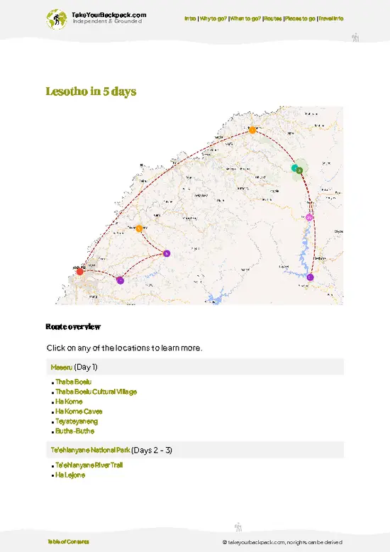
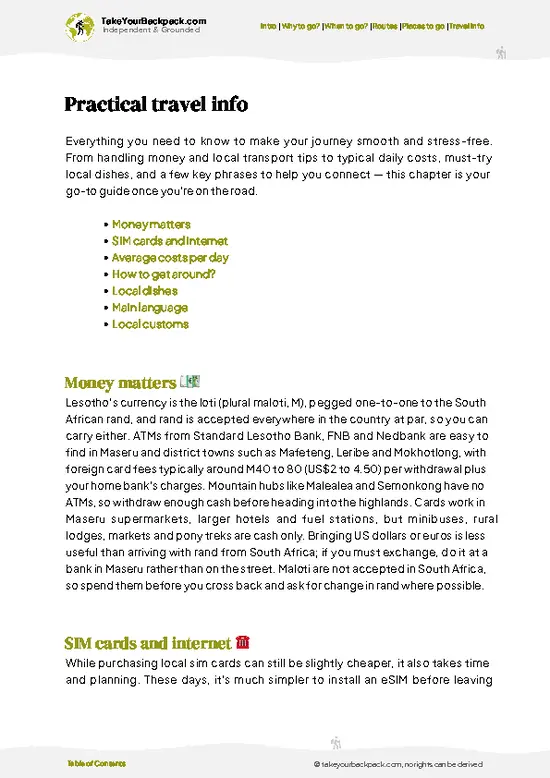
example page 0 from our offline Travel Guide for Lesotho
example page 1 from our offline Travel Guide for Lesotho
example page 2 from our offline Travel Guide for Lesotho
example page 3 from our offline Travel Guide for Lesotho
example page 4 from our offline Travel Guide for Lesotho
example page 5 from our offline Travel Guide for Lesotho
example page 6 from our offline Travel Guide for Lesotho
example page 7 from our offline Travel Guide for Lesotho
Loading the map 🌍
CLICK TO FILTER
cities
towns
villages
landmarks
national parks
hikes
attractions
festivals
regions
SHOW COUNTRY’S BESTSHOW ALL

✨ Why go?
Ranked #3 hike in Lesotho
What sets this place apart

Backpackers come to Ts’ehlanyane River Trail because the walking packs a lot of variety into a short distance. You pass from Lesotho’s remnant indigenous forest into open alpine grassland in a single day, which is rare in a country where most slopes are grazed to the bone. The trail is also easy to shorten or stretch. You can turn around at any pool, or push on toward the high ridge and make an overnight of it, camping near the river. That flexibility suits people on tight schedules and people with a free week alike.

It also fits smoothly into a northern Lesotho loop. The park sits near Bokong Nature Reserve, so you can pair the two on one stretch of the Maloti, with minibus taxis along the main road connecting the lowland towns. Crowds are thin even in good weather, and you will often have … read more 👉
Backpackers come to Ts’ehlanyane River Trail because the walking packs a lot of variety into a short distance. You pass from Lesotho’s remnant indigenous forest into open alpine grassland in a single day, which is rare in a country where most slopes are grazed to the bone. The trail is also easy to shorten or stretch. You can turn around at any pool, or push on toward the high ridge and make an overnight of it, camping near the river. That flexibility suits people on tight schedules and people with a free week alike.

It also fits smoothly into a northern Lesotho loop. The park sits near Bokong Nature Reserve, so you can pair the two on one stretch of the Maloti, with minibus taxis along the main road connecting the lowland towns. Crowds are thin even in good weather, and you will often have a pool entirely to yourself. Bring a filter or purification tablets, since the river is your main water supply.

💡 HighlightsThe experiences that define the visit

  1. Ts’ehlanyane River: The trail’s spine. The river runs cold and clear over basalt slabs, with deep green pools you can dip into on a warm afternoon. Crossings are part of the fun, and you can fill your bottle from side streams higher up.
  2. Indigenous Forest Patches: Pockets of native woodland, including mountain cypress and wild olive, line the lower valley. They are rare in Lesotho, where most of the highlands are open grassland. The air is cooler and smells of leaf litter, and you hear birds before you see them.
  3. Basalt Gorge and Rock Pools: Higher up, the valley narrows and the river drops over ledges into small plunge pools. This is the best spot for a long lunch. Stay clear of the wet rock edges, which are slick with algae.
  4. Alpine Grassland Plateau: Beyond the tree line the landscape opens onto
… read more 👉
  1. Ts’ehlanyane River: The trail’s spine. The river runs cold and clear over basalt slabs, with deep green pools you can dip into on a warm afternoon. Crossings are part of the fun, and you can fill your bottle from side streams higher up.
  2. Indigenous Forest Patches: Pockets of native woodland, including mountain cypress and wild olive, line the lower valley. They are rare in Lesotho, where most of the highlands are open grassland. The air is cooler and smells of leaf litter, and you hear birds before you see them.
  3. Basalt Gorge and Rock Pools: Higher up, the valley narrows and the river drops over ledges into small plunge pools. This is the best spot for a long lunch. Stay clear of the wet rock edges, which are slick with algae.
  4. Alpine Grassland Plateau: Beyond the tree line the landscape opens onto wide, windy grassland. Views stretch across ridgelines in layered blues, and you often see herders with livestock moving on the slopes. Mist can arrive within minutes, so keep a jacket handy.
  5. Bird and Wildlife Watching: Raptors, including vultures and eagles, ride the thermals above the cliffs, and you may spot rhebok or baboons along the quieter sections. Small birds work the forest edges. Go early and move quietly for the best chance of a sighting.
Ts’ehlanyane River Trail takes about five to six hours to walk, or a full day if you linger at the pools.
Spotted a mistake or missing something? Contact us.

Things to do near Ts’ehlanyane River Trail

Ratings based on Tripadvisor reviews. When you book through this link, you support our work at no extra cost to you.

🌤️ When to go?Weather, crowds, and seasonal trade-offs

Ts’ehlanyane River Trail is best walked from March to May or September to November, when days are mild and the river is low enough to cross comfortably.
  • Autumn (March to May): Clear, dry days of 15 to 22°C (59 to 72°F), cold nights near 0°C (32°F), and golden grass along the valley. Crowds stay thin.
  • Winter (June to August): Frosty mornings drop to -8°C (18°F), with daytime highs of 8 to 14°C (46 to 57°F). Snow can dust the upper slopes. Days are short, roughly 10 hours of light, so plan early starts.
  • Spring (September to November): Warming days of 14 to 24°C (57 to 75°F), flowering shrubs, and quiet trails. Wind can be fierce.
  • Summer (December to February): Highs of 24 to 28°C (75 to 82°F) and afternoon thunderstorms that swell the river. Light lasts up to 14 hours. Local school holidays around
… read more 👉
Ts’ehlanyane River Trail is best walked from March to May or September to November, when days are mild and the river is low enough to cross comfortably.
  • Autumn (March to May): Clear, dry days of 15 to 22°C (59 to 72°F), cold nights near 0°C (32°F), and golden grass along the valley. Crowds stay thin.
  • Winter (June to August): Frosty mornings drop to -8°C (18°F), with daytime highs of 8 to 14°C (46 to 57°F). Snow can dust the upper slopes. Days are short, roughly 10 hours of light, so plan early starts.
  • Spring (September to November): Warming days of 14 to 24°C (57 to 75°F), flowering shrubs, and quiet trails. Wind can be fierce.
  • Summer (December to February): Highs of 24 to 28°C (75 to 82°F) and afternoon thunderstorms that swell the river. Light lasts up to 14 hours. Local school holidays around December and January bring more campers and higher park rates.
Book a weekday midseason slot and you will likely have the valley almost to yourself.


source: climatestotravel.comJANJanuary: below average for travelingFEBFebruary: below average for travelingMARMarch: fair for travelingAPRApril: fair for travelingMAYMay: excellent for travelingJUNJune: excellent for travelingJULJuly: excellent for travelingAUGAugust: excellent for travelingSEPSeptember: excellent for travelingOCTOctober: fair for travelingNOVNovember: fair for travelingDECDecember: below average for traveling
lesotho-hike-tsehlanyane-river-trail v1
© Google |

✈️ The backpacker research shortcutLesotho Travel Guide

An offline-friendly backpacking guide with optimized travel routes, ranked highlights, transport advice, and the best areas to stay.
example page 0 from our offline Travel Guide for Lesotho
example page 1 from our offline Travel Guide for Lesotho
example page 2 from our offline Travel Guide for Lesotho
example page 3 from our offline Travel Guide for Lesotho
example page 4 from our offline Travel Guide for Lesotho
example page 5 from our offline Travel Guide for Lesotho
example page 6 from our offline Travel Guide for Lesotho
example page 7 from our offline Travel Guide for Lesotho
The digital guide (154 pages) contains:
✅ 35 highlights, ranked by travel appeal
✅ Optimized 2, 3 & 5-day travel routes
✅ Cities, national parks, landmarks, beaches
✅ How to get around
✅ Offline-friendly for travel without Wi-Fi
👉 Click to see all 30+ guide features

📅 Plan smarter in minutes, not weeks
✅ Month by month travel advice
✅ Festivals & national holidays
✅ Budget expectations

🗺️ Go to the right places, skip the overrated ones
✅ Honest pros & cons of destinations
✅ Top hikes, parks & viewpoints
✅ Lesser-known places most travelers miss
✅ Clear “worth it vs skip it” guidance

🛏️ Travel smoothly without rookie mistakes
✅ Best areas to stay
✅ Transport systems explained simply
✅ Common scams & safety advice
✅ SIM cards, money & practical tips

🌍 Understand the country, not just visit it
✅ Culture & traditions
✅ 52 Essential phrases & customs
✅ Festivals worth planning around
✅ Traveler-friendly historical context
✅ Insights that make places more meaningful

📱 Built for real travel conditions
✅ Fully downloadable PDF
✅ Works completely offline
✅ Optimized for phone use
✅ Useful in remote areas & buses
✅ Everything in one place
Stop searching, start planning
Get instant access to your full guide. 30‑day money-back guarantee.
+ Add another guide for just

By proceeding you agree to our terms.
Sent to your inbox immediately after payment • 100% Secure Checkout
Best Backpacking Travel Advisor 2025 tourism awardBest Backpacking
Travel Advisor
2025
What others say about Take Your Backpack Guides:
⭐⭐⭐⭐⭐
Fantastic, amazing amount of information!
⭐⭐⭐⭐⭐
My goodness this is amazing, it's what I've been looking for hats off too you!
⭐⭐⭐⭐⭐
I think this is absolutely BRILLIANT
⭐⭐⭐⭐
Very complete and informative. It's still missing places, but I gotta to commend you
⭐⭐⭐⭐⭐
This is truly amazing, thank you, can't wait to explore it with my kids!
⭐⭐⭐⭐⭐
Awesome resource, thank you!
⭐⭐⭐⭐⭐
This is amazing! Can't wait to explore the ones I haven't seen
⭐⭐⭐⭐
I love this! Well done, great idea.
⭐⭐⭐⭐⭐
Thanks for taking the time to make this gem!
⭐⭐⭐⭐⭐
This might be the best website I've ever seen.
⭐⭐⭐⭐⭐
Congratulations, and thank you so much for your work; it's incredibly valuable.
⭐⭐⭐⭐
In all seriousness I think you did a great job pointing out the important spots
⭐⭐⭐⭐⭐
10/10 very good
⭐⭐⭐⭐⭐
As someone who's only just starting to visit regularly this is awesome, thank you.
⭐⭐⭐⭐
Thank you very much! I'm going to visit my dad, it's going to be very useful!
⭐⭐⭐⭐⭐
This is really cool! We'll be travelling for the first time and this definitely come in handy.
⭐⭐⭐⭐⭐
You are now our minister of culture, congratulations 👨‍💼
⭐⭐⭐⭐⭐
Just wanted to tell you that this is a pearl! Going to follow your recommendations.
⭐⭐⭐⭐⭐
This is so cool. I'll definitely be using the resource for my travels soon.
⭐⭐⭐⭐⭐
This is very impressive! Good work.
⭐⭐⭐⭐⭐
This is an amazing and informative site. Very well done!

🛏️ Where to stay?Choosing the right base

If you enjoy meeting fellow travelers, consider choosing hostels with high ratings for atmosphere. On the other hand, if you prefer having your own space, a hotel might be a better option.

🥾 Hike detailsA practical overview of the hike

Total Distance: Ts’ehlanyane River Trail runs roughly 12 kilometers as a round trip along the river, with longer variations possible toward the high ridge.
Estimated Duration: Five to six hours at a steady pace, or an overnight if you extend into the upper valley.
Difficulty: Moderate. The gradient is gentle at first, then steepens near the gorge. River crossings and loose rock demand careful footing.
Starting Point: The trail begins near the park gate and campsite.
  • Public Transport: Minibus taxis run along the main highway from Hlotse and Butha-Buthe to the turnoff, and you walk or arrange a lift
… read more 👉
Total Distance: Ts’ehlanyane River Trail runs roughly 12 kilometers as a round trip along the river, with longer variations possible toward the high ridge.
Estimated Duration: Five to six hours at a steady pace, or an overnight if you extend into the upper valley.
Difficulty: Moderate. The gradient is gentle at first, then steepens near the gorge. River crossings and loose rock demand careful footing.
Starting Point: The trail begins near the park gate and campsite.
  • Public Transport: Minibus taxis run along the main highway from Hlotse and Butha-Buthe to the turnoff, and you walk or arrange a lift for the gravel stretch to the gate.
  • Facilities: Camping and basic huts are available, so bring your own food and a stove.
Major Landmarks:
  • Forest Section: Native trees shade the lower river with cool, damp air.
  • Gorge and Pools: The valley narrows and the river steps down over basalt ledges.
  • Upper Grassland: The valley opens onto high, windswept pasture.
Terrain and Scenery: Rocky footpaths, river stones and short, steep pitches. Views widen as you climb, with ridgelines stacked behind each other.
Vegetation: Mountain cypress and wild olive in the lower valley, then tussock grass, heath and hardy alpine shrubs above the tree line.
Wildlife: Rhebok, baboons and small rodents, plus vultures, eagles and many forest birds.
Practical Notes: Carry a rain layer, sun protection and a water filter. Mist and afternoon storms arrive quickly in the Maloti, so start early.
⚠️ Hiking info can sometimes be outdated or inaccurate. Before you hit the trail, check the latest conditions with locals. If you do spot anything that's off, I'd love to hear from you, so I can update it for fellow travelers.

🛡️ SafetyTraveler Safety Guide

Ts’ehlanyane River Trail is a well-defined, manageable hike inside a national park, and most problems come from weather and underpreparation. Afternoon thunderstorms in summer arrive fast, so start early and be off exposed ridges by midday. Lightning is a real hazard up high. Rain also lifts the river, and crossings that are ankle-deep in the morning can become knee-deep by evening, so unbuckle your pack belt and cross facing upstream. Winter nights drop well below freezing, and a proper sleeping bag matters more than an extra shirt. At roughly 2,000 to 3,000 meters, the sun is strong and the air thin, so carry sunscreen, a hat and plenty of water, and treat stream water. Footing is loose on steeper sections, so trekking poles help. Wildlife is minimal, mostly birds and the occasional baboon, … read more 👉
Ts’ehlanyane River Trail is a well-defined, manageable hike inside a national park, and most problems come from weather and underpreparation. Afternoon thunderstorms in summer arrive fast, so start early and be off exposed ridges by midday. Lightning is a real hazard up high. Rain also lifts the river, and crossings that are ankle-deep in the morning can become knee-deep by evening, so unbuckle your pack belt and cross facing upstream. Winter nights drop well below freezing, and a proper sleeping bag matters more than an extra shirt. At roughly 2,000 to 3,000 meters, the sun is strong and the air thin, so carry sunscreen, a hat and plenty of water, and treat stream water. Footing is loose on steeper sections, so trekking poles help. Wildlife is minimal, mostly birds and the occasional baboon, which you should never feed. Tell park staff your route and expected return before setting off.

FAQCommon questions from travelers

Most hikers spend 2 to 3 days on the Ts’ehlanyane River Trail, walking about 10 to 15 kilometers a day through the Ts’ehlanyane National Park valley. A fit day hiker can reach the upper river pools and return in 5 to 7 hours. Longer routes toward the high camps need an overnight stay.
The Ts’ehlanyane River Trail is moderate, with steady climbs, loose rock and several river crossings, but no technical scrambling. Expect elevation between roughly 2,000 and 2,800 meters, which makes the climbs feel harder than the distance suggests. Beginners with decent fitness manage it fine on a shorter day route, while the multi-day option suits those used to carrying a pack.
No guide is required on the Ts’ehlanyane River Trail, though local guides can be arranged at the park office for roughly US$10 to 20 a day. You do pay a park entry and camping or hut fee at the gate, typically a few US dollars per person, and you should register your route there. Ts’ehlanyane National Park lies near Butha-Buthe in northern Lesotho, and fees are paid in local currency.
⚠️ Things can change over time, so always validate details locally before you go.

Other Basotho hikes near Ts’ehlanyane River Trail

Explore more nearby:

  • Sani Pass—steep switchbacks, border crossing, rugged escarpment| 112 km away
  • Maletsunyane Falls—dramatic waterfall, basalt cliffs, deep gorge| 113 km away
  • Sehlabathebe Plateau—sandstone outcrops, alpine grasslands, remote wilderness| 123 km away

💡 Not sure where to go next?
Create a personalized itinerary for Lesotho including Ts’ehlanyane River Trail and the places that fit your trip.

Generate my itinerary

👉 Discover all hikes

Or checkout all Lesotho has to offer (think cities, towns, villages, national parks, hikes, beaches, festivals)
Country photo of Lesotho

We 💚 feedbackParting advice and final tips

Ts’ehlanyane River Trail rewards two nights better than a rushed day. Camp by the river, walk the gorge on the first morning and push toward the high grassland on the second, when the light is soft and the pools are empty. I would bring a warm layer even in summer, because nights at this altitude bite.

✍️ Help improve this page!
The information on this page is based on in-depth research, insights shared by experienced travelers, and feedback from the local travel community in Lesotho. While every effort is made to keep the information accurate and current, conditions can change — so if you spot anything incorrect or outdated, please get in touch.


🙋‍♂️ Give feedback

👋 Meet the founderWho’s Behind Take Your Backpack?

Johan, backpacker and founder of TakeYourBackpackHi, I’m Johan (Netherlands 🇳🇱), the creator of TakeYourBackpack. Over the past 3 decades, I’ve backpacked through 90+ countries across six continents, gaining extensive experience with independent travel, long-term trips, and overland routes.

This site is built on a combination of firsthand travel experience and carefully curated insights from other backpackers. Many guides are based on places I’ve personally visited, while others bring together tips, observations, and practical advice shared by trusted travelers I’ve met along the way.

The goal is to provide realistic, experience-driven guidance — not generic itineraries — so you can explore destinations with better context, clearer expectations, and more confidence.