×

Mexico🇲🇽 | national parksEl Cielo Biosphere ReserveCloud forest, Puente de Dios, guided birding, Gómez Farías | things to do and best time to go

Explore Volcán Nevado de ColimaExplore Pantanos de Centla

Backpacking in El Cielo Biosphere Reserve
🌟 Highlightnational park ranked #7
By Johan Kruseman 🇳🇱 | Updated October 20, 2026

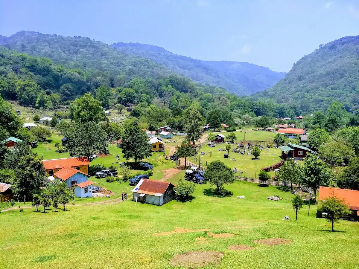
The real decision at El Cielo Biosphere Reserve is whether to book a local guide or try to wing it, and the park’s access rules tip it: several of the best areas sit on private or ejido land where guides are the norm. El Cielo lies in the Sierra Madre Oriental in the state of Tamaulipas, in the northeast of Mexico, in the highlands west of Ciudad Victoria and reached via Gómez Farías. Cloud forest, orchids, bromeliads and birds are the draw, and crowds are thin. The cost: slow roads, patchy signal, and cash-only habits. Withdraw pesos before you arrive and confirm trips a day ahead. I once paid about US$4 for a plate of enchiladas and a mug of café de olla at a small kitchen in Gómez Farías, and it outdid the fancy lunch I skipped. A first day could mean arriving by midday, eating early, then walking quietly along a river path as the afternoon mist rolls in.

Discover everything you want to know in the 📖 Mexico Travel Guide.
Best time to go: October - April
Daily cost: US$50 to 110 [gob.mx]
Duration: 3 days
Distance: 10 to 30 kilometers
Total ascent: 1200 meters


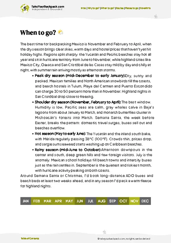
example page 0 from our offline Travel Guide for Mexico
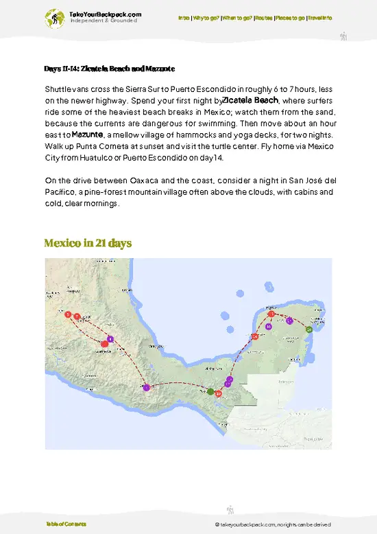
example page 1 from our offline Travel Guide for Mexico
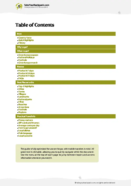
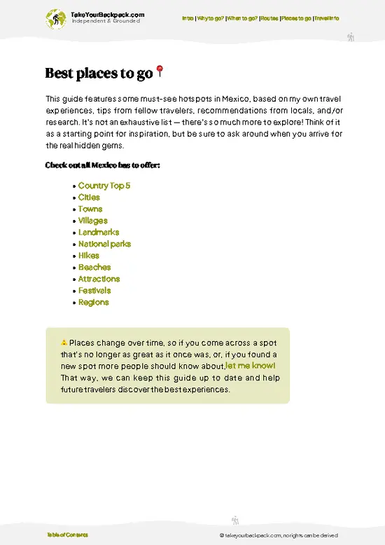
example page 2 from our offline Travel Guide for Mexico
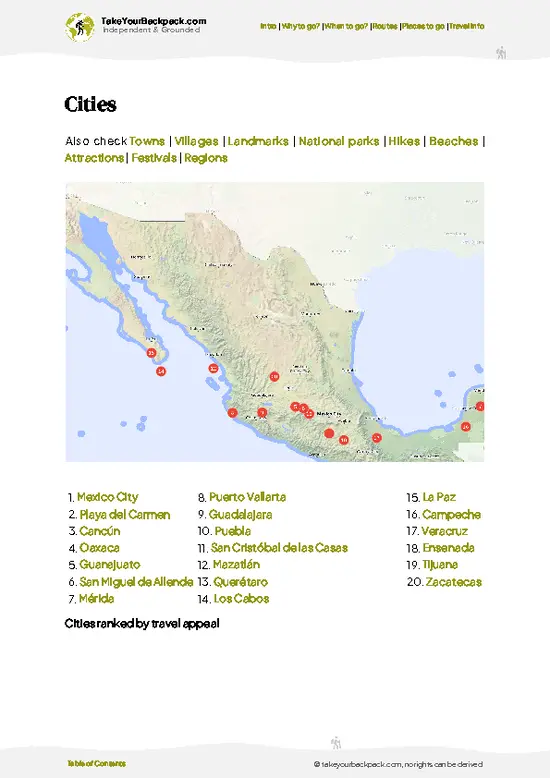
example page 3 from our offline Travel Guide for Mexico
example page 4 from our offline Travel Guide for Mexico
example page 5 from our offline Travel Guide for Mexico
example page 6 from our offline Travel Guide for Mexico
example page 7 from our offline Travel Guide for Mexico
Loading the map 🌍
CLICK TO FILTER
cities
towns
villages
landmarks
national parks
hikes
beaches
attractions
festivals
regions
SHOW COUNTRY’S BESTSHOW ALL

✨ Why go?
Ranked #7 national park in Mexico
Why visitors keep coming back

El Cielo Biosphere Reserve suits backpackers who like their wilderness unpackaged. The reserve climbs from tropical lowlands to pine and oak forest, with cloud forest in between, so a single day can cover several ecosystems that elsewhere take a week of travel to link. That gradient is the real pull, and it shows in the birdlife and the wildflowers.

Independent exploring works here in a modest way. Base yourself in the village of Gómez Farías, where small cabins, simple campsites and family-run kitchens keep costs low, and arrange walks with local guides on the spot. Guides know where the cloud forest trails and the quieter river stretches are, and they know which tracks are passable after rain. The park is far from the usual circuits, so you will often share a path with nobody. It rewards flexibility more than a tight itinerary.

💡 HighlightsPlaces and moments you shouldn't skip

  1. Cloud forest above Gómez Farías: the signature habitat of the reserve, with moss-draped oaks, tree ferns and mist that settles by afternoon. Walking here feels hushed and damp, and the birding is excellent.
  2. Alta Cumbre: a high-elevation area of pine and oak forest with big views over the Sierra Madre foothills. It is a good place for wildflowers and for spotting hawks riding the updrafts.
  3. Río Sabinas: a clear river near Gómez Farías with swimming holes and shaded banks, handy after a hot day on the trail.
  4. Puente de Dios: a cluster of turquoise pools fed by spring water, about a short drive from the village. The color is striking against the dark rock, and swimming is the point.
  5. Bird watching: the reserve shelters hundreds of species, including parrots, trogons and tropical forest birds that are
… read more 👉
  1. Cloud forest above Gómez Farías: the signature habitat of the reserve, with moss-draped oaks, tree ferns and mist that settles by afternoon. Walking here feels hushed and damp, and the birding is excellent.
  2. Alta Cumbre: a high-elevation area of pine and oak forest with big views over the Sierra Madre foothills. It is a good place for wildflowers and for spotting hawks riding the updrafts.
  3. Río Sabinas: a clear river near Gómez Farías with swimming holes and shaded banks, handy after a hot day on the trail.
  4. Puente de Dios: a cluster of turquoise pools fed by spring water, about a short drive from the village. The color is striking against the dark rock, and swimming is the point.
  5. Bird watching: the reserve shelters hundreds of species, including parrots, trogons and tropical forest birds that are hard to find elsewhere in the north of the country. Dawn walks with a guide are the best way to see them.
  6. Orchids and bromeliads: epiphytes cling to trunks throughout the mid-elevation forest, and some bloom in cooler months.
  7. Butterflies of the lowlands: the warm lower slopes fill with colorful species, especially after rain.
Start with Puente de Dios, since its easy access lets you adjust to the heat and gauge local conditions before committing to a longer forest walk. El Cielo Biosphere Reserve rewards a gentle first day.
Spotted a mistake or missing something? Contact us.
🌤️ When to go?Best time to explore El Cielo Biosphere Reserve

  • Spring (March to May): Clearest trail conditions and the pick for most hikers. Highs reach 28 to 34°C (82 to 93°F) in the lowlands and 18 to 24°C (64 to 75°F) in the cloud forest. Days run about 12 to 13 hours of light. Holy Week brings Mexican families and the busiest weekends.
  • Summer (June to September): Heavy afternoon downpours, slick clay trails and leeches near streams. Lowlands hit 35°C (95°F) or more, highs up in the forest sit near 20 to 25°C (68 to 77°F). Fog hides views, though visitors are few and lodging is easy to book.
  • Autumn (October to November): Rain tapers off, forests stay green, and butterflies are plentiful. Temperatures run 15 to 26°C (59 to 79°F).
  • Winter (December to February): Cool, misty nights can drop to 5 to 10°C (41 to 50°F) at altitude. Highs reach 18 to 24°C (64
… read more 👉
  • Spring (March to May): Clearest trail conditions and the pick for most hikers. Highs reach 28 to 34°C (82 to 93°F) in the lowlands and 18 to 24°C (64 to 75°F) in the cloud forest. Days run about 12 to 13 hours of light. Holy Week brings Mexican families and the busiest weekends.
  • Summer (June to September): Heavy afternoon downpours, slick clay trails and leeches near streams. Lowlands hit 35°C (95°F) or more, highs up in the forest sit near 20 to 25°C (68 to 77°F). Fog hides views, though visitors are few and lodging is easy to book.
  • Autumn (October to November): Rain tapers off, forests stay green, and butterflies are plentiful. Temperatures run 15 to 26°C (59 to 79°F).
  • Winter (December to February): Cool, misty nights can drop to 5 to 10°C (41 to 50°F) at altitude. Highs reach 18 to 24°C (64 to 75°F). Late December holidays bump up lodging prices.
Book Gómez Farías lodging early for Holy Week and Christmas, and visit midweek for the quietest trails.


source: climatestotravel.comJANJanuary: highly recommended for travelingFEBFebruary: excellent for travelingMARMarch: excellent for travelingAPRApril: excellent for travelingMAYMay: fair for travelingJUNJune: fair for travelingJULJuly: fair for travelingAUGAugust: fair for travelingSEPSeptember: fair for travelingOCTOctober: good for travelingNOVNovember: highly recommended for travelingDECDecember: highly recommended for traveling
mexico-national-park-el-cielo-biosphere-reserve v1
© Google |

✈️ The backpacker research shortcutMexico Travel Guide

An offline-friendly backpacking guide with optimized travel routes, ranked highlights, transport advice, and the best areas to stay.
example page 0 from our offline Travel Guide for Mexico
example page 1 from our offline Travel Guide for Mexico
example page 2 from our offline Travel Guide for Mexico
example page 3 from our offline Travel Guide for Mexico
example page 4 from our offline Travel Guide for Mexico
example page 5 from our offline Travel Guide for Mexico
example page 6 from our offline Travel Guide for Mexico
example page 7 from our offline Travel Guide for Mexico
The digital guide (402 pages) contains:
✅ 138 highlights, ranked by travel appeal
✅ Optimized 7, 14 & 21-day travel routes
✅ Cities, national parks, landmarks, beaches
✅ How to get around
✅ Offline-friendly for travel without Wi-Fi
👉 Click to see all 30+ guide features

📅 Plan smarter in minutes, not weeks
✅ Month by month travel advice
✅ Festivals & national holidays
✅ Budget expectations

🗺️ Go to the right places, skip the overrated ones
✅ Honest pros & cons of destinations
✅ Top hikes, parks & viewpoints
✅ Lesser-known places most travelers miss
✅ Clear “worth it vs skip it” guidance

🛏️ Travel smoothly without rookie mistakes
✅ Best areas to stay
✅ Transport systems explained simply
✅ Common scams & safety advice
✅ SIM cards, money & practical tips

🌍 Understand the country, not just visit it
✅ Culture & traditions
✅ 52 Essential phrases & customs
✅ Festivals worth planning around
✅ Traveler-friendly historical context
✅ Insights that make places more meaningful

📱 Built for real travel conditions
✅ Fully downloadable PDF
✅ Works completely offline
✅ Optimized for phone use
✅ Useful in remote areas & buses
✅ Everything in one place
Stop searching, start planning
Get instant access to your full guide. 30‑day money-back guarantee.
+ Add another guide for just

By proceeding you agree to our terms.
Sent to your inbox immediately after payment • 100% Secure Checkout
Best Backpacking Travel Advisor 2025 tourism awardBest Backpacking
Travel Advisor
2025
What others say about Take Your Backpack Guides:
⭐⭐⭐⭐⭐
Fantastic, amazing amount of information!
⭐⭐⭐⭐⭐
My goodness this is amazing, it's what I've been looking for hats off too you!
⭐⭐⭐⭐⭐
I think this is absolutely BRILLIANT
⭐⭐⭐⭐
Very complete and informative. It's still missing places, but I gotta to commend you
⭐⭐⭐⭐⭐
This is truly amazing, thank you, can't wait to explore it with my kids!
⭐⭐⭐⭐⭐
Awesome resource, thank you!
⭐⭐⭐⭐⭐
This is amazing! Can't wait to explore the ones I haven't seen
⭐⭐⭐⭐
I love this! Well done, great idea.
⭐⭐⭐⭐⭐
Thanks for taking the time to make this gem!
⭐⭐⭐⭐⭐
This might be the best website I've ever seen.
⭐⭐⭐⭐⭐
Congratulations, and thank you so much for your work; it's incredibly valuable.
⭐⭐⭐⭐
In all seriousness I think you did a great job pointing out the important spots
⭐⭐⭐⭐⭐
10/10 very good
⭐⭐⭐⭐⭐
As someone who's only just starting to visit regularly this is awesome, thank you.
⭐⭐⭐⭐
Thank you very much! I'm going to visit my dad, it's going to be very useful!
⭐⭐⭐⭐⭐
This is really cool! We'll be travelling for the first time and this definitely come in handy.
⭐⭐⭐⭐⭐
You are now our minister of culture, congratulations 👨‍💼
⭐⭐⭐⭐⭐
Just wanted to tell you that this is a pearl! Going to follow your recommendations.
⭐⭐⭐⭐⭐
This is so cool. I'll definitely be using the resource for my travels soon.
⭐⭐⭐⭐⭐
This is very impressive! Good work.
⭐⭐⭐⭐⭐
This is an amazing and informative site. Very well done!

🛏️ Where to stay?Best areas and accommodation options

The best base for backpackers is Gómez Farías, the small town at the reserve’s foot, where guesthouses and cabins run about US$25 to 60 a night. Inside the reserve, options are basic. Simple cabins and campsites sit in the highland communities such as Alta Cima, and some hostels and ranches in Gómez Farías arrange stays there. Camping at designated spots costs roughly US$5 to 12 per person, and facilities are minimal, so bring a sleeping bag and a headlamp. Several lodges near Gómez Farías, such as those along the road toward the Río Sabinas, offer rooms with garden views and bird-rich surroundings, … read more 👉
The best base for backpackers is Gómez Farías, the small town at the reserve’s foot, where guesthouses and cabins run about US$25 to 60 a night. Inside the reserve, options are basic. Simple cabins and campsites sit in the highland communities such as Alta Cima, and some hostels and ranches in Gómez Farías arrange stays there. Camping at designated spots costs roughly US$5 to 12 per person, and facilities are minimal, so bring a sleeping bag and a headlamp. Several lodges near Gómez Farías, such as those along the road toward the Río Sabinas, offer rooms with garden views and bird-rich surroundings, plus family-run meals. Ejido Alta Cima is the best option if you want to be on the trails by early morning. Ciudad Victoria, about 1.5 hours away by road, has chain hotels and the bus terminal, with rooms from US$35 to 70, and suits a late arrival or an early departure. Ciudad Mante also works as a stopover. Book ahead for Holy Week and December holidays, since Gómez Farías has only a limited number of rooms.

👛 Costs (as of 20 October 2026)Travel costs and budget guide for El Cielo Biosphere Reserve

El Cielo Biosphere Reserve costs a backpacker roughly US$50 to 110 a day, with guesthouse lodging as the biggest expense. Pay in pesos and carry cash, as the area has few ATMs.
CategoryBudget RangeLocal Reality
Entrance feesUS$2 to 5Small fees are collected at access points and by communities such as Alta Cima, and vary by route.
Accommodation (high season)US$20 to 45Basic rooms or cabins in Gómez Farías; camping is cheaper at roughly US$5 to 12.
Local guideUS$15 to 30Often required on many trails; the cost drops per person when split in a group.
Local transportUS$3 to 10Buses and shared vans from Ciudad Victoria or Ciudad Mante, plus short rides to trailheads.
Food and suppliesUS$10 to 20Home-cooked meals at small restaurants run US$4 to 8, and groceries are limited.
Total Daily BudgetUS$50 to 110Costs
… read more 👉
El Cielo Biosphere Reserve costs a backpacker roughly US$50 to 110 a day, with guesthouse lodging as the biggest expense. Pay in pesos and carry cash, as the area has few ATMs.
CategoryBudget RangeLocal Reality
Entrance feesUS$2 to 5Small fees are collected at access points and by communities such as Alta Cima, and vary by route.
Accommodation (high season)US$20 to 45Basic rooms or cabins in Gómez Farías; camping is cheaper at roughly US$5 to 12.
Local guideUS$15 to 30Often required on many trails; the cost drops per person when split in a group.
Local transportUS$3 to 10Buses and shared vans from Ciudad Victoria or Ciudad Mante, plus short rides to trailheads.
Food and suppliesUS$10 to 20Home-cooked meals at small restaurants run US$4 to 8, and groceries are limited.
Total Daily BudgetUS$50 to 110Costs shift with group size and whether you hire a guide.


source: gob.mx
⚠️ Prices can change and everyone travels differently, so take this as a rough guide. Hope it helps you plan your adventure!

🥾 TrailsHiking El Cielo Biosphere Reserve national park: highlights and difficulty

El Cielo Biosphere Reserve offers hikes that range from easy riverside strolls to long, steep climbs through shifting forest zones. Trails are mostly dirt, often muddy and slippery in the cloud forest, and elevation gain adds up quickly.
  • Gómez Farías area walks: short routes of a couple of hours along rivers and through lower forest, with easy terrain and good butterfly and bird viewing.
  • Cloud forest climbs: guided day walks that climb from the village into mist-covered forest, usually five to eight hours round trip, moderate to hard because of steep, wet ground.
  • Alta Cumbre routes: higher pine and
… read more 👉
El Cielo Biosphere Reserve offers hikes that range from easy riverside strolls to long, steep climbs through shifting forest zones. Trails are mostly dirt, often muddy and slippery in the cloud forest, and elevation gain adds up quickly.
  • Gómez Farías area walks: short routes of a couple of hours along rivers and through lower forest, with easy terrain and good butterfly and bird viewing.
  • Cloud forest climbs: guided day walks that climb from the village into mist-covered forest, usually five to eight hours round trip, moderate to hard because of steep, wet ground.
  • Alta Cumbre routes: higher pine and oak country with open views, often reached by vehicle and then explored on foot; moderate, with cool air and rough tracks.
  • Wildlife: expect birds in large variety, plus butterflies, and occasionally mammals such as deer or small cats seen only by lucky early walkers.
Practical matters: the reserve has no direct rail or metro, and public transport means buses to Ciudad Victoria followed by a local connection toward Gómez Farías. Crowds stay light except on holiday weekends. Some areas charge small entry or guide fees, usually paid in pesos, so carry cash. Boots with good grip help, and a rain layer is wise.
⚠️ Hiking info can sometimes be outdated or inaccurate. Before you hit the trail, check the latest conditions with locals. If you do spot anything that's off, I'd love to hear from you, so I can update it for fellow travelers.

🛡️ SafetySafety Tips and Common Scams in El Cielo Biosphere Reserve

El Cielo is straightforward for prepared hikers, and the main hazards are weather and footing. Trails climb steeply from tropical lowlands to cloud forest, and clay turns slick after rain, so wear shoes with real tread and carry trekking poles for descents. Fog can reduce visibility and mask junctions, so a downloaded offline map is worth having. Lowland heat is intense from April to September, so start early and carry at least 3 liters of water. Black bears, jaguars and snakes live here but are rarely encountered. Make noise on the trail, keep your distance from any snake, and store food securely at camp. Many routes require a local guide, which also reduces navigation worries. Check local conditions before heading up, since road access can be affected by heavy rain. Tell your host where you are going and when you plan to return.

FAQCommon questions from travelers

Plan on 2 to 3 days for El Cielo Biosphere Reserve. One full day covers the Gómez Farías lowland sights such as the Río Sabinas and the Nacimiento area, and a second day is needed for the cloud forest above. A third day allows an overnight at Alta Cima or a longer hike.
Yes, El Cielo Biosphere Reserve can be reached without a car, though it takes planning. Buses run from Ciudad Victoria (about 1.5 to 2 hours) and Ciudad Mante to Gómez Farías, where local guides and drivers arrange transport to trailheads. Shared vans and pickups serve the mountain communities, and fares typically stay below US$10.
Yes, El Cielo Biosphere Reserve has small entrance or access fees, usually around US$2 to 5, collected at entry points and by local communities. Many trails require a local guide, costing about US$15 to 30 a day. No separate national permit is usually needed for day hikes, but ask your lodging in Gómez Farías about requirements for camping and multiday routes.
⚠️ Things can change over time, so always validate details locally before you go.

Other Mexican national parks near El Cielo Biosphere Reserve

Explore more nearby:

  • Cumbres de Monterrey—limestone peaks, caves, mountain streams, high-altitude forest| 260 km away
  • El Chico—Peña del Cuervo, rock windows, trout lakeside, mining village| 347 km away
  • Desierto de los Leones—Carmelite monastery, fir forest, Los Dinamos route, weekend picnics| 443 km away

💡 Not sure where to go next?
Create a personalized itinerary for Mexico including El Cielo Biosphere Reserve and the places that fit your trip.

Generate my itinerary

👉 Discover all national parks

Or checkout all Mexico has to offer (think cities, towns, villages, national parks, hikes, beaches, festivals)
Country photo of Mexico

We 💚 feedbackSumming up the experience

El Cielo Biosphere Reserve fits well as a slow stop between the Gulf coast and the colonial towns of the Sierra Gorda or San Luis Potosí. I would pair it with the Huasteca Potosina waterfalls to the south, and keep three nights here so the mist has time to clear.

✈️ When did I visit Mexico?
As part of my 1.5 year travel around the world trip, I visited Mexico in February and March 2016. Had to hurry a bit as I didn’t want to miss the free performance of the Rolling Stones in Cuba.

✍️ Help improve this page!
The information on this page is based on my own backpacking experience in Mexico, supplemented with up-to-date research and feedback from other travelers. Travel details can change, so if you notice anything outdated or incomplete, feel free to let me know.


🙋‍♂️ Give feedback

👋 Meet the founderWho’s Behind Take Your Backpack?

Johan, backpacker and founder of TakeYourBackpackHi, I’m Johan (Netherlands 🇳🇱), the creator of TakeYourBackpack. Over the past 3 decades, I’ve backpacked through 90+ countries across six continents, gaining extensive experience with independent travel, long-term trips, and overland routes.

This site is built on a combination of firsthand travel experience and carefully curated insights from other backpackers. Many guides are based on places I’ve personally visited, while others bring together tips, observations, and practical advice shared by trusted travelers I’ve met along the way.

The goal is to provide realistic, experience-driven guidance — not generic itineraries — so you can explore destinations with better context, clearer expectations, and more confidence.