×

Mexico🇲🇽 | national parksLa Malinchedormant volcano, alpine forest, summit hike, panoramic views | things to do and best time to go

Explore CalakmulExplore Lagunas de Montebello

Backpacking in La Malinche
👍 Recommendednational park ranked #13
By Johan Kruseman 🇳🇱 | Updated June 6, 2026

Your first real decision at La Malinche is whether to treat it as a quick summit-and-go day trip from Puebla/Tlaxcala or to stay overnight and let your body adjust; that choice decides if you enjoy the climb or just suffer through altitude and loose ash. La Malinche National Park sits between Puebla and Tlaxcala in central Mexico, a high, dry volcano with pine forest, open páramo, and a rocky summit. Trails are straightforward but steep, with decent signage and plenty of weekend crowds near the trailhead, then long, quiet stretches higher up. Wildlife is mostly birds, small mammals, and the occasional stray dog cadging snacks at the cabins. Access is easier and cheaper than Iztaccíhuatl or Pico de Orizaba, with low entrance fees, basic roadside food, and simple cabañas and camping that feel more school-trip than mountain lodge. It’s less dramatic than those giants, but also less bureaucratic and less guided-tour heavy, which makes it a solid, no-nonsense training peak for backpackers who want altitude without blowing their budget.

Discover everything you want to know in the 📖 Mexico Travel Guide.


Get your Mexico guide
147 ranked highlights, routes & tips, works offline (532 pages)
Loading the map 🌍
CLICK TO FILTER
cities
towns
villages
landmarks
national parks
hikes
beaches
attractions
festivals
regions
SHOW COUNTRY’S BESTSHOW ALL

✨ Why go?
Ranked #13 national park in Mexico
Why visitors keep coming back

Backpackers flock to La Malinche for its blend of independent exploration and affordable options. The park offers budget camping and nearby hostels, making it easy to stretch your funds. With a range of trail variety, from gentle walks to challenging ascents, there’s something for everyone. This park is particularly suited for self-guided travelers; you can navigate the trails at your own pace without the pressure of a tour group. Just be prepared for changing weather and pack accordingly. The freedom here is what makes La Malinche a favorite among those seeking authentic adventure.
Want to include La Malinche in your Mexico route?
Create a personalized Mexico itinerary that includes La Malinche and the places that fit your trip — based on your travel style, budget, and available time. Get your route in seconds.

Generate my trip

💡 HighlightsDon't-miss highlights and experiences

  • Summit (Cima de La Malinche) — The big draw: a high, rocky summit at about 4,461 m with ridiculous panoramic views on a clear day (you can pick out Popocatépetl, Iztaccíhuatl and even Pico de Orizaba). It’s a proper full-day push, thin air near the top, and my personal favorite — nothing beats watching the light hit those volcanoes after a long climb.
  • Pine-fir forest (bosque de pino-oyamel) — Dense, cool woods that feel like another world compared to the lowlands. Great for shaded hiking, mushroom season, and listening for birds and small mammals. The scent alone is worth a detour.
  • High-altitude meadows and zacatonales — Open grassy plateaus between tree line and summit where wildflowers carpet the slopes in summer and the views are uninterrupted. Excellent for lunch stops, lightweight
read more 👉
  • Summit (Cima de La Malinche) — The big draw: a high, rocky summit at about 4,461 m with ridiculous panoramic views on a clear day (you can pick out Popocatépetl, Iztaccíhuatl and even Pico de Orizaba). It’s a proper full-day push, thin air near the top, and my personal favorite — nothing beats watching the light hit those volcanoes after a long climb.
  • Pine-fir forest (bosque de pino-oyamel) — Dense, cool woods that feel like another world compared to the lowlands. Great for shaded hiking, mushroom season, and listening for birds and small mammals. The scent alone is worth a detour.
  • High-altitude meadows and zacatonales — Open grassy plateaus between tree line and summit where wildflowers carpet the slopes in summer and the views are uninterrupted. Excellent for lunch stops, lightweight camping, and those wide-angle photos.
  • Wildlife and birdwatching — Look for white-tailed deer, foxes, rabbits, and a variety of birds (raptors, woodpeckers, hummingbirds in the lower zones). Not a safari, but solid pickings if you move quietly at dawn or dusk.
  • Trail network and traditional routes — Multiple trailheads from the Tlaxcala and Puebla sides mean you can choose anything from a steep summit assault to a mellow day hike. Trails are generally well used; expect steep sections, variable footing, and quick weather changes — pack layers and water.
  • Seasonal snow and changing landscapes — Winters (and early spring) bring snow and a totally different character: frozen ridges, crunchy trails, and dramatic contrasts. Hike with care, but the photos are worth it.
  • Sunrise/sunset viewpoints and stargazing — High elevation plus low light pollution equals brilliant skies. Sunrise from the upper slopes is a legit experience — golden light, a ring of volcanoes, and much fewer people than the more famous peaks.
Spotted a mistake or missing something? Contact us.

🌤️ When to go?Weather, crowds, and seasonal trade-offs


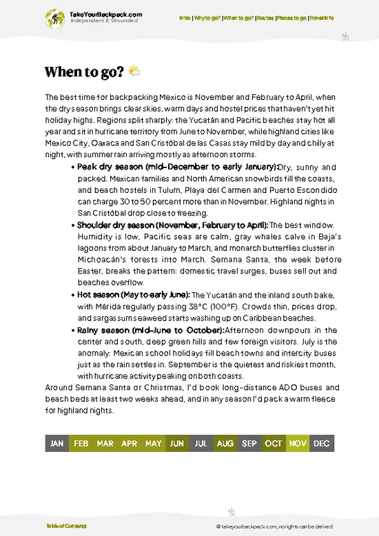
  • Weather: The dry season from November to April offers clear skies and minimal rain, ideal for hiking. The rainy season (May to October) brings frequent afternoon storms that can turn trails muddy and slippery.

  • Temperature: Daytime highs range from 15°C to 25°C (59°F to 77°F) in the dry season, comfortable for trekking. Nights can drop to near freezing at higher elevations, so pack layers.

  • Daylight Hours: Around 11 to 12 hours of daylight year-round, with slightly longer days in summer. Early starts are key to avoid afternoon weather shifts.

  • Crowds: Peak visitation aligns with dry months and weekends, especially December and Easter holidays. Weekdays and shoulder months see fewer hikers, offering more solitude.

  • Seasonal Activities: Spring brings wildflowers and birdwatching opportunities,
read more 👉

  • Weather: The dry season from November to April offers clear skies and minimal rain, ideal for hiking. The rainy season (May to October) brings frequent afternoon storms that can turn trails muddy and slippery.

  • Temperature: Daytime highs range from 15°C to 25°C (59°F to 77°F) in the dry season, comfortable for trekking. Nights can drop to near freezing at higher elevations, so pack layers.

  • Daylight Hours: Around 11 to 12 hours of daylight year-round, with slightly longer days in summer. Early starts are key to avoid afternoon weather shifts.

  • Crowds: Peak visitation aligns with dry months and weekends, especially December and Easter holidays. Weekdays and shoulder months see fewer hikers, offering more solitude.

  • Seasonal Activities: Spring brings wildflowers and birdwatching opportunities, while autumn offers clearer skies for summit views. Winter can be chilly but crisp, rewarding early risers with spectacular sunrises.

  • Price Fluctuations: Local accommodations and transport costs rise during holiday periods and weekends. Booking ahead during these times avoids last-minute premiums.


Pro-tip: Aim for late February to early April—dry trails, manageable temperatures, and fewer crowds let you focus on the climb, not the weather or hassle.


source: climatestotravel.comJANJanuary: highly recommended for travelingFEBFebruary: excellent for travelingMARMarch: excellent for travelingAPRApril: excellent for travelingMAYMay: fair for travelingJUNJune: fair for travelingJULJuly: below average for travelingAUGAugust: below average for travelingSEPSeptember: fair for travelingOCTOctober: good for travelingNOVNovember: highly recommended for travelingDECDecember: highly recommended for traveling
when-to-go

✈️ The backpacker research shortcutMexico Travel Guide

An offline-friendly backpacking guide with optimized travel routes, ranked highlights, transport advice, and the best areas to stay.
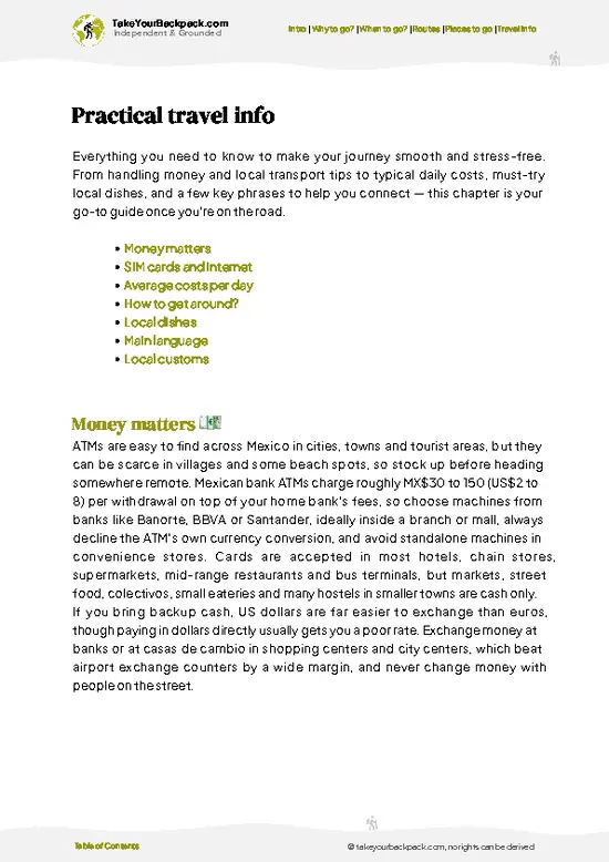
example page 0 from our offline Travel Guide for Mexico
example page 1 from our offline Travel Guide for Mexico
example page 2 from our offline Travel Guide for Mexico
example page 3 from our offline Travel Guide for Mexico
example page 4 from our offline Travel Guide for Mexico
example page 5 from our offline Travel Guide for Mexico
example page 6 from our offline Travel Guide for Mexico
example page 7 from our offline Travel Guide for Mexico
The digital guide (532 pages) contains:
147 highlights, ranked by travel appeal
Optimized 7, 14 & 21-day travel routes
Cities, national parks, landmarks, beaches
How to get around
Offline-friendly for travel without Wi-Fi
👉 Click to see all 30+ guide features

📅 Plan smarter in minutes, not weeks
Month by month travel advice
Festivals & national holidays
Budget expectations

🗺️ Go to the right places, skip the overrated ones
Honest pros & cons of destinations
Top hikes, parks & viewpoints
Lesser-known places most travelers miss
Clear “worth it vs skip it” guidance

🛏️ Travel smoothly without rookie mistakes
Best areas to stay
Transport systems explained simply
Common scams & safety advice
SIM cards, money & practical tips

🌍 Understand the country, not just visit it
Culture & traditions
52 Essential phrases & customs
Festivals worth planning around
Traveler-friendly historical context
Insights that make places more meaningful

📱 Built for real travel conditions
Fully downloadable PDF
Works completely offline
Optimized for phone use
Useful in remote areas & buses
Everything in one place
Save weeks of stressful planning
Get instant access to your full guide. 30‑day money-back guarantee.


By proceeding you agree to our terms.
Sent to your inbox immediately after payment • 100% Secure Checkout
Best Backpacking Travel Advisor 2025 tourism awardBest Backpacking
Travel Advisor
2025
What others say about Take Your Backpack Guides:
⭐⭐⭐⭐⭐
Fantastic, amazing amount of information!
⭐⭐⭐⭐⭐
My goodness this is amazing, it's what I've been looking for hats off too you!
⭐⭐⭐⭐⭐
I think this is absolutely BRILLIANT
⭐⭐⭐⭐
Very complete and informative. It's still missing places, but I gotta to commend you
⭐⭐⭐⭐⭐
This is truly amazing, thank you, can't wait to explore it with my kids!
⭐⭐⭐⭐⭐
Awesome resource, thank you!
⭐⭐⭐⭐⭐
This is amazing! Can't wait to explore the ones I haven't seen
⭐⭐⭐⭐
I love this! Well done, great idea.
⭐⭐⭐⭐⭐
Thanks for taking the time to make this gem!
⭐⭐⭐⭐⭐
This might be the best website I've ever seen.
⭐⭐⭐⭐⭐
Congratulations, and thank you so much for your work; it's incredibly valuable.
⭐⭐⭐⭐
In all seriousness I think you did a great job pointing out the important spots
⭐⭐⭐⭐⭐
10/10 very good
⭐⭐⭐⭐⭐
As someone who's only just starting to visit regularly this is awesome, thank you.
⭐⭐⭐⭐
Thank you very much! I'm going to visit my dad, it's going to be very useful!
⭐⭐⭐⭐⭐
This is really cool! We'll be travelling for the first time and this definitely come in handy.
⭐⭐⭐⭐⭐
You are now our minister of culture, congratulations 👨‍💼
⭐⭐⭐⭐⭐
Just wanted to tell you that this is a pearl! Going to follow your recommendations.
⭐⭐⭐⭐⭐
This is so cool. I'll definitely be using the resource for my travels soon.
⭐⭐⭐⭐⭐
This is very impressive! Good work.
⭐⭐⭐⭐⭐
This is an amazing and informative site. Very well done!

🛏️ Where to stay?Best areas to stay in Mexico

For backpackers heading to La Malinche National Park, options are limited inside the park itself. There are no formal lodges or hostels, so your best bet is to camp. Bring your own gear and set up at designated camping areas for a true nature experience.

Nearby, the town of Huamantla offers budget-friendly hostels and guesthouses. It’s about a 30-minute drive from the park entrance. Alternatively, the city of Tlaxcala is a bit farther but has more amenities and options. Just be aware of transportation costs; public transport can be slow. Plan ahead to keep your energy and budget intact for the trails.

👛 Costs (as of 2 September 2025)Money, prices, and spending tips

Visiting La Malinche National Park in Mexico is an experience that can be both rewarding and budget-friendly, but there are some costs to keep in mind to avoid surprises.

Entrance fees to the park typically range from $2 to $5 USD per person. This fee grants you access to the trails and the stunning landscapes. If you plan to camp, expect to pay around $10 to $15 USD per night for a campsite.

Guided tours are available and can vary widely in price. A basic group tour might cost around $30 to $50 USD, while private guides can charge $100 USD or more, depending on the length and inclusions of the tour.

If you’re considering transportation, local buses from nearby towns like Huamantla or Tlaxcala to the park can cost about $1 to $3 USD. However, if you opt for a taxi or rideshare, the fare … read more 👉
Visiting La Malinche National Park in Mexico is an experience that can be both rewarding and budget-friendly, but there are some costs to keep in mind to avoid surprises.

Entrance fees to the park typically range from $2 to $5 USD per person. This fee grants you access to the trails and the stunning landscapes. If you plan to camp, expect to pay around $10 to $15 USD per night for a campsite.

Guided tours are available and can vary widely in price. A basic group tour might cost around $30 to $50 USD, while private guides can charge $100 USD or more, depending on the length and inclusions of the tour.

If you’re considering transportation, local buses from nearby towns like Huamantla or Tlaxcala to the park can cost about $1 to $3 USD. However, if you opt for a taxi or rideshare, the fare could jump to $15 USD or more, especially if you’re traveling from further away.

Food options inside the park are limited. Bringing your own snacks is wise. If you choose to eat at local eateries outside the park, budget around $5 to $10 USD for a meal.

Plan for these costs to keep your budget intact and your energy focused on enjoying the park’s natural beauty.


source: gob.mx
⚠️ Prices can change and everyone travels differently, so take this as a rough guide. Hope it helps you plan your adventure!

🥾 TrailsBest hikes in La Malinche national park

La Malinche National Park is a hidden gem for hikers looking to explore Mexico’s natural beauty. The park features a mix of lush pine forests and rocky terrain, offering stunning views of the surrounding valleys and the majestic La Malinche volcano. Wildlife enthusiasts will appreciate the chance to spot various birds, deer, and even the occasional wild boar. The trails here can be a bit challenging, but they reward you with breathtaking panoramas.

One of the standout trails is Sendero La Malinche. Here are the details:
  • Length: 10 km
  • Estimated Duration: 4-6 hours
  • Difficulty Level: Moderate to Challenging
  • Key
read more 👉
La Malinche National Park is a hidden gem for hikers looking to explore Mexico’s natural beauty. The park features a mix of lush pine forests and rocky terrain, offering stunning views of the surrounding valleys and the majestic La Malinche volcano. Wildlife enthusiasts will appreciate the chance to spot various birds, deer, and even the occasional wild boar. The trails here can be a bit challenging, but they reward you with breathtaking panoramas.

One of the standout trails is Sendero La Malinche. Here are the details:
  • Length: 10 km
  • Estimated Duration: 4-6 hours
  • Difficulty Level: Moderate to Challenging
  • Key Features: Stunning views from the summit, diverse flora and fauna, and a chance to see volcanic rock formations.
  • Terrain: Steep inclines, rocky paths, and some sections may be muddy after rain.

Getting to La Malinche is pretty straightforward. You can hop on a bus from Puebla or Tlaxcala, and it’ll drop you off near the park entrance. The trails can get a bit busy on weekends, especially during peak season, so if you prefer a quieter experience, aim for a weekday hike. As for the entrance fee, it’s usually quite affordable, so you won’t break the bank just to enjoy the great outdoors. Just remember to bring plenty of water and maybe a snack or two; the views are worth lingering over!
⚠️ Hiking info can sometimes be outdated or inaccurate. Before you hit the trail, check the latest conditions with locals. If you do spot anything that's off, I'd love to hear from you, so I can update it for fellow travelers.

🛡️ SafetyScams, Hazards, and Annoyances

La Malinche offers a manageable hiking experience, but be prepared for its altitude and weather shifts. Temperatures can drop quickly, so layering is key. The trails are well-marked, yet steep sections require attention to footing. Navigation is straightforward, but a map can help if you stray. Wildlife is generally shy; keep a respectful distance and avoid feeding animals. Carry enough water and snacks to maintain energy, and start early to avoid afternoon storms. Simple preparation makes all the difference for enjoying this beautiful park.

Other Mexican national parks near La Malinche

Explore more nearby:

  • Copper Canyon—deep canyons, Tarahumara villages, scenic train, pine-oak forest
  • Calakmul—Maya ruins, dense jungle, howler monkeys, biosphere reserve
  • Cabo Pulmo—living coral reef, snorkeling, whale watching, desert coast

💡 Not sure where to go next?
Create a personalized itinerary for Mexico including La Malinche and the places that fit your trip.

Generate my itinerary

👉 Discover all national parks

Or checkout all Mexico has to offer (think cities, towns, villages, national parks, hikes, beaches, festivals)
Country photo of Mexico

We 💚 feedbackSumming up the experience

La Malinche offers a unique blend of biodiversity and stunning views that make every step worthwhile. But be prepared: the weather can shift quickly, so pack layers. Embrace the unpredictability; it’s part of the adventure. Just don’t let it catch you off guard.

✈️ When did I visit Mexico?
As part of my 1.5 year travel around the world trip, I visited Mexico in February and March 2016. Had to hurry a bit as I didn’t want to miss the free performance of the Rolling Stones in Cuba.

✍️ Help improve this page!
The information on this page is based on my own backpacking experience in Mexico, supplemented with up-to-date research and feedback from other travelers. Travel details can change, so if you notice anything outdated or incomplete, feel free to let me know.


🙋‍♂️ Give feedback

👋 Meet the founderWho’s Behind Take Your Backpack?

Johan, backpacker and founder of TakeYourBackpackHi, I’m Johan (Netherlands 🇳🇱), the creator of TakeYourBackpack. Over the past decade, I’ve backpacked through 80+ countries across six continents, gaining extensive experience with independent travel, long-term trips, and overland routes.

This site is built on a combination of firsthand travel experience and carefully curated insights from other backpackers. Many guides are based on places I’ve personally visited, while others bring together tips, observations, and practical advice shared by trusted travelers I’ve met along the way.

The goal is to provide realistic, experience-driven guidance — not generic itineraries — so you can explore destinations with better context, clearer expectations, and more confidence.

Get full Mexico guide •
Instant download • 147 highlights • Full Offline guide