
×

The Netherlands🇳🇱 | hikesLoonse en Drunense Duinen TrailDrifting sands, heather and juniper, pine woods, fens | things to do and best time to go

Explore KrijtlandpadExplore Maarten van Rossumpad

Backpacking in Loonse en Drunense Duinen Trail
By Johan Kruseman 🇳🇱 | Updated October 15, 2026

The practical advantage most hikers find out too late: the park’s paths are signed by colored marker posts at knotted junctions, and the trails loop back to several parking areas and a bus-reachable edge, so you can shorten or stretch any walk on the spot. The Loonse en Drunense Duinen sit in North Brabant, between Tilburg, Waalwijk and ’s-Hertogenbosch, close to Kaatsheuvel and the Efteling. The good side: shifting dunes up to roughly 30 meters high, heather, pine forest and fens, with easy to moderate walking and loops from 5 to 20 kilometers. The weaker side: it is flat to rolling, the sand is slow underfoot, and bus service to trailheads is thin compared with Veluwe hikes like Hoge Veluwe. Bus lines from Waalwijk or Tilburg reach Kaatsheuvel, then you walk or cycle in. At the Stuifzand café-style kiosk near Kaatsheuvel I paid about €4.50 for a warm appeltaart slice and a coffee, and ate it sitting on a bench facing a wall of bare white sand.

Discover everything you want to know in the 📖 The Netherlands Travel Guide.


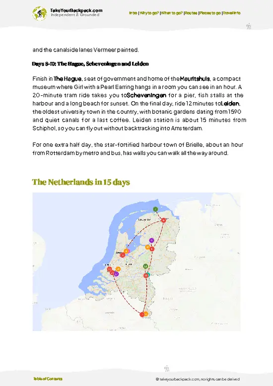
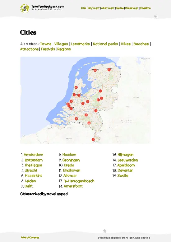
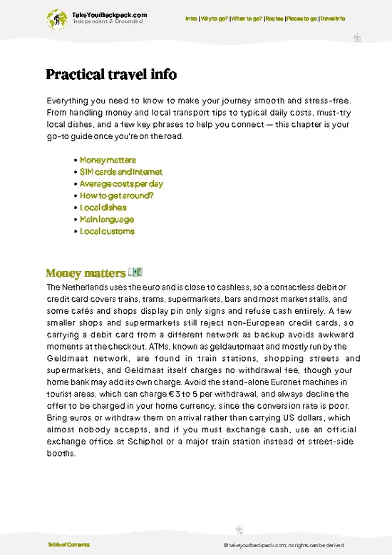
example page 0 from our offline Travel Guide for Netherlands
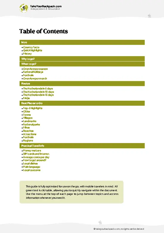
example page 1 from our offline Travel Guide for Netherlands
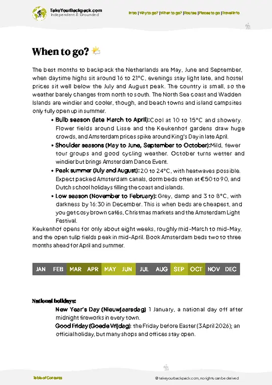
example page 2 from our offline Travel Guide for Netherlands
example page 3 from our offline Travel Guide for Netherlands
example page 4 from our offline Travel Guide for Netherlands
example page 5 from our offline Travel Guide for Netherlands
example page 6 from our offline Travel Guide for Netherlands
example page 7 from our offline Travel Guide for Netherlands
Loading the map 🌍
CLICK TO FILTER
cities
towns
villages
landmarks
national parks
hikes
beaches
attractions
festivals
regions
SHOW COUNTRY’S BESTSHOW ALL

✨ Why go?
Ranked #99 hike in The Netherlands
What makes this hike worth hiking

Backpackers come for the Land van Mulder-style open sand that looks nothing like the rest of the Netherlands: the Zandverstuiving of drifting dunes is the largest inland dune area in the country. You get a desert-like horizon within about 20 minutes of leaving a village street, which is rare in a country this flat and tidy. The second reason is flexibility. With junction-numbered routes and several entrances, you can piece together a 6 kilometer stroll or a full day of 20 kilometers without planning ahead. It also fits a longer route through Brabant, since Tilburg and ’s-Hertogenbosch both have trains, hostels and bike rental, and the area can be linked with Kaatsheuvel’s walks on a single day trip. Costs stay low: entry to the nature area is free, and a day usually needs only a bus fare and a packed lunch.

💡 HighlightsEssential experiences to have while hiking the Loonse en Drunense Duinen Trail

  1. Drifting sand dunes (Verstuiving): Wide stretches of bare, wind-shaped sand with almost no cover, a landscape found nowhere else this size in the Netherlands. Walk across the open dunes and the distant pines look like a coastline.
  2. Heather and juniper heath: In late summer the heath turns purple, with sheep grazing and junipers scattered through. It is the softest-looking part of the park.
  3. Pine forests: Planted in the 19th century to hold back the sand, the Scots pine woods give cool shade and quiet paths, a good contrast to the dunes.
  4. Fens and pools: Small ponds in the hollows between dunes attract frogs, dragonflies and wading birds. They are a good place to stop and watch.
  5. Wildlife: Look for roe deer, foxes, lizards and nightjars at dusk in summer. Quiet early starts improve your chances considerably.
… read more 👉
  1. Drifting sand dunes (Verstuiving): Wide stretches of bare, wind-shaped sand with almost no cover, a landscape found nowhere else this size in the Netherlands. Walk across the open dunes and the distant pines look like a coastline.
  2. Heather and juniper heath: In late summer the heath turns purple, with sheep grazing and junipers scattered through. It is the softest-looking part of the park.
  3. Pine forests: Planted in the 19th century to hold back the sand, the Scots pine woods give cool shade and quiet paths, a good contrast to the dunes.
  4. Fens and pools: Small ponds in the hollows between dunes attract frogs, dragonflies and wading birds. They are a good place to stop and watch.
  5. Wildlife: Look for roe deer, foxes, lizards and nightjars at dusk in summer. Quiet early starts improve your chances considerably.
Skip the pines when time is short and spend it on the open dunes.
Spotted a mistake or missing something? Contact us.

Things to do near Loonse en Drunense Duinen Trail

Ratings based on Tripadvisor reviews. When you book through this link, you support our work at no extra cost to you.

🌤️ When to go?Choosing the right time of year

The best time to hike the Loonse en Drunense Duinen Trail is late April to June, or September to early October, when days are mild and the heather and forest paths are at their best.
  • Spring (April to June): Highs of 12 to 21°C (54 to 70°F), long days of 14 to 16 hours of light, and fresh birch and pine greens. Weekends fill with day walkers and cyclists.
  • Summer (July to August): Highs of 20 to 25°C (68 to 77°F), occasionally hotter, with daylight until about 22:00. Shade is patchy on the sand drifts, and the heat reflects off them. Prices for nearby campsites and B&Bs peak.
  • Autumn (September to October): Highs of 12 to 18°C (54 to 64°F). Fewer people, and August to September brings purple heather bloom into early autumn. Rain becomes more frequent.
  • Winter (November to March): Highs of 3 to 8°C
… read more 👉
The best time to hike the Loonse en Drunense Duinen Trail is late April to June, or September to early October, when days are mild and the heather and forest paths are at their best.
  • Spring (April to June): Highs of 12 to 21°C (54 to 70°F), long days of 14 to 16 hours of light, and fresh birch and pine greens. Weekends fill with day walkers and cyclists.
  • Summer (July to August): Highs of 20 to 25°C (68 to 77°F), occasionally hotter, with daylight until about 22:00. Shade is patchy on the sand drifts, and the heat reflects off them. Prices for nearby campsites and B&Bs peak.
  • Autumn (September to October): Highs of 12 to 18°C (54 to 64°F). Fewer people, and August to September brings purple heather bloom into early autumn. Rain becomes more frequent.
  • Winter (November to March): Highs of 3 to 8°C (37 to 46°F), only 8 to 9 hours of daylight, and wet, muddy forest tracks. Quiet trails and the lowest accommodation prices, though some cafes close.
Aim for a weekday in late August for the heather bloom with thinner crowds.


source: climatestotravel.comJANJanuary: fair for travelingFEBFebruary: fair for travelingMARMarch: good for travelingAPRApril: highly recommended for travelingMAYMay: excellent for travelingJUNJune: highly recommended for travelingJULJuly: good for travelingAUGAugust: good for travelingSEPSeptember: excellent for travelingOCTOctober: highly recommended for travelingNOVNovember: fair for travelingDECDecember: fair for traveling
when-to-go

✈️ The backpacker research shortcutThe Netherlands Travel Guide

An offline-friendly backpacking guide with optimized travel routes, ranked highlights, transport advice, and the best areas to stay.
example page 0 from our offline Travel Guide for Netherlands
example page 1 from our offline Travel Guide for Netherlands
example page 2 from our offline Travel Guide for Netherlands
example page 3 from our offline Travel Guide for Netherlands
example page 4 from our offline Travel Guide for Netherlands
example page 5 from our offline Travel Guide for Netherlands
example page 6 from our offline Travel Guide for Netherlands
example page 7 from our offline Travel Guide for Netherlands
The digital guide (373 pages) contains:
✅ 127 highlights, ranked by travel appeal
✅ Optimized 5, 10 & 15-day travel routes
✅ Cities, national parks, landmarks, beaches
✅ How to get around
✅ Offline-friendly for travel without Wi-Fi
👉 Click to see all 30+ guide features

📅 Plan smarter in minutes, not weeks
✅ Month by month travel advice
✅ Festivals & national holidays
✅ Budget expectations

🗺️ Go to the right places, skip the overrated ones
✅ Honest pros & cons of destinations
✅ Top hikes, parks & viewpoints
✅ Lesser-known places most travelers miss
✅ Clear “worth it vs skip it” guidance

🛏️ Travel smoothly without rookie mistakes
✅ Best areas to stay
✅ Transport systems explained simply
✅ Common scams & safety advice
✅ SIM cards, money & practical tips

🌍 Understand the country, not just visit it
✅ Culture & traditions
✅ 52 Essential phrases & customs
✅ Festivals worth planning around
✅ Traveler-friendly historical context
✅ Insights that make places more meaningful

📱 Built for real travel conditions
✅ Fully downloadable PDF
✅ Works completely offline
✅ Optimized for phone use
✅ Useful in remote areas & buses
✅ Everything in one place
Stop searching, start planning
Get instant access to your full guide. 30‑day money-back guarantee.
+ Add another guide for just

By proceeding you agree to our terms.
Sent to your inbox immediately after payment • 100% Secure Checkout
Best Backpacking Travel Advisor 2025 tourism awardBest Backpacking
Travel Advisor
2025
What others say about Take Your Backpack Guides:
⭐⭐⭐⭐⭐
Fantastic, amazing amount of information!
⭐⭐⭐⭐⭐
My goodness this is amazing, it's what I've been looking for hats off too you!
⭐⭐⭐⭐⭐
I think this is absolutely BRILLIANT
⭐⭐⭐⭐
Very complete and informative. It's still missing places, but I gotta to commend you
⭐⭐⭐⭐⭐
This is truly amazing, thank you, can't wait to explore it with my kids!
⭐⭐⭐⭐⭐
Awesome resource, thank you!
⭐⭐⭐⭐⭐
This is amazing! Can't wait to explore the ones I haven't seen
⭐⭐⭐⭐
I love this! Well done, great idea.
⭐⭐⭐⭐⭐
Thanks for taking the time to make this gem!
⭐⭐⭐⭐⭐
This might be the best website I've ever seen.
⭐⭐⭐⭐⭐
Congratulations, and thank you so much for your work; it's incredibly valuable.
⭐⭐⭐⭐
In all seriousness I think you did a great job pointing out the important spots
⭐⭐⭐⭐⭐
10/10 very good
⭐⭐⭐⭐⭐
As someone who's only just starting to visit regularly this is awesome, thank you.
⭐⭐⭐⭐
Thank you very much! I'm going to visit my dad, it's going to be very useful!
⭐⭐⭐⭐⭐
This is really cool! We'll be travelling for the first time and this definitely come in handy.
⭐⭐⭐⭐⭐
You are now our minister of culture, congratulations 👨‍💼
⭐⭐⭐⭐⭐
Just wanted to tell you that this is a pearl! Going to follow your recommendations.
⭐⭐⭐⭐⭐
This is so cool. I'll definitely be using the resource for my travels soon.
⭐⭐⭐⭐⭐
This is very impressive! Good work.
⭐⭐⭐⭐⭐
This is an amazing and informative site. Very well done!

🛏️ Where to stay?Best areas to stay in The Netherlands

If you enjoy meeting fellow travelers, consider choosing hostels with high ratings for atmosphere. On the other hand, if you prefer having your own space, a hotel might be a better option.

🥾 Hike detailsTrail overview: what to expect on the hike

Total Distance: Marked loops run roughly 5 to 20 kilometers; a typical full-day route is about 15 to 18 kilometers.
Estimated Duration: 1.5 to 5 hours depending on loop, with extra time for slow sand sections.
Difficulty: Easy to moderate. There is little climbing, but soft sand adds effort.
Starting Point: Common trailheads are near Kaatsheuvel and Loon op Zand. Public transport:
  • Bus: Regional buses from Tilburg and Waalwijk stop in Kaatsheuvel and Loon op Zand, followed by a short walk or bike ride.
  • Train: Trains reach Tilburg and ’s-Hertogenbosch, where you change to the bus.
Major Landmarks:
  • Drunense
… read more 👉
Total Distance: Marked loops run roughly 5 to 20 kilometers; a typical full-day route is about 15 to 18 kilometers.
Estimated Duration: 1.5 to 5 hours depending on loop, with extra time for slow sand sections.
Difficulty: Easy to moderate. There is little climbing, but soft sand adds effort.
Starting Point: Common trailheads are near Kaatsheuvel and Loon op Zand. Public transport:
  • Bus: Regional buses from Tilburg and Waalwijk stop in Kaatsheuvel and Loon op Zand, followed by a short walk or bike ride.
  • Train: Trains reach Tilburg and ’s-Hertogenbosch, where you change to the bus.
Major Landmarks:
  • Drunense Duinen: The large open sand drifts in the north.
  • Loonse Duinen and Leemkuilen: Heath and forest to the south.
  • Pools and fens: Small waters between dunes.
Terrain and Scenery: Sand, forest paths and heath tracks, mostly flat with low dune ridges. Views open wide across bare sand.
Vegetation: Scots pine, heather, juniper, grasses and mosses.
Wildlife: Roe deer, foxes, lizards, nightjars and woodlarks, plus grazing sheep on some heath areas.
⚠️ Hiking info can sometimes be outdated or inaccurate. Before you hit the trail, check the latest conditions with locals. If you do spot anything that's off, I'd love to hear from you, so I can update it for fellow travelers.

🛡️ SafetyStaying Safe: What Travelers Should Know

The Loonse en Drunense Duinen Trail is a low-risk hike on well-marked sandy paths with no real altitude, so ordinary preparation is enough. The main issue is the soft sand: walking through the open drifts is slower and more tiring than the distance suggests, so pace yourself and wear shoes that keep sand out, such as light trail shoes with gaiters or snug-fitting uppers. Shade is limited on the dunes, so carry sun protection and at least 1.5 liters of water in summer, since there are few refill points along the route. Navigation is simple with the waymarkers, but junctions in the forest sections can confuse you, so keep an offline map handy. Ticks are common in heather and long grass, so wear long trousers and check your skin afterward. Highland cattle and sheep graze in parts of the area; … read more 👉
The Loonse en Drunense Duinen Trail is a low-risk hike on well-marked sandy paths with no real altitude, so ordinary preparation is enough. The main issue is the soft sand: walking through the open drifts is slower and more tiring than the distance suggests, so pace yourself and wear shoes that keep sand out, such as light trail shoes with gaiters or snug-fitting uppers. Shade is limited on the dunes, so carry sun protection and at least 1.5 liters of water in summer, since there are few refill points along the route. Navigation is simple with the waymarkers, but junctions in the forest sections can confuse you, so keep an offline map handy. Ticks are common in heather and long grass, so wear long trousers and check your skin afterward. Highland cattle and sheep graze in parts of the area; keep your distance and keep dogs on a leash. Stay on marked paths to protect the nesting birds and the drifting sands.

FAQFrequently asked questions about Loonse en Drunense Duinen Trail

Most walkers need 1.5 to 5 hours, depending on which marked loop they pick. Short loops of 5 to 8 kilometers take about 1.5 to 2 hours, while a 15 to 18 kilometer route takes around 4 to 5 hours because soft sand slows the pace. Plan a full day if you add a café stop in Kaatsheuvel.
The hike is easy to moderate. There is almost no elevation gain, with dune ridges of about 30 meters at most, but soft sand on the Drunense Duinen section makes walking more tiring. Routes of 15 kilometers or more suit reasonably fit walkers, and shorter loops are fine for children.
No guide is needed, as paths are signposted with colored markers and junction numbers. There is no permit and no entrance fee for walking in the area. Stay on marked paths, since parts are protected nature reserve, and keep dogs on a leash.
⚠️ Things can change over time, so always validate details locally before you go.

Other Dutch hikes near Loonse en Drunense Duinen Trail

Explore more nearby:


💡 Not sure where to go next?
Create a personalized itinerary for The Netherlands including Loonse en Drunense Duinen Trail and the places that fit your trip.

Generate my itinerary

👉 Discover all hikes

Or checkout all The Netherlands has to offer (think cities, towns, villages, national parks, hikes, beaches, festivals)
Country photo of The Netherlands

We 💚 feedbackIs it worth it?

This place suits walkers who like open space and short, flexible loops, especially families, birders and anyone based in Tilburg or ’s-Hertogenbosch. If you want mountains or multi-day solitude, you will find it small and sandy. For an easy day that feels oddly like a desert, it works very well.

✈️ When did I visit The Netherlands?
Netherlands is my home base, so whenever I don’t travel, you can find me in this tiny spot on the globe. When friends from abroad visit me, it’s the time to actually explore my own country as a traveler.

✍️ Help improve this page!
The information on this page is based on my own backpacking experience in The Netherlands, supplemented with up-to-date research and feedback from other travelers. Travel details can change, so if you notice anything outdated or incomplete, feel free to let me know.


🙋‍♂️ Give feedback

👋 Meet the founderWho’s Behind Take Your Backpack?

Johan, backpacker and founder of TakeYourBackpackHi, I’m Johan (Netherlands 🇳🇱), the creator of TakeYourBackpack. Over the past 3 decades, I’ve backpacked through 90+ countries across six continents, gaining extensive experience with independent travel, long-term trips, and overland routes.

This site is built on a combination of firsthand travel experience and carefully curated insights from other backpackers. Many guides are based on places I’ve personally visited, while others bring together tips, observations, and practical advice shared by trusted travelers I’ve met along the way.

The goal is to provide realistic, experience-driven guidance — not generic itineraries — so you can explore destinations with better context, clearer expectations, and more confidence.