×

The Netherlands🇳🇱 | hikesKrijtlandpadChalk hollow lanes, orchard slopes, Geul meadows, Wittem | things to do and best time to go

Explore Sprengenberg Route (Sallandse Heuvelrug)Explore Loonse en Drunense Duinen Trail

Backpacking in Krijtlandpad
🏆 Top pickhike ranked #2
By Johan Kruseman 🇳🇱 | Updated October 15, 2026

The main decision is whether to walk Krijtlandpad in one long day or split it over two, and the deciding factor is how much time you give the climbs. The route sits in South Limburg, in the Heuvelland around Gulpen and Wittem, where the Netherlands finally has real gradients. Expect hollow lanes, orchards, chalk-white fields and Geul valley meadows, roughly 20 to 25 km with repeated short, steep ascents. That makes it harder than any flat Dutch trail, though far easier than alpine hiking. Regional buses from Maastricht and Valkenburg reach the area, but they thin out in the evening and on Sundays, so check timetables first. Compared with nearby Mergelland routes, it is quieter and less polished. I stepped off the bus in Gulpen, followed the first waymark uphill, and the road dropped into a sunken lane with pale chalk showing in the banks. Ten minutes from the stop, the village noise was gone.

Discover everything you want to know in the 📖 The Netherlands Travel Guide.


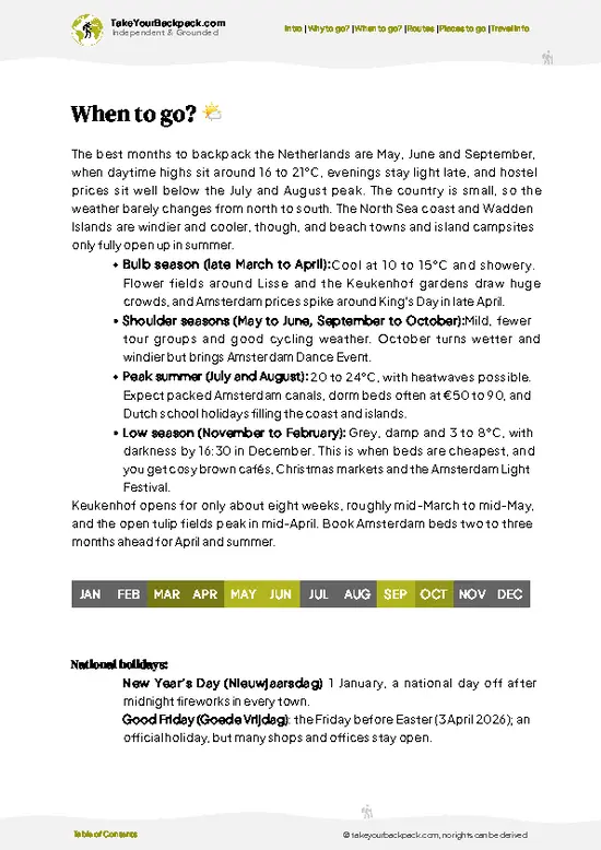
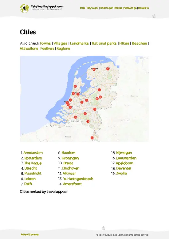
example page 0 from our offline Travel Guide for Netherlands
example page 1 from our offline Travel Guide for Netherlands
example page 2 from our offline Travel Guide for Netherlands
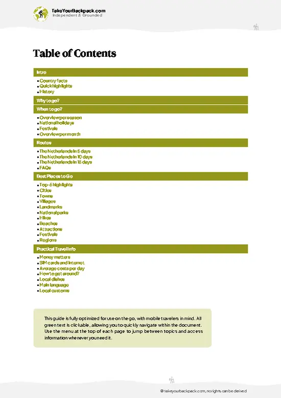
example page 3 from our offline Travel Guide for Netherlands
example page 4 from our offline Travel Guide for Netherlands
example page 5 from our offline Travel Guide for Netherlands
example page 6 from our offline Travel Guide for Netherlands
example page 7 from our offline Travel Guide for Netherlands
Loading the map 🌍
CLICK TO FILTER
cities
towns
villages
landmarks
national parks
hikes
beaches
attractions
festivals
regions
SHOW COUNTRY’S BESTSHOW ALL

✨ Why go?
Ranked #2 hike in The Netherlands
The unique appeal for travelers

Backpackers come for relief. After days of canals and flat polder cycling, South Limburg’s rolling Heuvelland delivers actual elevation, with short climbs that open onto long views across fruit trees and grazing land. The walk feels foreign to the rest of the country, which is the point.
The second reason is logistics. Maastricht is a natural hub on a Netherlands-Belgium-Germany route, and the trail starts a short regional bus ride away, so you can leave your big pack at your hostel and walk with a daypack. The Dutch, Belgian and German borders sit within a few kilometers, which makes Vaals and the Drielandenpunt a handy add-on if you want a longer outing.
The third is flexibility. Villages with cafés appear regularly along the route, so you can cut the day short or stretch it into an overnight … read more 👉
Backpackers come for relief. After days of canals and flat polder cycling, South Limburg’s rolling Heuvelland delivers actual elevation, with short climbs that open onto long views across fruit trees and grazing land. The walk feels foreign to the rest of the country, which is the point.
The second reason is logistics. Maastricht is a natural hub on a Netherlands-Belgium-Germany route, and the trail starts a short regional bus ride away, so you can leave your big pack at your hostel and walk with a daypack. The Dutch, Belgian and German borders sit within a few kilometers, which makes Vaals and the Drielandenpunt a handy add-on if you want a longer outing.
The third is flexibility. Villages with cafés appear regularly along the route, so you can cut the day short or stretch it into an overnight at a local guesthouse. Bring cash for the smaller places, since not every café takes cards.

💡 HighlightsEssential experiences to have while hiking the Krijtlandpad

  1. Chalk-banked hollow lanes: Sunken paths worn deep into the hillsides expose pale limestone and loess in the banks, and tree roots arch overhead. They are the clearest sign you are walking on chalk country.
  2. Orchard slopes: Hillsides of apple and pear trees dominate the area. Blossom in spring and ripe fruit in early autumn make these stretches the most colorful.
  3. Geul valley meadows: The Geul is a small, winding stream with grazed meadows and willows along its banks. The flat valley floor gives your legs a rest between climbs.
  4. Wittem and its surroundings: This small Limburg village has a castle and a monastery complex, and it works as a natural coffee stop. The brick and timber-framed buildings are typical of the region.
  5. Open plateau viewpoints: At the top of the climbs, fields roll away to the
… read more 👉
  1. Chalk-banked hollow lanes: Sunken paths worn deep into the hillsides expose pale limestone and loess in the banks, and tree roots arch overhead. They are the clearest sign you are walking on chalk country.
  2. Orchard slopes: Hillsides of apple and pear trees dominate the area. Blossom in spring and ripe fruit in early autumn make these stretches the most colorful.
  3. Geul valley meadows: The Geul is a small, winding stream with grazed meadows and willows along its banks. The flat valley floor gives your legs a rest between climbs.
  4. Wittem and its surroundings: This small Limburg village has a castle and a monastery complex, and it works as a natural coffee stop. The brick and timber-framed buildings are typical of the region.
  5. Open plateau viewpoints: At the top of the climbs, fields roll away to the horizon, with Belgian and German hills visible on clear days. They are the best places to see how close three countries sit.
Do the hollow lanes first, early in the morning, when the light is soft and the banks are still shaded and quiet.
Spotted a mistake or missing something? Contact us.

Things to do near Krijtlandpad

Ratings based on Tripadvisor reviews. When you book through this link, you support our work at no extra cost to you.

🌤️ When to go?When to go for the best experience

  • Spring (April to May): The best window for the Krijtlandpad, with highs of 12 to 18°C (54 to 64°F), long days of 14 to 16 hours of light, and orchids and chalk grassland flowers coming into bloom. Lambing and blossom season draws weekend walkers to the Gulpen and Vaals area.
  • Summer (June to August): Highs of 20 to 25°C (68 to 77°F), occasionally hotter, with daylight stretching past 9:30 pm. Shade is patchy on the plateau, so start early. Accommodation in South Limburg costs the most in July and August.
  • Autumn (September to October): Highs of 12 to 19°C (54 to 66°F), quieter paths, golden beech woods and shorter days of 10 to 13 hours. Rain is frequent and the clay sections get slippery.
  • Winter (November to March): Highs of 2 to 8°C (36 to 46°F), often wet, with only 8 to 10 hours of daylight
… read more 👉
  • Spring (April to May): The best window for the Krijtlandpad, with highs of 12 to 18°C (54 to 64°F), long days of 14 to 16 hours of light, and orchids and chalk grassland flowers coming into bloom. Lambing and blossom season draws weekend walkers to the Gulpen and Vaals area.
  • Summer (June to August): Highs of 20 to 25°C (68 to 77°F), occasionally hotter, with daylight stretching past 9:30 pm. Shade is patchy on the plateau, so start early. Accommodation in South Limburg costs the most in July and August.
  • Autumn (September to October): Highs of 12 to 19°C (54 to 66°F), quieter paths, golden beech woods and shorter days of 10 to 13 hours. Rain is frequent and the clay sections get slippery.
  • Winter (November to March): Highs of 2 to 8°C (36 to 46°F), often wet, with only 8 to 10 hours of daylight at the darkest. Mud is heavy, but crowds vanish and rooms are cheapest. Frost can make steep slopes tricky.
Aim for a weekday in late April or May to get blooms, long light and empty paths together.


source: climatestotravel.comJANJanuary: fair for travelingFEBFebruary: fair for travelingMARMarch: good for travelingAPRApril: highly recommended for travelingMAYMay: excellent for travelingJUNJune: highly recommended for travelingJULJuly: good for travelingAUGAugust: good for travelingSEPSeptember: excellent for travelingOCTOctober: highly recommended for travelingNOVNovember: fair for travelingDECDecember: fair for traveling
netherlands-hike-krijtlandpad
© Google |

✈️ The backpacker research shortcutThe Netherlands Travel Guide

An offline-friendly backpacking guide with optimized travel routes, ranked highlights, transport advice, and the best areas to stay.
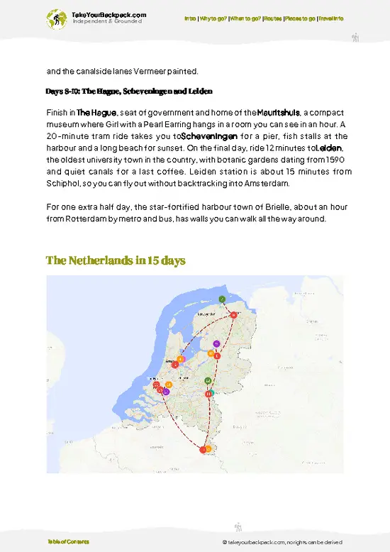
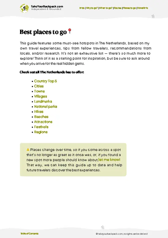
example page 0 from our offline Travel Guide for Netherlands
example page 1 from our offline Travel Guide for Netherlands
example page 2 from our offline Travel Guide for Netherlands
example page 3 from our offline Travel Guide for Netherlands
example page 4 from our offline Travel Guide for Netherlands
example page 5 from our offline Travel Guide for Netherlands
example page 6 from our offline Travel Guide for Netherlands
example page 7 from our offline Travel Guide for Netherlands
The digital guide (373 pages) contains:
✅ 127 highlights, ranked by travel appeal
✅ Optimized 5, 10 & 15-day travel routes
✅ Cities, national parks, landmarks, beaches
✅ How to get around
✅ Offline-friendly for travel without Wi-Fi
👉 Click to see all 30+ guide features

📅 Plan smarter in minutes, not weeks
✅ Month by month travel advice
✅ Festivals & national holidays
✅ Budget expectations

🗺️ Go to the right places, skip the overrated ones
✅ Honest pros & cons of destinations
✅ Top hikes, parks & viewpoints
✅ Lesser-known places most travelers miss
✅ Clear “worth it vs skip it” guidance

🛏️ Travel smoothly without rookie mistakes
✅ Best areas to stay
✅ Transport systems explained simply
✅ Common scams & safety advice
✅ SIM cards, money & practical tips

🌍 Understand the country, not just visit it
✅ Culture & traditions
✅ 52 Essential phrases & customs
✅ Festivals worth planning around
✅ Traveler-friendly historical context
✅ Insights that make places more meaningful

📱 Built for real travel conditions
✅ Fully downloadable PDF
✅ Works completely offline
✅ Optimized for phone use
✅ Useful in remote areas & buses
✅ Everything in one place
Stop searching, start planning
Get instant access to your full guide. 30‑day money-back guarantee.
+ Add another guide for just

By proceeding you agree to our terms.
Sent to your inbox immediately after payment • 100% Secure Checkout
Best Backpacking Travel Advisor 2025 tourism awardBest Backpacking
Travel Advisor
2025
What others say about Take Your Backpack Guides:
⭐⭐⭐⭐⭐
Fantastic, amazing amount of information!
⭐⭐⭐⭐⭐
My goodness this is amazing, it's what I've been looking for hats off too you!
⭐⭐⭐⭐⭐
I think this is absolutely BRILLIANT
⭐⭐⭐⭐
Very complete and informative. It's still missing places, but I gotta to commend you
⭐⭐⭐⭐⭐
This is truly amazing, thank you, can't wait to explore it with my kids!
⭐⭐⭐⭐⭐
Awesome resource, thank you!
⭐⭐⭐⭐⭐
This is amazing! Can't wait to explore the ones I haven't seen
⭐⭐⭐⭐
I love this! Well done, great idea.
⭐⭐⭐⭐⭐
Thanks for taking the time to make this gem!
⭐⭐⭐⭐⭐
This might be the best website I've ever seen.
⭐⭐⭐⭐⭐
Congratulations, and thank you so much for your work; it's incredibly valuable.
⭐⭐⭐⭐
In all seriousness I think you did a great job pointing out the important spots
⭐⭐⭐⭐⭐
10/10 very good
⭐⭐⭐⭐⭐
As someone who's only just starting to visit regularly this is awesome, thank you.
⭐⭐⭐⭐
Thank you very much! I'm going to visit my dad, it's going to be very useful!
⭐⭐⭐⭐⭐
This is really cool! We'll be travelling for the first time and this definitely come in handy.
⭐⭐⭐⭐⭐
You are now our minister of culture, congratulations 👨‍💼
⭐⭐⭐⭐⭐
Just wanted to tell you that this is a pearl! Going to follow your recommendations.
⭐⭐⭐⭐⭐
This is so cool. I'll definitely be using the resource for my travels soon.
⭐⭐⭐⭐⭐
This is very impressive! Good work.
⭐⭐⭐⭐⭐
This is an amazing and informative site. Very well done!

🛏️ Where to stay?Choosing the right base

If you enjoy meeting fellow travelers, consider choosing hostels with high ratings for atmosphere. On the other hand, if you prefer having your own space, a hotel might be a better option.

🥾 Hike detailsEverything you need to know before hiking Krijtlandpad

Total Distance: Roughly 20 to 25 km, depending on the variation you choose.
Estimated Duration: 6 to 7 hours of walking at a steady pace, 8 or more with stops.
Difficulty: Moderate. The surface is easy, but repeated short, steep climbs add up, and muddy sections in wet months slow you down.
Starting Point: The villages of Gulpen or Wittem in South Limburg.
  • By public transport: Take the train to Maastricht or Valkenburg, then a regional bus toward Gulpen and Wittem. Buses are less frequent in the evenings and on Sundays.
  • Return: Plan your last bus before you set out and keep a taxi number as a backup.
… read more 👉
Total Distance: Roughly 20 to 25 km, depending on the variation you choose.
Estimated Duration: 6 to 7 hours of walking at a steady pace, 8 or more with stops.
Difficulty: Moderate. The surface is easy, but repeated short, steep climbs add up, and muddy sections in wet months slow you down.
Starting Point: The villages of Gulpen or Wittem in South Limburg.
  • By public transport: Take the train to Maastricht or Valkenburg, then a regional bus toward Gulpen and Wittem. Buses are less frequent in the evenings and on Sundays.
  • Return: Plan your last bus before you set out and keep a taxi number as a backup.
Major Landmarks:
  • Hollow lanes: Deep sunken paths with exposed chalk banks.
  • Geul valley: Meadows and a small meandering stream.
  • Wittem: A village with a castle and monastery.
  • Plateau viewpoints: Open farmland with long views across the borders.
Terrain and Scenery: Rolling hills, with a mix of unpaved farm tracks, forest paths and short stretches of quiet road. Chalk and loess soils turn slick after rain, so shoes with grip are worthwhile.
Vegetation: Orchards, hedgerows, beech and oak patches, and wildflower verges. Spring blossom and autumn fruit are the highlights.
Wildlife: Songbirds, buzzards overhead, and the occasional roe deer at the edges of woodland. Grazing cattle and sheep sometimes share the paths, so close gates behind you.
Practical Notes: Carry water and snacks, since cafés cluster in villages and may close early or on Mondays. Waymarks are present but a downloaded offline map helps at junctions.
⚠️ Hiking info can sometimes be outdated or inaccurate. Before you hit the trail, check the latest conditions with locals. If you do spot anything that's off, I'd love to hear from you, so I can update it for fellow travelers.

🛡️ SafetyStaying Safe: What Travelers Should Know

The Krijtlandpad is a well-marked, low-risk walk through the rolling hills of South Limburg, and the main issues are mud and fatigue rather than danger. After rain, the loess and clay slopes turn greasy, so wear boots with real tread instead of trail runners, and take the descents slowly. Waymarks are frequent, but junctions in farmland and woods are easy to miss, so keep a downloaded map on your phone. There is no altitude issue, though the repeated short climbs add up over a full day. Weather changes quickly, so carry a rain layer even on sunny mornings. Shade is limited on open plateaus in summer, so bring sunscreen and at least 1.5 liters of water, since cafés and shops can be far apart and often close early on Sundays. Check for ticks after walking through long grass and bracken. Cattle … read more 👉
The Krijtlandpad is a well-marked, low-risk walk through the rolling hills of South Limburg, and the main issues are mud and fatigue rather than danger. After rain, the loess and clay slopes turn greasy, so wear boots with real tread instead of trail runners, and take the descents slowly. Waymarks are frequent, but junctions in farmland and woods are easy to miss, so keep a downloaded map on your phone. There is no altitude issue, though the repeated short climbs add up over a full day. Weather changes quickly, so carry a rain layer even on sunny mornings. Shade is limited on open plateaus in summer, so bring sunscreen and at least 1.5 liters of water, since cafés and shops can be far apart and often close early on Sundays. Check for ticks after walking through long grass and bracken. Cattle and sheep graze some sections. Close gates behind you, stay calm, and keep dogs on a leash. Stay on marked paths in the protected chalk grassland.

FAQTraveler FAQ

Plan on 6 to 7 hours of walking for the full route of roughly 20 to 25 km, or 8 hours with café stops. Most people finish it as a long day hike from Gulpen or Wittem. If you prefer a relaxed pace, split it across two days and sleep in a village guesthouse.
Moderate is the fair rating. The paths are mostly easy underfoot, but South Limburg’s short, steep climbs repeat all day, and chalk lanes get slippery after rain. A reasonable fitness level and shoes with decent tread are enough, and you do not need any technical skills.
Neither is needed. The route is public, waymarked and free to walk, so you can start from Gulpen or Wittem without booking. Bring an offline map for junctions, and keep to the marked paths because some tracks cross private farmland and orchards.
⚠️ Things can change over time, so always validate details locally before you go.

Other Dutch hikes near Krijtlandpad

Explore more nearby:


💡 Not sure where to go next?
Create a personalized itinerary for The Netherlands including Krijtlandpad and the places that fit your trip.

Generate my itinerary

👉 Discover all hikes

Or checkout all The Netherlands has to offer (think cities, towns, villages, national parks, hikes, beaches, festivals)
Country photo of The Netherlands

We 💚 feedbackIs it worth it?

The mistake to avoid is treating this like a flat Dutch stroll and starting at midday in thin sneakers. The climbs are short but steep, and the chalk lanes turn greasy after rain. Start early, wear shoes with real grip, and check the last bus back before you leave. Do that, and the hills feel like a pleasant surprise rather than a slog.

✈️ When did I visit The Netherlands?
Netherlands is my home base, so whenever I don’t travel, you can find me in this tiny spot on the globe. When friends from abroad visit me, it’s the time to actually explore my own country as a traveler.

✍️ Help improve this page!
The information on this page is based on my own backpacking experience in The Netherlands, supplemented with up-to-date research and feedback from other travelers. Travel details can change, so if you notice anything outdated or incomplete, feel free to let me know.


🙋‍♂️ Give feedback

👋 Meet the founderWho’s Behind Take Your Backpack?

Johan, backpacker and founder of TakeYourBackpackHi, I’m Johan (Netherlands 🇳🇱), the creator of TakeYourBackpack. Over the past 3 decades, I’ve backpacked through 90+ countries across six continents, gaining extensive experience with independent travel, long-term trips, and overland routes.

This site is built on a combination of firsthand travel experience and carefully curated insights from other backpackers. Many guides are based on places I’ve personally visited, while others bring together tips, observations, and practical advice shared by trusted travelers I’ve met along the way.

The goal is to provide realistic, experience-driven guidance — not generic itineraries — so you can explore destinations with better context, clearer expectations, and more confidence.