
×

New Zealand🇳🇿 | hikesAbel Tasman Coast TrackTidal estuary crossing, golden bays, water taxi hops, seal colony | things to do and best time to go

Explore SploreExplore Hooker Valley Track

Backpacking in Abel Tasman Coast Track
🌟 Highlighthike ranked #4
By Johan Kruseman 🇳🇱 | Updated October 15, 2026

The real decision is whether to walk the whole track or ride a water taxi for part of it, and the tides tip it. The Abel Tasman Coast Track runs along the northern edge of the South Island in New Zealand, and the Awaroa estuary crossing is passable only about two hours either side of low tide, so a missed crossing costs you half a day or an unplanned detour. I took the shuttle from Nelson to Marahau, and the driver stopped at a roadside stall so I could buy a bag of plums that I ate on the first beach. Book huts and campsites months ahead through the Department of Conservation, since huts and campsites must be booked all year. Carry cash for taxis, buy food in Motueka or Nelson because there are no shops on the track, and walk it as a one-way trip. The flat gradients make it easy, though the road access is the weak point. The first beach at Anchorage has golden sand and clear turquoise water.

Discover everything you want to know in the 📖 New Zealand Travel Guide.
Best time to go: October - April
Duration: 3 to 5 days
Distance: 60 kilometers
Total ascent: 1000 meters


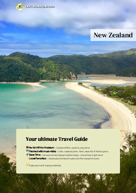
example page 0 from our offline Travel Guide for New Zealand
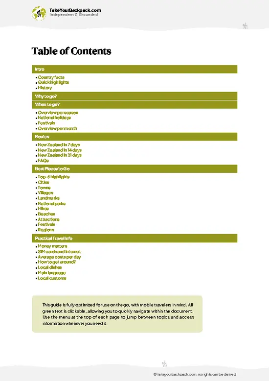
example page 1 from our offline Travel Guide for New Zealand
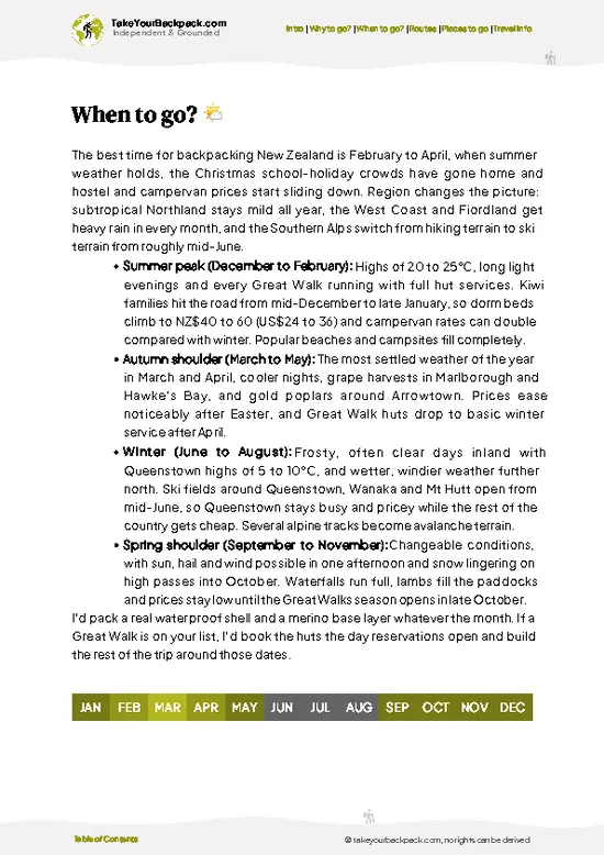
example page 2 from our offline Travel Guide for New Zealand
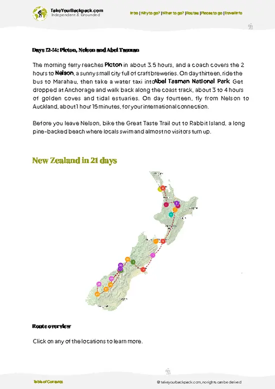
example page 3 from our offline Travel Guide for New Zealand
example page 4 from our offline Travel Guide for New Zealand
example page 5 from our offline Travel Guide for New Zealand
example page 6 from our offline Travel Guide for New Zealand
example page 7 from our offline Travel Guide for New Zealand
Loading the map 🌍
CLICK TO FILTER
cities
towns
villages
landmarks
national parks
hikes
beaches
attractions
festivals
regions
SHOW COUNTRY’S BESTSHOW ALL

✨ Why go?
Ranked #4 hike in New Zealand
The unique appeal for travelers

Backpackers come for a 60 kilometer coastal track that stays gentle enough for a first multi-day walk, with gradients you can manage in trail shoes and no technical ground. The scenery changes constantly: golden sand coves, granite headlands and bush that drops almost to the waterline. The big draw is flexibility. Water taxis run along the coast, so you can walk a section, ride a boat back or skip a stretch if your feet complain. You can do it in three days or stretch it to five, sleeping in huts or campsites in bays with names like Bark Bay and Onetahuti. It also fits neatly into a South Island loop, since Nelson and Motueka sit close to the start at Marahau and Takaka lies near the northern end at Wainui. Kayaking and swimming stops add variety without extra planning. Expect to book ahead, … read more 👉
Backpackers come for a 60 kilometer coastal track that stays gentle enough for a first multi-day walk, with gradients you can manage in trail shoes and no technical ground. The scenery changes constantly: golden sand coves, granite headlands and bush that drops almost to the waterline. The big draw is flexibility. Water taxis run along the coast, so you can walk a section, ride a boat back or skip a stretch if your feet complain. You can do it in three days or stretch it to five, sleeping in huts or campsites in bays with names like Bark Bay and Onetahuti. It also fits neatly into a South Island loop, since Nelson and Motueka sit close to the start at Marahau and Takaka lies near the northern end at Wainui. Kayaking and swimming stops add variety without extra planning. Expect to book ahead, as this is one of the most popular Great Walks in the country.

💡 HighlightsThe experiences that define the visit

  1. Split Apple Rock: A granite boulder split cleanly in two, sitting just offshore from Kaiteriteri. Most people see it from a kayak or a water taxi, and it is the picture most visitors search for.
  2. Cleopatra’s Pool: A natural rock pool and slide fed by a stream, reached by a short side trail off the main track near Torrent Bay. You can slide down the smooth rock into the deep water.
  3. Awaroa Inlet: A broad tidal estuary that you cross at low tide, with mudflats and a wide golden beach. It is the most dramatic tidal stretch of the track.
  4. Anchorage Bay: A sheltered, sandy bay with a large hut and campsite, where the water stays calm and warm enough for a swim. It makes a natural first night.
  5. Tonga Island Marine Reserve: Seals haul out on the rocks of Tonga Island, and boat trips from the track often
… read more 👉
  1. Split Apple Rock: A granite boulder split cleanly in two, sitting just offshore from Kaiteriteri. Most people see it from a kayak or a water taxi, and it is the picture most visitors search for.
  2. Cleopatra’s Pool: A natural rock pool and slide fed by a stream, reached by a short side trail off the main track near Torrent Bay. You can slide down the smooth rock into the deep water.
  3. Awaroa Inlet: A broad tidal estuary that you cross at low tide, with mudflats and a wide golden beach. It is the most dramatic tidal stretch of the track.
  4. Anchorage Bay: A sheltered, sandy bay with a large hut and campsite, where the water stays calm and warm enough for a swim. It makes a natural first night.
  5. Tonga Island Marine Reserve: Seals haul out on the rocks of Tonga Island, and boat trips from the track often pass them. The reserve protects the waters around the island and the coast nearby.
Most visitors skip the Wainui Falls walk near the northern trailhead, a short bush track to a thundering waterfall.
Spotted a mistake or missing something? Contact us.

Things to do near Abel Tasman Coast Track

Ratings based on Tripadvisor reviews. When you book through this link, you support our work at no extra cost to you.

🌤️ When to go?Weather, crowds, and seasonal trade-offs

  • Summer (Dec to Feb): Warmest and busiest, with highs of 22 to 26°C (72 to 79°F) and light until about 9 pm. Huts and campsites need booking months ahead, and Great Walk fees are at their peak.
  • Autumn (Mar to May): Settled, clear days around 17 to 22°C (63 to 72°F), warm enough for the sea, with trails thinning out after Easter. Daylight drops to roughly 6 pm by May.
  • Winter (Jun to Aug): Cold nights near 3 to 5°C (37 to 41°F), days of 12 to 15°C (54 to 59°F), and light from about 7:30 am to 5 pm. Tracks are quiet and huts are cheaper, though rain can swell creeks, and tide crossings still matter.
  • Spring (Sep to Nov): Mixed weather of 14 to 19°C (57 to 66°F) with bright bush, birdsong and lambs on nearby farmland. Crowds build from November and bookings open up fast.
Book the Tonga Quarry to Awaroa … read more 👉
  • Summer (Dec to Feb): Warmest and busiest, with highs of 22 to 26°C (72 to 79°F) and light until about 9 pm. Huts and campsites need booking months ahead, and Great Walk fees are at their peak.
  • Autumn (Mar to May): Settled, clear days around 17 to 22°C (63 to 72°F), warm enough for the sea, with trails thinning out after Easter. Daylight drops to roughly 6 pm by May.
  • Winter (Jun to Aug): Cold nights near 3 to 5°C (37 to 41°F), days of 12 to 15°C (54 to 59°F), and light from about 7:30 am to 5 pm. Tracks are quiet and huts are cheaper, though rain can swell creeks, and tide crossings still matter.
  • Spring (Sep to Nov): Mixed weather of 14 to 19°C (57 to 66°F) with bright bush, birdsong and lambs on nearby farmland. Crowds build from November and bookings open up fast.
Book the Tonga Quarry to Awaroa tide-dependent sections around low tide times, which shift daily and affect your start time in any season.


source: climatestotravel.comJANJanuary: excellent for travelingFEBFebruary: excellent for travelingMARMarch: excellent for travelingAPRApril: highly recommended for travelingMAYMay: fair for travelingJUNJune: below average for travelingJULJuly: below average for travelingAUGAugust: below average for travelingSEPSeptember: fair for travelingOCTOctober: good for travelingNOVNovember: highly recommended for travelingDECDecember: excellent for traveling
new-zealand-hike-abel-tasman-coast-track
© Google | Around The World

✈️ The backpacker research shortcutNew Zealand Travel Guide

An offline-friendly backpacking guide with optimized travel routes, ranked highlights, transport advice, and the best areas to stay.
example page 0 from our offline Travel Guide for New Zealand
example page 1 from our offline Travel Guide for New Zealand
example page 2 from our offline Travel Guide for New Zealand
example page 3 from our offline Travel Guide for New Zealand
example page 4 from our offline Travel Guide for New Zealand
example page 5 from our offline Travel Guide for New Zealand
example page 6 from our offline Travel Guide for New Zealand
example page 7 from our offline Travel Guide for New Zealand
The digital guide (327 pages) contains:
✅ 110 highlights, ranked by travel appeal
✅ Optimized 7, 14 & 21-day travel routes
✅ Cities, national parks, landmarks, beaches
✅ How to get around
✅ Offline-friendly for travel without Wi-Fi
👉 Click to see all 30+ guide features

📅 Plan smarter in minutes, not weeks
✅ Month by month travel advice
✅ Festivals & national holidays
✅ Budget expectations

🗺️ Go to the right places, skip the overrated ones
✅ Honest pros & cons of destinations
✅ Top hikes, parks & viewpoints
✅ Lesser-known places most travelers miss
✅ Clear “worth it vs skip it” guidance

🛏️ Travel smoothly without rookie mistakes
✅ Best areas to stay
✅ Transport systems explained simply
✅ Common scams & safety advice
✅ SIM cards, money & practical tips

🌍 Understand the country, not just visit it
✅ Culture & traditions
✅ Local customs
✅ Festivals worth planning around
✅ Traveler-friendly historical context
✅ Insights that make places more meaningful

📱 Built for real travel conditions
✅ Fully downloadable PDF
✅ Works completely offline
✅ Optimized for phone use
✅ Useful in remote areas & buses
✅ Everything in one place
Stop searching, start planning
Get instant access to your full guide. 30‑day money-back guarantee.
+ Add another guide for just

By proceeding you agree to our terms.
Sent to your inbox immediately after payment • 100% Secure Checkout
Best Backpacking Travel Advisor 2025 tourism awardBest Backpacking
Travel Advisor
2025
What others say about Take Your Backpack Guides:
⭐⭐⭐⭐⭐
Fantastic, amazing amount of information!
⭐⭐⭐⭐⭐
My goodness this is amazing, it's what I've been looking for hats off too you!
⭐⭐⭐⭐⭐
I think this is absolutely BRILLIANT
⭐⭐⭐⭐
Very complete and informative. It's still missing places, but I gotta to commend you
⭐⭐⭐⭐⭐
This is truly amazing, thank you, can't wait to explore it with my kids!
⭐⭐⭐⭐⭐
Awesome resource, thank you!
⭐⭐⭐⭐⭐
This is amazing! Can't wait to explore the ones I haven't seen
⭐⭐⭐⭐
I love this! Well done, great idea.
⭐⭐⭐⭐⭐
Thanks for taking the time to make this gem!
⭐⭐⭐⭐⭐
This might be the best website I've ever seen.
⭐⭐⭐⭐⭐
Congratulations, and thank you so much for your work; it's incredibly valuable.
⭐⭐⭐⭐
In all seriousness I think you did a great job pointing out the important spots
⭐⭐⭐⭐⭐
10/10 very good
⭐⭐⭐⭐⭐
As someone who's only just starting to visit regularly this is awesome, thank you.
⭐⭐⭐⭐
Thank you very much! I'm going to visit my dad, it's going to be very useful!
⭐⭐⭐⭐⭐
This is really cool! We'll be travelling for the first time and this definitely come in handy.
⭐⭐⭐⭐⭐
You are now our minister of culture, congratulations 👨‍💼
⭐⭐⭐⭐⭐
Just wanted to tell you that this is a pearl! Going to follow your recommendations.
⭐⭐⭐⭐⭐
This is so cool. I'll definitely be using the resource for my travels soon.
⭐⭐⭐⭐⭐
This is very impressive! Good work.
⭐⭐⭐⭐⭐
This is an amazing and informative site. Very well done!

🛏️ Where to stay?Choosing the right base

If you enjoy meeting fellow travelers, consider choosing hostels with high ratings for atmosphere. On the other hand, if you prefer having your own space, a hotel might be a better option.

🥾 Hike detailsRoute, distance, and difficulty explained

Total Distance: About 60 kilometers one way from Marahau to Wainui.
Duration: Three to five days on foot, with most people taking four.
Difficulty: Easy to moderate. The track is well graded and wide, with a few modest climbs over headlands.
Starting Point: Marahau in the south, reached by shuttle from Nelson or Motueka. The northern end at Wainui is served by shuttles from Takaka.
Major Landmarks:
  • Anchorage: The first major hut and campsite, set on a sheltered bay.
  • Torrent Bay: Home to the estuary crossing and the Cleopatra’s Pool side trip.
  • Bark Bay: A hut and campsite beside a lagoon and a suspension
… read more 👉
Total Distance: About 60 kilometers one way from Marahau to Wainui.
Duration: Three to five days on foot, with most people taking four.
Difficulty: Easy to moderate. The track is well graded and wide, with a few modest climbs over headlands.
Starting Point: Marahau in the south, reached by shuttle from Nelson or Motueka. The northern end at Wainui is served by shuttles from Takaka.
Major Landmarks:
  • Anchorage: The first major hut and campsite, set on a sheltered bay.
  • Torrent Bay: Home to the estuary crossing and the Cleopatra’s Pool side trip.
  • Bark Bay: A hut and campsite beside a lagoon and a suspension bridge.
  • Awaroa: A large inlet crossed on a falling tide.
  • Totaranui: A big beach and campground reachable by road.
Terrain and Scenery: Sandy beaches, rocky points and boardwalks lead through coastal forest, with open views over Tasman Bay. Tidal crossings need careful planning.
Vegetation: Beech and podocarp forest, tree ferns, manuka scrub and native bush down to the shore.
Wildlife: Fur seals, little blue penguins, tui, bellbirds, weka and oystercatchers. Weka will steal unattended food.
⚠️ Hiking info can sometimes be outdated or inaccurate. Before you hit the trail, check the latest conditions with locals. If you do spot anything that's off, I'd love to hear from you, so I can update it for fellow travelers.

🛡️ SafetyTraveler Safety Guide

The Abel Tasman Coast Track is well-marked, well-graded and heavily used, so most problems come from tides and underpreparation rather than danger. Awaroa Inlet and Bark Bay can only be crossed safely within about two hours either side of low tide. Check the posted tide tables at the huts and start early rather than gambling with a rising channel. Rain arrives quickly and can flood creeks, so wait a few hours rather than forcing a crossing. Sun is strong on the open beaches, so carry a hat, sunscreen and at least 2 liters of water, as some campsites rely on untreated sources. Sandflies are constant near the water, so pack repellent. Weka, the flightless birds, will steal food and small items, so keep your pack closed and your boots inside. Never feed them. Water taxis run daily and offer an … read more 👉
The Abel Tasman Coast Track is well-marked, well-graded and heavily used, so most problems come from tides and underpreparation rather than danger. Awaroa Inlet and Bark Bay can only be crossed safely within about two hours either side of low tide. Check the posted tide tables at the huts and start early rather than gambling with a rising channel. Rain arrives quickly and can flood creeks, so wait a few hours rather than forcing a crossing. Sun is strong on the open beaches, so carry a hat, sunscreen and at least 2 liters of water, as some campsites rely on untreated sources. Sandflies are constant near the water, so pack repellent. Weka, the flightless birds, will steal food and small items, so keep your pack closed and your boots inside. Never feed them. Water taxis run daily and offer an easy exit if your knees or the weather turn against you.

FAQCommon questions from travelers

Most hikers walk the full Abel Tasman Coast Track in 3 to 5 days, covering about 60 kilometers (37 miles) between Marahau and Wainui. Four days is the common pace, with nights at huts or campsites such as Anchorage, Bark Bay and Awaroa. Water taxis and kayaks let you shorten it to 1 or 2 days, or split the route into sections, and the Awaroa Inlet crossing must be timed within about 1 to 2 hours either side of low tide.
Easy to moderate, this is a Great Walk with well-formed, graded paths and no technical climbing. Daily stages run roughly 10 to 16 kilometers (6 to 10 miles) with gentle climbs, the highest point being around 200 meters (650 feet) above sea level. The main challenges are tide crossings at Awaroa and Torrent Bay, plus sandflies and sun exposure, so most reasonably fit first-timers manage it comfortably.
No guide is needed because the track is well marked, but huts and campsites must be booked in advance through the Department of Conservation (DOC) all year. From October to April hut bunks cost NZ$84 per international adult per night (about US$50) and campsites NZ$31, with lower rates from May to September. Bookings open months ahead and fill fast in summer, while the track itself is free to walk, and a water taxi from Marahau or Kaiteriteri costs about NZ$40 to 80 depending on the stop.
⚠️ Things can change over time, so always validate details locally before you go.

Other New Zealander hikes near Abel Tasman Coast Track

Explore more nearby:

  • Te Araroa Trail—Richmond Range, greywacke ridges, Nelson Lakes, flood-prone rivers| 61 km away
  • Queen Charlotte Track—Marlborough Sounds, Ship Cove start, pack shuttles, bellbird forest| 97 km away
  • Whanganui Journey—Canoe route, river gorge, Bridge to Nowhere, marae stay| 245 km away

💡 Not sure where to go next?
Create a personalized itinerary for New Zealand including Abel Tasman Coast Track and the places that fit your trip.

Generate my itinerary

👉 Discover all hikes

Or checkout all New Zealand has to offer (think cities, towns, villages, national parks, hikes, beaches, festivals)
Country photo of New Zealand

We 💚 feedbackParting advice and final tips

Most first-timers overlook the tide tables and treat the Awaroa and Torrent Bay crossings as a footnote. I would plan each day around them, carry the printed times and start early. Pack insect repellent for the sandflies on the beaches, and bring a waterproof bag for your sleeping gear.

✈️ When did I visit New Zealand?
All the way back in high school I have been visiting the North Island of New Zealand (1993).

✍️ Help improve this page!
The information on this page is based on my own backpacking experience in New Zealand, supplemented with up-to-date research and feedback from other travelers. Travel details can change, so if you notice anything outdated or incomplete, feel free to let me know.


🙋‍♂️ Give feedback

👋 Meet the founderWho’s Behind Take Your Backpack?

Johan, backpacker and founder of TakeYourBackpackHi, I’m Johan (Netherlands 🇳🇱), the creator of TakeYourBackpack. Over the past 3 decades, I’ve backpacked through 90+ countries across six continents, gaining extensive experience with independent travel, long-term trips, and overland routes.

This site is built on a combination of firsthand travel experience and carefully curated insights from other backpackers. Many guides are based on places I’ve personally visited, while others bring together tips, observations, and practical advice shared by trusted travelers I’ve met along the way.

The goal is to provide realistic, experience-driven guidance — not generic itineraries — so you can explore destinations with better context, clearer expectations, and more confidence.