
×

New Zealand🇳🇿 | hikesQueen Charlotte TrackMarlborough Sounds, Ship Cove start, pack shuttles, bellbird forest | things to do and best time to go

Explore Whanganui JourneyExplore Abel Tasman National Park

Backpacking in Queen Charlotte Track
👍 Recommendedhike ranked #6
By Johan Kruseman 🇳🇱 | Updated October 15, 2026

The real decision on the Queen Charlotte Track is whether to carry your pack or pay to have it shuttled by water taxi between lodges, and your budget and your knees tip it either way. The track runs 70 kilometers through the Marlborough Sounds in the north of the South Island of New Zealand, from Ship Cove to Anakiwa. Boats are the only way to reach Ship Cove, so the first day starts on the water. I took the water taxi out of Picton, and halfway there the skipper cut the engine to let a pod of dolphins slide alongside, and the whole boat went quiet. That is how the track works: ridge views over two sounds, forest that is easy underfoot, and logistics that cost money. Day one could be a boat to Ship Cove, a short loop around the bay, then a gentle first stretch to Resolution Bay.

Discover everything you want to know in the 📖 New Zealand Travel Guide.
Best time to go: October - May
Duration: 3 to 5 days
Distance: 70 kilometers
Total ascent: 1800 meters


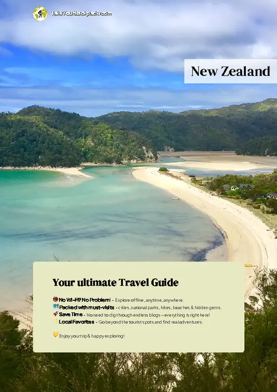
example page 0 from our offline Travel Guide for New Zealand
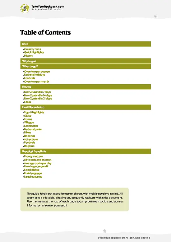
example page 1 from our offline Travel Guide for New Zealand
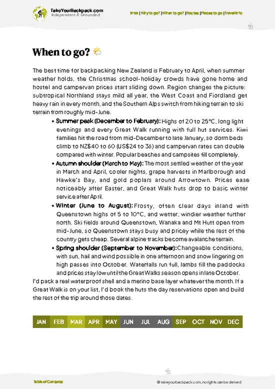
example page 2 from our offline Travel Guide for New Zealand
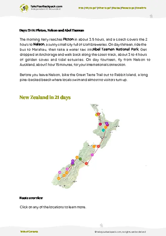
example page 3 from our offline Travel Guide for New Zealand
example page 4 from our offline Travel Guide for New Zealand
example page 5 from our offline Travel Guide for New Zealand
example page 6 from our offline Travel Guide for New Zealand
example page 7 from our offline Travel Guide for New Zealand
Loading the map 🌍
CLICK TO FILTER
cities
towns
villages
landmarks
national parks
hikes
beaches
attractions
festivals
regions
SHOW COUNTRY’S BESTSHOW ALL

✨ Why go?
Ranked #6 hike in New Zealand
Why visitors keep coming back

Backpackers pick this one because the Marlborough Sounds scenery changes every few hours, from bush-lined bays to open ridgelines where you can see both Queen Charlotte Sound and Kenepuru Sound at once. The track is also unusually flexible. Water taxis stop at bays all along the route, so you can walk the full 70 kilometers over three to five days, or take a single stage of a few hours and boat back. Lodges, campsites and a shuttle service for bags mean you can choose how rugged you want it. It also fits neatly into a South Island loop, starting a short ferry-and-bus hop from the Interislander terminal at Picton, and finishing at Anakiwa, where you can catch a ride back.

💡 HighlightsKey sights and experiences for travelers

  1. Ship Cove (Meretoto): the official start, where Captain Cook anchored several times in the 1770s. A monument stands by the beach, and the bay is calm, green and sheltered, with a short waterfall walk nearby.
  2. Saddle Ridge views near Onahau: the high sections give you Queen Charlotte Sound on one side and Kenepuru Sound on the other, with ferns and beech forest dropping to the water.
  3. Onahau Bay and Resolution Bay: quiet sheltered coves with pebbly beaches, where you can swim, watch for dolphins, and listen to bellbirds and tui at dawn.
  4. Bay of Many Coves: a long descent to a sheltered anchorage dotted with boats, lodges and a lookout above the water, ideal for a late lunch stop.
  5. Anakiwa and the finish: the track ends at the head of the sound with a small jetty, a café and a sense of arrival after
… read more 👉
  1. Ship Cove (Meretoto): the official start, where Captain Cook anchored several times in the 1770s. A monument stands by the beach, and the bay is calm, green and sheltered, with a short waterfall walk nearby.
  2. Saddle Ridge views near Onahau: the high sections give you Queen Charlotte Sound on one side and Kenepuru Sound on the other, with ferns and beech forest dropping to the water.
  3. Onahau Bay and Resolution Bay: quiet sheltered coves with pebbly beaches, where you can swim, watch for dolphins, and listen to bellbirds and tui at dawn.
  4. Bay of Many Coves: a long descent to a sheltered anchorage dotted with boats, lodges and a lookout above the water, ideal for a late lunch stop.
  5. Anakiwa and the finish: the track ends at the head of the sound with a small jetty, a café and a sense of arrival after the final forest stretch.
Ship Cove and Resolution Bay combine well in one day, since the first stage is short, gentle and finishes at a bay with good swimming.
Spotted a mistake or missing something? Contact us.

Things to do near Queen Charlotte Track

Ratings based on Tripadvisor reviews. When you book through this link, you support our work at no extra cost to you.

🌤️ When to go?Best time to hike the Queen Charlotte Track

  • Summer (December to February): Warmest and busiest, with highs of 20 to 24°C (68 to 75°F) and daylight past 9 pm. Water taxis and Picton lodgings fill early and prices peak, especially around New Year.
  • Autumn (March to May): Settled, clear days of 15 to 21°C (59 to 70°F), calmer crowds and swimmable bays into March. Light fades by about 6 pm by May.
  • Winter (June to August): Highs of 11 to 14°C (52 to 57°F), lows near 4°C (39°F), and slick clay on the ridge. Some lodges and water taxis cut back services, though rates drop.
  • Spring (September to November): Changeable, 13 to 18°C (55 to 64°F), with bursts of rain and wind. Birdsong is loud, tracks quiet, and bookings are easy until late November.
Book bed and bag transfers by October for any summer dates, since the small lodges along the track sell out months ahead.

source: climatestotravel.comJANJanuary: highly recommended for travelingFEBFebruary: highly recommended for travelingMARMarch: excellent for travelingAPRApril: excellent for travelingMAYMay: good for travelingJUNJune: fair for travelingJULJuly: below average for travelingAUGAugust: below average for travelingSEPSeptember: fair for travelingOCTOctober: good for travelingNOVNovember: excellent for travelingDECDecember: highly recommended for traveling
new-zealand-hike-queen-charlotte-track
© Google |

✈️ The backpacker research shortcutNew Zealand Travel Guide

An offline-friendly backpacking guide with optimized travel routes, ranked highlights, transport advice, and the best areas to stay.
example page 0 from our offline Travel Guide for New Zealand
example page 1 from our offline Travel Guide for New Zealand
example page 2 from our offline Travel Guide for New Zealand
example page 3 from our offline Travel Guide for New Zealand
example page 4 from our offline Travel Guide for New Zealand
example page 5 from our offline Travel Guide for New Zealand
example page 6 from our offline Travel Guide for New Zealand
example page 7 from our offline Travel Guide for New Zealand
The digital guide (327 pages) contains:
✅ 110 highlights, ranked by travel appeal
✅ Optimized 7, 14 & 21-day travel routes
✅ Cities, national parks, landmarks, beaches
✅ How to get around
✅ Offline-friendly for travel without Wi-Fi
👉 Click to see all 30+ guide features

📅 Plan smarter in minutes, not weeks
✅ Month by month travel advice
✅ Festivals & national holidays
✅ Budget expectations

🗺️ Go to the right places, skip the overrated ones
✅ Honest pros & cons of destinations
✅ Top hikes, parks & viewpoints
✅ Lesser-known places most travelers miss
✅ Clear “worth it vs skip it” guidance

🛏️ Travel smoothly without rookie mistakes
✅ Best areas to stay
✅ Transport systems explained simply
✅ Common scams & safety advice
✅ SIM cards, money & practical tips

🌍 Understand the country, not just visit it
✅ Culture & traditions
✅ Local customs
✅ Festivals worth planning around
✅ Traveler-friendly historical context
✅ Insights that make places more meaningful

📱 Built for real travel conditions
✅ Fully downloadable PDF
✅ Works completely offline
✅ Optimized for phone use
✅ Useful in remote areas & buses
✅ Everything in one place
Stop searching, start planning
Get instant access to your full guide. 30‑day money-back guarantee.
+ Add another guide for just

By proceeding you agree to our terms.
Sent to your inbox immediately after payment • 100% Secure Checkout
Best Backpacking Travel Advisor 2025 tourism awardBest Backpacking
Travel Advisor
2025
What others say about Take Your Backpack Guides:
⭐⭐⭐⭐⭐
Fantastic, amazing amount of information!
⭐⭐⭐⭐⭐
My goodness this is amazing, it's what I've been looking for hats off too you!
⭐⭐⭐⭐⭐
I think this is absolutely BRILLIANT
⭐⭐⭐⭐
Very complete and informative. It's still missing places, but I gotta to commend you
⭐⭐⭐⭐⭐
This is truly amazing, thank you, can't wait to explore it with my kids!
⭐⭐⭐⭐⭐
Awesome resource, thank you!
⭐⭐⭐⭐⭐
This is amazing! Can't wait to explore the ones I haven't seen
⭐⭐⭐⭐
I love this! Well done, great idea.
⭐⭐⭐⭐⭐
Thanks for taking the time to make this gem!
⭐⭐⭐⭐⭐
This might be the best website I've ever seen.
⭐⭐⭐⭐⭐
Congratulations, and thank you so much for your work; it's incredibly valuable.
⭐⭐⭐⭐
In all seriousness I think you did a great job pointing out the important spots
⭐⭐⭐⭐⭐
10/10 very good
⭐⭐⭐⭐⭐
As someone who's only just starting to visit regularly this is awesome, thank you.
⭐⭐⭐⭐
Thank you very much! I'm going to visit my dad, it's going to be very useful!
⭐⭐⭐⭐⭐
This is really cool! We'll be travelling for the first time and this definitely come in handy.
⭐⭐⭐⭐⭐
You are now our minister of culture, congratulations 👨‍💼
⭐⭐⭐⭐⭐
Just wanted to tell you that this is a pearl! Going to follow your recommendations.
⭐⭐⭐⭐⭐
This is so cool. I'll definitely be using the resource for my travels soon.
⭐⭐⭐⭐⭐
This is very impressive! Good work.
⭐⭐⭐⭐⭐
This is an amazing and informative site. Very well done!

🛏️ Where to stay?Best areas and accommodation options

If you enjoy meeting fellow travelers, consider choosing hostels with high ratings for atmosphere. On the other hand, if you prefer having your own space, a hotel might be a better option.

🥾 Hike detailsKey facts about the Queen Charlotte Track hike

Total Distance: About 70 kilometers one way from Ship Cove to Anakiwa.
Duration: Three to five days on foot. Many people split it to suit lodge or campsite stops.
Difficulty: Moderate. The gradients are steady rather than steep, but some days run 5 to 7 hours.
Starting Point: Ship Cove, reached only by water taxi or boat from Picton.
  • Public Transport: Picton has bus and ferry connections, and water taxis run to Ship Cove and pick up along the route.
  • Finish: Anakiwa, where a shuttle or water taxi can take you back to Picton.
Major Landmarks: Ship Cove monument, Resolution Bay, Onahau saddle, Bay of Many
… read more 👉
Total Distance: About 70 kilometers one way from Ship Cove to Anakiwa.
Duration: Three to five days on foot. Many people split it to suit lodge or campsite stops.
Difficulty: Moderate. The gradients are steady rather than steep, but some days run 5 to 7 hours.
Starting Point: Ship Cove, reached only by water taxi or boat from Picton.
  • Public Transport: Picton has bus and ferry connections, and water taxis run to Ship Cove and pick up along the route.
  • Finish: Anakiwa, where a shuttle or water taxi can take you back to Picton.
Major Landmarks: Ship Cove monument, Resolution Bay, Onahau saddle, Bay of Many Coves, Torea Saddle and Anakiwa.
Terrain and Scenery: Well-formed track, mostly under 500 meters in elevation, with ridge lines, sheltered bays and sound views.
Vegetation: Native podocarp and beech forest, tree ferns, and in places regenerating scrub.
Wildlife: Tui, bellbirds, fantails and weka, plus dolphins, seals and little blue penguins from the water.
⚠️ Hiking info can sometimes be outdated or inaccurate. Before you hit the trail, check the latest conditions with locals. If you do spot anything that's off, I'd love to hear from you, so I can update it for fellow travelers.

🛡️ SafetyTraveler Safety Guide

The Queen Charlotte Track is well managed and suits first-timers with decent fitness, but the ridgeline sections between Kenepuru Saddle and Torea Saddle are exposed and climb steadily. Weather shifts quickly in the Marlborough Sounds, so carry a rain jacket and warm layer even on a bright morning, and start early to finish in daylight. After rain the clay turns greasy, so wear shoes with real tread. Water is not available everywhere on the ridge, so fill up at stops and carry at least 2 liters between them. Sandflies are common at the bays, and repellent helps. Wild pigs and goats are rarely encountered, and the birds, including weka, are bold but harmless, so keep food zipped away. Pre-book water taxis and sleeps, and check the schedule, as missing a pickup can strand you for a night.

FAQCommon questions from travelers

Most walkers take 3 to 5 days to cover the full 70 km from Ship Cove to Anakiwa. A common 4-day itinerary stays at Resolution Bay, Punga Cove and Portage, while fast hikers do it in 3 days. Water taxis from Picton to Ship Cove take about 1.5 hours.
Moderate overall, with no technical sections but several long climbs of up to 400 m, and the track rises to roughly 400 to 500 m on the ridges. Daily stages run 12 to 24 km, and the stretch from Punga Cove toward Portage is among the hardest. Mountain bikers find it demanding too, and a basic level of hiking fitness is enough.
No guide is needed, as the track is clearly marked and well signposted from Ship Cove to Anakiwa. No permit is required to walk it, but a Queen Charlotte Track Pass of NZ$15 for one day or NZ$30 for up to five days (US$9 to 18) is required for the track's privately owned sections, and it is sold in Picton. Book camping, lodges and water taxis ahead in summer, with camping around NZ$15 to 25 per night.
⚠️ Things can change over time, so always validate details locally before you go.

Other New Zealander hikes near Queen Charlotte Track

Explore more nearby:

  • Te Araroa Trail—Richmond Range, greywacke ridges, Nelson Lakes, flood-prone rivers| 76 km away
  • Abel Tasman Coast Track—Tidal estuary crossing, golden bays, water taxi hops, seal colony| 97 km away
  • Whanganui Journey—Canoe route, river gorge, Bridge to Nowhere, marae stay| 219 km away

💡 Not sure where to go next?
Create a personalized itinerary for New Zealand including Queen Charlotte Track and the places that fit your trip.

Generate my itinerary

👉 Discover all hikes

Or checkout all New Zealand has to offer (think cities, towns, villages, national parks, hikes, beaches, festivals)
Country photo of New Zealand

We 💚 feedbackFinal thoughts on hiking the Queen Charlotte Track

I would walk it in early morning, when the bellbirds are loudest and the sounds are still glassy, and finish stages by early afternoon for a swim. Autumn gives the clearest light and thinner crowds. Book lodges well ahead, since beds fill.

✈️ When did I visit New Zealand?
All the way back in high school I have been visiting the North Island of New Zealand (1993).

✍️ Help improve this page!
The information on this page is based on my own backpacking experience in New Zealand, supplemented with up-to-date research and feedback from other travelers. Travel details can change, so if you notice anything outdated or incomplete, feel free to let me know.


🙋‍♂️ Give feedback

👋 Meet the founderWho’s Behind Take Your Backpack?

Johan, backpacker and founder of TakeYourBackpackHi, I’m Johan (Netherlands 🇳🇱), the creator of TakeYourBackpack. Over the past 3 decades, I’ve backpacked through 90+ countries across six continents, gaining extensive experience with independent travel, long-term trips, and overland routes.

This site is built on a combination of firsthand travel experience and carefully curated insights from other backpackers. Many guides are based on places I’ve personally visited, while others bring together tips, observations, and practical advice shared by trusted travelers I’ve met along the way.

The goal is to provide realistic, experience-driven guidance — not generic itineraries — so you can explore destinations with better context, clearer expectations, and more confidence.